Passport
- Altai, Yuzhno-Chuysky Ridge, Akkol gorge, 1.3
- Mt. Bolshoy Luzhetsky via 3rd ridge
- Category 3A is proposed (submitted for increasing the category of complexity).
- The route is rocky.
- Height difference 670 m, length 1120 m, average slope 36°, average steepness of the main part of the route 48°.
- Rock pitons used – 3, chocks – 4.
- Travel hours – 8.5.
- Leader Drakin A.V. – CMS.
Participants:
- Abornev S. – 3rd sports category
- Neyaskina O. – 3rd sports category
- Prisyazhnykh V. – 3rd sports category
- Tkachenko S. – 3rd sports category
- Coach: Drakin A.V., 1st category, No. 68.
- Departure for the route: 6:00 July 16, 2004, reaching the summit at 13:00, returning to the bivouac at 17:00.
- Organization: “West Siberian Search and Rescue Team of EMERCOM of Russia named after V.V. Zyukov”
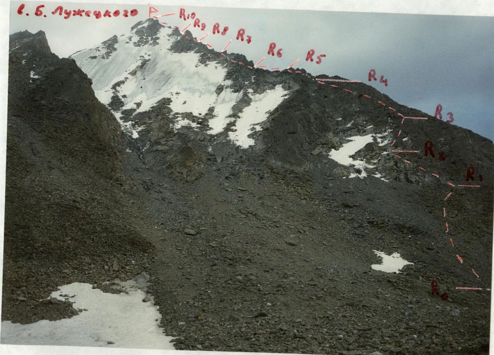 Mt. B. Luzhetsky via 3rd ridge. Shooting point No. 1
 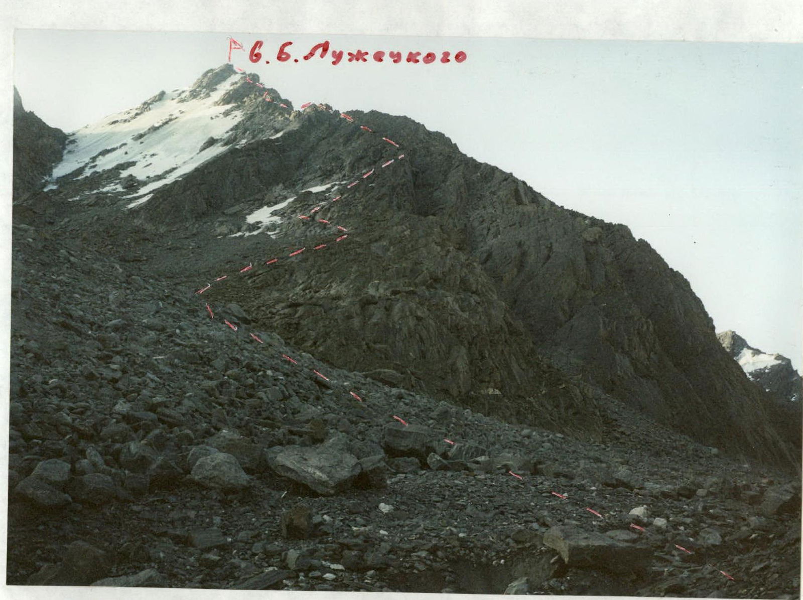 Mt. B. Luzhetsky via 3rd ridge. Shooting point No. 2
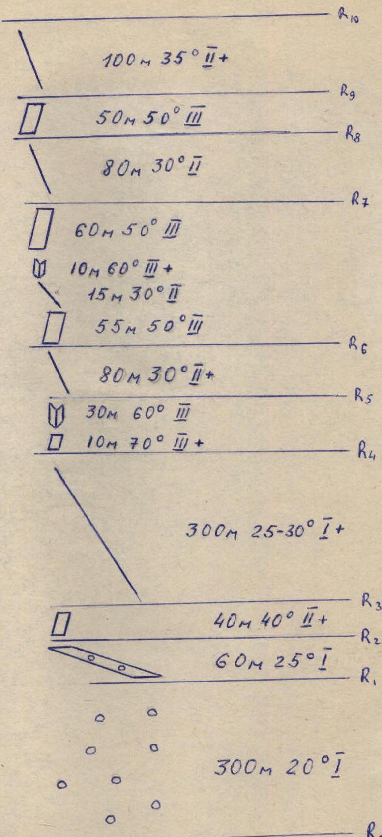
Route scheme in UAA symbols
Mt. B. Luzhetsky via the western counterforce 3A category (approximately)
Route Scheme
Route sections according to the scheme:
- R0: 300 m 20° I
- R1: 60 m 25° I
- R2: 40 m 40° II+
- R3: 300 m 25–30° I+
- R4: 30 m 60° III, 10 m 70° III+
- R5: 80 m 30° II+
- R6: 55 m 50° III
- R7: 60 m 50° III, 10 m 60° III+, 15 m 30° II
- R8: 80 m 30° II
- R9: 50 m 50° III
- R10: 100 m 35° II+
Approach
From the base camp, located at the confluence of the Tura-Oyuk river and the Akkol river, move along the Akkol river to the Sofiysky glacier. An implicit trail initially goes along swampy slopes, then along scree. Ascend to the glacier and move along it in the direction of the right (orographic) branch of the glacier, bounded by the ridges of Mt. B. Luzhetsky, Sister, and Chuysky. Ascend to the beginning of this branch of the glacier. In the lower part, on the left along the path, a stream flows on a moraine ridge. Next to it, in the folds of the moraine ridge, there are places to pitch tents. A convenient bivouac site.
Approach time: 4–5 hours from the base camp.
Route Description
From the bivouac, move towards the western edge of Mt. B. Luzhetsky along the moraine or glacier. The edge drops towards the glacier with two counterforts.
Approach the left counterfort along the scree, below the lower ice patch on the slope. Along the scree ledge, move up to the right to this patch and ascend to the edge via a slab. The slab is traversed alternately. Along the edge, on simple rocks, keeping to the right side, approach the first gendarme. The ascent to it initially goes along a wall, then along an internal corner. Climbing is difficult, piton belay. (Ropes).
Further movement to the summit mainly passes along the left side of the edge. Throughout the remaining length of the route to the summit, the movement is alternate.
Along the ridge, approach the second gendarme. The ascent to it begins along a wall, then along a crest, approach a complex internal corner, which leads to a convenient platform behind a large overhanging rock. From the platform, left and up, along complex slabs, exit to the ridge behind the gendarme.
Movement:
- Alternate
- Piton belay (Ropes)
Further along the ridge, approach the wall of the last gendarme, on which the last ropes are organized. Further movement to the summit tower passes along slabs of medium difficulty alternately. The control cairn is located on the far elevation of the tower.
Descent is along the northern ridge via route 2B category (Have ice equipment).
Safety Recommendations
The route is rocky, ridge. Objectively safe. At the same time, when passing internal corners and walls, it is necessary to consider the subjective actions of the climbing participants.
Equipment Recommendations
The route is rocky, descent is icy. A small set of rock pitons and chocks (8–10) is required, crampons for the entire group, and 4–5 ice screws.
Preliminary Route Assessment
Writing this report was prompted by three inconsistencies related to this route.
First - the category of complexity. The route is more complex than the accepted 2B in KTMGV. The route is more complex than the following classified routes of 3A category: Akturu via W. ridge, Berkut via the center of N. side, Radistov Peak via N. slope, and is comparable to the following 3A routes: Karatash via SE couloir of NE ridge, Georgy Zhukov via NE ridge, Kzyl-Tash from Uчитель pass.
Therefore, it is proposed to change the category of complexity of the route upwards and classify it as 3A. Bringing the category of complexity in line is driven by safety requirements.
Second - two routes to Mt. B. Luzhetsky are listed in the table under the same number:
- One goes along the northern ridge
- The other - along the western counterfort
These are completely different routes both in terms of orography and character. Combining them under the same number is simply inexplicable.
Third - the name of the route. It would obviously be more correct to name it along the western edge rather than the western counterfort. 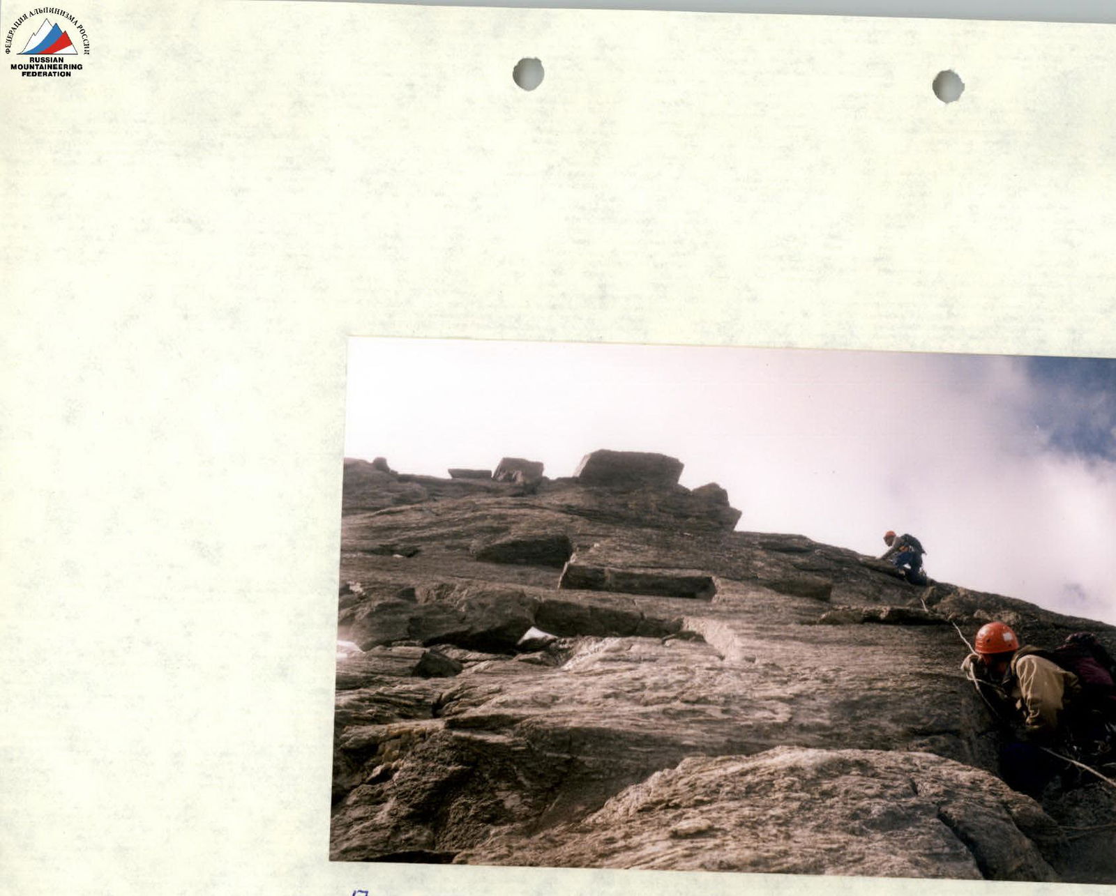
Passing the upper slab on section R6–R7


