PASSPORT
I. Category of the first ascent. 2. Altai, South-Chuisky ridge, area of Sofiysky glacier. 3. v. B. Luzhetskogo from N ridge. 4. Category 3A first ascent is proposed. /Initial visual assessment of the route was 2A–2B/ 5. Height 3600 m, height difference 550 m, length 1100 m. 6. Pitons: 9 ice screws, 1 rock piton. 7. 14 hours of climbing time. 8. Overnight stays: not necessary. 9. Leader: Drakin Andrey Valentinovich CMS.
Team members:
- Okhtimenko Irina Nikolaevna 2nd sports category
- Pisarev Yaroslav Vladimirovich 3rd sports category.
- Coach: Drakin Andrey Valentinovich 1st climbing category, certificate №68.
- Date of ascent: August 12, 1998.
- Organization: Altai Krai Alpine Federation.
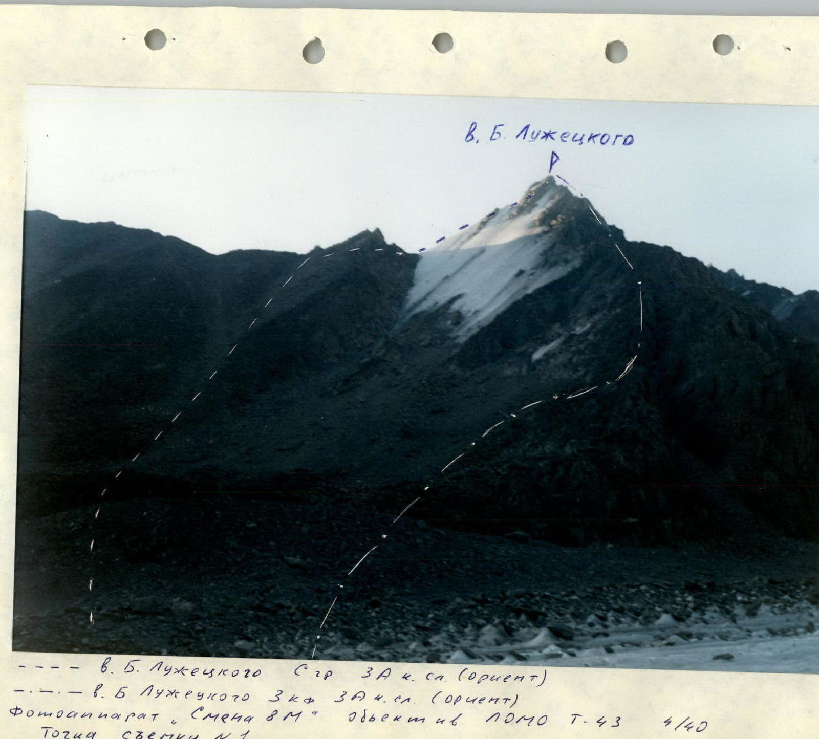
v. B. Luzhetskogo P N ridge --- v. B. Luzhetskogo N ridge 3A category (orientation) -.-.-. v. B. Luzhetskogo 3A 4 category (orientation) Camera "Smena 8M" lens "POMO 7-43" 4/40 Shooting point №1
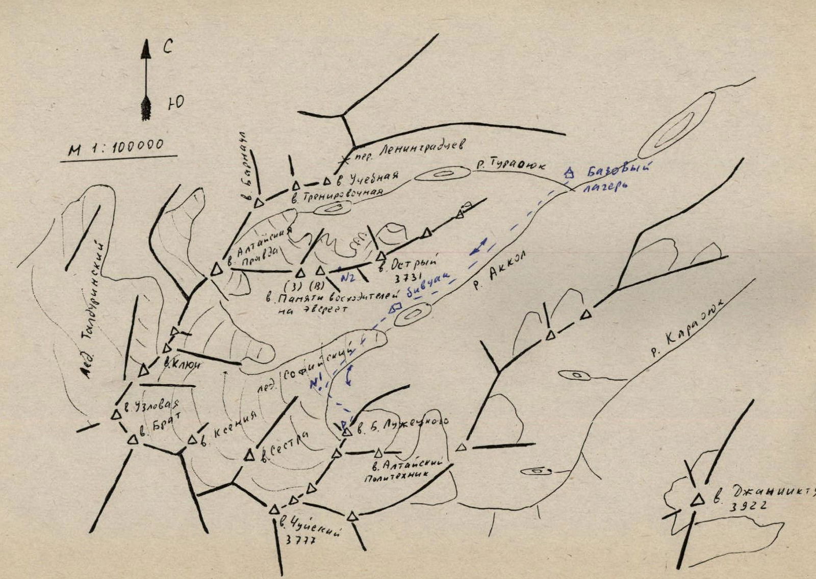
AC M 1:100000 Taldurinsky glacier 10 R. Turasyuk A Base camp v. Barnaul v. Altayskaya Pravda A pass Leningradtsev D-Dv Uchotnaya v. Trenirovochnaya △△N28. Ostry (3) (B) N2 3731 v Pamyati voskhoditeley bivouac on Everest R. Akkol incl v. Uzlovaya v. Brat D Kseniya A v Sestra v. Chuyskiy 3777 v. B. Luzhetskogo v. Altayskiy Politekhnik R. Karasyuk Dv. Dzhanuktu 3922
Route sections description
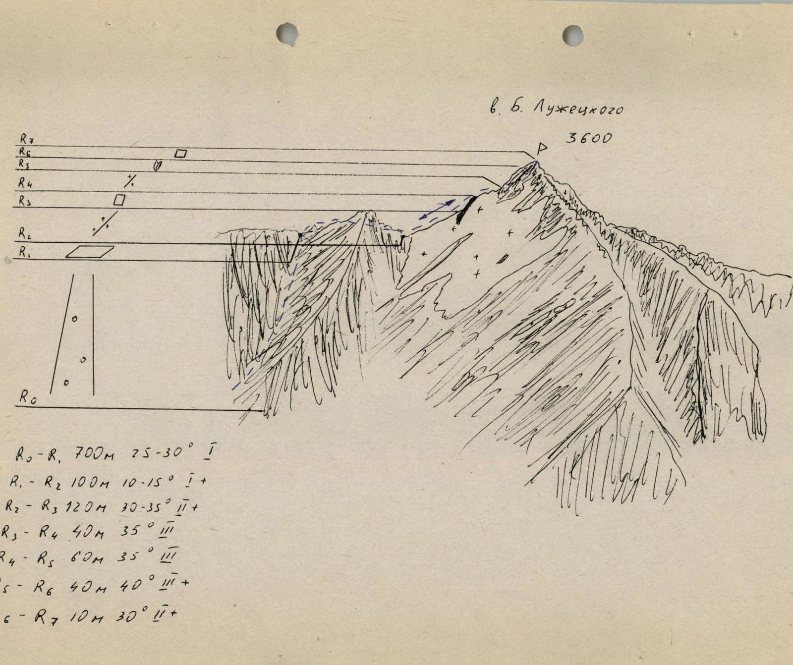
v. B. Luzhetskogo 3600 P
- R0–R1: 700 m, 75–30° 1
- R1–R2: 100 m, 10–15° 1
- R2–R3: 120 m, 30–35° 2
- R3–R4: 40 m, 35° 3
- R4–R5: 60 m, 35° 3
- R5–R6: 40 m, 40° 3
- R6–R7: 10 m, 30° 2
Approach and route description
Approach description
From the base camp, located at the confluence of the Turayuk river and the Akkol river, cross the Turasyuk river and follow a faint trail along the Akkol river, initially through marshy meadows, then through scree to the lake. On the upper part of the lake's shore, there are small clear ponds. A convenient place to set up a bivouac. Travel time is 2–2.5 hours.
Route description
From the bivouac, move along the Akkol river to the tongue of the Sofiysky glacier. Ascend to the glacier and move leftwards to the confluence with its right (orographic) branch. Cross to this branch via moraines and approach v. B. Luzhetskogo.
Travel time from bivouac:
- 3–3.5 hours.
Ascend the steep scree couloir to the N ridge (2 hours). The gendarme on the ridge is bypassed on the right via easy ledges. Then follows the ice ridge of Zverevka. Move with piton protection. The ice ridge is interrupted by a rock slab, which is passed with piton protection. From the slab, descend to the ice ridge via a crack on the left and then move two rope lengths along the ridge through a rock outcrop to approach a not clearly defined, ice-filled inner corner. Piton protection is used. The inner corner is 45 m long. Move with protection via ice screws and rock pitons.
Further, a simple rock wall leads to the summit. Travel time from the ridge: 2.5–3 hours.
Throughout the route, there are many loose rocks on the cliffs.
Descend via the ascent route. On rock sections, use rappelling with subsequent rope retrieval, on ice sections use a twist-out ice screw.
Descent time from the summit to the bivouac:
- 3–4 hours.