
| Peak Irbistu (Tymomu) |
|---|
| via the left part of the Northwest slope, |
| 3A — snow-ice climb, |
| Korneev V.S. |
| Altai, South-Chuya Ridge 1.2. |
Ascent Passport
- Class: snow-ice climb.
- Altai, South-Chuya Ridge, Elangash valley 1.3.
- Peak Irbistu (Tymomu), coordinates 49°45.536 N, 88°05.186 E, height 3967 m, via the left part of the Northwest slope.
- Proposed category — 3A cat. dif., first ascent*.
- Height difference: from the start of the route to the summit — 1070 m; from the forward camp to the summit — 1160 m; route length — 2500–2600 m; average steepness of the route — 25°.
- Pitons used on the route: ice screws — 15.
- Travel time: from the start of the route to the summit — 5:00 h; from the start of the route to the forward camp — 8:30 h; from the forward camp to the forward camp — 10:00 h.
- No overnight stays on the route.
- Team: Korneev Vladimir Stanislavovich — 1st sports category; Badanov Pavel Alexandrovich — 2nd sports category.
- Coach: Drakin Andrey Valentinovich — 1st category (№68).
- Departure from the forward camp: 6:10, August 8, 2015. Departure onto the route: 7:30, August 8, 2015. Reaching the ice-snow ridge: 9:30, August 8, 2015. Reaching the saddle: 11:00, August 8, 2015. Reaching the summit: 12:30, August 8, 2015. Start of descent towards the Western rib: 12:40, August 8, 2015. Return to the forward camp: 16:10, August 8, 2015.
- Organization: Training camps of the Altai Regional
Alpine Federation (AKFA).
*Note — the first ascent of the route was made in August 2013
by a group of climbers from AKFA led by Korneev V.S.

Fig. 1. Map-scheme of the South-Chuya Ridge, Elangash valley 1.3.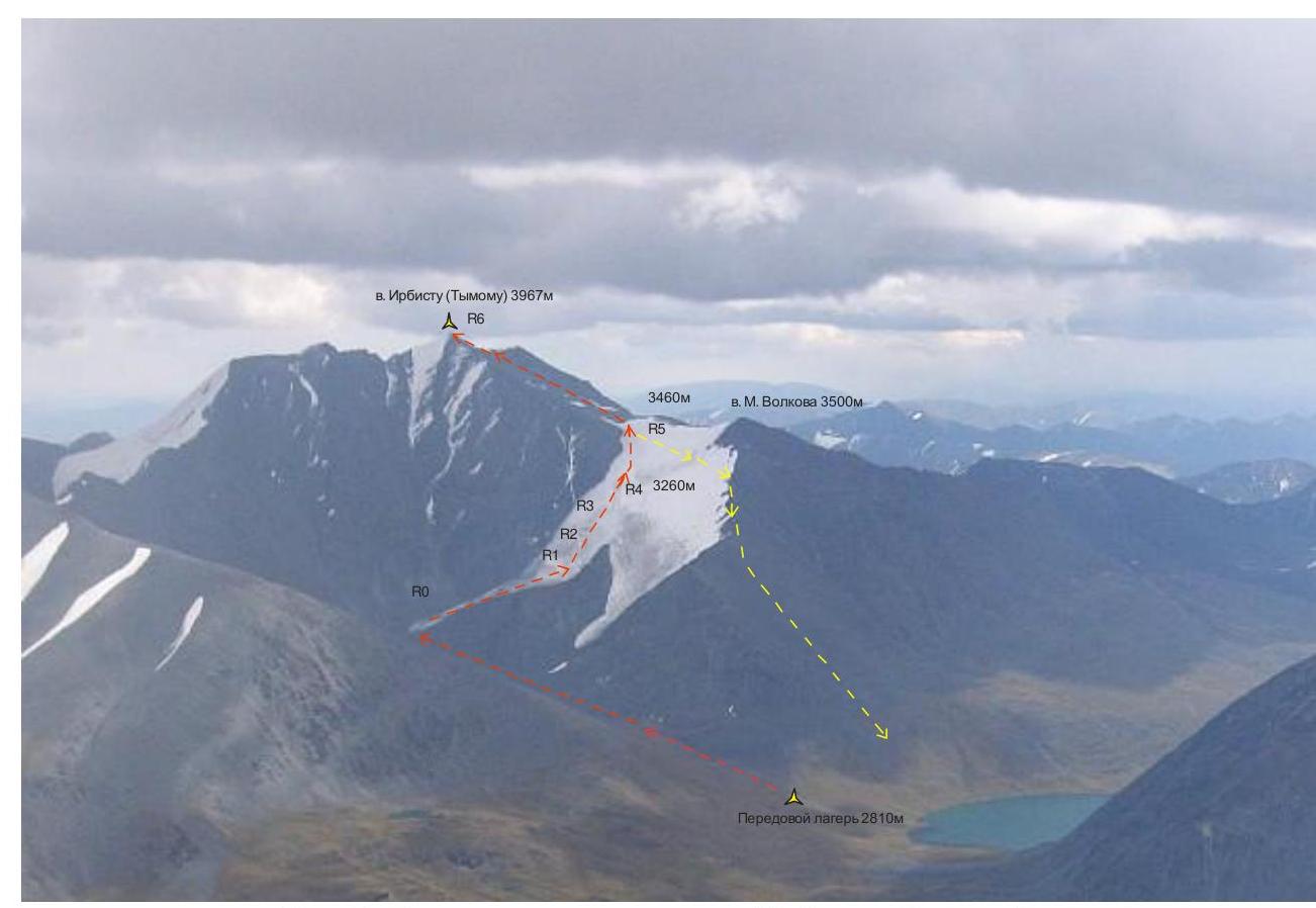
Fig. 2. View from the west at peak Irbistu (Tymomu) (dashed lines indicate the ascent route via 3A and descent from the summit via 1B).

Fig. 3. Scheme of the 3A route via the left part of the Northwest slope.
Comments
Sign in to leave a comment