
Irbistu peak via the center of the North-West slope, 2B cat. diff., combined, by Barnov S.I. Altai, South-Chuya Ridge 1.2
Passport
- Class: combined.
- Altai, South-Chuya Ridge, Elangash valley, 1.3
- Irbistu peak via the center of the North-West slope. Coordinates: (49°45.536′ N, 88°05.186′ E, height 3967, 3963 according to navigator)
- Proposed — 2B cat. diff., first ascent.
- Elevation gain: 1000 m (between the summit and intermediate camp: 1157 m); length — 2500 m. Average steepness of the route — 30–35 degrees.
- Pits used on the route: ice screws — 5.
- Team's travel time: 4 h 50 min from the start of the route to the summit; 8 h 30 min from the start of the route to the advanced base camp; 10 h 00 min from the advanced base camp to the advanced base camp (49°45.469′ N, 88°03.065′ E, height 2806 m according to navigator).
- Overnights — none.
- Climbing pair: Barnov Sergey Ivanovich, 1st sports category. Guselnikov Vitaly Mikhailovich, Master of Sports.
- Coach: Drakin Andrey Valentinovich, 1st category (№68).
- Departure from advanced base camp: 6:10 AM, August 8, 2015. Departure on the route: 7:30 AM, August 8, 2015. Reaching the ice wall rib: 9:00 AM, August 8, 2015. Reaching the saddle: 11:00 AM, August 8, 2015. Reaching the summit: 12:20 PM, August 8, 2015. Start of descent towards the W rib: 12:40 PM, August 8, 2015. Return to advanced base camp: 4:10 PM, August 8, 2015.
- Organization: Altai Regional Alpine Federation training camp
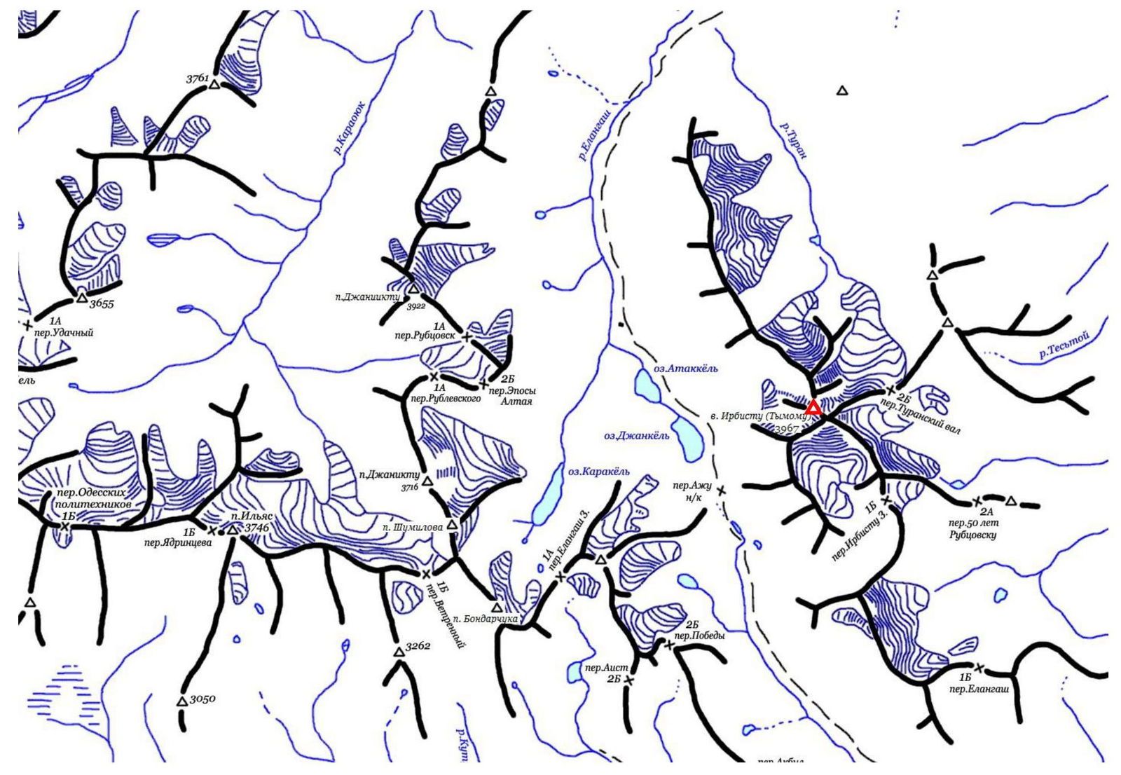
South-Chuya Ridge, Elangash valley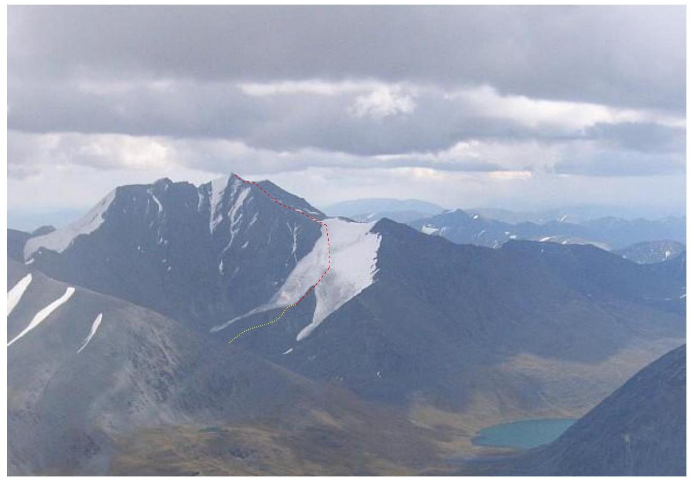
Route, view from the west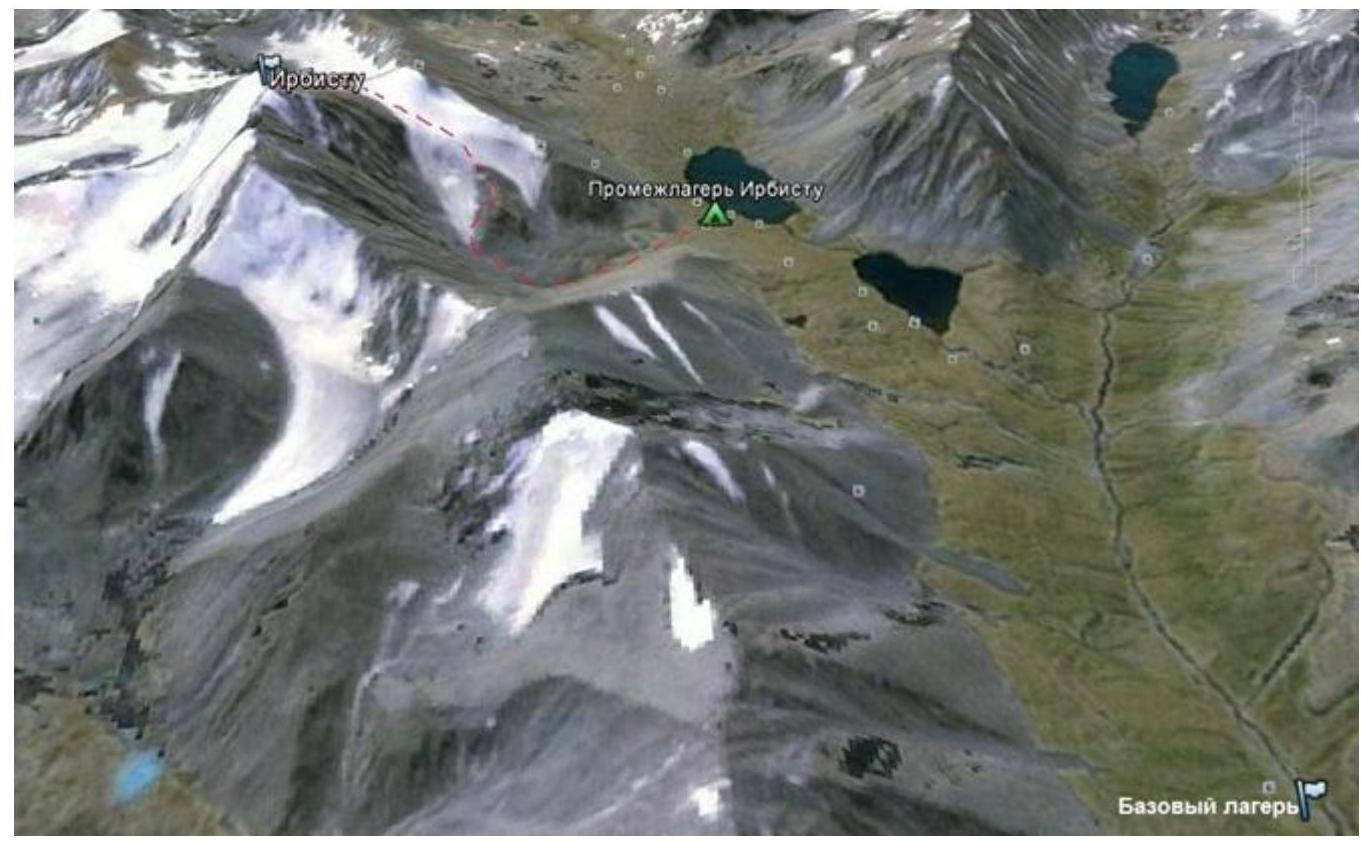
Route to Irbistu peak, base and advanced (intermediate) camp
Comments
Sign in to leave a comment