
Ascent Passport
- Altai, South Chuya Ridge, classifier section 1.3
- Irbistu, 3967 m, via the western edge.
- Proposed category: 1B.
- Route type: combined.
- Elevation gain: 750 m.
Route length: 1600 m. Length of sections with category V: 0, category VI: 0. Average slope: 28°.
- Pitons left on the route
Total: 0, bolted pitons: 0.
- Team's total climbing time: 7.5 hours, 1 day.
- Team leader: Ivan Yarovoy, Candidate for Master of Sports.
Team members:
- Pavel Gamayunov
- Dmitry Nemuschenko
- Coach: Ivan Yarovoy
- Approach to the route from the base camp
Route started: 8:00 AM, May 2, 2014. Summit reached: 3:30 PM, May 2, 2014. Return to base camp: 8:00 PM, May 2, 2014. Descent from the summit via the ascent route.
- Organizing body: Novosibirsk, Federation of Alpinism of Novosibirsk Oblast (FANSO).
- Person responsible for the report: Ivan Yarovoy (email: fanso@mail.ru, phone: 8-913-724-6765)
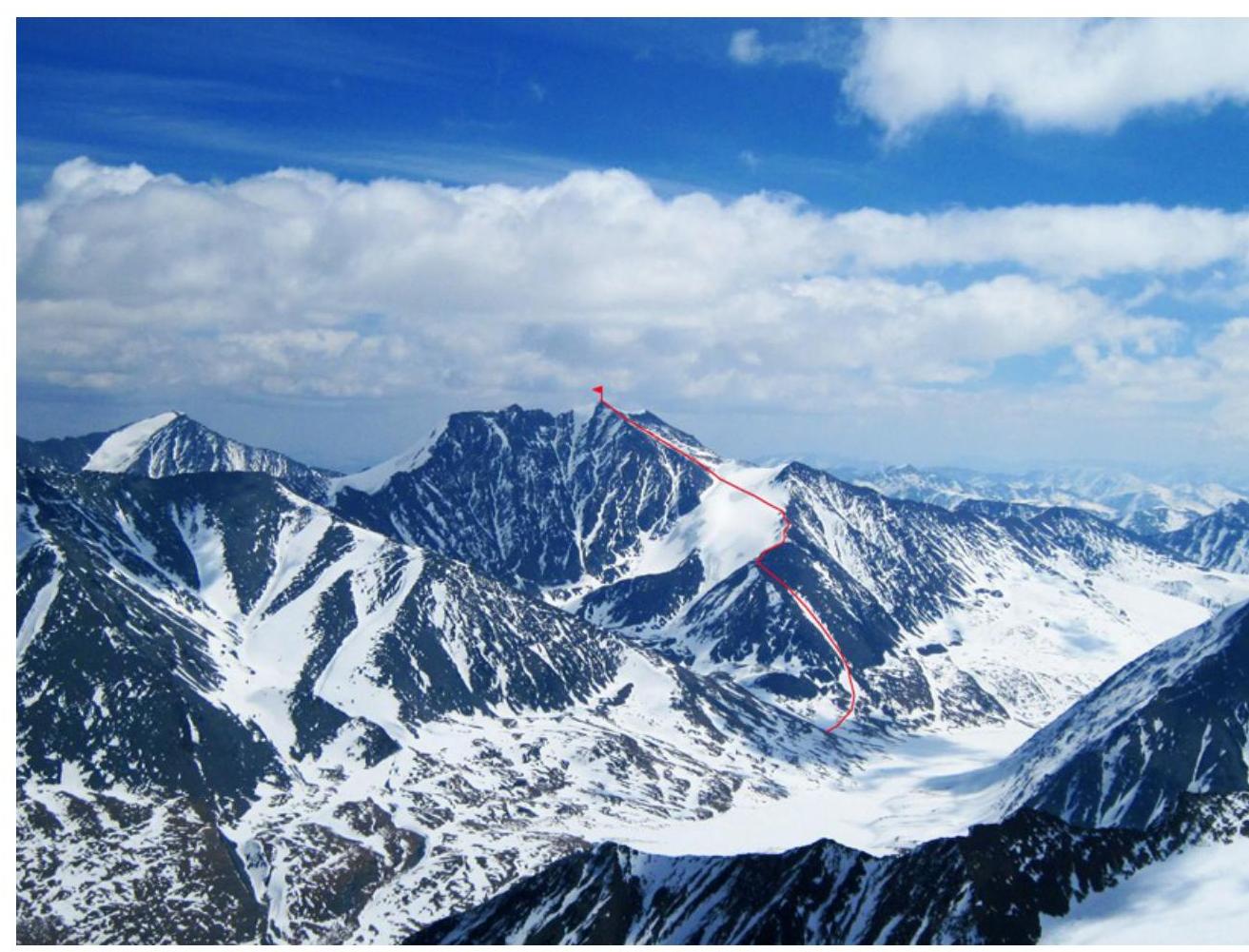
General photo of the summit. Taken on May 4, 2014, from the slopes of Janiiktu.
3716 m
Area Map
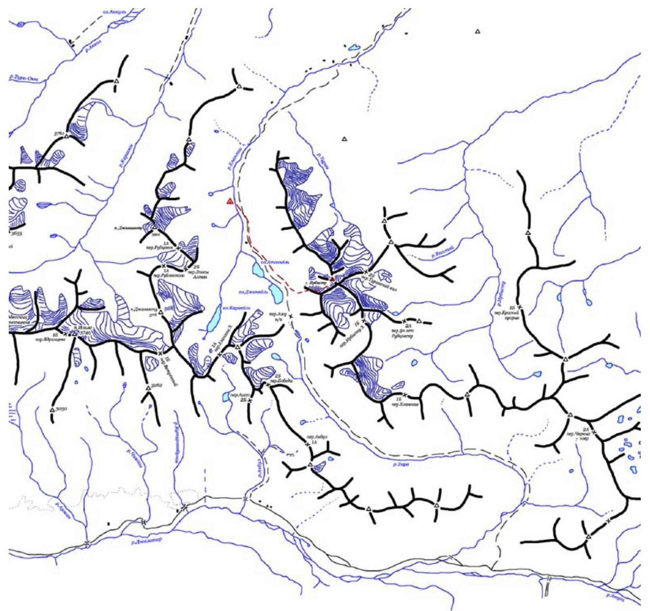
To reach the area:
- Drive along the Novosibirsk-Tashanta highway (M-52) to the settlement of Ortolyk
- Continue on a dirt road using high-clearance vehicles to the upper reaches of the Elangash River
Here, you can set up a base camp.
This ascent is not a first ascent. Irbistu (also known as Tymomu) is the highest peak of the South Chuya Ridge and, although not frequently, is climbed by tourist groups. However, it is not listed in the "Classifier of Routes to Mountain Peaks".
Route Description
| Section | Length (m) | Slope (degrees) | Terrain Type | Category | Number of Pitons |
|---|---|---|---|---|---|
| R0–R1 | 600 | 25-30 | Snow and scree slope | I | 0 |
| R1–R2 | 50 | up to 40 | Broken rocks | I | 0 |
| R1–R3 | 200 | 20-25 | Snow ridge | I | 0 |
| R3–R4 | 250 | 25 | Snow and ice slope | II– | 4 |
| R4–R5 | 500 | 30 | Scree slope | I | 0 |
PHOTO OF THE ROUTE WITH SECTION BREAKDOWN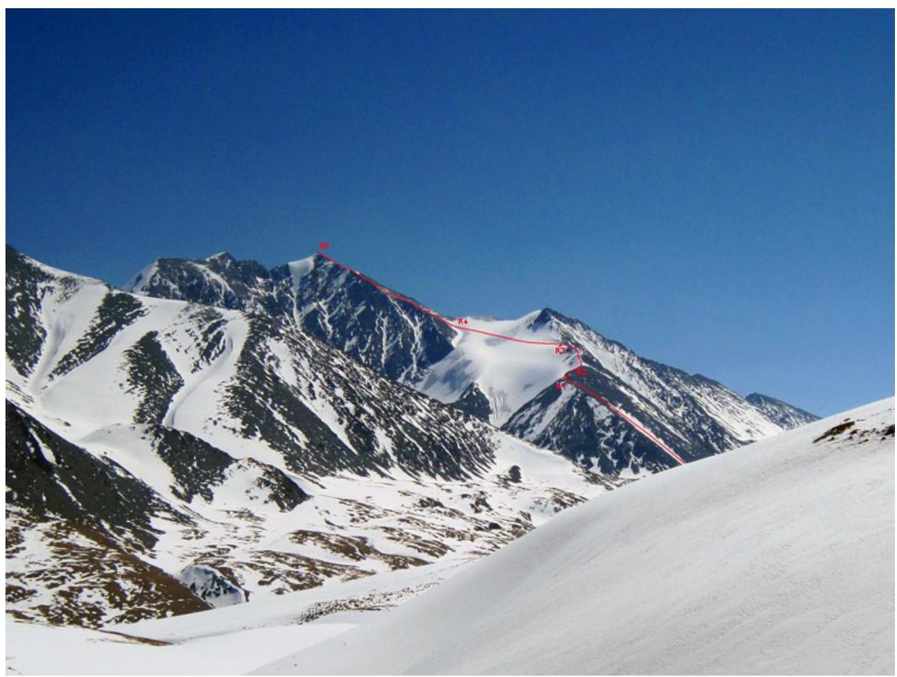
ROUTE PROGRESSION BY SECTION
From the base camp, move up the right (orographic) bank of the Elangash River, gradually bearing left, to reach the terraces above Lake Jankel. The journey from the base camp to the start of the route takes about 3 hours.
R0–R1: Ascend the snow and scree slope to reach the ridge.
R1–R2: Simple broken rocks.
R2–R3: Snow-covered ridge. Movement is simultaneous throughout.
R3–R4: Cross the glacier flowing from the Irbistu ridge. Hard ice (partially exposed, partially covered with a thin layer of snow). Can be traversed simultaneously, but using ice screws as intermediate protection.
R4–R5: Scree slope. Simultaneous movement.
PHOTO ILLUSTRATIONS
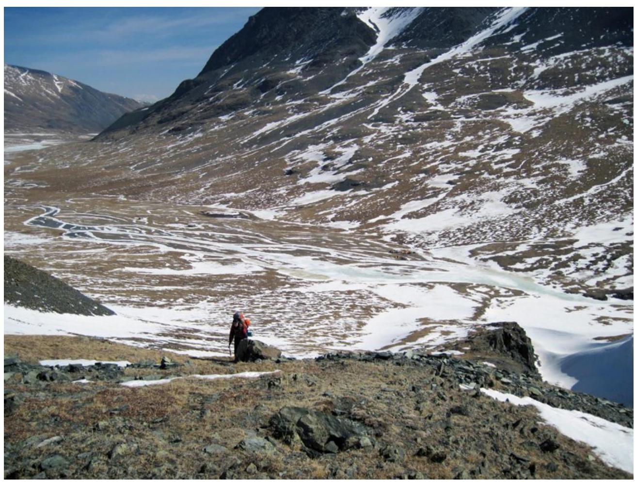
Photo 1. Base camp location in the Elangash River valley.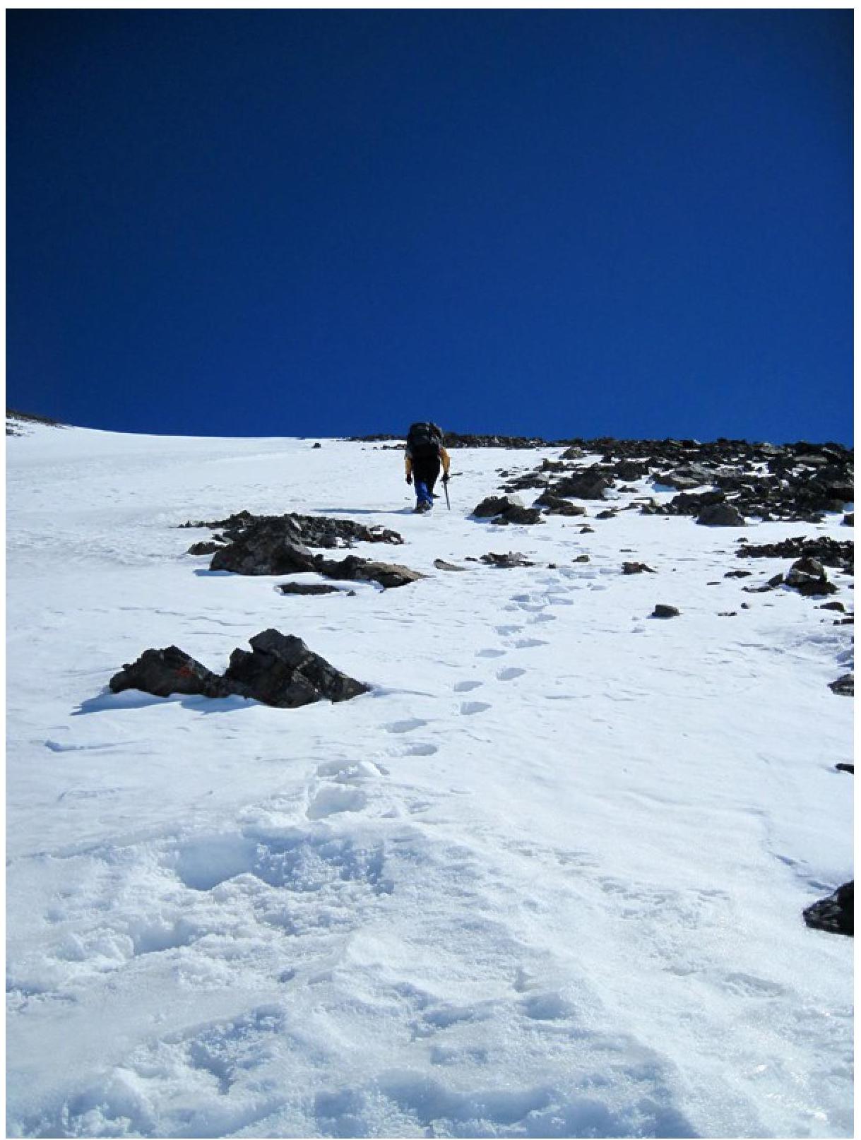
Photo 2. Movement on section
R0–R1.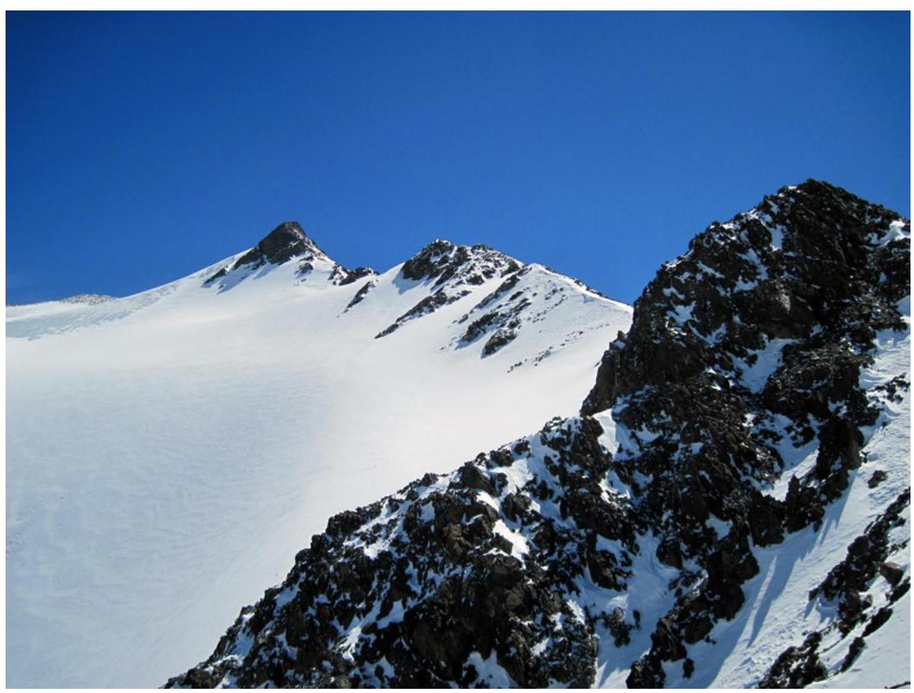
Photo 3. Start of section
R1–R2.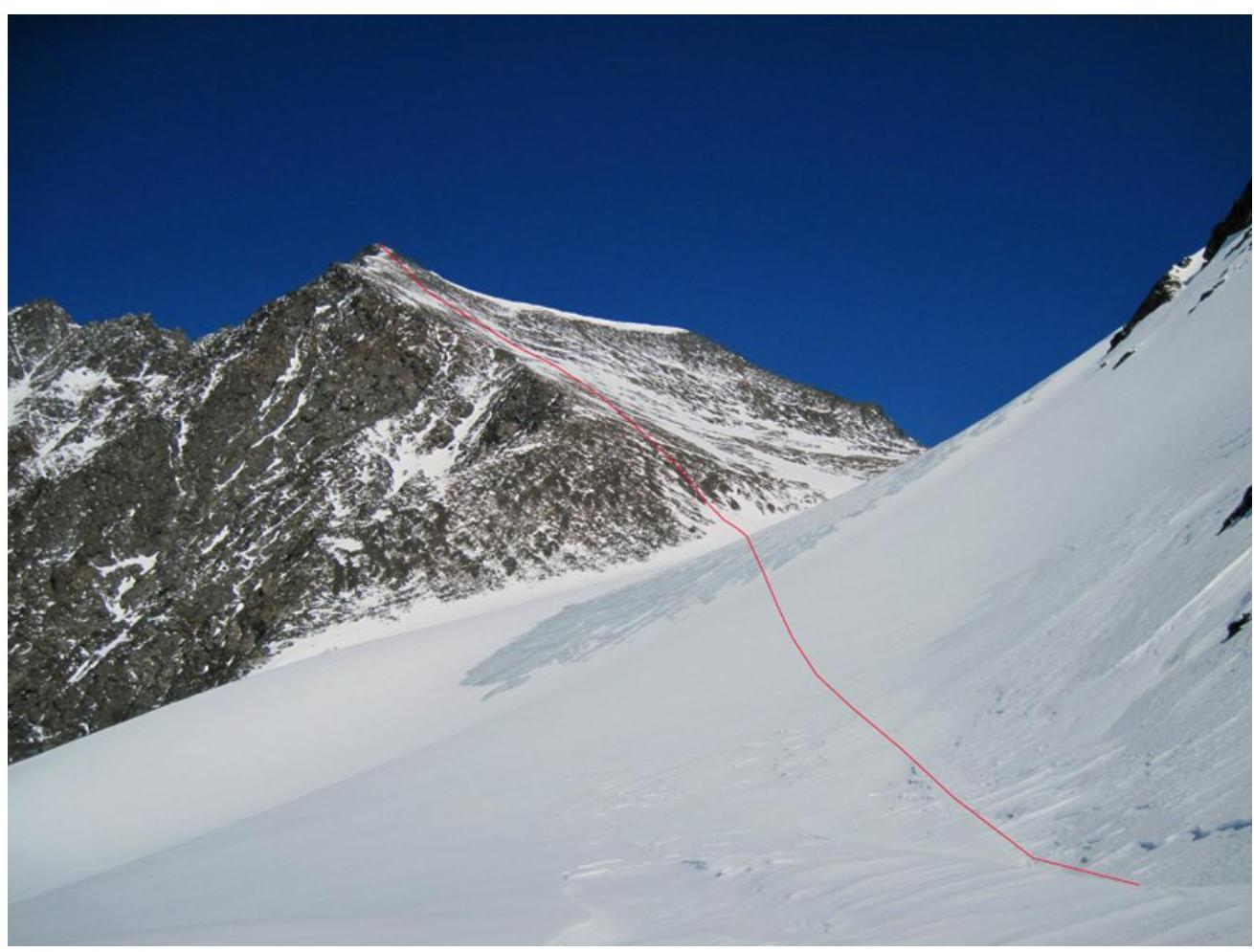
Photo 4. Sections R3–R4 and
R4–R5.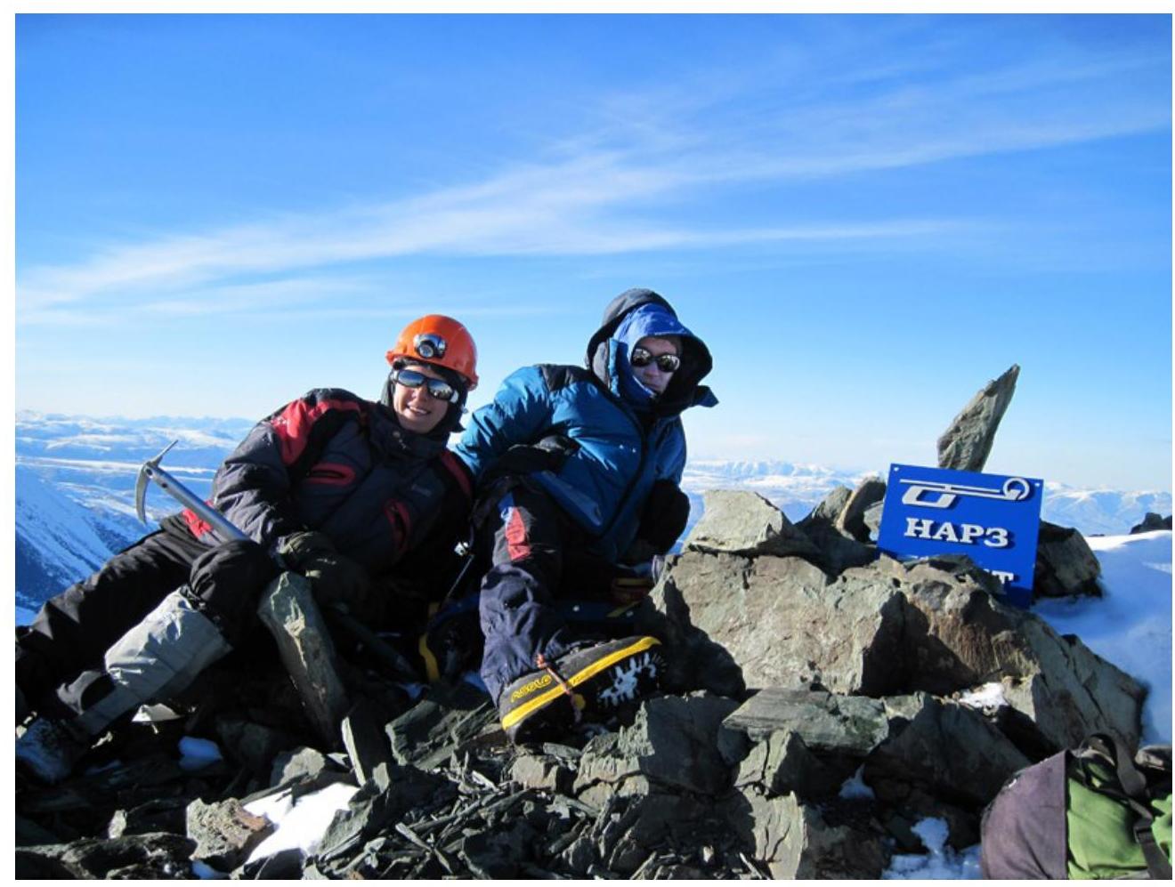
Photo 5. At the summit.
Comments
Sign in to leave a comment