Ascent Passport
- Altai, South Chuya Ridge, section 1.3 of the classifier
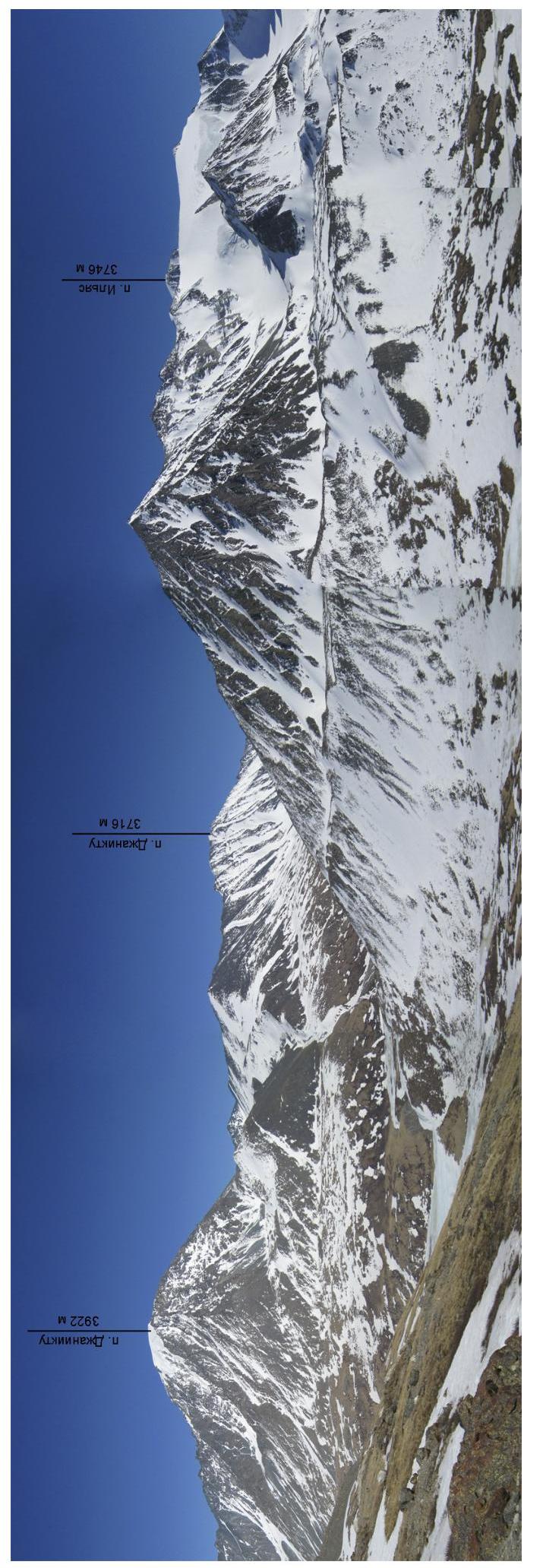
- Dzhanikktu, 3922 m, via the southeast ridge from Rubtsovsk Pass.
- Proposed category: 1B.
- Route type: combined.
- Height difference: 760 m.
Route length: 1480 m. Length of sections with category V complexity: 0, category VI complexity: 0. Average slope: 30°.
- Pitons left on the route
Total: 0, bolted pitons: 0.
- Team's travel time: 7 hours, 1 day.
- Leader: Ivan Yarovoy, Candidate Master of Sports.
Team members: Ilya Abyzov, Denis Belov, Natalia Belozorova, Marina Vashkulat, Pavel Gamayunov, Oleg Ivanov, Dmitry Nemuschenko, Mikhail Yatsenko.
- Coach: Ivan Yarovoy.
- Exit to the route from the assault camp
Route started: 8:00, May 5, 2014. Summit reached: 15:00, May 5, 2014. Return to camp: 19:00, May 5, 2014. Descent from the summit via the ascent route.
- Organization: Novosibirsk, Alpinism Federation of Novosibirsk Oblast (FANSO).
- Responsible for the report: Ivan Yarovoy (email: fanso@mail.ru, phone: 8-913-7246765)
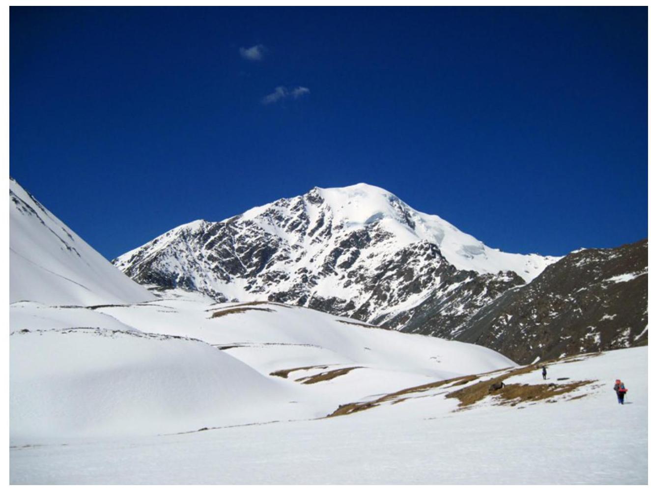
General photo of the summit. Taken on May 4, 2014, from the valley of the left tributary of the Elangash River.
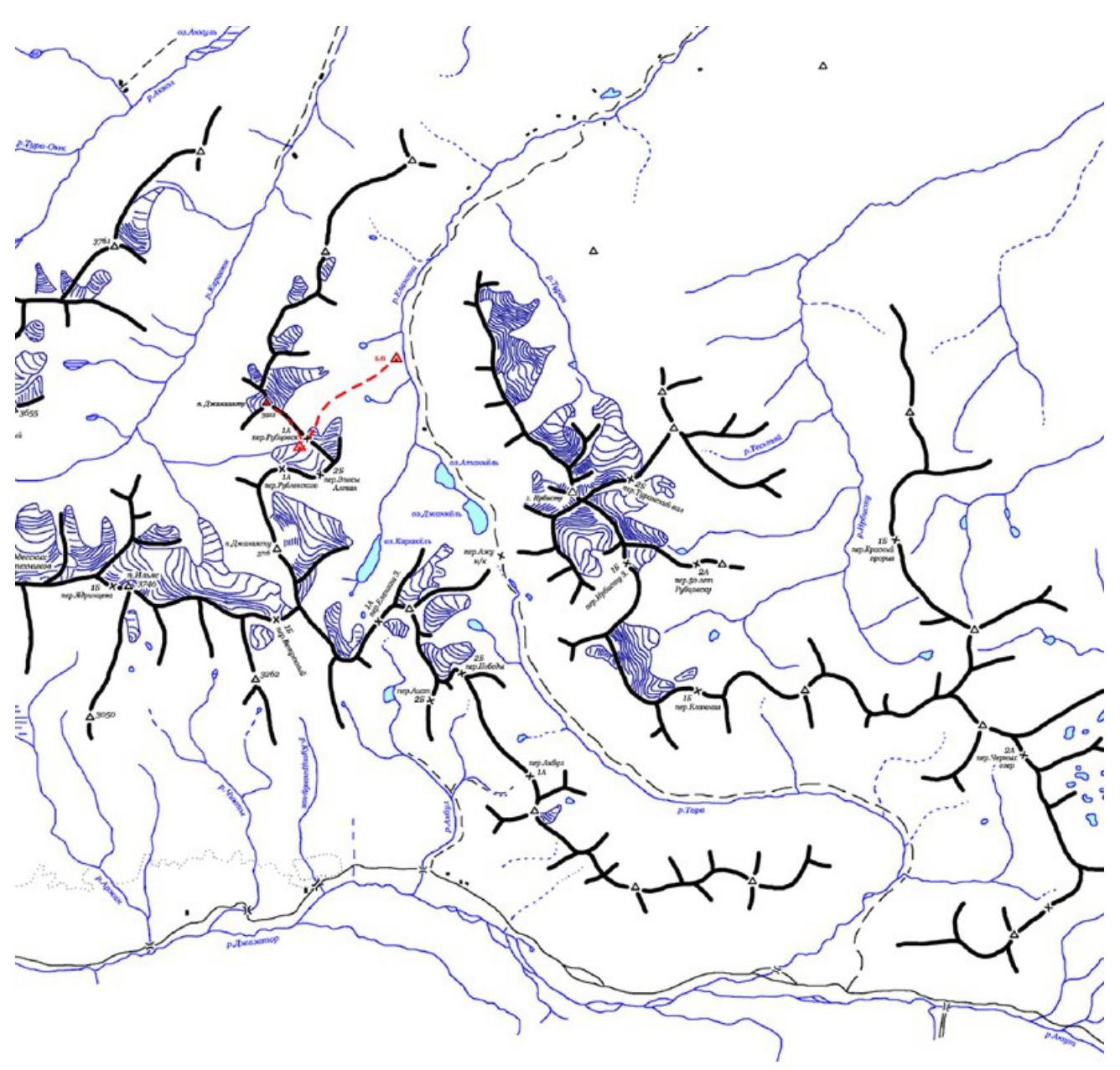
To reach the area, travel along the Novosibirsk – Tashanta highway (M-52) to the settlement of Ortolyk. Then continue on a dirt road using high-clearance vehicles to the upper reaches of the Elangash River, where a base camp can be established.
From the base camp, move upward initially along the grassy right slope (in the direction of travel), then along the left scree slope of the valley leading to Rubtsovsk Pass. The journey from the base camp to the pass takes about 5 hours.
Route Description
| Section | Length, m | Slope, degrees | Terrain characteristics | Complexity category | Number of pitons |
|---|---|---|---|---|---|
| R0–R1 | 830 | 30-35 | Scree slope with sections of snow. | I | 0 |
| R1–R2 | 200-250 | 25 | Destroyed rocky ridge. | I–II | 0 |
| R2–R3 | 150 | 30 | Scree ridge. | I | 0 |
| R3–R4 | 50 | 50 | Rocky wall. | II | 0 |
| R4–R5 | 150 | 5-10 | Wide snow-covered ridge. | I | 0 |
| R5–R6 | 50 | about 45 | Ice slope. | II | 2 |
PHOTO OF THE ROUTE WITH SECTION BREAKDOWN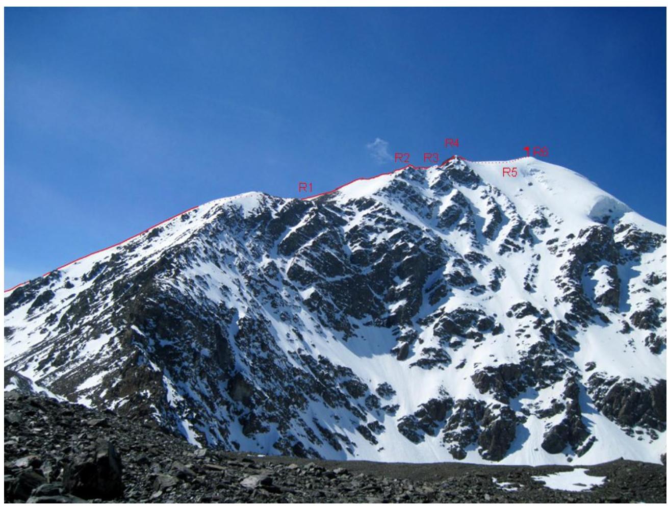
PASSAGE OF THE ROUTE BY SECTIONS
- From the pass, move upward along the average scree with sections of dense snow.
- In the second third of the section, the slope becomes gentler.
- Then the steepness increases again, and the scree turns into destroyed rocks.
Movement is simultaneous. The destroyed rocky ridge turns into a steeper scree slope, which leads to a rocky section that brings you to the pre-summit shoulder. On this section, we used a rope fixed to a ledge.
Further movement is along a wide snow-covered ridge, with a cairn at the top. The summit is a large ice cap; to reach it from the wide pre-summit ridge, one needs to traverse one rope length of ice with gradually increasing steepness.
PHOTO ILLUSTRATIONS
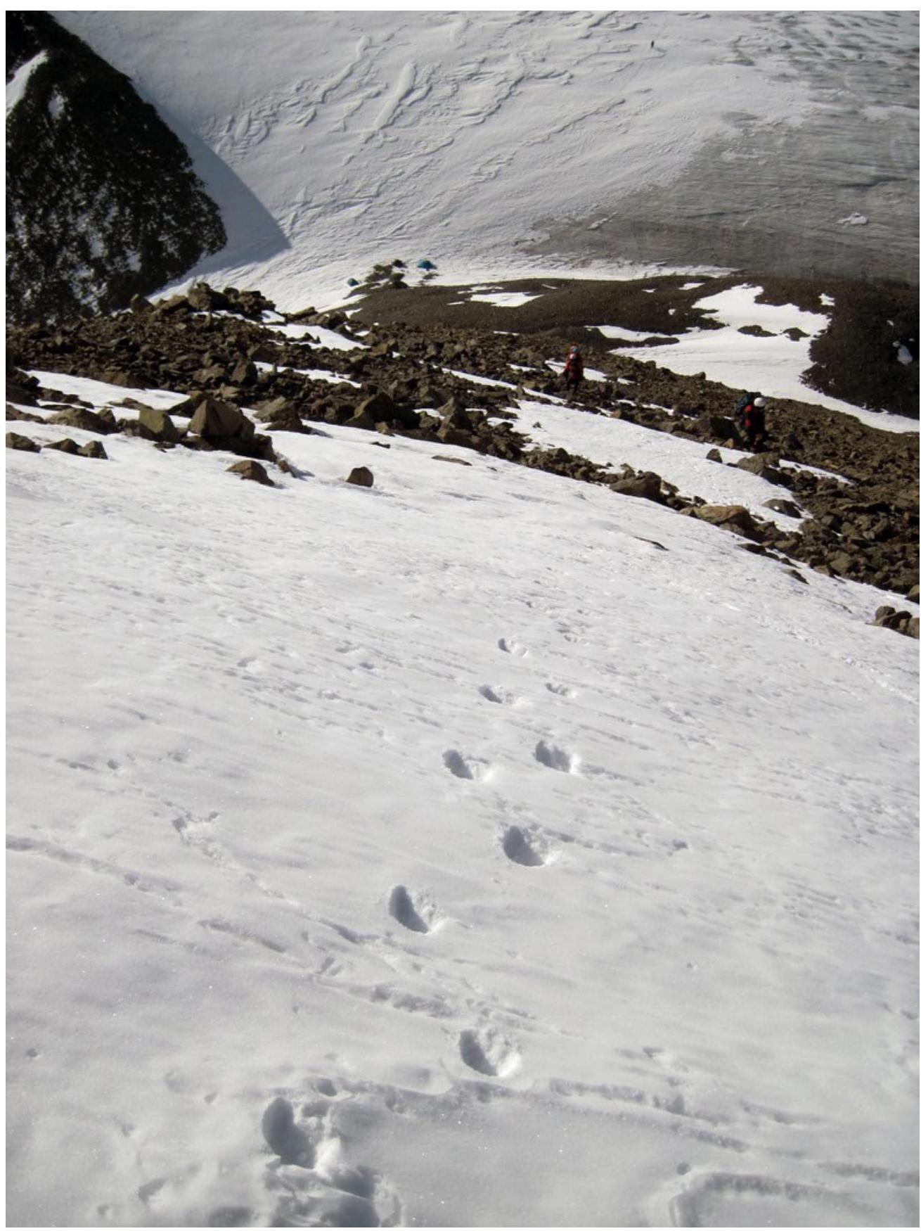
Photo 1. Section R0–R1.
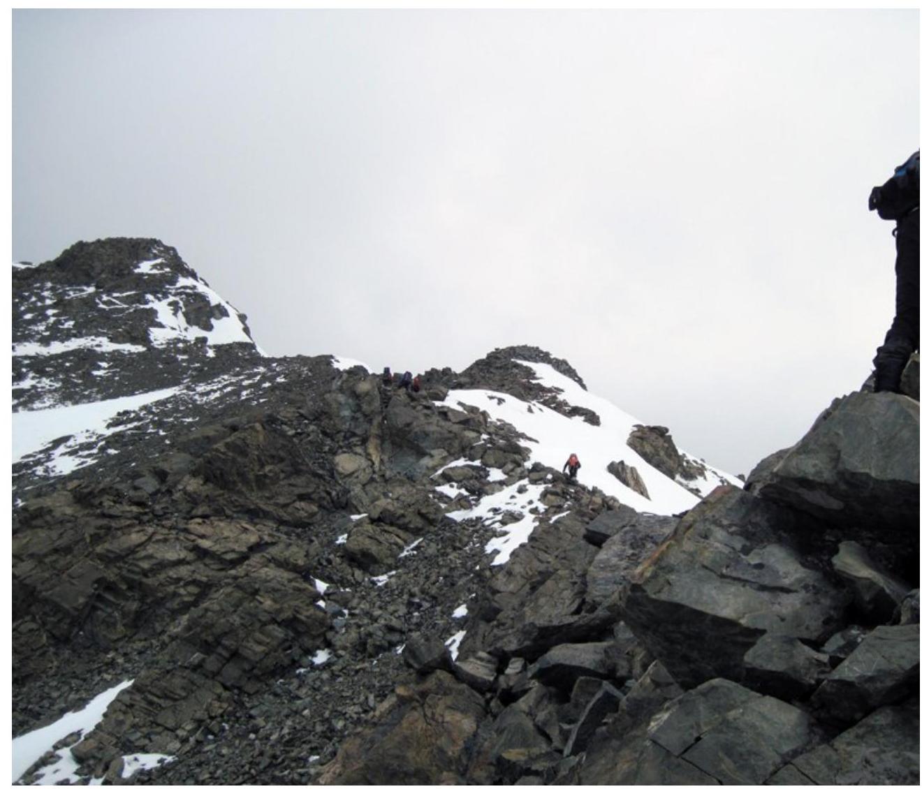
Photo 2. Section
R1–R2.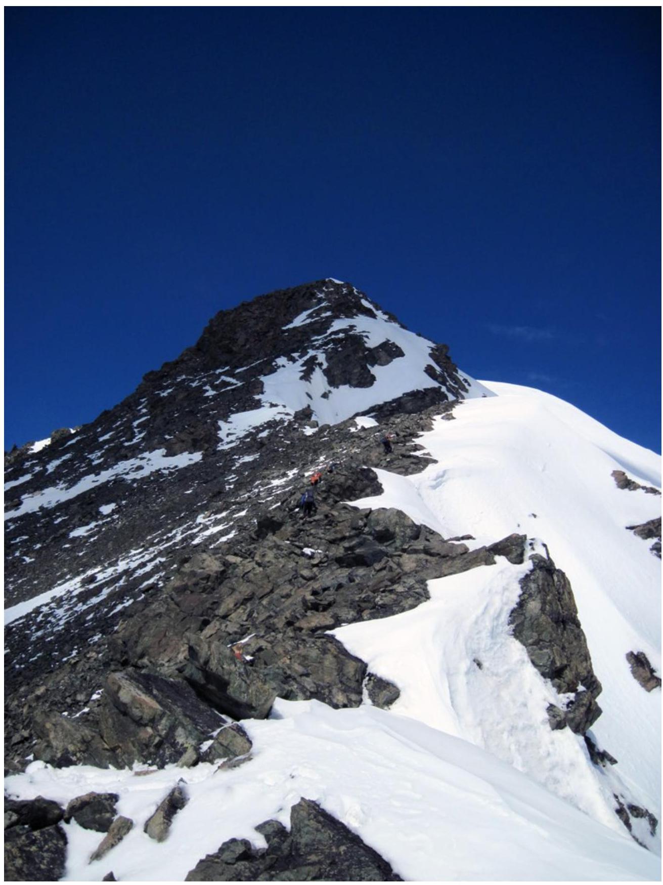
Photo 3. Section R1–R2. View of sections R2–R3 and
R3–R4.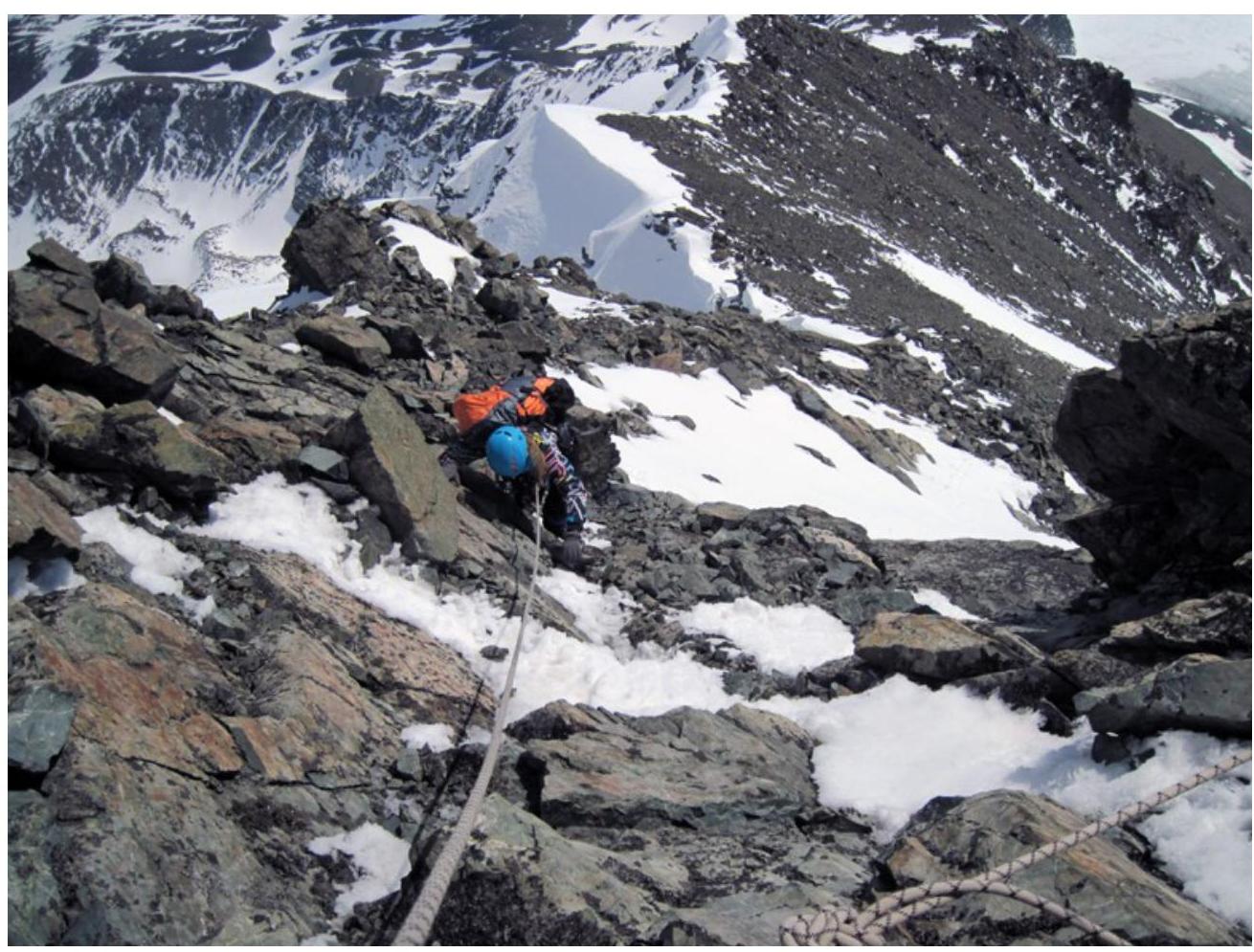
Photo 4. On section
R3–R4.
Photo 5. Section
R5–R6.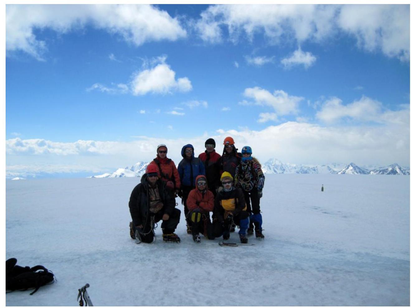
Photo 6. On the summit.


