
1.2.114
Passport
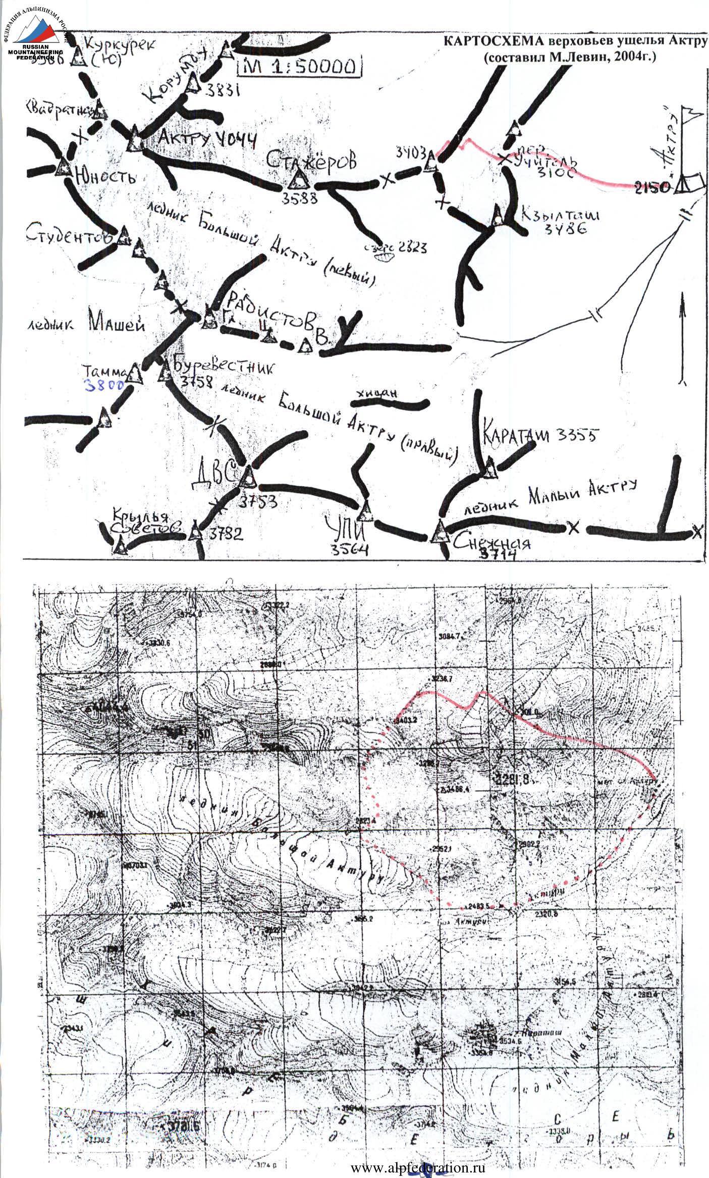
1.2. Severo-Chuyskiy ridge, Aktru gorge.
Peak Yubileynaya 3403: via south-eastern couloir of north-eastern ridge
Proposed: Category 1B difficulty, first ascent Route type: combined Note: height (3403.2) — according to the published online map M 1:50000
Altitude difference according to group's altimeter: 3400–2940 = 460 m. Route length: couloir — 500 m (estimated), ridge — 450 m (estimated), total — 950 m (estimated), including Category I difficulty section — 180 m from 45° to 60°. Average steepness of the entire route — 30° (estimated).
Total used for ascent: none cams and pitons (no fixed protection points left).
July 3, 2005 total 8 hours 42 minutes of walking time:
from Aktru alpine center (2100 m) to Uchyitel' pass (3100 m) — 1 hour 30 minutes (4:00–5:30) from Uchyitel' pass to the start of the route (2940 m) — 1 hour (5:30–6:30) from the start of the route to peak 3403 m — 3 hours (7:00–10:00) descent to Aktru alpine center via southern route Category 1B difficulty — 3 hours 12 minutes (10:15–15:30)
Leader: Askarov Samat Nurmukhametovich (Candidate Master of Sports, 3rd class) — Trehgorny (Chelyabinsk region) Participant: 2. Moshkov Viktor Vladimirovich (Candidate Master of Sports, 2nd class) — Chelyabinsk
Coach: Master of Sports Levin M.S. (senior coach of Aktru alpine center) — Chelyabinsk
Organization: see letter from Aktru alpine center dated July 24, 2005 (attached)
In 1968, Akturu alpine camp (head of training department — A.A. Kuznetsov) celebrated its 30th anniversary; and in the 1970s, peak 3403 m was named "Yubileynaya" and was a Category 1B ascent from the south, until the route was removed from the next "KTMPV USSR" as a Category 1A difficulty.
According to the training department of Aktru alpine center, the proposed "hiking" route over Uchyitel' pass will be valuable for physical and technical evaluation of badge holders.

Photo # 1: View from the east (from Uchyitel' pass plateau, approximately 3000 m, July 3, 2005)
Hand-drawn profile of the route (page 4)
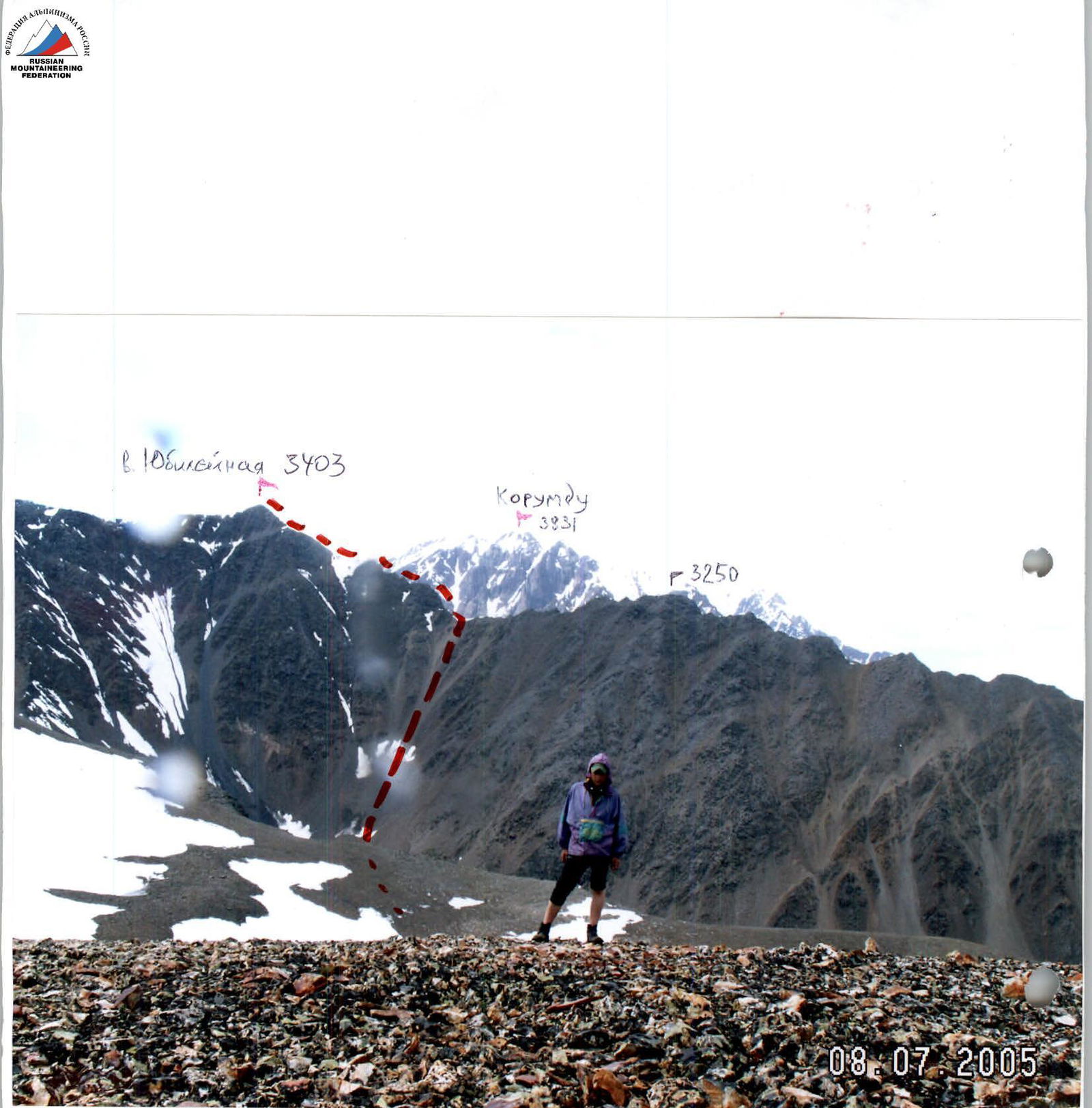
Photo # 2: View from the east, from Uchyitel' pass 3100 m
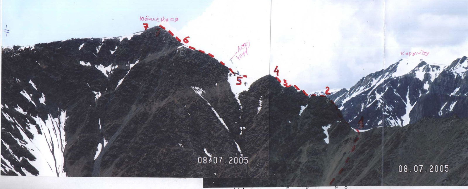
Photo # 3: Three ridges of peak Yubileynaya (view from eastern ridge of Stazhyorov peak):
- in the foreground — western ridge and Znachkistov pass 3240 m
- on the north-eastern ridge, the described route is shown
- southern ridge — towards Kontiner pass 3298 m

Photo # 4: View from the south, from peak Snezhnaya 3714 m
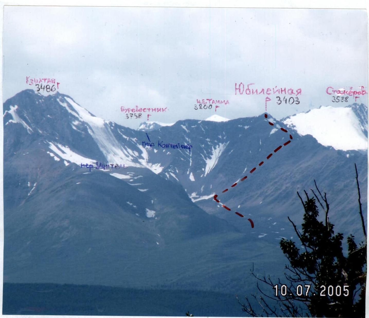
Photo # 5: View from the north, from Kurai valley
 www.alpfederation.ru ↗
Route description
From Aktru alpine center along the trail to Uchyitel' pass and south to the upper reaches of a nameless glacier (2 hours 30 minutes–3 hours). Landmark — the last wide talus couloir leading from the east into the gap in the north-eastern ridge of peak Yubileynaya.
From the snow bridge, traverse left to a rocky ascent; continue along the ridge, which drops steeply to the right. On the jagged ridge, very steep walls with good holds are encountered. Before the summit — a small ascent (2 hours–2 hours 30 minutes from the glacier).
Descent to Aktru alpine center either via the ascent route (3 hours–3 hours 30 minutes), or to lake 2823 m and Bol'shoy Aktru-Levy glacier.
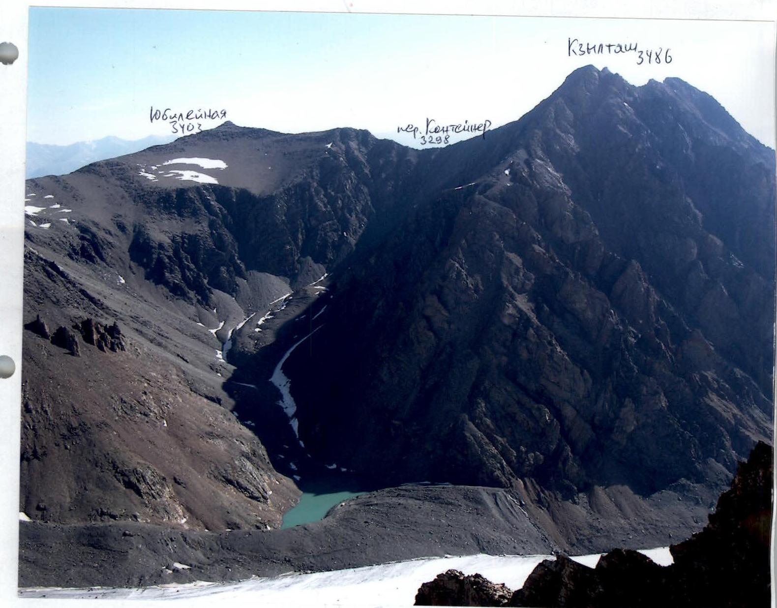
Photo # 6: View from the south-west, from the ridge of peak Radiostov-Vostochnaya (approximately 3500 m)
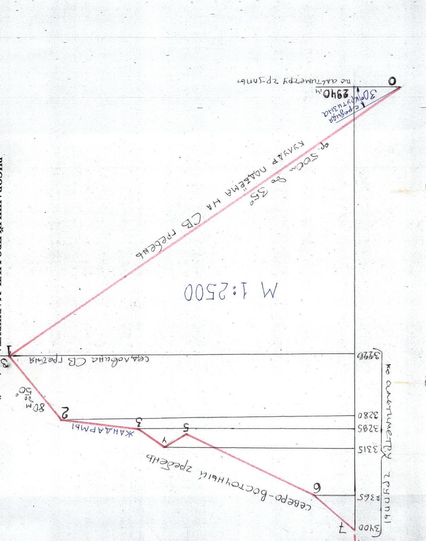
Table of main characteristics (M 1:2000)
| Section # | Protection points, description | Quantity | UIAA symbols | Category difficulty | Length (meters) | Steepness (degrees) |
|---|---|---|---|---|---|---|
| 1. | 2. | 3. | 4. | 5. | 6. | 7. |
| R3–R4 | simultaneous | - | 3295 | 1 | 50 | 35 |
| R2–R3 | jagged ridge, alternating via outcrops | - | 3280 | 2 | 100 | 60 |
| R1–R2 | ridge ascent, alternating | - | 3220 | 2 | 80 | 50 |
| R0–R1 | simultaneous | - | 1 | 500 | 35 |
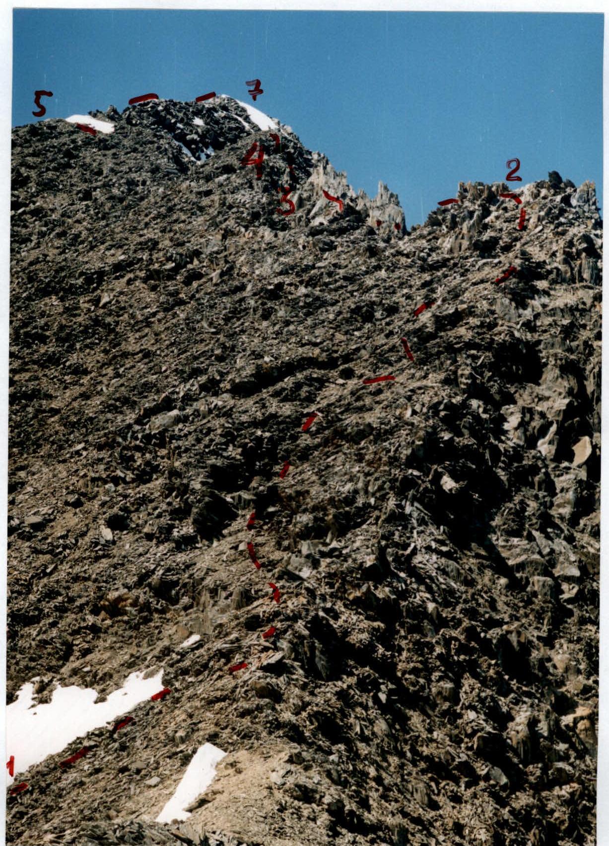
Photo # 8: Sections R1–R5, R7
| Section # | Protection points, description | Quantity | UIAA symbols | Category difficulty | Length (meters) | Steepness (degrees) |
|---|---|---|---|---|---|---|
| 1. | 2. | 3. | 4. | 5. | 6. | 7. |
| R6–R7 | peak Yubileynaya 3403 m, simultaneous ascent along the ridge to the summit | - | 1 | 50 | 40 | |
| R5–R6 | simultaneous along the ridge | - | 3365 | 1 | 150 | 25 |
| R4–R5 | simultaneous | - | 3315 | 1 | 20 | 35 |
Technical photo of the route
Comments
Sign in to leave a comment