1.2. Severo-Chuyskiy ridge, Aktuu valley
STUDENTOV Vostochny 3745 m via the south-eastern ridge
Proposed:
- Cat. diff. 2A, route No. 64-a
- Route type: combined
Note: the height (3745.1) is taken from a published online map at 1:50,000 scale.
Elevation gain according to the group's altimeter: 3750–2830 = 920 m.
Route length:
- to the pass level — 2700 m (calculated)
- along the ridge — 820 m (calculated)
- total — 3520 m (calculated)
including:
- Cat. diff. 1 — 1500 m
- Cat. diff. 2 — 80 m
Steepness of the most challenging sections: from 40° (l/s) to 60° (rock).
Equipment used during the ascent:
- no pitons or cams used (no fixed protection points left)
Protection:
- through ice axes
- through rock features (slings)
July 2–3, 2006, total of 8 hours to reach the summit: from the Aktuu alpine center (2100 m) to the assault bivouac (2823 m) — 2.0 hours (16:00–18:00); from the assault bivouac to the turn towards Maashey Pass (3080 m) — 1.0 hour (5:30–6:30); from the turn to the route to the exit (3600 m) almost at the pass level — 2.0 hours (6:30–8:30); along the south-eastern ridge to the summit of Studentov Vostochny (3745 m) — 3.0 hours (8:30–11:30); descent to the assault bivouac (following the ascent route only) — 3.6 hours (11:45–15:20).
Leader:
- Askarov Samat Nurmukhametovich (CMS, 2 cat. diff.) — Trekhorny (Chelyabinsk region)
Participants:
- Akbashev Azat Rishatovich (3rd sports category) — Ufa
- Liukkonen Andrey Aleksandrovich (2nd sports category) — Moscow
- Maslov Dmitry Mikhaylovich (2nd sports category) — Kyshtym (Chelyabinsk region)
- Shvets Ivan Borisovich (3rd sports category) — Chelyabinsk
Coach:
- MS Levin M.S. (senior coach at Aktuu alpine center) — Chelyabinsk
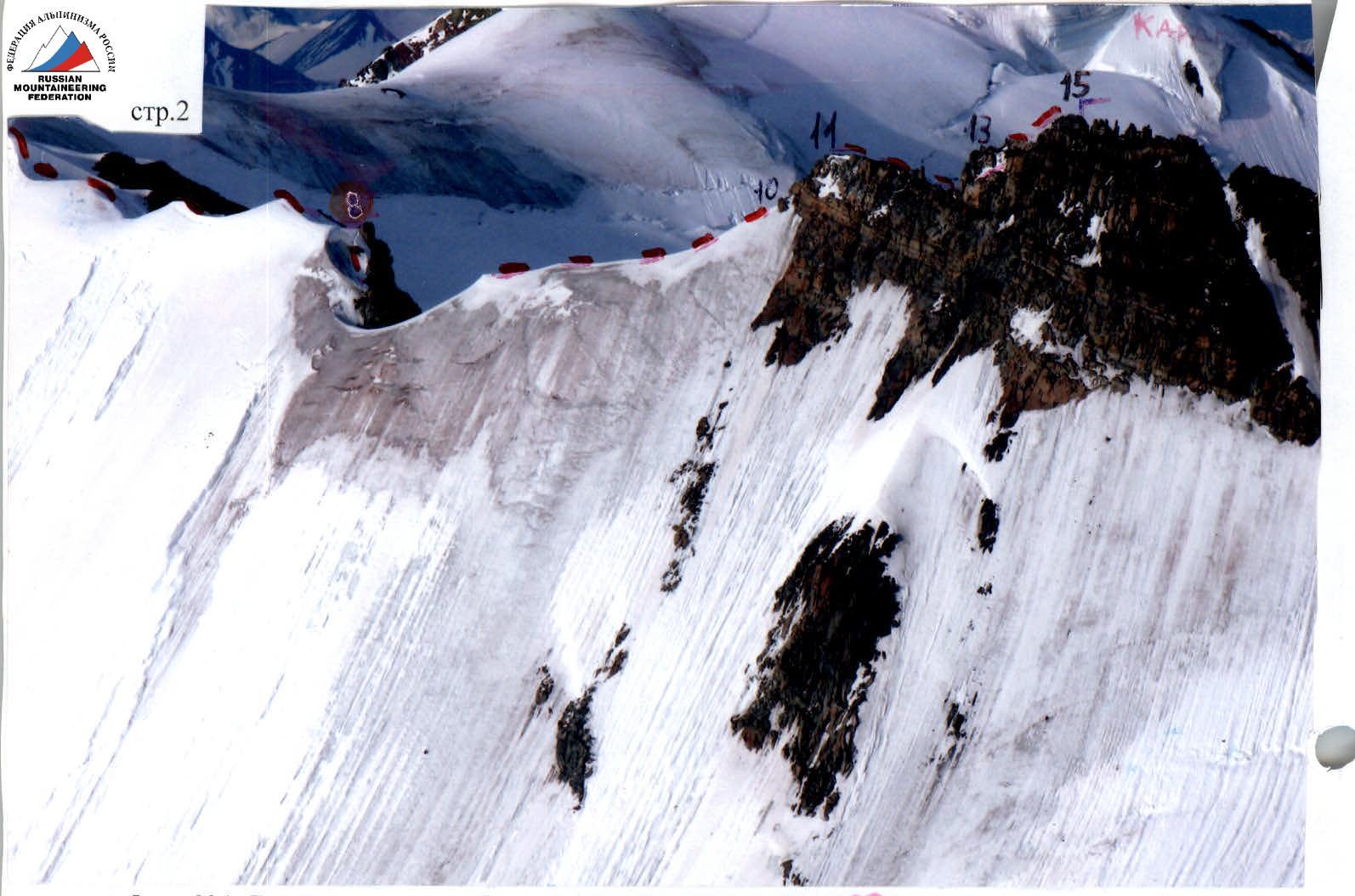
Photo No. 1: View from the north, from the ridge of Aktuu peak (see point A on photo No. 2 for the shooting location). Sections No. 1–8 are shown on the Technical Photos.
Photo No. 2: View from the south, from the slopes of I.E. Tamm peak. In the foreground is the descent into the Maashey valley.
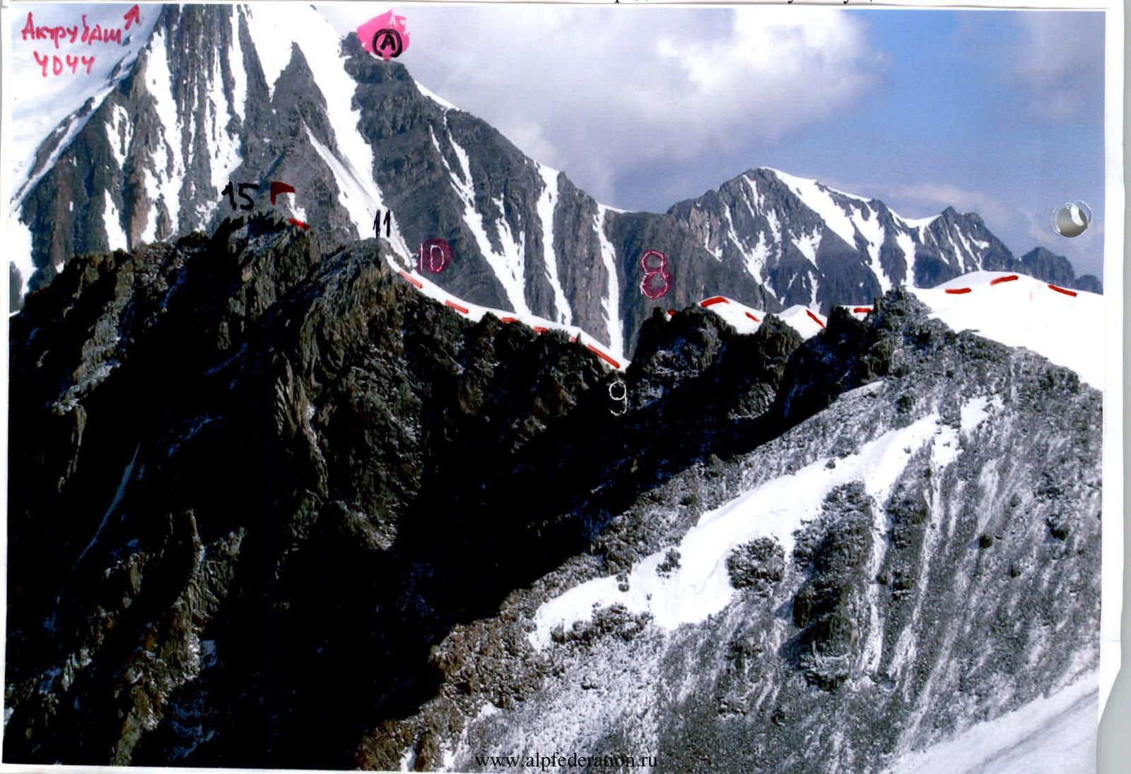
A — shows a non-classified path to Studentov Zapadny peak; the author mistakenly believes it is Yunost peak!
The description is tailored to the photo: it is recommended to ascend from the assault bivouac at 2823 m (lake) up the Bolshoy Aktuu-levy glacier for 2.5–3 hours to the saddle to the right of the peak. Then it is recommended to ascend to this right saddle (steep! bergschrund!), then along the simple ridge to the summit.
We are aware of groups that, having given up trying to understand the online description, ascended to this saddle, from where they could see two peaks — Yunost and Studentov Zapadny — and were perplexed about where the 2B category route was.
In reality, the right saddle connecting Yunost peak and Aktuu Pass is gentle and far away, almost a kilometer! The last sentence is also misleading: "Descent along the ascent route to the lake takes 1–1.5 hours" — no, it's twice as long: 5 gentle kilometers across slushy snow, risking encountering crevasses.
Unfortunately, the archive of Aktuu Alpine Center lacks a description of the traverse of Yunost–Studentov. The available online description of the traverse Yunost–Studentov Vostochny 2B cat. diff. is entirely fabricated. In our opinion, its author did not go beyond Maashey Pass! He has no idea where Yunost peak is and writes nonsense:
- "After a simple snow-covered eastern ridge before Studentov peak, there is a 'Big Gendarme' in the form of a rock 'saw' — the key section! After the 'saw,' a simple ridge leads to Studentov peak (1.5–2 hours from Maashey Pass)."
- "Descent from Studentov peak and ascent to Yunost peak along a simple ridge takes 25–30 minutes."
It actually takes 2–2.5 hours from Maashey Pass to reach the first rocks of the route — a flat shoulder and the ascent to the summit; then another 170 m of rocks to the summit. If the "Big Gendarme" is Studentov Vostochny, then where is the key rock "saw" after the simple snow-covered SE ridge?!
If "their Yunost" is Studentov Zapadny, then it's another 700 m, including 300 m of descent along a narrow rocky (appearing to be 3rd cat. diff.) ridge — not easy and not 0.5 hours!
Proposals to refine the KMGV-2001:
-
- Studentov V. — 3. — Yunost 2B for the traverse.
- 64-a. Studentov V. 3745 m 2A to the SE ridge. S. Askarov, 06
-
- Yunost 3823 m 1B l/s SE ridge from Aktuu valley. V. Kozhin, 54
-
- Yunost — Studentov 3. — V. 2B to the SE ridge, tr. to Maashey Pass. V. Kozhin, 54
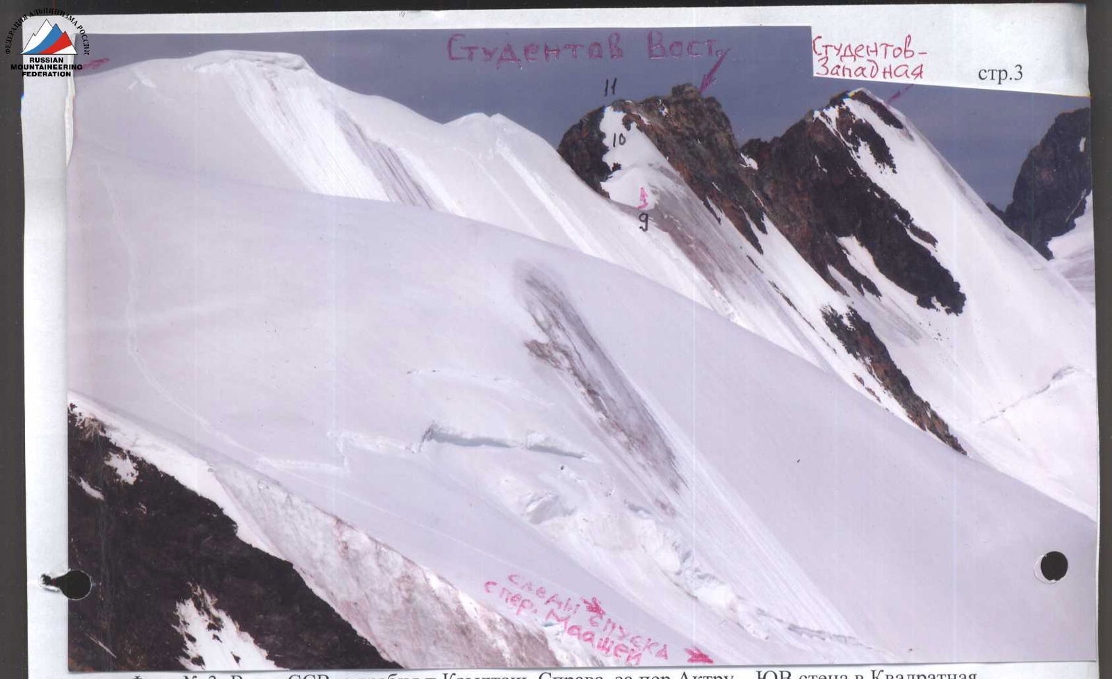
Photo No. 3: View from NNE, from the ridge of Kzyl-Tash peak. To the right, behind Aktuu Pass — the SE wall of Kvadratnaya peak.
Photo No. 4: View from the east, from the 2823 m lake (bivouac site). Sections No. 1–8 of the route are visible.

TABLE OF MAIN CHARACTERISTICS
| Section No. | Protection: number of points, names | Brief description of the section | UIAA symbol designation | Cat. diff. | Length, m | Steepness, ° |
|---|---|---|---|---|---|---|
| 1. | 2. | 3. | 4. | 5. | 6. | 7. |
| R14–R15 | Simultaneously | Summit rock ascent (photos No. 18, No. 19) (3740 m) | 1 | 20 m | 50 | |
| R13–R14 | Simultaneously | Short rock shoulder (photo No. 17) (3740 m) | 1 | 40 m | <10 | |
| R12–R13 | Alternating through rock features | Rock wall with an internal angle 7 m and snow-covered ledges (photos No. 15, No. 16) | 2 | 20 m | 60 | |
| R11–R12 | Simultaneously | Long rock shoulder (photos No. 1, No. 2) | 1 | 90 m | <10 | |
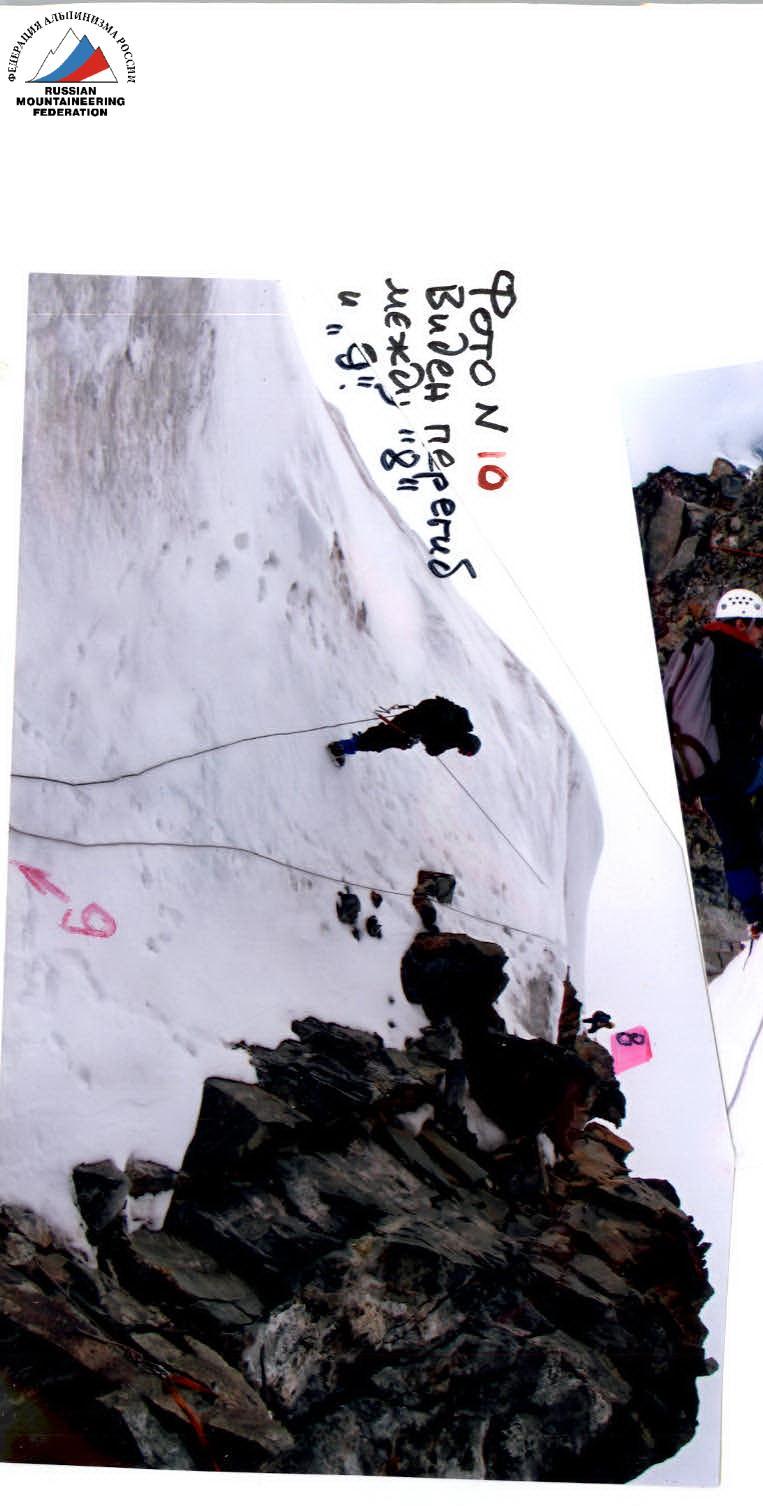
| R10–R11 | Through ice axe | Snow couloir (photos | No. 3, No. 12, No. 13, No. 14) | 1 | 30 m | |
| R9–R10 | Simultaneously | Snow ridge (photos No. 1, No. 2, No. 3, No. 12, No. 13) (3670 m) | 1 | 180 m | <20 | |
| R8–R9 | Rappel on a sling | Descent through a bend along an ice-snow slope (photos No. 1, No. 9, No. 10, No. 11) (3700 m) | 2 (on return) | 40 m | 50 | |
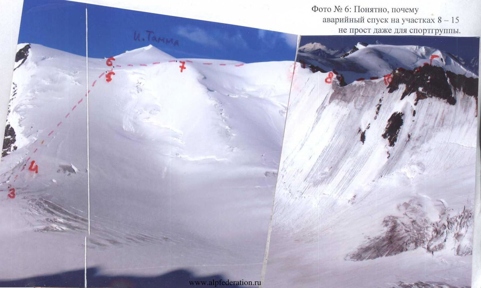
| R7–R8 | Through ice axe | SE snow ridge with humps, cornices! (photos No. 2, No. 5, No. 6, No. 8) (3600 m) | 1 | 400 m | <40 | |
| R6–R7 | Entire rope length | Traverse of the pass plateau to the right (photos No. 5, No. 6, No. 7) (3500 m) | 1 | 300 m | <10 | |
| R5–R6 | Through ice axe | Crossing a large bergschrund (photos No. 5, No. 6) (3480 m) | 2 | 20 m | 60 | |
| R4–R5 | Entire rope length | Snow-ice slope of Maashey Pass: closed longitudinal crevasses! (photos No. 4, No. 5, No. 6) (3180 m) | 1 | <1000 m | 25 | |
| R3–R4 | Through ice axe | Second snow-ice ascent (photos No. 4, No. 5, No. 6) (3090 m) | 1 | 150 m | <40 | |
| R2–R3 | Entire rope length | Turn left through the glacier (photo No. 4) (3080 m) | 1 | 250 m | <10 | |
| R1–R2 | Entire rope length | First snow-ice ascent (photo No. 4) (2860 m) | 1 | 300 m | <40 | |
| R0–R1 | Without ropes | From the bivouac above the lake along moraines, then along the glacier (photo No. 4) (2830 m) | 1 | 700 m | <15 |
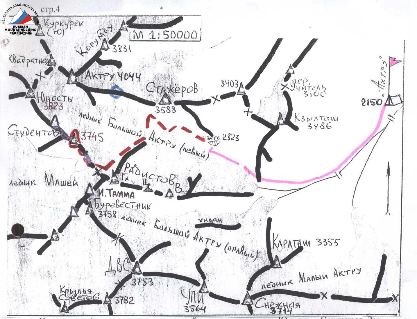
Map diagram (the ratio of distances between Yunost — Studentov Zapadny, Studentov Vostochny — Maashey Pass is somewhat distorted).
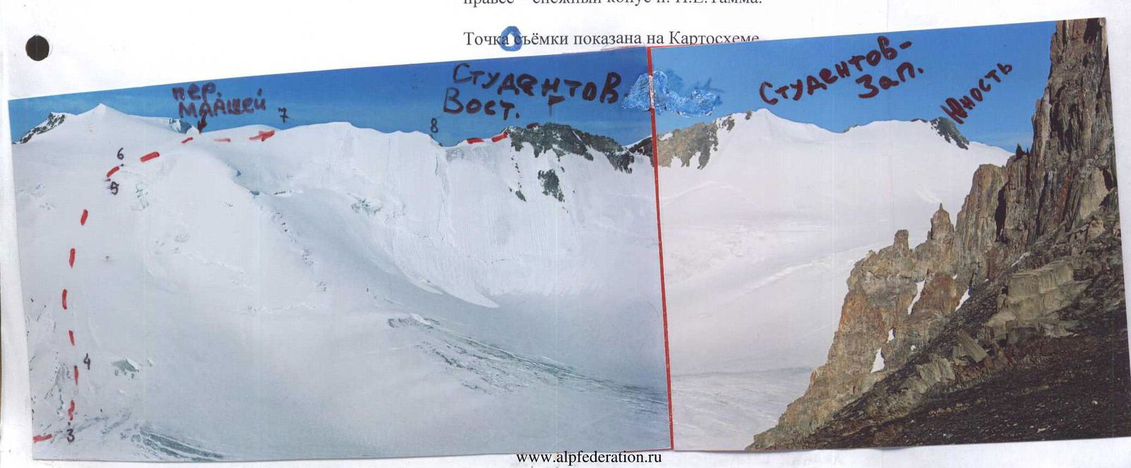
Photo No. 5: Panorama of the western part of the South-Aktuu ridge.
- On the top left — rock outcrops of Burevestnik peak
- To the right — the snow cone of I.E. Tamm peak
 Towards the pass
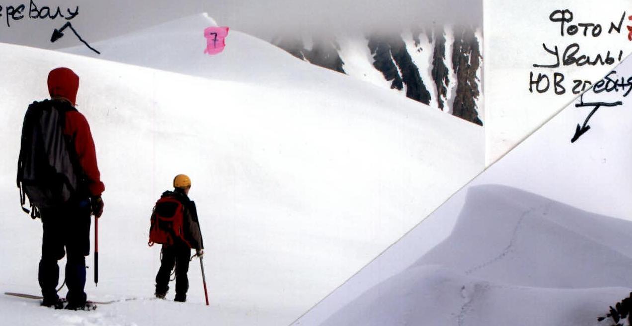
Photo No. 8: Maashey Pass is shown.
Photo No. 9: Descent tracks from R8.
Route description
Follow the trail from the Tomsk State University base (2100 m), without crossing the Aktuu River, to the high "ram's foreheads" (1–1.5 hours), which are bypassed on the right along a steep scree slope. Then follow the edge of the glacier past the slopes of Kzyl-Tash peak towards the slopes of Stazhery peak. Before reaching them, to the right behind the coastal moraine lies the "Blue Lake" and a glaciologist's hut (2–2.5 hours from the base). Set up a bivouac here (2830 m according to the group's altimeter).
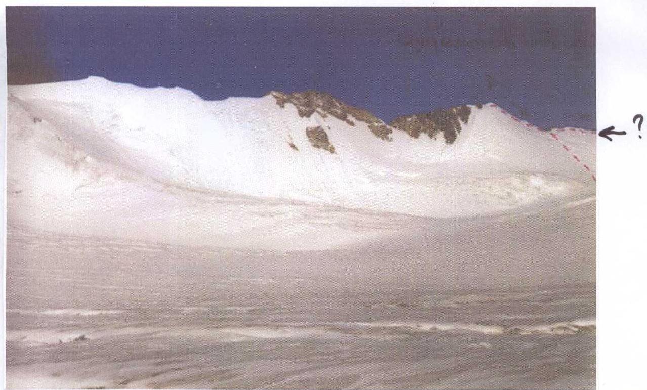
Early in the morning, move along the moraine to the Bolshoy Aktuu-levy glacier, and bypass the rock step to the west to the first ascent. On crampons and in rope teams (crevasses!), exit beyond the ascent (2940 m) and turn left opposite the western saddle of Stazhery peak. Against the skyline is Maashey Pass-Zapadny (3680 m), the right depression in the South-Aktuu ridge.
After the turn, ascend at 40° for 100 m, then directly up a long slope >25° — crevasses everywhere! A large bergschrund lies at the top bend, followed by a plateau (<10°). Along this, a path leads left to Burevestnik peak; to the Maashey valley — to the right. Do not go through the SE ridge of the Studentov massif towards the rocks to the right of the start of the descent into the Maashey valley (pass cairn)!
If visibility is poor on the pass: immediately after the large bergschrund, turn right and traverse 200–300 m along the N slopes of the very wide SE ridge of Studentov peak. The ridge narrows, its N slope becomes steeper — here, exit south of the ridge line (2.5–4 hours from the bivouac above the lake, depending on the condition and snow cover of the ice slope).
Then, through several humps on the snow ridge (cornices on the north) to a dip. Descend sporting 40° 40 m past the bend (ice!), then ascend and along the snow ridge to a snow-ice couloir on the first rock shoulder of the sub-summit.
The destroyed sharp ridge of the shoulder (right-hand detours) leads under a steep ascent, after which a snow ledge leads to the second, short shoulder and to the summit tower (cairn (3745 m) in a crevice; 2.5–3 hours from the pass level).
Descent — only along the ascent route; consider that the snow has already become slushy! Organize rappel points on carefully tested rock features. For a group of two teams, it takes 1.5–2 hours to reach the pass.
For an emergency descent to the Bolshoy Aktuu-levy glacier, have 4 ice screws.
Combined photo No. 11. In the background are the peaks of the South-Chuyskiy ridge. The "Genstaff" map posted online (original scale 1:50,000, heights to a tenth of a meter, 20 m contour interval, and tied to Greenwich) is currently the primary source of information. Naturally, not all peaks are indicated, and only the highest are named.
There are tourist ridge maps where Yunost peak is southeast (?) of Studentov peak, near Maashey Pass. There are also maps where Studentov peak is not shown at all, and the nodal Yunost peak is depicted.
In reality, there are three peaks between Maashey Pass and Aktuu Pass.
The distance between Maashey Pass and the 3823 m peak to the east is 2.5 km on the map.
This 3823 m peak:
- Was named "Yunost" by the first ascender, Viktor Kozhin, the then head of the training department at Aktuu alpine camp.
- Was led to by the camp's sports instructor, Sergey Frolov, on August 6, 1954, with students from UPI, including M.S. Levin, the current senior coach at Aktuu Alpine Center.
From Yunost peak, V. Kozhin's group traversed the bifurcated 3745 m massif, which is closer to Maashey Pass, and named it "Studentov peak."
The two peaks of Studentov (in 1954, they were jokingly called "Student" and "Studentka"; "Studentka" is to the east and 30 m lower) are 700–800 m apart and separated by a difficult saddle. But let's refrain from the temptation to name the eastern peak "Studentka"! It would be a regret later: "Where are you?" — "Sitting on Studentka!" (the highest point is very sharp, you can't lie down!)
It is the eastern peak of Studentov, the object of this ascent. The album of descriptions compiled for Aktuu Alpine Center in Tomsk repeats 1:1 the online materials from S. Kostryulev (Bratsk, 1990–1996) and others. The album contains a photo (see below) with a line of movement along the 1B cat. diff. route to Yunost peak. But Yunost peak is not even visible in this photo!
Yunost from Aktuu valley 1B cat. tr.
From the camp, move upstream along the river towards the Bolshoy Aktuu glacier. Walk along the slopes of Kzyl-Tash peak, sticking to the riverbed until the large rock "ram's foreheads" (1–1.5 hours), which are bypassed on the right along a steep scree slope.
Then:
- follow the edge of the glacier to the slopes of Stazhery peak
- the lake is located behind the moraine ridge
- on the moraine — a glaciologist's tent
- 2–2.5 hours walking from the camp
- a convenient place to overnight
From the moraine lake:
- head towards the Bolshoy Aktuu glacier (crevasses! Move in rope teams!)
- move, keeping to the right-hand slopes as you go, towards Yunost peak
- cross the glacier towards the saddle to the right of Yunost peak
- time: 2.5–3 hours
Ascent:
- to the saddle along a steep snow slope (bergshrund may be exposed at the bottom)
- then along a simple ridge to the summit (1–1.5 hours)
Descent along the ascent route to the direction of the lake — 1–1.5 hours.
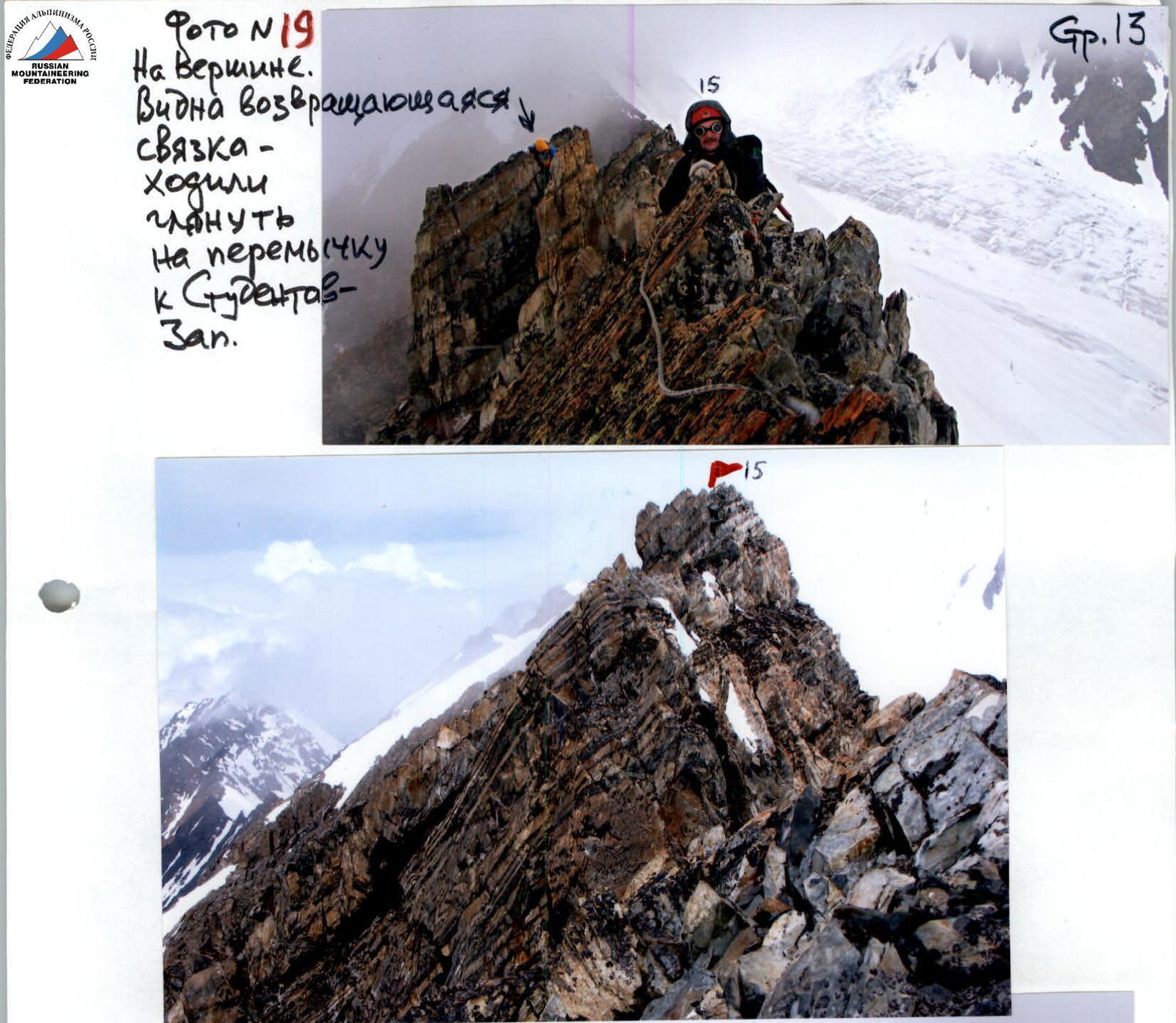
Photo No. 19: On the summit. The returning team is visible — they went to check the saddle towards Studentov Zapadny.
Photo No. 18: The summit is visible.
Photo No. 17: View from the summit on the route taken.
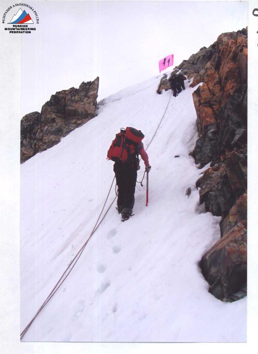
Photo No. 14
Upper part of the couloir.
Photo No. 13
Ahead is the couloir. In the fog — the drop of the rock shoulder.
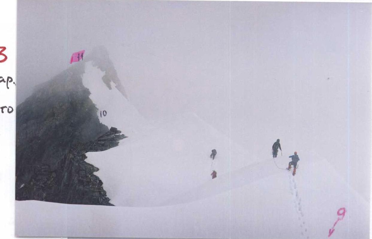
Photo No. 12
Snow ridge after the dip — 1st rope.
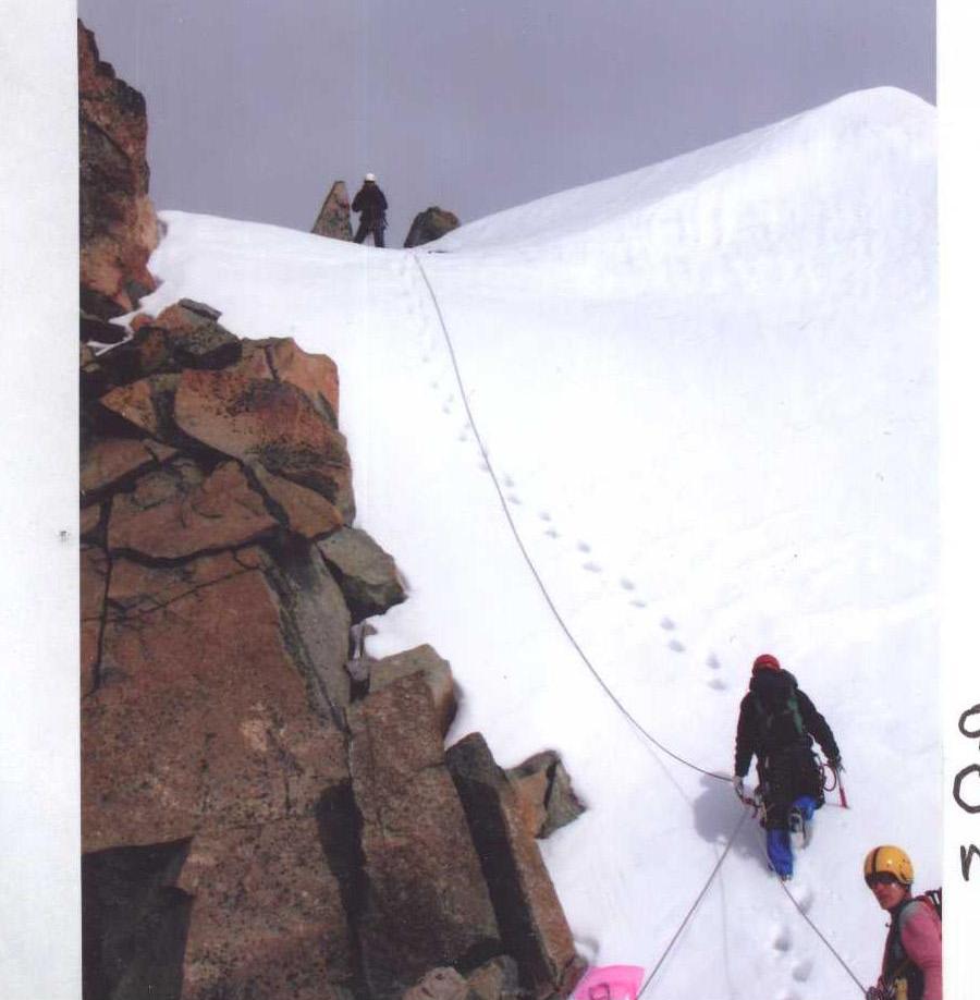
Photo No. 15: The first team is heading behind the internal angle above the rock shoulder.

Photo No. 16: Detour along the ledges. View from the short pre-summit rock shoulder.


