Passport
1.2. North Chuya Range, Aktru gorge.
Radistov (E) 3523 via the left part of the northern slope of the eastern ridge. Proposed: Category 2B difficulty, first ascent. Route character: ice-snow. Note: height (3522.7) - according to the published online map M 1:50 000. Altitude difference according to the group's altimeter: 3530–2940 = 590 m. Route length – 1100 m (estimated); including: Category III difficulty – 140 m up to 50°. Average steepness of the route – 33°. Total used on ascent: ice screws – 18, rock pitons and stoppers – none (no abandoned belay points). Traveling hours on July 3, 2005: from Aktru alpine center (2100 m) to the start of the route – 2 hours (5:00–7:00), from the start of the route to the summit – 4 hours (7:30–11:30), descent from the summit to Aktru alpine center – 4 hours (12:00–16:00).
Leader: Viktor Vladimirovich Moshkov (Candidate for Master of Sports, 2nd sports category) – Chelyabinsk. Participant: 2. Samat Nurmukhametovich Askarov (Candidate for Master of Sports, 3rd sports category) – Trehgorny (Chelyabinsk region). Coach: Master of Sports Mikhail S. Levin (senior coach of Aktru alpine center) – Chelyabinsk.
Organization: see letter from Aktru alpine center dated July 24, 2005 (attached).
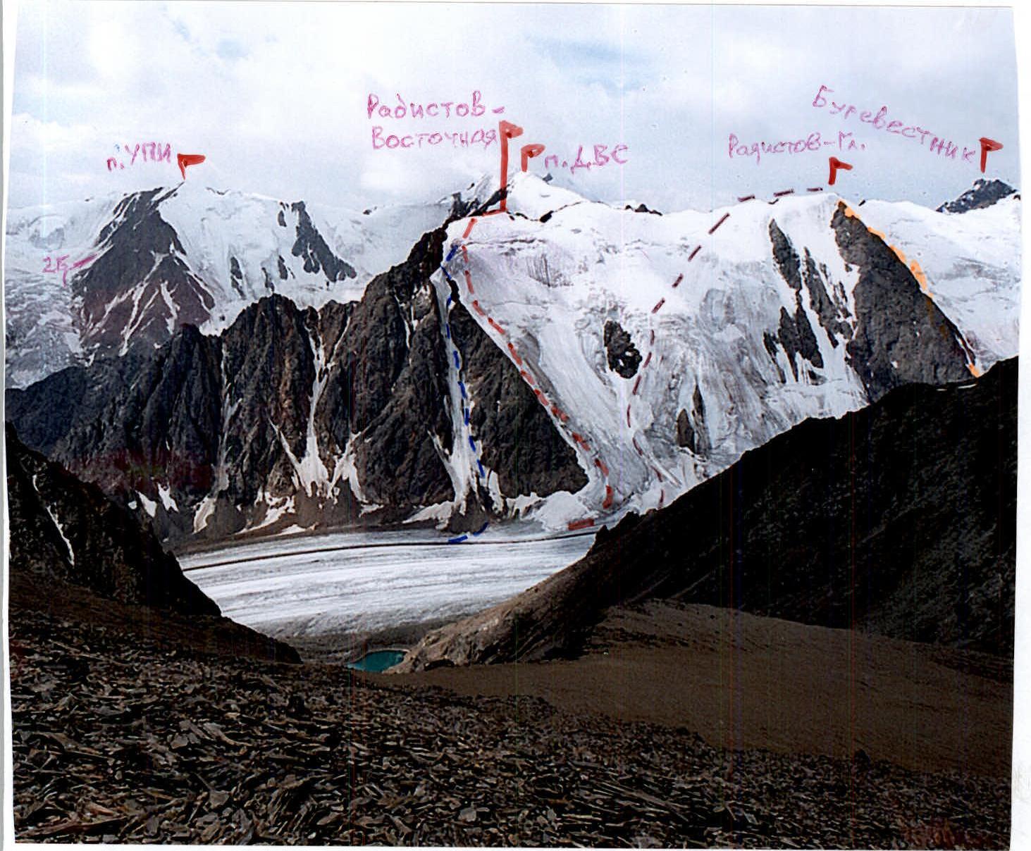
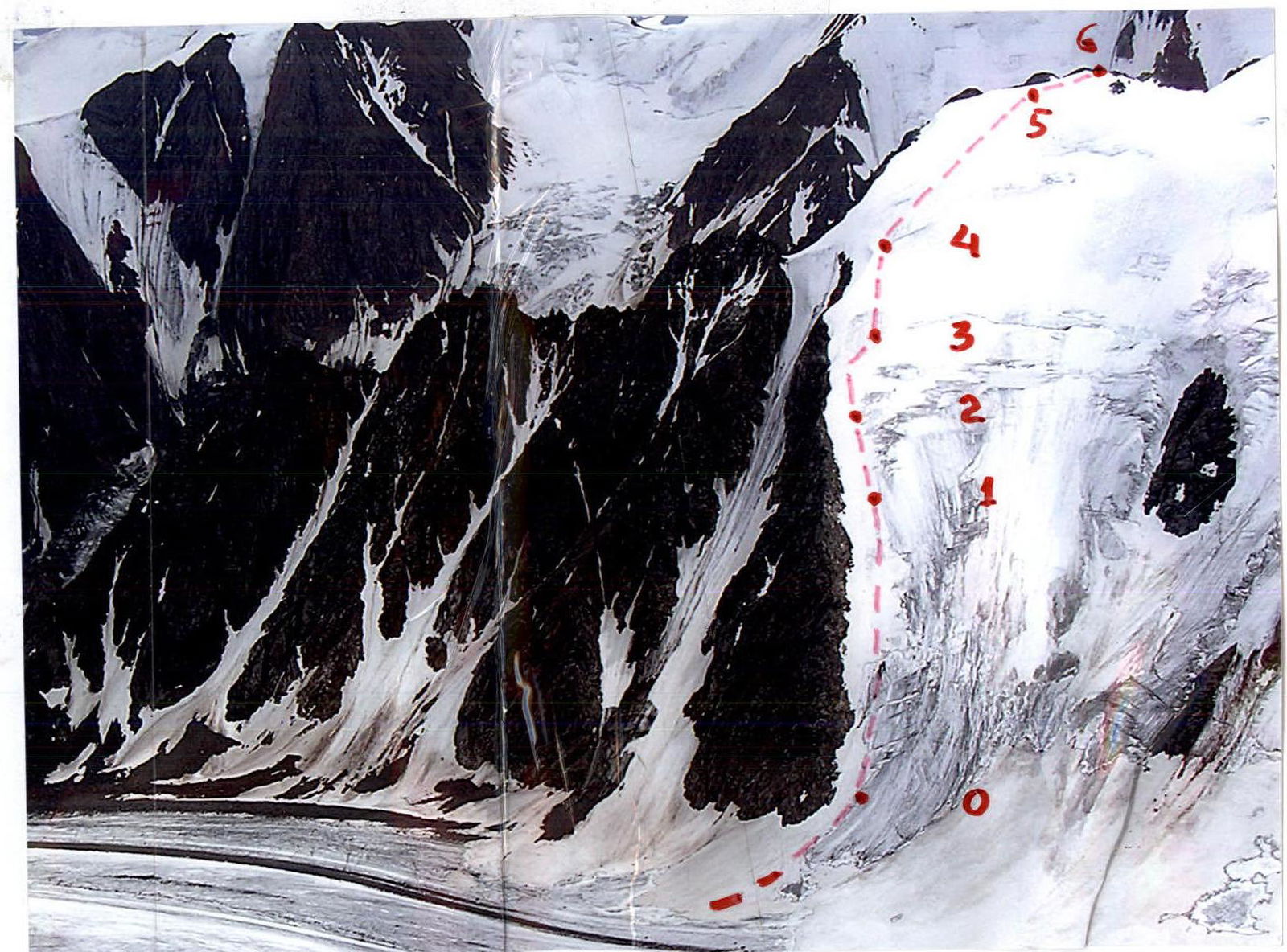
Photo # 1: view from the north, from Znachkistov pass (orienting at 3200 m, July 23, 2005).
Legend: – described route to Radistov-Eastern 3523 peak; – route Category 3A difficulty by A. Gaponov (1.2–100); – route Category 3A difficulty by A. Drakin's team (1.2–53a); – route Category 3A difficulty combined (1.2–53).
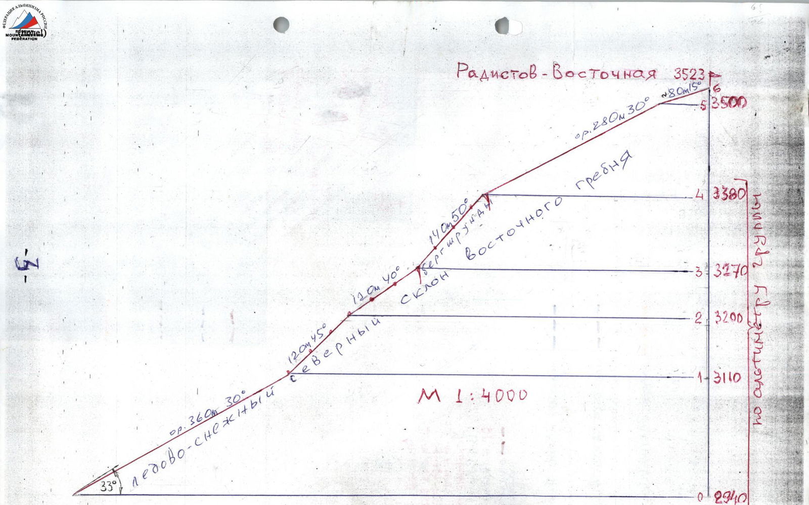
Drawn profile of the route (page 4).
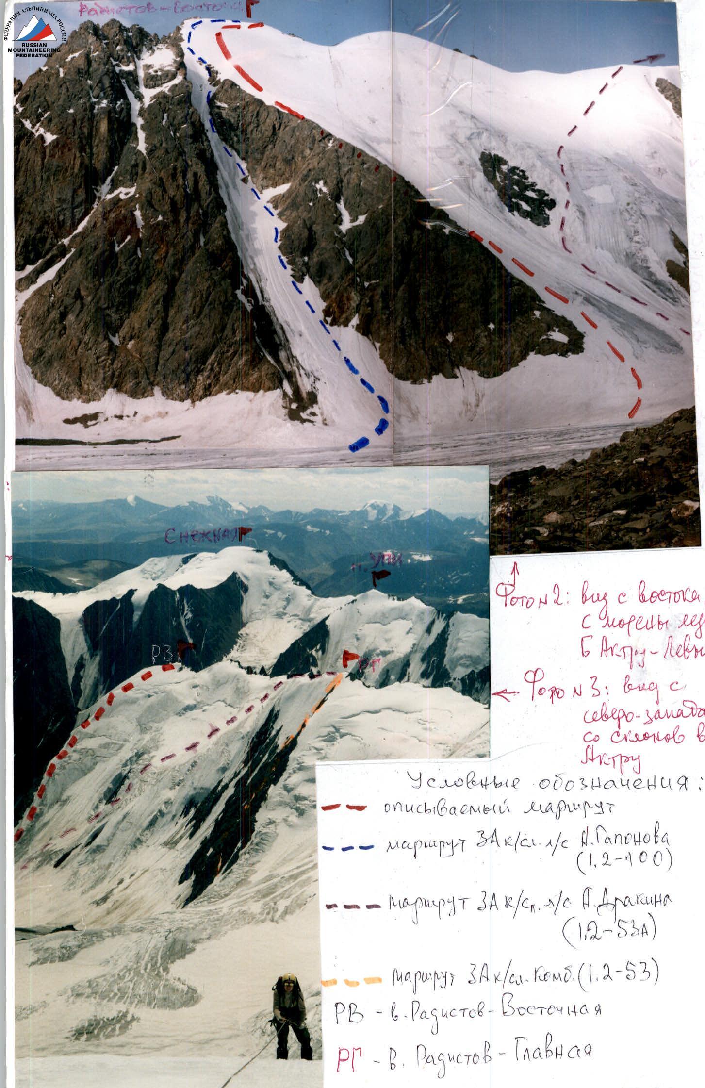
Photo # 2: view from the east, from the moraine of Big Aktru – Left glacier. Photo # 3: view from the northwest, from the slopes of Aktru peak. Legend: – described route; – route Category 3A difficulty by A. Gaponov (1.2–100); – route Category 3A difficulty by A. Drakin's team (1.2–53a); – route Category 3A difficulty combined (1.2–53). RV – Radistov-Eastern peak. RG – Radistov-Main peak.

Photo # 4: View from "Green Hotel" 2858 on the northern ridge of Kupol peak. Legend: – described route to Radistov-Eastern 3523 peak; – descent option to the south from Radistov-Eastern peak; – start of route Category 3A difficulty by A. Gaponov (1.2–100); – start of route Category 3A difficulty combined (1.2–53); – route Category 1B difficulty via Mashey pass 3680 to I.E. Tamm peak 3800.
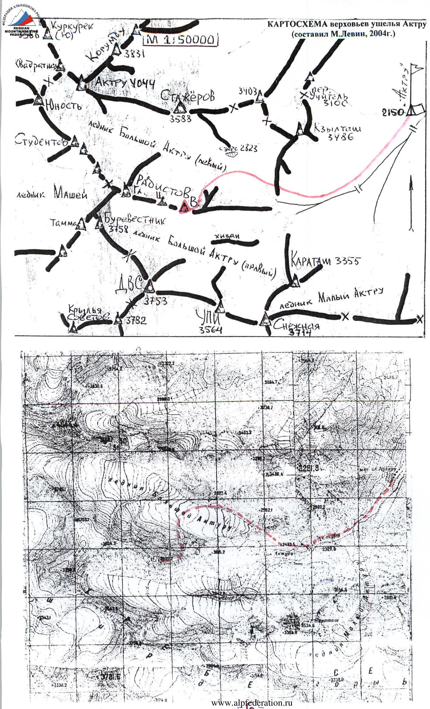
MAP of the upper Aktru gorge (compiled by M. Levin, 2004). M 1:50 000.
Route Description
From Aktru alpine center along the trail on the left (here and further orogr.) bank of the river to the "ram's foreheads" of Big Aktru – Left glacier, where between the "foreheads" – exit to the left side of the glacier. To the left along the way – rocky counterforts of the eastern ridge of Radistov-Eastern peak. Landmark: the last counterfort-barrier, which to the left limits the ice-snow slope of the Radistov triple peak massif.
Exit to the slope – 20–30 m to the right of the "barrier" rocks, ascent with belay through ice axes. At the level of the lower part of the "eye" the steepness increases, near the counterfort rocks there is little snow; with belay through ice screws to the bergschrund, before which the steepness decreases. Beyond the bergschrund – more than two rope lengths, the steepest, to the next bergschrund; then along the slope to the rock outcrops of the eastern ridge and along them to the summit cairn.
– along the slope to the rock outcrops of the eastern ridge; – along them to the summit cairn.
Time allocation for a training group considering movement along the fixed ropes: from Aktru alpine center (2100 m) to the start of the route – 2 hours 00 min – 2 hours 30 min; from the start of the route to the summit – 5 hours – 6 hours.
Descent: – to Big Aktru – Left glacier (by traversing through Central and Main Radistov peaks and to the right from Mashey pass); – to Big Aktru – Right glacier (down the eastern ridge to a large gendarme and to the south along the couloir); takes at least 4–5 hours.
The route is safe, very straightforward, without alternatives (exit to the left onto the upper rocks of the counterfort is dangerous) and comparable in difficulty to Profsoyuzov peak Category 2B difficulty in the Shkhelda massif or to Ullu-Tau-Western peak Category 2B difficulty.
At the same time: – A. Gaponov's route (2004) along the narrow couloir to the left of our "counterfort-barrier" – undoubtedly more difficult and, of course, more dangerous than all Category 3A difficulty routes in the area. – Ice-snow Category 3A by A. Drakin's team (1997) – diagonally past the "eye" – significantly longer and more variable in relief than the described route.
TABLE OF MAIN CHARACTERISTICS (M 1:2000)
Radistov-Eastern peak 3523 m.
| Section | Belay points | Number | UIAA symbols | Difficulty category | Length (m) | Steepness (degrees) |
|---|---|---|---|---|---|---|
| R3–R4 | Alternating with belay through ice screws, fixed ropes 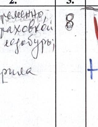 | 8 |  | 3 | 3×40+20 = 140 | 50 |
| R2–R3 | Alternating with belay through ice screws, fixed ropes  | 6 | 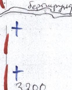 | 2 | 3×40 = 120 | 40 |
| R1–R2 | Alternating with belay through ice screws, fixed ropes  | 4 |  | 2 | 3×40 = 120 | 45 |
| R0–R1 | On crampons simultaneously | – |  | 2 | height 360 m | 30 |
| R5–R6 | Simultaneously | – | 3500++ | 1 | about 80 m | 15 |
| R4–R5 | Simultaneously | – | ++ | 2 | about 280 m | 30 |
TECHNICAL PHOTO OF THE ROUTE


