Passport
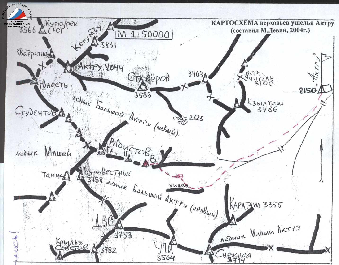
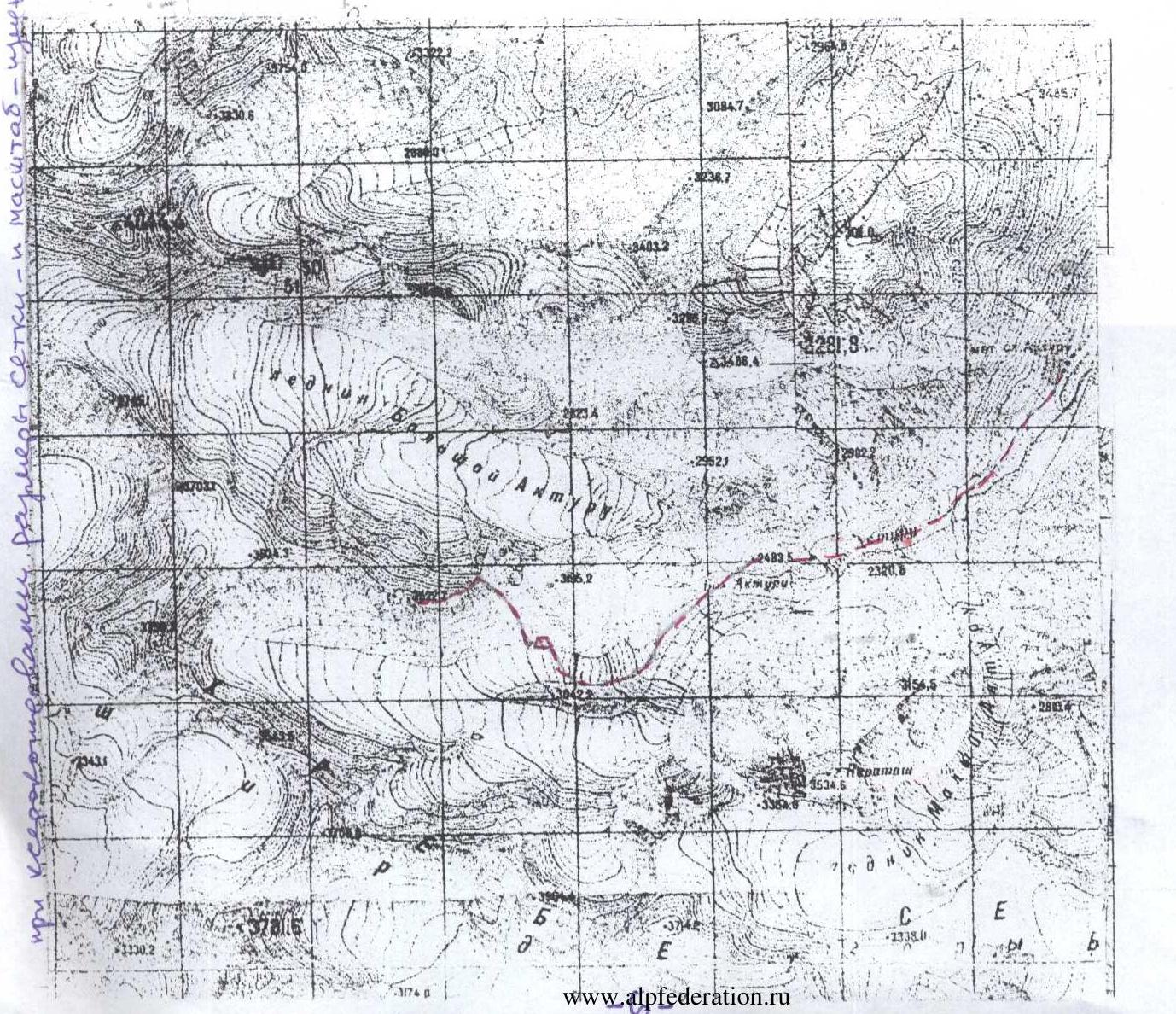
1.2. North-Chuya Range, Aktru gorge.
EXISTING: "1.2.54 Radistov (V) 3750 1B from the south via Akturu couloir. A. Drakin, 91"
Proposed Reclassification of the Route
1.2.54 Radistov (V) 3523 2A category of difficulty to the south couloir of the eastern ridge Note: height (3522.7) - according to the published map M 1:50000. Altitude difference according to the group's altimeter: 3550–2930 = 620 m. Route length – 1,200 m (estimated); including category III difficulty – 290 m up to 40°. Average steepness of the entire route – 30°. Used in total for the ascent: ice screws – 6 rock stoppers and rock pitons — none (no left behind protection points) Storm bivouac (sh/b) – 2,900 m according to the group's altimeter
Traveling hours:
- from alpine camp "Aktru" (2100) to sh/b – 2.5 hours (July 12, 2005 17:30–20:00)
- from sh/b to the summit – 4.2 hours (July 13, 2005 4:30–8:45)
- descent from the summit to sh/b – 3.3 hours (July 13, 2005 9:30–12:50)
- descent from sh/b 2900 to alpine camp "Aktru" – 1.5 hours (July 13, 2005 16:30–17:55)
Leader: Shchukin Vladimir Ivanovich (Master of Sports of the USSR, 1st sports category) – Chelyabinsk
Participants: 2. Bakhtin Ivan Nikolaevich (badge holder) – Ufa 3. Zuev Andrey Alexandrovich (badge holder) – Nizhnevartovsk 4. Korovin Alexander Anatolyevich (3rd sports category) – Ufa 5. Penigin Egor Alexandrovich (3rd sports category) – Ufa 6. Sultanov Alfred Rifhatovich (badge holder) – Ufa 7. Tarasenko Ekaterina Mikhailovna (3rd sports category) – Ufa
Coach: Levin M.S. (senior coach of Aktru alpine camp) — Chelyabinsk
Organization: see letter from Aktru alpine camp dated July 24, 2005 (attached)
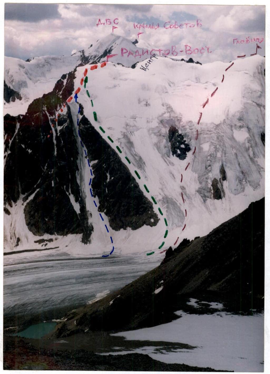
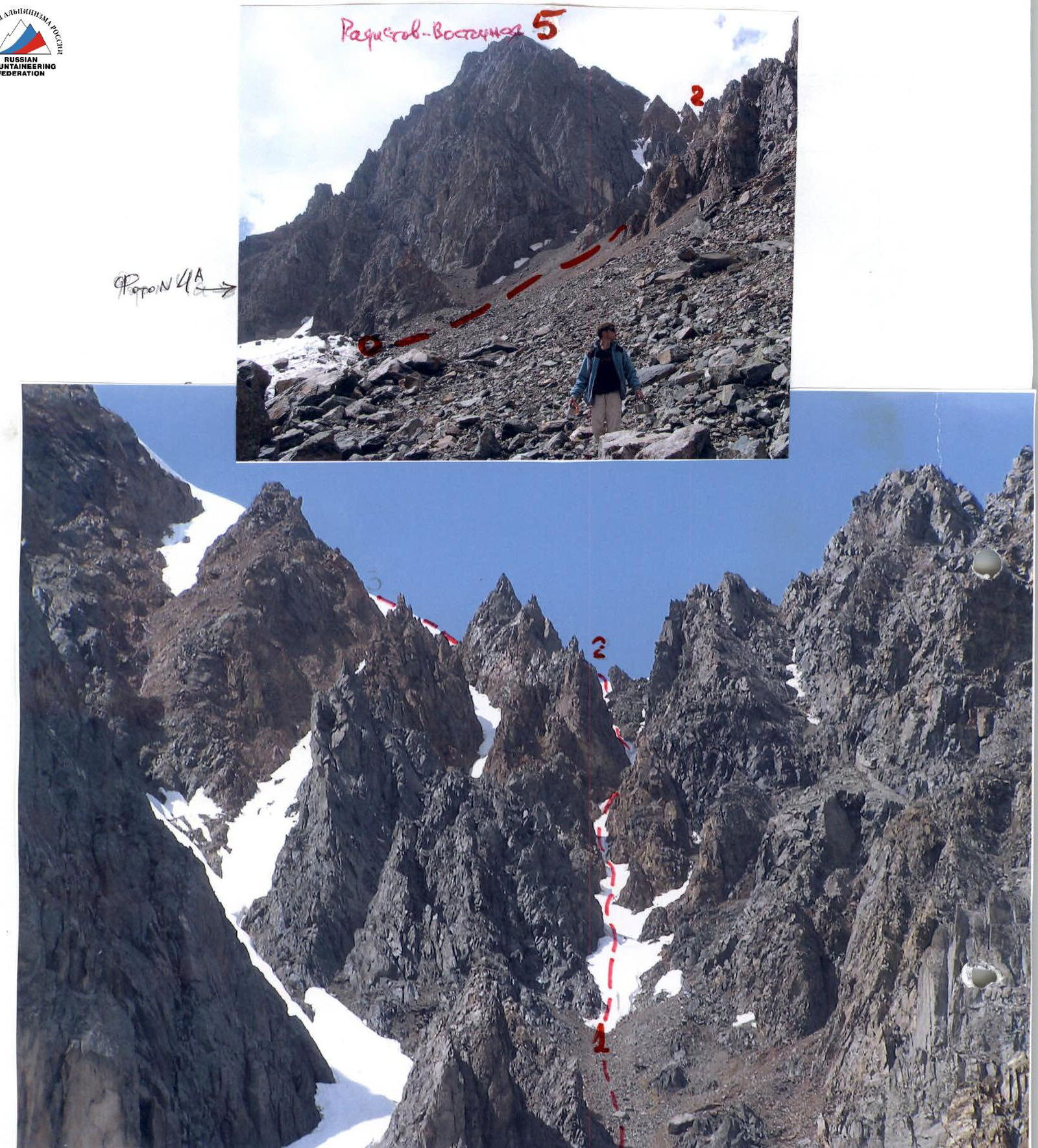
Photo #1: view from the north, from Znachistov pass (orienting point 3,200 m, July 23, 2005)
Conventions:
- described route to Radistov-East 3,523 m (second half, visible part) ...
- invisible part of the same route
- route 3A category of difficulty by A. Gaponov (1.2–100)
-
-
- route 2B category of difficulty by V. Moshkov – 2005
-
- route 3A category of difficulty by A. Drakin (1.2–53a)
p. 2 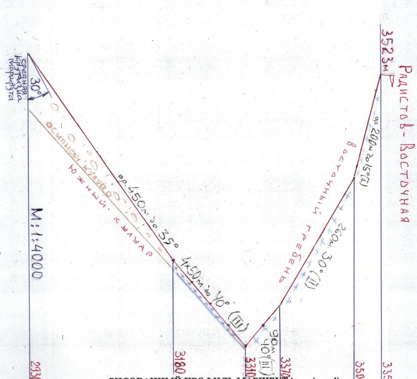
Fig. 4 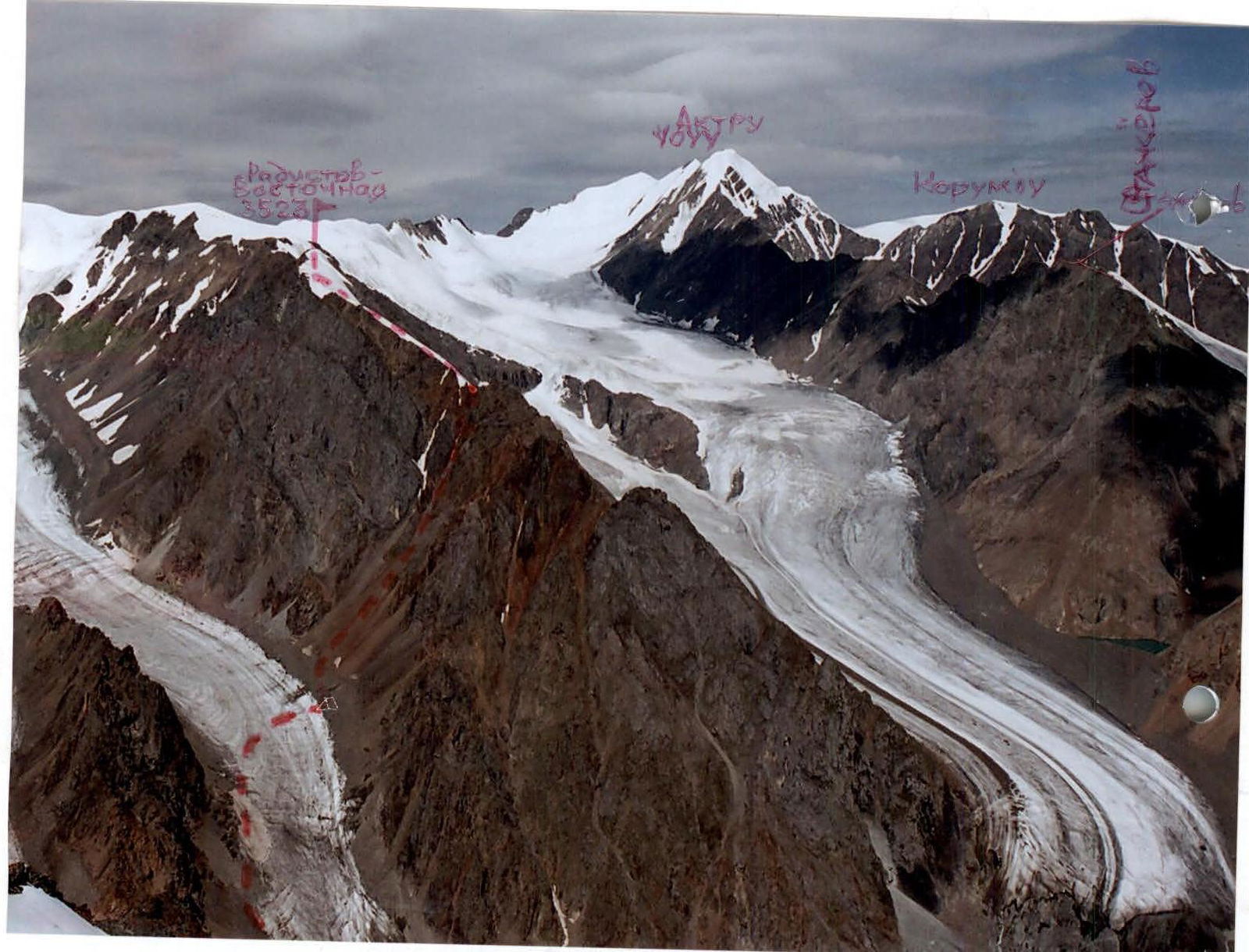
Photo #2: View from the east, from Karatash peak 3,355 m (August 19, 2004)
Shown:
- storm bivouac 2,930 m
- described route via the southern couloir of the eastern ridge to Radistov-East
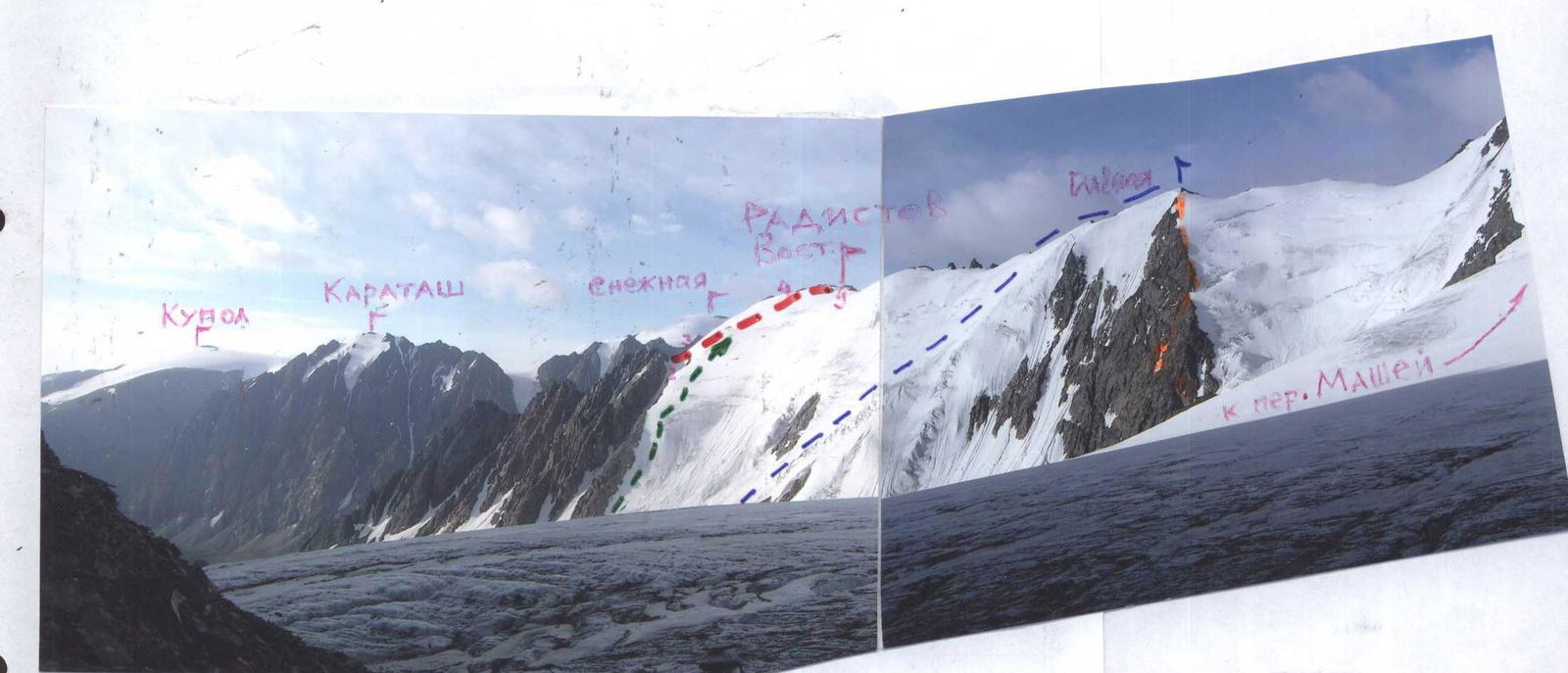
Photo #3: view from the northwest, from the couloir of Stazhiorov peak (from route 2B category of difficulty, orienting point 3,300 m)
Conventions:
- described route to Radistov-East 3,523 m (second half, visible part)
- route 2B category of difficulty by V. Moshkov – 2005 to the same peak
-
-
- route 3A category of difficulty by A. Drakin (1.2–53a) to Radistov-Main 3,634 m
-
- route 3A category of difficulty combined (1.2–53) to the same peak
Route Description
From Aktru alpine camp follow the trail leading to Big Aktru glacier; past the precipitation gauge turn left to the snow bridge, cross it and go under the northern slope of the ridge. In rope teams, go left of the glacier tongue and then along Big Aktru glacier - Pravy (orogr.), not reaching the massive rock tower of Radistov-East peak, to a wide snow (in the lower part - talus) couloir, divided by rock ridges (2–2.5 hours from "Aktru"). Under the snow - ice, crampons and ice screws are necessary. Above the couloir is a "V"-shaped depression in the ridge between the tower of Radistov-East and a large gendarme; to the left of the lower point are two characteristic gendarmes, a triangular one and to the right - with a "saw", which, continuing down, forms the left-hand side of the vertical couloir, into which one should ascend from the right part of the wide couloir. Before the couloir narrows, the steepness increases (handrails!). With piton protection and protection through ledges, two ropes to the upper fork and along the left, less narrow couloir, two ropes to the saddle of the eastern ridge. Then left along the ice-snow, initially steep and already thawed slope, flattening out before the summit (3–4 hours from the glacier). Descent along the ascent route (in the couloir - handrails!) – 2–3 hours to the glacier. A lot of time is spent on placement on rocks, hiding from stones thrown by descending climbers. The route is recommended as a training route only in the first half of the season and only for a group of 4–6 people (do not stretch out in the couloir!).
NOTE: in A. Drakin's description (1.2–54) in the training part of Aktru alpine camp, there is no photo with the line of movement; from the text, one can guess that the first ascenders started the ascent along the left part of the wide couloir, and only having ascended to the lower fork, crossed the rock ridge to the right, into the vertical couloir described by us. If this is the case, then both routes coincide.
TABLE OF MAIN CHARACTERISTICS (M 1:2000)
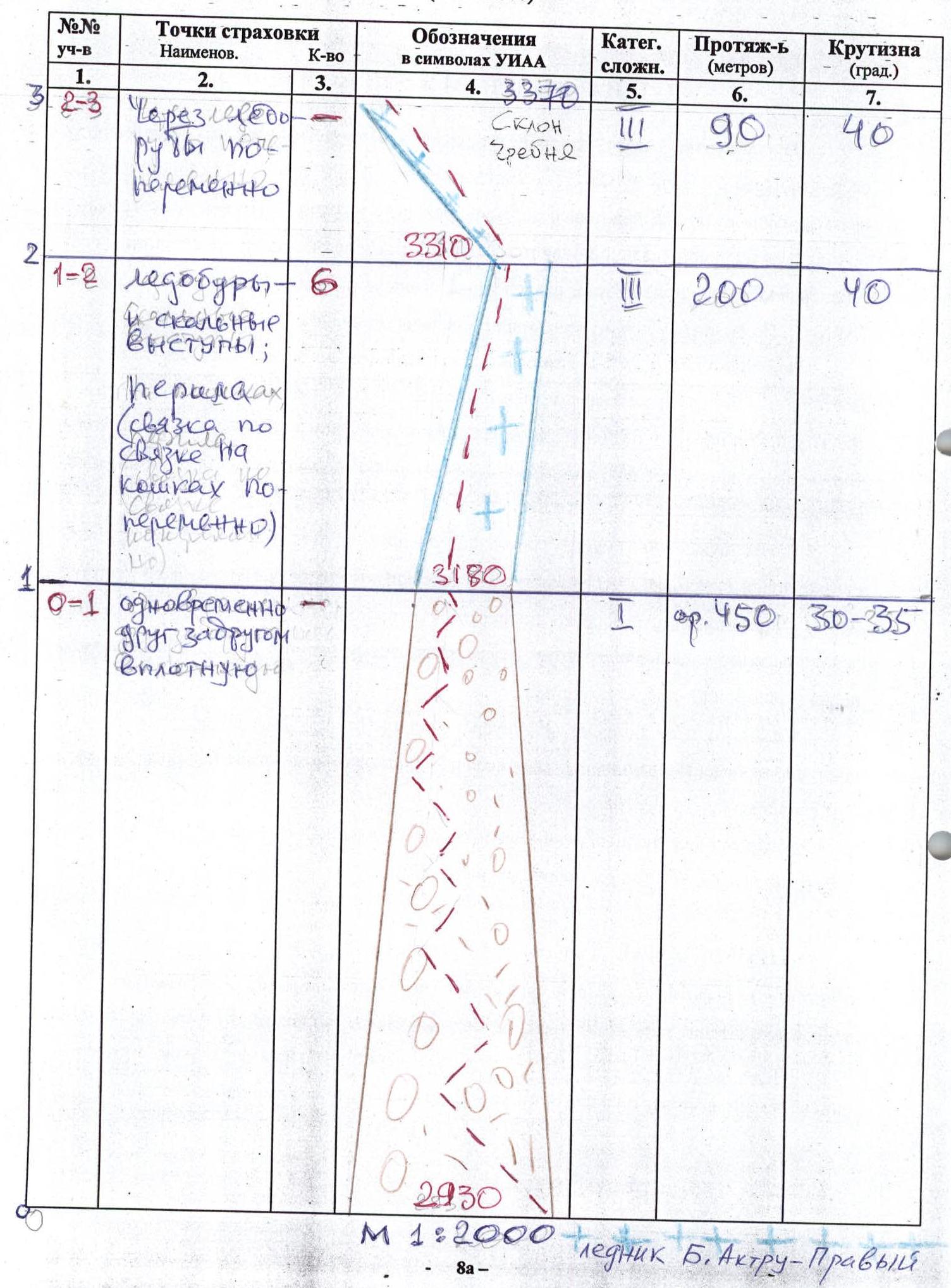
| Section # | Protection Points Description | Quantity | Designation in UIAA symbols | Category of difficulty | Length (meters) | Steepness (degrees) |
|---|---|---|---|---|---|---|
| 1. | 2. | 3. | 4. | 5. | 6. | 7. |
| R2–R3 | Through ice screws; alternately | Ridge slope 3370 | 3 | 90 m | 40° | |
| R1–R2 | Ice screws and rock ledges; handrails (team in rope teams on crampons alternately) | 6 | 3310 | 3 | 200 m | 40° |
| R0–R1 | Simultaneously, one after another, close together | 3180 | 1 | approx. 450 m | 30–35° |
| Section # | Protection Points Description | Quantity | Designation in UIAA symbols | Category of difficulty | Length (meters) | Steepness (degrees) |
|---|---|---|---|---|---|---|
| 1. | 2. | 3. | 4. | 5. | 6. | 7. |
| R4–R5 | Simultaneously | Radistov-East 3,523 m | 1 | approx. 200 m | 15° | |
| R3–R4 | Simultaneously | 3500 | 2 | 260 m | 30° |
TECHNICAL PHOTO OF THE ROUTE (#1) Sections R2–R5 see on photo #3.
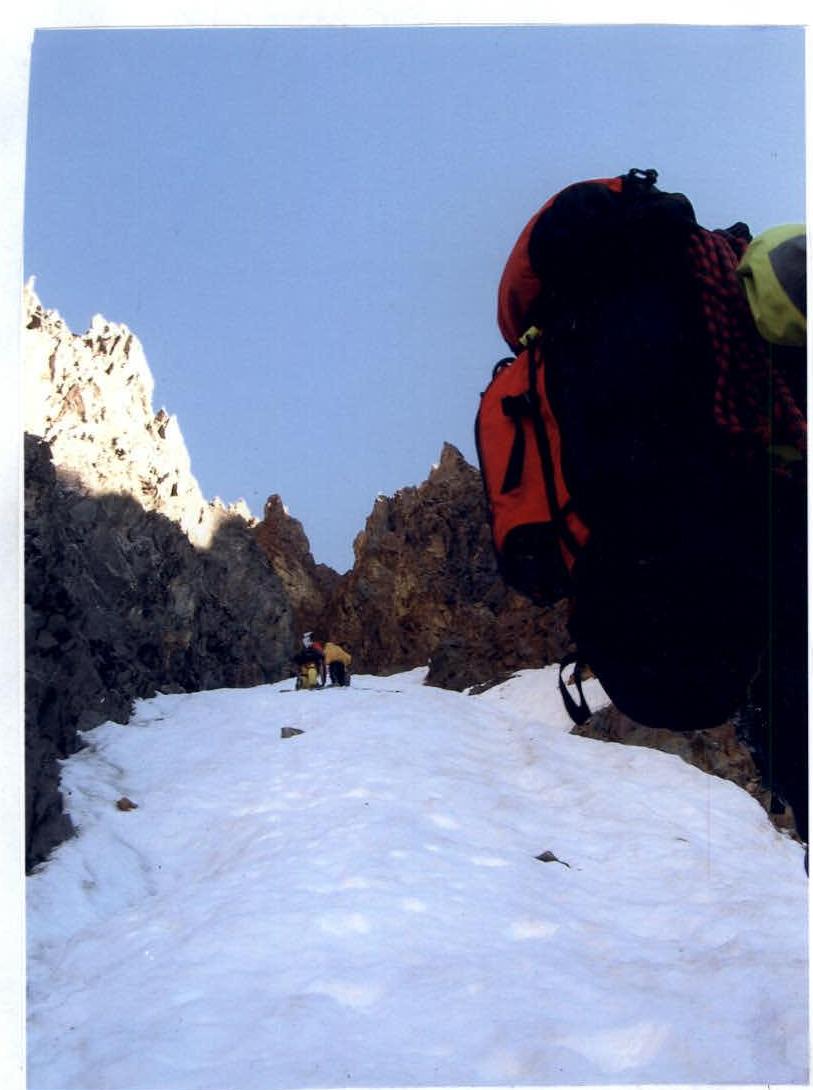
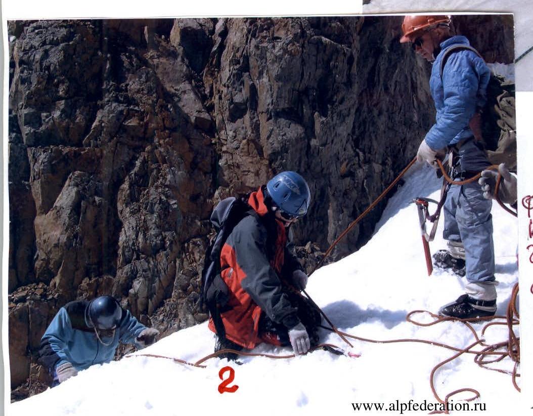
Photo #6: Group gathering at the end of the first rope.
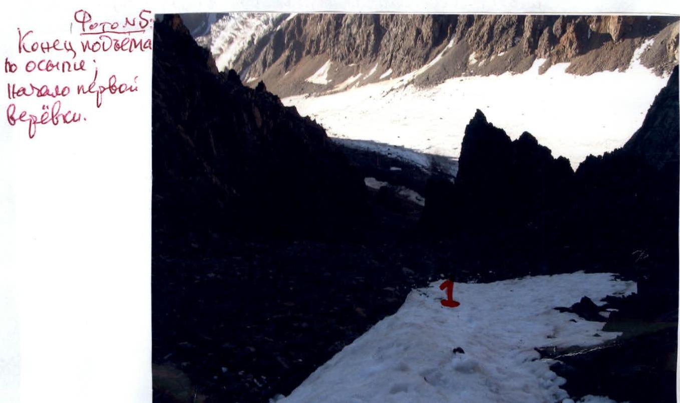
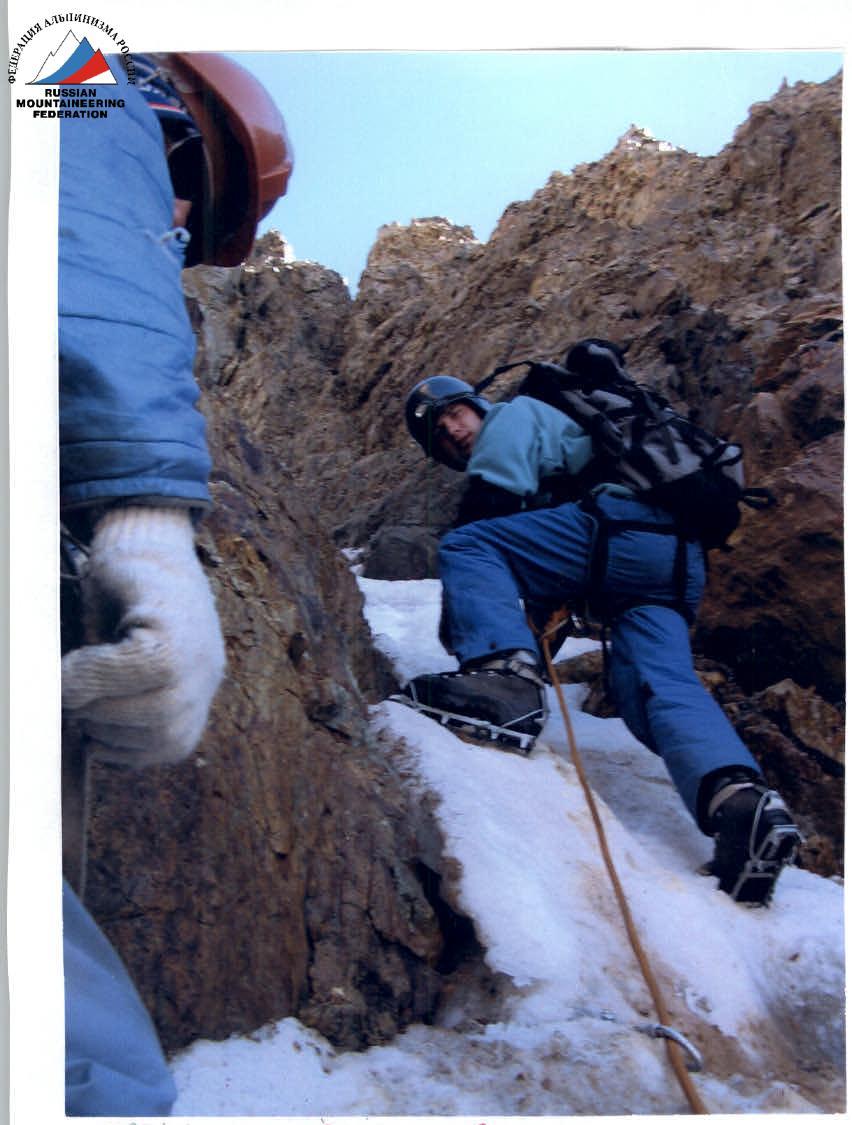
Photo #8: In the gorge; start of the third rope.
Photo #7: End of the second rope (before the gorge)
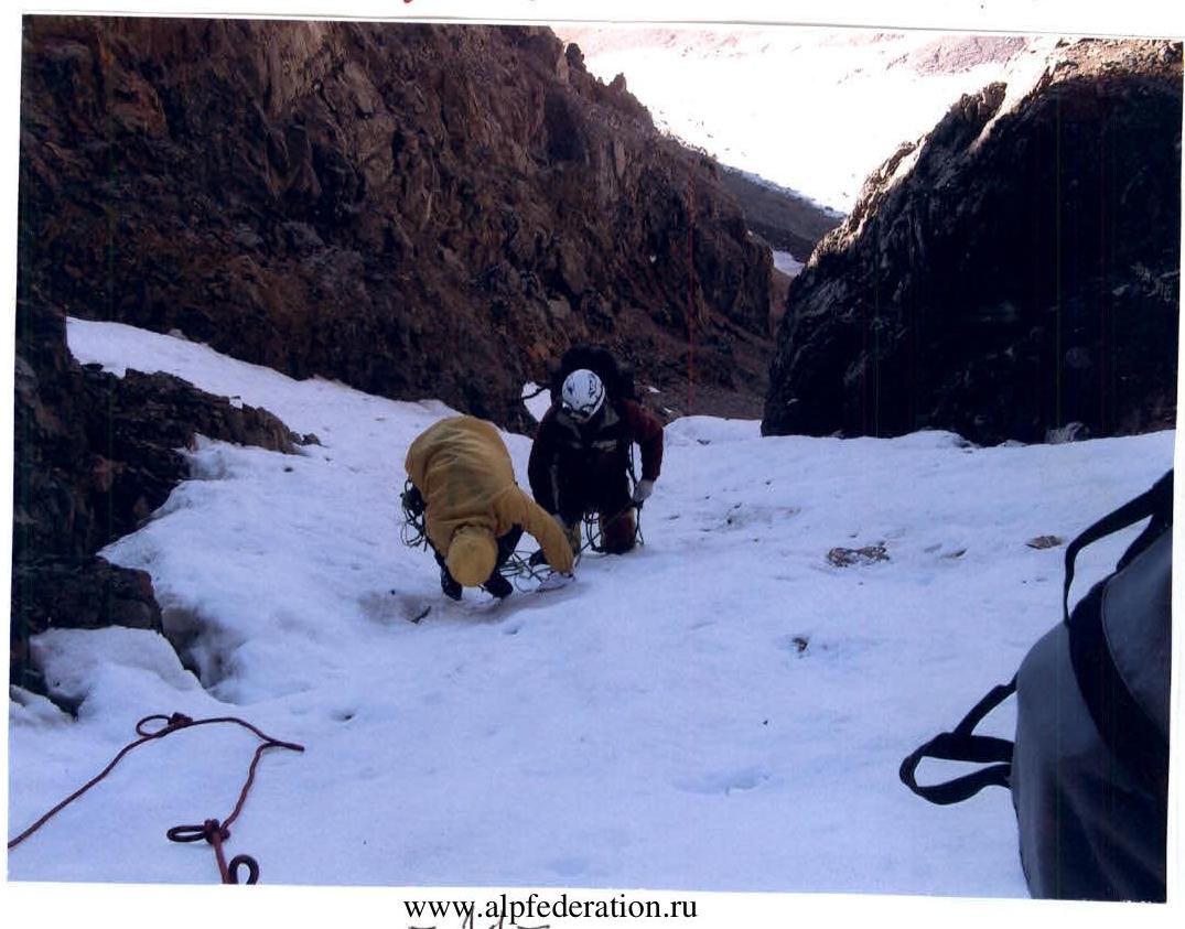

Photo #12: Group on the summit of Radistov-East.
Photo #11: On the snow ridge (sections R2–R4).

Photo #10: End of the fourth rope. Group in the Snizhny saddle, ridge.