Passport
-
Class: Second ascent (first ascent done by Semenov S.A. and Dumaĭskaya E.L. in 1999).
-
Altai, Severo-Chuyskiy ridge, Karakabak gorge.
-
Okhotnik peak via NE ridge.
-
Proposed category: 2A.
-
Height 3100 m, elevation gain 420 m, length 1090 m.
-
Pitons were not used.
-
Duration: 12 hours from camp to camp; 6 hours from the start of ascent to the saddle to the start of descent.
-
Leader: Drakin A.V., CMS, participants:
- Mokhova V.M., 1st sports category;
- Shlyakhoyoĭ A.A., 2nd sports category;
- Mardasova E.V., novice;
- Nikulina O.V., novice;
- Patrushev E.M., novice;
- Samsonova O.A., novice;
- Tankova M.V., novice;
- Isakova N.E., novice;
- Prokop'eva K.Yu., novice;
- Polyakov A.A., novice;
- Tuz A.A., novice;
- Tuz T.I., novice.
-
Coach Drakin A.V., 1st category, #68.
-
Ascent date: July 23, 2000.
-
Organization: Altai regional alpinism federation.
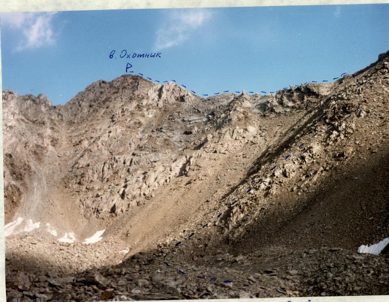
"Okhotnik peak via NE ridge. Lomo T-43 lens, 4/40. Shooting point #1."
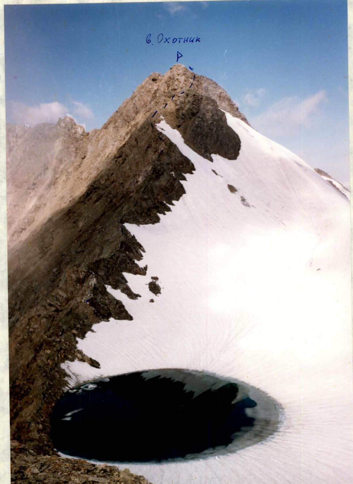
"Okhotnik peak via NE ridge. 'Smena 8m' camera. Lomo T-43 lens, 4/40. Shooting point #2."
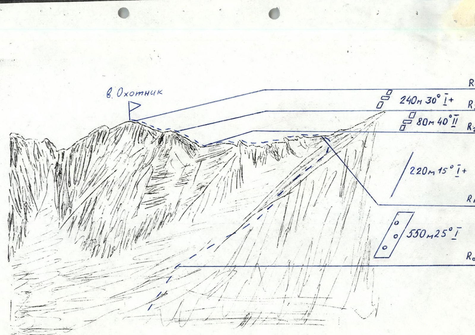
Okhotnik peak via NE ridge
From the base camp located in the middle stream of Karakabak river, move upstream along the river and then along the lakes. After the third lake, a stream flows into the river from the right. Move in the direction of Okhotnik peak, first along this stream, then along the moraine ridges.
(5 hours) The ascent to the saddle between Okhotnik and Suvorova peaks goes along the scree slope to the right of the saddle. There is a round lake on the saddle.
From the saddle, move in the direction of Okhotnik peak along the NE ridge. In the lower part of the ridge, the movement is simultaneous with short walls that are climbed alternately. Belay is through a rock outcrop. In the middle part, there is a series of walls with ledges that require alternate movement. Belay and handrails are organized through rock outcrops. The length of this section is 80 m. The slope is 40°. Further, there is a simple ridge and a series of ledges and walls to the right of the ridge. This section leads to the summit. Time: 4 hours.
Descent is via the ascent route.