Passport
- Technical category.
- Altai, Maashey gorge.
- V. Maashey, via the northern wall.
- Proposed 5B category of difficulty, first ascent.
- Elevation gain — 1125 m. Length 1510 m.
Length of sections with category 6 difficulty — 150 m. Average steepness of the main part — 55°. 6. Pitons used: ice screws — 167; rock and placement pitons — 11. 7. Team's travel time — 21 hours, days — 2. 8. Overnight stay — lying in a "zdarka" on a platform in a crevasse. 9. Leader — Afanasiev Andrey Evgenievich — Master of Sports, 1st sports category.
Team members: Zyatkov Nikolay Alekseevich — 1st sports category. + 1 person (Salin A.V.) 10. Coach: Afanasiev A.E. 11. Approach to the route: August 2, 1998.
Summit: August 3, 1998. Return: August 3, 1998.
- Organization — Irkutsk Regional Council of the All-Russia Physical Culture and Sports Society "Dynamo".
Sheet 1 (back). General photo of the summit.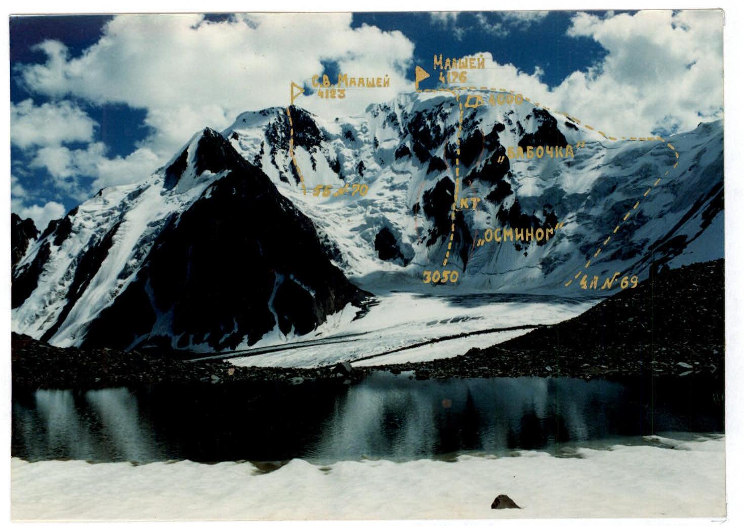
July 31, 1998 12:30. Shooting point #1. H — 3000 m. Distance ≈ 5 km. Camera "Kodak".
Sheet 2
Photo of the wall profile from the right.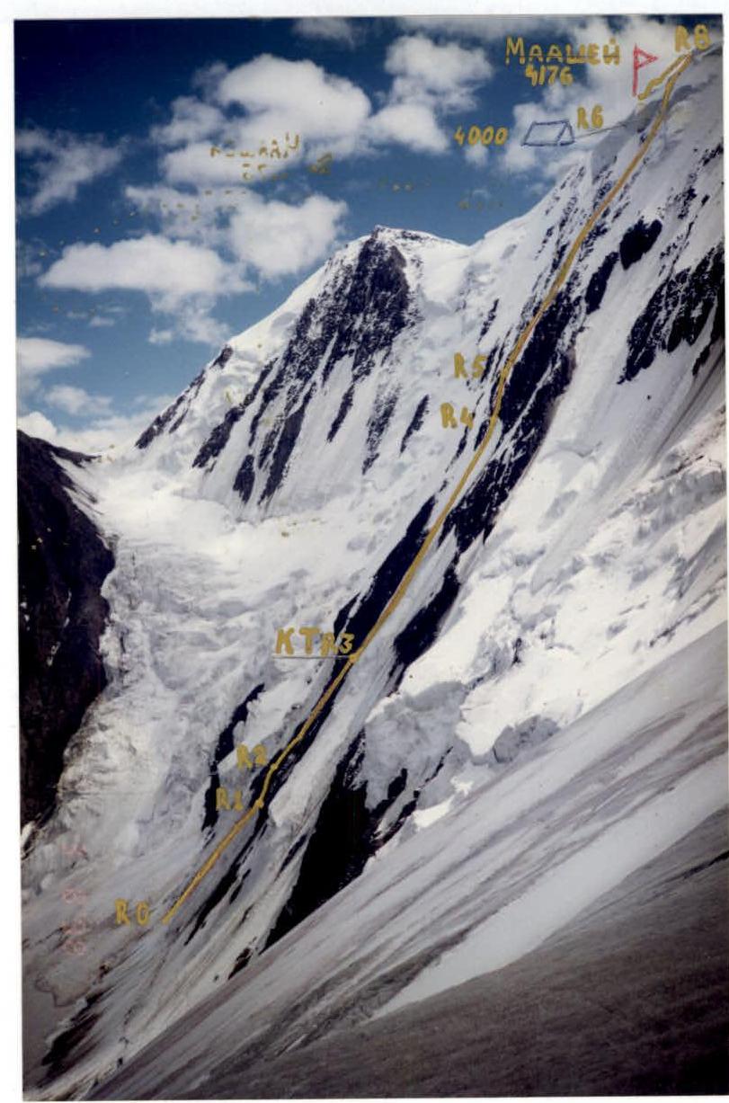 August 3, 1998 13:00. Shooting point #2. H — 3500 m. Distance ≈ 1.5 km. Camera "Kodak".
Sheet 2 (back)
Photo of the wall profile from the left.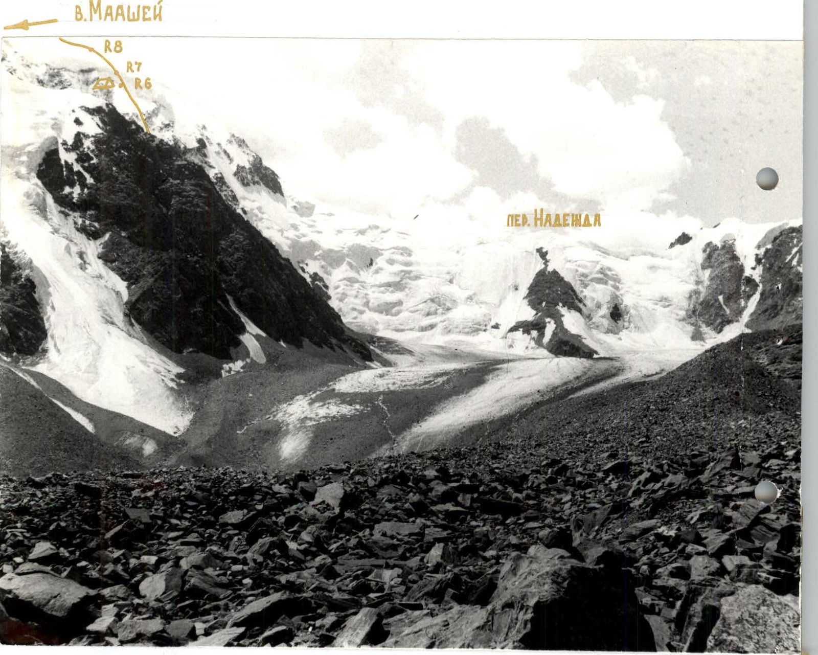
August 1995. Shooting point #3. H — 2500 m. Distance ≈ 10 km. Camera "Smena-8M".
Sheet #4. Photopanorama of the area from the north.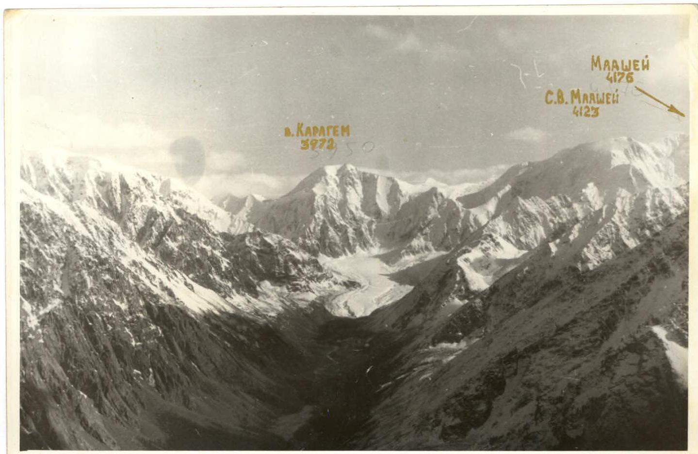
August 1980. Taken from a helicopter. Camera "Smena-8M".
Sheet #4 (back). Photopanorama of the area from the south.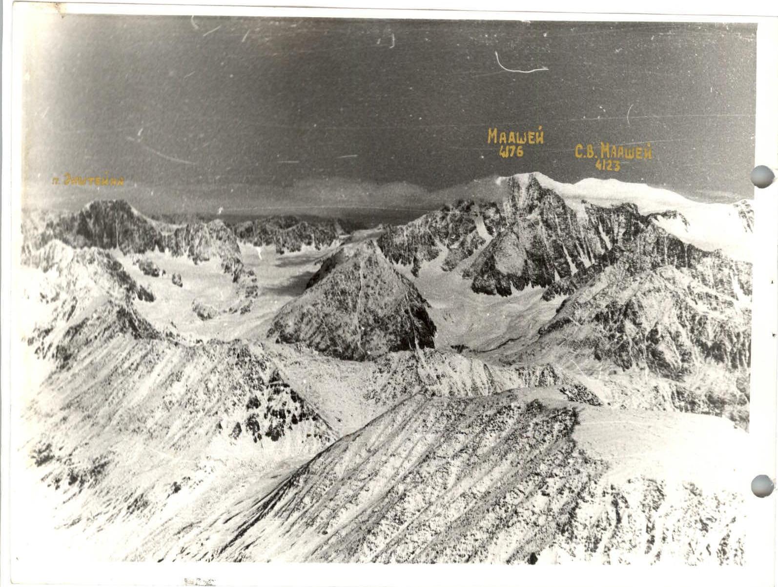
November 1981. Taken from a helicopter. Camera "Smena-8M".
Sheet 7. Tactical actions of the team.
Due to the fact that a large part of the route has ice terrain, the path was planned, one might say, with a ruler: from the lowest point straight to the summit. Since no one from the team had been on the mountain before, the right sub-summit, visually predominant, was taken for the summit. In reality, the highest point is 150 m to the east with a height difference of about 7 meters.
The route line crossed three steep climbs longer than a rope — two rock and one firn. Based on this, in addition to ice screws, the following were taken:
- rock pitons,
- placement pitons,
- ice axes with flukes.
According to preliminary observations, the lower part of the route ("octopus") is exposed to rockfall from the "Right wing of the butterfly" rock formation in the second half of the day. Therefore, this section had to be passed before 14:00. The exit to the route was planned for 4:00. The ascent to the "roof" was expected by the end of the day with an overnight stay on the ridge. The route turned out to be more difficult than expected, and the firn on the upper slope had turned soggy by the end of the day and did not hold even ice axes with flukes. Movement on gentle sections was simultaneous with ice screw placement every 10 m, on steep sections — with fixed ropes.
There were no significant deviations from the tactical plan.
Sheet 8a. Scheme of routes in symbols M 1:2000.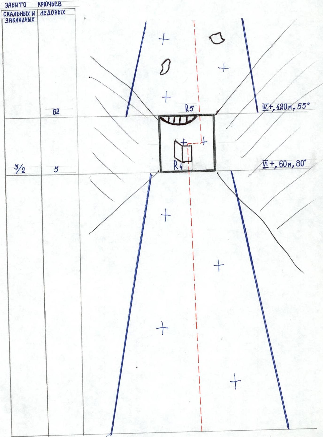
Sheet 8b. Scheme of routes in symbols M 1:2000.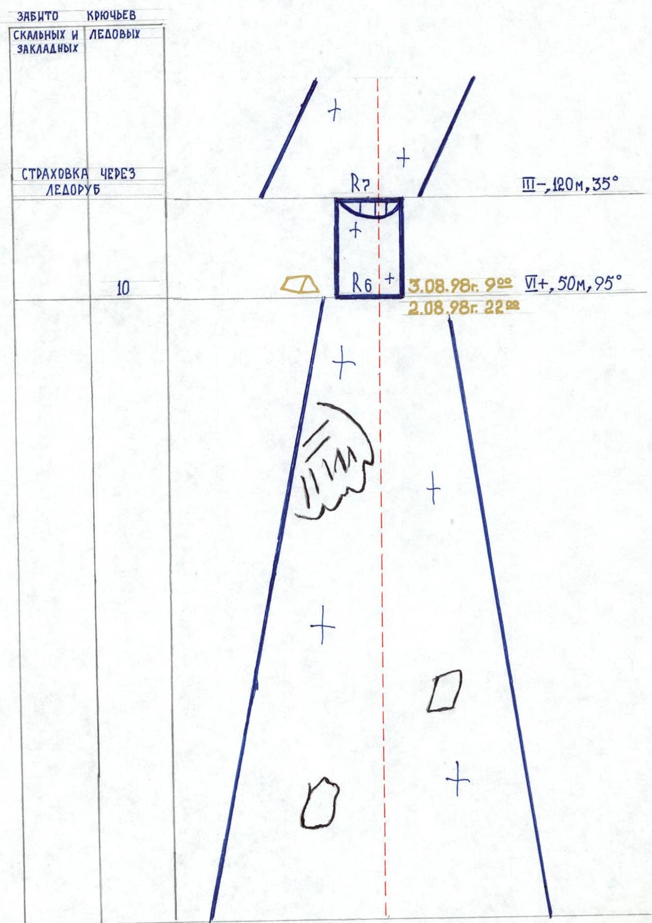
Sheet 8c. Scheme of routes in symbols M 1:2000.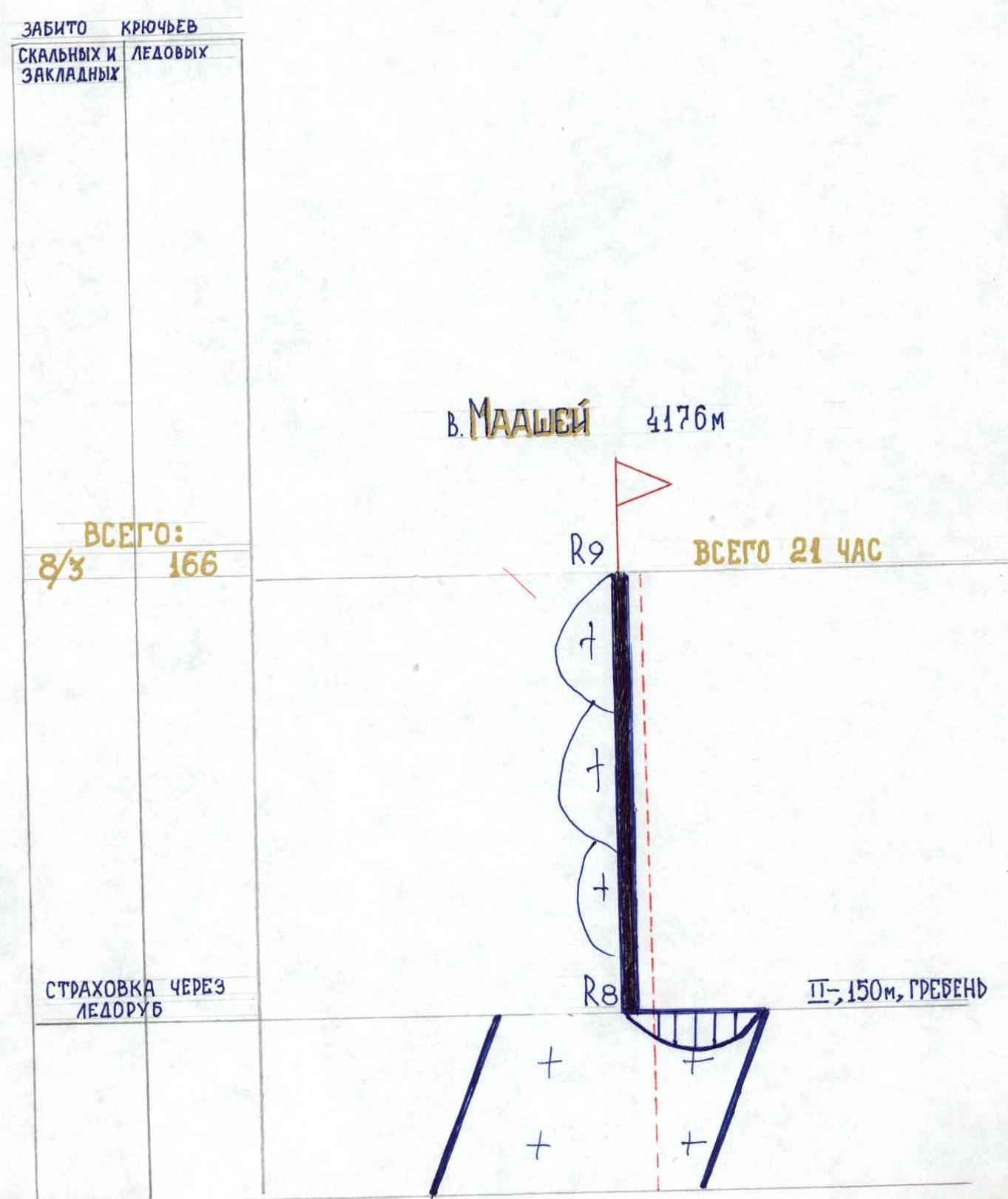
Sheet #9. Description of the route by sections.
R0–R1. The route starts from the bergschrund. A small overhang. Then an icy undulating slope 55°, 200 m. The waves run across, every 4–5 meters. The ice is clean throughout the section: almost not covered with firn or debris. Passed simultaneously on ice axes.
R1–R2. Beginning of the "octopus". Rock wall with a total length and steepness of 40 m, 80°. The entire section is covered in ice. At the top — a 7 m overhang. Under the rock cornice is a snow cushion. Fixed ropes.
R2–R3. Ice lining 55° "Cutting off the octopus leg". Ice on rocks, some of which protrude. Protection via rock and ice pitons. At the end of the section, a control cairn is on the right, on an overhanging wall of reddish color, at a height of 1.5 meters, on the second rock from the top of the right "cut-off leg of the octopus". A note is in a tin can attached with a rock piton.
R3–R4. Section difficulty IV-. Steepness decreased to 50°. Approach to the "butterfly". The "butterfly" is the second rock formation along the route. The right "wing" is larger than the left. Rockfall from the right "wing" sometimes occurs, covering the lower part of the route. The "butterfly" should be reached before 14:00.
R4–R5. The "butterfly" is passed between the "wings" on loose snow on a vertical rock face, 60 m. Protection mainly via rock pitons. Second crux of the route.
R5–R6. Snow-ice slope with rock outcrops. Avalanche hazard. Pitons are placed more frequently than below. Approach to the firn slope. Slightly to the left of the ascent line is the most convenient section to pass. In the lower third of the overhanging firn slope is a ledge with a horizontal platform inside — a place for an overnight stay. Section length 420 m, steepness 55°.
R6–R7. Third crux. Firn slope. Passed on ice axes with flukes with protection via ice screws screwed into ice lenses, up to the middle. The upper part of the section is an overhang of loose snow. Passed by digging diagonally. At the exit — protection and fixed ropes on ice axes.
R7–R8. Snow slope 35°, three ropes. Snow is loose. Protection via ice axes. Exit to the right sub-summit.
R8–R9. Sharp snow ridge with large cornices to the left. Passed on the steep slope to the right, sometimes along cracks where cornices have broken off. 150 m to the highest point. The summit is snowy. Rock outcrops are far below. No cairn. Descent via the 4A category route through the Pereval Nadezhda.
Sheet 13
Technical photo of the route.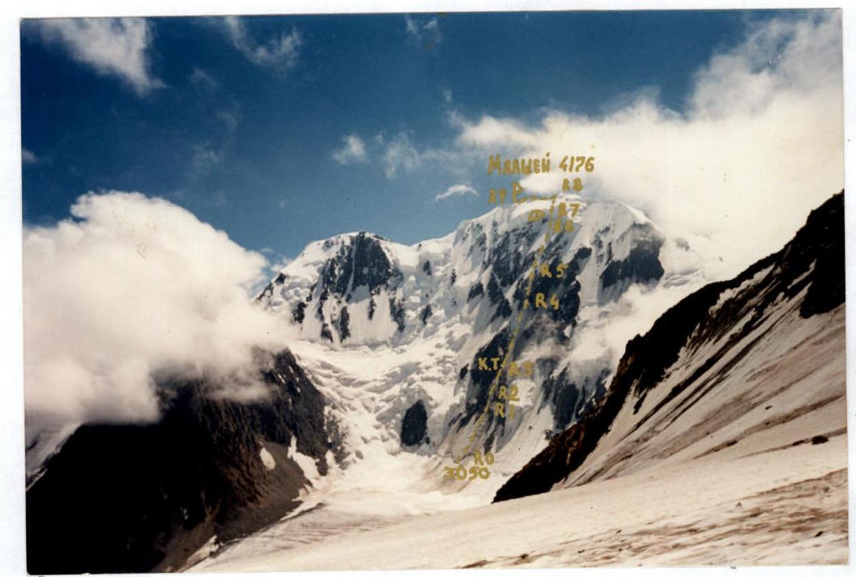 July 31, 1998 13:00. Shooting point #4. H — 3300 m. Distance 6 km. Camera "Kodak".


