Ascent Passport
1 Region — Altai Republic, North Chuya Range 2 Peak — Kyzyltash 3486 m via the northwest slope icefall 3 Proposed — 4B category of difficulty, first ascent. 4 Route characteristics — ice and snow.
- Route characteristics:
elevation gain of the main part 480 m,
route length — 740 m.
length of sections
- 5th category of difficulty — 110 m.
- 4th category of difficulty — 190 m
average steepness of the main part 55°
- Equipment used on the route: ice screws — 74
- Number of climbing hours — 10.5, days — 1.
- Leader: Ivliev Andrey Vladimirovich 1st sports category
Team members: Kulishova Alena Maratovna 2nd sports category
Pintsov Anton Nikolaevich 2nd sports category
Syutkin Andrey Leonidovich 2nd sports category
- Team coach: Filatov Sergey Alekseevich Master of Sports
- Departure date:
On the route — at 8:00, May 4, 2015,
On the summit — at 18:30, May 4, 2015.
Return to Base Camp — at 22:10, May 4, 2015.
Descent from the summit: via 1B category of difficulty from Konteyner Pass
- Ascent organized by — Novosibirsk, Federation of Alpinism of Novosibirsk Region.
- Responsible for the report: Ivliev Andrey Vladimirovich. Email and
phone: ivliev@yandex.ru, +7 903 904 56 98. General view
of the route
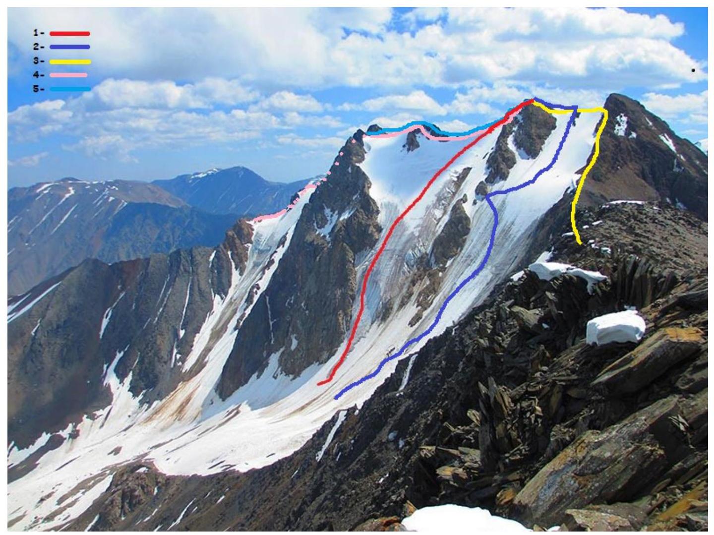
1 — Climbed route. 2 — 3A on the S slope of the SW ridge, Moshkov. 3 — 1B from Konteyner Pass, Kostryulev. 4 — 3A on the middle ridge of the S slope, Afanasiev. 5 — 3B on the right ridge of the S slope, Afanasiev.
- Climbed route
- 3A on the S slope of the SW ridge, Moshkov
- 1B from Konteyner Pass, Kostryulev
- 3A on the middle ridge of the S slope, Afanasiev
- 3B on the right ridge of the S slope, Afanasiev
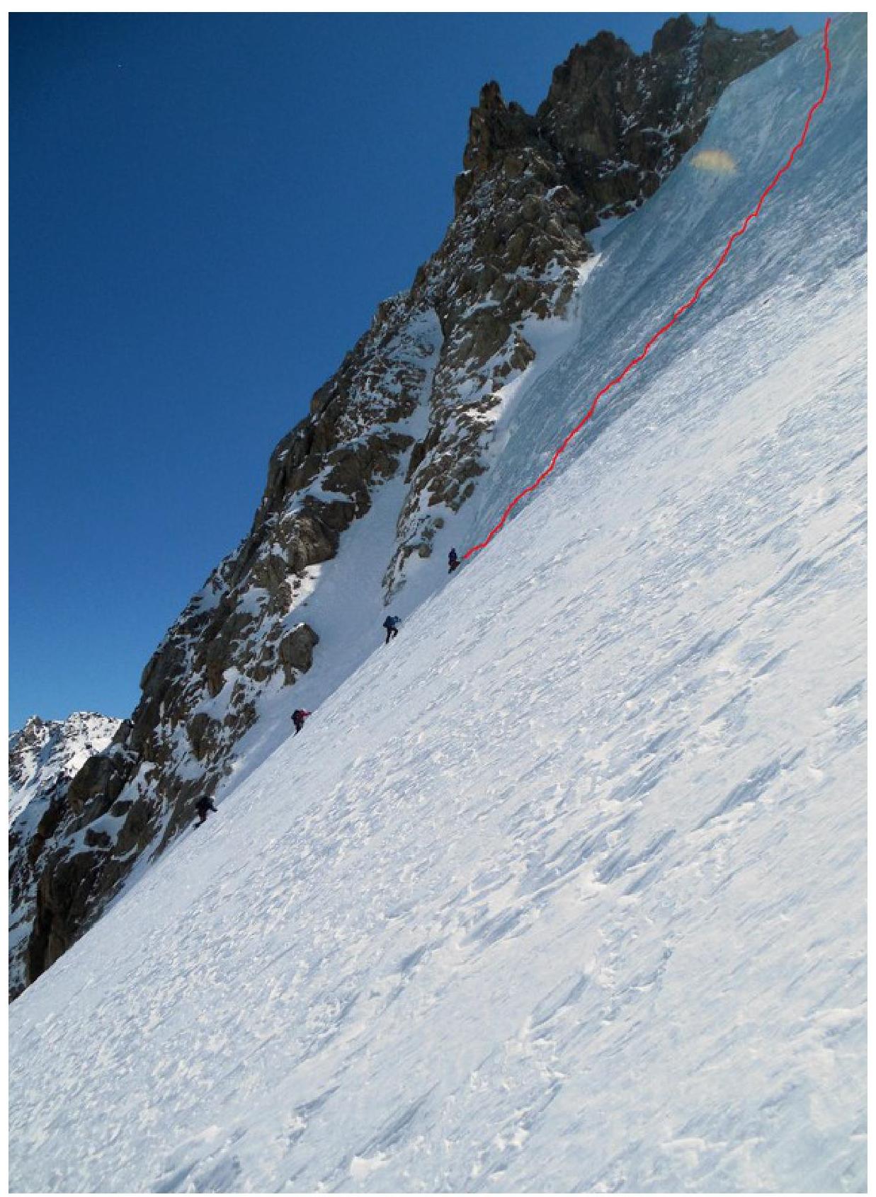
Photo of the route profile
 Panorama
of the area
Panorama
of the area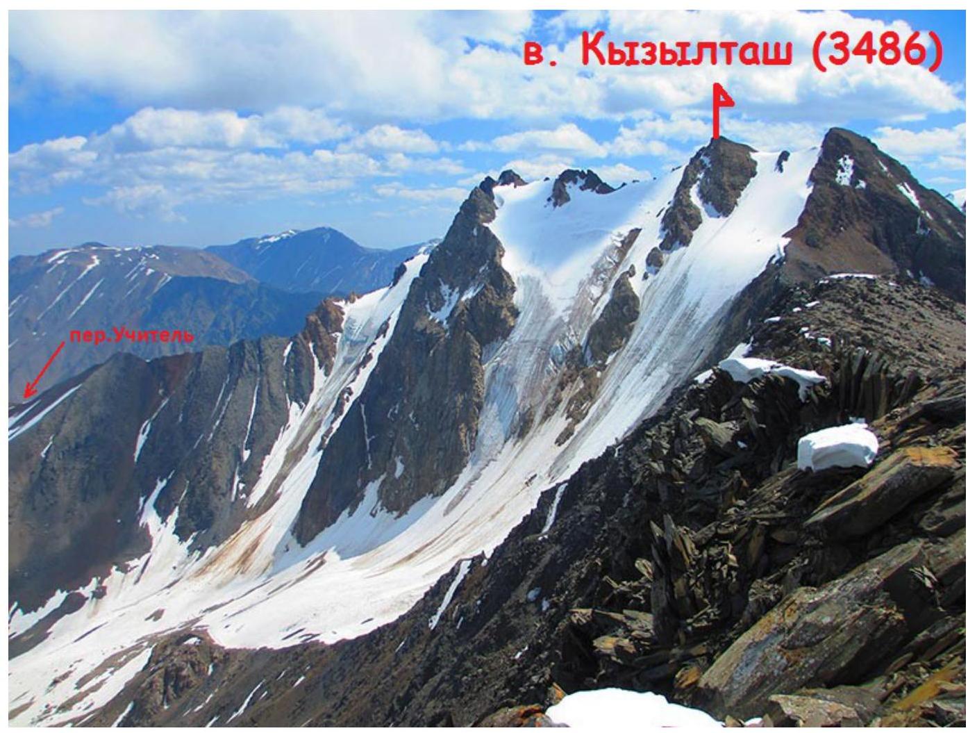 Scheme
of the ascent area
Scheme
of the ascent area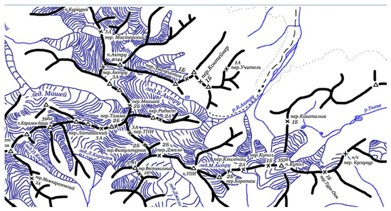
Tactical actions of the team, overview of the area.
This year in Aktru gorge, from April 30 to May 11, FANO climbers completed about 20 ascents, including:
- 2 first ascents.
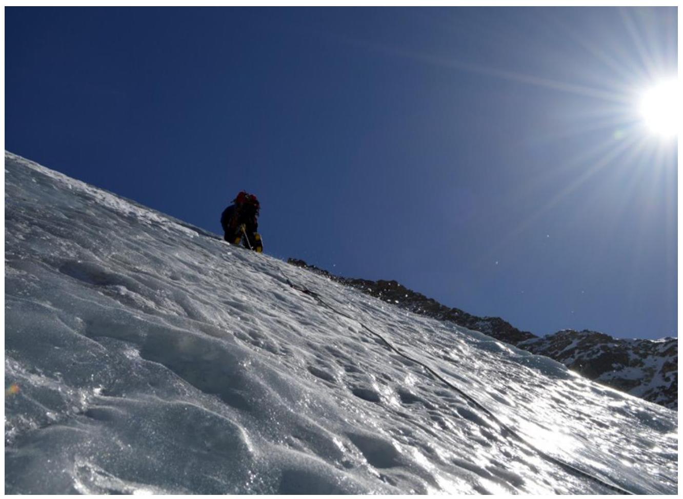
At home, when choosing the route, we paid attention to the icefall on the northwest slope of Kyzyltash peak. Since there is only one route 3A on this slope, which goes much to the right, we decided to lay a new, more interesting and challenging route through the center of the icefall.
On May 4, 2015, at 6:00, we left Aktru Base Camp and through Uчитель Pass approached the start of the route at 8:00. The key section of the route, the icefall itself, starts almost immediately. Then there is some flattening of the glacier to 50–55°, and further — to 35–40°, leading to the pre-summit ridge. We reached the ridge at 18:15, bypassing the summit on snow-covered ledges to the right, and ascended to the summit at 18:30.
We descended to Base Camp at 22:10. Route scheme in UIAA symbols
| № | Ice screws | ||
|---|---|---|---|
| 4 | 10 |  | II, 100 m, 30–35° |
| 3 | 20 |  | III, 230 m, 40–45° |
| 2 | 20 |  | IV, 190 m, 50–55° |
| 1 | 24 |  | V, 120 m, 75–80° |
| 0 |  | I, 100 m, 30° |
Brief description of the route passage by sections:
-
Section R0–R1 — Start of the route, snow slope. The angle of inclination increases in the upper part.
-
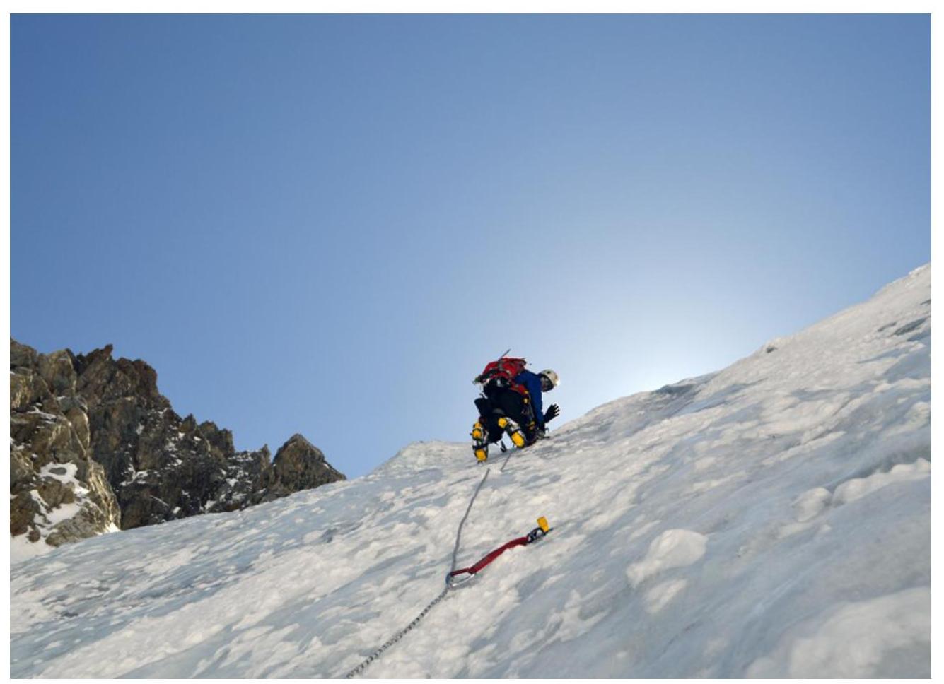
Section R1–R2 — Key section of the route. Icefall with a steep slope. Passed with thorough screw protection.
-
Section R2–R3 — Ice slope. Slight flattening. Passed with thorough screw protection.
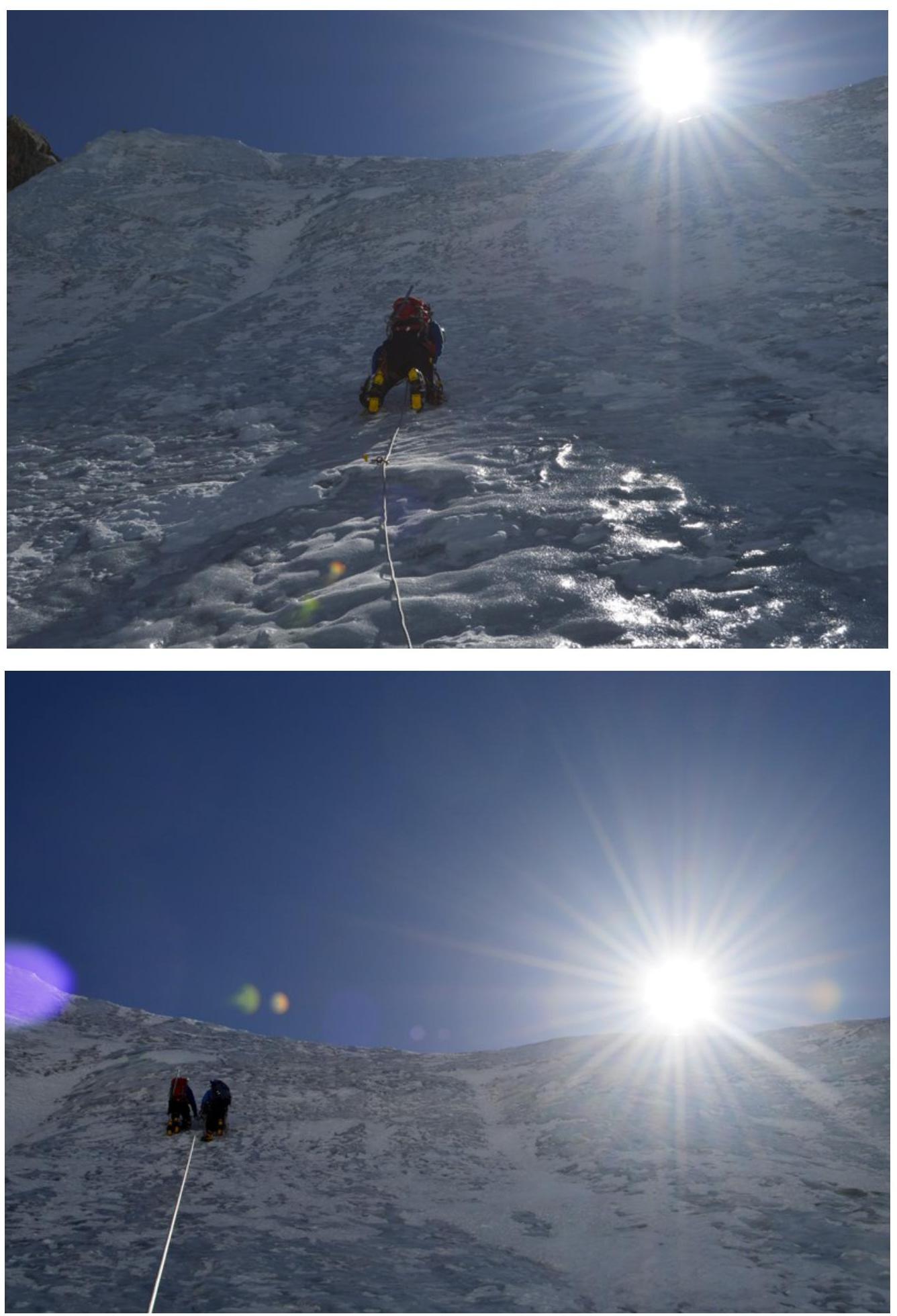
Section R3–R4: Further flattening of the ice slope to 30–35°. Transition to a snow slope. Exit to the pre-summit ridge 50–70 m and the summit.
- Section R0–R1
Section R2: R3
Section R3: R4
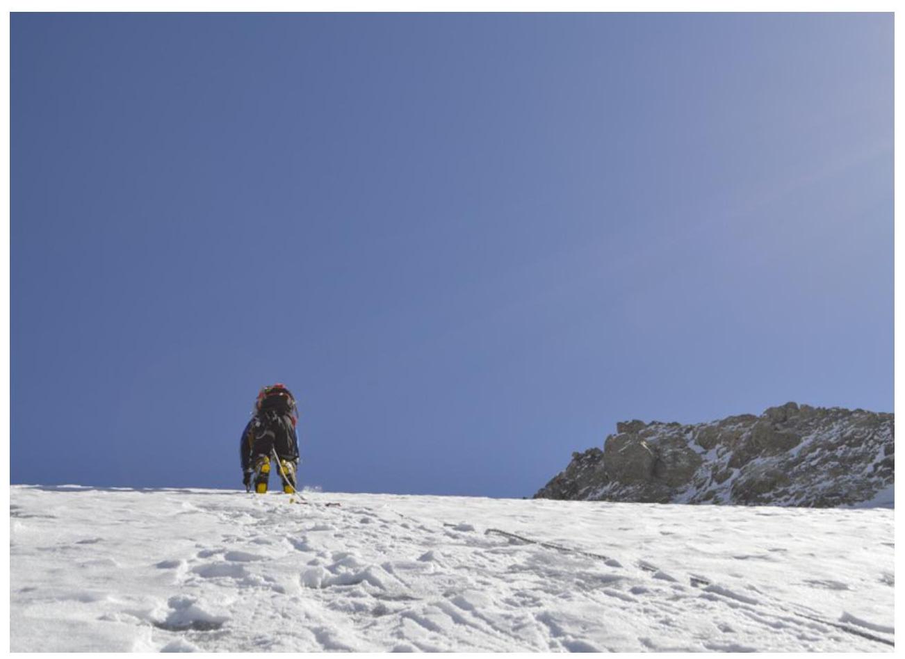
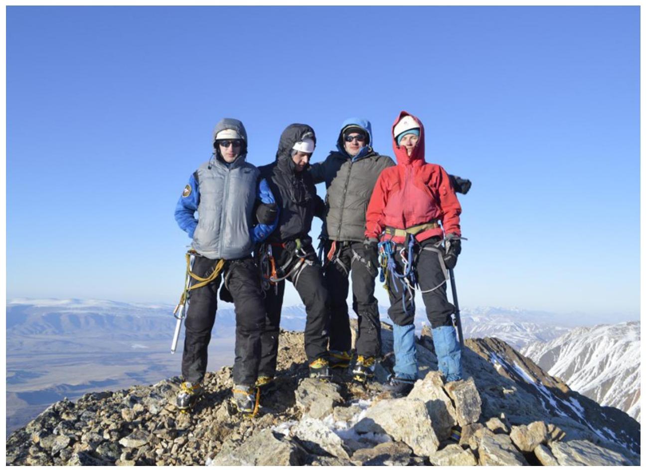
May 4, 18:30, Kyzyltash peak