1.2. North Chuya Range, Aktru gorge
Kzyl-Tash 3486 m via the North slope of the Southwest ridge
Proposed category: 3B, first ascent
Route type: snow-ice. Note: height (3486.4) is as per the published 1:50,000 map available on the Internet.
Altitude difference as per the group's altimeter: 520 m
Route length — 900 m (estimated); including 400 m of category 3 difficulty, between 45° to 50°
Average steepness of the entire route — 35°
Equipment used on the ascent: 12 ice screws, no rock pitons or stoppers (no protection left behind)
Climbing hours on July 16, 2005: from Aktru alpine camp (2100 m) to Uchyitel' pass (3100 m) — 1.5 h (4:00–5:30), from Uchyitel' pass to the start of the route (3000 m) — 1.0 h (5:30–6:30), from the start of the route to the 3486 m summit — 4.0 h (7:30–11:30), descent to Aktru alpine camp via a category 1B route — 3.0 h (12:30–15:30)
Leader: Viktor Vladimirovich Moshkov (CMS, 2nd sports category) — Chelyabinsk
Participants:
- 2. Vladimir Sergeyevich Volkov (2nd sports category) — Mezhgorye (Bashkortostan)
-
- Anna Nikolayevna Pronkina (2nd sports category) — Tomsk
Coach: Master of Sports Mikhail S. Levin (senior coach at Aktru alpine camp) — Chelyabinsk
Organisation: see letter from Aktru alpine camp dated July 24, 2005 (attached)
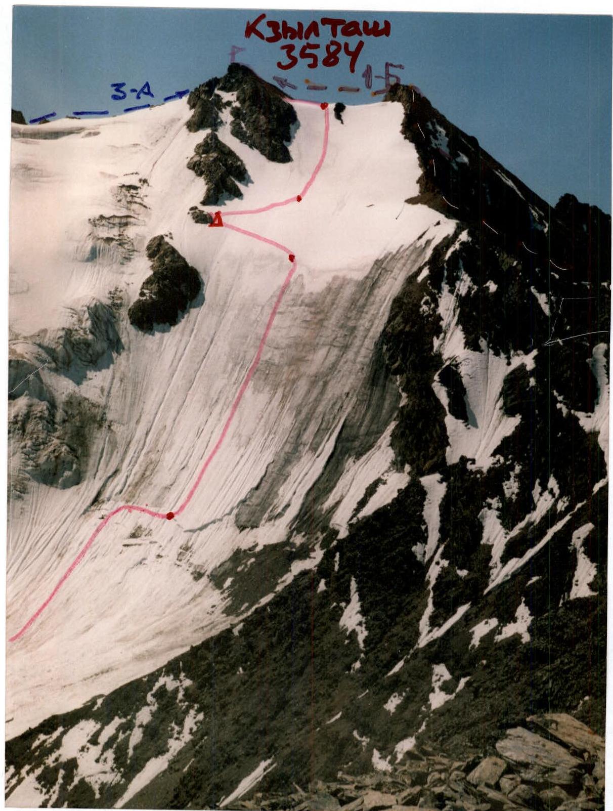
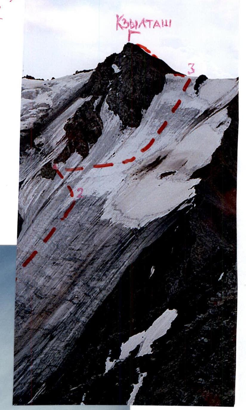
Photo 1: View from the Northwest, from the summit of Yubileynaya (3403 m) on July 3, 2005 (control cairn is shown)
Route profile diagram (p. 4)
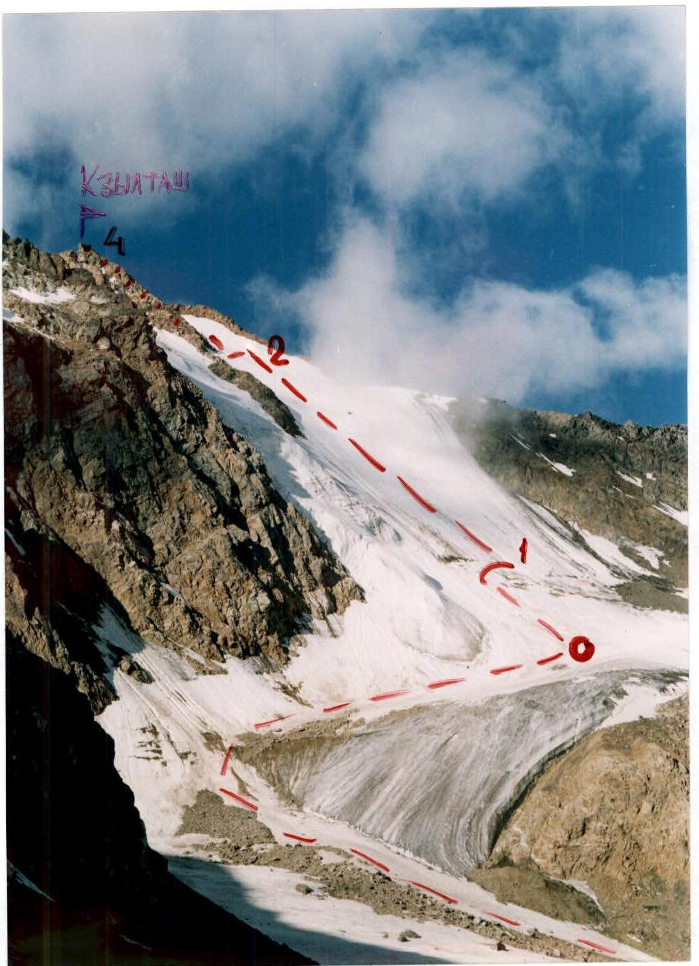
Photo 2: View from the Northeast, from the Uchyitel' pass (about 3000 m). The start of the route is labelled "0".
Brief sporting description of Kzyl-Tash peak
Kzyl-Tash means "red stone" in the local dialect of the Altai language (in Turkic languages — "kyzyl"). In mountaineering circles, the name Kzyl-Tash (without the first "ы") is commonly used for this mountain. The mountain is indeed largely composed of red-colored rocks, due to the presence of cinnabar, a mercury ore.
The mountain is conveniently located near the camp, with three-quarters of its slopes facing the Aktru gorge. It has two classified routes:
- 1B
- 3A category
This report proposes two additional routes characterized by a short approach, significant altitude gain, and primary difficulties in the lower section, making them particularly interesting for the area.
The southern slopes, known as "Tyoplyye" (Warm), serve as a training ground for groups at various levels of training.
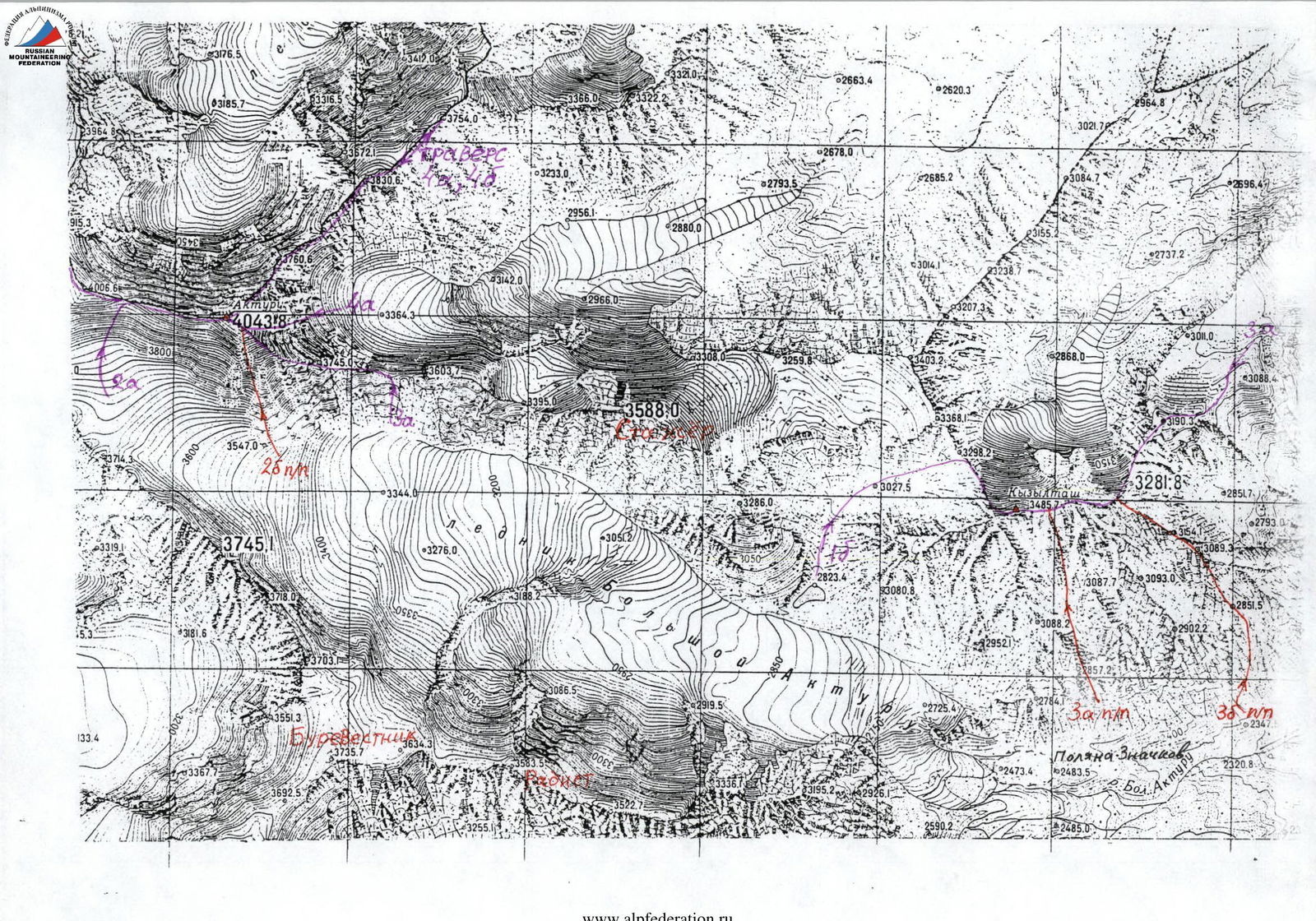
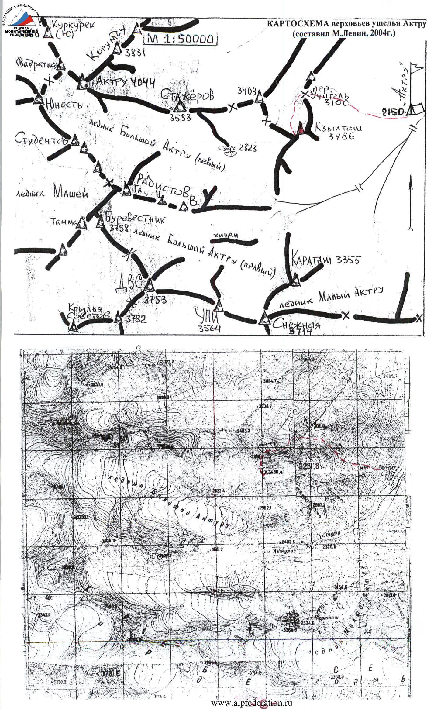
Kzyl-Tash has several well-trodden ridges on its southern and western sides, a counterfort on the northern side, and several possible routes of category 3-4 difficulty on the southern ridges (see schematic map).
In the summer, the southern slopes are snow-free, i.e., the routes are dry. The best time for the ascent is:
- May
- June
Both routes are recommended for training groups of the corresponding level.
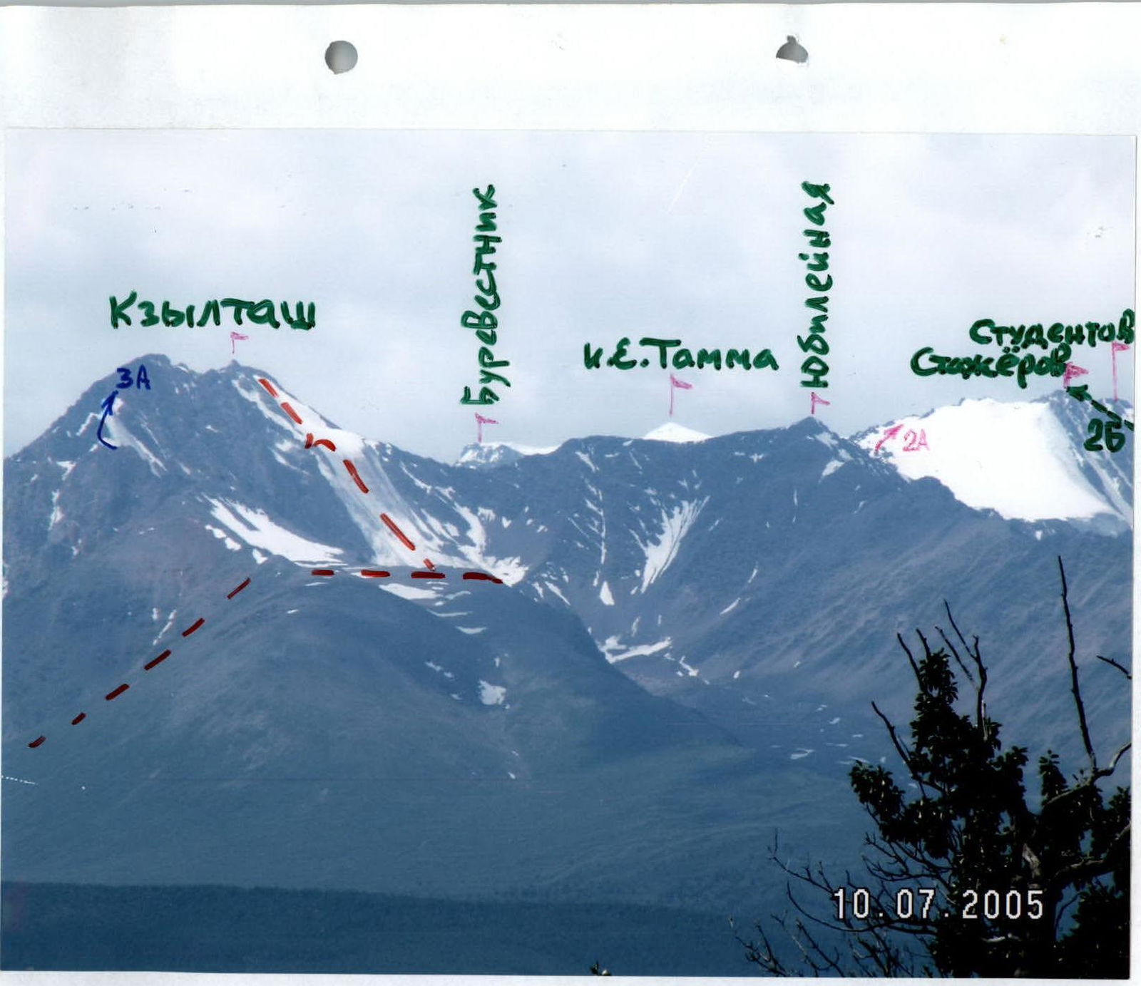
Photo 3: View from the North, from the Kurai steppe.
Route description
From Aktru alpine camp, follow the trail towards Uchyitel' pass, then left and down to the glacier, and along the right (here and further — orographic) side of the glacier to the snow-ice slope descending from the summit area of Kzyl-Tash (2.5–3.0 h).
Exit through the bergschrund in the center of the slope: on the left, there are rocky outcrops of the summit counterfort; on the right, there are rocks of the western ridge closing the cirque near Yubileynaya peak.
From the bergschrund — upwards 8 rope lengths (50 m each) to the end of the steep ascent; ice screw protection, ropes!
After reaching the gentle snow plateau — leftwards to the lower rocky outcrop, where the control cairn is located (2–2.5 h from the bergschrund). Then follow the second ascent to the southwest ridge of Kzyl-Tash, near the summit cairn (total 3.5–4.0 h from the bergschrund).
Descent to Bol'shoy Aktru-Levy glacier via the western ridge to Konteyner pass and further (category 1B route); total descent time from the summit to Aktru alpine camp — 3–3.5 h.
The route was repeated on July 23, 2005, by a group led by instructor Andrey P. Tkachenko (2nd category, CMS); both groups agree that it is category 3B: significantly more challenging than DVS, Radistov Gl., and other category 3A snow-ice routes in the area, and comparable to category 3B routes such as:
- Izyiskatel' via the NW wall (7.4-61)
- Germogenova via the North slope (2.4-45)
- Kopr via "Priyut pyati" (7.2-92)

TABLE OF MAIN CHARACTERISTICS (M 1:2000)
| Section | Insurance points (Name) | Quantity | UIAA symbol designation | Category | Length (meters) | Steepness (degrees) |
|---|---|---|---|---|---|---|
| R2–R2A | simultaneously | - | 1 | approx. 150 m | 15–20° | |
| R1–R2 | alternating crampons with ice screw protection, ropes | 12 | 3 | 50 m × 8 = 400 m | 45–50° | |
| R0–R1 | simultaneously | - | bergschrund (3040 m) | 1 | approx. 170 m | 20–25° |
| R3–R4 | simultaneously | - | 1 | 60 m | up to 30° | |
| R2A–R3 | simultaneously | - | 2 | 160 m | 35° |
TECHNICAL PHOTO OF THE ROUTE (№5)
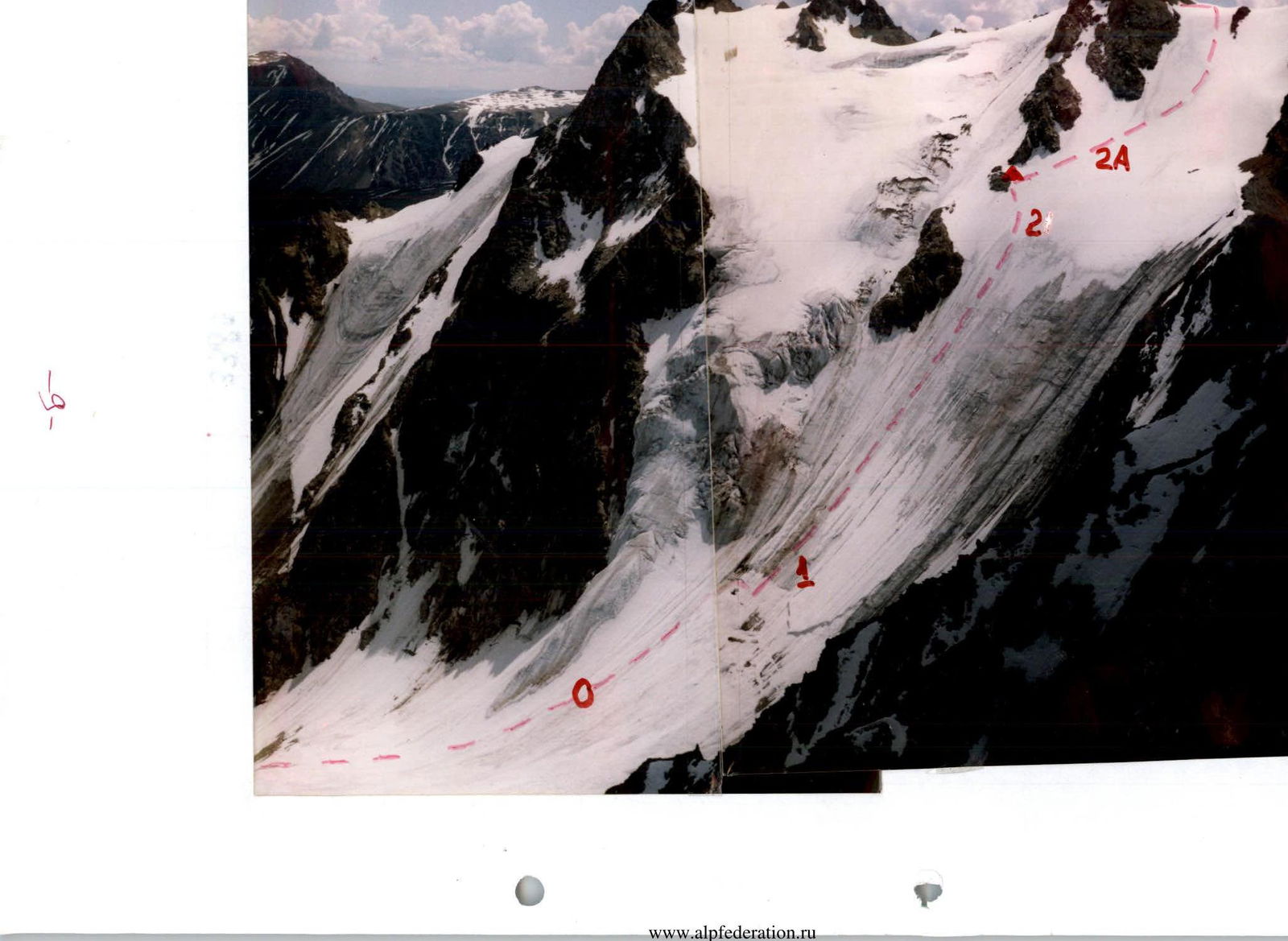
Photo 6: View from the western ridge of Kzyl-Tash. The descent from Uchyitel' pass plateau and the approach to the control cairn are shown.
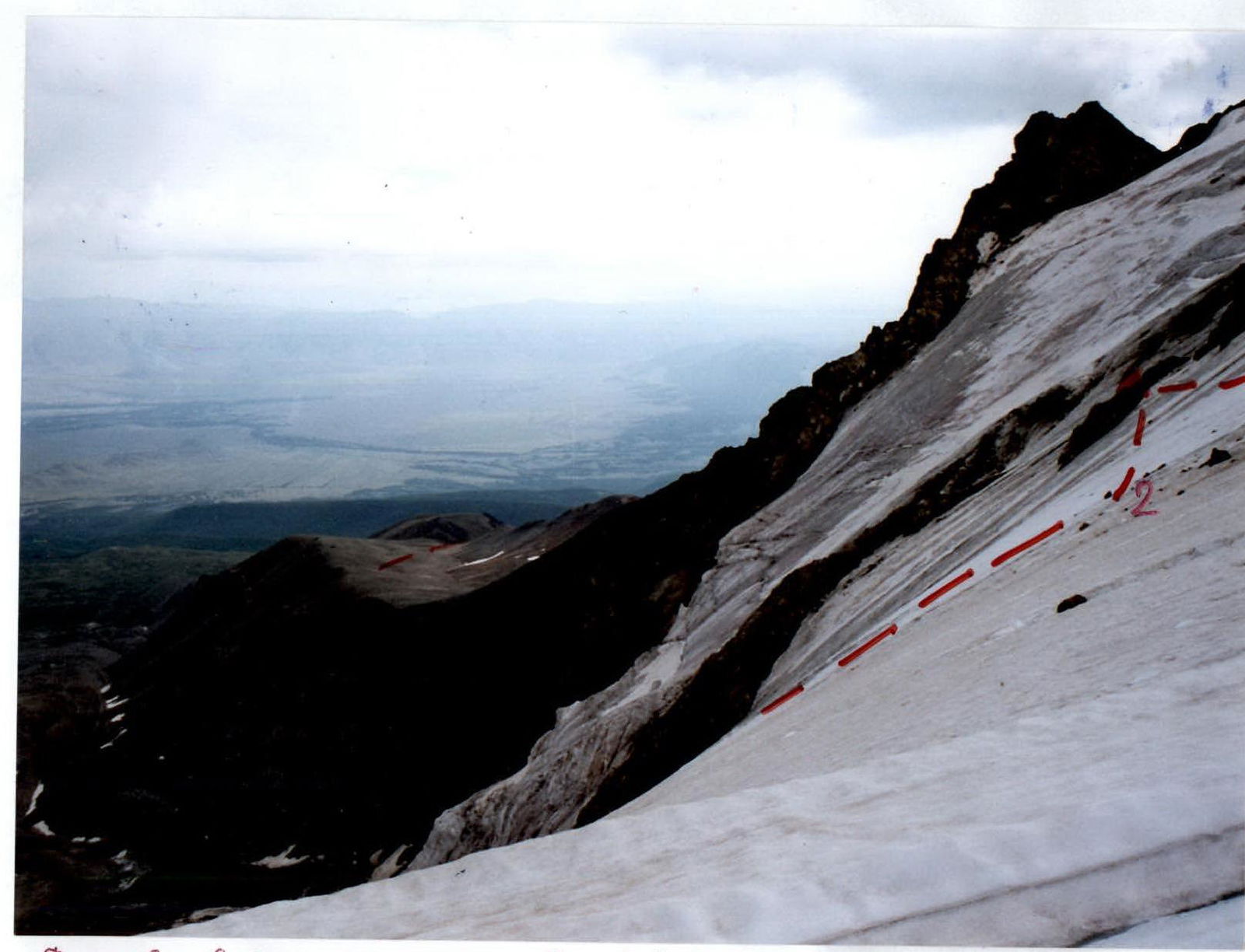
Photo 7: View from the Eastern shoulder (3298 m) of Yubileynaya peak on August 20, 2004.
Photo 8: A team of three on the route on July 23, 2005.