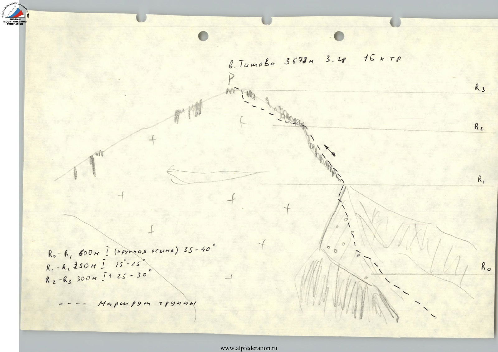
V. Titova 3 ridge.
Drakin A.V. Altai. Katunsky ridge. I.
1.6 dated November 26, 1993, p. 9
Passport
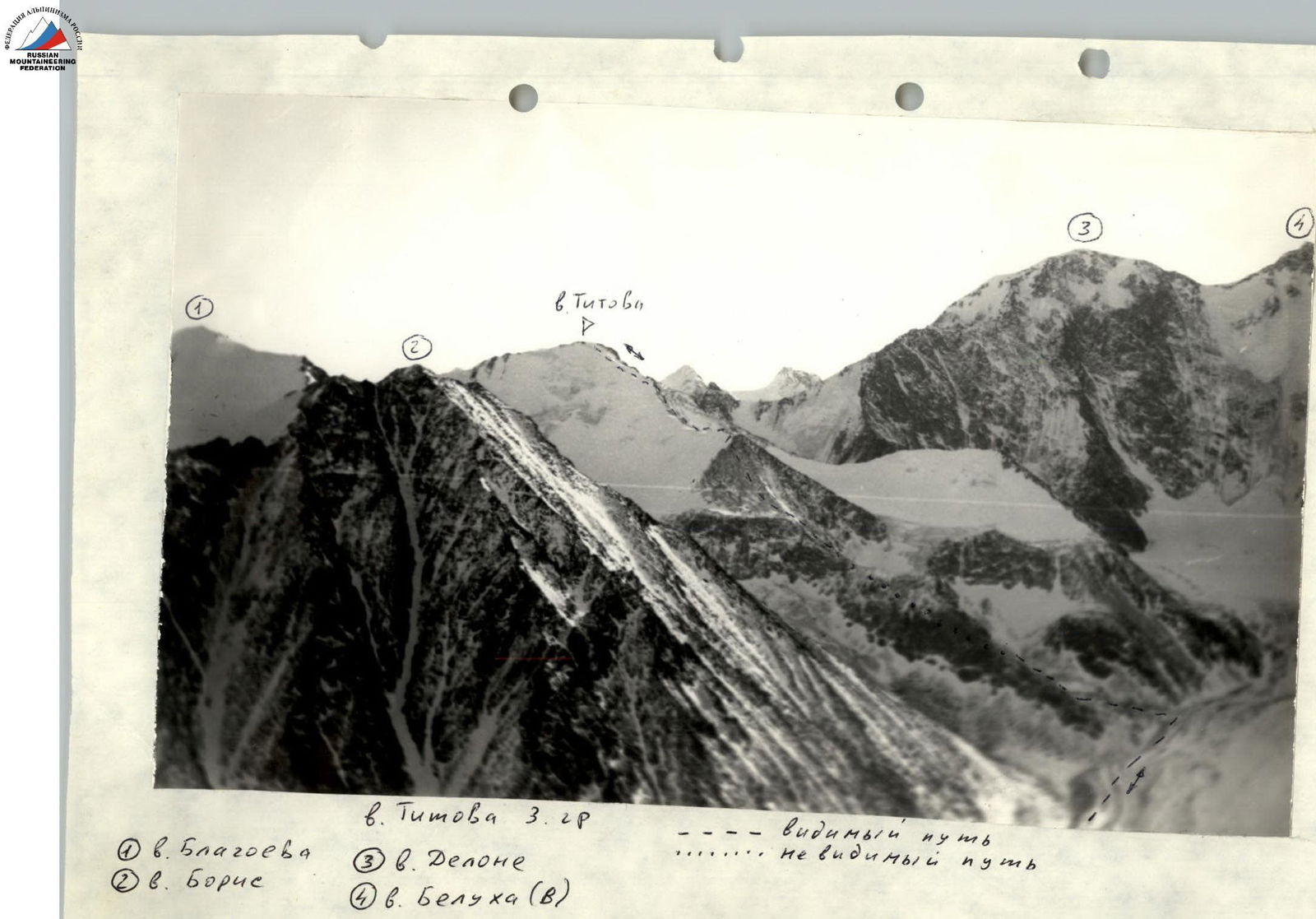
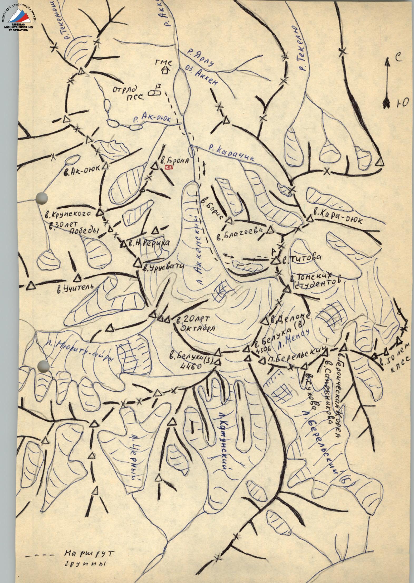
- Altai. Katunsky ridge. Akkem lake area.
- V. Titova 3 ridge. Height 3678.
- Proposed 1B category of difficulty (first ascent)
- Height difference 700 m, length 2300.
- Moving time (from the base camp on Akkem lake and back) 15 hours.
- Leader: Drakin Andrey Valentinovich CMS Participants: Mokhova Valentina Mikhailovna 1st sports category Drakin Georgy Valentinovich 3rd sports category, Shevchenko Alexander Vladimirovich 3rd sports category
- Departure to the route and return January 16, 1993.
- Organization: West Siberian Regional Search and Rescue Service.
 ↗
↗
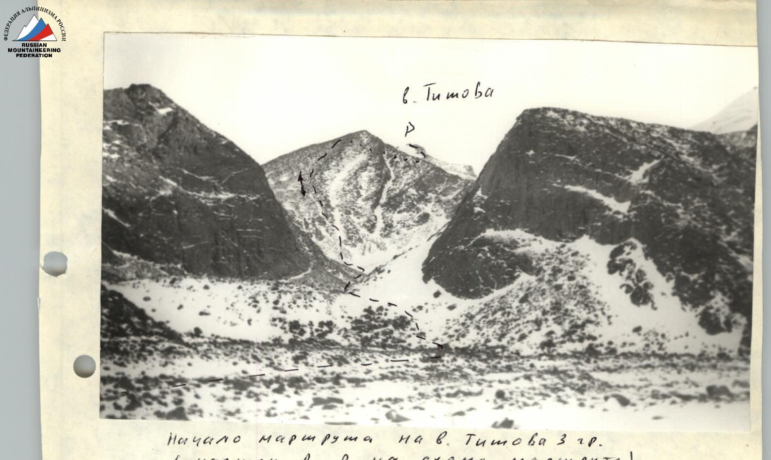
Start of the route to V. Titova 3 ridge. (section R0–R on the route scheme)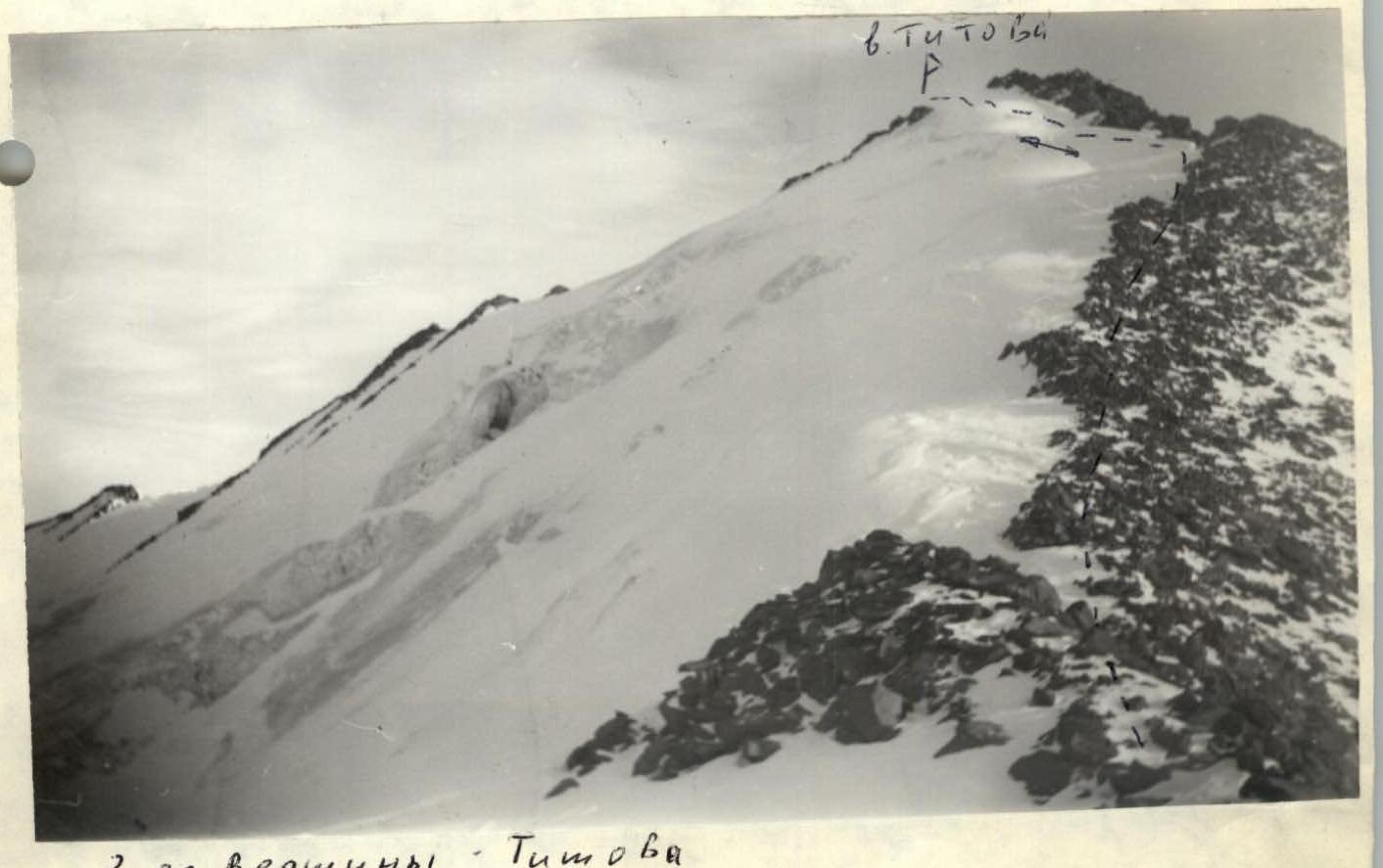
3 ridge of Titov peak (sections R1–R3 on the route scheme)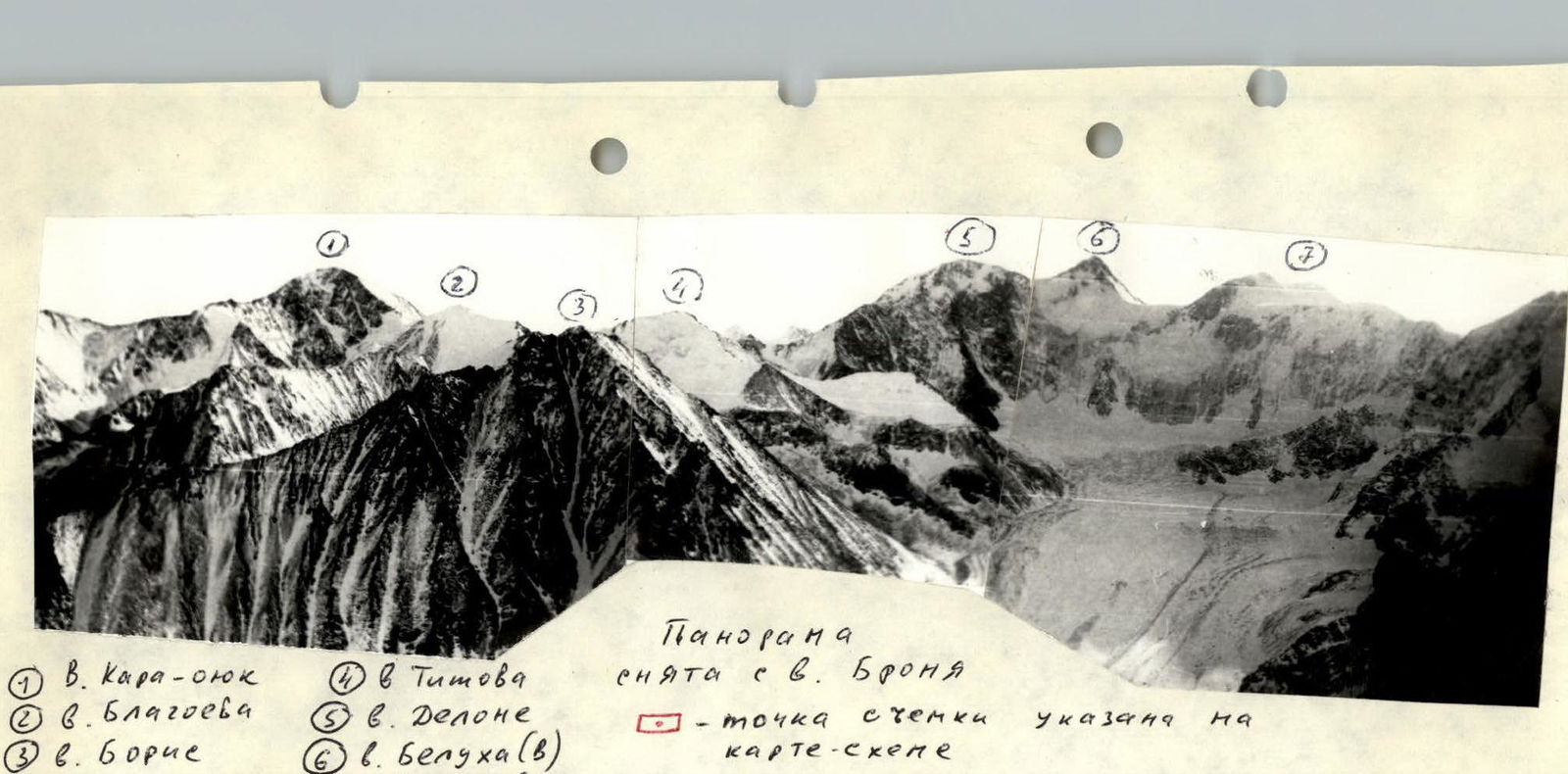
Panorama taken from V. Bronya. The shooting point is indicated on the map diagram.
Route description
Brief characteristics of the sections:
- R0–R1: 600 m, 1 (large scree), 35–40°
- R1–R2: 350 m, 1, 15–25°
- R2–R3: 300 m, 1+, 25–30° Route terrain. From the base camp on the shore of Akkem lake, move along the trail along the lake, where the river flows into the lake, cross to the other bank and move along the river along the trail to the tongue of the Akkem glacier. On the left, ascend the scree to the glacier. Travel time 2 hours. Then move along the glacier or along the lateral moraine on the left. The western ridge of Titov peak bifurcates and forms a small cirque. Enter this cirque along the large scree and then move along the slope located on the left, initially rocky and then scree, to the end of this cirque. Travel time 3 hours.
Up to the left along the steep slope covered with large scree, ascend to the western ridge. Time — 2 hours.
Further movement:
- goes along simple rocks or along the snow to the left of the rocks;
- in the upper part of the ridge — put on crampons and move to the snowy slope on the left, bypassing the more complex part of the rocky ridge;
- along the snowy slope, ascend to a small snowy saddle before the peak and from it to the peak.
Travel time — 2 hours. Descent — via the ascent route.