
Ascent Passport
-
CLASS — first ascent
-
REGION — Altai
-
PEAK — XX let Oktyabrya, left buttress of the eastern wall, 4167 m.
-
CATEGORY — proposed 5B cat. diff., first ascent.
-
ELEVATION GAIN — 1200 m, LENGTH — 1500 m, LENGTH OF 6B cat. diff. sections — 425 m, AVERAGE STEEPNESS OF MAIN SECTIONS 70° (920 m), including 6 cat. diff. (75 m) 80°.
-
PITS (for passage / for belay)
rock — 12 / 130, bolt — 1 / 6, chocks — 3 / 18, ice — 8.
-
CLIMBING HOURS: 55; CLIMBING DAYS: 5.
-
OVERNIGHT STAYS:
- 1st — sitting bivouac;
- 2nd–3rd — snow platform for 4 people;
- 4th — on descent from the summit on a broad firn ridge.
-
LEADER: Gnoevsky Ivan Petrovich, Candidate Master of Sports
PARTICIPANTS:
- Mashchenko Sergey Fedorovich, Candidate Master of Sports
- Bratsev Sergey Evgenievich, Candidate Master of Sports
- Varavin Pavel Vasilievich, Candidate Master of Sports
- Shebolkov Viktor Vasilievich, Candidate Master of Sports
-
COACH: Makarenko Boris Fedorovich, Candidate Master of Sports.
-
APPROACH TO THE ROUTE: July 16, 1983.
SUMMIT: July 19, 1983. RETURN TO BASE CAMP: July 20, 1983.
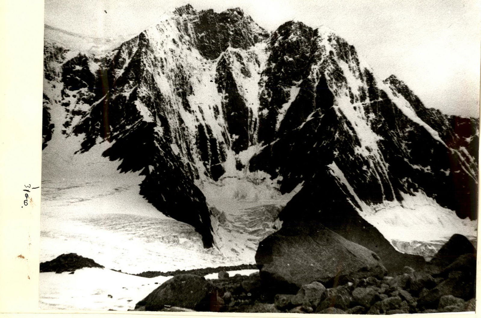
View from the right
I. Object of Ascent
The peak XX let Oktyabrya is located near the Belukha massif and closes the so-called Akkem wall on the right. To the northeast of the peak are prominent pre-summit gendarmes, one of which is reached by the route taken by the team. Further to the northeast, the ridge leads to the peaks:
- Urusvati
- D. Roerich
- N. Roerich
To the southwest of the peak is a snow-firn plateau adjacent to Western Belukha. The overall orientation of the peak massif is northeast — southwest.
The climate in the ascent area in June — August is mostly rainy. According to long-term observations, the most favorable weather for climbing is in:
- March;
- September.
Unfavorable climatic conditions, inaccessibility, and relatively low altitude of the area determine the low attendance of the area. Although it should be noted that the area is promising in terms of interesting "unclimbed" routes and peaks up to 4200 m high.
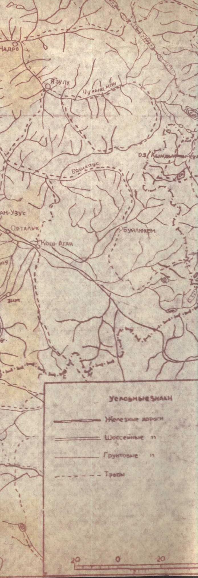
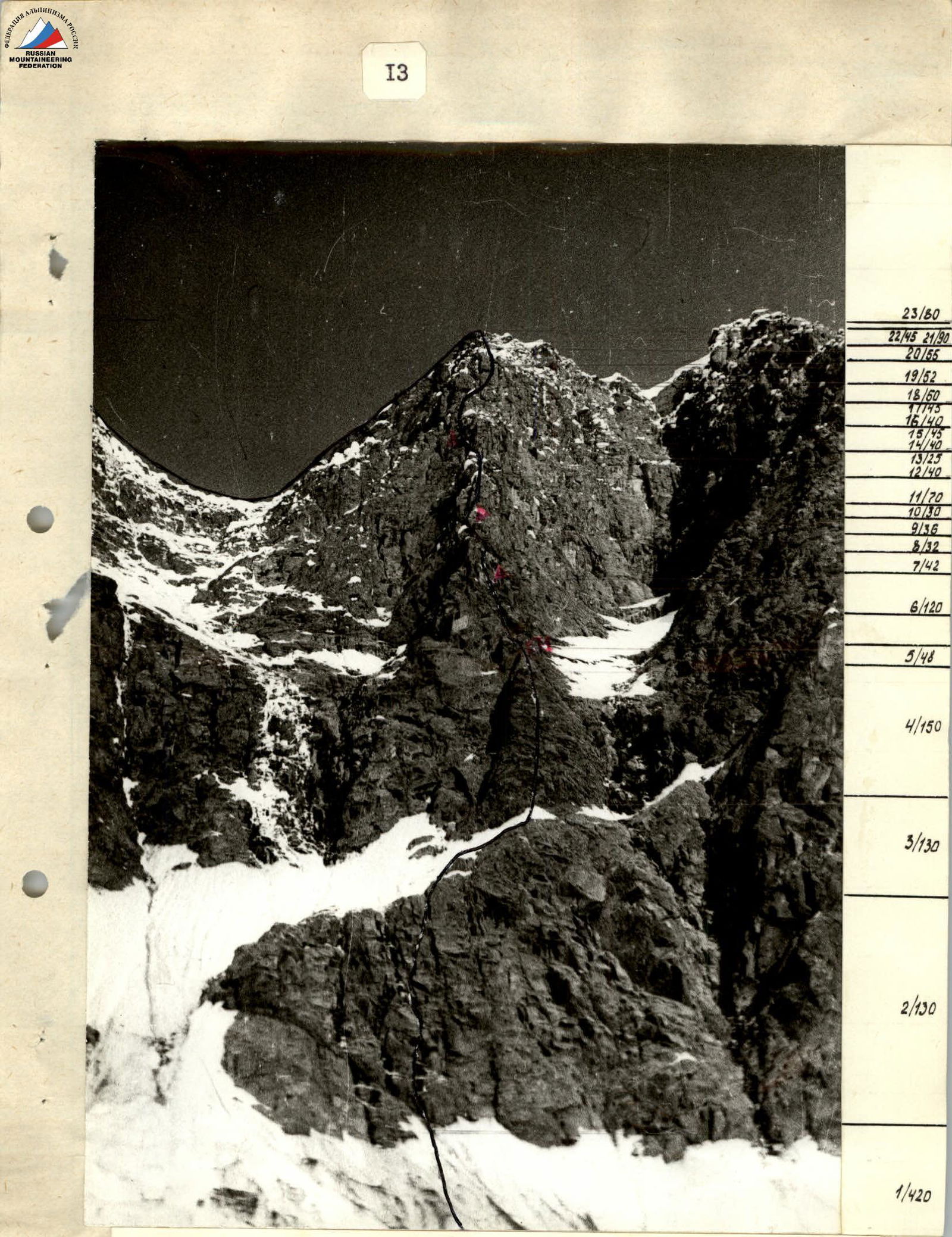
The path to the described route begins from Barnaul, through Gorno-Altaisk, Ust-Koksa, which can be reached by plane on a local airline. From Ust-Koksa to Tyungur, there is a bus (84 km). From Tyungur to Akkem Lake, you can only get by pack transport along a mountain trail, having previously overcome a forest pass along a mountain taiga road. This 58 km path is covered with pack transport in three days.
Options for passage:
- Pack transport — the journey takes three days.
- Helicopter — but due to prolonged bad weather, it can be waited for up to 10 days.
We crossed the pass into the Akkem gorge from Kucherla on a geologists' vehicle to the "kosh". Then all the cargo was carried on our backs to Akkem Lake over 5 days (in 3 trips), as we could not obtain horses due to the field work in the kolkhoz. But we got excellent acclimatization.
The area around Akkem Lake (altitude 2000 m) is characterized by swampiness (even in dry weather), so there are very few places to set up a base camp.
However, the presence of forest solves the problem of cooking in the base camp.
For staying in the base camp and for approaches, boots are simply necessary.

Tactical Actions of the Team
Preliminary observations and inspection of the route showed the following:
- the route's height is 1300–1400 m;
- the route is mainly rock, except for the lower snow-ice section, which is 150–200 m high;
- the average steepness of the route is around 70°;
- the nature of the rocks: well-fractured monolithic blocks;
- the upper third of the route is the most technically challenging;
- the route is safe and very logical;
- no overnight stay locations were identified during observation;
- the bergschrund, 4–5 m high, is almost completely blocked by avalanche cones in two places, which are pierced by small stones during the day.
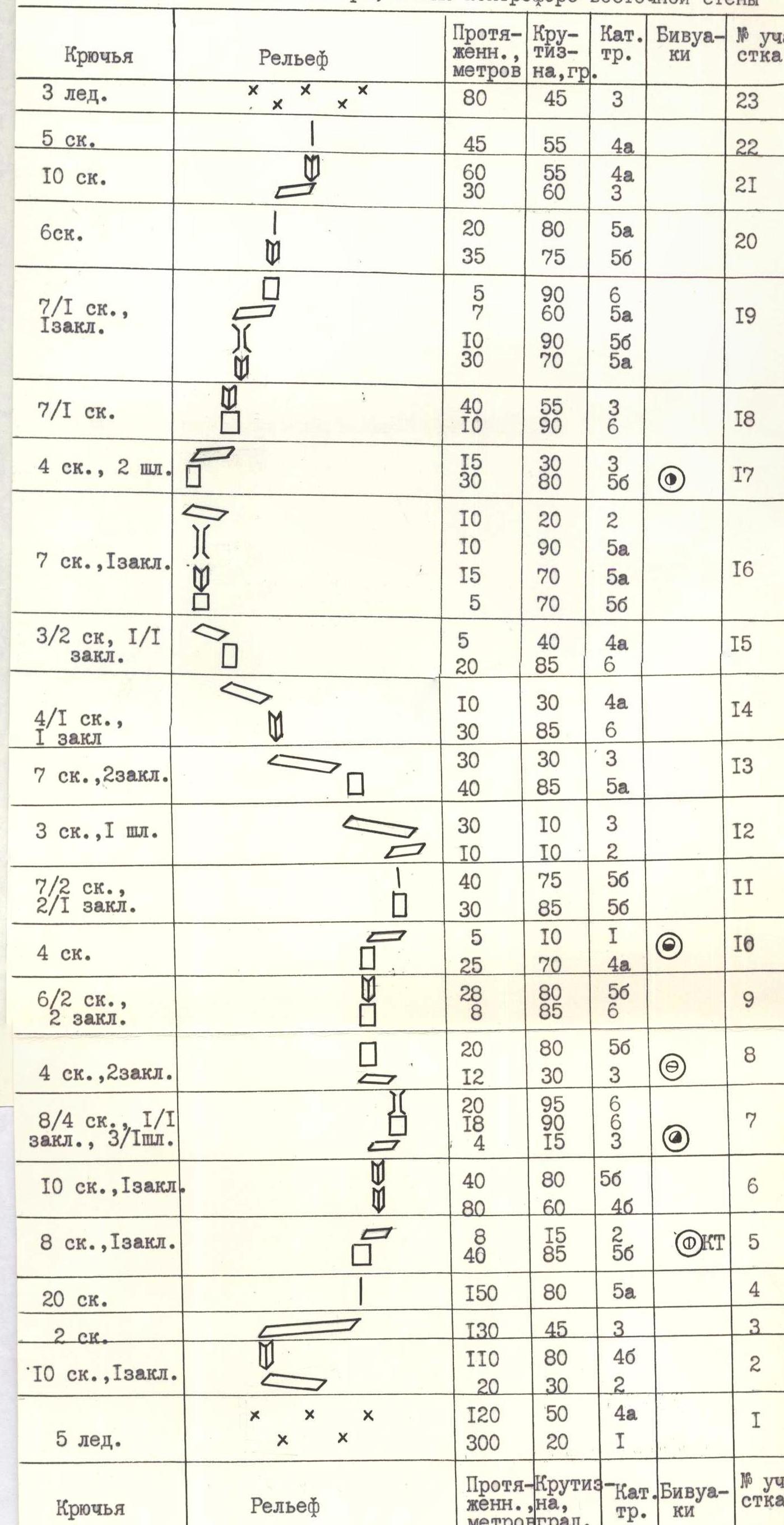
The above determined the team's tactical actions when passing the route and the set of equipment for the ascent (see table on page 12). The route was divided into 4 sections, each of which was supposed to be covered in one day.
On the first day, an early start was planned (at 5:00) to:
- cross the bergschrund and most of the snow-ice section before sunrise;
- be under the cover of rocks.
For this reason, on the day of approach, they organized an overnight stay on the glacier within 20 minutes' walk from the bergschrund.
Preliminary processing of the route was deemed impractical because:
- the lower part of the route does not present significant difficulties;
- approaching the route during the day is not safe.
Insurance for each participant was carried out using a double rope.
Given the large number of complex sections (5, 6 cat. diff.), it was planned to widely use passage of such sections on a fixed rope with the help of jumar ascenders.
The nature of the route did not allow the team to gather in one place during the day, so:
- no special stops for rest and food were planned;
- hot meals were provided in the morning and evening at bivouacs;
- each participant received an individual ration for the day.
A pair of observers was constantly on duty under the route, visually monitoring the team with 8x binoculars and maintaining communication with the base camp. The team's communication with the observers was carried out using a "Vitalka" radio station 3 times a day + 2 emergency communications.
Additionally, the group had on the route:
- 2 signal flares.
Descent from the route is only possible along the ascent path or through the summit and then either:
- along the eastern edge (4A cat. diff.) to the Akkem glacier;
- along the northwestern ridge through peak N. Roerich to the base camp area.
The main provisions of the planned route tactics were implemented.
The route turned out to be somewhat more complicated than expected, especially since after prolonged bad weather before the ascent, huge snow drifts in the most unexpected places, often under rock cornices, significantly hindered us.
Practically the entire wall had to be equipped with fixed ropes. Only in one place (section #3) was it possible to go with autonomous rope teams. The rest of the wall was traversed with fixed ropes and jumar ascenders.
The use of:
- ascenders;
- lightweight metal equipment;
- optimal selection of its quantity and assortment;
- correct distribution of products by day according to the tactical plan —
made it possible to climb with relatively light backpacks without having to pull them up on the route. Only in two places — sections above the first and third bivouacs — did the first climber go without a backpack.
To ensure insurance for the participants, only a double rope was used.
The autoclave taken on the route was of significant help, saving fuel and time on cooking.
The tactical plan was fulfilled day by day.
On the first day, Shebolkov was the first to work on the ice part of the route, then Gnoevsky climbed the rock part, who was replaced by Mashchenko at the end of the day.
On the second day, Gnoevsky was the first to climb most of the route, and on the last three ropes, he was replaced by Mashchenko.
On the third day, Gnoevsky started the movement, then Varavin took over, followed by Mashchenko.
On the fourth day, Mashchenko was the first to climb, then Varavin, then Mashchenko again, followed by Gnoevsky, and the last two ropes before reaching the main ridge were led by Varavin.
The last in the team were Bratsev (first day) and Shebolkov (second — fourth days).
All days, the movement was practically without special stops for rest; each participant received an individual food ration in the morning and had a flask with water, tea, or fruit mixture solution like "Veloton".
Description of the Route by Sections
The lower part of the route (section R1) is snow-ice. Its passage is not particularly difficult. The snow is dense; the bergschrund, 4–5 m high, is crossed along one of the avalanche cones. The ice surface is loose; deep holes need to be dug for pitons.
- At least one pair of crampons is required per rope team.
- Tying two ropes together may be useful in the upper part of the section.
It is recommended to pass this section very early (before sunrise) as the wall is immediately lit, and the section starts to be hit by small stones.
Sections R2–R4 are very logical, passing along a not very pronounced buttress, which on section R3 intersects a wide inclined ledge leading to the right and upwards. The rocks are monolithic, well-fractured.
Section R4 ends before a complex 40-meter wall (section R5), after which a small platform is left with a control cairn — the only one on the route, as it is impossible to deviate from it anywhere: the wall is continuously hit by stones both to the left and right of the route.
Section R6 passes along the right "cheek" of the buttress, 5–15 meters from its edge, along a not very pronounced inner corner, bypassing the overhanging rock blocks above the edge.
Rocks:
- heavily destroyed;
- sharp "feathers";
- many "live" stones.
This is the most dangerous place on the route. Here, one should consider the possibility of transitioning to the left "cheek" of the buttress approximately in the middle of section R6. Inspection of this route variant from above allowed us to assume that such a variant is safer (and possibly simpler).
After the end of section R6, on a snowdrift under a huge rock cornice, there is a small platform suitable for a sitting bivouac for 4–5 people.
Section R7 is the most challenging part of the route. It is passed in "ladder" fashion, without a backpack. The length of the section is 42 m. From the bivouac platform, half a rope length of very complex climbing to the right and upwards along a steep monolithic wall in the direction of a chimney. The place is very complex. Here, before entering the chimney, a single bolt piton was driven for the passage of the route. Further, 20 m of complex climbing upwards along a wet chimney, covered with ice in the upper part, leads to an inclined ledge (beginning of section R8).
Sections R8–R10 pass directly along the buttress; 2 ropes of very complex rocks using artificial aids (AIDs) end at the top with a 25-meter wall of medium complexity, above which there is a small inclined platform.
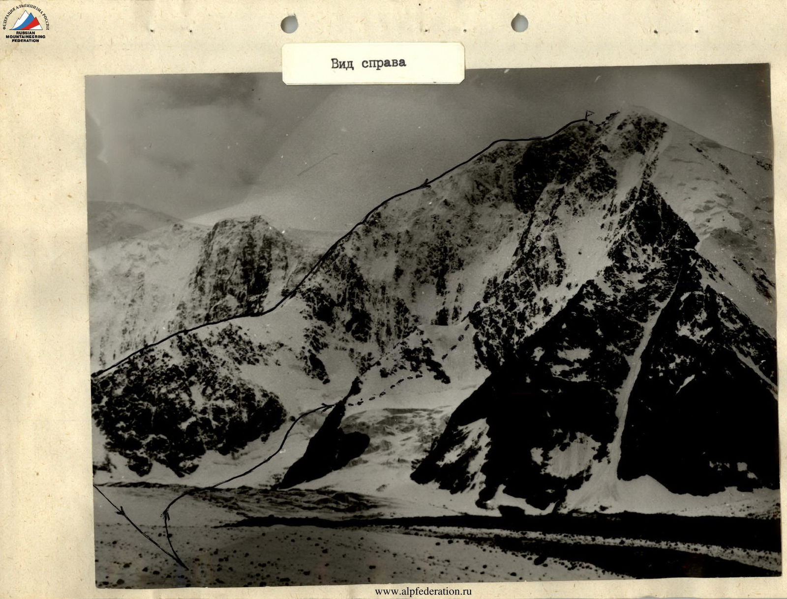
UIAA symbol route diagram
Peak XX let Oktyabrya, left buttress of the eastern wall
Section R11 — two ropes of complex rocks with microrelief pass directly along the buttress, and further, starting from section R12, the route moves to the left "cheek" of the buttress and up to section R20 represents a bypass of the overhanging rock tower above the buttress edge. The general direction of movement:
- to the left and upwards on sections R12–R17;
- upwards and to the right on sections R18–R20.
Sections R12–R13 represent a transition to the left "cheek" of the buttress along simple rocks, and then, starting from section R14, the actual bypass of the overhanging rock tower begins.
Sections R14–R15 and the beginning of R16 — 1.5 ropes of very complex climbing first along a monolithic inner corner, then:
- after a 10-meter traverse to the left — a complex 20-meter wall, which is passed "head-on";
- further traverse to the right under a small wall turning into an inner corner;
- the inner corner leads to a wide steep chimney.
Section R16 ends after exiting the chimney before a complex 40-meter wall (section R17), above which is a wet inclined ledge leading to the right and upwards, ending with a small inclined platform with a snowdrift under a steep monolithic wall.
The complexity of the bivouac depends on the conditions:
- In the presence of snow: it is possible to cut off the upper part of the drift and make a decent platform for a tent.
- In the absence of snow: the bivouac platform is inconvenient.
Section R18 begins with the above-mentioned 10-meter steep monolithic wall. Climbing is very complex; AIDs are used. This is, perhaps, the second most challenging place on the route.
Further, the path goes along the left side of the buttress ridge, along icy very complex rocks. The general direction of movement:
- first upwards and to the right (sections R18–R20);
- then directly upwards (sections R21–R23), maintaining a general direction towards the ridge.
The most unpleasant place in this part of the route is a 10-meter chimney with a cold "shower" on section R19. The most dangerous is the 60-meter inner corner on section R21 due to the presence of a large number of "live" stones that can be dislodged by those ahead. Snow clumps breaking off from cornices and snow drifts also pose a certain danger.
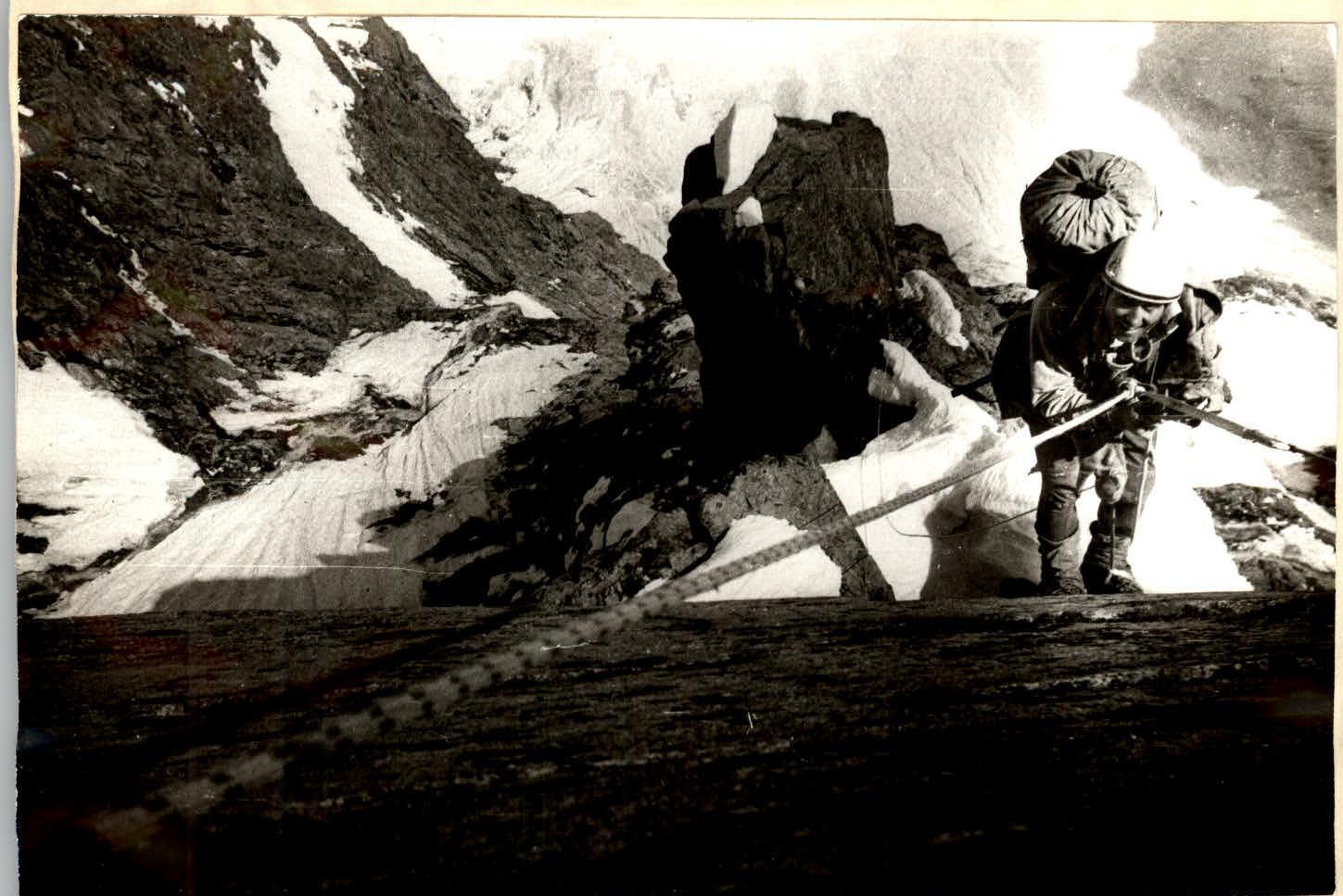
Sections R23–R24: at first steep, and then more and more gentle rocks, which after an implicit chimney (live stones!) lead to a snow-ice ridge with a steepness of 45° and a length of 80 m, leading to the main ridge of the peak.
The descent from the summit along the eastern edge to the Akkem glacier does not present difficulties.
Technical Photography
View down from section R4
Section R2
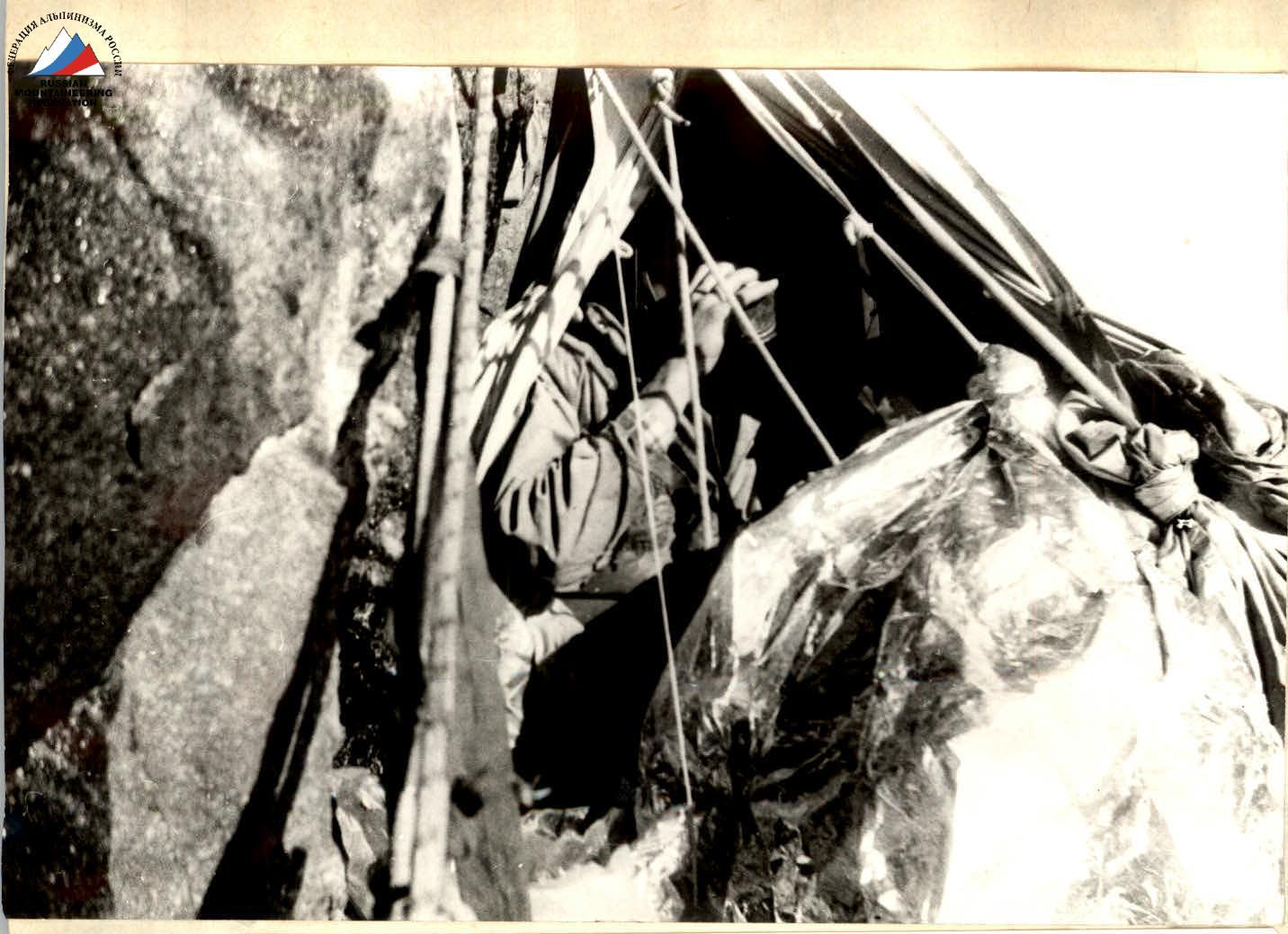
Section R7. Sitting bivouac
Section R8

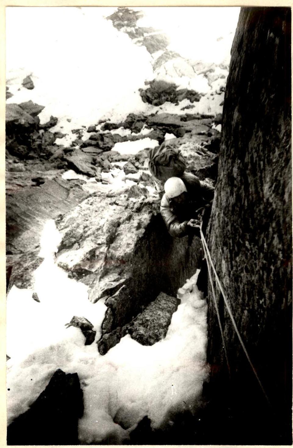
Section R5. 40 m above the control cairn
Section R7. Exit from the chimney
Comments
Sign in to leave a comment