
ALPINIADA
Of Tomsk Regional Council of the Student Sports Union "Burevestnik"
Mountainous Altai
Ak-kem valley
July 10-20, 1963
First ascent of Pik Gidrometслужбы Braня
Route Description
First Ascent of Pik Gidrometслужбы
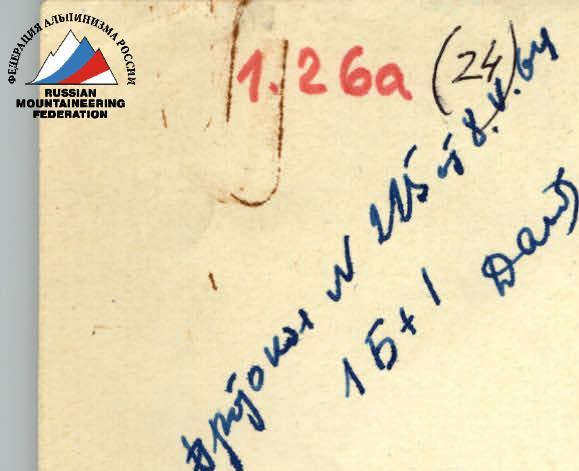
(Category 2A difficulty)
Climbing Report
On August 12, 1963, a group of climbers, participants in the Alpinada of Tomsk Regional Council of the Student Sports Union "Burevestnik" comprising:
- Khizhnyak V.G. — leader
- Molodezhnikov A.M. — participant
- Denisov V.M. — completed the first ascent of an unnamed peak, named by the first ascenders as Pik Gidrometслужбы in honor of the selfless workers of the meteorological station on Ak-kem lake, who perform their labor duty in any conditions, winter and summer.
The ascent was made from a stony cirque located on the southern side of the eastern ridge of the summit. The ascent route, which went along the eastern ridge, was assessed by the first ascenders as category 2A difficulty.
The location of Pik Gidrometслужбы and the stony cirque can be seen on the map — a scheme of the area (see Appendix 1).
From the summit, a bearing was taken by compass on Pik Razoruzhenie — it equals 150° (direction to the north — 0°).
The height of the peak is approximately — 3500 m (based on bearings taken on other peaks).
The approach route from the base camp is described in detail in the "Report on the First Ascent of Pik Razoruzhenie" by Khizhnyak V.G. The ascent to Pik Razoruzhenie was made from the same stony cirque as the ascent to Pik Gidrometслужбы. In good weather conditions, the ascent to Pik Gidrometслужбы can be made directly from the base camp when leaving at 5:00–6:00.
Description of the ascent route to Pik Gidrometслужбы from the stony cirque along the eastern ridge
(see Appendix II and III)
It is possible to leave the overnight stay in the stony cirque for the route at any time before 12:00, as the state of the snow does not play a significant role in the speed of movement: snow is only encountered on gentle sections of the ridge.
The group set out on the ascent at 11:00. The direction of movement — east-northeast along the slope of the cirque. The slopes of the cirque are very broken rocks and solid stone scree. The steepness of the slopes is from 30 to 50°. In the middle part of the slopes, along the entire perimeter, there is a rock wall 5–7 m high and immediately above it, exactly the same, located above the first ledge. Between individual sections of the wall, there are couloirs with a steepness of 60–70°, down which streams flow. The group overcame the wall through one such couloir by simple climbing.
There are many "live" stones and fragments of various sizes on the rocks. Sections of stone scree consist of stones of various sizes (from tens of cm to 3–4 m) and shapes (there are stones of cubic, spherical shape and slabs).
The slopes of the cirque are traversed by simple climbing.
After 1 hour 40 minutes, the group reached that section of the northern ridge of Pik Razoruzhenie (A), where it changes its direction to the west (2). At this point, the eastern ridge of Pik Gidrometслужбы begins. The main direction of this ridge is to the west, towards the summit.
To the left (in the direction of travel) — the northern slopes of the cirque (1), to the right — a snowy saddle (3) with slopes to the northwest (4) and sheer rock drops to the east (5), bounded to the north by an unnamed peak (6).
Moving along the saddle, along the edge of snow and rocks, the group approached a not very steep (25–30°) snowy-rocky rise of the edge (7) and continued to move along the edge of snow and rocks.
The snow is dense in some places, loose in others, covered with a thin crust of firn and cut by crevasses (8). The group moved in a rope team without crampons. The rocks on the left (in the direction of travel), southern slopes of the ridge are very broken, stepped, with varied inclinations of the steps, with a large number of fragments on them and "live" stones.
In the upper part of the left slope, the rocks are mostly sheer (80–90°) (9), lower down the steepness changes from 80 to 60°. At the foot of the rocks, there are large talus slopes and scree. The northern, right-hand (in the direction of travel) slopes of the ridge are snowy fields, cut by crevasses and descending to the east — towards the saddle, to the north — down into the valley. The steepness of the northern slopes of the first part of the ridge is from 40° in the upper part to 60–70° in the lower part.
After 30–40 minutes of movement, the group overcame the snowy-rocky rise and reached the false summit (10).
Further on, the entire ridge is mainly rocky, dropping steeply to the south with steep rocks and large scree with a steepness of 70 to 45°, and to the north — with snowy-ice cornices and drops, sometimes with rocky outcrops, with a steepness of 70–90°.
10 minutes' walk from the false summit brought the group to a small, broken gendarme (11) (5–8 m high), representing a jumble of very large stone blocks of regular geometric shape. The gendarme is bypassed by simple climbing to the left along ledges with alternate belay through outcrops.
15–20 minutes' walk after the gendarme — a low (4–6 m) talus slope (12), consisting of large feather-like slabs. The talus slope is overcome in its middle part along the fissures between the "feathers" by simple climbing with alternate belay through outcrops.
Over the next 15–20 minutes of movement along the ridge with alternate belay, the group overcame a small rocky rise (13) along the edge of rocks and ice cornices hanging over the northern slopes of the ridge, representing at this point an almost sheer ice wall with rocky outcrops, stretching far down into the valley — and approached a steep (45–50°) pre-summit rise (14). At this point, the ridge deviates from its westerly direction to northwesterly.
The left-hand (in the direction of travel) slopes of this section of the ridge are similar to the previous ones, and the right-hand slopes are very broken rocks with a steepness of 45–50° in the upper part.
The rise is overcome by simple climbing with alternate belay in 20–30 minutes and leads to the summit.
The entire journey from the overnight stay in the stony cirque to the summit took 3 hours 30 minutes.
A cairn was built on the summit and a note was left. As the first ascenders, the group named the summit Pik Gidrometслужбы, as mentioned above, and assessed the ascent route as category 2A difficulty.
The descent along the ascent route took 2 hours. Throughout the ascent, the weather did not favor the climbers: very dense, wet, and at times dry, stinging snow fell; a sharp, strong wind blew; very often, due to continuous cloud cover and fog, visibility did not exceed 15–20 m.
The total time of the ascent, counting from the overnight stay in the stony cirque, was 5 hours 30 minutes–6 hours.
The ascent was successful.
Group leader — (V. Khizhnyak) November 20, 1963