Ascent Log
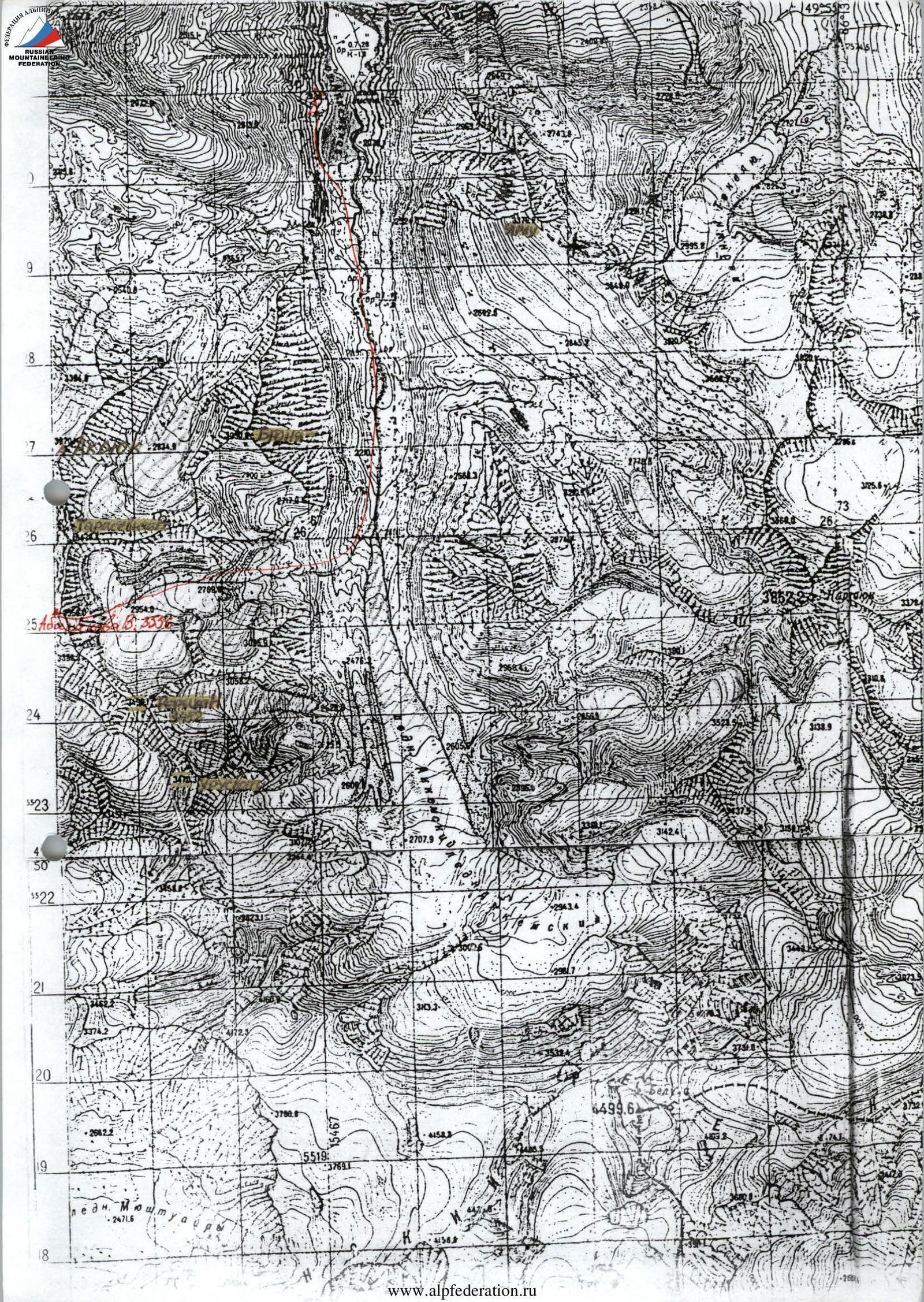
- Altai, Katunskie Belki ridge, Akkem valley, section 1.
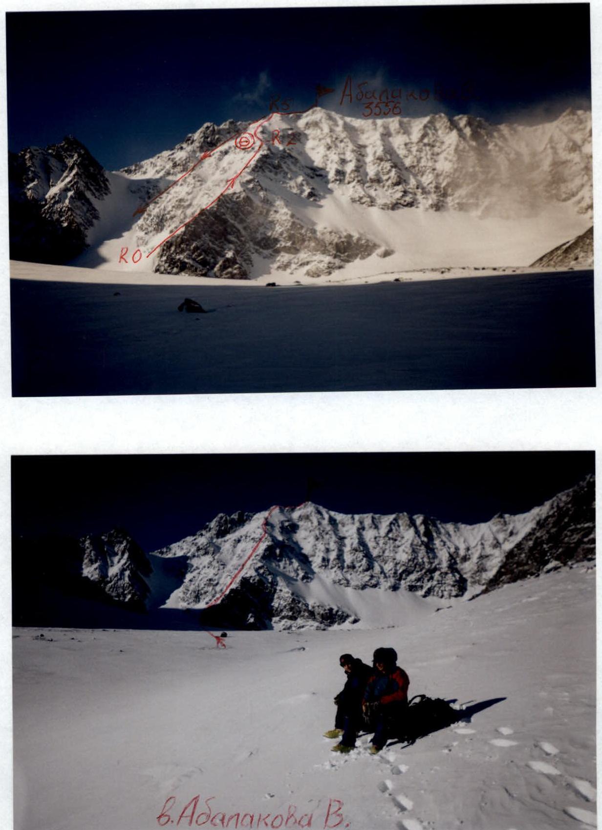
- Peak Abalakova V., 3556 m, via East ridge.
- Proposed 2A cat. diff., first ascent.
- Route character is combined.
- Height difference 450 m, length 700 m, average slope 40°.
- Pitons hammered: rock and wired 6.
- Team's travel hours — 12 h, days 2.
- One overnight stay in a tent on the ridge.
- Leader Afanasiev A.E. MS. Participants:
- Kolesov P.O. CMS
- Sherstnev I.V. CMS
- Coach Afanasiev A.E.
- Departure to the route February 6, 2002, return February 7, 2002.
Route Description of the ascent to peak Abalakova V.M. via the eastern ridge 2A cat. diff., first ascent
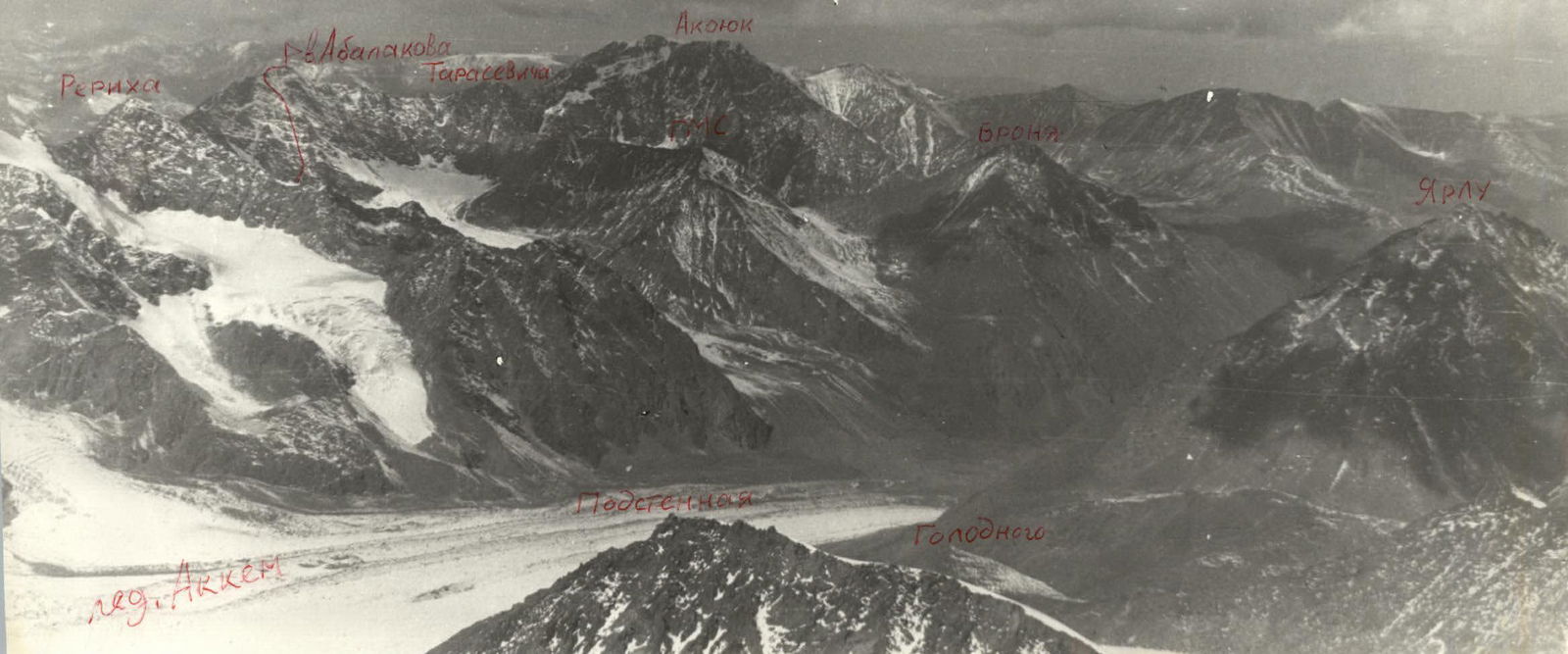
Peak Abalakova V. 3556 m. Located in the V.V. Roerich–Tarasevich cirque between these peaks and is the highest point of the cirque. No tour was found on the summit. We propose to name the peak after Abalakov Vitaly Mikhailovich, who made the second ascent of peak Belukha with a group in 1933 and the first from the Akkem valley.
The approach from the base camp to the route takes 4–5 hours.
Ascent sections:
- R0–R1: 60 m, 30°, 1. Snow slope.
- R1–R2: 400 m, 45°, 2. Snowy rocks. Alternating movement. Protection through ledges and pitons. Exit to the ridge. Overnight stay.
- R2–R3: 30 m, 55°, 3. Snowy rocks. Pitons protection, ropes.
- R3–R4: 100 m, 35°, 2. Snow ridge.
- R4–R5: 30 m, 45°, 2. Destroyed rocks.
- R5–R6: 80 m, 20°, 1. Summit ridge.
Exit to the summit. Descent via the southern couloir of the Eastern ridge, having previously fired it with stones and triggered an avalanche.
Technical photo of the route
Photopanorama
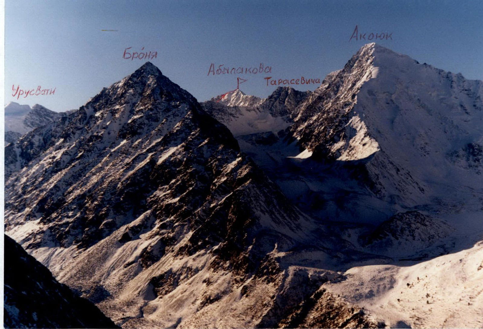
Photopanorama