Passport
I. Rock category 2. Spurs of the Turkestan Range, Ak-su gorge 3. Peak 4240 via the right part of the N-3 wall 4. Proposed — 6B category of difficulty, second ascent 5. Height difference 940 m, length 1020 m, length of sections with category IV difficulty — 385 m Length of sections with category V difficulty — 370 m Average steepness of the route — 70°, average steepness of the wall section — 80° 6. Pitons hammered:
| rock | nut placements | bolt | ice |
|---|---|---|---|
| 73 | 255 | 22 | 0 |
| 38 | 64 | 20 | 0 |
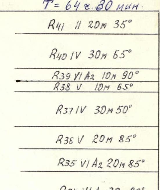
- Team's travel hours: 64.5 h, days — 6 and one day for preparation
- Overnights: on the route in hammocks
- Leader: Pavlysh Sergey Nikolayevich — CMS Prikhodko Yuri Pavlovich — MS Morozov Oleg Anatolyevich — CMS Tochinsky Viktor Iosifovich — CMS Savenko Vladimir Andreyevich — CMS
- Coach: Khitrikov Vladimir Andreyevich — MS, 2nd sports category.
- Departure to the route: June 26, 1988 Summit: July 2, 1988 Return: July 3, 1988
- Organization: Dnipropetrovsk Regional Sports Committee
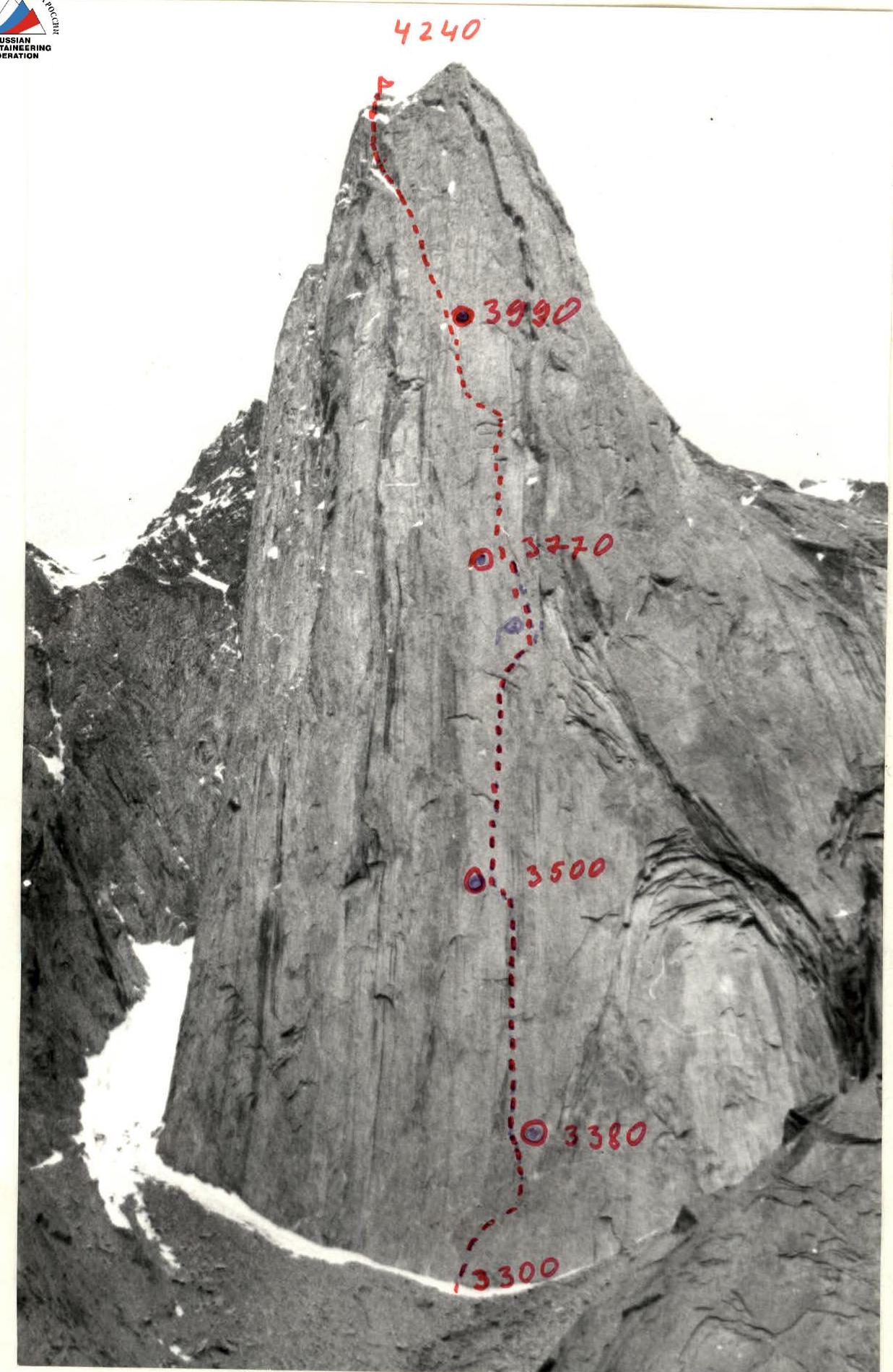
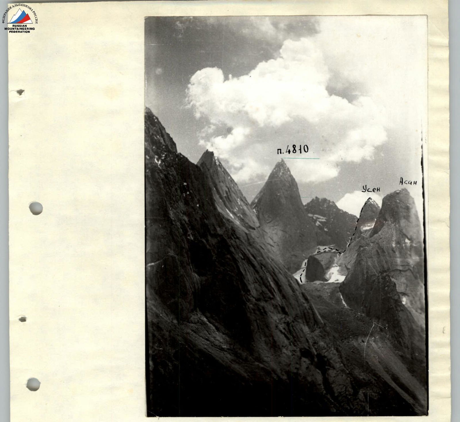
Photo No. General photo of the summit. Date and time of shooting: May 5, 1988 at 15:00. Lens type — Industar-50. Distance to the object — 2000 m. Shooting point number — N. Height of the shooting point — 2620.
| 2/1 | 2 | 0 |
|---|---|---|
| 1 | 4 | 0 |
| 3 | 0 | 0 |
| 3 | 9 | 0 |
| 0 | 10 | 0 |
| 2 | 1 | 0 |
| 0 | 8/2 | 0 |
| 0 | 9 | 0 |
| 2/2 | 3/3 | 12/12 |
| 3 | 3 | 0 |
| 4/4 | 12/10 | 0 |
| 3/3 | 8/5 | 0 |
| 2/2 | 7/7 | 0 |
| 2/2 | 5/2 | 0 |
| 2 | 9/8 | 0 |
| 3/3 | 11/11 | 6/6 |
| 6/6 | 14/10 | 4/2 |
| 3 | 3 | 0 |
| 1/1 | 6/5 | 0 |
| 2/2 | 7 | 0 |

- R1: 40 m, category of difficulty 5, 75°
- R2: 25 m, category of difficulty 6 (A1), 80°
- R3: 15 m, category of difficulty 4, 70°
- R4: 40 m, category of difficulty 6 (A2), 85°
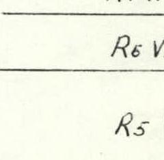
- R5: 40 m, category of difficulty 6 (A4), 90°
- R6: 20 m, category of difficulty 6 (A2), 85°
- R7: 20 m, category of difficulty 6 (A1), 85°
- R8: 20 m, category of difficulty 6 (A1), 80°
- R9: 20 m, category of difficulty 6 (A3), 80°
- R10: 30 m, category of difficulty 6 (A3), 75°
- R11: 10 m, category of difficulty 6, 85°
- R12: 40 m, category of difficulty 6 (A4), 85°
- R13: 30 m, category of difficulty 5, 70°
- R14: 30 m, category of difficulty 5, 75°
- R15: 10 m, category of difficulty 4, 70°
- R16: 40 m, category of difficulty 5, 70°
- R17: 40 m, category of difficulty 4, 65°
- R18: 10 m, category of difficulty 5, 70°
- R19: 20 m, category of difficulty 5, 70°
- R20: 10 m, category of difficulty 6 (A1), 75°
- R21: 20 m, category of difficulty 6 (A1), 85°
- R22: 20 m, category of difficulty 6 (A3), 85°
- R23: 40 m, category of difficulty 5, 70°
- R24: 20 m, category of difficulty 5, 70°
- R25: 10 m, category of difficulty 6 (A2), 85°
- R26: 20 m, category of difficulty 5, 70°
- R27: 10 m, category of difficulty 5, 70°
- R28: 40 m, category of difficulty 5, 65°
- R29: 40 m, category of difficulty 4, 65°
- R30: 25 m, category of difficulty 4, 60°
- R31: 40 m, category of difficulty 5, 70°
- R32: 30 m, category of difficulty 4, 70°
- R33: 30 m, category of difficulty 4, 50°
- R34: 30 m, category of difficulty 6 (A1), 80°
- R35: 20 m, category of difficulty 6 (A2), 85°
- R36: 20 m, category of difficulty 5, 85°
- R37: 30 m, category of difficulty 4, 50°
- R38: 10 m, category of difficulty 5, 55°
- R39: 10 m, category of difficulty 6 (A2), 90°
- R40: 30 m, category of difficulty 4, 65°
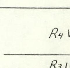
- R41: 20 m, category of difficulty 2, 35°
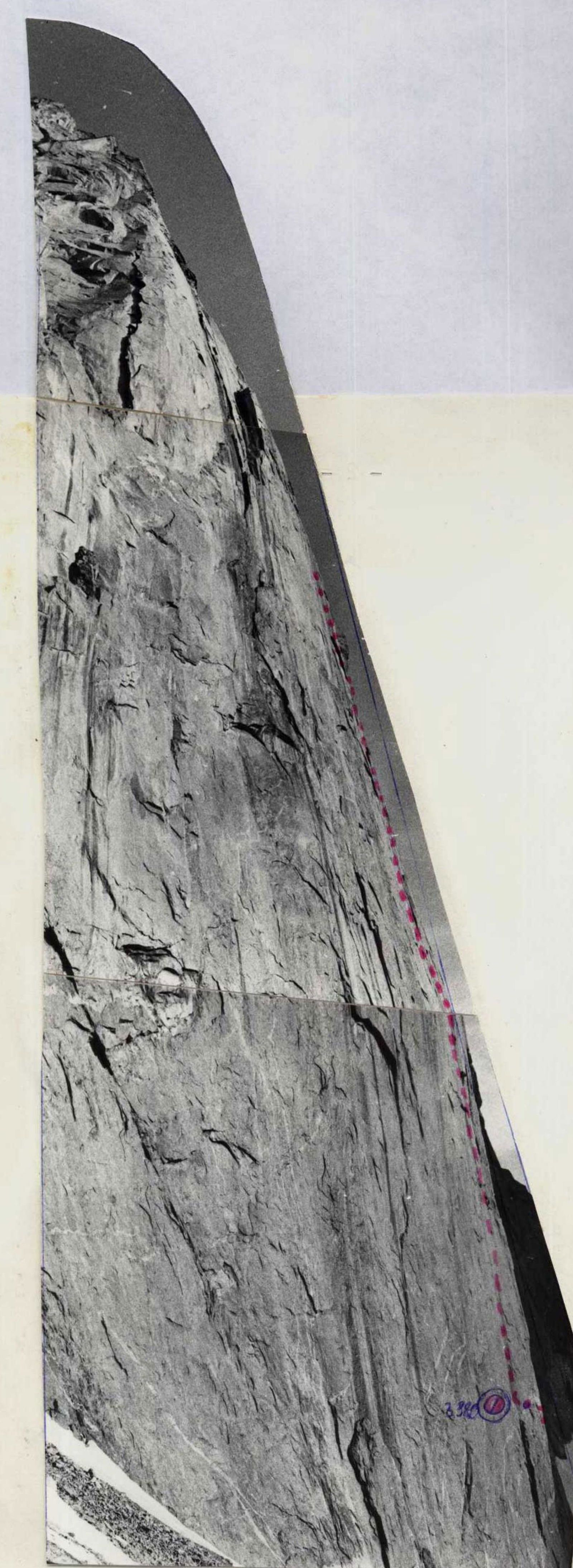
Photo No. 3. Profile of the wall from the left. Date and time of shooting: June 19, 1988 at 18:00. Lens type: Industar-50 mm. Distance to the object: 200 m. Shooting point — C9. Height of the shooting point: 3300 m. The profile of the wall from the left is also represented by technical photo No. 5, 6.

Photo No. 2. Profile of the wall from the right. Date and time of shooting: June 30, 1988, 17:00. Lens type — Industar-F-50 mm. Distance to the object — 2000 m. Shooting point number — C2. Height of the shooting point — 3700 m.
Description of the route by sections
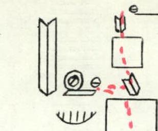
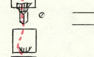
Preparation day — June 26, 1988. The Prikhodko–Tochinsky rope team worked on preparation. They covered 40 meters. The relief is heavily destroyed, movement from left to right along the chip — pendulum piton — exit to the shelf. Due to rain with snow, they descended down. R0–R1.
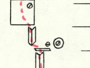
1st day: The Pavlysh–Savenko rope team works. Section R2 — 25 m. From the shelf, along the inner corner to the left, using AID (large friends). The inner corner leads to a small shelf. Section R3 — 15 m — small slabs with shelves, leading to a "finger." Above the "finger" — cut bolts from the Rostov team. R4 — 40 m — starts from the "finger," a small inner corner turning into a crack. Poor microrelief, deep cracks. Cut bolts are encountered. Their own bolt pitons are used. Passage of the section on AID. On the "finger" is an overnight stay spot: sitting and hammocks. In case of bad weather, the "finger" is reinforced with stones from the roof — limit the number of overnights, double belays!!!
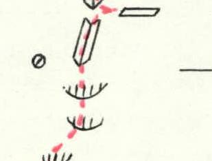
2nd day: The Pavlysh–Morozov rope team works. R5 — 40 m. A series of cornices ends with a wall that leads to an inner corner. The section is steep, passed on AID, using their own bolt pitons, as the Rostov team's bolts are damaged (//). R6–R7 — 40 m. Inner corner, overhanging at the beginning, leading to a small shelf. Then the inner corner closes with a narrow long shelf — hanging overnight stay. After the shelf, there is a change of lead. R8–R9 — 40 m. On the left part of the narrow shelf, a tight inner corner turns into a crack, then a slab with tight cracks (small nut placements, petals). Control belay on the narrow shelf! R10–R11 — 40 m. The wall continues, then an inner corner closed by a cornice.
3rd day: The Prikhodko–Tochinsky rope team works. R12 — 40 m — the cornice is passed "head-on" on AID, then a steep wall without microrelief and a trail of bolt pitons. The group hammered 12 bolts. Between the bolt pitons, holes for rock pitons were used. Many cut bolts. R13 — 30 m — a large chip forms an inner corner with a slope to the right, leading to a series of shelves (possible overnight stay spot!). R14–R15 — 40 m — wall with a crack, turning into a crack that closes with an inner corner with a shelf. Tochinsky works first. R16–R17 — 80 m — a series of inner corners with slabs, leading to an overnight stay (many "live" blocks!!!). R18–R19–R20 — 40 m — a series of large inner corners, in the direction of a large cornice visible above.
4th day: The Savenko–Morozov rope team works. R21–R22 — 40 m. Steep inner corner, convenient belay spot absent. "Live" blocks are encountered. A slab leading under a cornice, which is bypassed along the inner corner to the right. Large friends and nut placements are used on the section. R23 — 40 m — behind the cornice to the left, an inner corner representing a wide crack with smooth sides and complex climbing. R24 — 20 m — continuation of the inner corner, veering to the right and overhanging with a cornice, leading to a steep wall. R25 — 10 m — steep wall, limited on the left by a steep inner corner, entrance to the corner and exit to a small shelf. R26–R27 — 30 m — the inner corner closes with a 10-meter wall. After the wall, a convenient shelf. R28 — 40 m — wall, not steep, leading to a series of convenient shelves for sitting overnights ("live" stones!!!). R29 — 40 m — the Pavlysh–Tochinsky rope team works. A series of walls crossing the shelves (stonefall hazard!). Category of difficulty 6.
5th day: The Pavlysh–Morozov rope team works. R30 — 25 m — inner corner 60°, turning into a wall. Category of difficulty 4. R31 — 40 m — steep wall with cracks for nut placements, a series of inner corners. Category of difficulty. R32 — 30 m — inner corner closing with a wall ("live" stones!), category of difficulty 4–5. R33 — large inner corner, 30 m — passed along the left part. R34 — 30 m — wall, closing with an overhang with a water flow. There is water at this point on the route. The overhang is passed "head-on." Belay spot is "raw." R35–R36 — 40 m — inner corner filled with ice, deviation to the steep left wall along a crack (friends, large nut placements). Exit to the 50-meter slab with a large crack. R37 — inclined slab, cut by a crack, passed with free climbing, in the direction of a cornice. R38–R39 — 20 m — 10-meter wall, leading to an overhang, the overhang is passed on AID along a crack. R40 — 30 m — inclined slab with cracks, leading to the pre-summit ridge. R41 — 20 m — simple ridge, leading to the summit. The summit is of a table type, heavily destroyed.
Descent from the summit to the east along heavily destroyed simple wall (category of difficulty 2). On the ridge, against the sky — a cairn. Climb to it along a small scree and descend into a heavily destroyed couloir. Adhere to the left part of the descent along shelves, walls, to the loops of sport descents.
Photopanorama of the area.


