Ascent Passport
- Ascent area: Pamir-Alay, Turkestan Range, Karavshin gorge
- Peak name: Peak Odessa (4810 m)
- Route name: via the center of the bastion of the left part of the northwest wall (Sakharov K.A. 1994)
- Difficulty category: 6B
- Route type: rock
- Height difference: 1260 m
Route length: 1619 m Wall section length: 1190 m Section lengths: 5th diff. cat. — 160 m 6th diff. cat. — 1191 m Average steepness: — wall section — 80° — entire route — 68°
- Pitons used on the route (including for standing pitons on belay):
Pitons: 180(60); removable bollards 7(3); old bollards 90(50); chocks: 30(21); Skyhooks: 300(300)
- Total standing pitons used: 450 points
- Leader:
Dozhdyev Ivan Valeryevich, Master of Sports Team members: Anoshkin Vasily Yuryevich, Candidate for Master of Sports; Zybalov Anton Sergeyevich, Candidate for Master of Sports; Chugunov Dmitry Sergeyevich, Candidate for Master of Sports
- Coach:
Timoshenko T.I.
- Team's travel time:
- Route start:
July 20, 2013 Summit ascent: July 26, 2013 Return to Base Camp: July 27, 2013
Geographic description of the area.
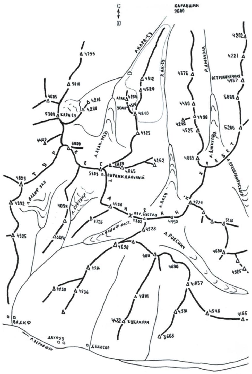
The Karavshin gorge is located in the Turkestan Range (Pamir-Alay system) in the Batken district of Osh region, Kyrgyzstan. At its head, it divides into the Ak-Su and Kara-Su gorges.
The Ak-Su gorge contains the peaks:
- Ortotyubek
- Slesov
- Ptitsa
- 4774
- Peak Odessa (4810 m)
The Kara-Su gorge contains the peaks:
- Asan
- Usen
- Peak Odessa (4810 m)
- 1000th anniversary of the Baptism of Rus
- Peak Piramidalny
- Peak Zholtyaya stena.