2021 World Mountain Championship, High-Altitude Technical Climbing Class
Report of the National Team of the Republic of Kazakhstan
Peak Odessa (4810 m) via the right edge of the northwest wall, Ovcharenko route (1988), 6A category.
Ascent Passport
-
Region, gorge: Pamir-Alai, Turkestan Range. Karavshin gorge. Section number according to the classification table of climbing routes № 5.4.3 (according to the FAR classifier).
-
Name of the peak, route name: Peak Odessa (4810 m) via the right edge of the northwest wall (Ovcharenko route, № 5.4.3.24d according to the FAR classifier).
-
Category: 6A
-
Route type: rock
-
Height difference of the route: 1000 m (wall section 900 m)
Route length: 1200 m
Length of sections with V category: 555 m
Length of sections with VI category: 130 m
Average steepness of the wall section: 65° -
Equipment used on the route:
- anchor hooks — 40 pieces
- camalots — 40 pieces
- chocks — 20 pieces
- hooks left on the route — none
-
Team's total climbing hours: 20 h, 2 days
-
Team leader: Ten Maxim Valentinovich — Master of Sports
Team members: Shesterin Roman Valerievich — Candidate Master of Sports, Abduraimov Zakirjan Zaripjanovich — 1st sports category, Ovchinnikov Nikolai Andreevich — 1st sports category. -
Coach: Skopin Artem Alekseevich, Master of Sports
-
Departure to the route: July 28, 2021, at 16:00
Summit ascent: July 29, 2021, at 20:00
Return to base camp: July 30, 2021, at 16:00 -
Organization: FAiSS RK.
General photo of the summit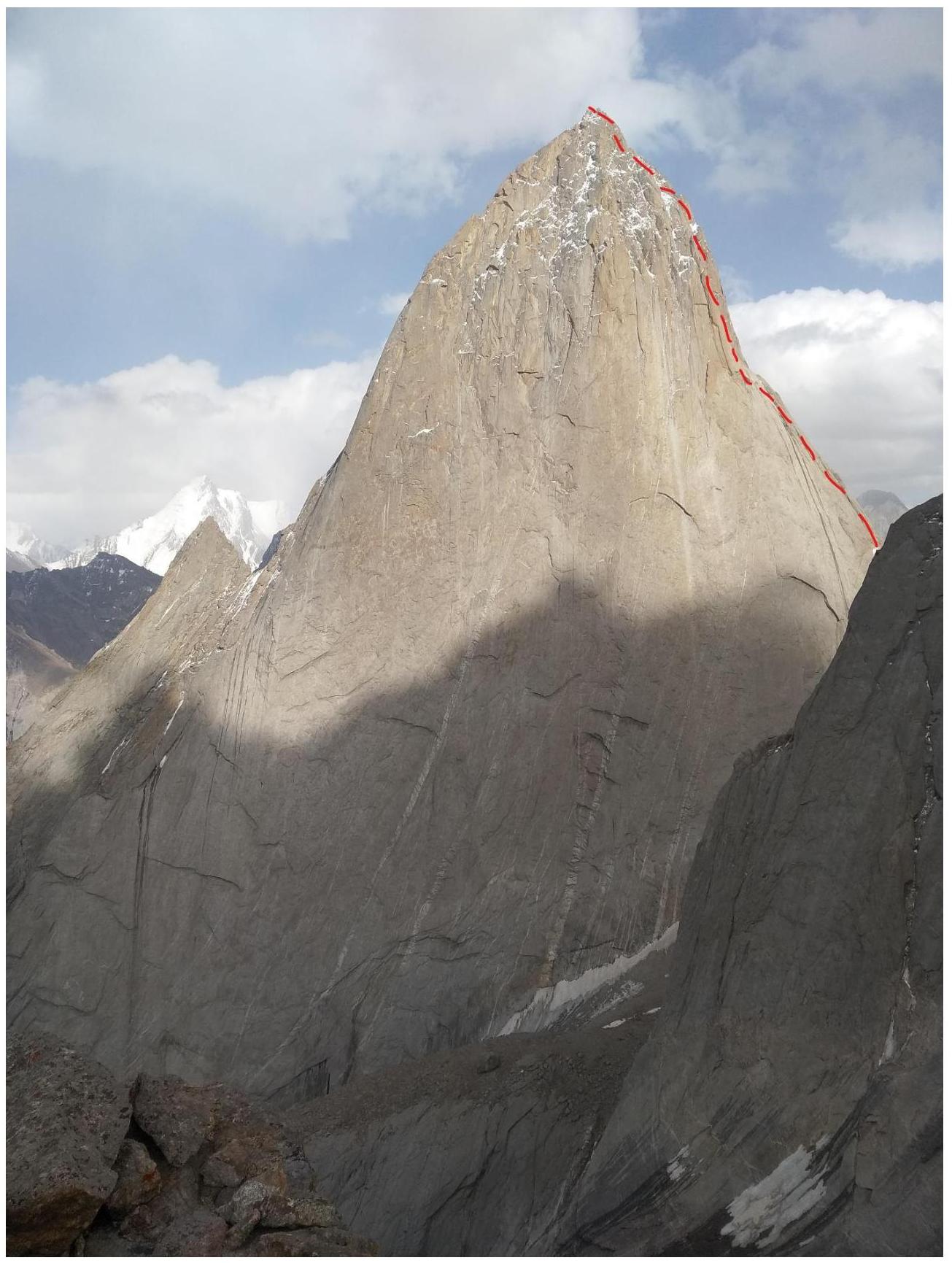
Photo from point Asan

-
4810 via the North wall, 5B (Sitnik M.)
-
4810 via the center of the bastion on the left part of the Northwest wall, 6B (Saharova K.)
-
4810 via the center of the Northwest wall, 6A (Igolkin V.)
-
4810 via the center of the Northwest wall, 6B (Kritsuk A.)
-
4810 via the "mirror" of the West wall, 6A (Ruseev A.)
-
4810 via the center of the Northwest wall, 6B (Voronov, 88)
-
4810 via the right edge of the Northwest wall, 6A (Ovcharenko S.)
Characteristics of the Climbing Region and Object
Pamir-Alai is a mountain system situated between Pamir and Tian Shan. It includes several ranges stretching latitudinally, bordering the Fergana valley to the south. The main range is the Alai Range, which then branches into the Turkestan, Zeravshan, and Gissar Ranges.
The Karavshin region is geographically located in the Turkestan Range, west of the Matcha mountain node. Politically and administratively, it is in the Batken district, Osh region of Kyrgyzstan. The region can be accessed either by helicopter or on foot. The watershed of the Ak-Suu and Kara-Suu rivers, which includes peaks 4810, 1000-letie Kreshcheniya Rusi, Kotina, Asan, Usen, etc., is located in the northern spur of the Turkestan Range. The Kara-Suu gorge is bounded to the south by Peak Piramidalnyi (5503 m) with a large glaciation, feeding the Kara-Suu glacier and determining the microclimate in the gorge.
On the left orographic side of the Kara-Suu glacier are snow peaks with heights up to 5300 m; on the right is a whole system of peaks with heights from 4200 to 4900 m, among which peaks Asan and 4810 stand out with their powerful monolithic sheer walls. All peaks on this side have a slight snow cover and are mainly composed of granitoids.
The region began to be explored by climbers in 1980, when three 6B category routes were first ascended on the northwest wall of Peak Asan during the USSR Championship. The same year, a 5B category route was ascended on the west ridge of Peak 4810.
In 1987, teams from Leningrad and Odessa attempted to tackle the northwest wall of Peak 4810 but were forced to retreat due to harsh weather conditions. In subsequent years, the problem of both the northwest and east walls of Peak 4810 was solved. The most logical and expressive routes on the northwest wall are currently considered to be those of Moshnikov and Ruseev.
The most popular peaks have been and remain:
- Asan
- Slesova
- 4810
They stand out both for the number of routes laid along their walls and for the number of ascents made on them.
Each of these peaks at its time determined the fashion of its class of ascents. Asan was the calling card of the region in 1986–1988. Currently, 9 routes have been laid to the summit, of which:
- 8 pass through the sheer northwest wall, with a height difference of more than 900 m.
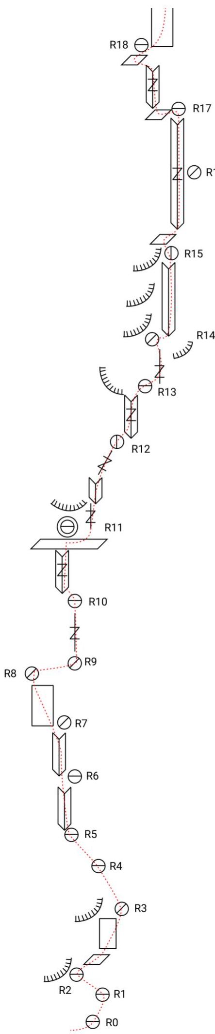
Route diagram in UIAA symbols 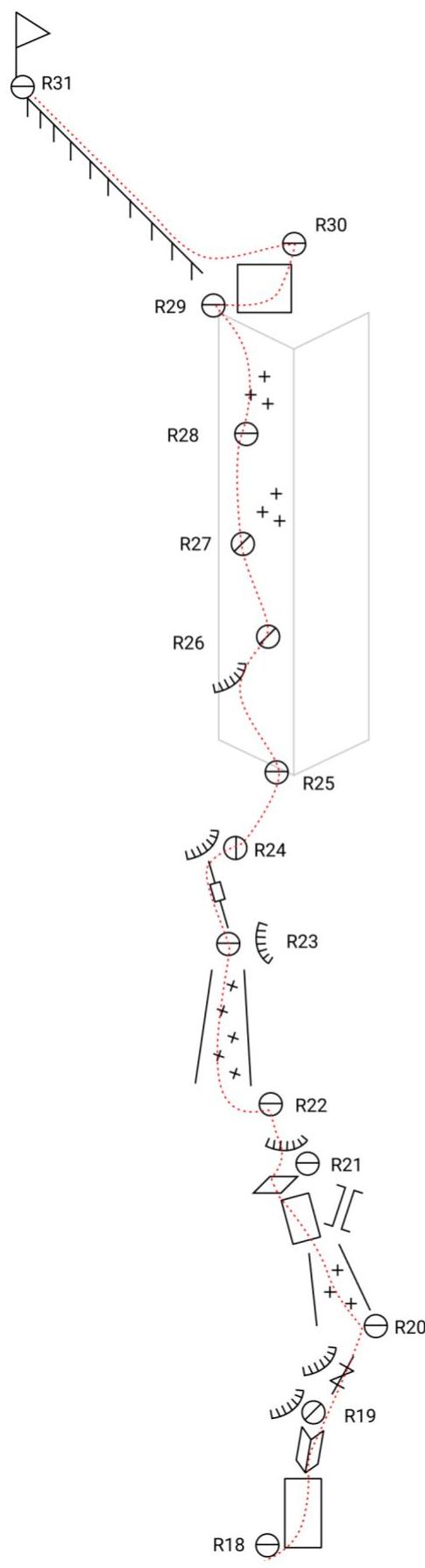
R31 Summit
R30 IV 30° 120 m
R29 IV 60° 55 m
R28 IV+ 70° 90 m
R27 V+ 80° 30 m
R26 IV A1 60° 40 m
R25 V A1 60° 15 m
R24 III 60° 15 m
R23 V A1 60° 15 m
R22 V- 70° 40 m
R21 V 70° 40 m
R20 VI 80° 25 m
III 45° 15 m
R19 IV 60° 15 m
VI 80° 30 m
R18 V 75° 10 m
IV 60° 30 m
R17 IV 70° 30 m
R16 V+ 75° 40 m
R15 V 70° 40 m
R14 VI 75° 40 m
R13 V+ 75° 40 m
R12 V+ 70° 30 m
R11 V+ 70° 30 m
V 70° 20 m
R10 V 70° 40 m
R9 V 70° 40 m
R8 IV 60° 20 m
R7 V+ 70° 40 m
R6 V 70° 40 m
R5 V 60° 40 m
R4 III–IV 40° 50 m
R3 II–III 30° 100 m
R2 VI 30° 15 m
V 70° 15 m
II 20° 15 m
R1 VI 80° 20 m
R0 IV 70° 15 m
III 60° 15 m
Technical Description of the Route
The approach from the base camp to the northwest wall of 4810 takes from 2 to 5 hours, depending on the amount of gear and the group's acclimatization.
- R0–R1: Simple sloping scree shelves, approach to the wall.
- R1–R2: Wall, inner corner leading to a shelf.
- R2–R3: Wall with cracks for camalots and chocks.
- R3–R5: Large sloping shoulder of the mountain — shelves mixed with gentle slabs, with potential bivouac sites.
- R5–R7: Inner corners, free climbing, protection with camalots.
- R7–R8: Wall, cracks ranging from wide (for camalots) to narrow.
- R8–R10: Traverse right along a narrow ledge, wall with a crack for camalots.
- R10–R11: Traverse left into an inner corner, protection with camalots. The corner leads to shelves. Three shelves at different heights, the middle one is most suitable for bivouac. There's a snow patch, water streams down the rock to the right, where clean water can be collected. Occasionally, the shelves are exposed to rockfall.
Bivouac
R5–R11. Series of long inner corners (V–VI category). Sometimes there are shelves. Free climbing, occasional use of artificial technical aids (ITD). Protection with camalots and anchors. Ice in the cracks, water seeping through. Exit to a large shelf.
R15–R17 Long inner corner. Exposed to rockfall from above! Free climbing, protection mainly with camalots. Ice in the cracks.
R17–R18 Inner corner, exit left to a shelf under a complex section of the wall.
R18–R19 Complex wall, transitioning into an inner corner. Belay station under a cornice.
R19–R20 Right, bypassing cornices, to a snow patch. Very wet, potential rockfall.
R20–R22 Left of a chimney, via a simple wall to a shelf. Then, bypassing a cornice, to the start of a small couloir with ice.
R22–R23 Left, across the couloir, under a wall with a crack.
R23–R24: Small wall section with a crack (simple ITD), belay station under a cornice.
R24–R25: Traverse right across simple rock to the start of a huge inner corner.
R25–R29: Up the inner corner-couloir, protection with camalots or via outcrops, ice in the cracks, "live" rocks underfoot.
R29–R30: Exit to a simple ridge, left to the summit, about 100 m.
Team's Tactical Actions
The team's main tactical focus during the ascent was on working efficiently. Due to this, food supplies were minimal, and equipment was chosen optimally. The first climber worked without a backpack, the second with a light backpack, and the third and fourth carried all bivouac gear. There was one 2-person tent and 3 sleeping bags. Water was not carried; it was collected at bivouac sites.
July 28. Departed from Karasu alpine camp at 10:00. Arrived at the campsite after the bergschrund (between peaks Usen and 4810) at 14:00. Began working on the route at 16:00. Reached a shelf (R5) by 17:00; due to lack of water and remaining daylight, it was decided to continue to the shelf at R11. By 19:00, half the team set up a bivouac at R11, while the other half worked on two ropes above the shelf.
Weather: sunny.
July 29. Started moving up the route at 7:00. Reached under a complex inner corner (R17) by 13:00; as it was partially iced and had streams running down, the team decided to divert to a complex monolithic wall to the left, with narrow cracks, protection with anchors, partially ITD. Reached the "roof" by 19:00, and the entire team was on the summit by 20:00.
Bivouac
Weather: cloudy until 13:00, then occasional rain, cold wind. As the wall was constantly wet and the upper part of the route was in shadow, it was very cold.
July 30. Snow began falling on the summit at night. Started descending at 7:00. Descent followed the ascent route in snowy conditions. Reached the start of the route by 13:00.
The route was ascended without any falls or prior processing. Key sections were climbed using free climbing and ITD.
- The first climber worked on a double rope.
- The second, third, and fourth climbers ascended on fixed ropes with backup protection on a second rope.
Photos
View of the bergschrund on the approach. Passable on the right side, very rockfall-prone. 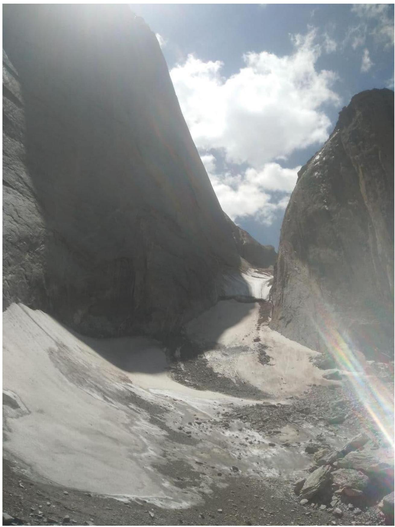
First rope from the diagonal shelves (R2). 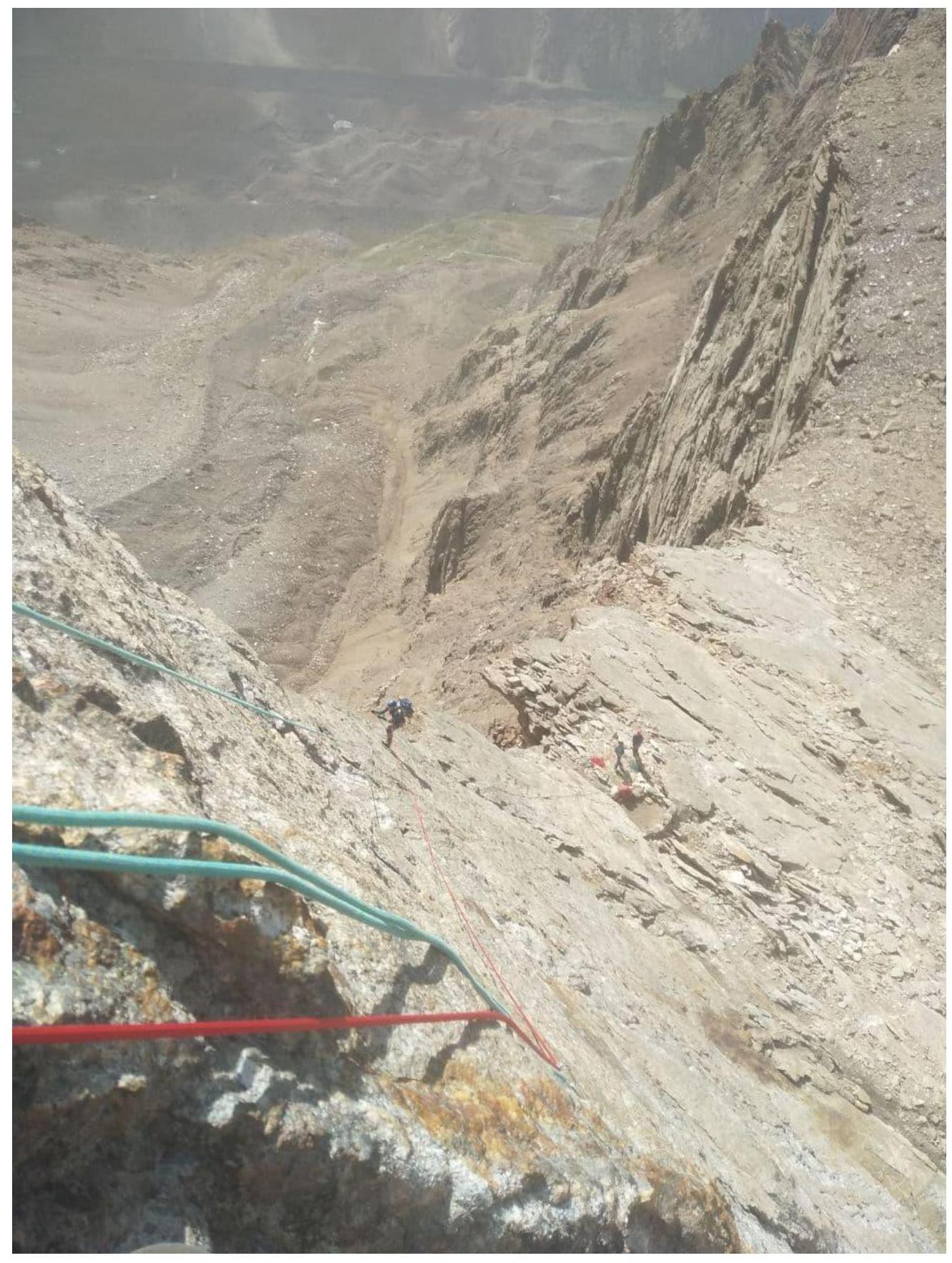
First rope from the "shoulder" (R5). 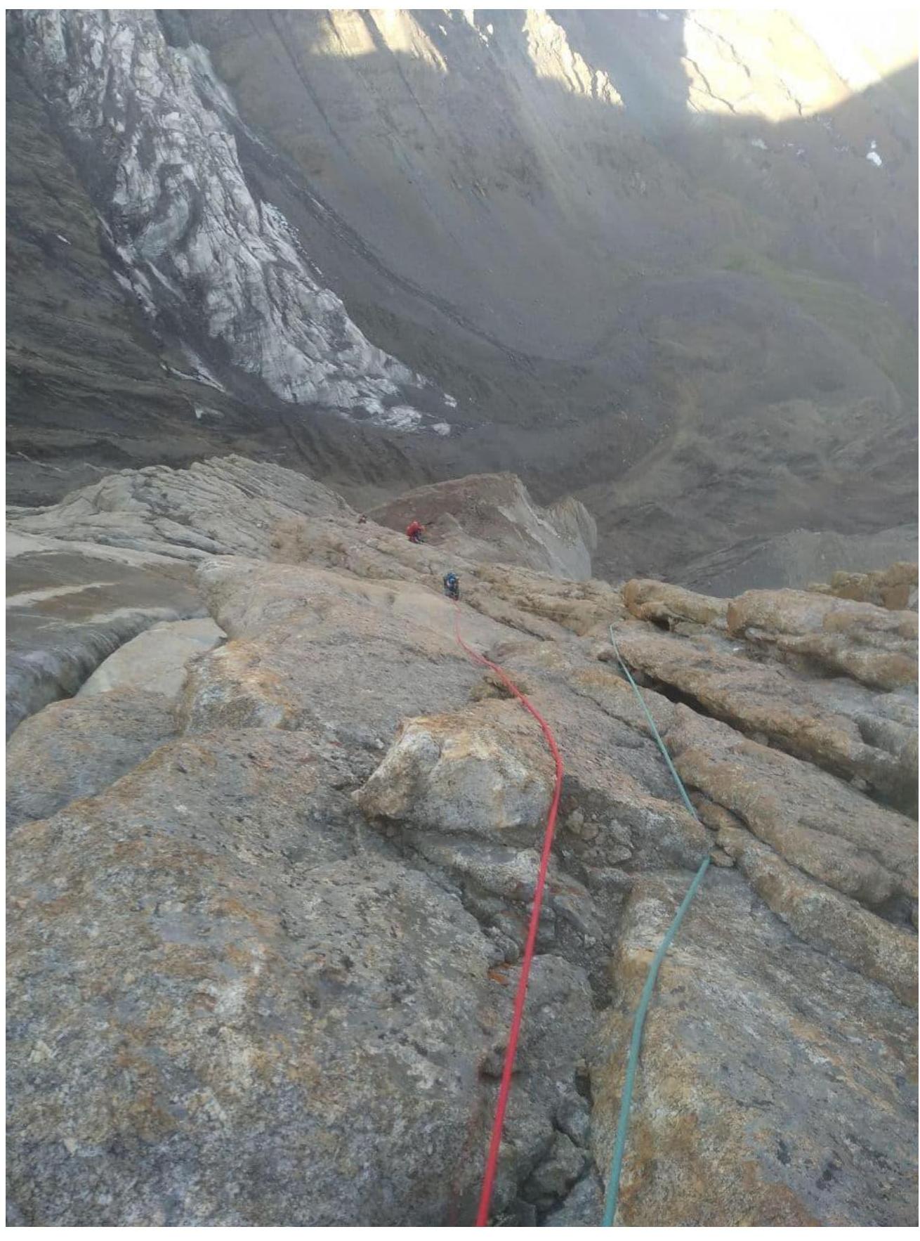
Bivouac (R11). 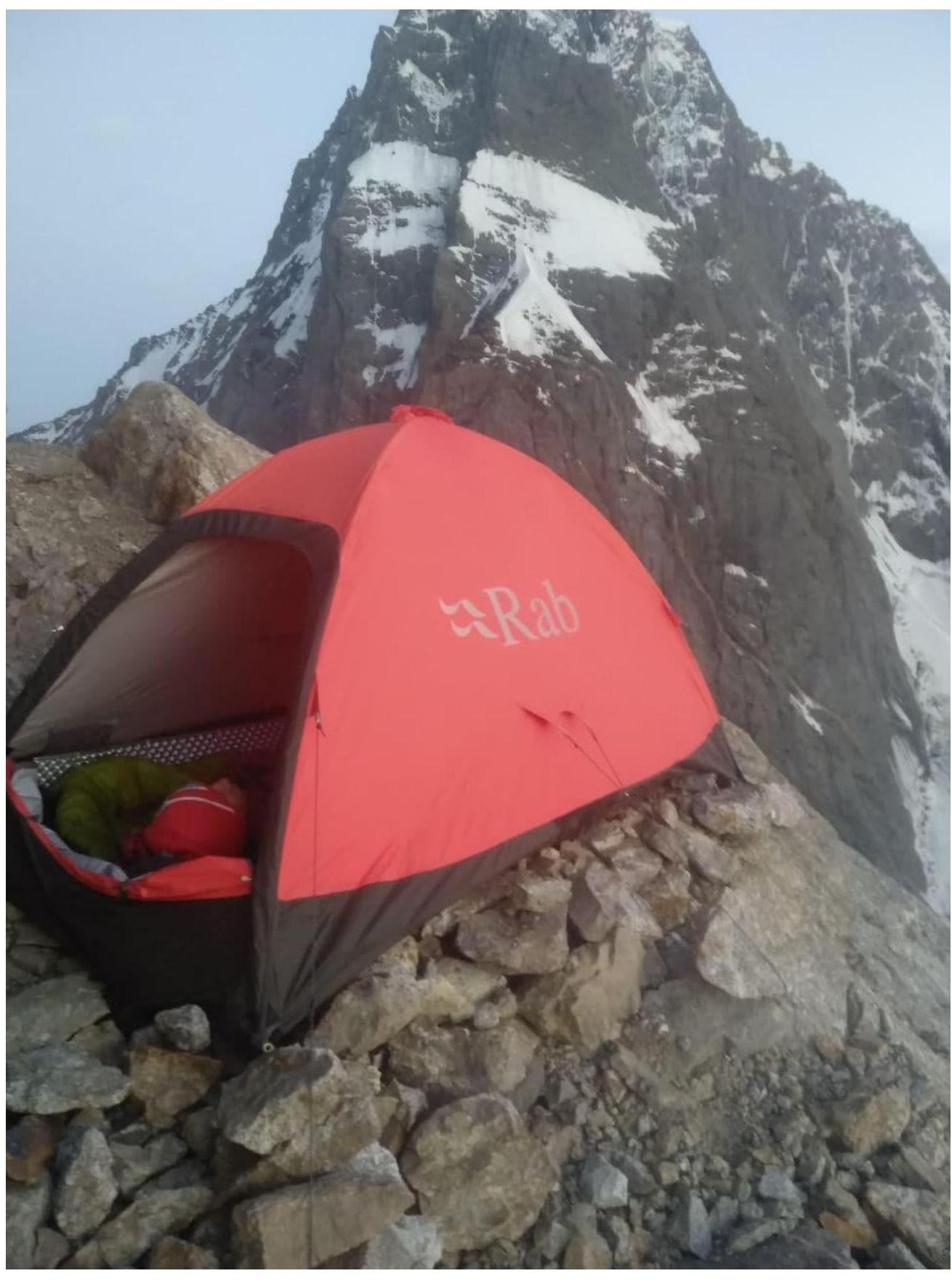
Bivouac (R11). 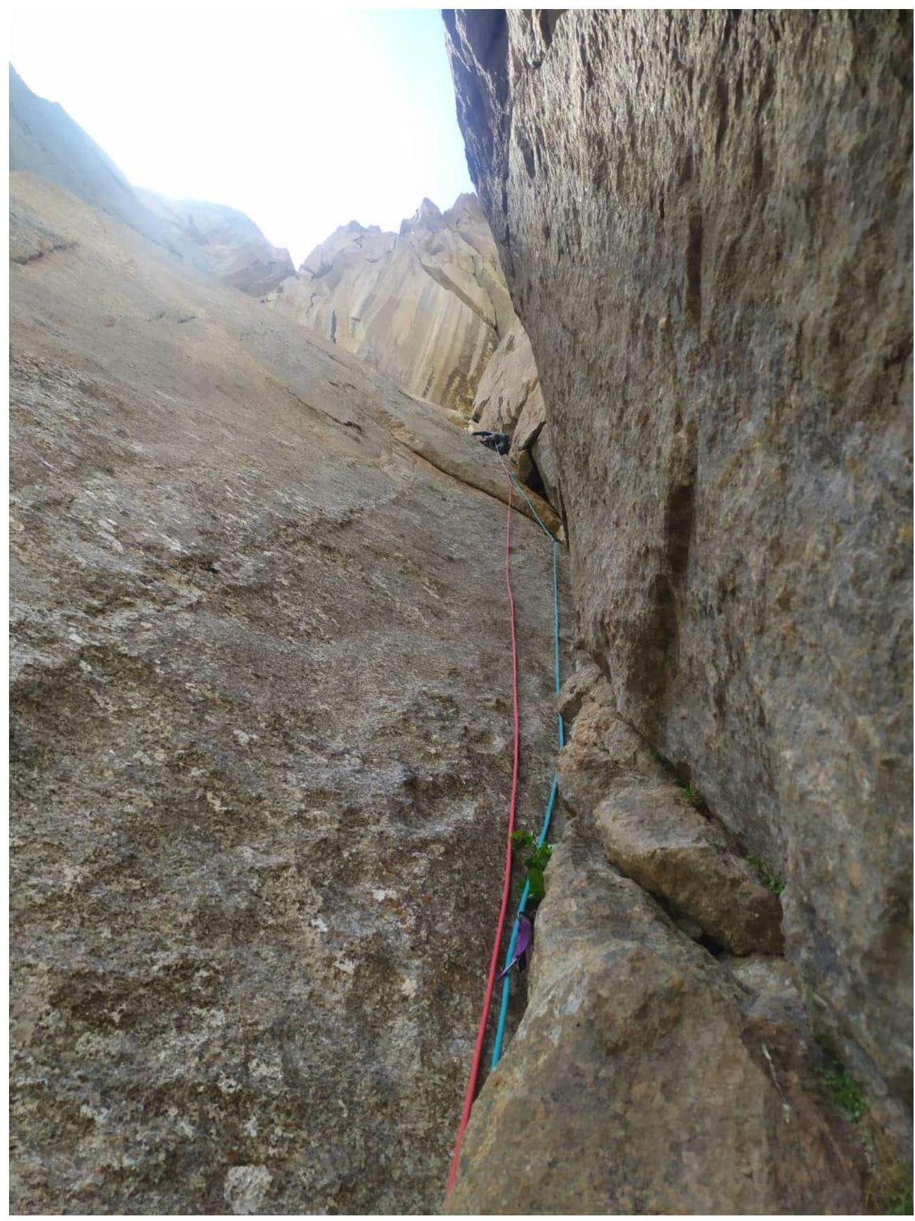
R14. 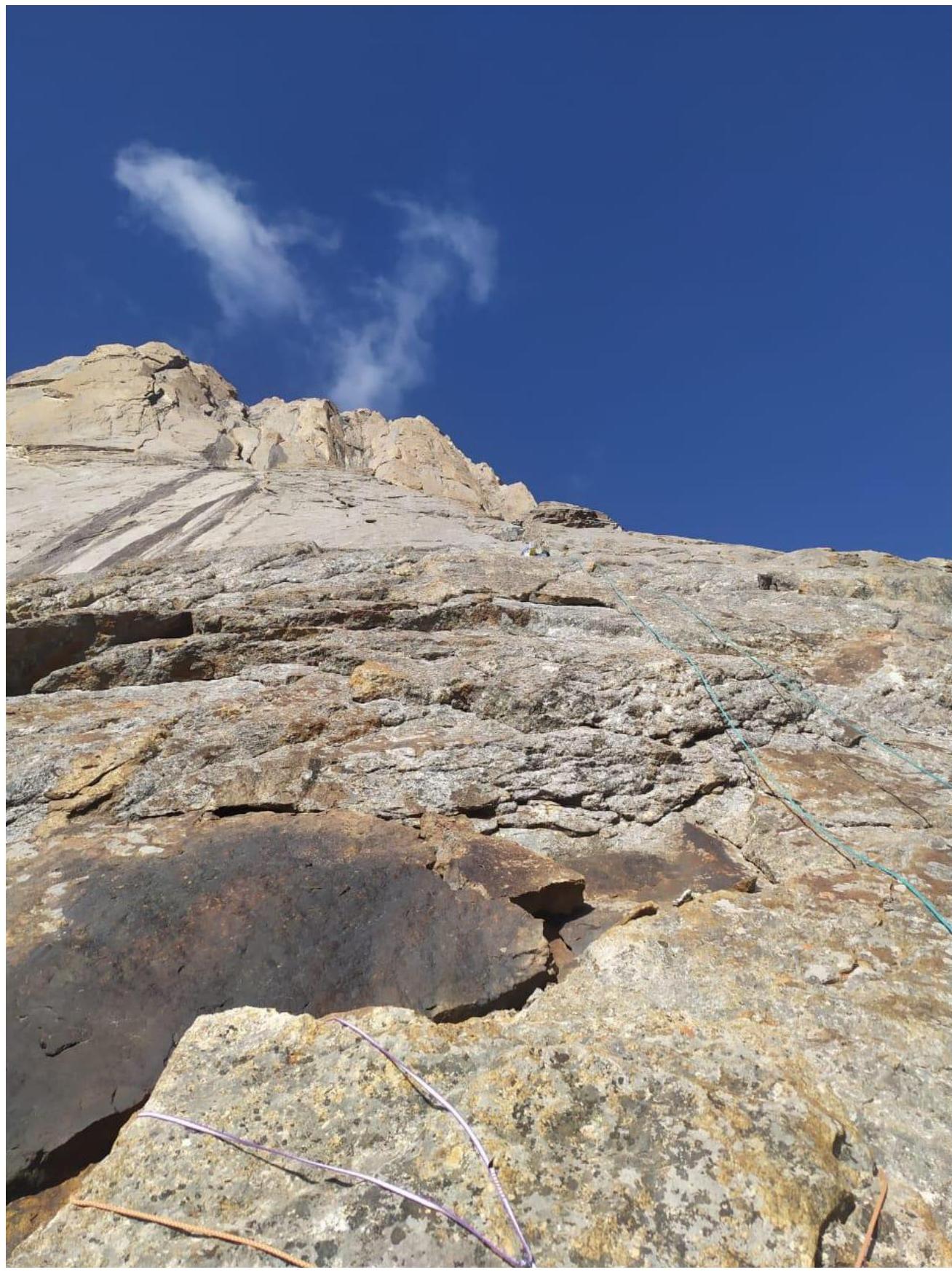
R16. 
View from the shelf in the inner corner under the summit (R20). 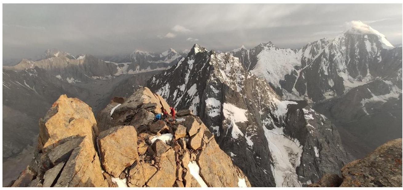
Team on the summit ridge. 
Team on the summit. 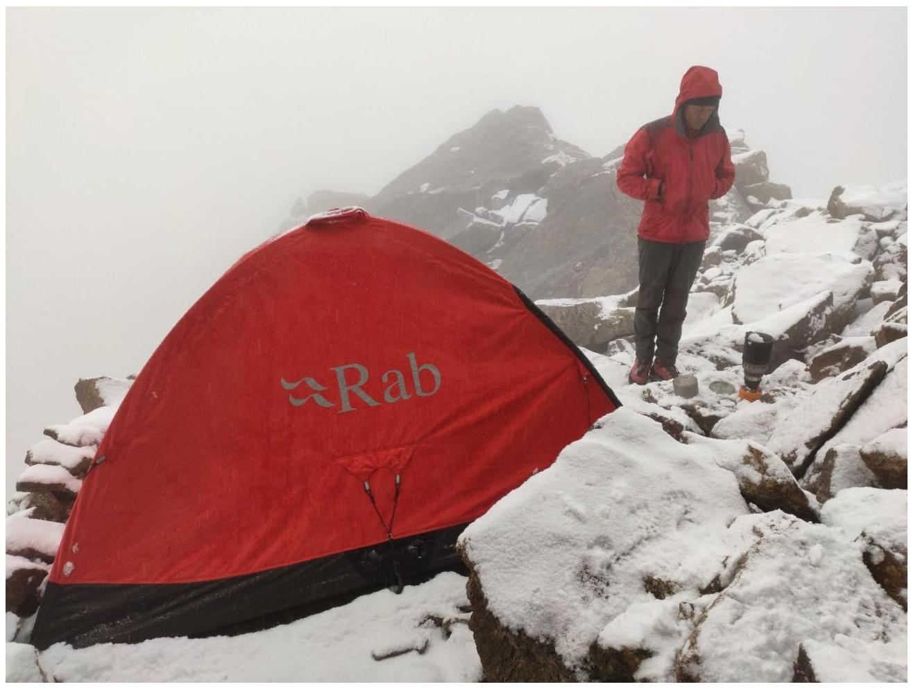
On the summit before descent.