Ascent Passport
- Ascent category — technical.
- Ascent area — Pamir-Alay, Turkestan Range, Kara-Su gorge.
- Peak 4810 from the northwest.
- Category 5B difficulty, second ascent.
- Height difference — 1270 m, route length — 1870 m. Length of sections with 5–6 category difficulty — 370 m. Average steepness of the route — 46°. Average steepness of the main part of the route — 58° (4040–4490), including 6 category difficulty — 80° (4310–4390).
- Pitons driven: rock — 29+5x/5, ice — 10/0, bolt — 4x/8, chocks — 81/8.
- Climbing hours — 28, days — 3.
- Overnights — on lying platforms.
- Leader — Vedernikov Vladislav Valentinovich, Master of Sports. Participant — Potankin Igor Vadimovich, Candidate for Master of Sports.
- Coach — Solonnikov Viktor Aleksandrovich, Master of Sports of International Class.
- Departure to the route — June 30, 1987, summit — July 2, 1987, return — July 3, 1987.
- Organization — LOS DFFC, Leningrad.
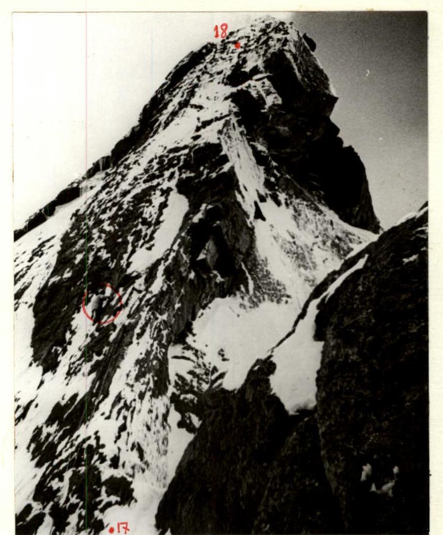
 Peak 4810 from the northwest. Δ — overnights and their elevations. — Path of the "Avangard" team (Odessa) 1986, repeated by the LOS DFFC group.
Photo August 8, 1987, "Minitar-I" lens, focal length 32 mm, distance to object ≈ 1.5 km. Route diagram in M 1:2000 symbols (1 mm = 2 m) in height.
1000 m covered in a day, climbing hours — 10.
| Rock Pitons | Chockstones | Bolt Pitons | Ice Pitons | Section Length, m | Section Steepness, degrees | Difficulty Category | Section Numbers |
|---|---|---|---|---|---|---|---|
| 3 | 8 | – | – | 120 | 40 | 4 | 11 |
| 1 | – | – | 1 | 15 | 45 | 4 | 10 |
| – | 3 | – | 1 | 25 | 50 | 1 | 9 |
| 2/1 | 7 | – | 2 | 30 | 65 | 1 | 8 |
| 3 | – | – | 1 | 40 | 50 | 4 | 7 |
| 3 | 4/2 | – | – | 20 | 80 | 1 | 6 |
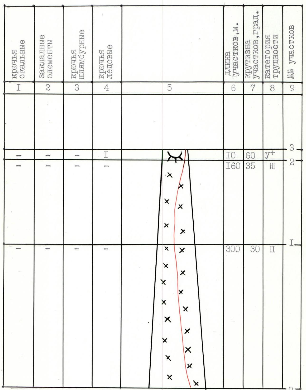
| – | – | – | – | 40 | 30 | 3 | 5 |
| – | 5 | – | 4 | 360 | 45 | 1 | 4 |
390 m covered in a day, 80 m processed, climbing hours — 10.
| Rock Pitons | Chockstones | Bolt Pitons | Ice Pitons | Section Length, m | Section Steepness, degrees | Difficulty Category | Section Numbers |
|---|---|---|---|---|---|---|---|
| 3/2 | 10/6 | – | 1 | 80 | 60 | 3 | 18 |
| 2 | 6 | – | – | 120 | 40 | 4 | 17 |
| 2/2 | 4 | – | – | 40 | 50 | 1 | 16 |
 | |||||||
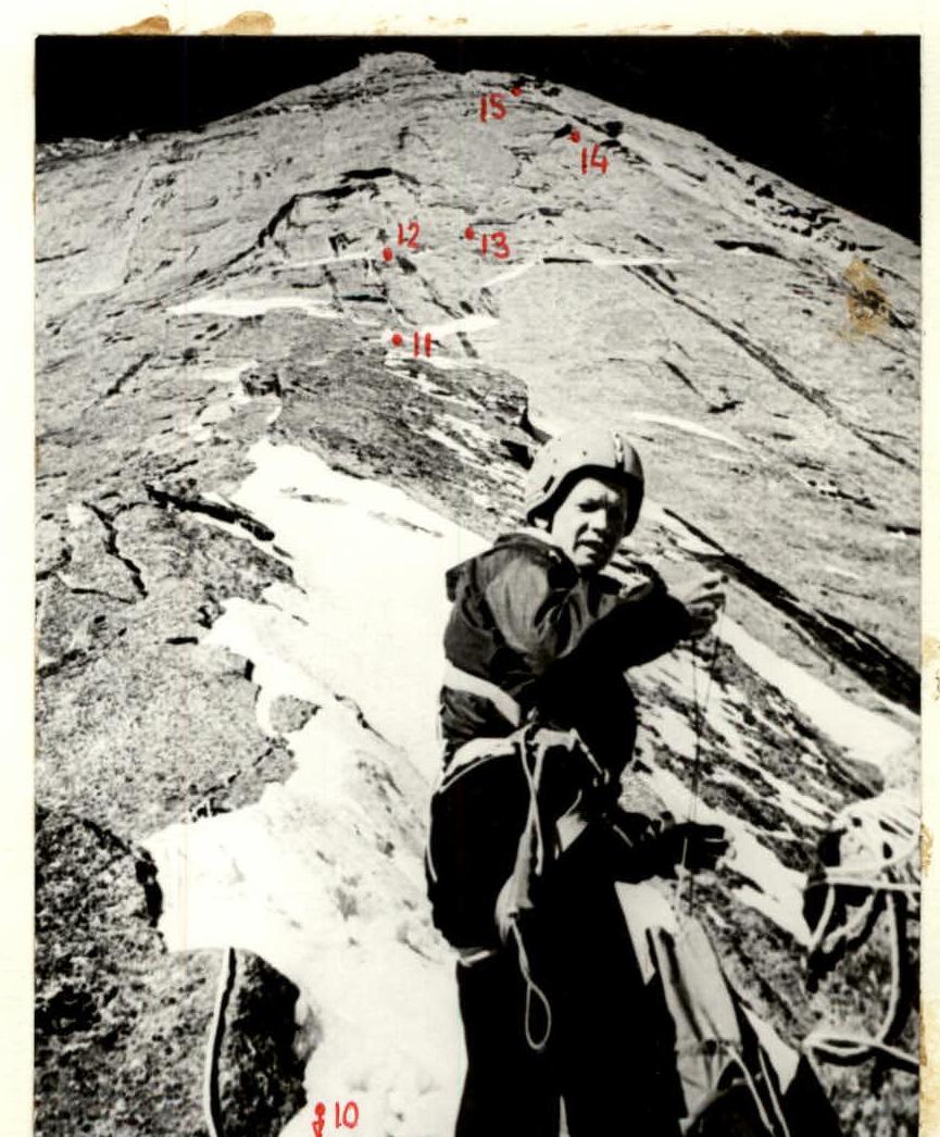
| 1+3x | 6 | – | – | 80 | 60 | 15 | |
 | |||||||
| 1 | 4 | 4x | – | 80 | 80 | 1 | 14 |
 | |||||||
| 1+2x | 2 | – | – | 40 | 65 | 4 | 13 |
 | |||||||
| 2 | 4 | – | – | 30 | 60 | 12 | |
 |
Total distance covered on the route — 1870 m, climbing hours — 28. 480 m covered in a day, including 80 m processed the day before. Climbing hours — 8.
| Rock Pitons | Chockstones | Bolt Pitons | Ice Pitons | Section Length, m | Section Steepness, degrees | Difficulty Category | Section Numbers |
|---|---|---|---|---|---|---|---|
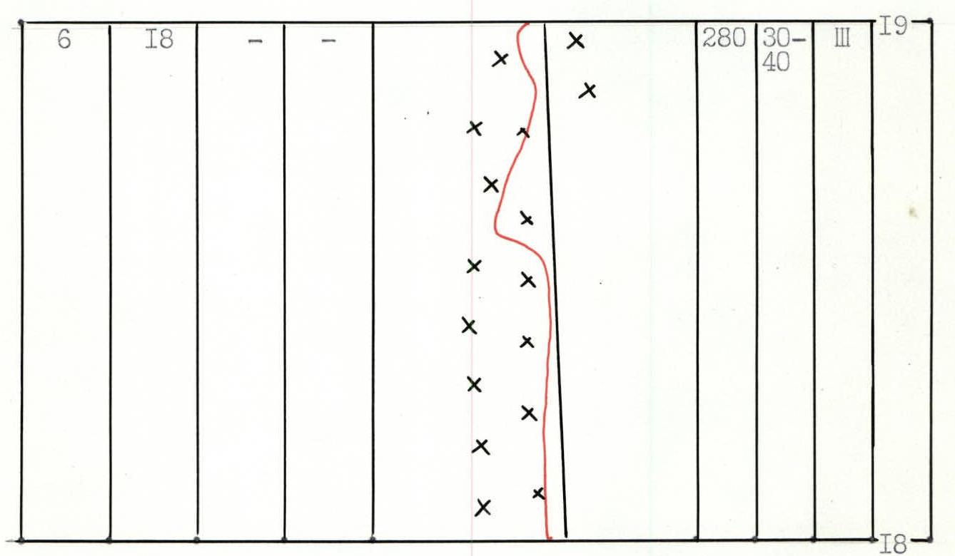
| 6 | 18 | – | – | 280 | 30– | 3 | 19 |