Report
Teams from Sverdlovsk Region
on the first ascent through the center of the western wall, to peak Kyrkchilta, 4507 m (Karavshin Valley)
July 23–28, 2015
Climbing Passport
- Category — high-altitude and technical.
- Pamir-Alay, Turkestan Range, Karavshin Valley, 5.4.3.23a
- Peak Kyrkchilta, 4507 m, through the center of the W wall.
- Proposed 6B category of difficulty, First Ascent.
- Route character — rock climbing.
- Route characteristics:
- Route height difference — 1250 m
- Route length — 1755 m
- Length of the wall section — 1350 m
- Length of sections with 5–6 category difficulty — 1130 m, including 6 category difficulty — 840 m.
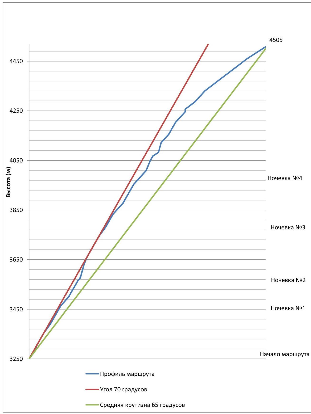
- Average steepness of the entire route — 65°, main part — 70°
- Pitons used:
- Anchor — including ITO — 73/40
- Friends — including ITO — 200/135
- Removable bolt hanger — including ITO — 17/10
- Skyhooks (hole/relief) — 9/4
- Total — including ITO — 290/198
- Pitons left on the route — 2 (on rappels)
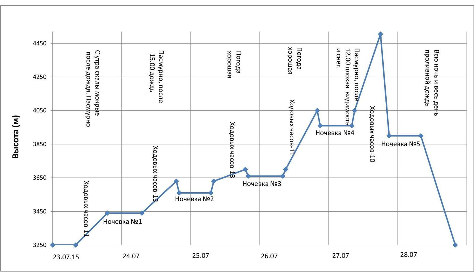
- Team's climbing hours — 58 hours to the summit; Descent 17 hours;
- Start of the route — July 23 at 7:00 Summit — July 27 at 17:00. Descent via the French ridge — July 28 at 20:30
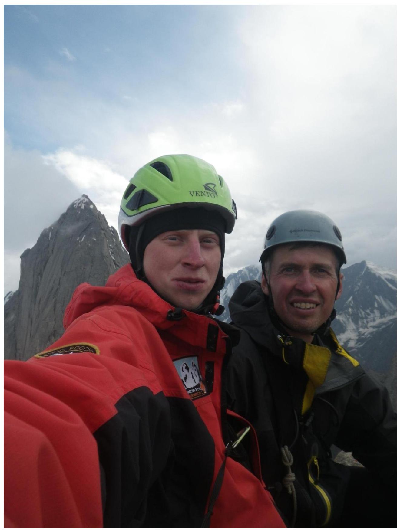
- Team members: David Mikhail Marenglenovich — ZMS, MSMK
Cheremnykh Artem Vladimirovich — CMS.
Coaches:
- David Mikhail Marenglenovich — ZMS
- Syshchikov Anatoly Gennadievich — MS
General photo of the route
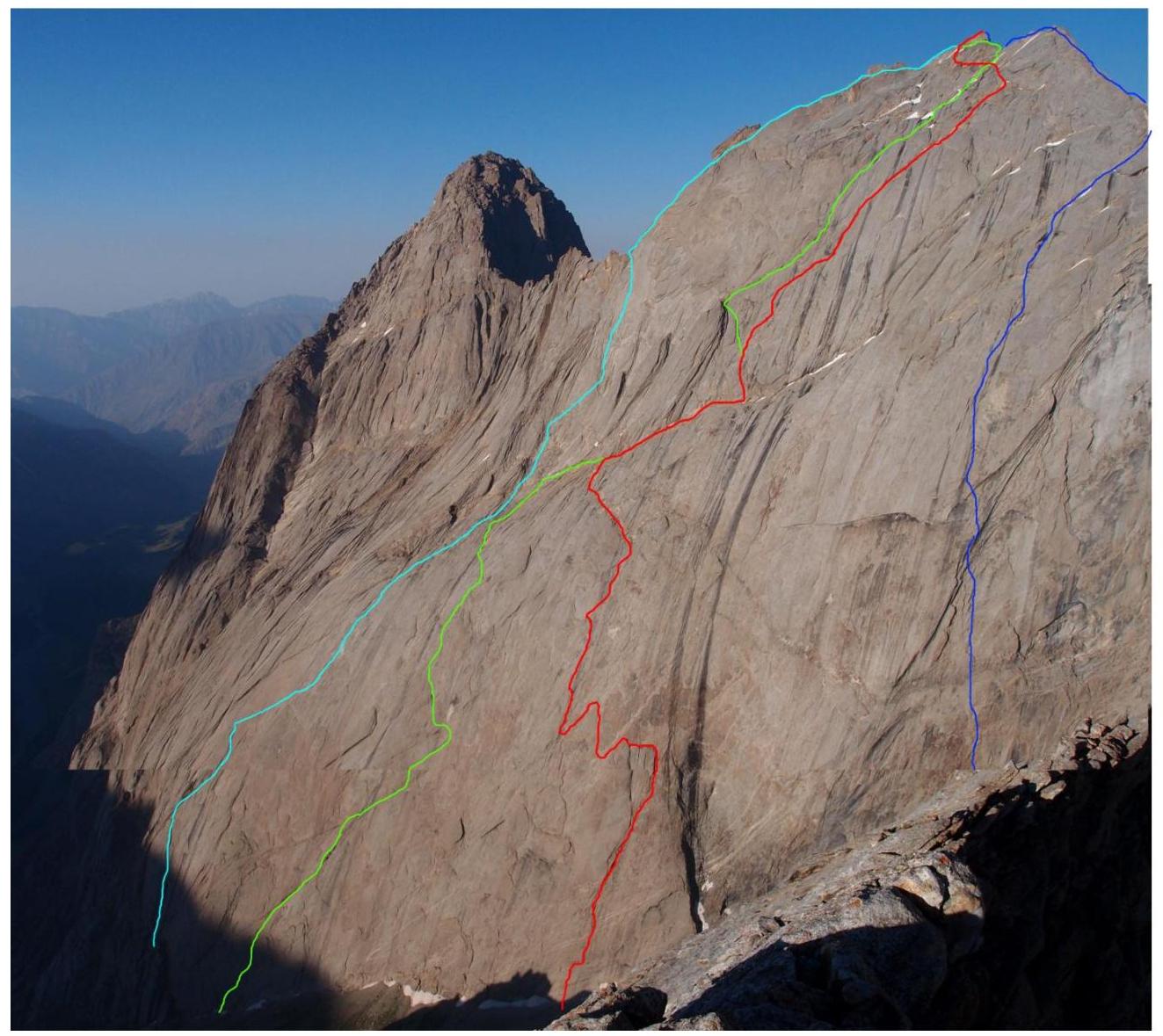
V. Skripko's route (1988) A. Klepikov's route (2015) Route climbed by the team V. Igolkin's route (1988)
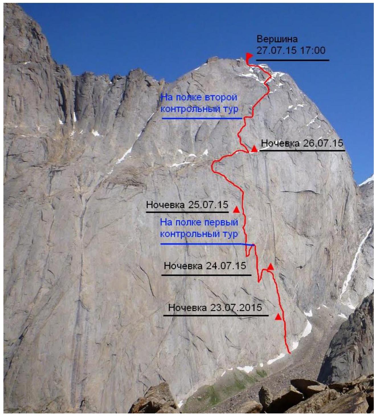
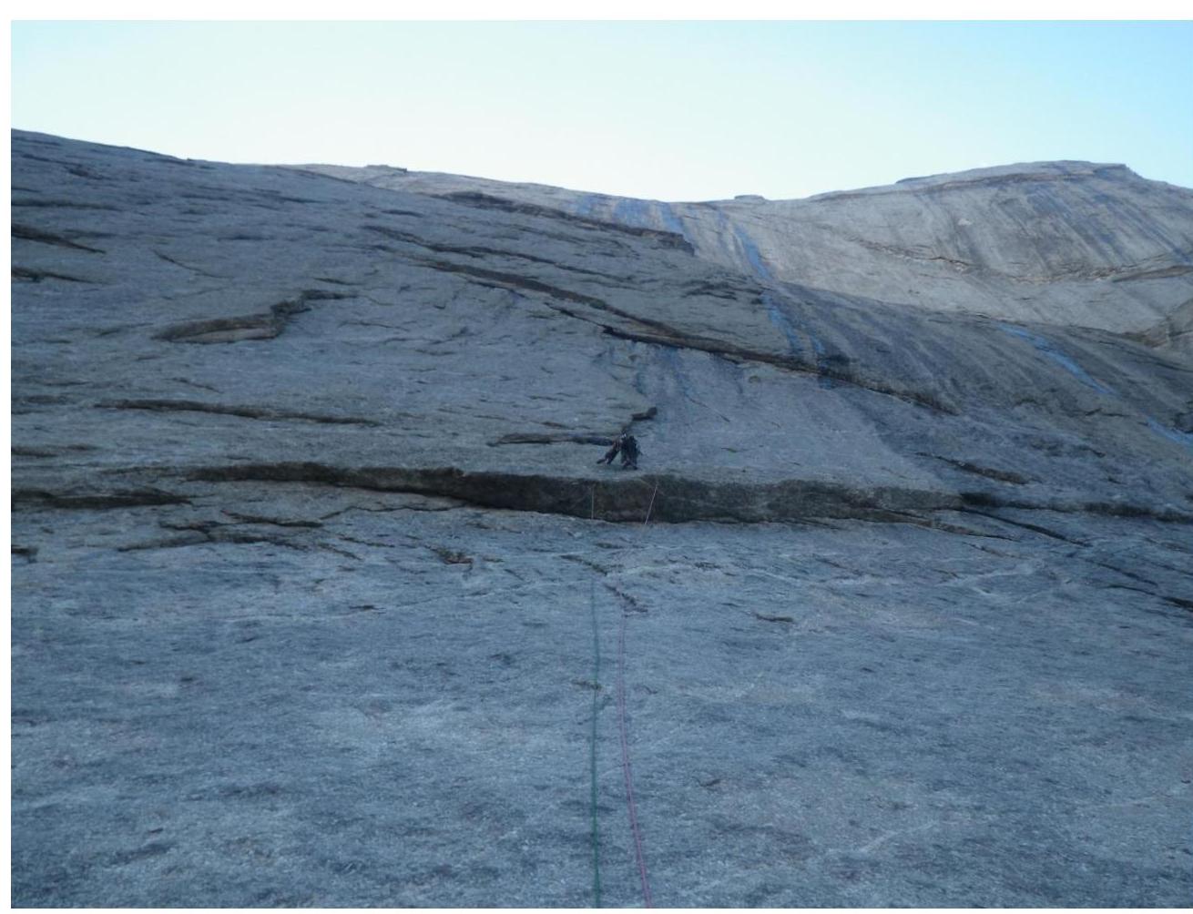
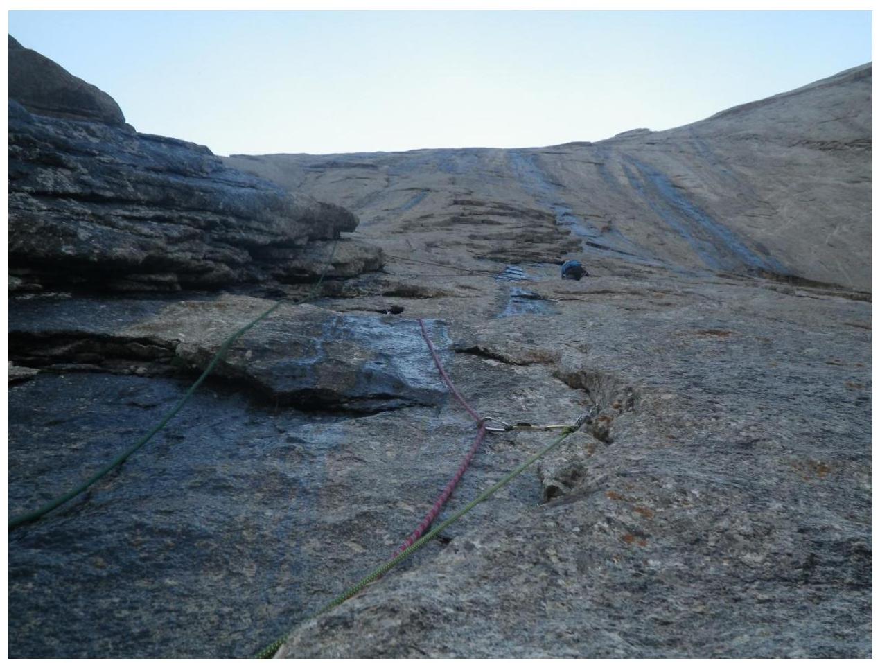
Technical photo of the route
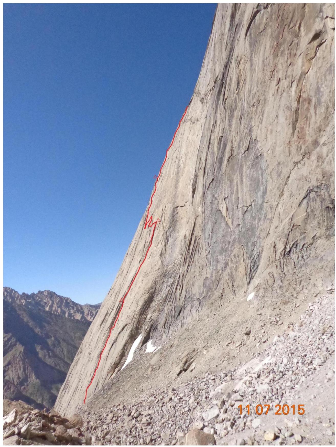
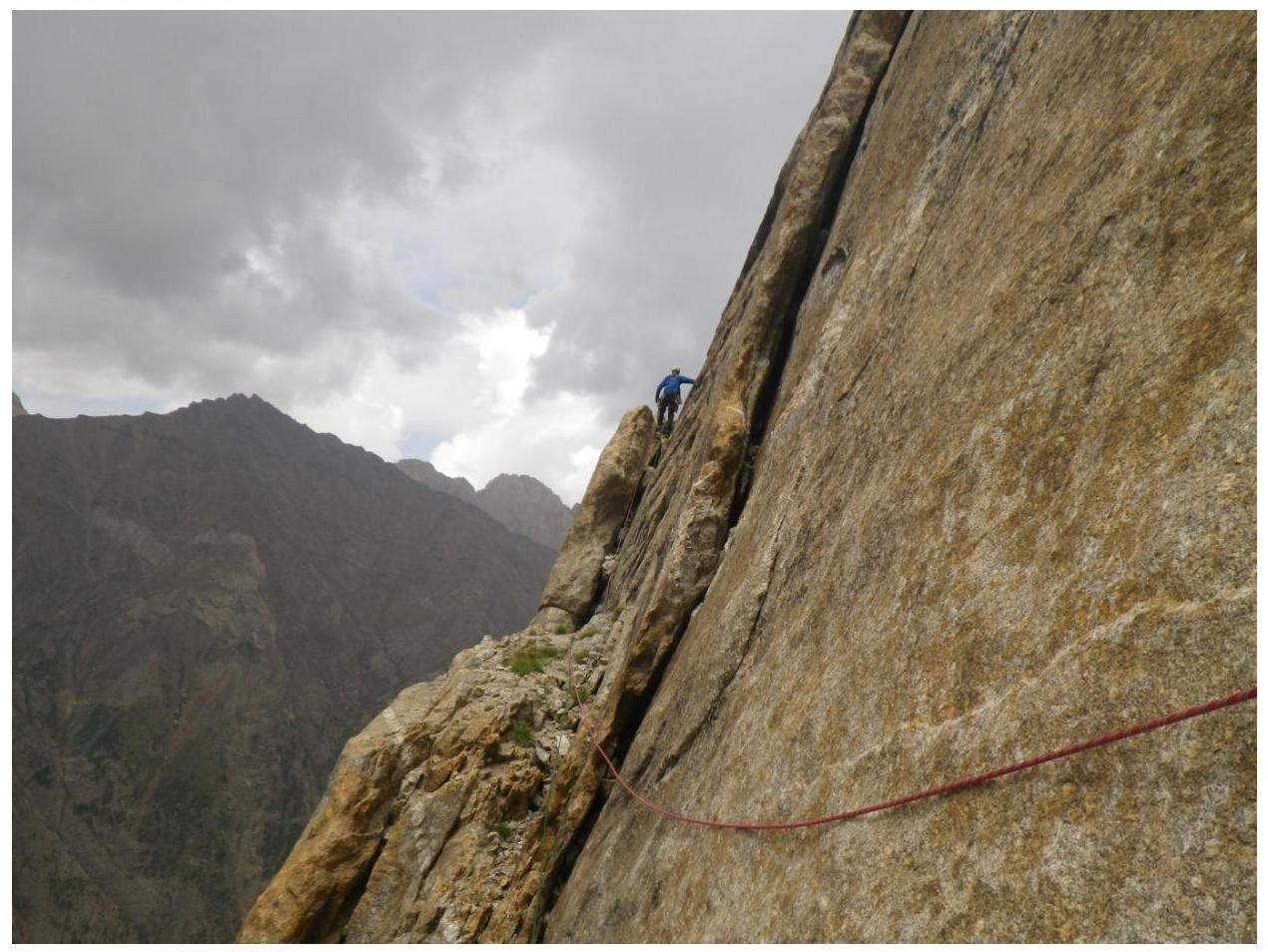
Start of the route (view from below)

Semi-profile of the route from the right

Semi-profile of the route from the right (first bastion)
Drawn profile of the route
Photopanorama and map-scheme of the area
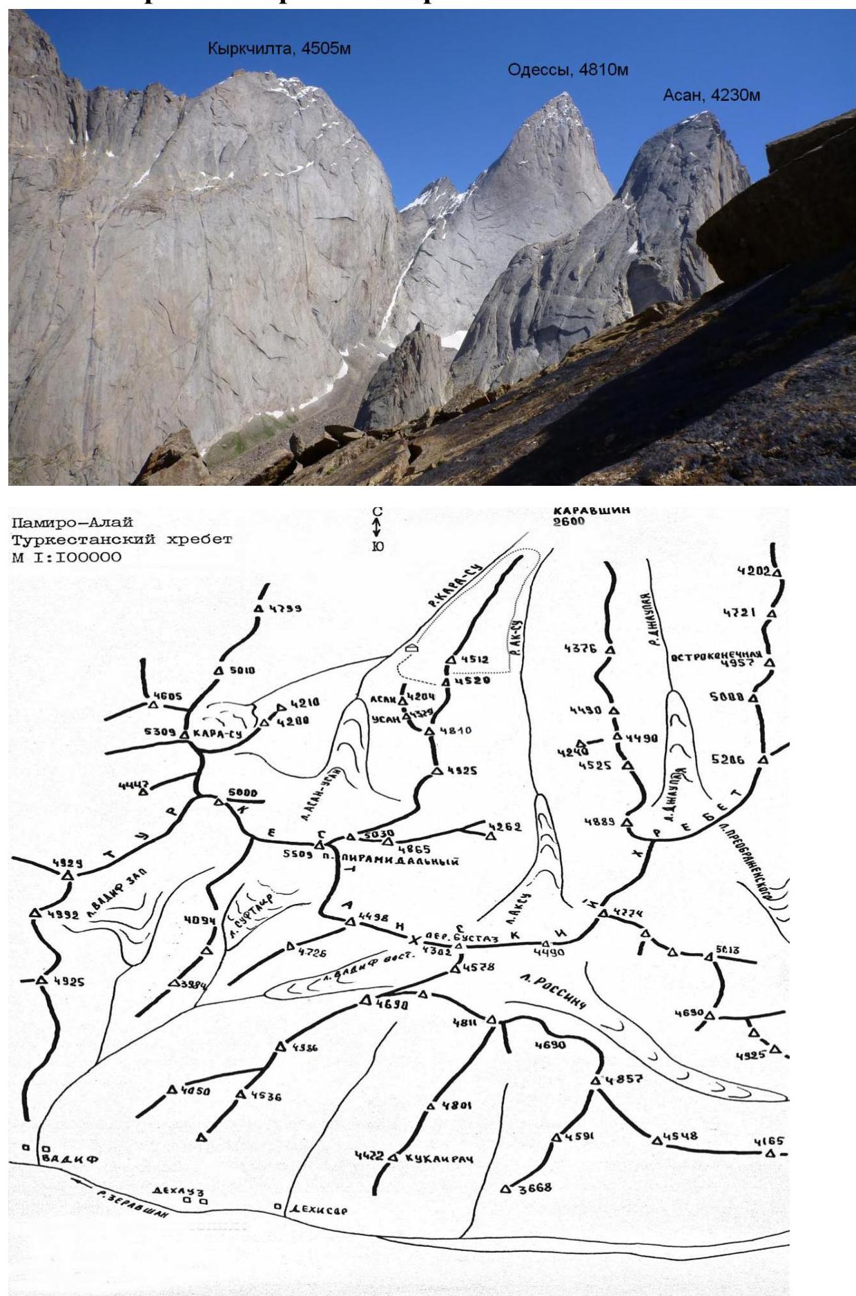
Here peak Kyrkchilta — p. 4520 m.
Team's Tactical Actions
For the first time, the Western (erroneously named Northwest in the classifier) wall of peak Kyrkchilta was ascended in 1998 by a team from Zelenograd, which climbed it via the left edge, made the first ascent to the summit, and proposed the name "1000th Anniversary of the Baptism of Rus". In the same year, Igolkin's team from Magnitogorsk climbed a route on the right part of this wall, exiting to the summit via the North ridge.
It is surprising that over the past 27 years, the vast center of the wall remained untouched. Probably, the main reason was the lack of obvious lines and the giant scale of the wall — its height difference is from 1100–1300 m.
And so, in 2015, a team from the Sverdlovsk region decided to establish a new route on this wall. Route reconnaissance was carried out during an acclimatization ascent to peak Usen via a 5A category route, from the summit of which all details of Kyrkchilta's western wall can be seen. We planned a route through the center of the wall, exiting to the summit.
When choosing the route, we were guided by the desire to climb the most challenging route that follows the natural relief, to climb it in the lightest style possible — in a team of two, with maximum use of free climbing and minimal use of bolt hangers and skyhooks.
Because of this, the route turned out to have prolonged traverses and even diagonal rappels when transitioning from one crack system to another, but this allowed us to climb the route without using a platform, numerous days of processing, hanging belays, and other features of the traditional "big wall" style, which has recently lost its popularity even in an area like Karavshin, and gave way to the alpine style of ascent.
During the preparatory season, the team mainly trained to achieve a high level of free climbing (Artem Cheremnykh's climbing level is up to 7b on the French scale) and engaged in rock-technical training (participants regularly went on training trips to the rocks during the winter and spring and participated in several rock climbing competitions). Attention was also paid to selecting high-quality equipment.
To traverse from crack to crack in the middle part of the route, the team used microfriends, relief, and hole skyhooks. For belay organization in the absence of relief — removable bolt hangers produced by "Ural-Alp".
Satisfactory rest, regardless of the terrain and weather conditions, was ensured by one sleeping bag, a bivvy sack, and a waterproof hammock (kindly lent to us by the Irkutsk team), which was stretched like a two-person tent during night stops on terraces and during descent, and hung next to the wall for one person on uncomfortable small ledges.
The accumulated experience of climbing in this area (this was the team leader's seventh season in Karavshin) and the availability of high-quality weather forecasts transmitted to the base via satellite phone from Yekaterinburg's satellite phone allowed us to choose a time for the ascent with stable weather; a slight snowfall began only when we reached the summit, and a radical deterioration in the weather occurred on the day of descent, which took place under heavy rain.
The team's movement was organized using a method already tested by the team on wall ascents. The first climber moved without a backpack on a double rope, one of which was UIAA-rated, and the second was an Ascan Highlander static rope with dynamic properties, which was then fixed as a belay for the second. The second climber moved along the belay with upper protection, carrying a small backpack, and used a pulley with a locker to pull up the haul bag, specially made for us by "Manaraga".
This method allows for quick and effortless movement along steep and even relatively gentle terrain with a haul bag weighing over 35 kg.
Conditions and regime: (Due to the lack of water in the lower part of the wall and a forecast of clear weather, the team took 22 liters of water with them, based on 5 liters per day). Nutrition regime — hot food in the morning and evening, individual snacks during the day.
Throughout the route, there was stable communication with the base and observers. A combined rescue team was constantly present in the base camp and on nearby peaks, with the right to enter the route with a 6B category difficulty. The team had a first-aid kit for providing first aid. The route was left clean, all trash was taken down to the base camp. All pitons were removed, except for two left on diagonal rappels, one of which had a control cairn (the second was left in a stone cairn on a ledge).
The combination of these tactical actions allowed the team to complete a highly complex ascent on a new route in a good style, quite quickly (first ascents of routes of this complexity in a team of two have never been done faster in Karavshin) and without accidents within the framework of the Russian Championship — 2015.
The climbed route undoubtedly exceeds the complexity of the other three routes on this wall, including the one climbed this year by the Irkutsk team (the lower bastion of our route is steeper than on Skripko's and Klepikov's routes and follows a less obvious relief; Igolkin's route is comparable in steepness but starts higher and exits to the ridge earlier). The route climbed by the team is also more complex than all 6A category routes in this area that we have climbed (this is more than 10 routes on peaks 4810, Asan, Slesova, and Kyrkchilta). We believe that the route should be classified as 6B category, with the condition of passing through both control cairns.
Movement and Weather Log
UIAA Scheme
| Anchor | Friends | Bolt Hangers | Skyhooks (relief / hole) | Section | Length | Steepness | Difficulty | Note |
|---|---|---|---|---|---|---|---|---|
| 2 | 4 | 2 | 0 / 1 | R1 | 30 m | 65 | VI, A2 | July 23, 2015 |
| 5 | 3 | 4 | 0 / 4 | R2 | 30 m | 75 | VI, A2e, A3 | |
| 10 | 3 | - | - | R3 | 50 m | 70 | VI, A1–A2 | |
| 8 | 2 | - | - | R4 | 40 m | 65 | V | |
| 11 | 5 | - | - | R5 | 50 m | 70 | VI, A2 | |
| 9 | 3 | - | - | R6 | 30 m | 70 | VI, A2 | July 24, 2015. Overnight: on a ledge, sitting, one in a hammock. |
| 8 | 5 | - | - | R7 | 40 m | 60 | VI, A2 | |
| 10 | - | - | - | R8 | 30 m | 70 | VI, A2 | |
| 8 | 3 | - | - | R9 | 30 m | 70 | VI, A2 | Overnight: on a ledge, lying down |
| 1 | - | - | - | R10 | 10 m | 70 | V | |
| 10 | 4 | - | 0 / 1 | R11 | 50 m | 80 | VI, A2 | On a ledge, first control cairn July 25, 2015 |
| 12 | 3 | - | - | R12 | 10 m | 75 | V | |
| 10 | 4 | 3 | 3 / 1 | R13 | 50 m | 80 | VI, A3e | |
| 7 | 5 | - | - | R14 | 30 m | 75 | VI, A2 | |
| 6 | 7 | 4 | 0 / 1 | R15 | 40 m | 70 | VI, A3e | Overnight: on a ledge, semi-reclined, one in a hammock. |
| 8 | 5 | 4 | 1 / 1 | R16 | 45 m | 70 | VI, A3e | July 26, 2015 |
| 8 | - | - | - | R17 | 45 m | 65 | VI | |
| - | - | - | - | R18 | 100 m | 30 | I–II | |
| 2 | - | - | - | R19 | 50 m | 60 | IV | |
| - | 3 | - | - | R20 | 200 m, 45 m | 20, 60 | II, IV | Overnight: on a terrace, lying down |
| 3 | - | - | - | R21 | 20 m | 60 | V | |
| 8 | 2 | - | - | R22 | 40 m | 75 | VI | July 26, 2015 |
| 7 | 3 | - | - | R23 | 20 m, 20 m | 45, 70 | IV, VI | |
| 4 | 7 | - | - | R24 | 40 m | 80 | VI, A2 | |
| 6 | 2 | - | - | R25 | 40 m | 60 | VI | |
| 10 | 3 | - | - | R26 | 60 m | 60 | VI | On a ledge, second control cairn |
| 7 | - | - | - | R27 | 50 m | 70 | VI | |
| 2 | - | - | - | R28 | 50 m | 60 | IV | |
| 4 | - | - | - | R29 | 40 m, 10 m | 50, 90 | IV, VI | |
| 3 | - | - | - | R30 | 50 m | 60 | V | |
| 5 | - | - | - | R31 | 50 m | 50 | V–VI | |
| 3 | - | - | - | R32 | 60 m | 50 | IV–V | |
| - | - | - | - | R33 | 60 m, 60 m | 45, 50 | II, III | |
| - | - | - | - | R34 | 20 m | 45 | V |
Route Description by Sections
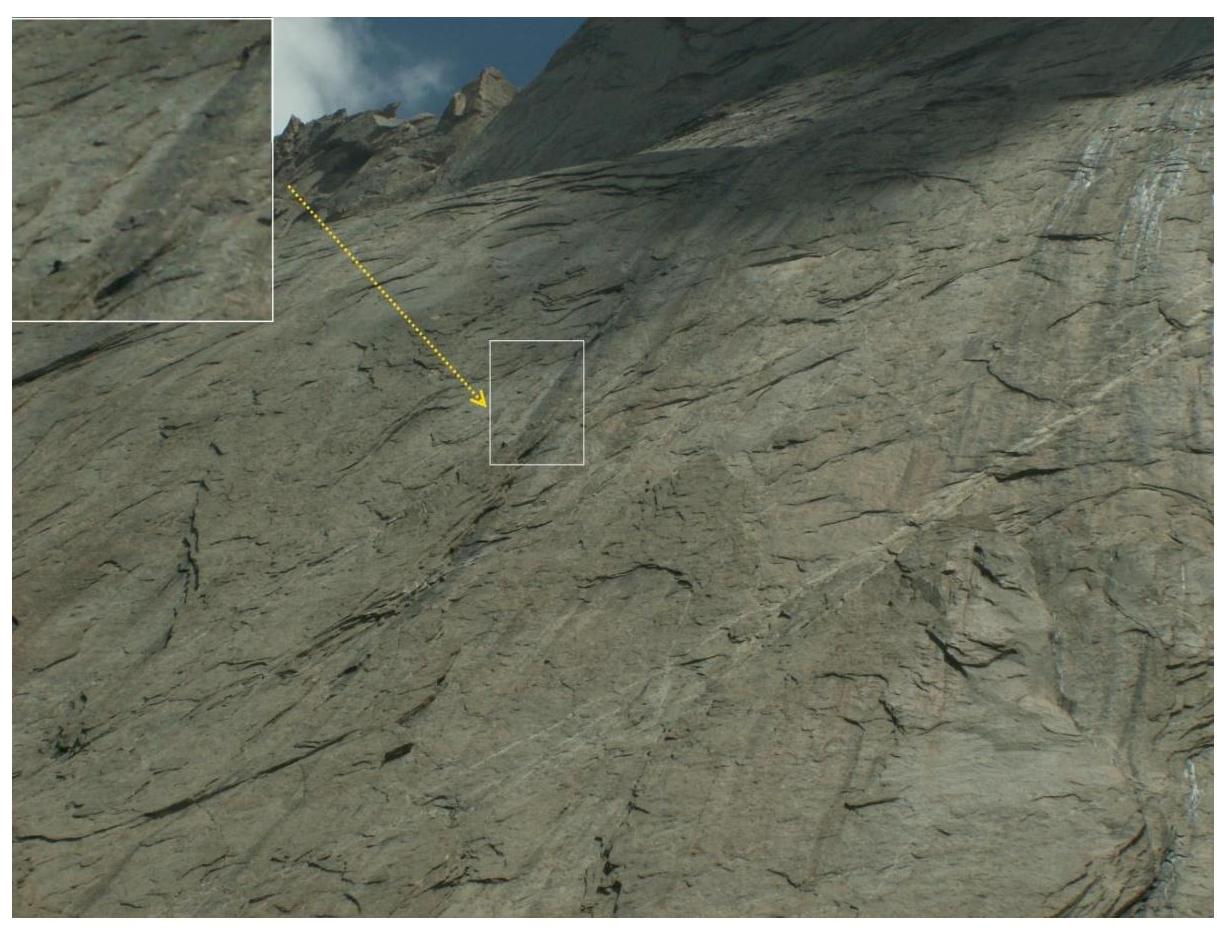
The entire route can be divided into two bastions, separated by a fairly wide diagonal terrace. Both bastions are approximately equal in length and steepness but differ radically in complexity and micro-relief.
The lower bastion represents relatively gentle (about 70°) rocks, uncharacteristic for Karavshin's routes, but is extremely complex, with very poor micro-relief, which, even with flakes, presents significant problems for free climbing, belay organization, and is inconvenient for ITO, as most flakes form overhangs, and one has to climb diagonally upwards under the eaves.
The second bastion is almost entirely climbed like typical granite routes of such steepness.
The team spent 3.5 days on the first bastion, and the second bastion was climbed in less than a day.
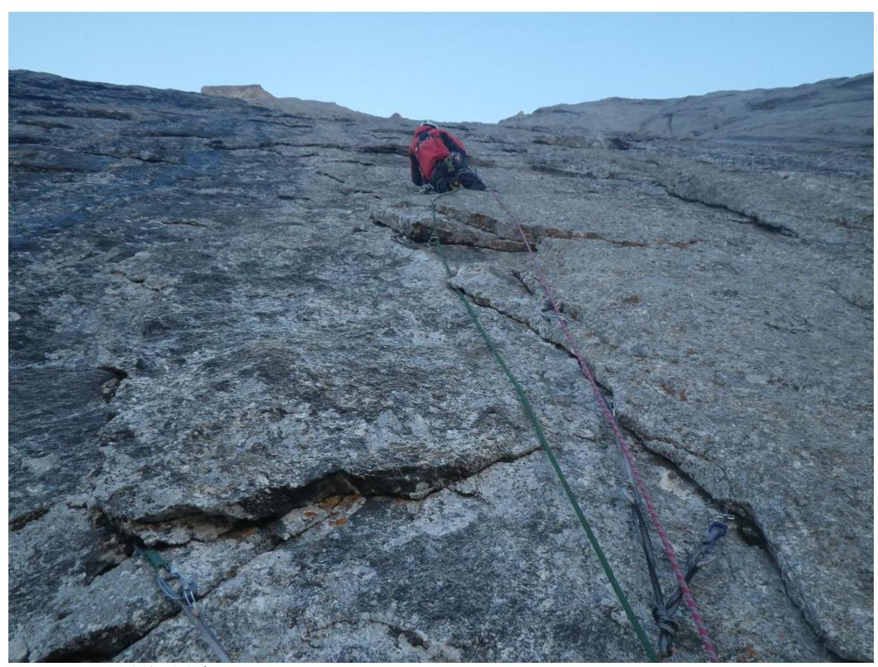
R0–R1. Smooth slab with an eave, turning into a crack. There's a hole for a skyhook on the eave. Below and above the eave, protection was placed for belaying.
R1–R2. Crack, abutting against an eave. Under the eave, traverse 10 m to the right, then ITO via holes to a system of blind cracks. Station on a small ledge on 2 protection and an anchor.
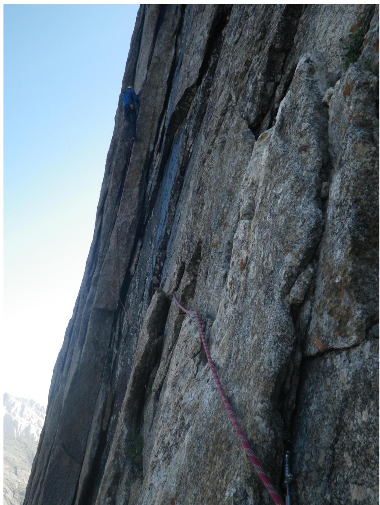
R2–R3. Through a small wall into a large flake. Water runs along the flake in places. Difficult climbing, with transitions to ITO.
R3–R6. Further up along the flake. Difficult climbing, with transitions to ITO. On R5, there's a small ledge where we stopped for the night.
R6–R7. The flake ends. Via a system of blind cracks to the right and upwards, continuing the flake. Balanced climbing, with ITO in the upper part.
R7–R9. Further up along the flake, exiting to a large ledge. We stopped for the night on the large ledge. Processed another 2 ropes.
R9–R10. Along the ledge to the left, through a small wall (10 m). Then rappelled to the left, to the next large flake.
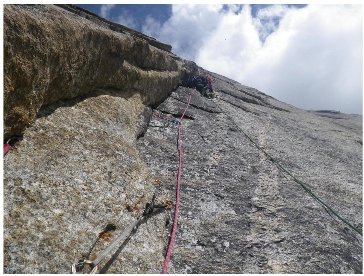
R10–R11. Up the flake 60 m, exiting to a ledge. On the ledge, a control cairn on a bolt hanger, from which a rappel was organized to the left and down, towards the next flake.
R11–R12. To the flake, traverse 10 m, then up the flake. Difficult climbing, with transitions to ITO.
R12–R13. System of interrupted blind cracks, climbed on ITO with transitions to extremely difficult climbing. Several pendulum moves from one crack to another. In the upper part, several moves on relief skyhooks. Section of extreme difficulty.
R13–R14. Up the crack, exiting to a ledge. ITO in the lower part, climbed in the upper part. We stopped for the night on the ledge, processed 1 rope upwards.
R14–R16. From the ledge, via a system of blind cracks to the right and upwards. Very difficult climbing on balance. ITO in places, pendulum transitions from one crack to another. Very poor protection.
R16–R17. Along the crack, traversing to the right, exiting to a quartz "vein". Along the "vein" to the left and upwards, under the eave. Exiting to the first large terrace.
R17–R18. Along the terrace to the left and upwards, 100 m of easy rocks.
R18–R19. Easy climbing straight up, exiting to the second large terrace.
R19–R20. Along the terrace, 200 m to the right and upwards, via easy rocks. Processed two ropes from the terrace straight up, climbed in the direction of debris flakes. Overnight on the terrace.
R20–R21. Short section up a crack to a small ledge.
R21–R22. Along the crack, to an overhanging flake on one side. Through the flake, exit to a ledge.
R22–R23. Traverse in the direction of the next flake. Then up the flake, difficult climbing on loose rock.
R23–R25. Up the overhanging flake on one side, difficult climbing on loose rock. Exit to a ledge.
R25–R26. Along the ledge slightly to the right, then up a wall, and 40 m to the right and up a crack in the direction of a large internal angle. Along the internal angle, exit to a ledge. Here is the 2nd control cairn and a convenient place for a possible overnight stay.
R26–R27. From the ledge, up the internal angle.
R27–R29. To the right and up, in the direction of a large eave. The eave is traversed from the right.
R29–R32. To the right and up, in the direction of the right peak gendarme.
R32–R34. Without reaching the gendarme, traverse with descent along debris ledges to the left, and through an easy wall, exit to the ridge, left of the summit.
R34. Along the ridge to the summit, 20 m to the right.
Photos by Sections
Section R0–R1
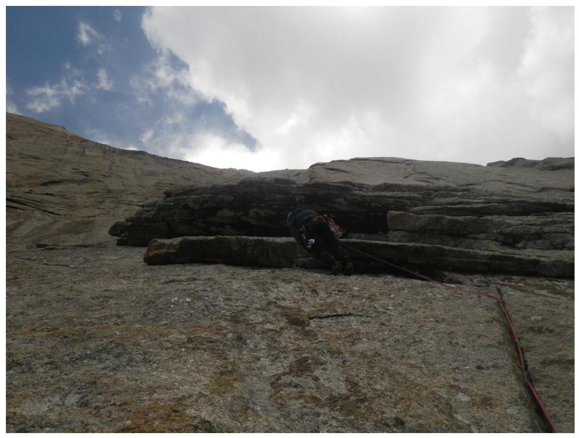
Section R6–R7
Ledge on R9–R10

Section R10–R11
Section R11–R12

Start of section R12–R13
Group on section R12–R13
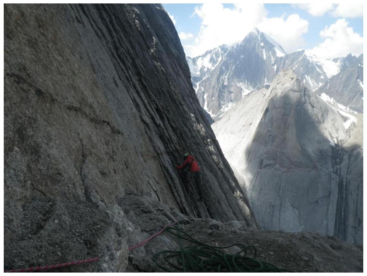
Section R13–R14
Section R15–R16
Section R21–R22
Section R26–R27 (On this ledge is the control cairn)
Photos from the Summit
A note from the Irkutsk team was found on the summit, but during the descent under heavy rain, it turned into a wet lump that could not be flattened.