Moscow Alpinism Championship
Technical Class
Report on the ascent of Peak Slesova via the North face
MAI Alpine Club Team
2018
Ascent Passport:
-
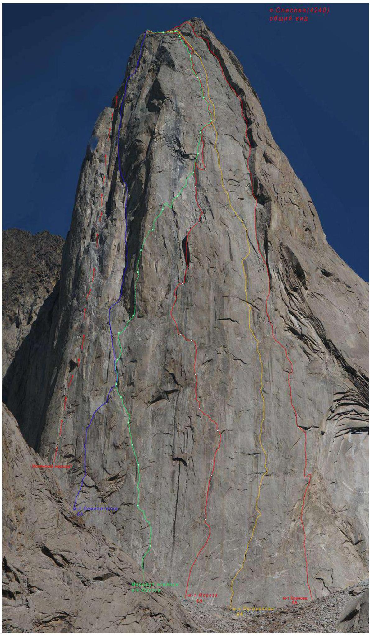
Region: Pamir-Alai, Turkestan Range, Karavshin valley, 5.4.3.
-
Route name: Peak Slesova, 4240 m, via the center of the North face (Pogorelov's route)
-
Complexity category: 6A cat. diff.
-
Route type: rock
-
Route characteristics:
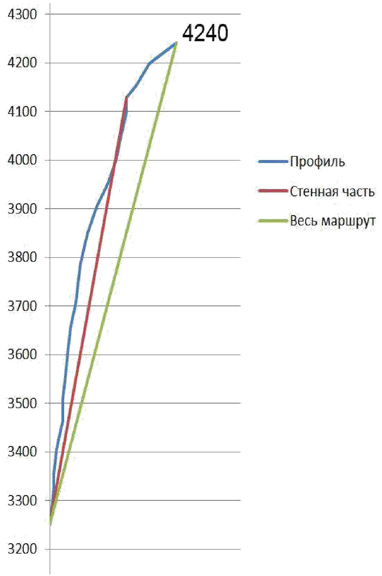
Elevation gain: 850 m. Route length: 1030 m. Section lengths:
- V cat. diff.: 60 m
- VI cat. diff.: 850 m.
Average steepness:
- main part of the route: 82°
- entire route: 79°
-
Protection and artificial protection points used on the route:
bolted fixed: 27 pieces, incl. artificial protection: 15 pieces; bolted removable: 1 piece, incl. artificial protection: 0 pieces; nuts and friends: 120, incl. artificial protection: 70; pitons: 53, incl. artificial protection: 40. Pitons left on the route: total: 1 piece, incl. bolted: 1 piece (on descent). Total artificial protection points (artificial aids) used: 160, incl. fifi hooks and skyhooks: 70.
-
Team's total time on the route: 33 hours, 4 days, including processing time – 5 hours, 1 day.
-
Leader: Belousov Vladimir Alexandrovich, qualification: Candidate Master of Sports. Participants: Sushko Denis Olegovich, Master of Sports, Tsvetov Pavel Nikolaevich, Candidate Master of Sports.
-
Coach: Belousov Vladimir Alexandrovich, Candidate Master of Sports.
-
Processing: 10:00–15:00, July 31, 2018.
Departure onto the route: 7:00, August 1, 2018. Reach the summit: 16:30, August 3, 2018. Return to Base Camp: 14:00, August 4, 2018.
 Route profile on the right. The lower part is obscured by the shoulder of Peak Slesova.
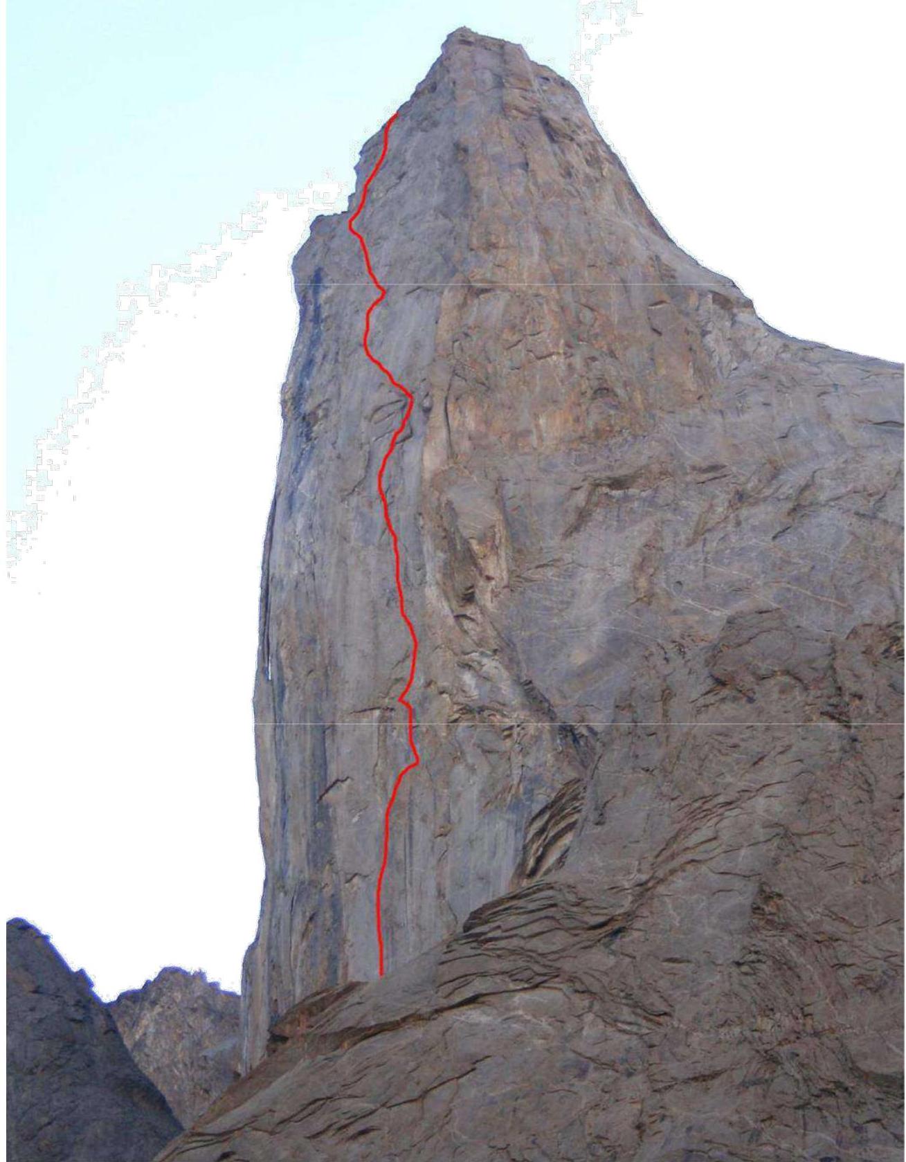
Hand-drawn route profile.
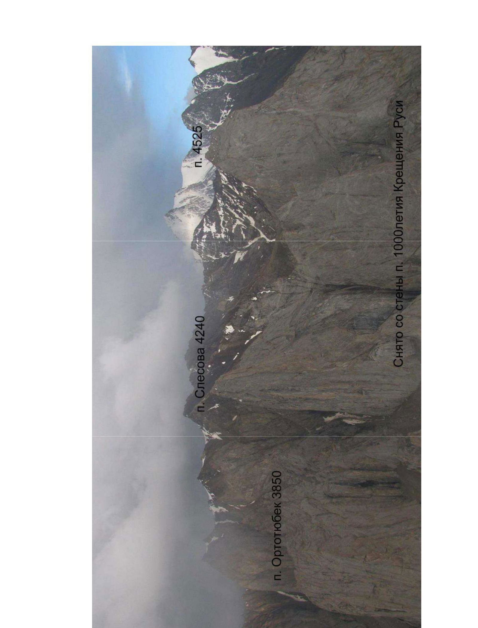
Taken from the wall of Peak 1000-letiya Kreshcheniya Rusi.
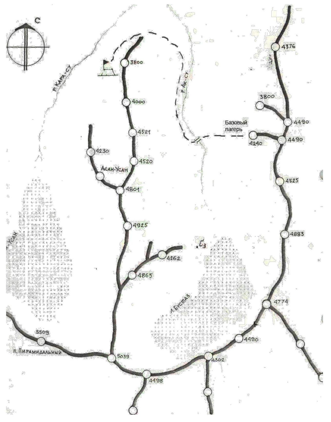
Area map
| July 31, 2018 | August 1, 2018 | August 2, 2018 | August 3, 2018 | August 4, 2018 |
|---|---|---|---|---|
| Processing (5 hours) | Departure, ascent to the first bivouac (12 hours) | Work on the route, ascent to the second bivouac (9 hours) | Ascent without bivouac. Summit. Descent to bivouac (7 hours + 2 hours descent) | Descent to Base Camp (3 hours + 1 hour on moraine) |
| R0–R4 | R4–R11 | R11–R17 | R17–R24–R17 | |
| Cloudy, thunderstorm after 16:00 | Variable cloudiness, wind. | Variable cloudiness, wind. | Sunny, calm. | Sunny, calm. |
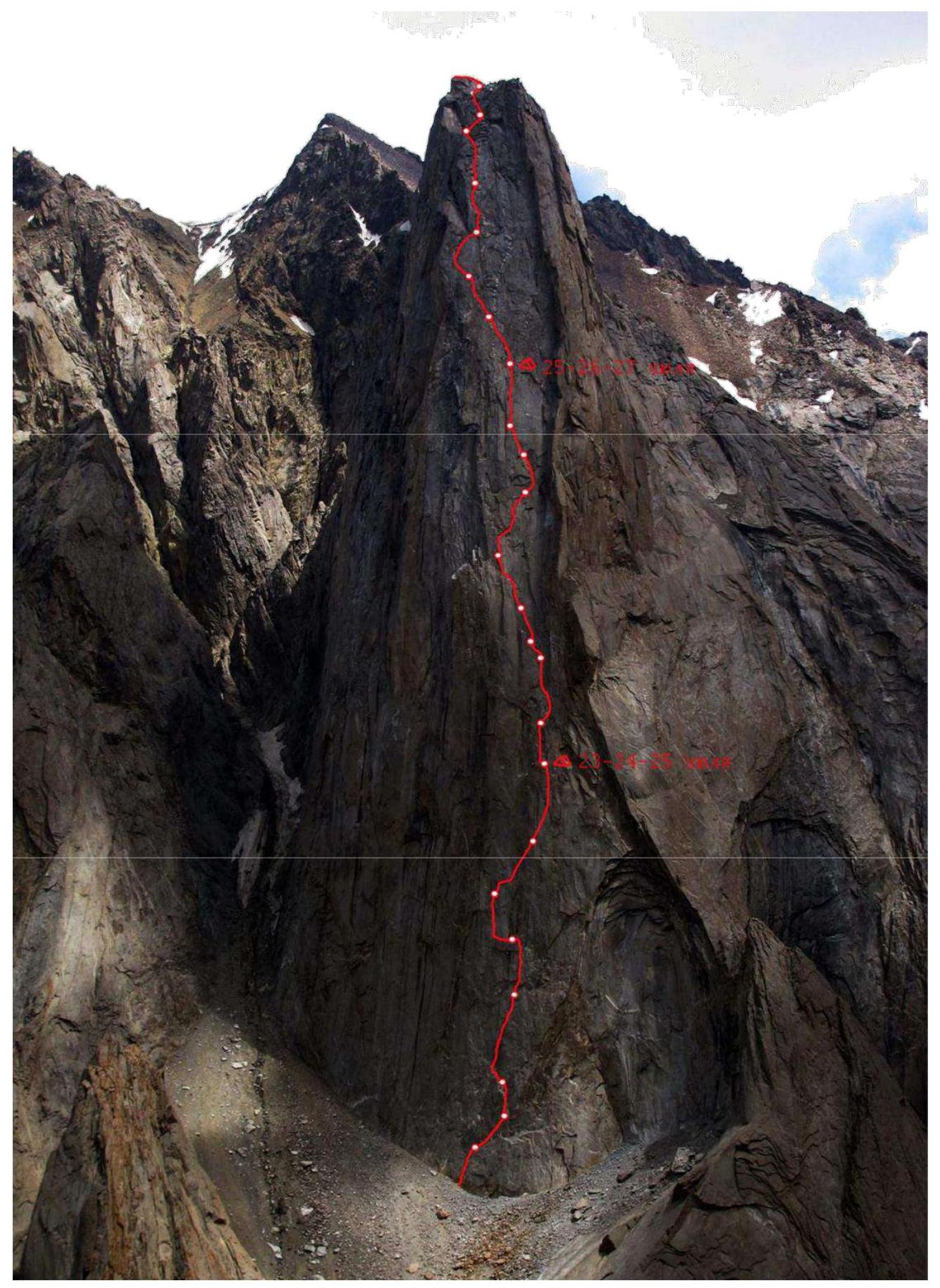
Technical Photographs of the Route
Approach to the Route:
From the base camp in the Ak-Su valley, ascend via large-block talus to Peak Slesova. 1 hour.
General Route Characteristics:
The route was first ascended during the USSR Championship in 1988 by a Rostov team led by A.G. Pogorelov. Until the late 90s, it was classified as "6B". Along with Moroz's route, it follows the most logical terrain on the wall, which determined the team's choice. There is no water on the wall.
The route consists of three parts:
- the steepest and most barren lower section (R0–R14),
- a slightly less steep and more dissected upper section (R14–R22), and a very short roof.
Due to the long and complex wall section, routes on Peak Slesova are more similar to routes on Peak 4810 than on Peak Asan.
Compared to other 6th category difficulty routes, this route is:
- more difficult than the Dorro and Voronin routes on Peak Erydag,
- significantly more difficult than Pogorelov's route on Peak Asan,
- slightly more difficult than Potankin's route on Peak 1000-letiya Rusi,
- slightly less difficult than Voronov's route on Peak 4810.
Route Description by Sections:
R0–R1 Internal corner, ascended with free climbing. Protection with cams and nuts.
R1–R2 Diagonal crack, ascended using artificial aids. Pitons and nut placements used. Station on a ledge.
R2–R3
- First, ascend the internal corner
- Then traverse the slab along it, following bolts
- Hanging station on two bolts.
R3–R4 System of cracks, between them – via bolts. Overcome the cornice using artificial aids – holes and bolts. Station on a ledge.
R4–R5 Climb the off-width crack to reach a shelf. Protection with nuts. Overnight stay possible on the shelf.
R5–R6 From the shelf, first climb, then use artificial aids to move through a system of cracks towards an internal corner. Nuts, anchor pitons, and a bolt present. Station at the start of the corner.
R6–R7 Ascend the corner to a cornice, overcome the cornice, and move across a slab using skyhooks. Bolt protection on the slab.
R7–R8 Ascend the slab, then the internal corner to reach a shelf suitable for an overnight stay.
R8–R9 Ascend a wide crack, then an internal corner to a small ledge.
R9–R10 Climb an off-width crack, followed by artificial aids through a flat, wide crack (cams).
R10–R11 Climb the off-width crack to a shelf with bolts for hanging a platform.
R11–R12 Ascend a wide, flat crack towards a chimney. Artificial aids, cams. Station under the chimney.
R12–R13 In the chimney until the plug, then exit left onto slabs with a crack.
R13–R14 Move through a system of cracks, bypassing the cornice on the right.
R14–R15 Climb an internal corner to a sloping shelf forming a large, inclined internal corner. Continue moving up the corner.
R15–R16 Ascend the internal corner until it ends.
R16–R17 Move through a crack, then transition left into an internal corner, ascend the corner to a small ledge with a bolt, then climb a crack to a shelf with bolts for hanging platforms.
R17–R18 Climb a crack into an internal corner, which turns into a crack that peters out. Station near a marble vein.
R18–R19 Climb an off-width crack. Difficult transition into the second off-width crack.
R19–R20 Climb a crack, leaving the cornice on the left. Station on a ledge.
R20–R21 Artificial aids through a crack, then climb an internal corner. Hanging station.
R21–R22 Initially climb, then use artificial aids to bypass cornices. Aim for the left part of the roof. Station behind a ridge.
R22–R23 Climb a relatively easy internal corner.
R23–R24 First, traverse a ledge, then climb a simple internal corner to reach the ridge.
R24–R25 Ascend a simple ridge to the summit.
Tactical Actions of the Team:
The route was ascended with 3 overnight stays (one on descent), with one day of processing, followed by an alpine-style ascent. The weather was mostly good throughout the ascent, except for the processing day – dry rock and complete absence of water. Dry rock allowed for free climbing where possible.
The leader worked on a double rope. The team did not leave any personal holes for skyhooks; they hammered 1 bolt (used for hanging platforms). There were no falls or injuries during the ascent.
On July 31, the team processed the route, with the Sushko-Tsvetov team working on the wall. Sushko worked first. They completed four rope lengths. Belousov made 2 load-carrying pitches and lifted a platform to the end of the processed pitches.
On August 1, the team departed, with Tsvetov working first, Belousov providing protection, and Sushko hauling the sack. They completed 7 more rope lengths. They spent the night on a platform.
On August 2, Belousov worked first, Sushko provided protection, and Tsvetov handled sack hauling. They completed 7 rope lengths. They spent the night at the standard location on R17. They divided R16–R17 into 2 sections of 30 meters each.
On August 3, after completing 9 rope lengths, the team reached the summit. They found a cairn but no note. Sushko worked first; the others followed on the fixed ropes. From the summit ridge, they rappelled down 4 times to a platform.
On August 4, they began descending via the ascent route, reaching below the wall by 13:00. They arrived at Base Camp by 14:00.
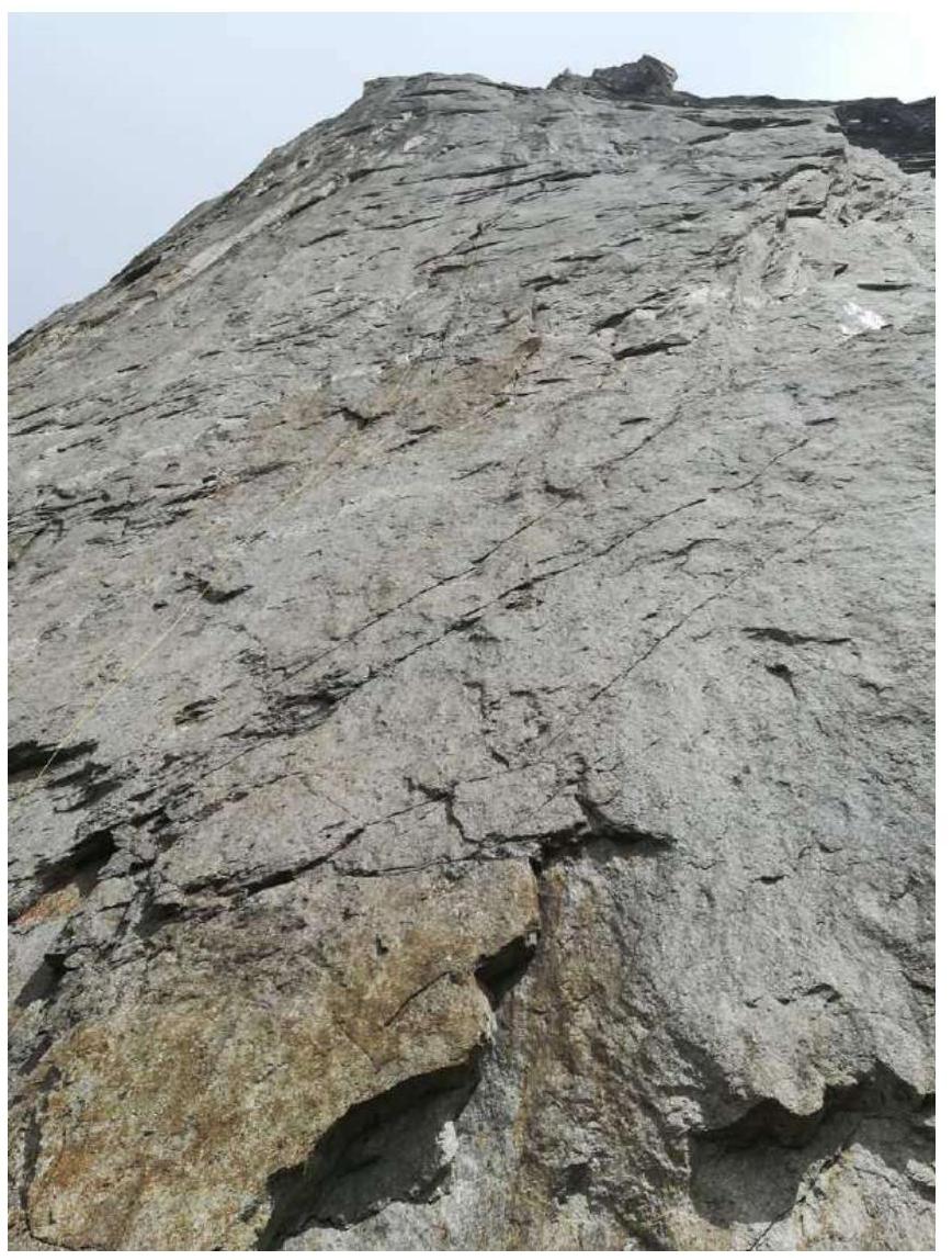
Photo 1. Processing R3–R4. Sushko working first.
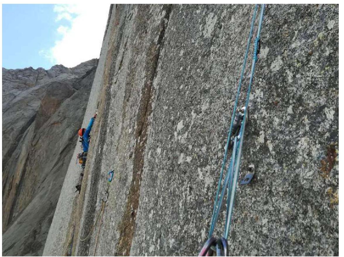
Photo 2. R5–R6, Tsvetov working first.
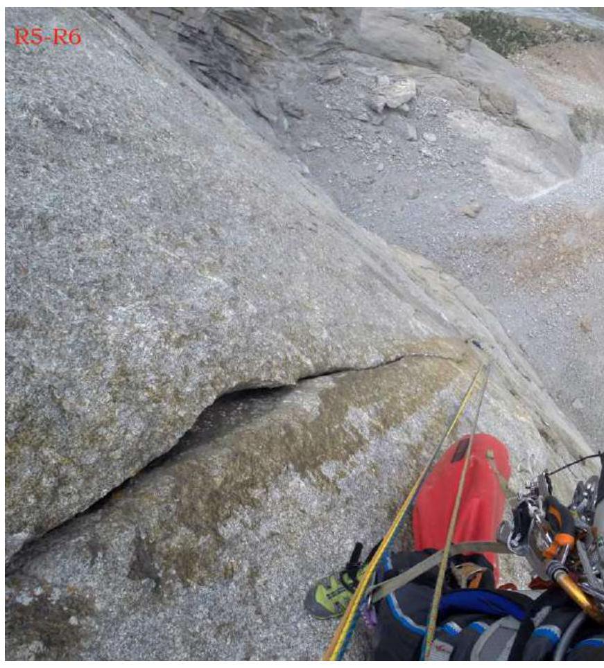
Photo 3. View of R5–R6 from the station.
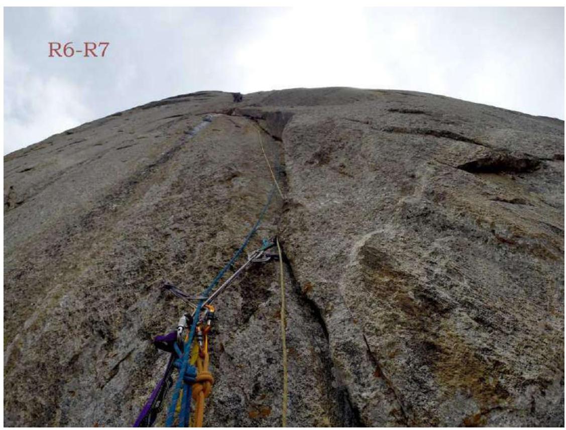
Photo 4. R6–R7, after the cornice, holes and bolts.
Photo 5. View from the station to R7–R8.
Photo 6. R8–R9.
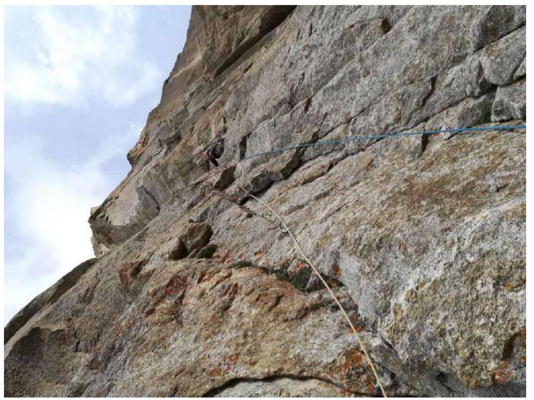
Photo 7. R9–R10.
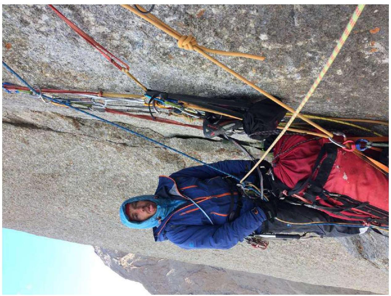
Photo 8. Morning after the first bivouac on R11.

Photo 9. R11–R12.
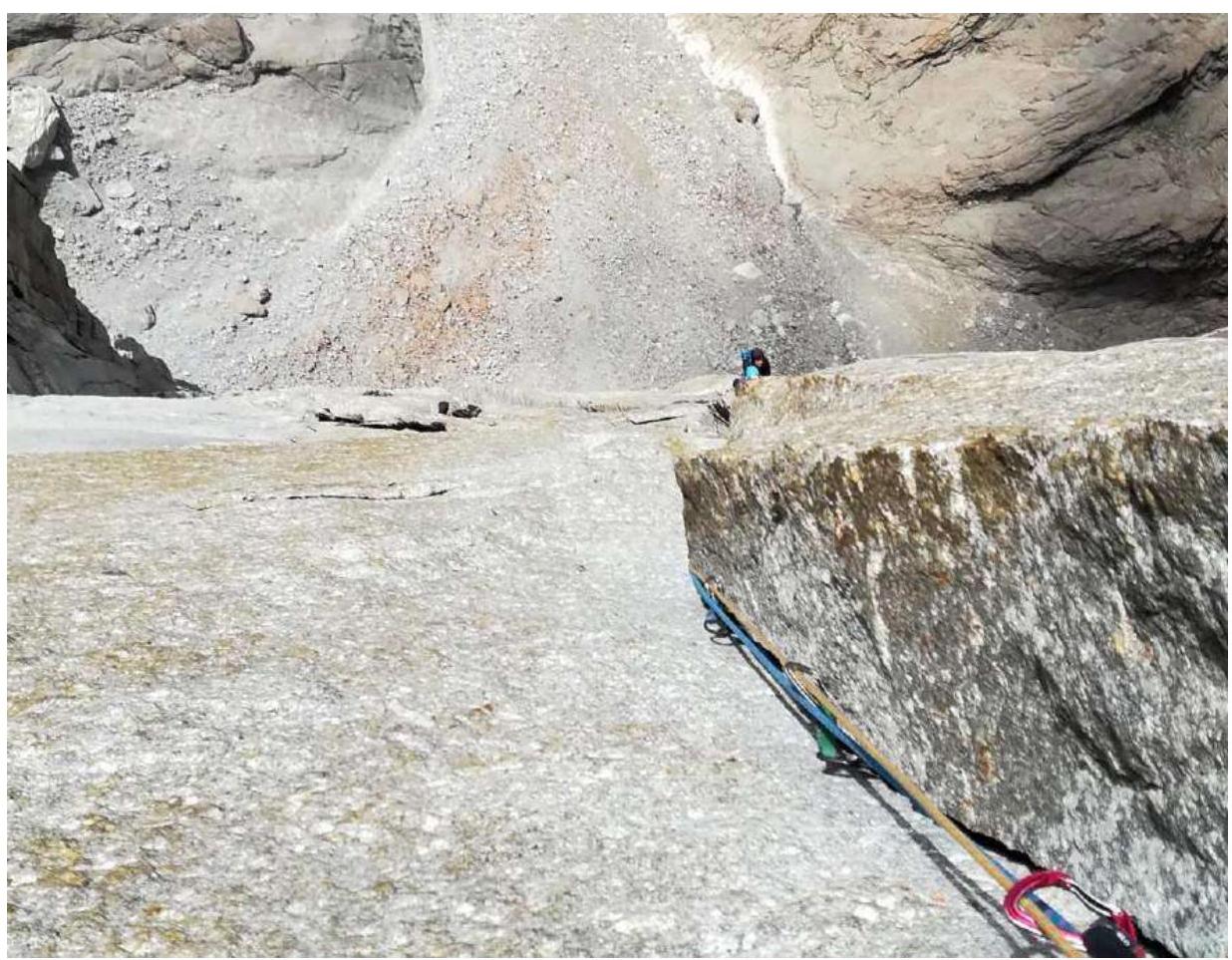
Photo 10. R13–R14.

Photo 11. On the platform for the 2nd bivouac.
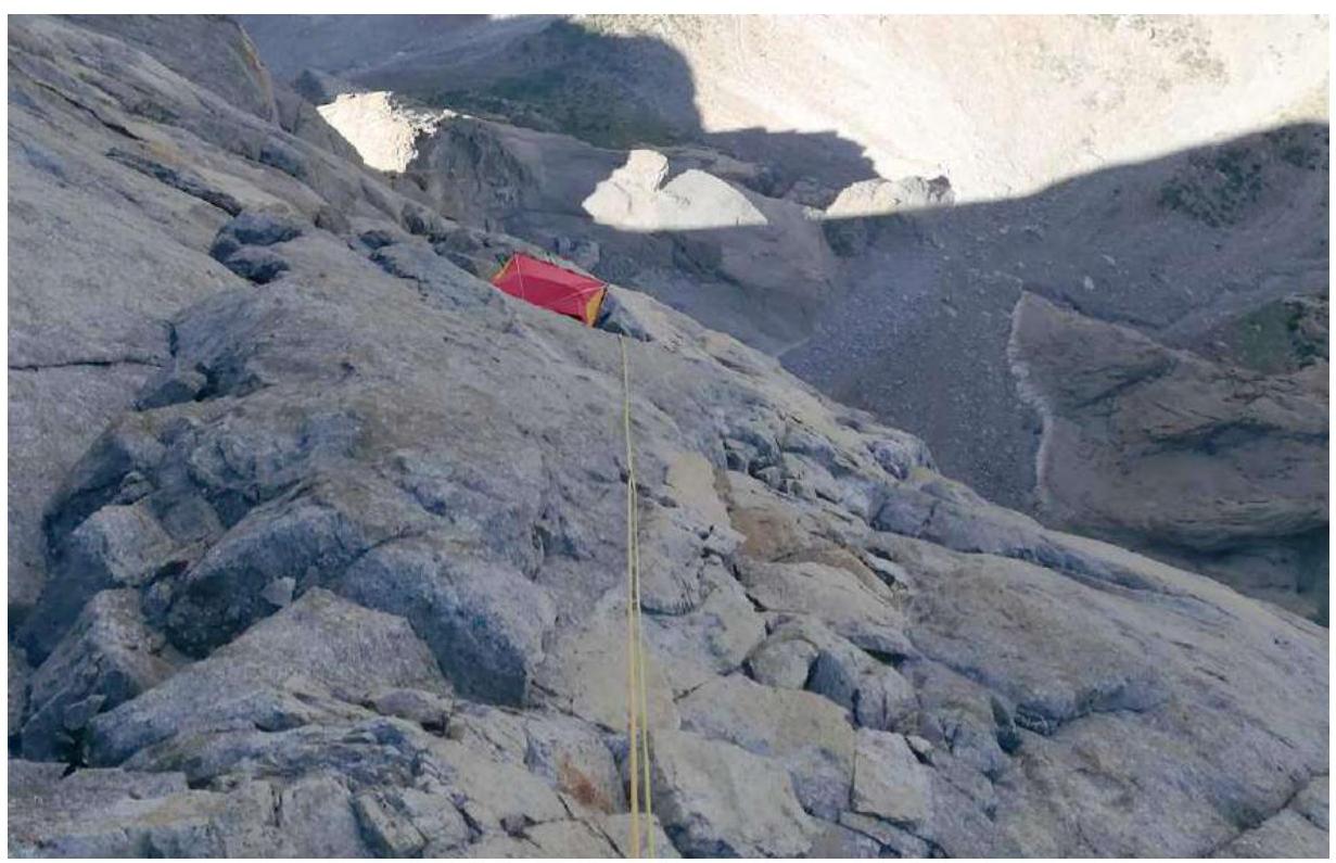
Photo 12. View of the platform from R18.
Photo 13. R17–R18.
Photo 14. R18–R19.
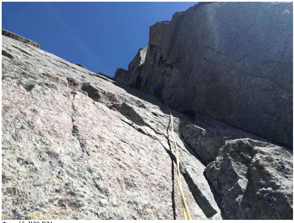
Photo 15. R20–R21.
Photo 16. R21–R22.
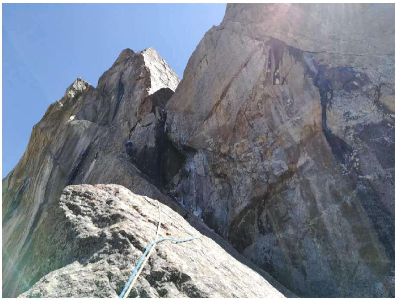
Photo 17. R22–R23.
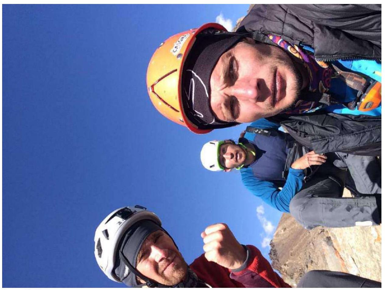
Photo 18. Summit.
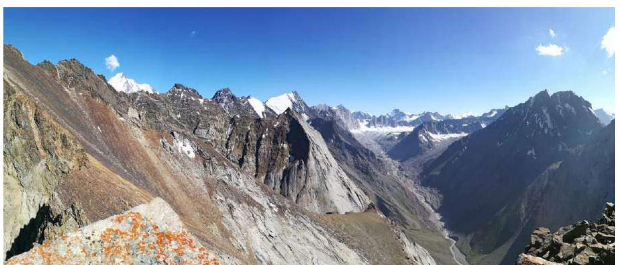
Photo 19. Panorama from the summit.
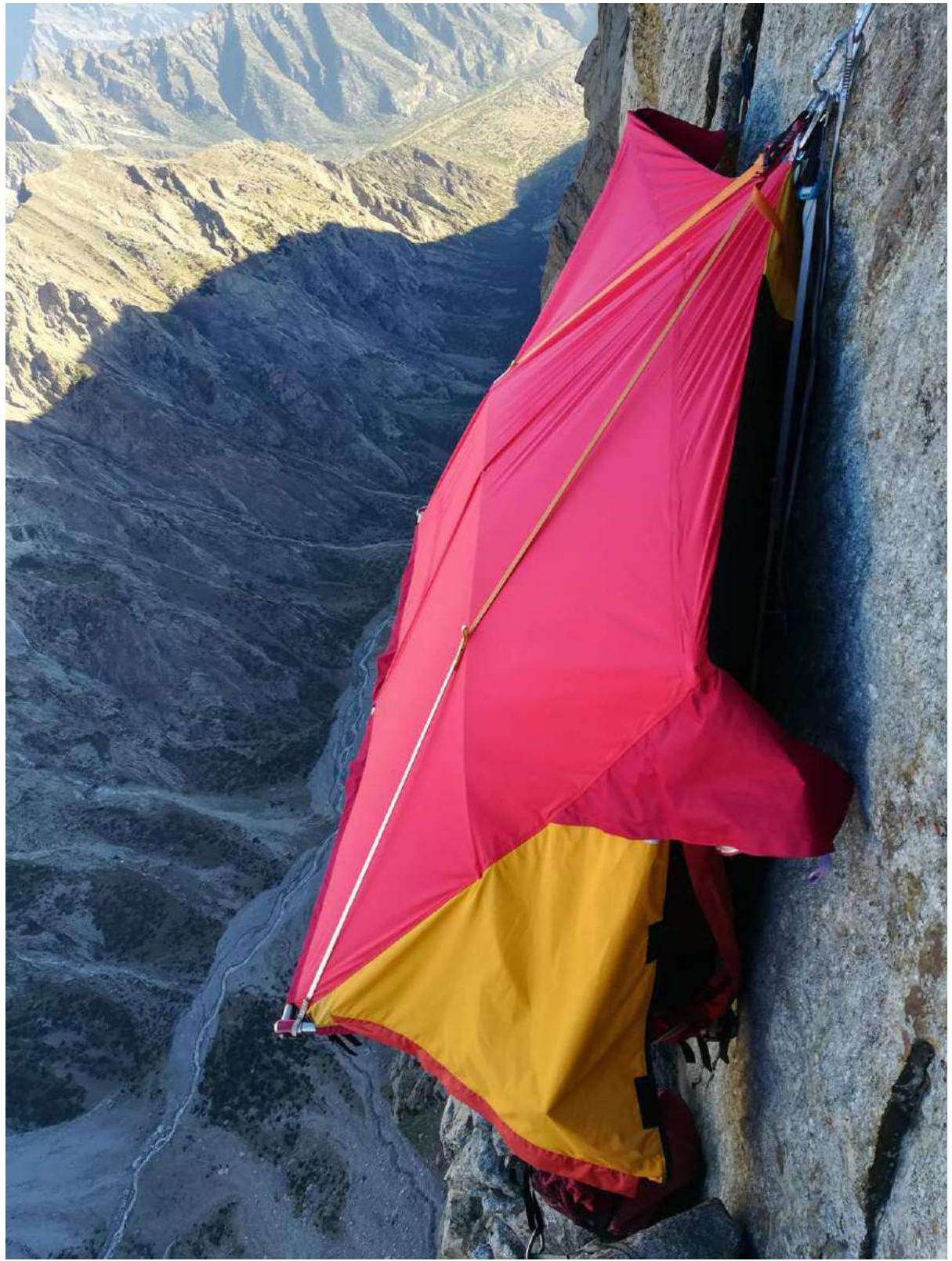
Photo 20. Platform on the 2nd bivouac.