Ascent Passport
I. Ascent class — technical 2. Area — Turkestan Range, Kara-Su gorge, Karavshin river valley 3. Peak 1000-letie krashcheniya Rusi, via the left part of the NW wall 4. 6A category of difficulty, second ascent — did not complete the upper part! 5. Height difference — 1307 m, route length — 1890 m, average steepness — 54°. Length of sections with 5–6 category of difficulty — 990 m, including 365 m of 6 category. Steepness of the main route section: first wall — 62°, second wall — 83° 6. Pitons driven:
| Rock | Bolts | Nuts | Ice |
|---|---|---|---|
| 120 | 3 | 277 | 12 |
| 20 | 1 | 50 | 0 |
- Team's total climbing hours: 41 hours and days — 5
- Overnights: 1st–2nd on comfortable ledges, 3rd on a sloping slab, bivouac site formed from snow
- Leader: Mingalёv Vladimir Nikolaevich — Master of Sports
Team members:
- Zhilin Nikolai Fedorovich — Candidate for Master of Sports
- Volegov Alexander Vladimirovich — Candidate for Master of Sports
- Shestopalov Pavel Ivanovich — Candidate for Master of Sports
- Osipova Tatiana Alekseyevna — Candidate for Master of Sports
Coach: Lebedikhin Alexey Veniaminovich
II. Departure to the route: July 2, 1989 Summit: July 5, 1989. Return: July 6, 1989.
Note: х — used
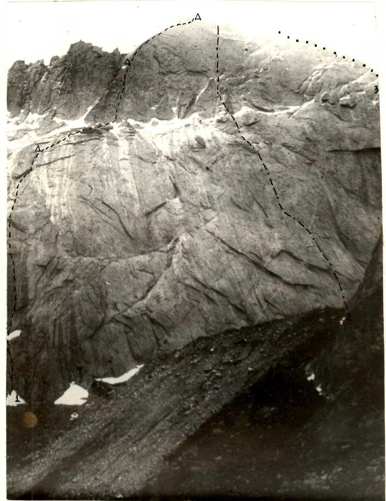
Photo 1. General photo of the summit. Taken on June 30, 1989 at 14:00. Shooting point on the area diagram — №1. 3000 m. Distance — 2 km. Lens — Т-22, F=75 mm.
- R1 — Skripko route, 1988 (completed by the team)
- R2–R4 — Igожкина, 1988
- R3 — Kazachka, 1988
| Rock | Nuts | Ice | Bolts | UIAA route diagram symbols | Length, m | Steepness, degrees | Category of difficulty |
|---|---|---|---|---|---|---|---|
| - | 6 | - | - |  | 40 | 50 | 4 |
| - | 6 | - | - |  | 40 | 55 | 4 |
| - | 8 | - | - |  | 40 | 65 | 5 |
| 3 | 5 | - | - |  | 40 | 50 | 5 |
| 4 | 9/4 | - | - |  | 40 | 75 | 6 |
| 2 | 11 | - | - |  | 40 | 75 | 5 |
| - | 12 | - | - |  | 30, 10 | 70, 100 | 5, 6 |
| 3 | 9 | - | - |  | 40 | 70 | 5 |
| 5/2 | 10/3 | - | - |  | 25, 15 | 60, 90 | 6, 6 |
| 3/1 | 10/2 | - | - |  | 40 | 75 | 6 |
| 6 | 8/2 | - | - |  | 40 | 85 | 6 |
| 6/1 | 9/3 | - | - | 15, 25 | 95, 75 | 6, 5 | |
| Rock | Nuts | Ice | Bolts | UIAA route diagram symbols | Length, m | Steepness, degrees | Category of difficulty |
| :--: | :--: | :-: | :--: | :--------------------------------------------------------------------------------------------------------------------------------------------------------: | :-------: | :----------------: | :--------------------: |
| 3 | 1 | - | - | Θ | 40 | 40 | 3 |
| 1 | 3 | 2 | - | Θ | 40 | 45 | 4 |
| 1 | - | 1 | - | Θ | 40 | 30 | 2 |
| 2 | - | 3 | - | Θ July 2, 1989. 10 climbing hours | 40 | 40 | 3 |
| - | 5 | - | - | 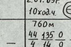 | 40 | 45 | 4 |
| 5 | 4 | - | - | Θ | 15, 25 | 55, 80 | 4, 5 |
| - | 8 | - | - | Θ | 40 | 50 | 4 |
| 3 | 6 | - | - |  | 80 | 55 | 4 |
| 1 | 4 | - | - |  | 40 | 50 | 4 |
| 3 | 5 | - | - |  | 40 | 55 | 5 |
| Rock | Nuts | Ice | Bolts | UIAA route diagram symbols | Length, m | Steepness, degrees | Category of difficulty |
| :--: | :--: | :-: | :--: | :--------------------------------------------------------------------------------------------------------------------------------------------------------: | :-------: | :----------------: | :--------------------: |
| 4 | 15 | 6 | - |  | 120 | 45 | 4 |
| 3/2 | 10/5 | - | - |  July 3, 1989. 12 climbing hours. 525 m | 45 | 75 | 6 |
| 5/1 | 7/3 | - | - | 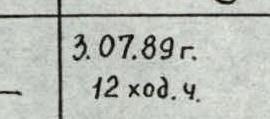 47 810 10 27 0 | 40 | 80 | 6 |
| 6/4 | 10/5 | - | 2/1 | 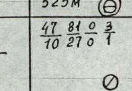 | 40 | 95 | 5 |
| 5/2 | 9/2 | - | - | 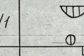 | 40 | 80 | 6 |
| 2 | 12/8 | - | 1 |  | 40 | 90 | 5 |
| 6/2 | 9/5 | - | - |  | 40 | 85 | 6 |
| 10/1 | 14/4 | - | - |  | 85 | 80 | 5 |
| 6 | 16 | - | - |  | 80 | 70 | 5 |
| Rock | Nuts | Ice | Bolts | UIAA route diagram symbols | Length, m | Steepness, degrees | Category of difficulty |
| :--: | :--: | :-: | :--: | :--------------------------------------------------------------------------------------------------------------------------------------------------------: | :-------: | :----------------: | :--------------------: |
| - | - | - | - |  July 5, 1989. 41 climbing hours. 1890 m. 120 277 12 3 20 50 0 7 | 300 | 45 | 3 |
| 5 | 14 | - | - |  | 60 | 85 | 5 |
| 6 | 10 | - | - |  | 40 | 90 | 6 |
| 7/4 | 8/2 | - | - |  | 40 | 60 | 5 |
| 4 | 8/2 | - | - |  | - | - | - |
Description of the route by sections
R0–R1. Smooth slab with small holds, overcome on friction; carnage passed from left to right using nuts. R1–R3. Inner corner turning into a crack, climbing in a stem. R3–R5. Overhang, overcome in the left part with free climbing along protruding feathers; further inclined slab turning into a vertical one, small shells — applicable for skyhooks. R5–R6. Overhang, overcome along the fault; further crack 20–30 cm wide, for auxiliary support a hammer was used. R6–R7. Slabs with flakes, nuts go well. R7–R8. Thin crack, mostly climbed on aid. R8–R11. Chimney, climbed in a stem; further along the crack leading to an inner corner. R11–R12. Slab, climbed with free climbing. R12–R13. Crack, climbed with free climbing, turns into an overhang. R13–R14. Slab; further convenient belay site on top of a pillar, good platform. R14–R15. Inner corner with smooth walls. R15–R16. Crack, climbed with free climbing, with hands and feet wedged. R16–R17. Slab turning into an inclined ledge. R17–R18. Inclined inner corner, ends with a good ledge; good platform for a tent, water available. R18–R22. Slabs and ledges heavily snowed and iced, climbed in crampons; belay through ice screws and rock pitons, nuts. R22–R23. Smooth wall with gradually increasing steepness; movement from left to right towards a patch under two overhangs; belay points inconvenient. R23–R24. Smooth slabs; movement left up between the system of overhangs towards a large flaking slab; small nuts go well. R24–R25. Slab climbed mostly with free climbing on friction; further inner corner with an overhang on the left, then through an overhang and into a crack. R25–R26. Along the crack under the overhang, through it into an inner corner and again left onto a smooth slab; for belay, a bolt driven by the first ascensionists was used. R26–R27. Smooth slab; further crack, climbed on aid; on the left — a large overhang. R27–R28. Along the slab, bypassing the overhang right up, aid; two bolt pitons used; further along the crack through the overhang onto a narrow ledge. R28–R30. Traverse left into a crack that defines further movement:
- in some places the crack is filled with snow;
- on the left and right of the crack — smooth slabs.
Climbed on aid, in some places — with free climbing. The crack leads to a ridge leading to the "Kvadrat" pinnacle. R30–R31. Up the ridge; snowed slabs, in some places the snow cover is up to 0.5 m thick; for belay, it is necessary to clear the snow by hand; there is some built-up ice. R31–R32. Along the crack, approach under the "Kvadrat" pinnacle. R32–R34. Difficult traverse right along smooth, snowed slabs, aid; belay point hanging, belay organization complicated; pendulum right into an inner corner and up the corner onto the ridge behind the pinnacle; the corner is filled with water. R34–R35. At the start of the section — overnight on an inclined slab, platform formed from snow; further along the heavily snowed ridge to the summit.
Descent towards peak 4810 along a sharp, snowed and iced ridge.
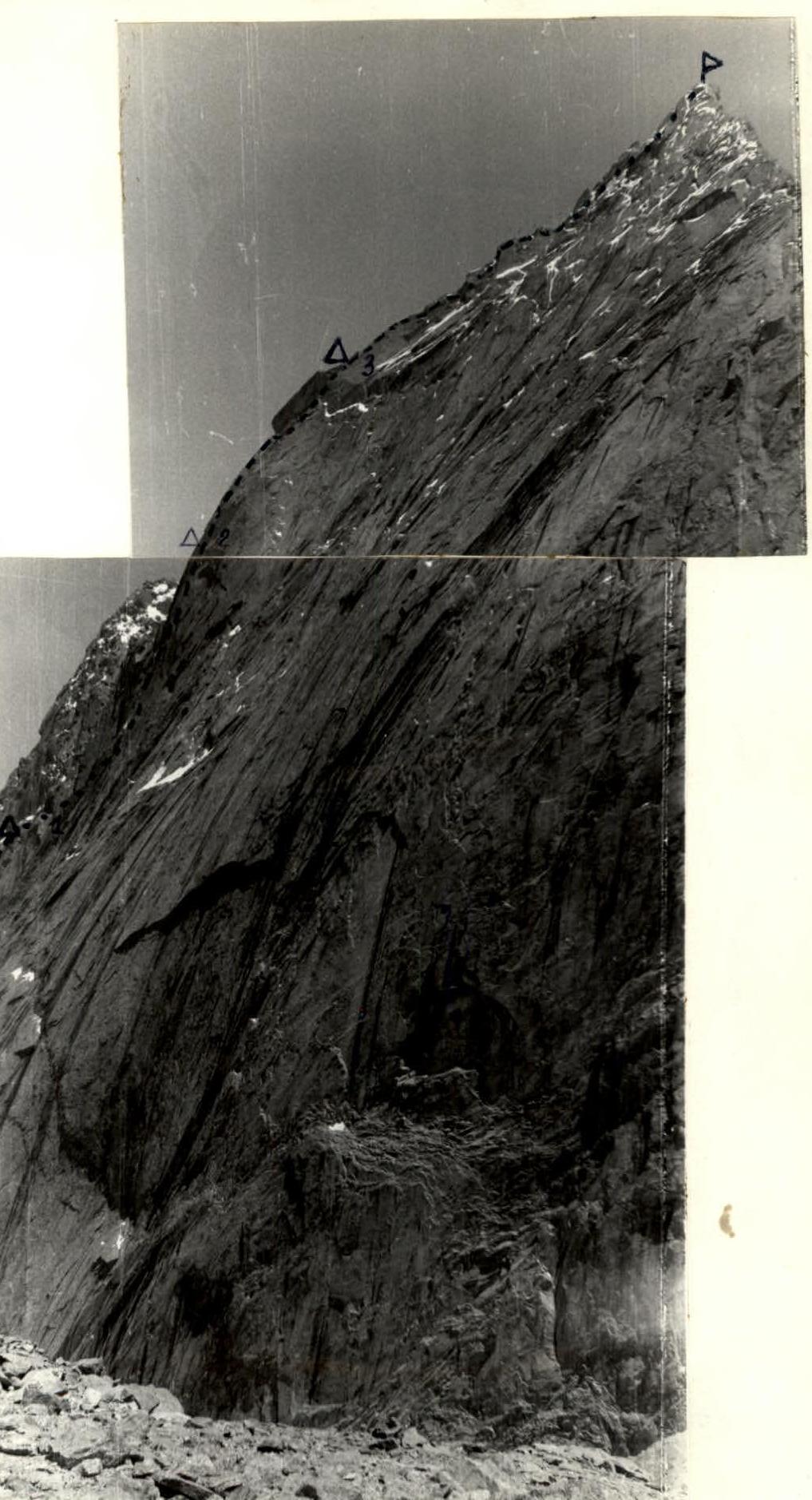
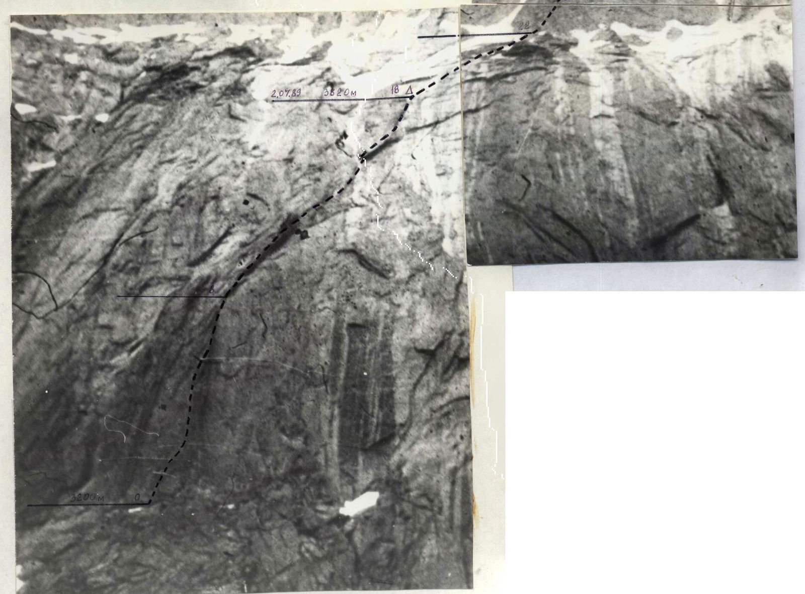
Photo 2. Profile of the wall on the right. Taken on July 10, 1989 at 16:00. Shooting point on the area diagram — №3. 4000 m. Distance — 2 km. Lens — Т-22, F=75 mm.
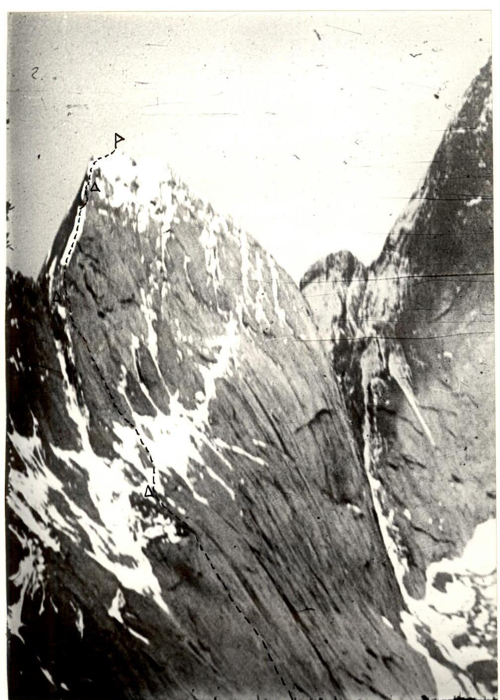
Photo 2a. Profile of the wall on the left. Taken on June 22, 1989 at 13:30 from a helicopter. 4200 m. Distance — 2 km. Lens — Т-22, F=75 mm.
Additional information
R44–R45 along the ridge to the summit. Overnight roughly halfway on an inclined slab. At the summit, no signs of human presence. Leaving a note. By the right of the first ascensionists, we propose to name the peak "1000-letie krashcheniya Rusi". Descent towards peak 4810 along a very sharp ridge.
Photo 5. Technical photograph of the route. Taken on June 30, 1989 at 14:00. Shooting point on the area diagram — №1. 3000 m. Distance — 2 km. Lens — Т-22, F=75 mm.