- Climbing region — Pamir-Alay, Turkestan Ridge
- Summit — 4500 m, Karasu via the North-East ridge
- Proposed route — cat. 4A, first ascent, combined route
- Length — 1290 m, of which 240 m are cat. 5; height difference — 950 m; average steepness — 50°
- Pitons hammered — 15; rock chocks — 35
- Time taken — 20 hours, 2 days. Team leader — Belova Marina Albertovna — 1st sports category. Team members — Bogdanova Tatyana Vyacheslavovna — 2nd sports category, Vasiliev Alexander Borisovich — 2nd sports category, Fedorkov Yuri Vladimirovich — 2nd sports category
- Coach — Master of Sports of the USSR, Lenivkova Zinaida Dmitrievna
- Team from Professional Applied Climbing Club "Gornjak"
- Approach to the route — June 16, 1988
Reached the summit — June 17, 1988. Returned — June 17, 1988.
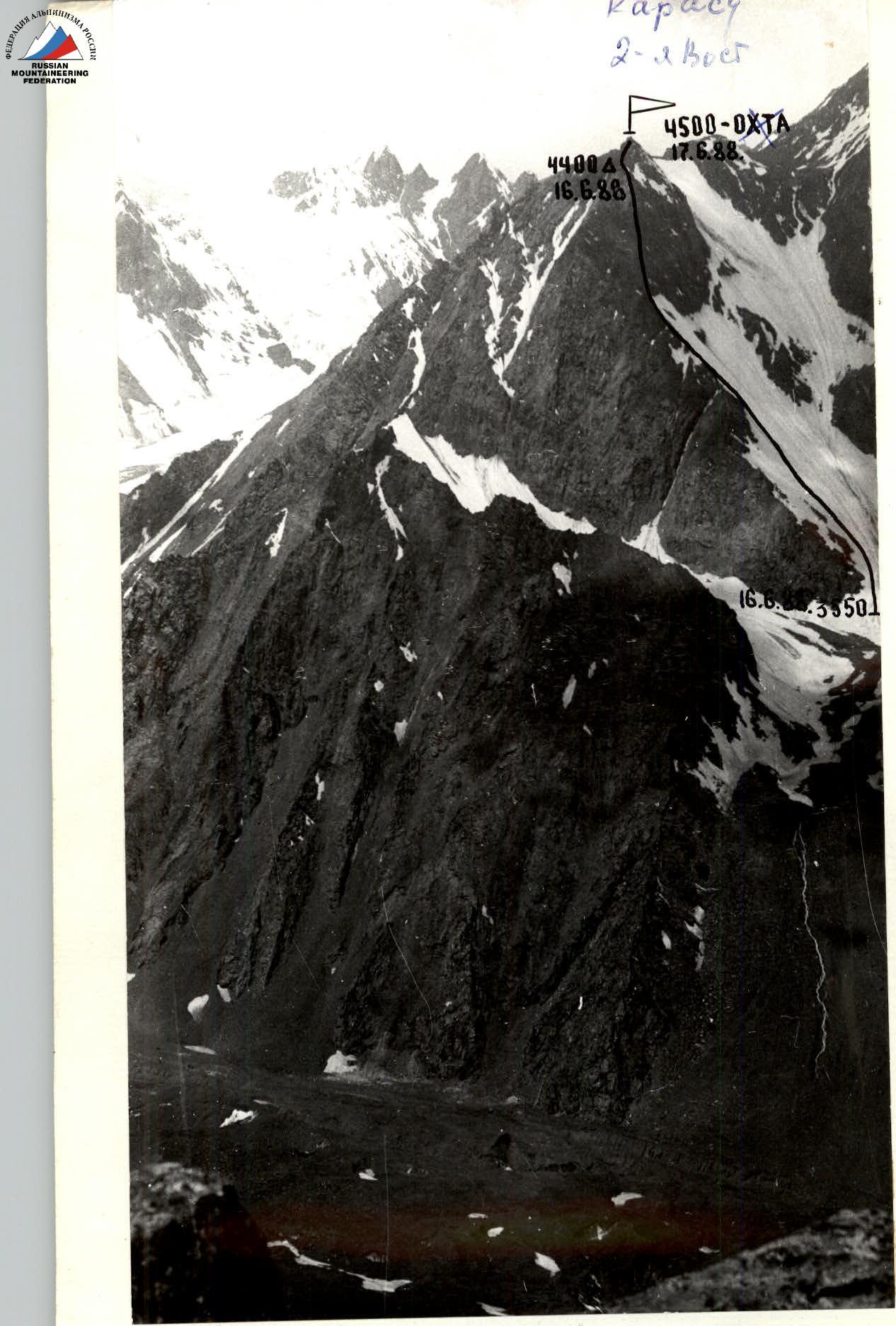
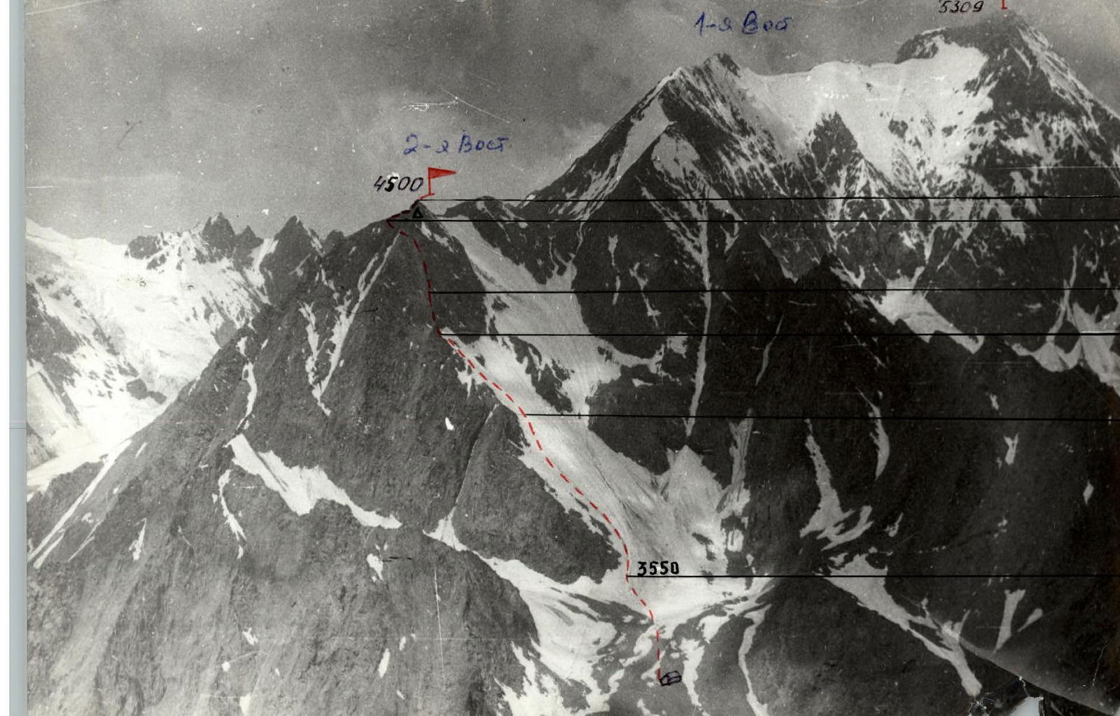
"Belova's route to the summit 4500 m (Okhta) via the North-East ridge, cat. 4A, 1988." The approach to the route goes from the base camps in the Karasu river valley. The path leads to the Asan-Usan glacier, then move in the "pocket" between the glacier and the slopes of Karasu peak towards the Pyramidalny peak. The 4500 m summit (Okhta) is located in the Eastern spur of the Turkestan Ridge. Having approached the cliffs, one should ascend to a small cirque and organize a storm camp on the moraine outcrops there. The approach takes 4 hours.
Section R0–R1. From the storm camp, exit to a wide snow couloir. Ascend to the right of the ridge along the edge of the snow couloir. It is recommended to traverse this section early in the morning, as the slope may be avalanche-prone during the day. 500 m, 30–35°, cat. 2–3. Section R1–R2. Snow slope. 200 m, 35–50°, cat. 3. Section R2–R3. Exit to the rocky ridge. The rocks are quite steep, heavily destroyed. 200 m, 50°, cat. 4. Control tower. Section R3–R4. Crux section. The North-East ridge is a heavily dissected rock wall; climbing goes through a natural "corridor" up to 5 m wide. Caution is required both when working as a leader and on the belay due to the possibility of rockfall. 240 m, 70–80°, cat. 5. Section R4–R5. From the ridge, exit to the pre-summit ridge. Here, on the shoulder, there is a convenient area for an overnight stay. On the ridge, the first gendarme is bypassed on the right along a steep snow slope, and the second one is overcome "head-on". 150 m, 40°, cat. 3, then along a gentle snow ridge to the summit. Descent. The descent goes along the Eastern ridge to the snow couloir, then along the snowfield to the storm camp site.
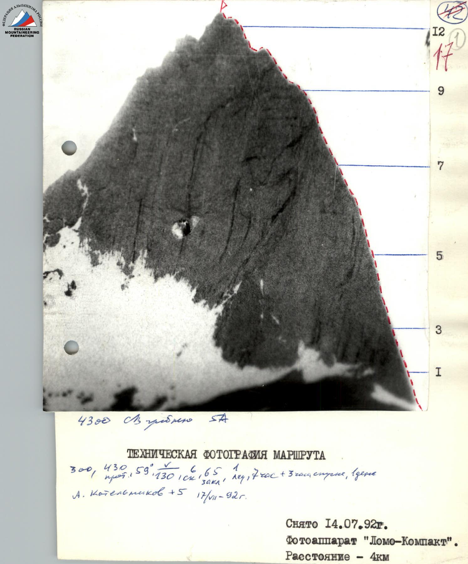
Taken on July 14, 1992. Camera "Lomo-Compact". Distance — 4 km.