Ascent Passport
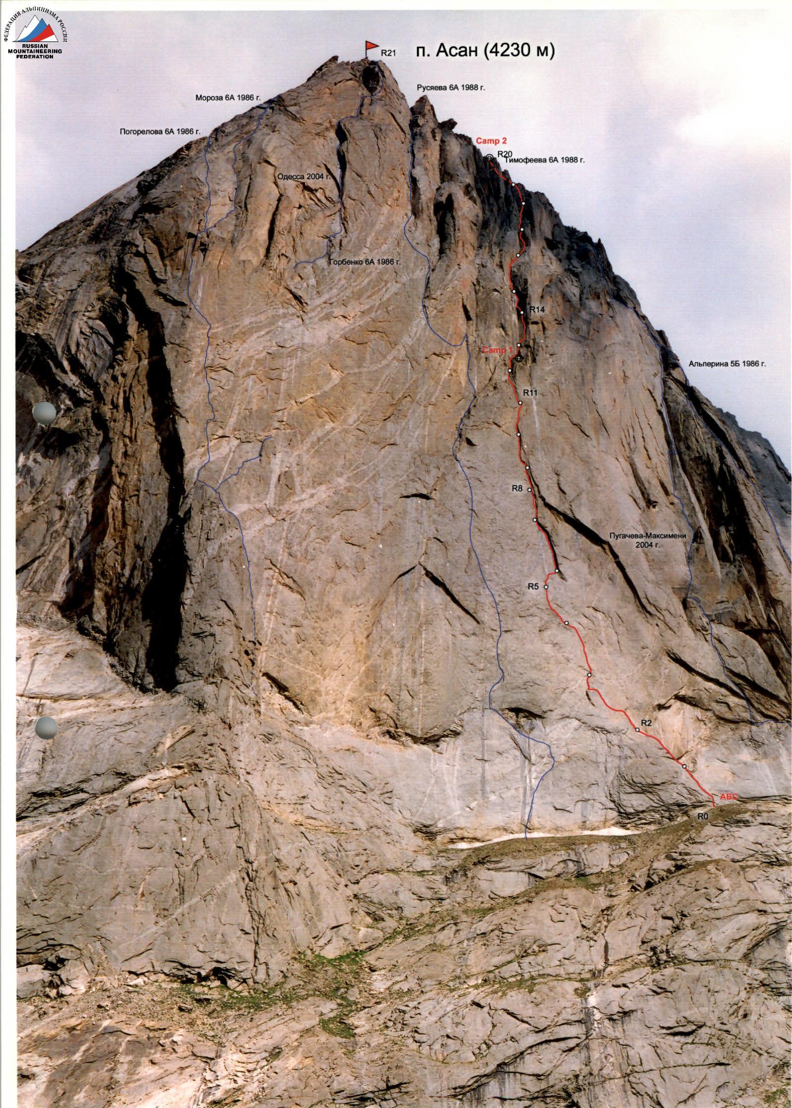
- Pamir-Alay, Karavshin valley, 5.4.3
- Peak Asan, Timofeev's route through the center of the NW wall.
- 6A category of difficulty
- Route type: rock
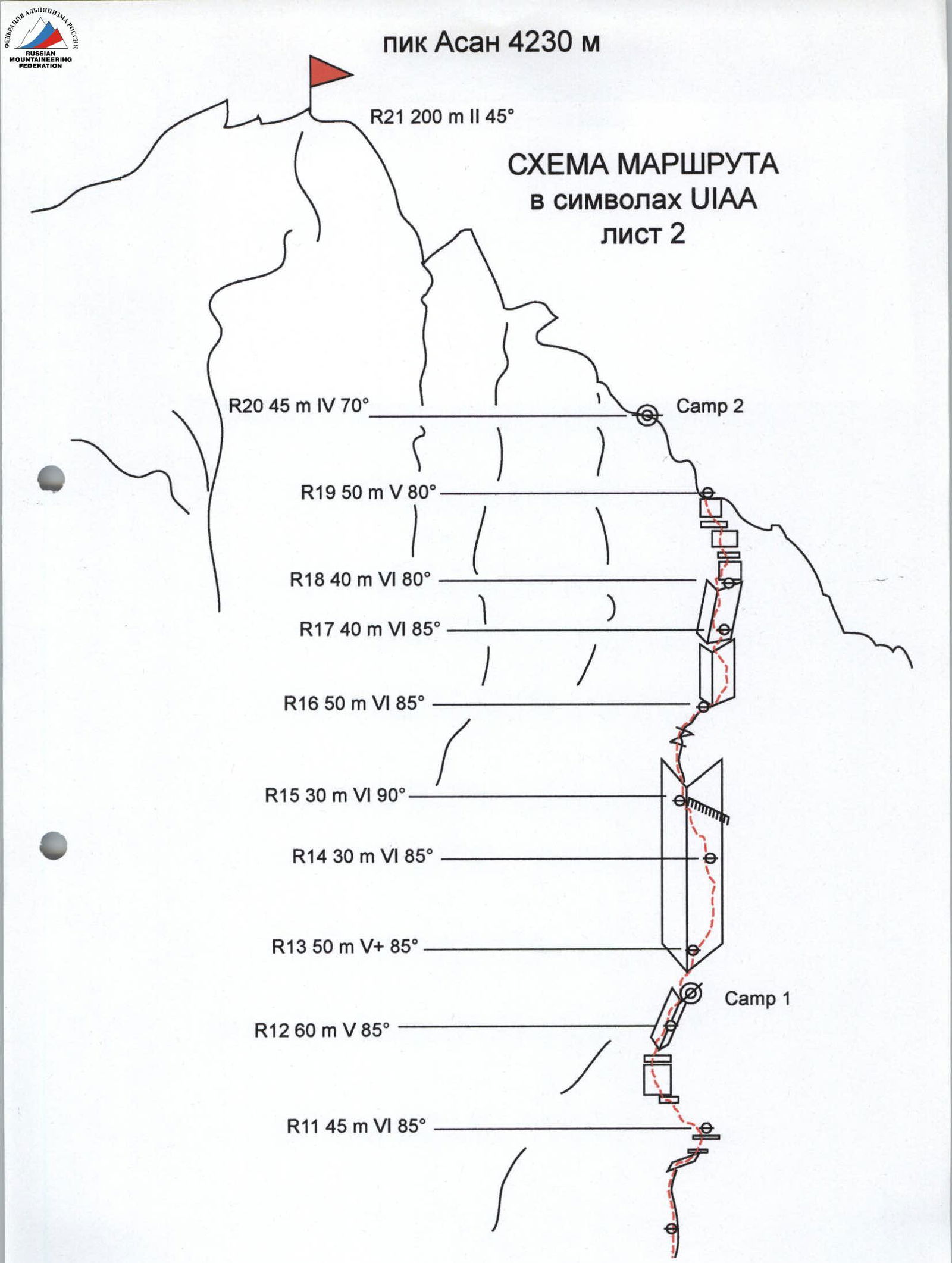
- Route elevation gain: 930 m (3300–4230)
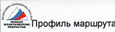
- Route length: 1110 m
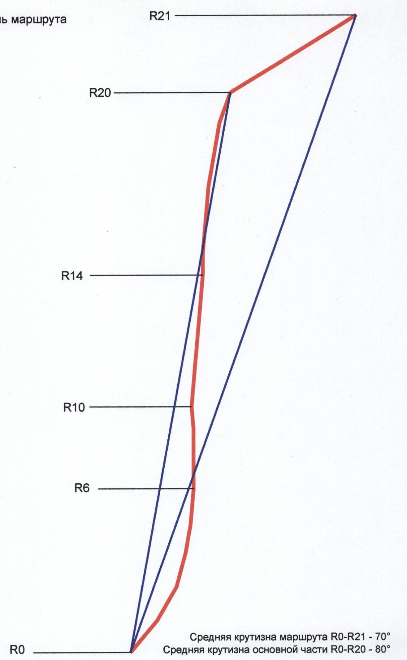
Length of sections: cat. diff. V — 215 m, cat. diff. VI — 635 m. Average slope: main part of the route — 80°, entire route — 70°. Hooks left on the route: total — 2; incl. bolted — 2. Hooks used on the route: bolted stationary — 35, incl. artificial aids — 30; bolted removable — 0, incl. artificial aids — 0. Total artificial aids used — 150. Team's travel time: 25 hours, 5 days
- Team leader: Mogila Vladimir Fedorovich — MS
- Participants: Zagirnyak Mikhail Vasil'evich — MS, Lavrinenko Alexander Vadimovich — CMS, Nikolaev Vadim Valer'evich — CMS, Cheban Viarel Ivanovich — 1st sports category
- Coach: Gorbenko Mstislav Mstislavovich — ZMS, ZTU
- Approach to the route: 7:00, August 8, 2004 Reached the summit: 9:00, August 12, 2004. Returned to Base Camp: 17:30, August 12, 2004
Route Profile
Peak Asan 4230 m
 Team's movement schedule by sections:
-
August 8, 2004 from 7:00 to 15:00 — initial route processing (sections R0–R5)
-
from 15:00 — rain
-
August 9, 2004 — second day of processing (R5–R8)
-
from 16:00 — rain
-
August 10, 2004 — sections R8–R14 completed August 11, 2004 — sections R14–R20 completed August 12, 2004 R20–R21 from 8:30 to 9:00
-
at 9:00 — reached the summit
-
at 10:30 — began descent
-
at 17:30 — returned to base camp