Ascent Record
- Turkestan Range, Pamir-Alay region, Karavshin-Karasu gorge, №5,4,3 according to KVGK
- Peak Asan (4230 m)
- Pogorelova route via the left part of NW wall, 6A category of complexity
- Route type: rock
- Route elevation gain: 1000 m Route length: 1100 m Section length: V category of complexity 625 m, VI category of complexity 345 m Average steepness of the route: 78°
- "Hooks" left on the route: total 2, including 2 pitons
Used on the route:
- rock pitons: 125 (41)
- chocks and friends: 212 (102)
- stationary pitons: 19 (including 17 fif)
- anchor hooks: 128 (75) Total artificial points of support used: 233
- Team's climbing hours:
- to the summit: 42 h
- descent: 7 h
- Team leader: Krivosheev Maxim Leonidovich, MS
Team members:
- Veretennin Denis Anatolievich, MS
- Kustov Andrei Viktorovich, CMS
- Coaches:
- Krivosheev Maxim Leonidovich, MS
- Skaller Grigory Leontievich, CMS
- Departure to the route: 7 h 15 min August 3, 2005 Reach the summit: 12 h 00 min August 6, 2005 Return to Base Camp: 20 h 35 min August 6, 2005
- Organization — Irkutsk Region Alpine Federation.
Team leader: Krivosheev M.L. Coaches: Krivosheev M.L., Skaller G.L. 2005
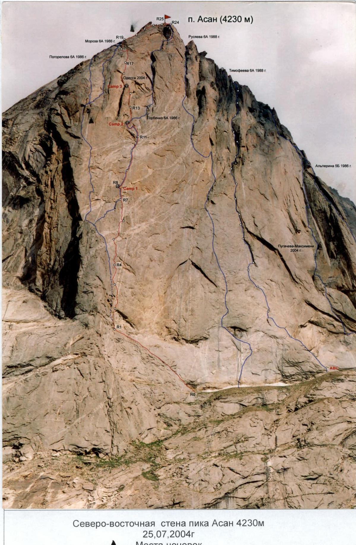
North-east wall of Peak Asan 4230 m July 25, 2004. A — Overnight locations
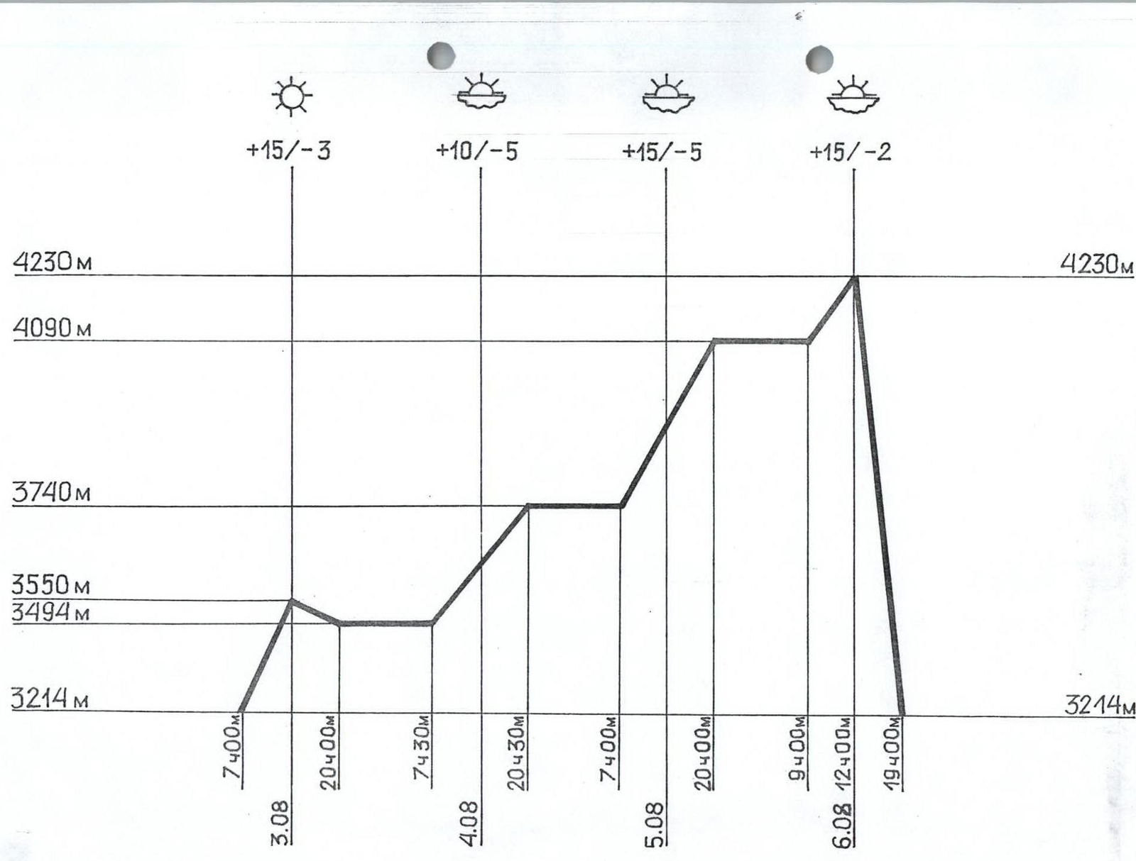 Climbing days — 4
Climbing hours — 42
Climbing days — 4
Climbing hours — 42
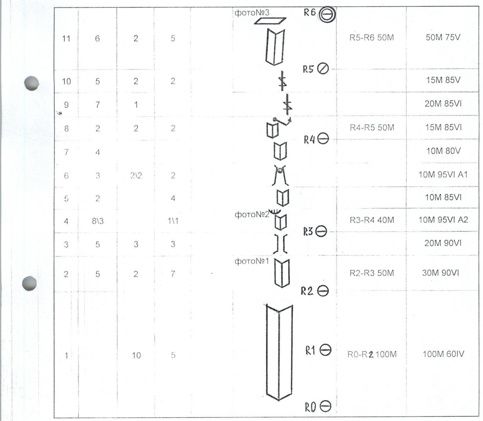
| № sect | chocks friends | pitons | fifa | pitons scheme in UIAA skyhooks | rope length and quantity | length, steepness and complexity of sect. |
|---|---|---|---|---|---|---|
| 1 | 10 | 5 | R1 | R0–R2 100 m | 100 m 60IV | |
| 2 | 5 | 2 | 7 | photo №1 R2 | R2–R3 50 m | 30 m 90VI |
| 3 | 5 | 3 | 3 | 20 m 90VI | ||
| 4 | 813 | 111 | photo №2 R3 | R3–R4 40 m | 10 m 95VI A2 | |
| 5 | 2 | 4 | 10 m 85VI | |||
| 6 | 3 | 212 | 2 | 10 m 95VI A1 | ||
| 7 | 4 | R4 | 10 m 80V | |||
| 8 | 2 | 2 | 2 | R4–R5 50 m | 15 m 85VI | |
| 9 | 7 | 1 | 20 m 85VI | |||
| 10 | 5 | 2 | 2 | R5 | 15 m 85V | |
| 11 | 6 | 2 | 5 | photo №3 R6 | R5–R6 50 m | 50 m 75V |
| 12 | 10 | photo №4 | R6–R7 45 m | 20 m 80V | ||
| 13 | 515 | 212 | 10 m 85VI A1 | |||
| 14 | 818 | 212 | photo №5 | 10 m 95VI A2 | ||
| 15 | 313 | 212 | 5 m 90VI A2 | |||
| 16 | 212 | 313 | R7 | R7–R8 45 m | 10 m 90VI A2 | |
| 17 | 717 | 111 | 313 | 10 m 85VI A2 | ||
| 18 | 111 | 212 | 515 | 10 m 90VI A3 | ||
| 19 | 10\10 | 313 | 10 m 90VI A3 | |||
| 20 | 313 | 212 | 414 | photo №6 R8 | R8–R9 45 m | 15 m 95VI A2 |
| 21 | 616 | 212 | 515 | 12 m 90VI A1 | ||
| 22 | 313 | 717 | 10 m 95VI A3 | |||
| 23 | 313 | 212 | 313 | 8 m 90VI A2 | ||
| 24 | 515 | 111 | 50 m 90VI A2 | |||
| 25 | 20120 | 10\10 | 10\10 | 111 | photo №8 R9 | |
| 26 | 414 | 10\10 | 30\30 | R10 R10–R11 50 m | 50 m 92VI A3 | |
| 27 | 212 | 212 | 313 | 212 | photo №9 R11 R11–R12 45 m | 10 m 90VI A1 |
| 28 | 20120 | 414 | 515 | 30 m 90VI A2 | ||
| 29 | 5 m 40 | |||||
| 30 | 10 | R12 R12–R13 50 m | 30 m 75V | |||
| 31 | 5 | 3 | 313 | photo №10 R12 | 15 m 85VI | |
| 32 | 1 | 1 | 5 m 75V | |||
| 33 | 5 | 2 | 3 | 2 | R13 R13–R14 50 m | 30 m 80V |
| 34 | 5 | 1 | 4 | 20 m 80V | ||
| 35 | 4 | 6 | R14 | R14–R15 45 m | 30 m 85V | |
| 36 | 10 | R15 | 15 m 85V | |||
| 37 | 20 | 30 | 10 | photo №11 R19 | R15–R19 200 m | 200 m 60V |
| 38 | 10 | 20 | 10 | 1 photo №12 R22 | R19–R22 150 m | 150 m 70V |
Route Description
Section №1. Wide inner corner. Many loose rocks. Medium complexity rocks.
№2. The wall section of the route begins. Inner corner consisting of overhanging flakes. We use friends and chocks. Old pitons are encountered.
№3. Vertical chimney, passable by free climbing. Good ledge for belay.
№4. Overhanging inner corner with a small ledge, which is bypassed to the right. Large friends are used for passage.
№5. Small inner corner, passed by free climbing. Anchor hooks are used for belay.
№6. Wide chimney tapering upwards. A plug at the top of the chimney forms a small overhang, which is passed on ATO. Old pitons are encountered.
№7. Fifteen-meter section of the inner corner is passed by free climbing. There is a small ledge for a belay station 1.5 m to the left.
№8. Continuing inner corner ends with a ledge. We swing right to another inner corner. Climbing is complex, using friends, chocks, and anchor hooks for belay.
№9, 10. Almost vertical inner corner consists of a series of flakes turning into an overhang. Climbing is complex. The overhang is bypassed to the left. The continuation of the corner leads to an uncomfortable belay spot.
№11. The rock becomes less steep. The inner corner leads to a huge ledge (top of OGURTSA). Friends are used for passage. We set up a tent on the ledge at 15:00.
№12. Twenty-meter slab with a crack of the same size is passed by free climbing. Friends and chocks of 2 and 3 sizes are actively used.
№13, 14. Inner corner turning into an overhanging flake. Passed on ATO. Friends and old pitons are helpful. We move to the left side of the flake.
№15. We enter another inner corner and make a hanging belay station at the end.
№16. New inner corner gradually turning into a flake.
№17. Overhanging flake going to the right. Friends and anchor hooks are helpful.
№18. At the end of the flake, we pass a small ledge, followed by a small wall. Climbing is extremely complex.
№19, 20. Not clearly defined inner corner turning into a flake. Climbing is complex, on the verge of a fall. The flake ends with a small ledge, under which we organize a hanging belay station.
№21. We swing left for 5 m to a vertical inner corner. Along the corner, we approach a sloping meter-long ledge, which is passed head-on.
№22. Vertical wall is passed from right to left. The wall leads to a small ledge with pitons.
№23. Overhanging slab is passed using anchor hooks and small friends.
№24. Inner corner turning into a flake. Friends and chocks are used. We organize a belay station.
№25. Vertical 50 m slab is passed along a 2–3 cm wide crack using friends and chocks. The belay station is hanging.
№26. Continuation of the vertical slab. The crack has narrowed to 0.5–1.0 cm. Everything is done on ATO using fif, anchor hooks, and channels. The belay station is hanging.
№27. Flake expanding upwards. Large friends are helpful during passage. After 10 m, the flake ends with a 2 m long and 25 cm wide ledge. We hammered two stationary pitons and organized a hanging overnight stay on them.
№28. Swing 5 m to the left. Then up along a wide inner corner under a ledge. The ledge is bypassed to the right. Climbing using ATO.
№29. Exit to a sloping ledge. Good spot for a belay station.
№30. Wide 30 m chimney is passed by free climbing.
№31. The chimney becomes almost vertical. At the exit from the chimney, there is a plug, for which ATO is used.
№32. Inner 5 m corner with a good belay spot at the end.
№33. 30 m slab with many cracks is passed by free climbing.
№34. Vertical 20 m chimney leads to a small sloping ledge. Good spot for a belay station.
№35. Almost vertical slab, passed from right to left, rests on a small ledge. Complex free climbing, with good cracks for friends.
№36. Ten-meter inner corner leads to the eastern ridge. Friends are used for belay.
№37. 200 m up the eastern wall is passed along inner corners alternating with small slabs. Climbing is complicated by wet rocks and icy sections in some places. We reached a 1 m wide sloping ledge and organized an overnight stay.
№38. Along inner corners, the steepness of which gradually increases, we reach the summit at 12:00. The weather is good. Descent via 4B. At 19:00, we descended from the wall. At 20:00, we were back at Base Camp.
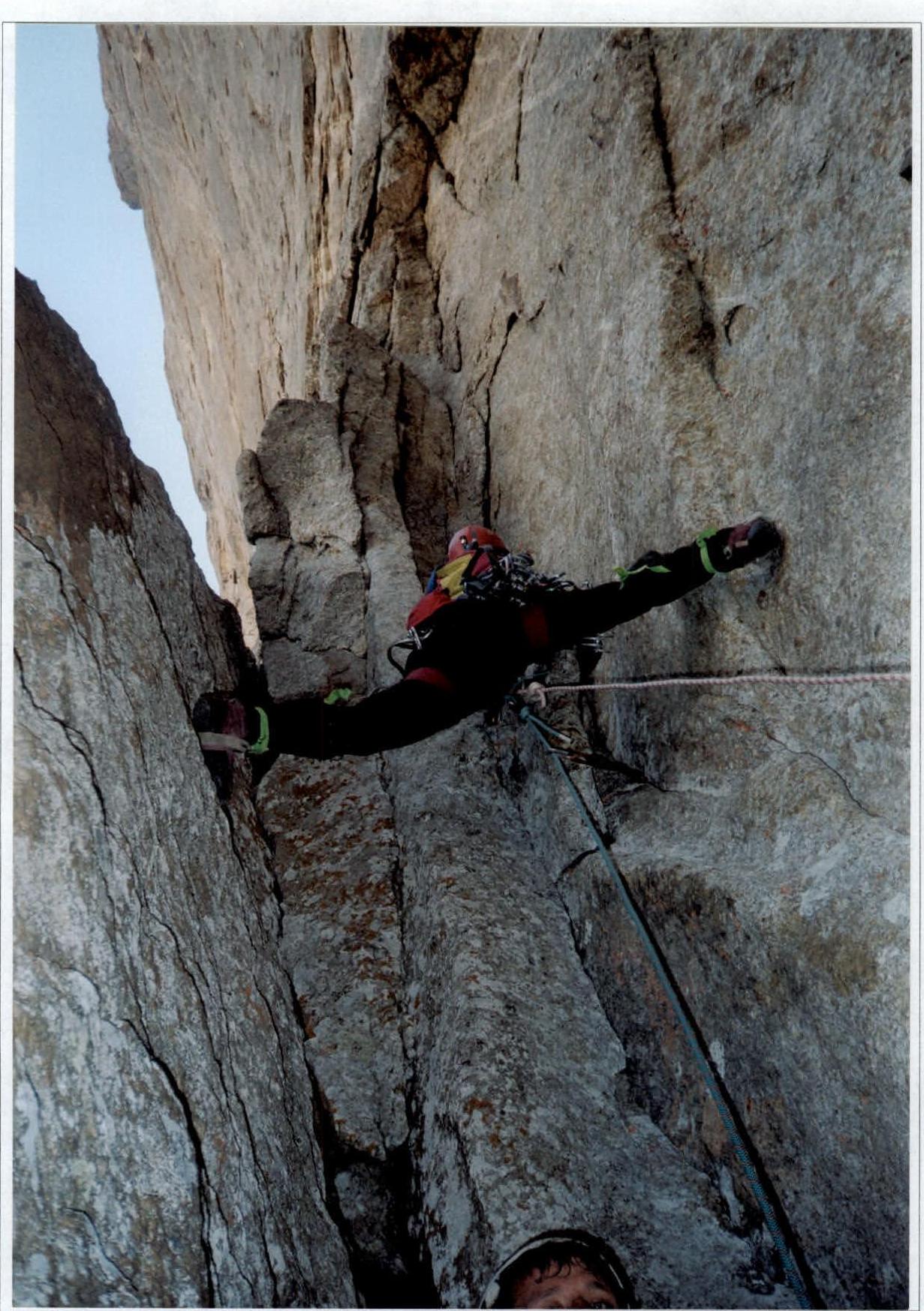
Photo №2. Section №4 is led by Krivosheev M.

North-east wall of Peak Asan 4230 m
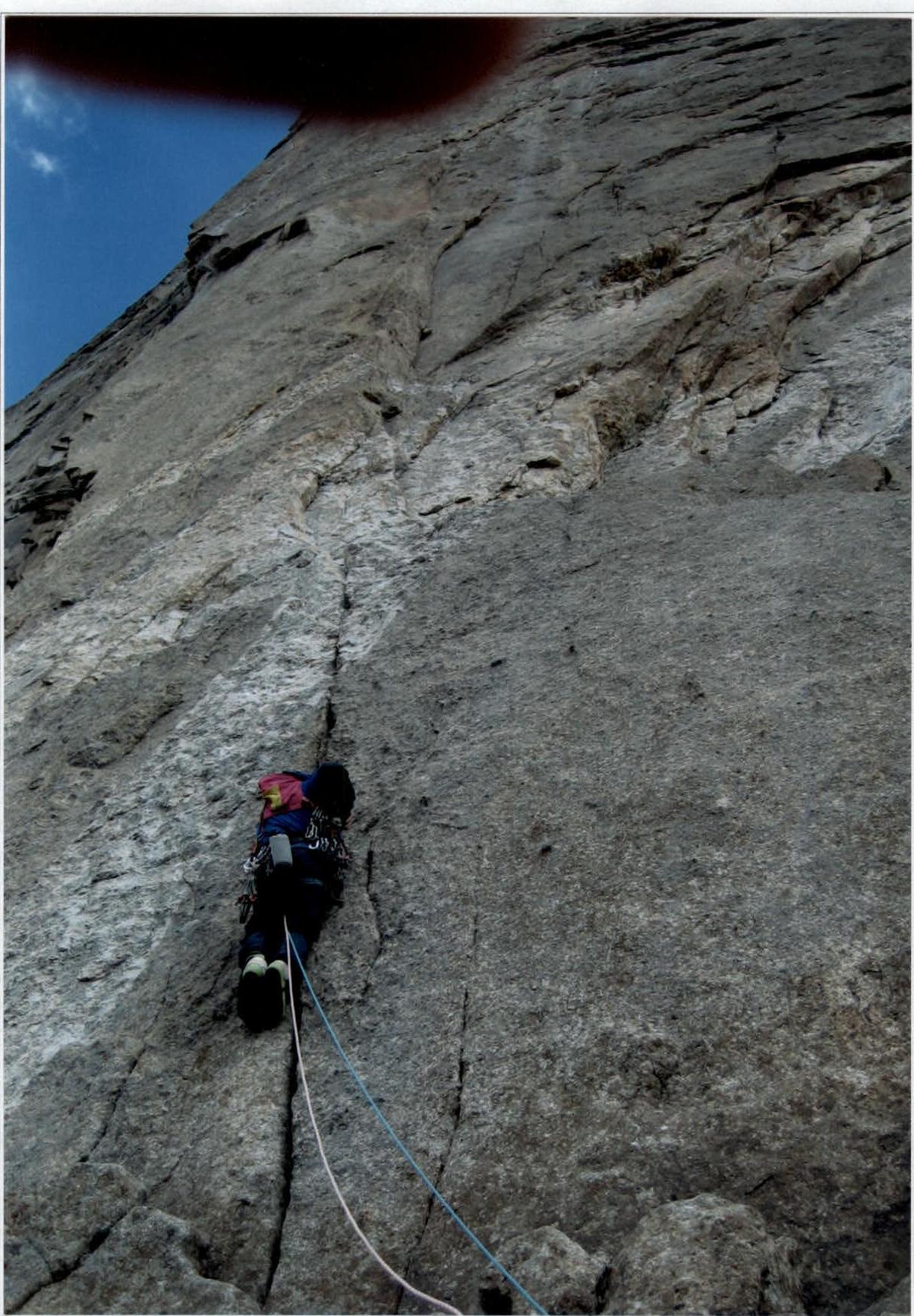
Photo №4. Section №12 is led by Kustov A.
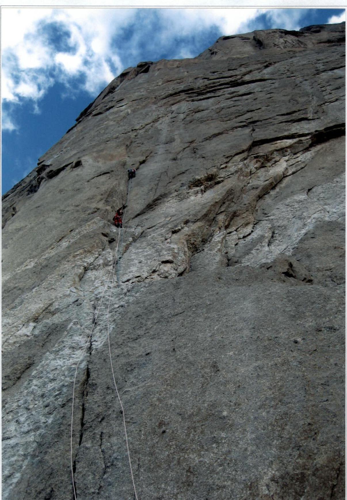
Photo №5. Section №14 is led by Kustov A., belayed by Veretennin D.
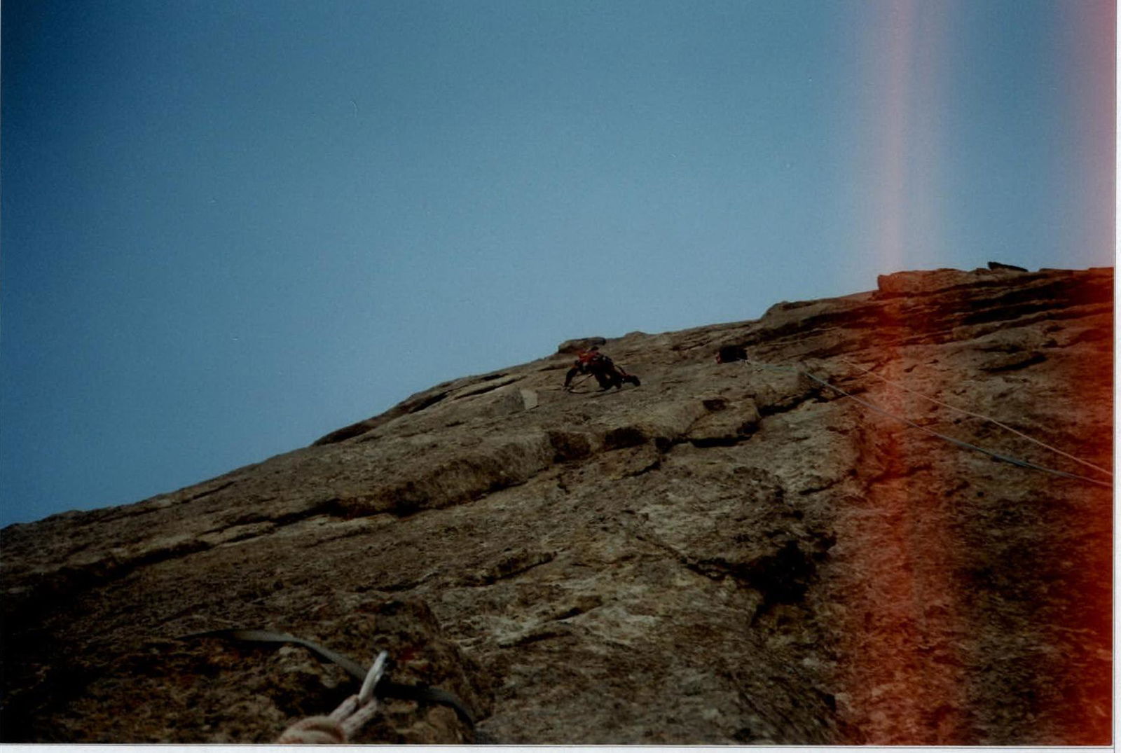
Photo №6. Section №20 is led by Veretennin D.
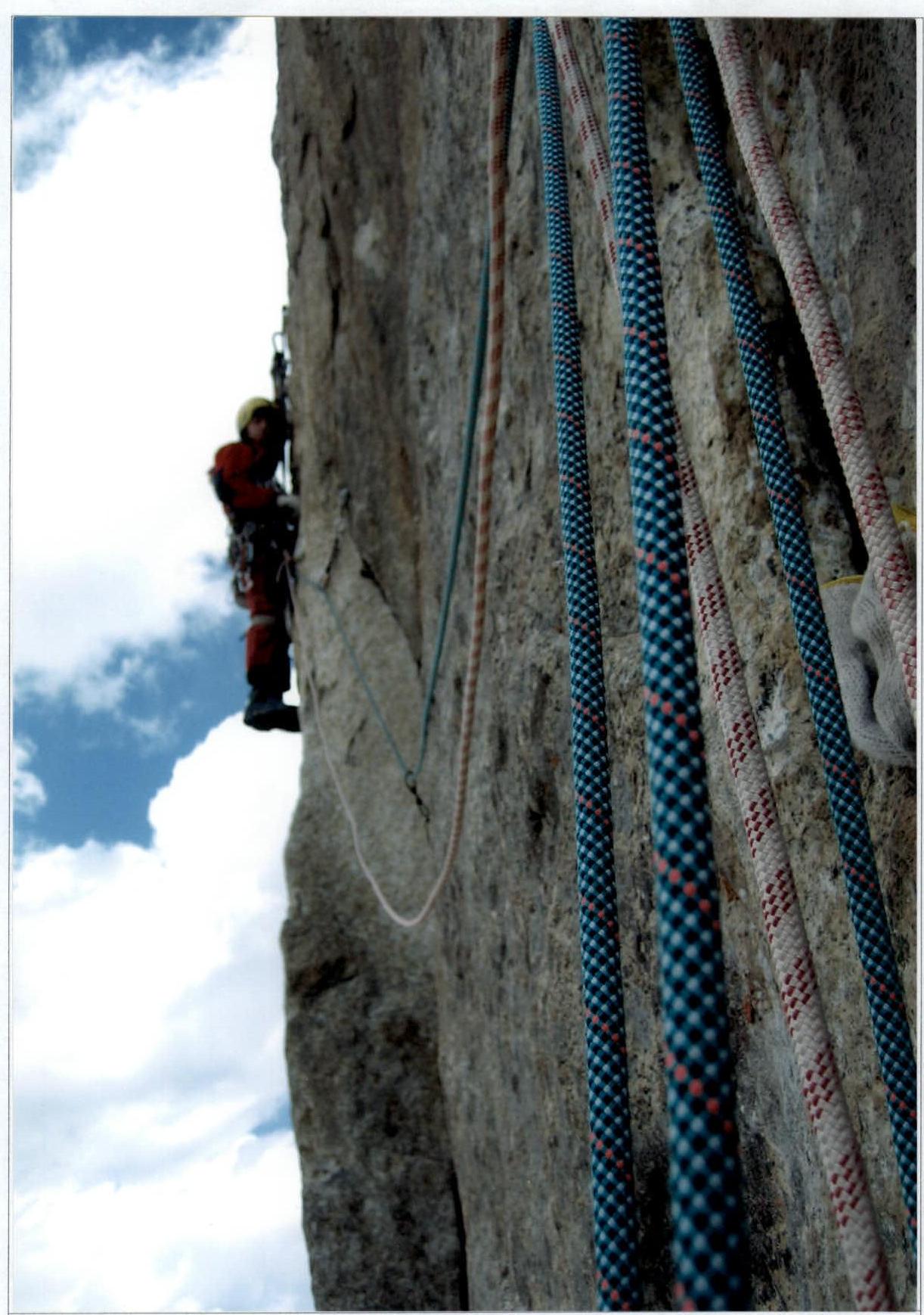
Photo №7. Section №22 is led by Veretennin D.
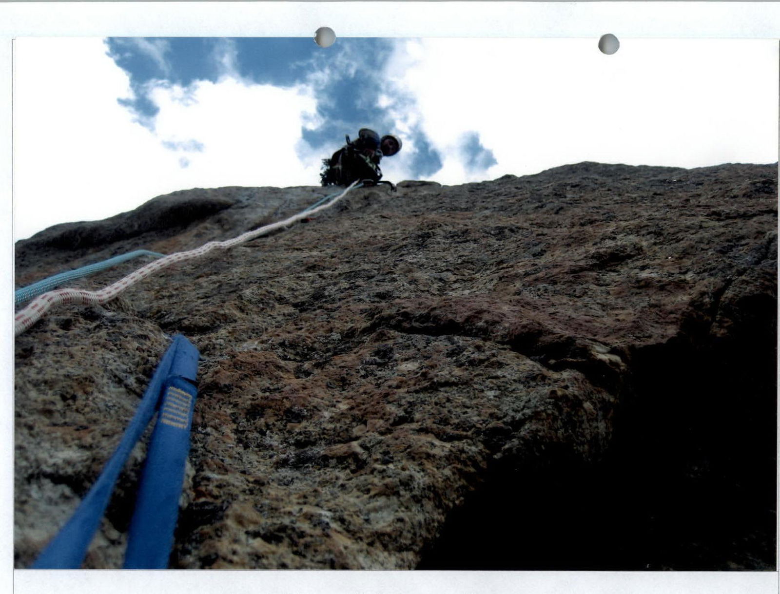
Photo №8. Section №25 is led by Krivosheev M.
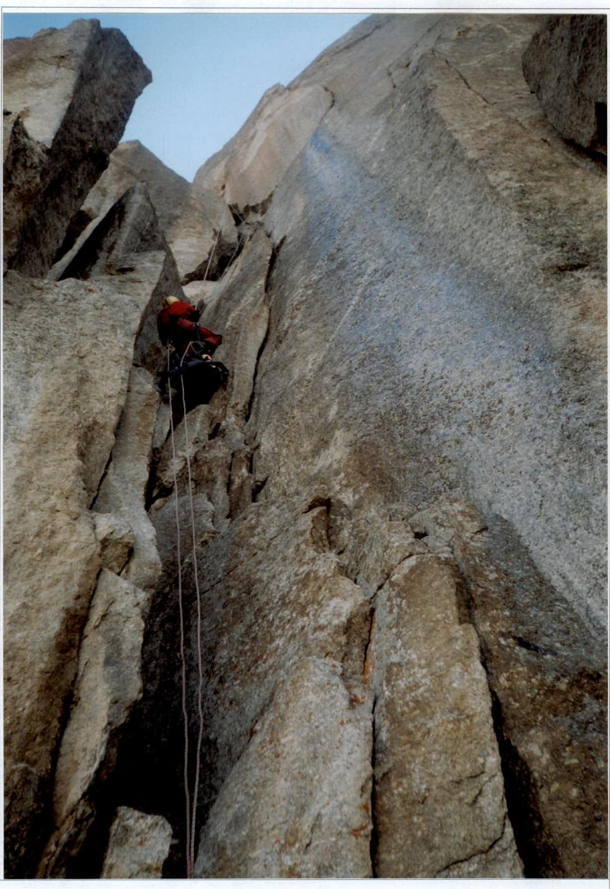
Photo №10.111. Photo №30 on safe-rope Veretennin D.
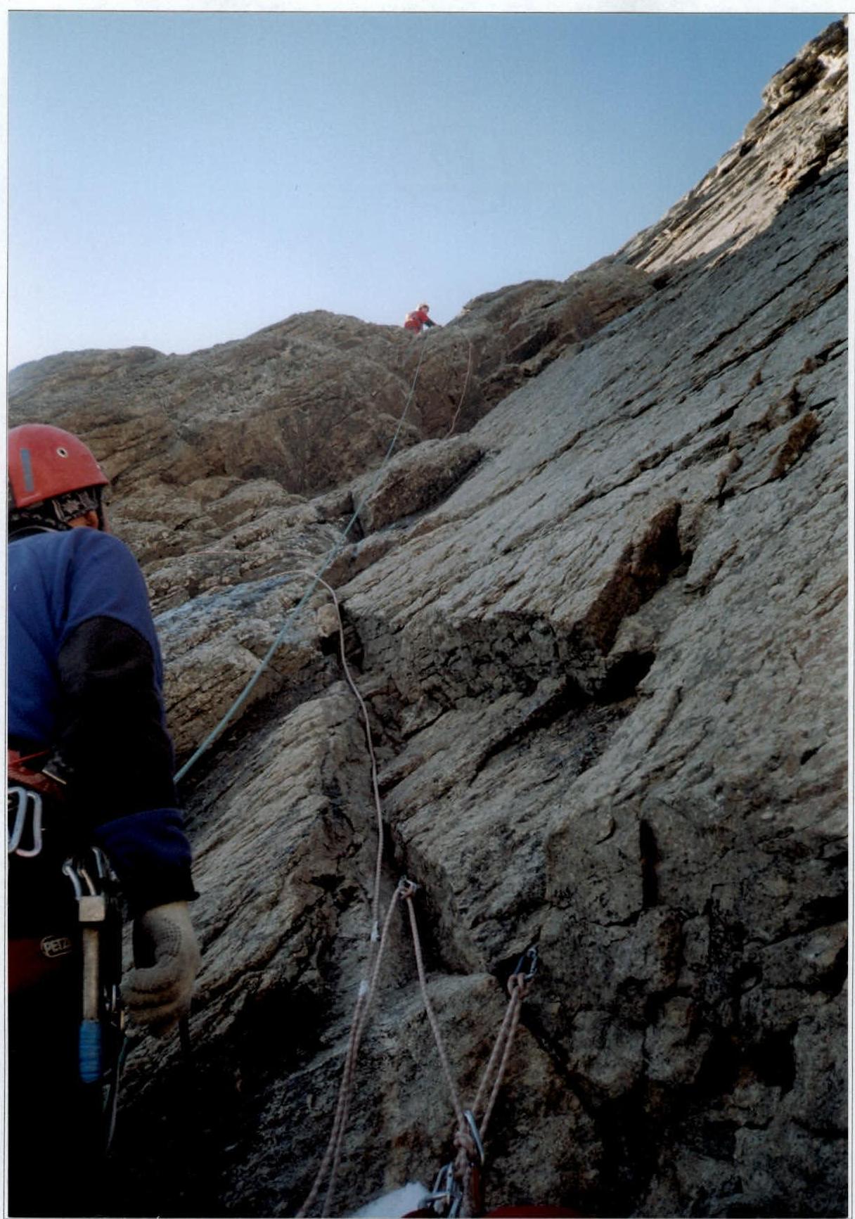
Photo №12. Section №38 is led by Veretennin D., belayed by Krivosheev M.