St. Petersburg Climbing Championship 2021 (high-altitude technical class)
Report on the ascent to the summit of Asan (4230 m) via the left part of the E wall, 5B category
The route was completed by the team of the Alpine Federation of St. Petersburg
Ascent Passport
-
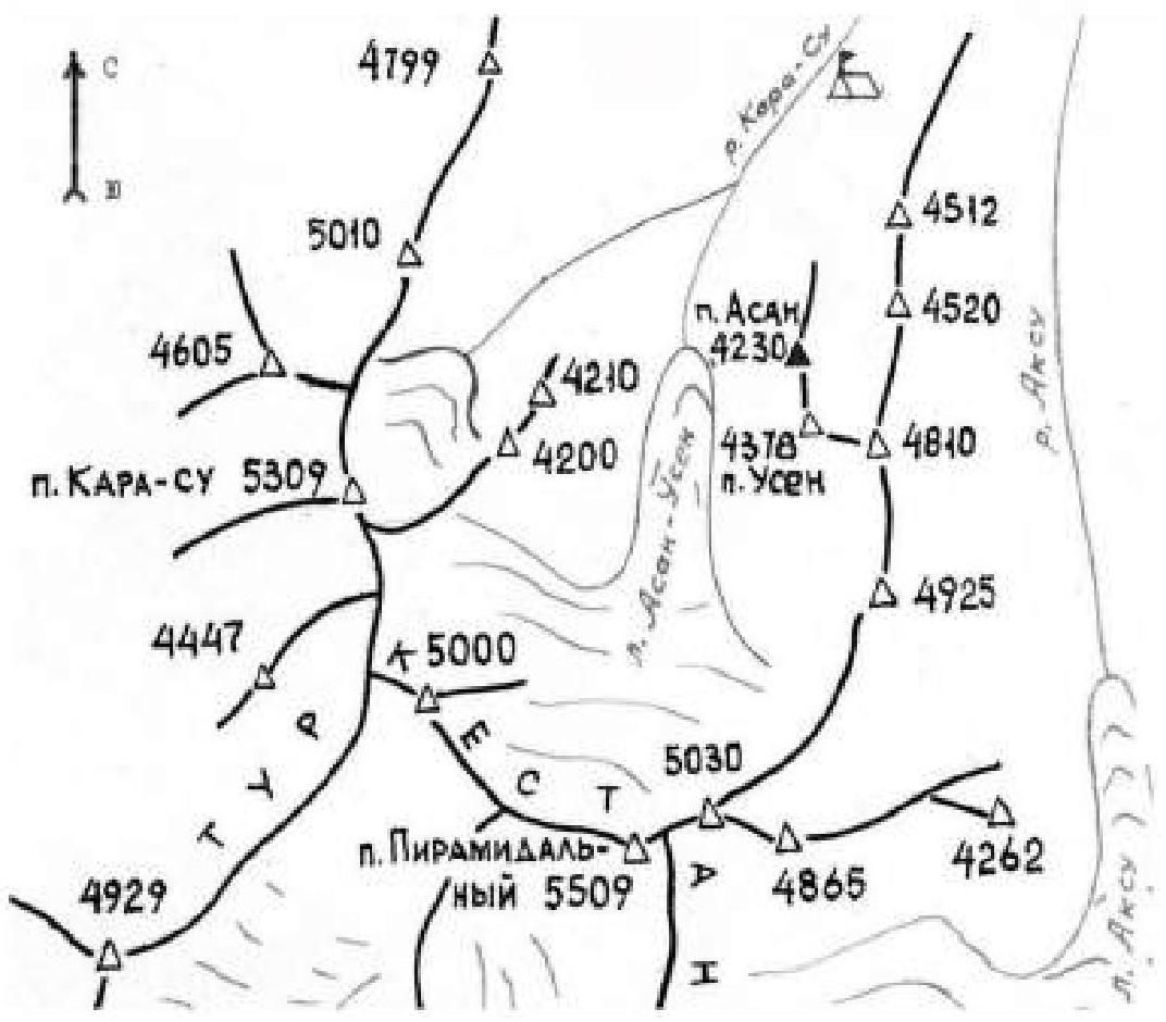
Gissaro-Alay, Karavshin valley
Section No. 5.4.3 of the classifier for mountain peak routes
-
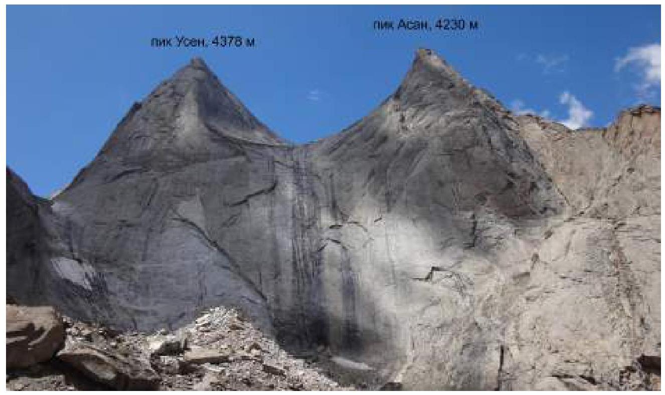
Asan peak, 4230 m, via the left part of the E wall (M. Gorbenko route, 1988)
-
Category: 5B
-
Route type: rock
-
Height difference: ~700 m
Route length: ~1200 m. Length of the wall section (before reaching the ridge): ~800 m
Section lengths: IV category - 200 m, V category - 300 m, VI category - 20 m
Average slope: wall section ~70°, entire route ~60°
-
Pitons left on the route: total – 0, including bolted pitons – 0
Total points used on the route: not counted. Total artificial aids used: 2
-
Team's working hours (until the summit): 21 h 10 min, 2 days
-
Leader: Pilshtchikova Nadezhda, Candidate Master of Sports
Participants: Kovalenko Dmitry, 1st sports category
-
Coaches: Kornev V. M., 1st sports category
-
Departure from the base camp in the Kara-Suu valley: July 25, 2021, 12:30
Start of work on the route: July 26, 2021, 7:00. Summit reached: July 27, 2021, 14:40. Return to the base camp: July 27, 2021, 23:20
Responsible for the report: Pilshtchikova N., yalie@yandex.ru
Area Map
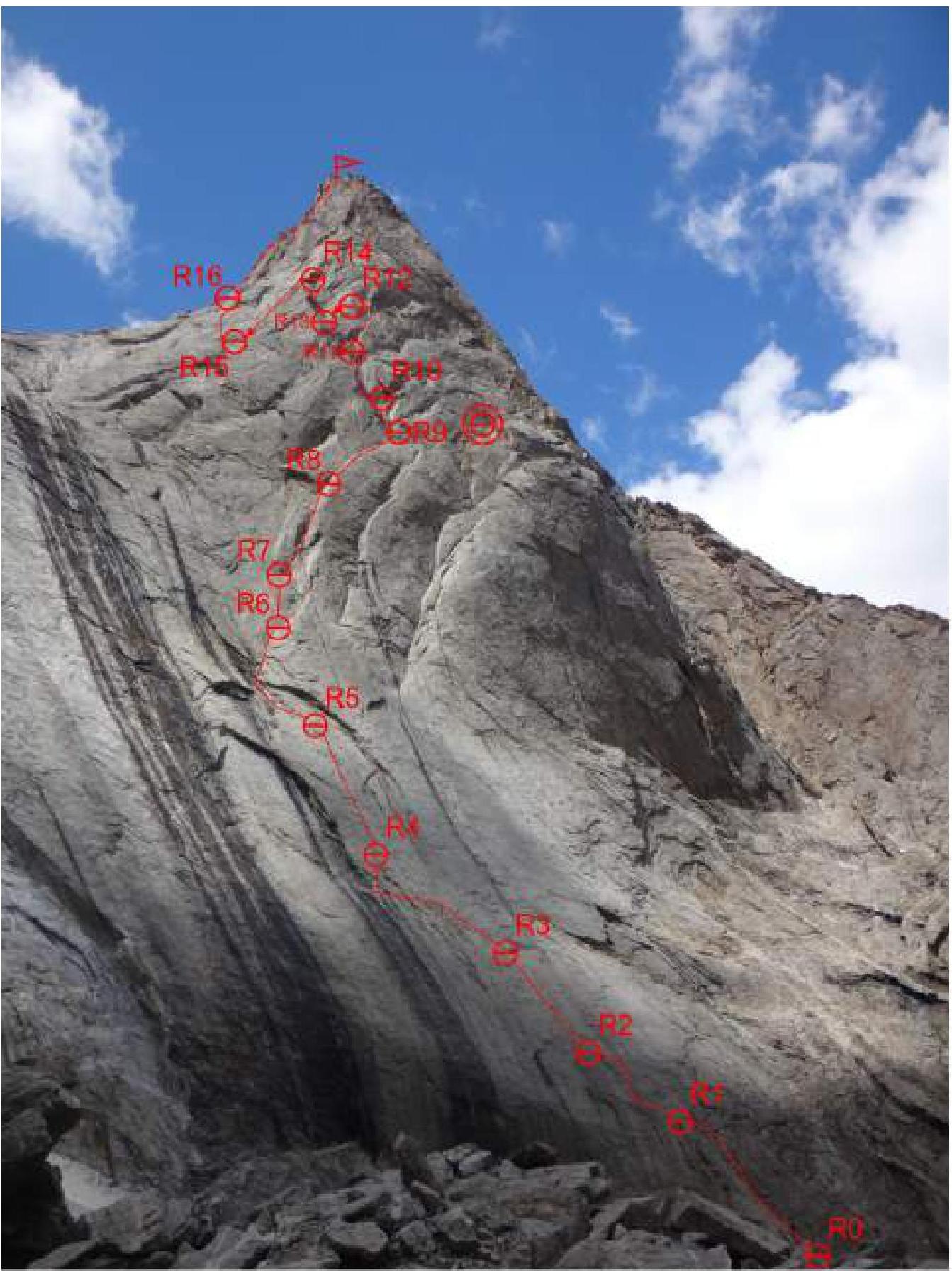
General Photo of the Summit
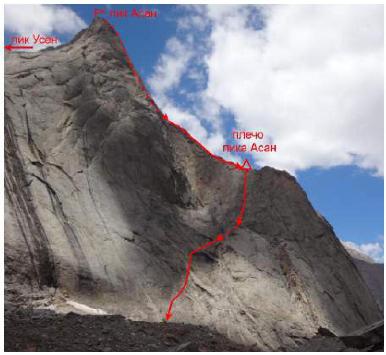
View of the E wall of peaks Usen and Asan from the cirque 4810
Technical Photo
Route Profile
Route Diagram in UIAA Symbols

| Section | Route Line | Difficulty | Length, m | Slope, ° |
|---|---|---|---|---|
| R17–R18 | II–III | 400 | 25–45 | |
| R16–R17 | I | 100 | 20 | |
| R15–R16 | V | 60 | 70 | |
| R14–R15 | rappel | 50 | 60 | |
| R13–R14 | IV | 30 | 70 | |
| R12–R13 | rappel | 15 | 80 | |
| R11–R12 | I | 10 | 5 | |
| V+ | 20 | 85 | ||
| IV | 15 | 70 | ||
| IV | 10 | 70 | ||
| R10–R11 | VI | 20 | 85 | |
| III | 20 | 60 | ||
| R9–R10 | IV | 10 | 70 | |
| R8–R9 | I | 15 | 20 | |
| II–III | 20 | 50 | ||
| IV | 10 | 70 | ||
| III | 15 | 60 | ||
| R7–R8 | IV | 15 | 70 | |
| V+ | 25 | 80 | ||
| V | 20 | 80 | ||
| R6–R7 | IV | 30 | 75 | |
| R5–R6 | V | 30 | 80 | |
| IV | 15 | 70 | ||
| IV | 15 | 30 | ||
| R4–R5 | V+ | 60 | 80 | |
| R3–R4 | 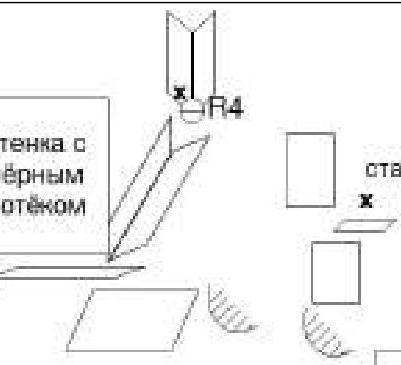 | IV | 15 | 75 |
| V+ | 35 | 70 | ||
| R2–R3 | V- | 60 | 70 | |
| R1–R2 | IV+ | 40 | 70 | |
| R0–R1 | III | 60 | 60 |
Route Description
Approach
From the base camp in the Kara-Suu valley, follow the trail through the frozen mudflow and forest to the abandoned kosh. From there, ascend towards the walls of peaks Kotina and 1000-letie Kreshcheniya Rusi. Along the walls, follow the trail into the cirque of peak 4810; after the ascent, cross the moraines (large boulder scree), moving towards peak Asan. Follow the stream bed, cluttered with stone blocks, to the base of the eastern wall.
Overnight stay under the traditional descent from Asan, under a rock in the riverbed (if looking at the wall, from the black gully to the right of the rappels); there is a dry stream bed that leads to the rock, and under it is the overnight stay. From the overnight stay to the start of the route is a 10-minute walk across the scree.
R0–R1
To the summit of the buttress, then slightly higher and to the left onto a ledge, 60 m, III.
R1–R2
From the ledge, slightly upwards, moving strongly to the left, to the edge of the "attached" slab, then upwards onto the slab.
- Careful climbing at the beginning
- Anchor protection
- Rope drag
40 m, IV+.
R2–R3
Upwards, slightly moving to the left, to a shelf.
- Careful climbing on slabs
- Varied protection
There is a bolt and a rusty anchor at the belay station.
60 m, V-.
R3–R4
Upwards to the left at 45° along a system of internal corners from "resounding" slabs (mark above the base of the quartz internal corner). Enter the internal corner, find a bolt there, and secure it with your own points (belay station on a small ledge). Protection is problematic; anchors are needed. Rope drag.
60 m, V+.
Team's variation:
- Upwards to the left along a system of internal corners, 35 m, V+, to an old bolt with a rappel ring
- From the bolt, a pendulum swing to the left and down to a sloping ledge with a black streak at the base of the quartz corner
- Then upwards along the corner, 15 m, IV, to a bolt.
Belay station on a bolt and anchors.
R4–R5
Upwards along the corner, then along slabs (anchor and small stopper protection) to the next corner (slightly to the left) to a ledge with a bolt and a piton, 60 m, V+.
R5–R6
Be careful here; it's easy to take a wrong turn! From the ledge, move upwards to the left towards a streak, 15 m, IV, then upwards between the streak and the cornice, 15 m, IV, and sharply turn right into an internal corner, 30 m, V, to a ledge. From the ledge, a chimney (a crack in the shape of a nose) is visible; move towards it. Possible variations: continuing along the streak or moving right along the ledge are both incorrect. The "nose" is between them.
R6–R7
Upwards along the corner-crack, 30 m, IV, to a ledge, belay station on the ledge on a large block.
R7–R8
Along the ledge to the right to the base of a crack-chimney, upwards along it, 20 m, V. If you exit the chimney to the right onto a ledge, you can find a bolt (8 mm without an eye). Further up the chimney, 25 m, V+, climbing eases, the chimney turns into a wide internal corner, upwards along the corner, 15 m, IV, belay station on a small ledge on anchors (there is an old piton).
R8–R9
Continue moving along the internal corner to a chimney (15 m, III), then along the chimney; at the narrowing, exit to the wall on the right, 10 m, IV. Continue moving along the internal corner-ledge to an osypnaya ledge (scree ledge), 20 m, II–III. Along the osypnaya ledge, approach the base of a wide internal corner, 15 m, I.
If you move right along this ledge for 5 minutes with a slight ascent, you'll reach an overnight stay; there may be ice in the cracks.
R9–R10
From the huge internal corner, upwards to the right, 10 m, IV, then along ledges, 20 m, III, to the base of an overhanging internal corner.
R10–R11
Along the overhanging corner with wedged blocks, 20 m, VI, 10 m, IV. Belay station on a ledge on a block; rockfall hazard.
R11–R12
You need to move upwards, but due to rockfall hazard, it's better to move right and upwards along an internal corner, 15 m, IV, 20 m, V+, exit to a ledge, then 10 m to the left to a rappel ring.
R12–R13
Rappel to the left and down, 10–15 m, to a ledge at the base of an internal corner.
R13–R14
Along the internal corner with large blocks, 30 m, IV, upwards to a ledge protected by a cornice ("room"). Overnight stay possible here. The ridge between Asan and Usen is visible.
R14–R15
Rappel to the left onto a ledge, 50 m.
R15–R16
To the left and upwards along slabs with sparse protection (rope drag) for the entire rope length, 60 m, V.
There's an alternative variation for sections R14–R16:
- Rappel for 20–30 m to a ledge under the base of an internal corner with a developed system of cracks.
- Then move upwards along the corner, bypassing a small bastion on the right, 60 m, V.
- Further descent along a gentle gully to scree.
According to reviews, this variation has good protection and enjoyable climbing.
R16–R17
Carefully exit to the left onto scree, walk on scree to the ridge.
R17–R18
Along the ridge to the summit — 1.5 hours. There's a platform for an overnight stay before the summit; snowfields are possible in the crevices.
Descent
Descent from the summit along the north-eastern ridge towards the cirque 4810. After about 50 m, find a rappel ring. From the ridge, 6 rappels along the northern wall to the shoulder of peak Asan, moving towards the cirque 4810 (rappel rings "lead" to the left; it's essential not to miss the exit to the shoulder). Further, you can make three to four "horizontal" rappels along the shoulder or descend by climbing (I–III) to a large cairn. From it, 3 rappels to the southeast towards the cirque of peak 4810; you can continue with rappels or descend by climbing (I–IV). Then walk on scree. The descent leads back to the start of the route.
Descent Diagram
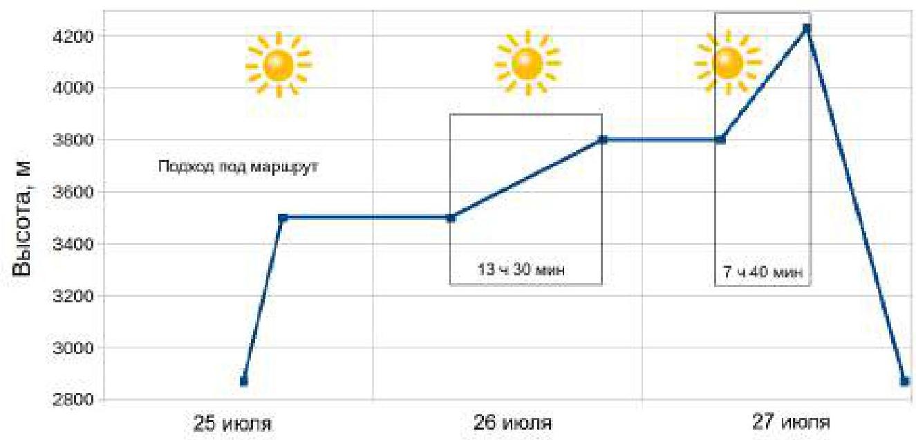
Ascent Schedule and Weather Conditions
Team Actions
July 25, 2021
Departed from the base camp in the Kara-Suu valley at 12:30, reached the cirque of peak 4810 by 15:00. Around 16:00, set up an overnight stay under the start of the route. Managed to find the site described in the guidebook under a large rock in the riverbed, ~100 m above it; you can reach water (the river flows under a jumble of stone blocks).
July 26, 2021
Departed from the overnight stay at 6:50, started work on the route at 7:00; Pilshtchikova N. leads. By 20:30, reached a large osypnaya ledge (R9) and set up an overnight stay. The overnight stay is lying down; there are several sites for tents on the ledge, but no water.
July 27, 2021
Continued movement along the route at 7:00; Kovalenko D. leads. Reached the ridge between Asan and Usen by 13:00, and the summit by 14:40. Retrieved a note from Panov A. dated July 27, 2021 (Alperin route, 5B). Descended under the route by 21:20 and decided to continue the descent to the base camp, arriving at 23:20.
Equipment Used
2 ropes (main dynamic 60 m and half 70 m), 14 quickdraws (15–60 cm), 2 station slings (120 cm), set of nuts (5 pcs), set of cams (13 pcs, from C3 to #3), 6 anchors, 2 hammers, 2 jumar, 1 tent (RF Explorer solo pro), 2 down jackets, 1 sleeping bag, 1 sleeping mat, JetBoil, backpack, personal equipment.
Photos from the Route
View from R1 towards the start of the route
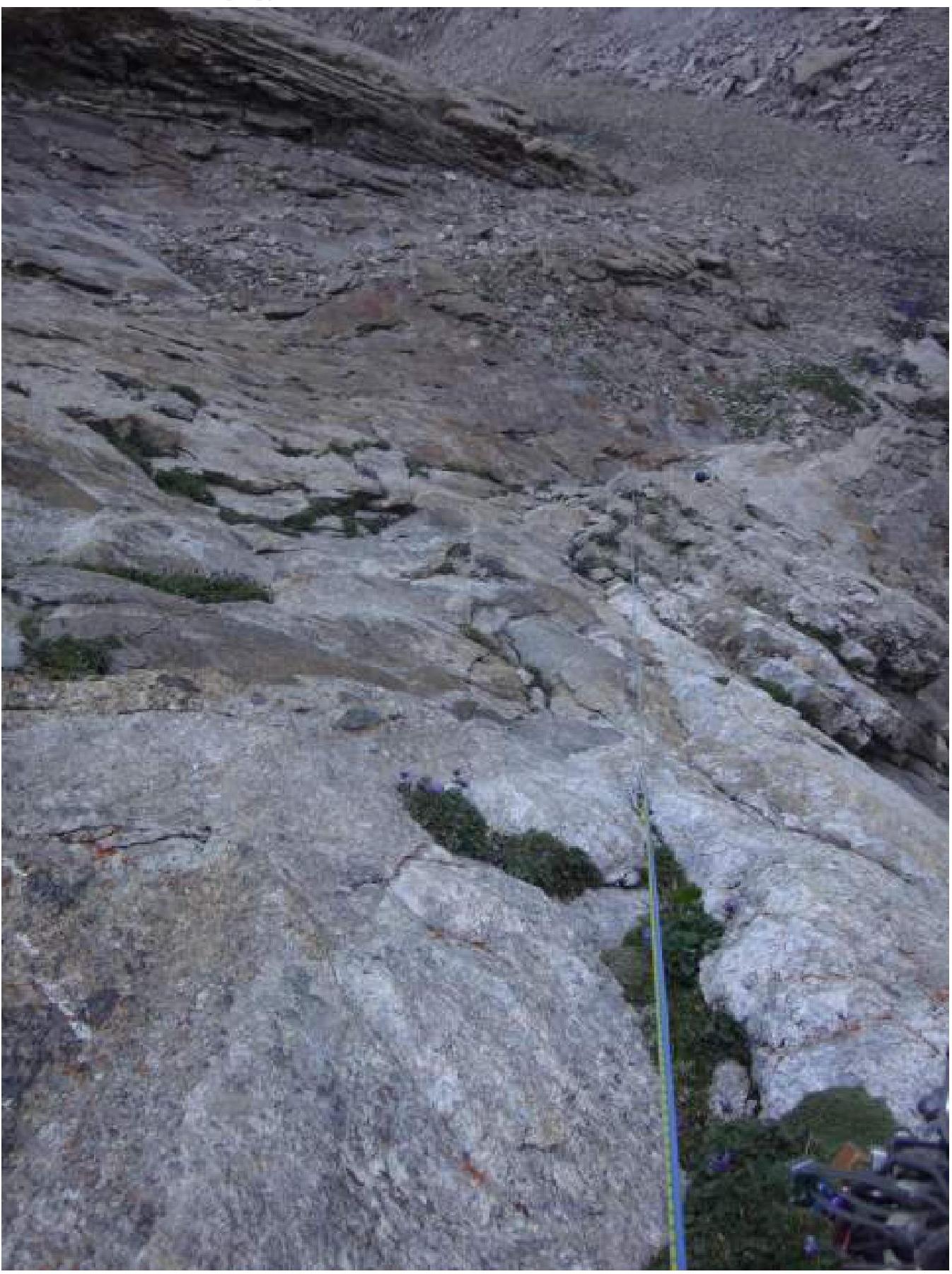
View from R3 towards sections R3–R4–R5
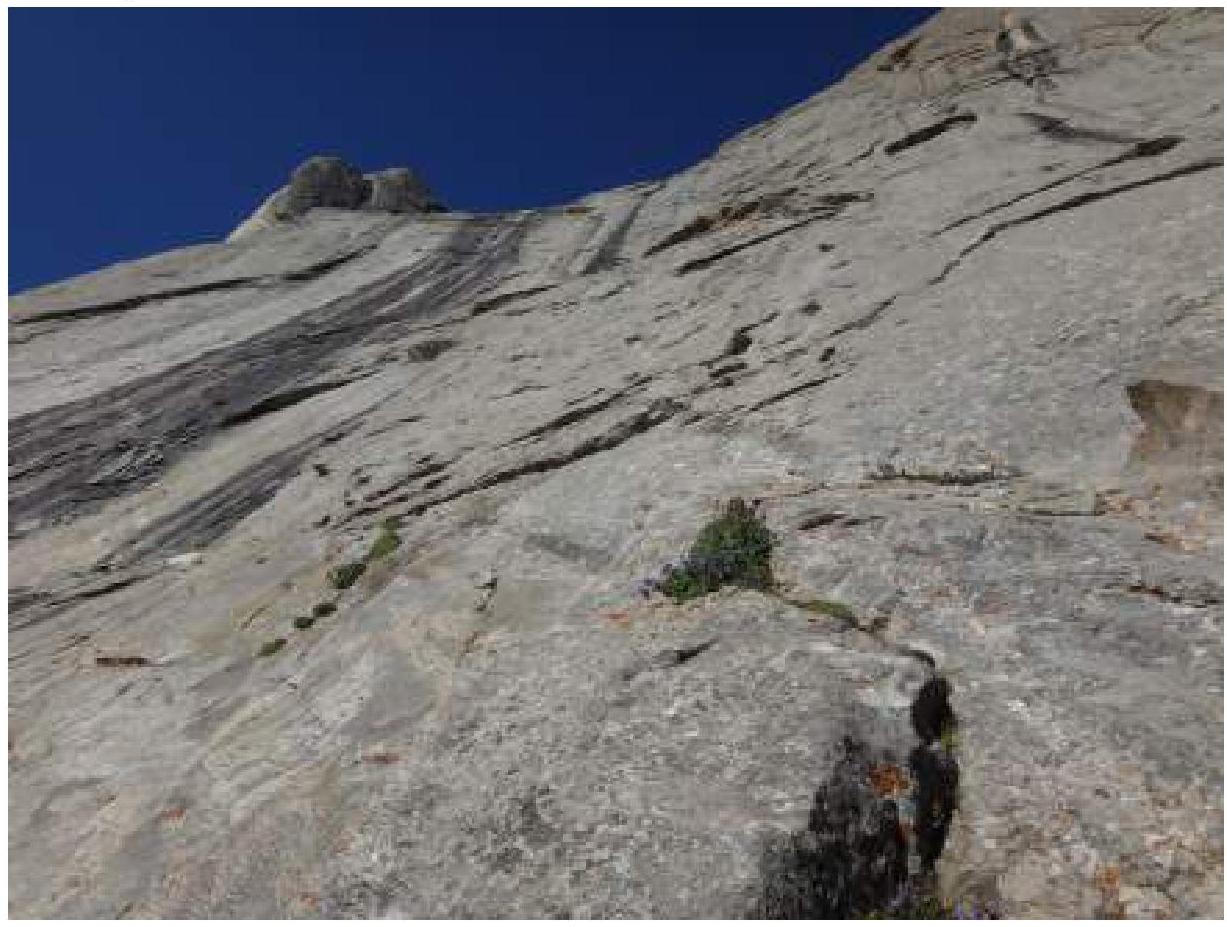
View downwards from station R4 (second climber, Kovalenko D., is at station R3)
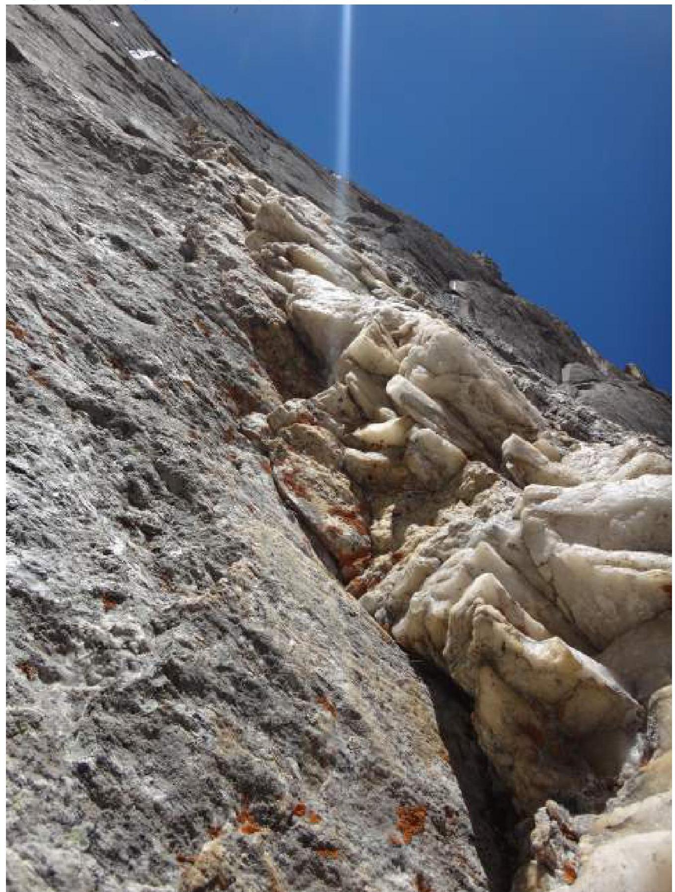
Quartz corner on section R4–R5, view from station R4
Leader (Kovalenko D.) on section R10–R11
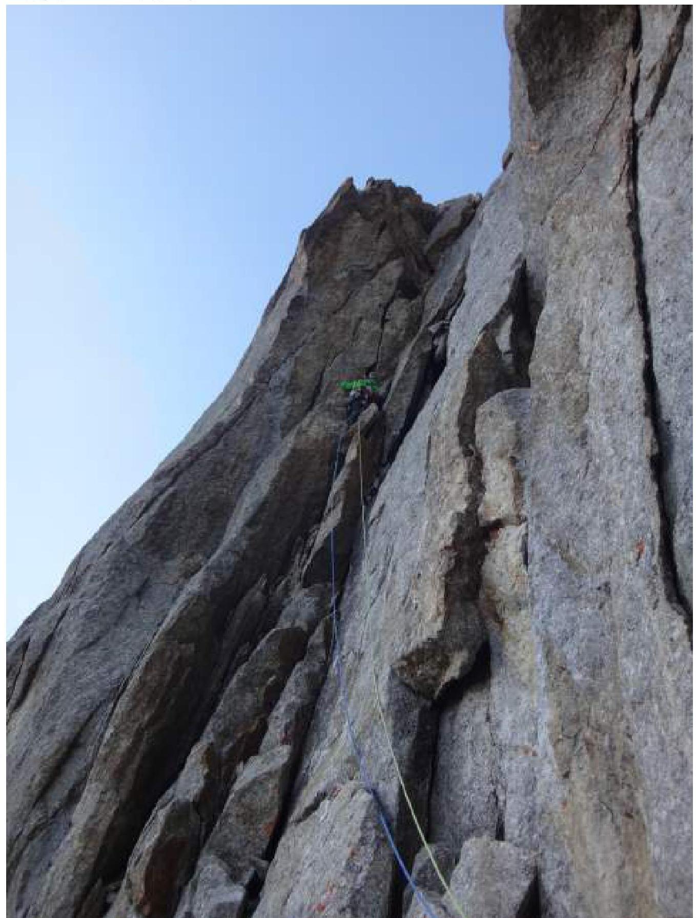
Leader (Kovalenko D.) on section R11–R12

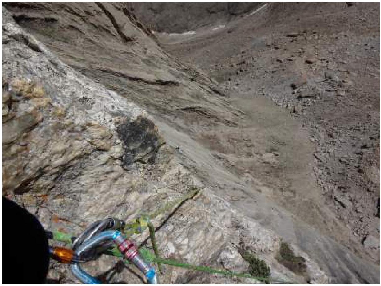
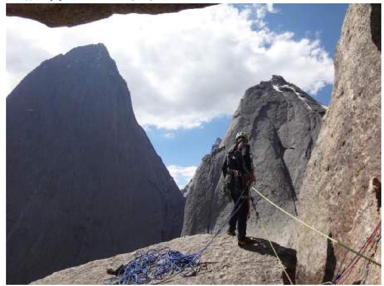
Start of rappel from "room" (R14)
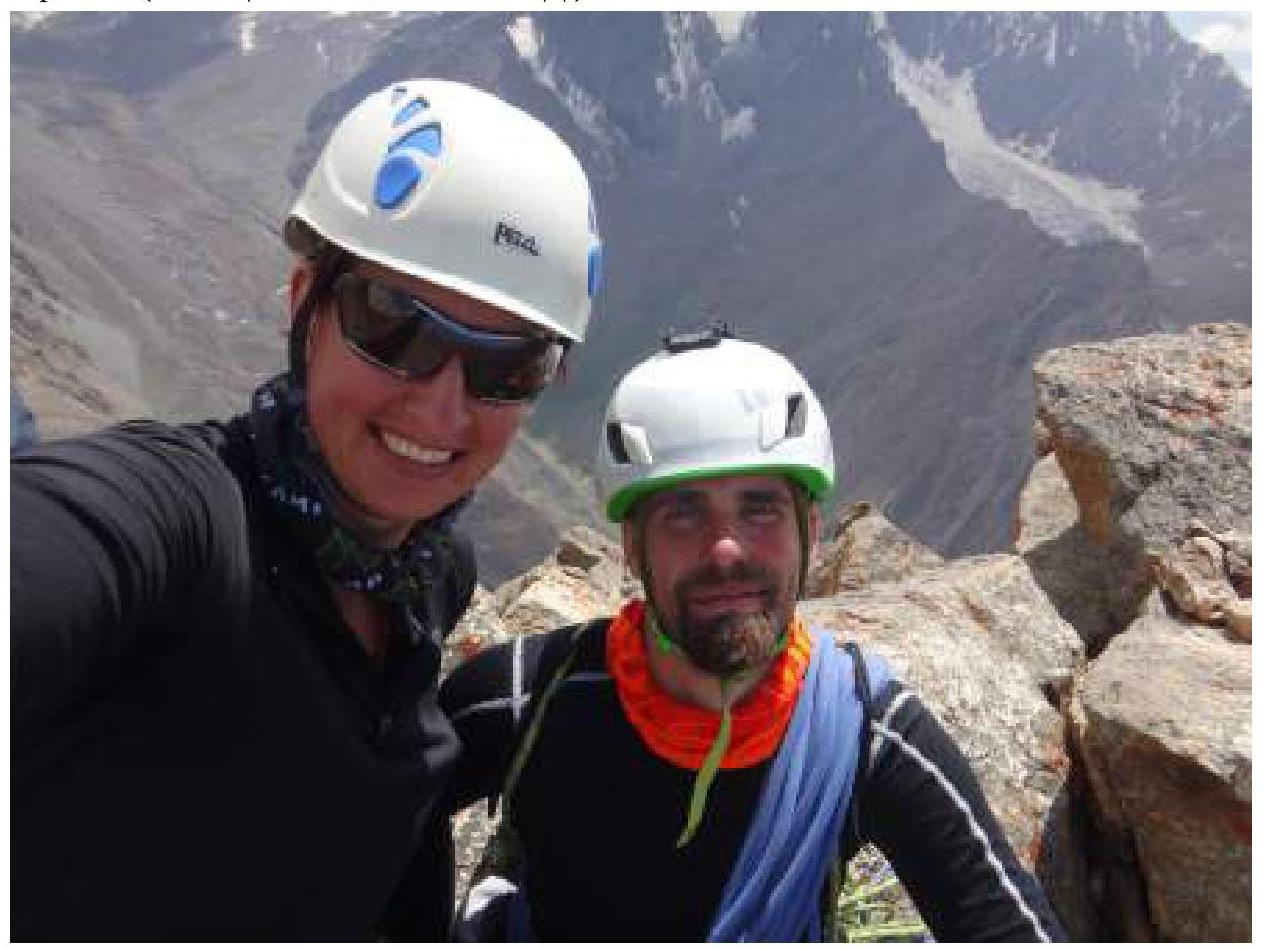
On the summit (Pilshtchikova N., Kovalenko D.)