V. V. Mast. 1st sports category technical.
- Technical class.
- Pamir, Ak-Su valley.
- Western shoulder of A. Blok via north-west face.
- Difficulty category — 5B (second ascent).
- Height difference — 680 m.
Distance — 1728 m, distance of sections 5–6 diff. cat. — 640 m, average steepness of main sections:
- Ice part — 60°
- Wall part — 80°
-
Pitons hammered in:
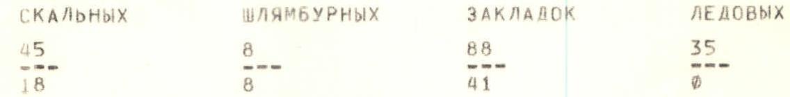
Rock Bolt Nuts Ice screws 45 8 88 35 18 8 41 0 -
Climbing hours — 64 (including descent) over eight days.
-
Night bivouacs:
- 1st — on the moraine of the glacier below the route.
- 2nd, 3rd — on a talus shelf.
- 4th, 5th — platform for 4 people in a ridge depression.
- 6th, 7th — platform on a saddle below A. Blok peak.
- Team leader: Kozel V.M., CMS.
Team members:
- Tyurin A.S., CMS
- Gerasimov A.V., CMS
- Kovensky E.I., CMS
- Coach: Kovensky G.I., CMS.
- Approach to the route — July 8, 1988.
Summit — Western shoulder on July 12, 1988, return — July 15, 1988.
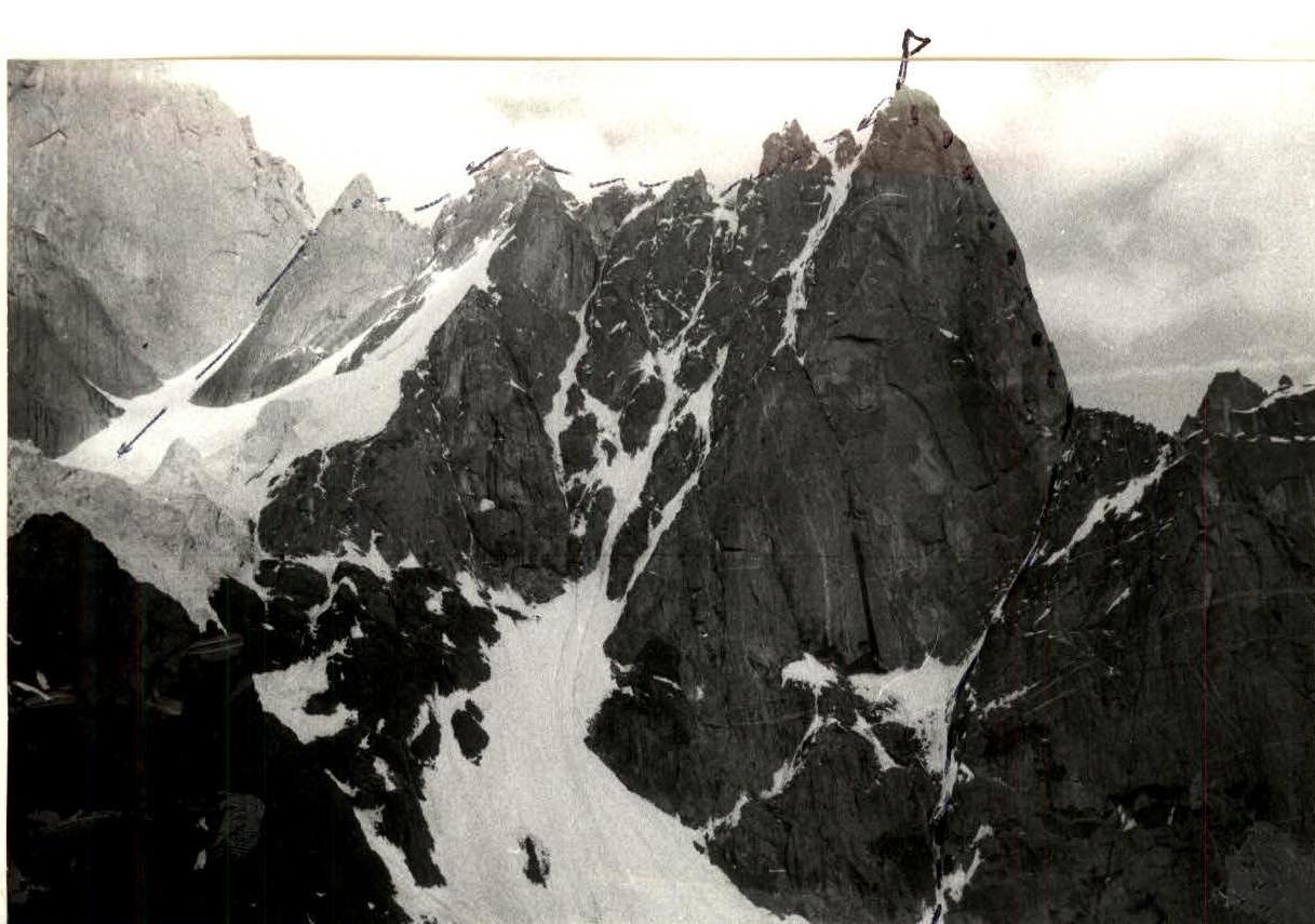
General photo of the summit. Date, time of shooting: July 7, 1988, 19:00. Lens type, focal length: F=40. Distance: 700 m. Shooting point number, its height: Ф1, 4200 m.
Tactical actions of the team
The team's tactical actions were based on reconnaissance data, consultation with the head of AUSV "Alay" Yakovlev V.D. and a description of the first ascent of the route to the Western shoulder of the Bashirov group in 1983. The team chose a tactic of movement using ten ropes, i.e., with preliminary lengthy processing of complex sections of the route. This tactic made it possible to organize bivouacs in convenient places and not depend on frequent and abrupt weather changes. Due to the unstable weather in the ascent area, two ascent options were tactically planned. Each option had two reserve days.
On the wall part of the route, where preliminary processing was not carried out, taking into account the complexity, steepness, and objective danger, the team chose a movement scheme according to the "person-rope" principle, ensuring the movement of each participant on a double rope. At the same time, the safety of the leader was additionally ensured by using a BEPУ-type shock absorber.
The leaders on sections R0–R7, R9–R17 were Tyurin A.S., R7–R9, R17–R29 — Kozel V.M.
Sections R0–R5, R8–R15 were preliminarily processed. Work on the route began at 9:00 and ended when the weather worsened.
An individual ration was provided, including vitamins, dried fruits, and chocolate.
This tactic allowed the team to complete the route, having only two overnight stays in an inconvenient place, for which a platform was prepared. All bivouac sites were chosen based on safety requirements, protection from rockfall, ice and snow avalanches, allowing for the belay of each participant.
Communication with the base camp was maintained using the "Karat" radio station.
Route description by sections
- R0–R1: Hard snow, bergschrund is passed along a snow bridge, belay through ice axes.
- R1–R2: Traverse right, crossing an ice couloir (rockfall hazard), exit to rocks to the right of a frozen waterfall.
- R2–R3: Rock wall to the right of a frozen waterfall.
- R3–R4: Thin layer of snow on ice.
- R4–R5: Ice with rock outcrops.
- R5–R6: Rocks with ice.
- R6–R7: Talus shelf, convenient bivouac.
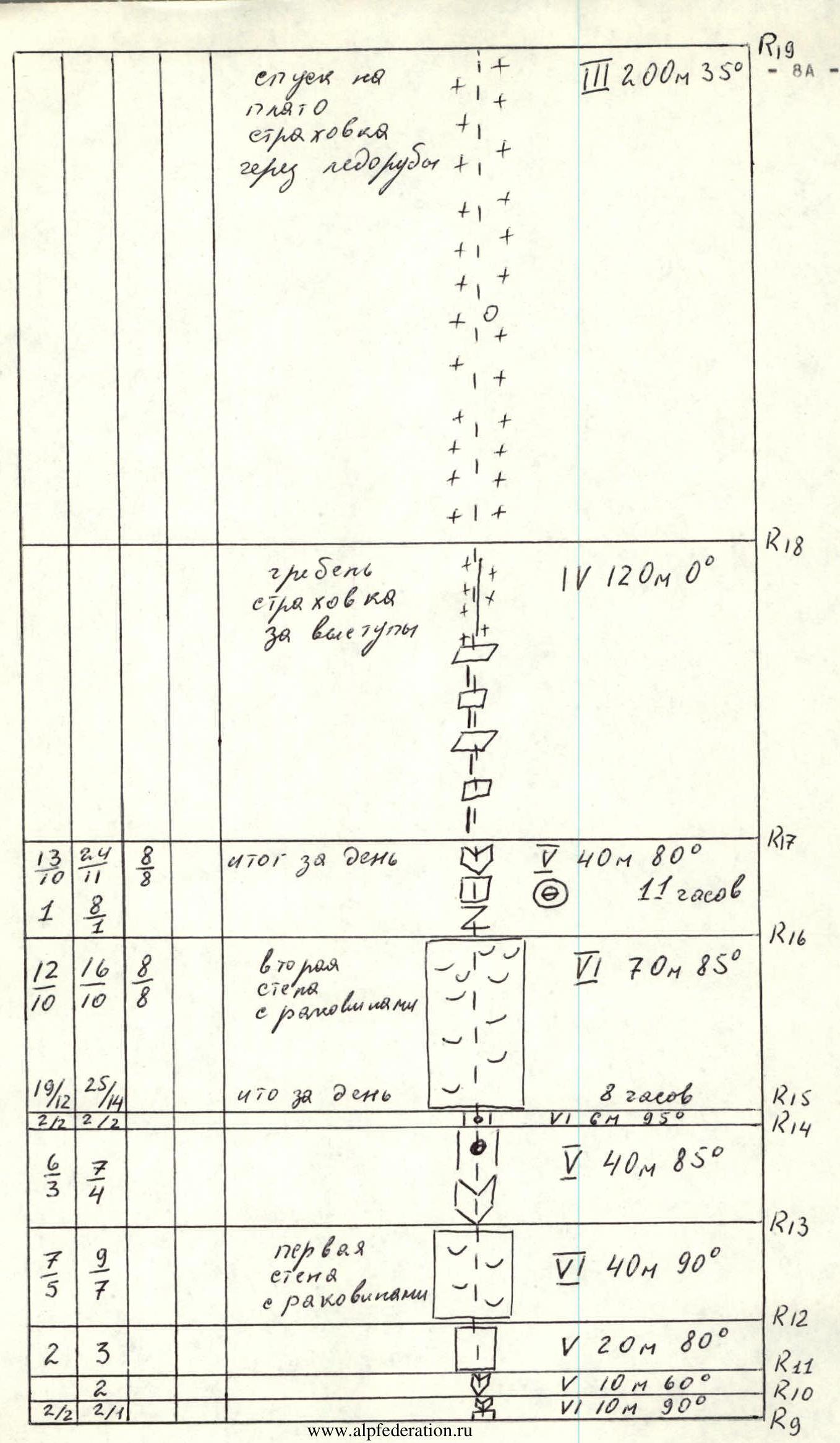
- R7–R8: Wall, complex climbing.
- R8–R9: Slab, pendulum left into a crack with chocks, ascent to a shelf to an internal corner filled with ice.
- R9–R10: Internal corner with a crack.
- R10–R11: Internal corner with a crack.
- R11–R12: Wall.
- R12–R13: 1st wall with cavities.
- R13–R14: Internal corner, walls, blocks.
- R14–R15: Internal corner with a chockstone.
- R15–R16: 2nd wall with cavities.
- R16–R17 — Crevice, rock walls, exit to the ridge.
- R17–R18 — Ridge, mainly traversed on the left.
- R18–R19 — Descent right from the ridge to a plateau, bypassing two gendarmes.
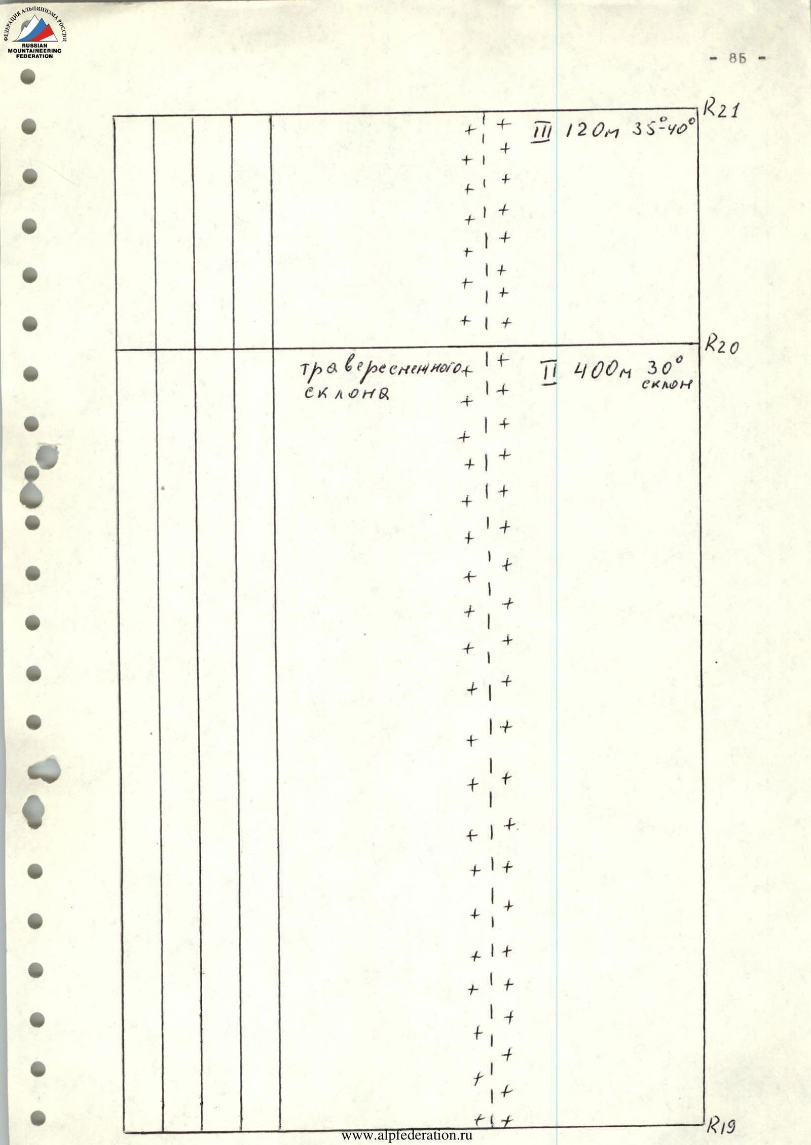
- R19–R20 — Traverse of a snowy slope.
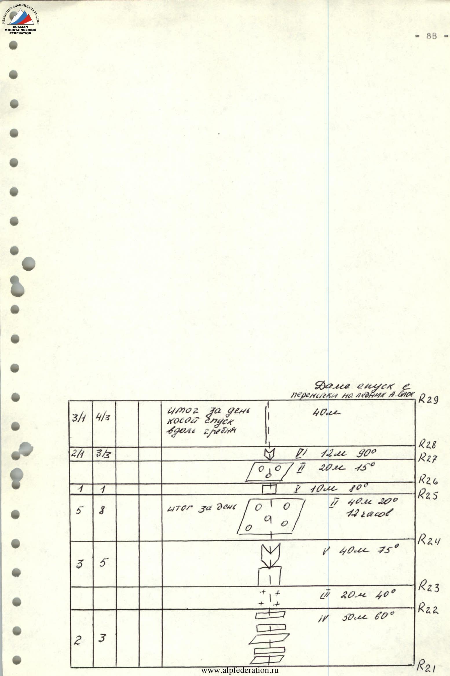
- R20–R21 — Ascent along snow under a ridge depression.
- R21–R22 — Rocks, 4th diff. cat.
- R22–R23 — Snow-ice couloir.
- R23–R24 — Rocks, 5th diff. cat., exit to the ridge.
- R24–R25 — Talus shelf.
- R25–R26 — Rock wall.
- R26–R27 — Inclined shelf.
- R27–R28 — Internal corner, passed using ИТО (Intermediate Technical Object - not translated as per instruction).
- R28–R29 — Oblique descent along the ridge to a saddle below A. Blok peak.