- Rock class.
- Pamir-Alay, Akh-Su gorge.
- Peak 3900 m via North-West edge.
- Second ascent of category 3A difficulty, approximately.
- Height difference 400 m, average steepness 40°, length 790 m.
- Pitons driven — 8 pcs.
- Climbing hours — 5.
- No overnight stays on the route.
- Leader: Sytnyk D. N. — 1st sports category. Participants: Glushchenko A. A. — 1st sports category, Kononov A. V. — 1st sports category, Gumennyy A. T. — 1st sports category.
- Coach: Kasimov A. M. — 1st sports category.
- Departure to the route August 6, 1984. Return to camp August 6, 1984.
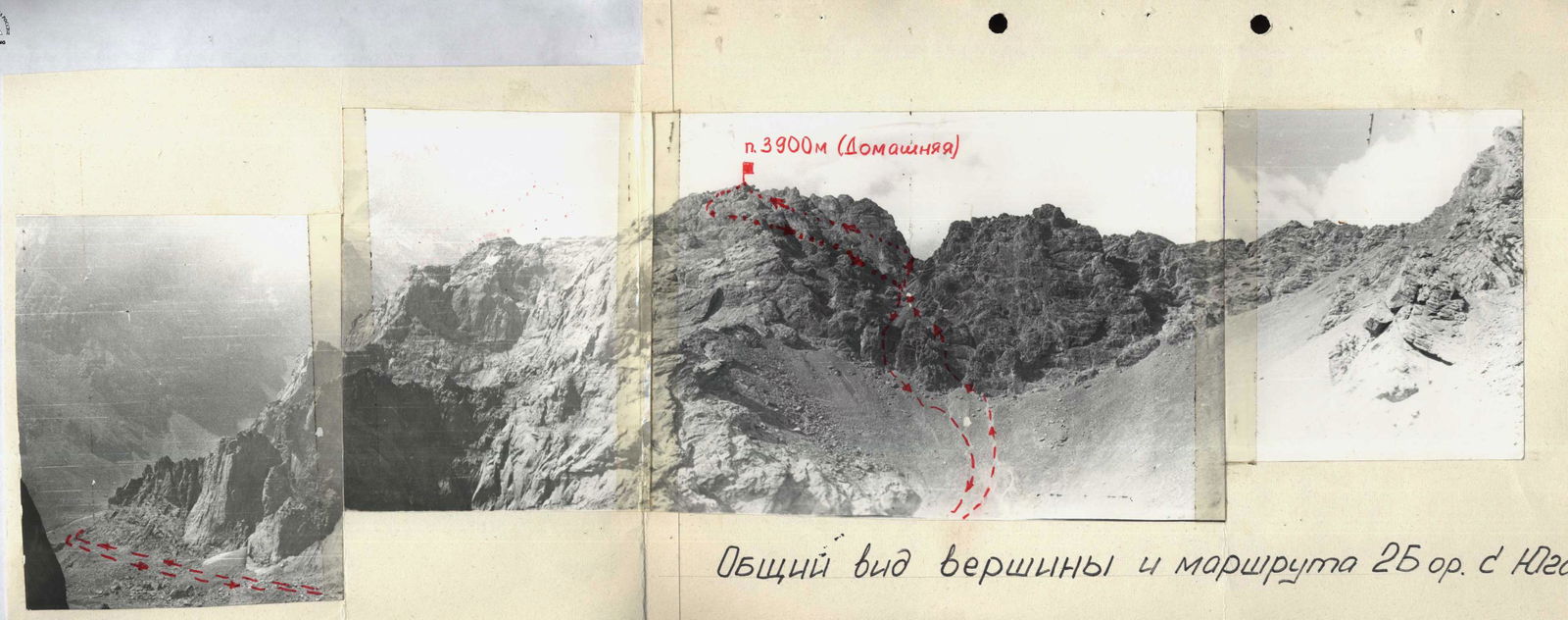
General view of the summit and route 25° from the South.
Peak 3900 m
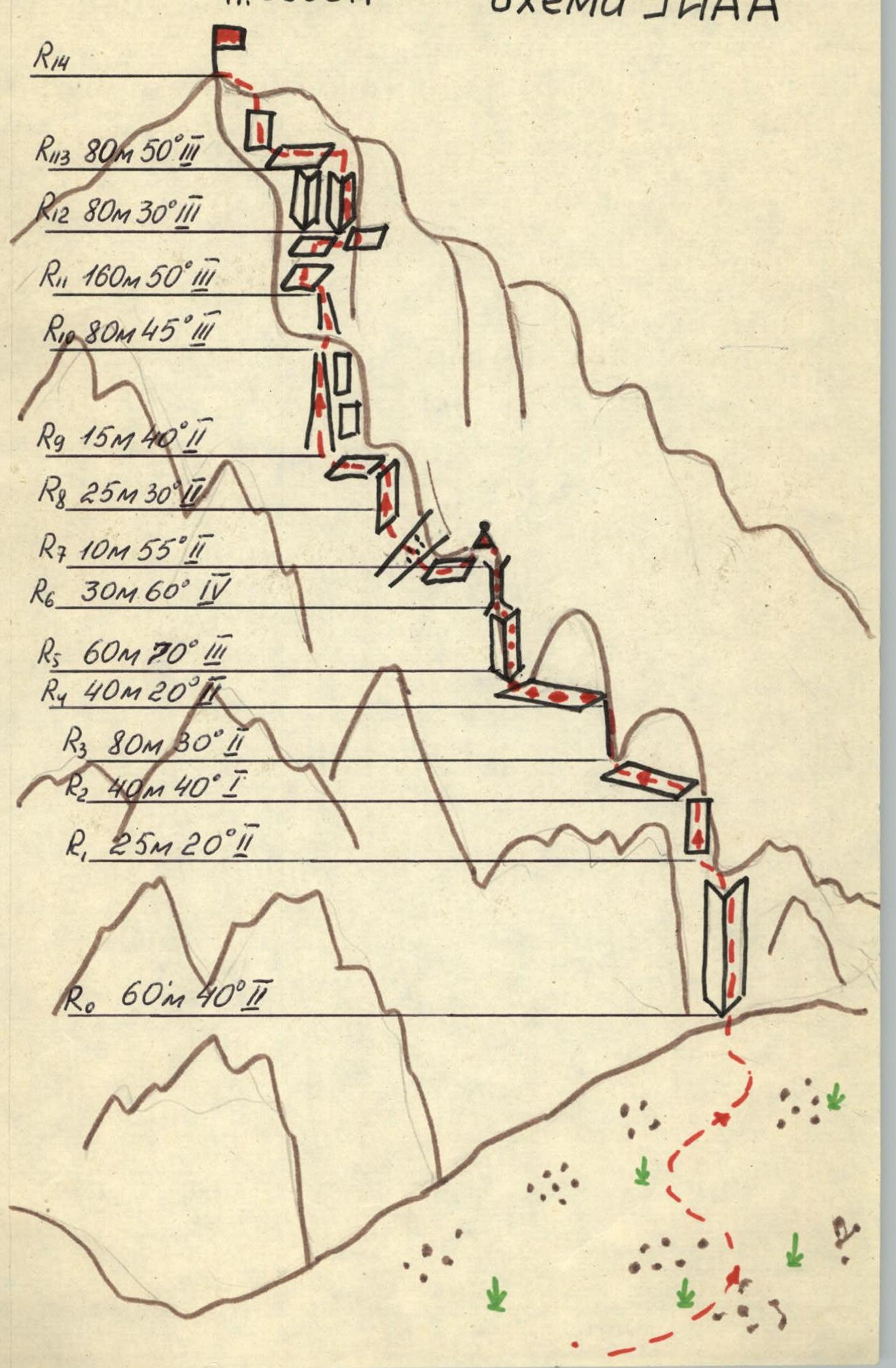
Route sections table
| Date | Designation | Average steepness | Length | Terrain characteristics | Difficulty | Route condition | Weather conditions | Pitons | Movement type |
|---|---|---|---|---|---|---|---|---|---|
| 06.08.1984 | R0 | 40° | 60 m | Inner corner | 1 | Monolith | Excellent | – | Simultaneously |
| R1 | 20° | 25 m | Rocky ridge | 1 | Monolith | –"– | – | –"– | |
| R2 | 40° | 40 m | Rocky ledges | 2 | Live rocks | –"– | – | –"– | |
| R3 | 30° | 80 m | Ridge | 1 | Monolith | –"– | – | –"– | |
| R4 | 20° | 40 m | Diagonal ledge | 1 | Live rocks | –"– | – | –"– | |
| R5 | 70° | 60 m | Inner corner | 3 | Monolith | –"– | 1 | Alternating | |
| R6 | 60° | 30 m | Couloir | 4 | Monolith | –"– | 5 | Alternating, rope | |
| R7 | 55° | 10 m | Couloir crossing | 1 | Broken rocks | –"– | – | Simultaneously | |
| R8 | 30° | 25 m | Wall, ledge | 1 | Live rocks | –"– | – | –"– | |
| R9 | 40° | 15 m | Scree couloir | 1 | Rockfall hazard | –"– | – | –"– | |
| R10 | 45° | 80 m | Couloir | 3 | Dry rocks | –"– | 2 | Alternating | |
| R11 | 50° | 160 m | Diagonal ledges | 3 | Broken rocks | –"– | – | Alternating | |
| R12 | 30° | 80 m | Couloir | 3 | Broken rocks | –"– | – | –"– | |
| R13 | 50° | 80 m | Ledges | 3 | Rocks, monolith | –"– | – | –"– |
Departure at 7:30, at the summit at 12:30, back at camp at 15:00.
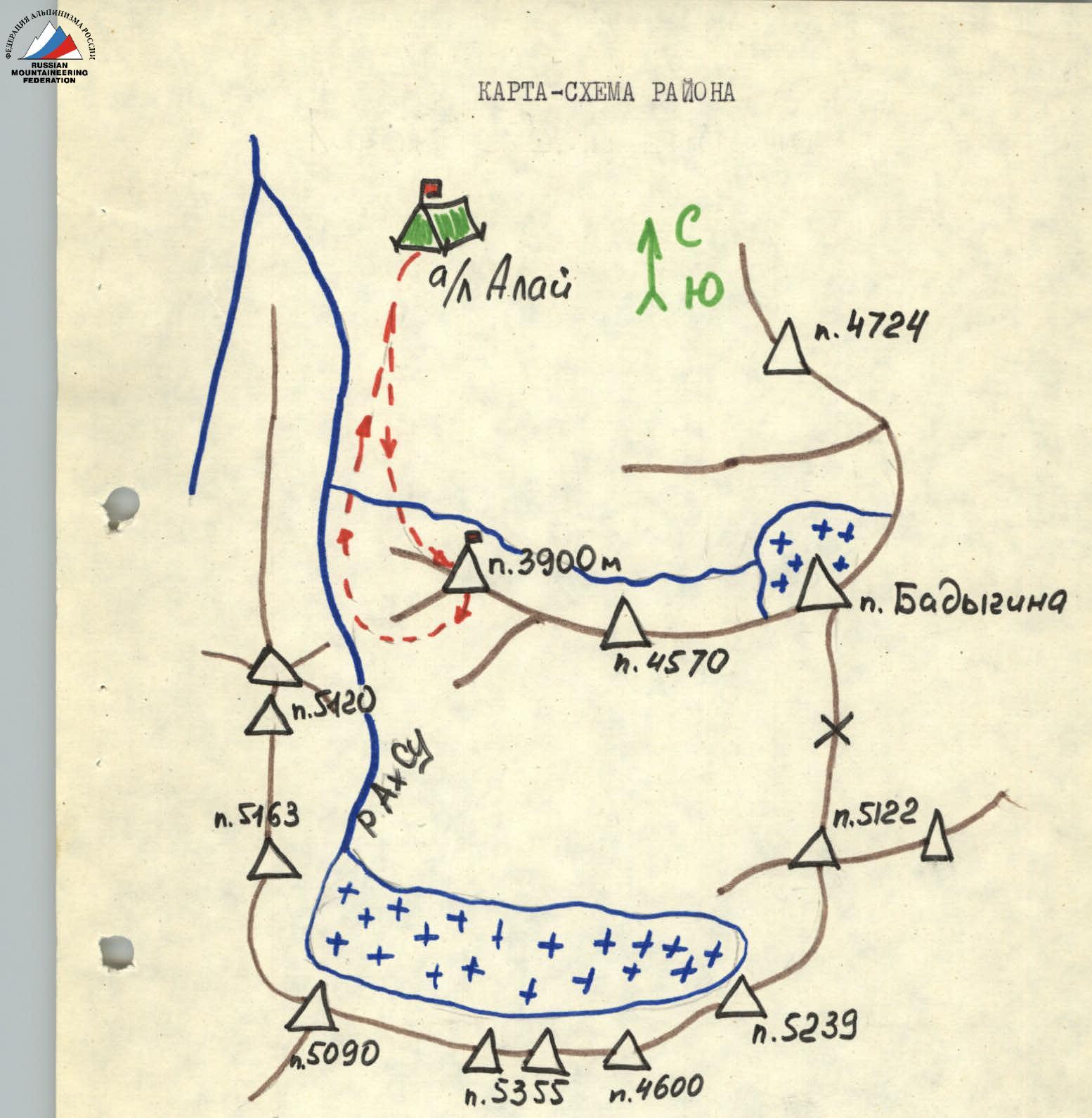
Approach description
From the camp, cross the river to a green hill near the North-West ridge of Peak 3900 to the beginning of the route. 1.5–2 hours from the camp.
UNAA scheme
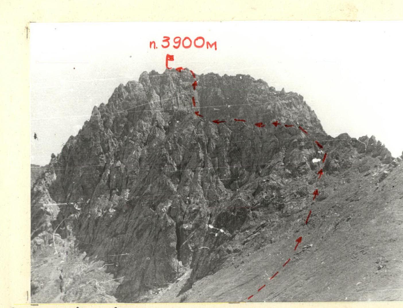
General view of the summit and route category 3A, approximately, via North-West ridge.