
Ascent Record
- Technical category
- Pamir-Alay, Kara-Su gorge
- Peak 4437 m (Atabekova) via North Ridge, category 3A difficulty
- Height difference 210 m from the gendarme, distance 300 m from the gendarme, average steepness 45°, average steepness of the key section 60°
- Moving time 5–6 hours
- No overnight stops on the route
- Pitons driven - 6
- Leader: Pyshkin A. V. - 1st sports category
Participants:
- Chuprina A. I. - 1st sports category
- Panenko V. A. - 1st sports category
- Vaisberg E. I. - 1st sports category Coach: Prikhodchenko A. I. - Candidate Master of Sports
- Departure to the route August 19, 1984
Return August 19, 1984
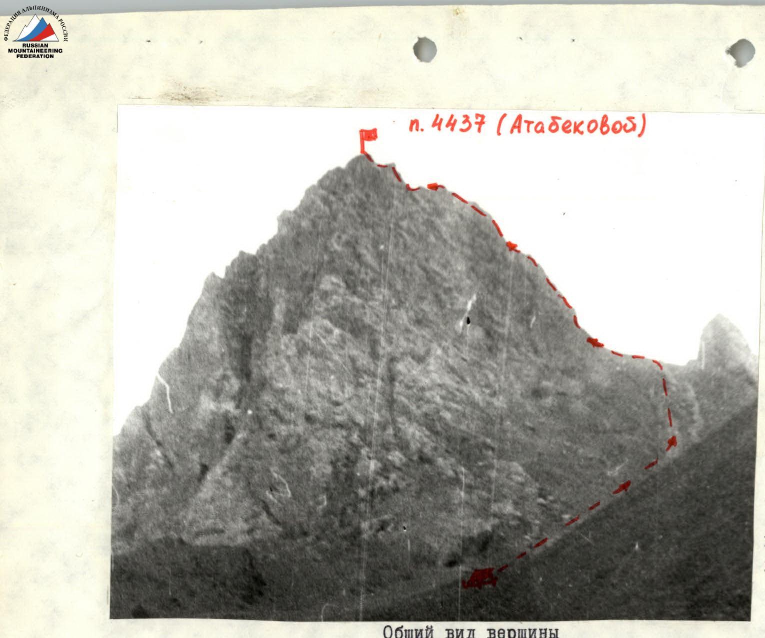
General view of the summit and the route category 3A via North Ridge
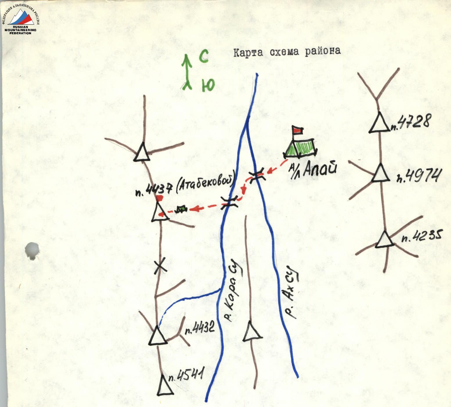
From the base camp, descend down, cross the Akh-Su and Kara-Su rivers by bridges and then follow the trail up to the right into a wide scree couloir and ascend to the route. Biwak at large, separately lying stones. From the base camp 3–3.5 hours.
Diagram of UNA p. 4437 (Atabekova)
R0 — 400 m, 30°, 1 R1 — 60 m, 10°, 1 R2 — 40 m, 30°, 2 R3 — 30 m, 60°, 4 R4 — 30 m, 50°, 3 R5 — 10 m, 50°, 4 R6 — 30 m, 30°, 2 R7 — 35 m, 45°, 3 R8 — 15 m, 50°, 3
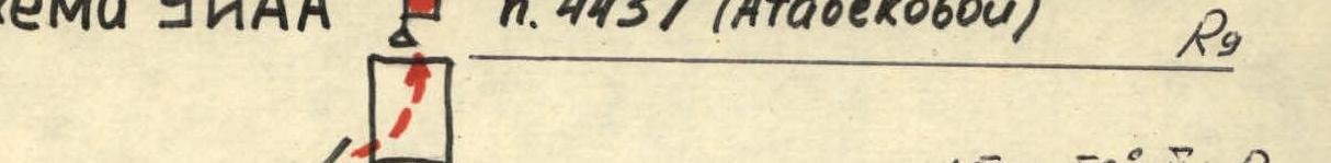
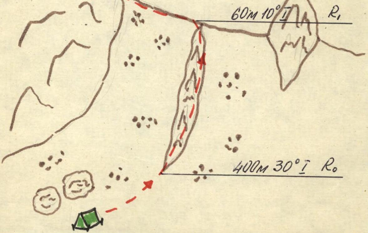
Table of sections
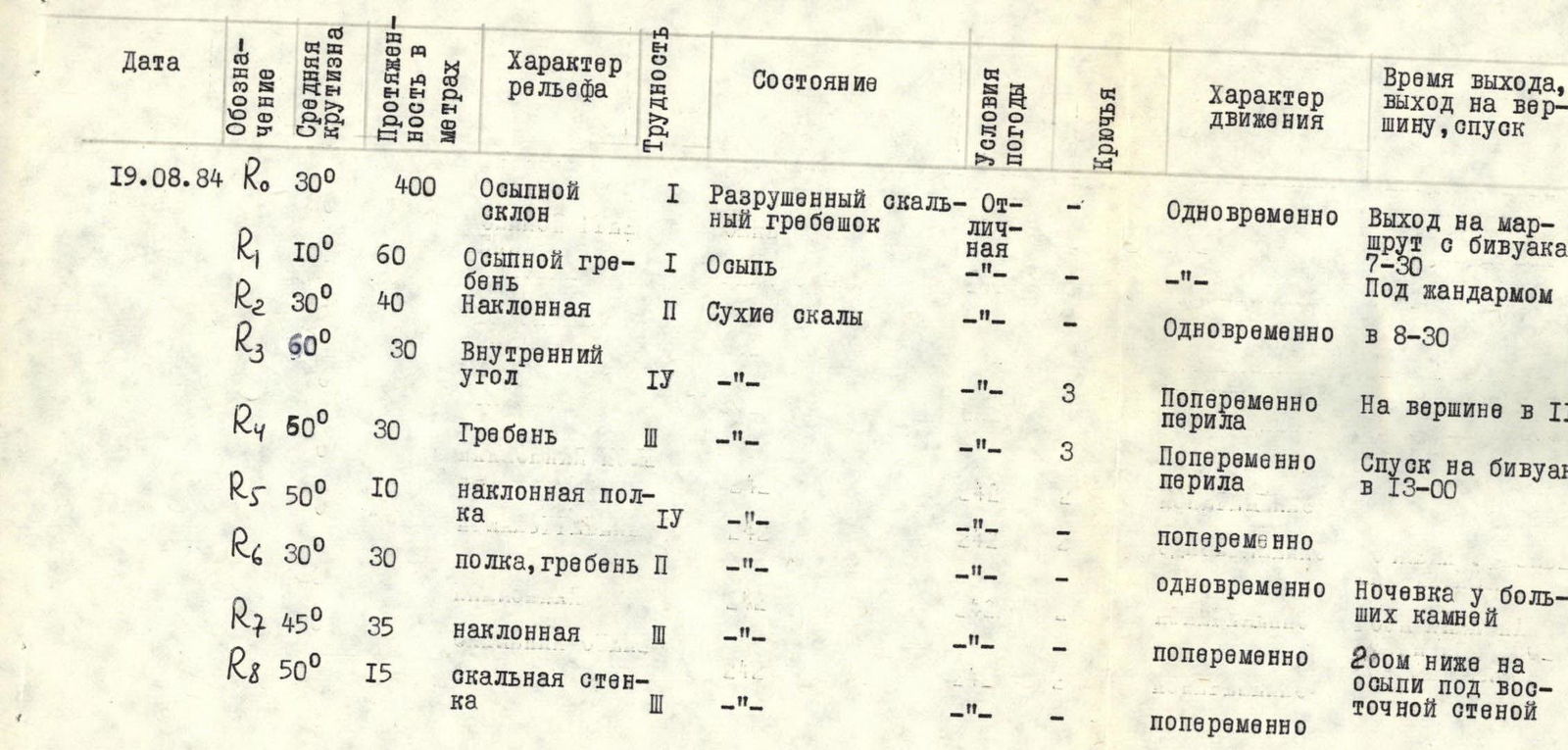
Route description by sections
R0 — Scree slope with 30° steepness, simultaneous movement. Move along destroyed rocks (ridge). R1 — Scree saddle, simultaneous movement. R2 — Inclined shelf, protection on protrusions. Caution, loose rocks! R3 — Inner corner with 60° steepness, difficult climbing, pitons, rope protection. R4 — Rocky ridge, moderate difficulty climbing, pitons, rope protection. R5 — Inclined shelf with overhang, protection on protrusions. R6 — Rocky shelves, ridge, simultaneous movement. R7 — Inclined shelf. Rocks of moderate difficulty. Loose rocks! Protection on protrusions. R8 — Ascent to the summit via a destroyed rocky wall, protection on protrusions. Loose rocks!
Descent via the ascent route with two 30 m rappels in the lower part of the route.
From the gendarme along the scree ridge 60 m via destroyed rocks, bypassing them on the left. Exit under the walls onto an oblique shelf 30–40 m. Along the shelf up to the right 30 m to an inner corner. The inner corner is passed on the right side with an exit into a couloir and then left up 20 m onto a shelf under the wall. Along the shelf to the right onto the ridge shoulder, from the ridge up along its left part to the wall. Under the wall, traverse left along a small ledge with an overhang in the upper part and exit onto a platform at the top of the wall, 40 m. From this point along the shelf on the left and then along the ridge and shelf, exit under the slab on the right, 40 m. Then 40 m along the shelf under the wall, exit under the base of the wall leading to the summit. Via the right monolithic part of the wall, exit onto the summit.