Ascent Report
of the "Odessa" Alpine Club team to the summit of Ak-su North (5217 m) via the center of the bastion on the North Face (first ascent). CIS Championships (EAAC) in alpinism. High-altitude technical ascents category. Pamir-Alay, July-August 2006. Odessa - 2006
Ascent Passport
-
Pamir-Alay, Lyaylak valley area, 5.4.2
-
Mt. Ak-su (N), 5217 m, via the center of the bastion on the N face.
-
Proposed - 6B category difficulty, first ascent
-
Route character: rock
-
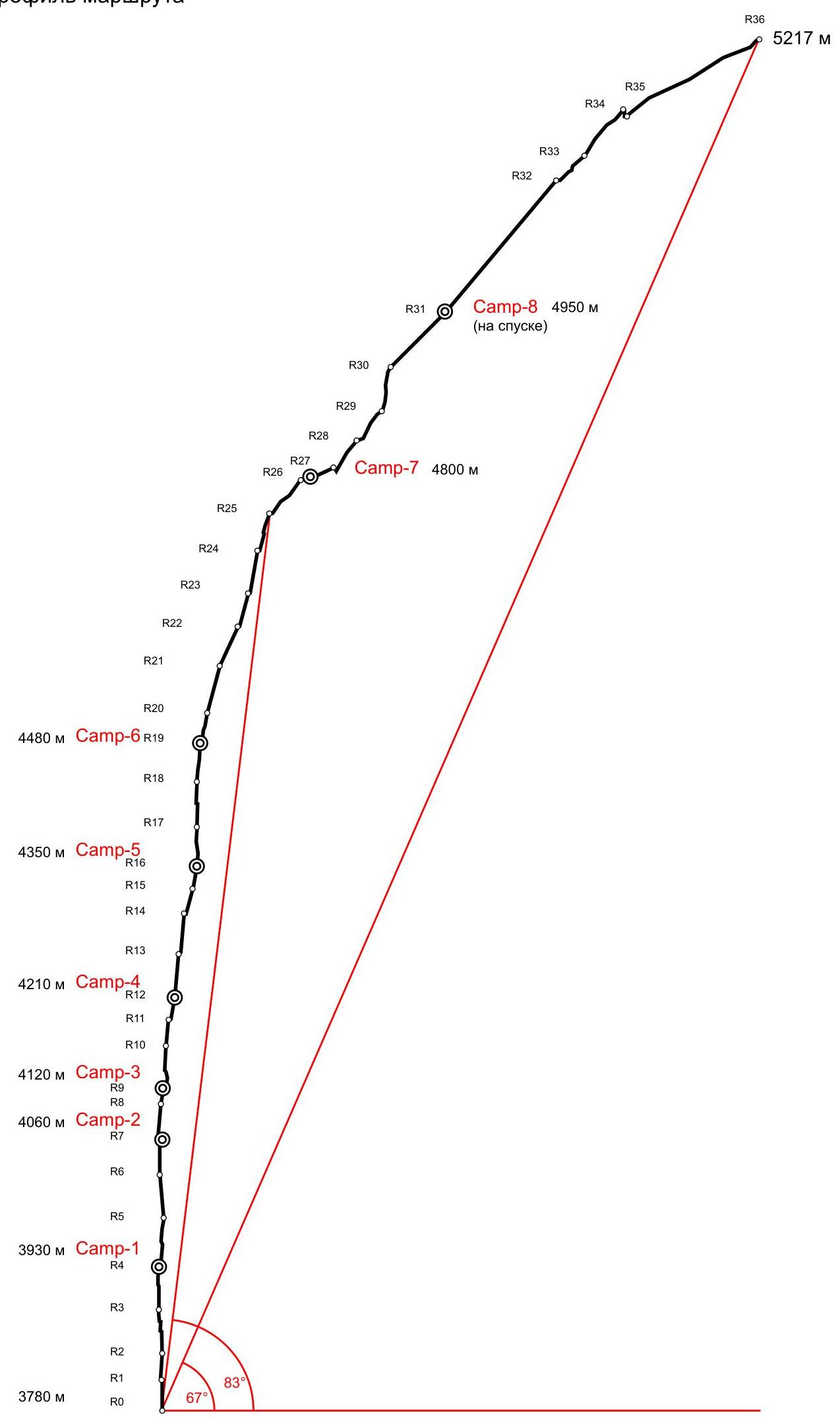
Route height difference: 1437 m (3780-5217) Route length: 1848 m. Length of sections: V category difficulty - 365 m, VI category difficulty - 855 m. Average steepness: main part of the route - 83°, total route - 67°
-
Pitons left on the route: total - 46; including bolted pitons - 46 Pitons used on the route: stationary bolted pitons - 46, including for artificial support - 24 removable bolted pitons - 0, including for artificial support - 0 Total artificial support points (ASP) used - 344
-
Team's total climbing hours: 132 hours, 13 days
-
Team leader: Mogyla Volodymyr Fedorovych - Master of Sports of International Class
Team members:
Lavrynenko Oleksandr Vadymovych - Candidate for Master of Sports Tsushko Taras Viktorovych - Candidate for Master of Sports Cheban Viarel Ivanovych - Candidate for Master of Sports
-
Coach: Horbenko Mstyslav Mstyslavovych - Honored Master of Sports, Honored Coach of Ukraine
-
Departure to the route: 7:30, July 23, 2006
Summit reached: 19:00, August 4, 2006 Return to Base Camp: 17:00, August 6, 2006
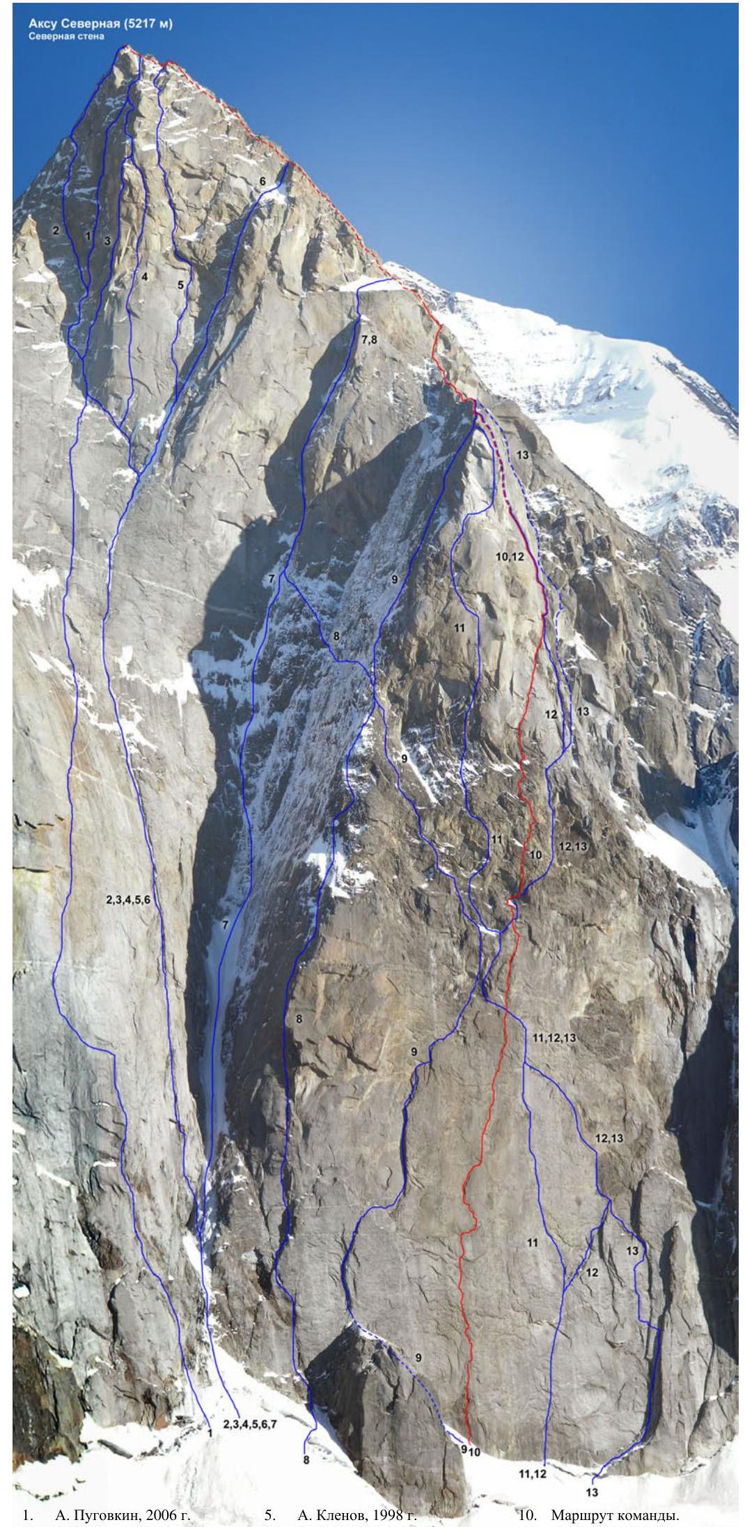
- A. Pugovkin, 2006
- V. Popov, 1986
- P. Shabalin, 1994
- I. Tukhvatullin, 2002
- A. Klenov, 1998
- I. Chaplynsky, 1988
- A. Moshnikov, 1984
- Yu. Kostenko, 1988
- L. Troshchinenko, 1982
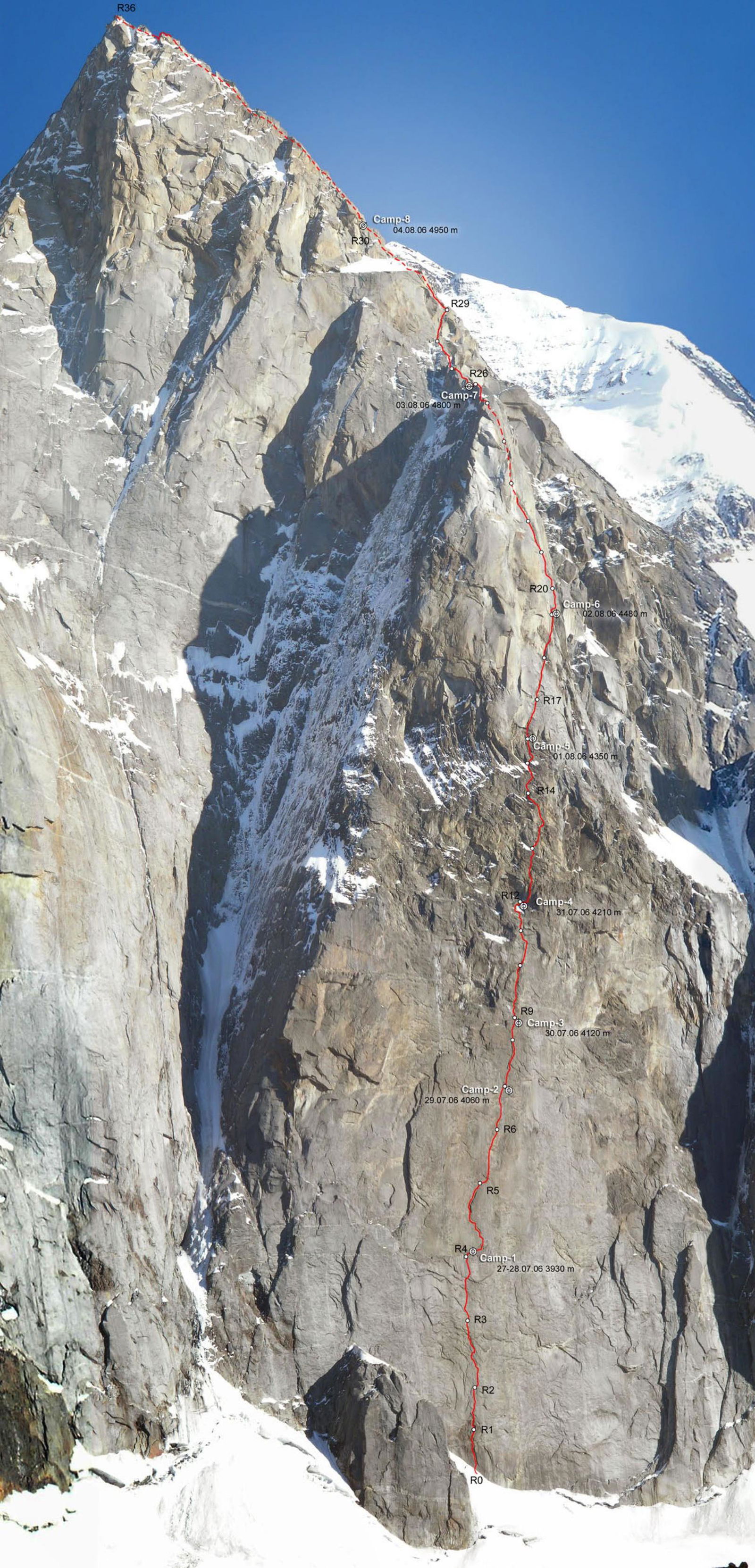
- Team's route.
- A. Klenov, 1996
- V. Pershin, 1988
- V. Vedernikov, 1986
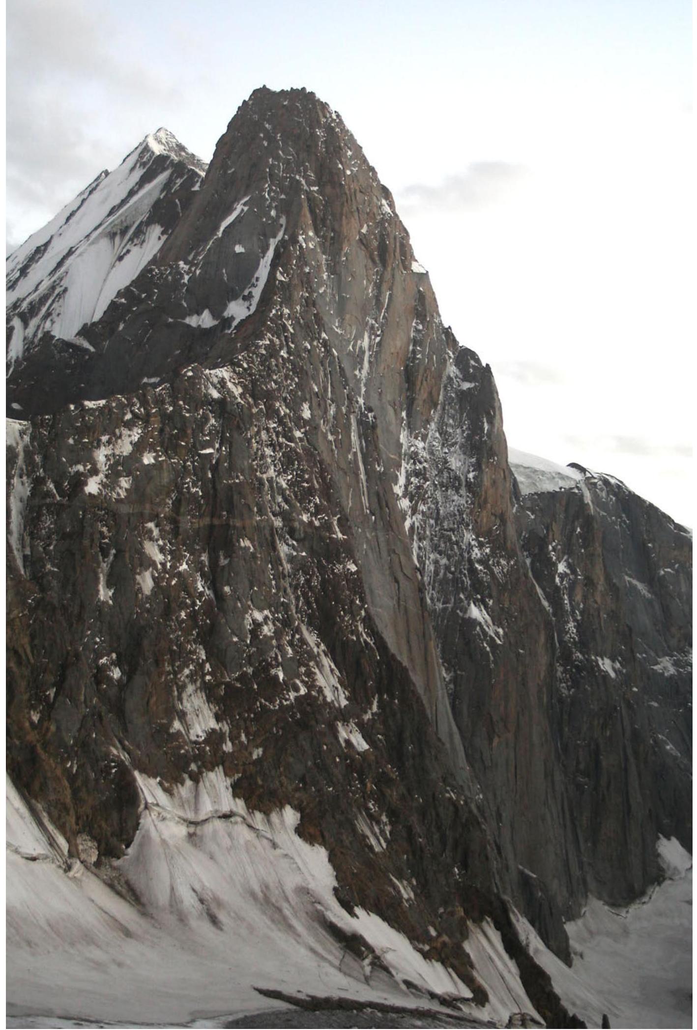 Photo of the face profile from the left. Taken on July 25, 2006, 19:47, from the bivouac under Peak A. Blok.
Route profile
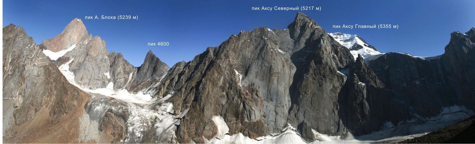
 Panorama of the area. Taken on August 13, 2006, 16:37, from the slopes of Iskander peak.
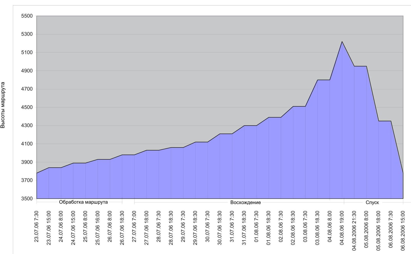
Ascent days
Team's movement schedule by sections
July 23, 2006, 7:30 - 15:00 - start of route processing (sections R0-R2). In the afternoon, the lower part of the face is exposed to rockfall - work until 15:00-16:00. July 24, 2006, 8:00 - 15:00 - processing (R2-R3). July 25, 2006, 8:00 - 16:00 - processing (R3-R4). July 26, 2006, 8:00 - 18:30 - processing (R4-R5). July 27, 2006:
- 7:00 - 9:00 - lifting cargo via fixed ropes
- 9:00 - 18:00 passed section R5-R6, overnight stay at Camp 1 July 28, 2006, 7:30 - 18:30 - passed section R6-R7, overnight stay at Camp 1 July 29, 2006, 7:30 - 18:30 - passed sections R7-R9, overnight stay at Camp 2 July 30, 2006, 7:30 - 18:30 - passed sections R9-R12, overnight stay at Camp 3 July 31, 2006, 7:30 - 18:30 - passed sections R12-R14, overnight stay at Camp 4 August 1, 2006, 7:30 - 18:30 - passed sections R14-R17, overnight stay at Camp 5 August 2, 2006, 7:30 - 18:30 - passed sections R17-R20, overnight stay at Camp 6 August 3, 2006, 7:30 - 18:30 - passed sections R20-R26, overnight stay at Camp 7 August 4, 2006:
- 8:00 - 19:00 - passed sections R26-R36
- 19:00 - reached the summit
- 19:30 - 21:30 - started descending via the ascent route, overnight stay at Camp 8 August 5, 2006, 8:00 - 18:00 - descended via the ascent route, overnight stay at Camp 5 August 6, 2006, 17:00 - returned to Base Camp.
| chocks | friends | bolts | Route scheme in UIAA Symbols. Sheet-1 | № | length | category | steepness |
|---|---|---|---|---|---|---|---|
| 3 / 1 | 15 / 10 | 1 | 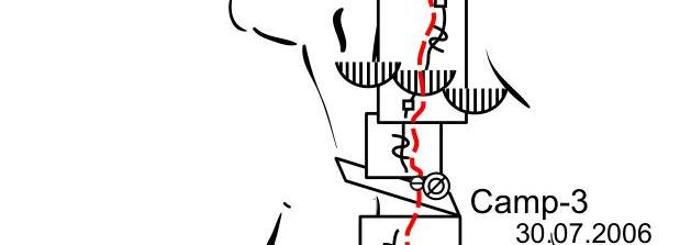 | R11 | 30 m | VI, A2 | 85 ° |
| 8 / 7 | 18 / 12 | 2 / 1 | R10 | 50 m | VI+, A3 | 90 ° | |
| 2 / 1 | 6 / 2 | 2 | R9 | 15 m | V+, A1 | 80 ° | |
| 12 / 11 | 12 / 10 | 1 | R8 | 40 m | VI, A2 | 85 ° | |
| 8 / 8 | 12 / 8 | 2 / 1 | R7 | 40 m | VI, A3 | 90 ° | |
| 9 / 9 | 8 / 8 | 6 / 5 | R6 | 50 m | VI, A3 | 95 ° | |
| 7 / 4 | 19 / 10 | 3 / 1 | R5 | 55 m | VI, A2 | 85 ° | |
| 9 / 9 | 11 / 9 | 8 / 7 | R4 | 50 m | VI, A2 | 90 ° | |
| 10 / 10 | 16 / 14 | 4 / 3 | R3 | 50 m | VI+, A4 | 95 ° | |
| 8 / 8 | 8 / 8 | 4 / 2 | R2 | 30 m | VI, A3 | 90 ° | |
| 9 / 7 | 11 / 9 | 3 / 2 | R1 | 35 m | VI, A3 | 90 ° | |
| R0 |
| chocks | friends | bolts | Route scheme in UIAA Symbols. Sheet-2 | № | length | category | steepness |
|---|---|---|---|---|---|---|---|
| - | - | Camp-7 | R27 | 40 m | — | 20 ° | |
| 4 / 3 | 5 / 3 | - | R26 | 50 m | V, A2 | 50 ° | |
| 1 | 8 | - | R25 | 45 m | V+ | 75 ° | |
| 2 | 6 | - | R24 | 50 m | V+ | 80 ° | |
| 3 / 1 | 6 / 1 | - | R23 | 40 m | V, A1 | 75 ° | |
| 14 / 12 | 10 / 8 | - | R22 | 50 m | VI, A2 | 65 ° | |
| 8 / 8 | 14 / 12 | 1 | R21 | 55 m | VI, A2 | 75 ° | |
| 4 / 4 | 9 / 4 | 1 | R20 | 35 m | VI, A2 | 80 ° | |
| 6 / 2 | 11 / 10 | 1 | R19 | 45 m | VI-, A2 | 85 ° | |
| 8 / 7 | 12 / 11 | 1 / 1 | R18 | 50 m | VI, A2 | 90 ° | |
| 5 / 5 | 14 / 9 | 2 / 1 | R17 | 45 m | VI, A2 | 90 ° | |
| 3 | 6 | - | R16 | 25 m | V | 80 ° | |
| 1 | 7 | 1 | R15 | 30 m | V- | 75 ° | |
| 6 / 5 | 12 / 10 | 1 | R14 | 45 m | VI, A2 | 85 ° | |
| 9 / 5 | 12 / 10 | 1 | R13 | 50 m | VI-, A2 | 85 ° | |
| 3 / 2 | 9 / 4 | 1 | R12 | 25 m | V, A1 | 80 ° | |
| R11 |
| chocks | friends | bolts | Route scheme in the UIAA Symbols. Sheet-3 | № | length | category | steepness |
|---|---|---|---|---|---|---|---|
| 1 | - | R36 | 180 m | III | 30 ° | ||
| - | - | R35 | 8 m | descent | — | ||
| 4 | - | R34 | 70 m | IV | 50 ° | ||
| 4 | 5 | - | R33 | 40 m | V+ | 45 ° | |
| 9 | - | R32 | 200 m | III–IV | 50 ° | ||
| 5 | - | R31 | 90 m | III | 45 ° | ||
| 6 / 4 | 10 / 5 | - | R30 | 50 m | VI, A2 | 80 ° | |
| 2 | 4 | - | R29 | 45 m | V- | 50 ° | |
| 5 | - | R28 | 40 m | IV | 50 ° | ||
| R27 |
Ak-su North (5217 m) North Face
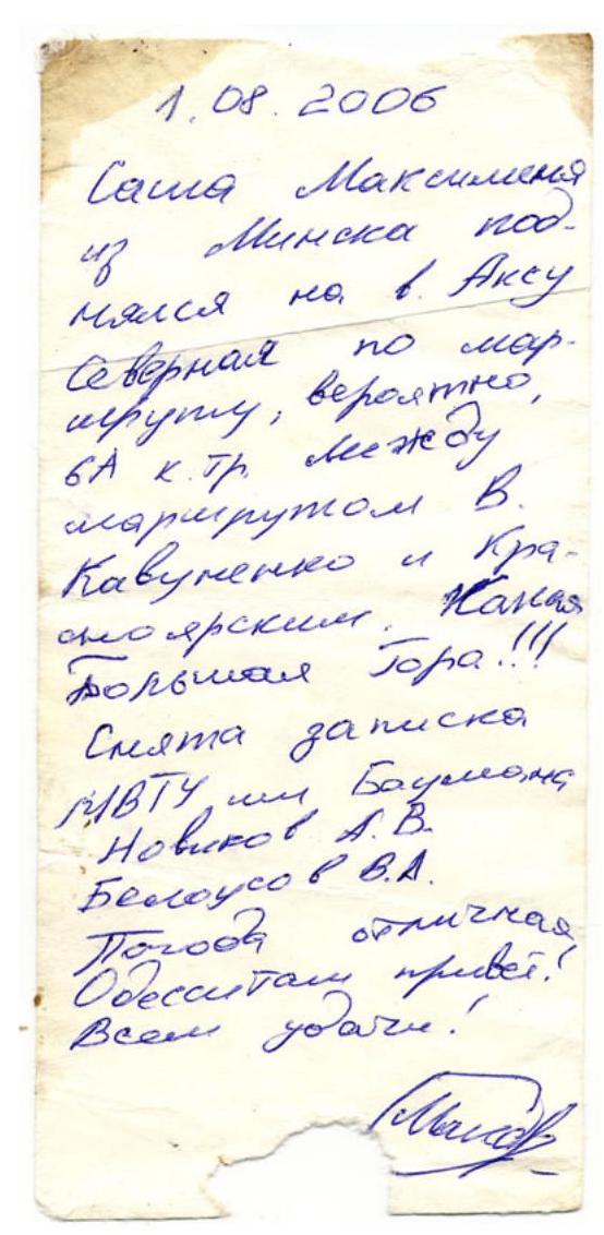
1.08.2006 Sasha Maksimenya from Minsk on Mde ascended Ak-su North via the route, likely 6A cat. Between V. Kavumenko's route and Krasnoyarsk Kazak's route. Big Mountain!!! Note left BMSTU, Bauman MSTU Novikov A.V. Belousov V.A. Weather is excellent. Greetings to Odessites! Good luck to all.
The note was retrieved on August 4, 2006, 19:00, from the summit cairn of Ak-su North.
Brief description of the route and team's actions
The route taken by the team passes through the center of the right bastion of the North Face of Ak-su (N). This face is one of the longest and most technically challenging rock faces in the world and has become a classic object for BIG WALL ascents. The right bastion is the steepest and most monolithic part of Ak-su's North Face. The exact orientation of the face is north-northwest. During the team's ascent, the bastion began to be illuminated by the sun at 15:30-16:00. The high steepness makes the route virtually objectively safe, except for the first few ropes, which are exposed to rockfall in the latter part of the day when the bastion is illuminated by the sun. The route consists of two dissimilar parts - the bastion (the main technically complex part) and the ridge. The bastion is almost entirely composed of solid monolithic granites. The lower part has a very sparse, poorly articulated relief, making it challenging to move using standard alpine methods and organize protection without excessive use of pitons and bolts. Nevertheless, the team aimed to find a new complex and interesting route thread that would not contradict the style and logic of modern alpinism. Contrary to expectations, they managed to find a previously unclimbed system of cracks leading through almost the entire central part of the bastion. The first 200 m of the bastion were less successful but not hopeless, with virtually no opportunities for free climbing. The team was aided by a good set of modern "big wall" equipment, including a diverse range of sky hooks and anchor pitons, which allowed them to move, albeit slowly, through a system of small cornices, "nodules," and "blind" microscopic cracks without excessive use of bolted pitons. As the wall recedes from the glacier, it becomes less "polished," and it becomes more feasible to transition to free climbing. Despite unusually sunny and dry weather, the team managed to replenish their water supply on the wall. The route thread intersects several wet bands formed by the melting of a belt of small snow patches in the middle part of the wall. Nevertheless, they almost always had to carry a small (about 15 liters) water reserve. All team members took turns working at the lead. As a result, the team maintained a very stable schedule: one day of route processing, one day of belaying, and two days of cargo transfer. Two compact, quickly assembled, and quickly disassembled Black Diamond platforms allowed for relatively normal rest on the wall. The route thread passes through the center of the right part of the North Face, between the routes of L. Troshchinenko (1982) and V. Pershin (1988). The first 20 ropes from the base of the wall to Camp 6 are a standalone (new) part of the route. Above Camp 6, the thread coincides with V. Pershin's route. All used bolted pitons (eyes) were left on the route.
On the ascent to the summit, 7 bivouacs were organized, 6 of which were "hanging." The team planned to descend from the summit via the ascent route, so almost all stations on the main, standalone part of the route have at least one bolted piton. 46 bolted pitons were hammered into the route, most of which are "SPIT" (Ø 12 mm, L 300 mm). Almost half of them were used to organize stations. Considering the route's considerable length - 1848 m (44 ropes) - this is a good indicator for a route of such complexity. The style of route ascent was combined, using 5 ropes (2 ropes Ø 8 mm and 9.2 mm, 3 ropes Ø 10 mm). Almost every day (except the first), the bivouac was moved to a new location. All team members have extensive experience in complex technical ascents and have worked together for many years. Having experience climbing walls like Trango, 4810, Asan, P. Slesova, walls of the Fann Mountains, Petit Dru, Grand Jorasses, Marmolada, Civetta, and having done numerous winter ascents in Crimea, the team was impressed by the North Face of Ak-su and noted not only its length and grandeur but also the route's exceptional technical difficulty, surpassing even the most challenging short routes in Crimea.
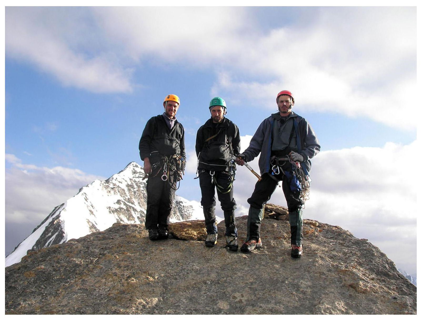
 Team members at the summit of Ak-su North. Ak-su Main in the background.
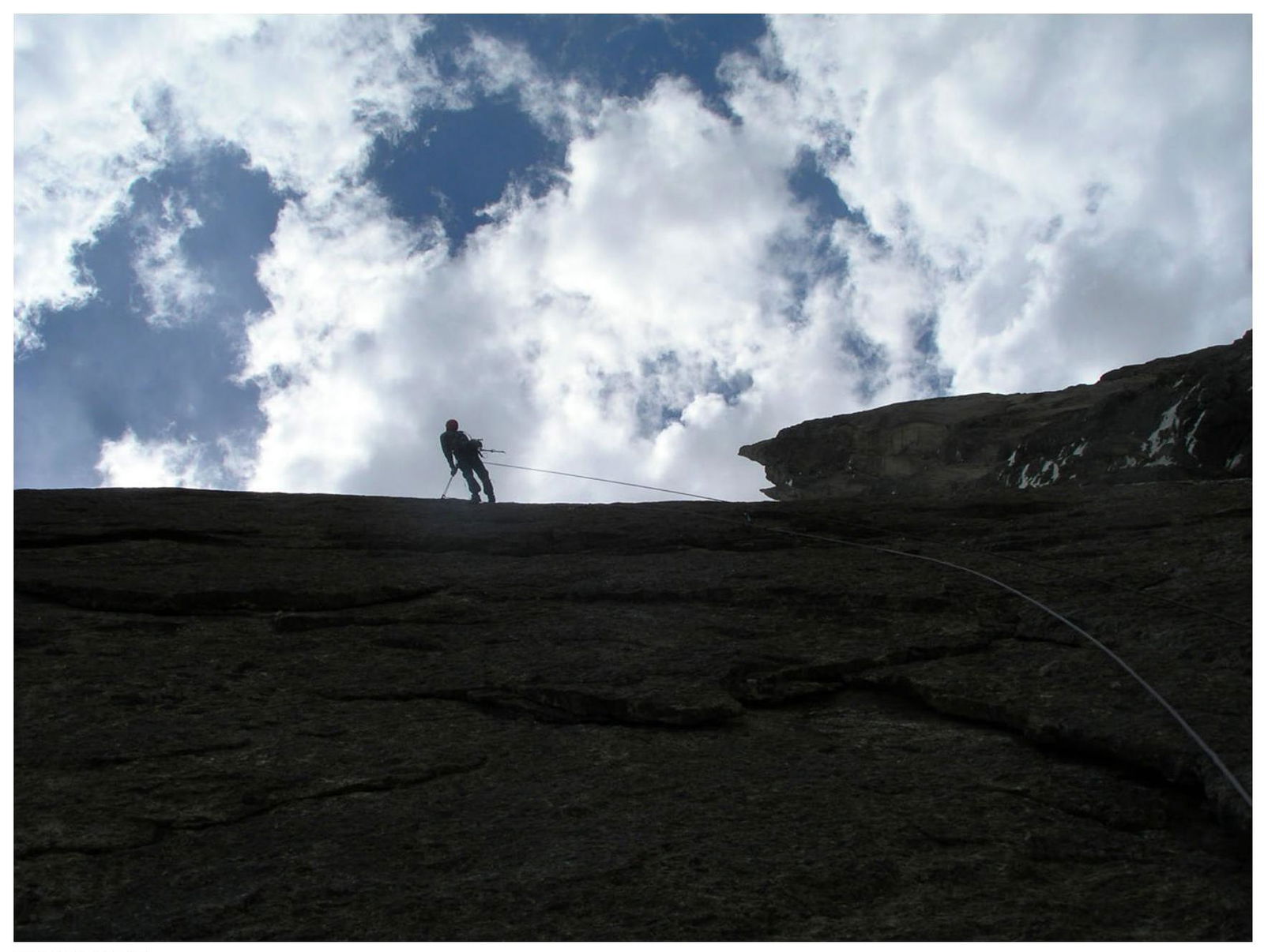
 Start of section R3-R4.
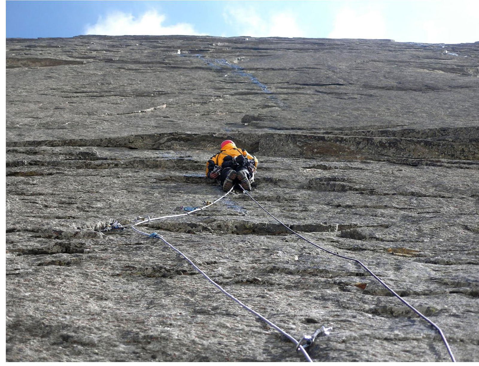
 Ropes on section R2-R3.
 Camp 1 bivouac. View from station R5.
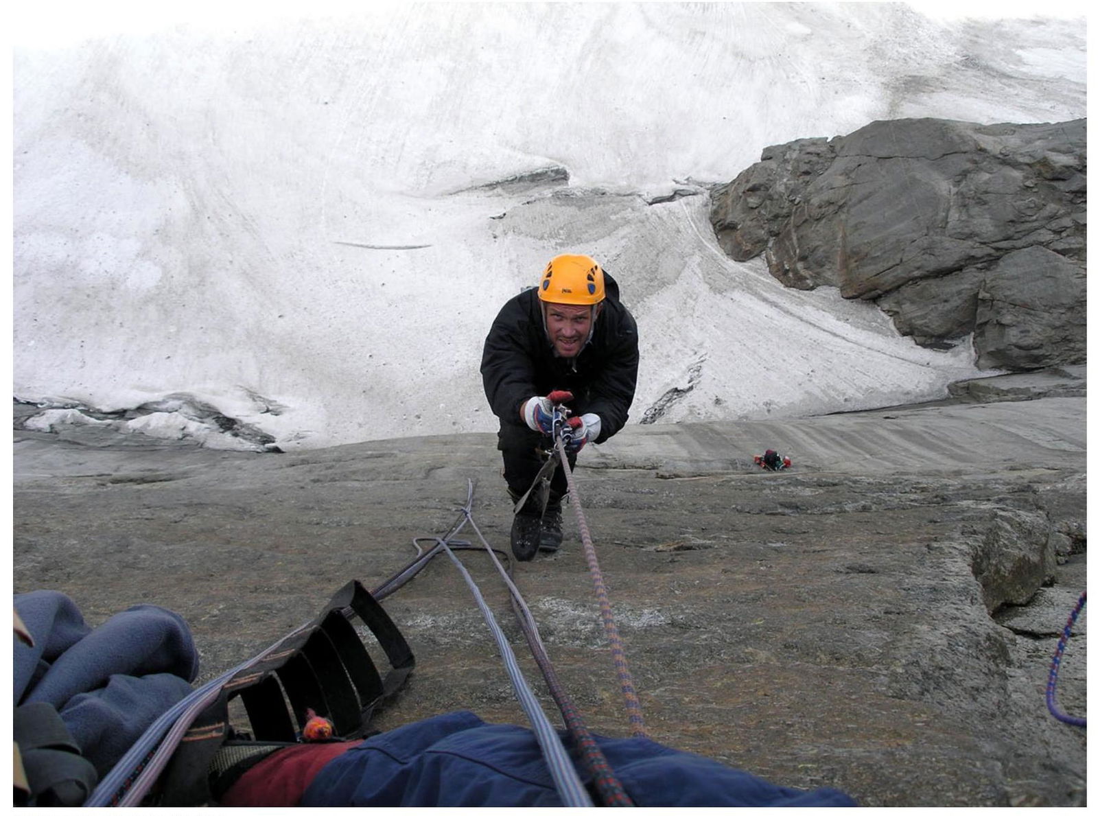
 Section R5-R6.