Climbing Passport
- High-altitude technical climb
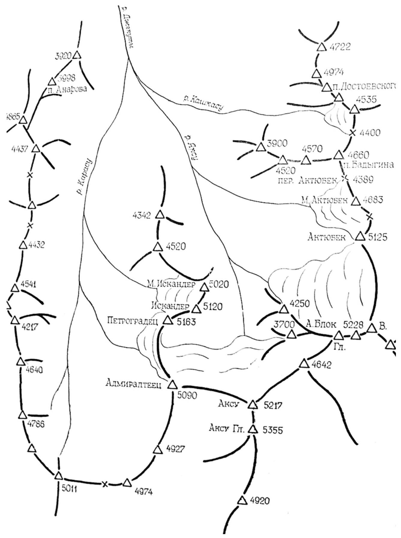
- Pamir-Alay, Turkestan Range, Lyaylyak valley
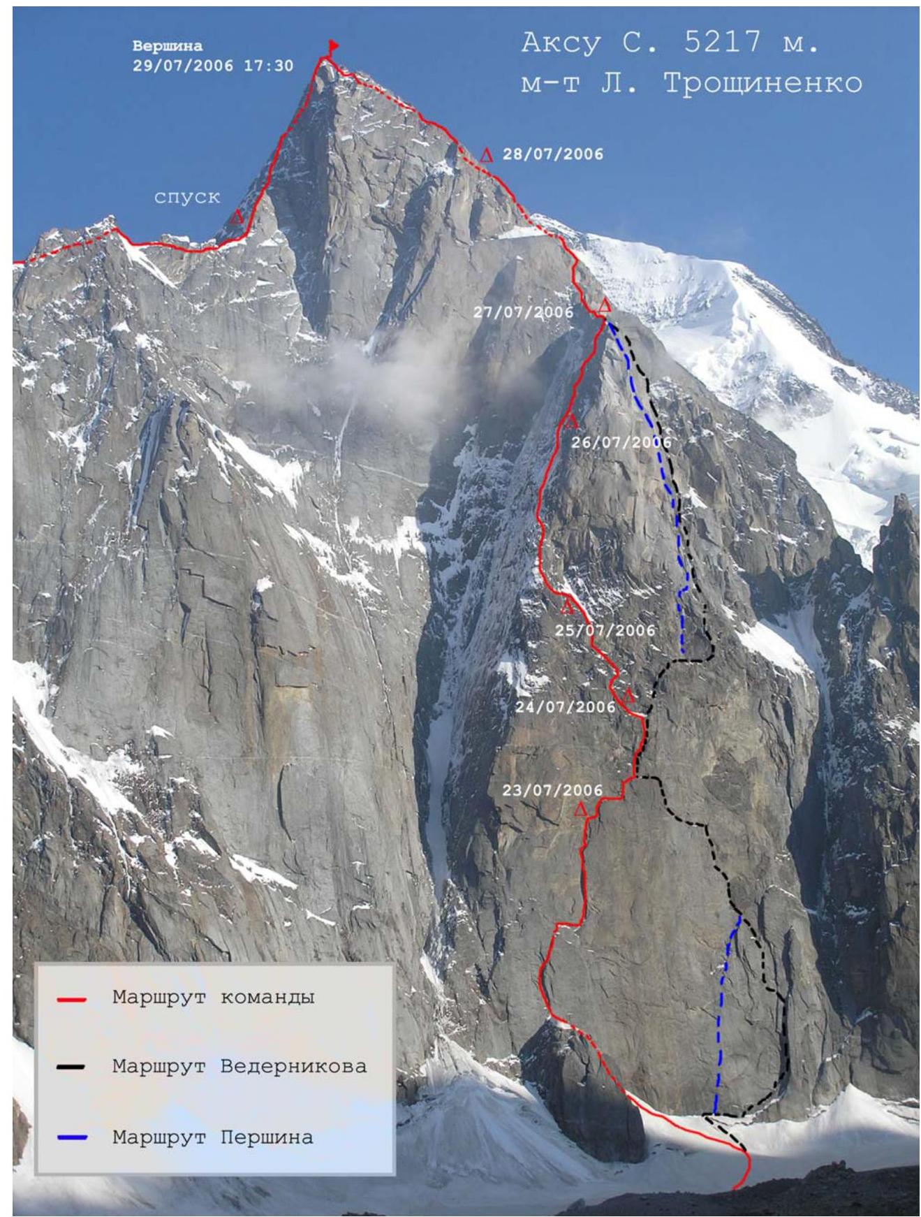
- Ak-Su (5217 m) via the North Face, L. Troshchinenko route.
- 6A category of difficulty
- Height difference 1590 m, length 2490 m, length of sections with 5th category of difficulty – 885 m, length of sections with 6th category of difficulty – 435 m, average steepness of the route – 60°, average steepness of the main part of the route – 74°.
- Pitons used:
rock: ice: nuts: bolt pitons: 70/0 17/0 202/0 22*/22*
- – previously placed
- Team's total climbing hours 89 hours, 7 days ascent, 2 days descent.
- Overnight stops: 1 – sitting in a hammock, 2 – sitting on a sack, 3 – sitting in a hammock, 4 – sitting on a ledge, 5 – lying in a tent, 6 – lying in a tent, 7 – lying in a tent, 8 – lying in a tent.
- Team leader Belousov Vladimir Alexandrovich, Candidate Master of Sports, Odintsovo, Team member Novikov Alexander Viktorovich, 1st sports category, Moscow.
- Coach Kauts Leonid Sergeevich, Candidate Master of Sports, Moscow.
- Departure to the route July 23, 2006.
Reached the summit July 29, 2006. Returned July 31, 2006.
- Moscow City Federation of Alpinism and Rock Climbing.
Map of the area
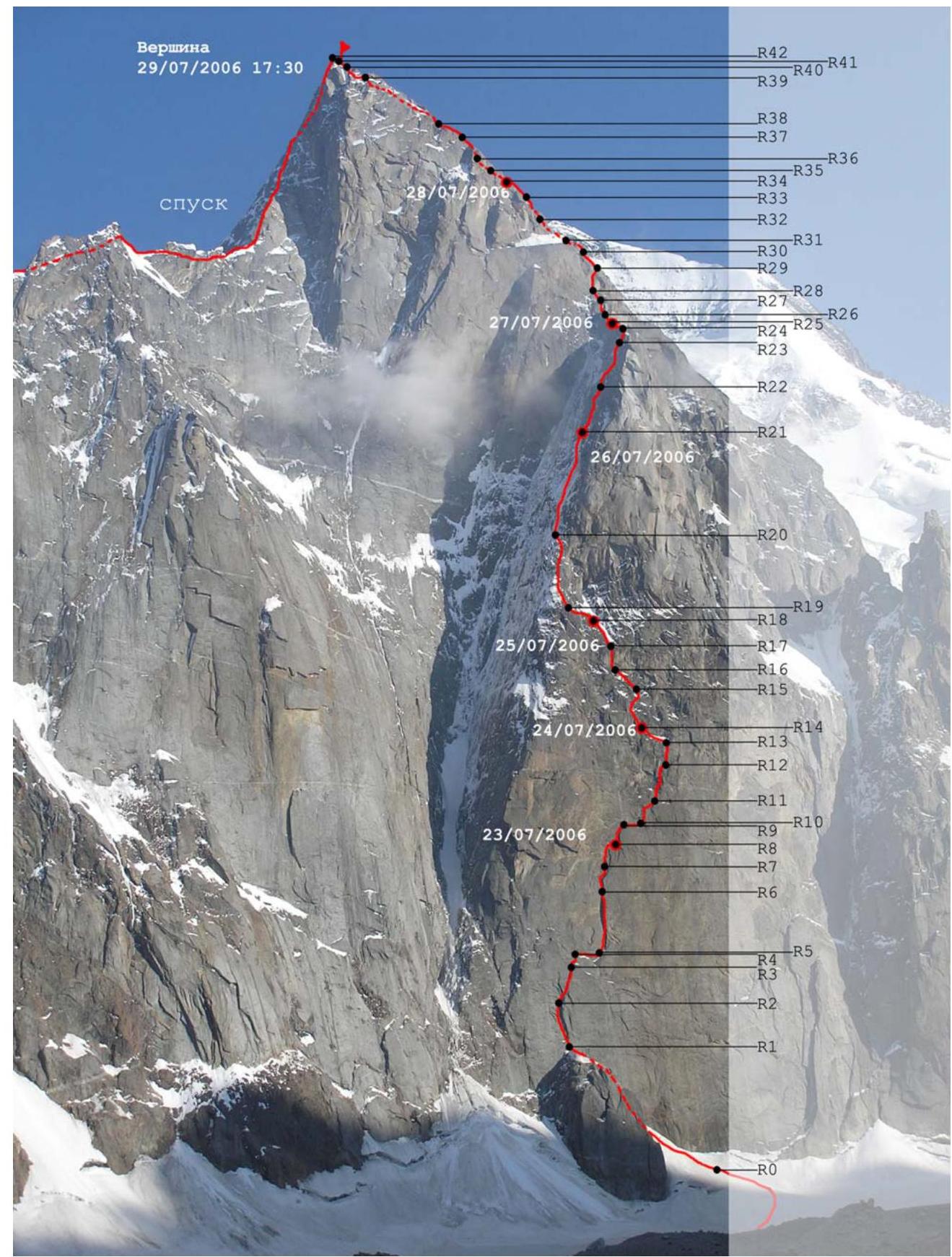
 General photo of the route
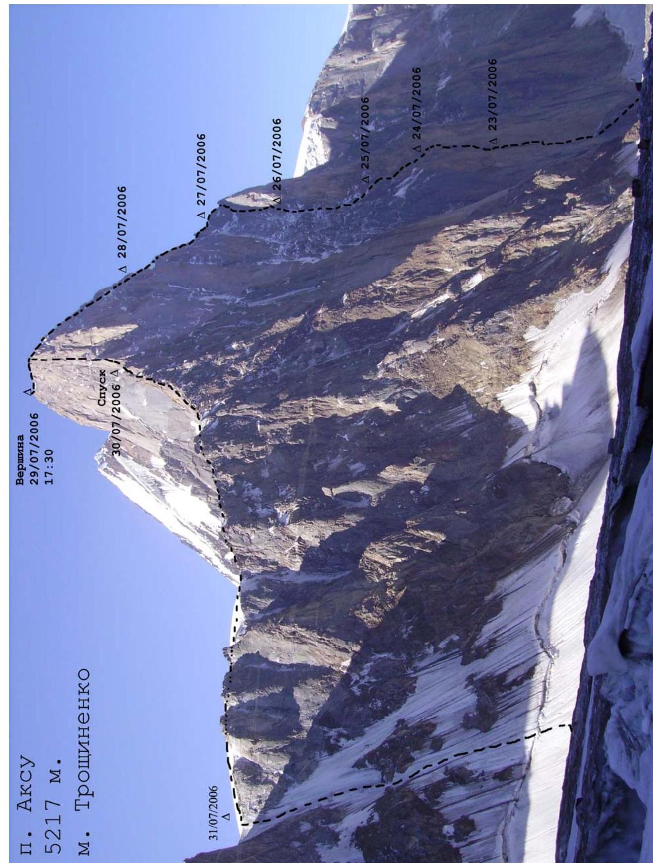
 Profile of the route on the left
Technical and Tactical Actions of the Team
According to the pre-planned plan, the team started the ascent on July 23 at 5:00. They began working on the wall at 8:00. The route was heavily waterlogged from snow patches. The water did not freeze at night. Often they had to work under the flow of water. After 16:00, the water flow intensified as the wall began to be lit by the sun.
The team's tactical plan did not include preliminary processing of the route. The team worked on the route until evening twilight, after which they settled in for the night, having a suspended hammock for two. Water supplies were replenished during the night stop. Before reaching the "cold corner," they collected water from streams flowing down the wall in the evening. After that, they melted water from snow and ice. The overnight stops on the first bastion and in the "cold corner" were sitting, two in a hammock and two on small ledges.
Key sections of the route were climbed using ITO and free climbing. There were very few local bolt pitons, and most of them were in very poor condition. In the lower part of the wall, the cracks were free of ice, which allowed a significant part of the route to be climbed free. The lead climber changed every day. The first climber went with two ropes – a dynamic and a static one. The dynamic rope was used for belaying, and the static rope was used with a Petzl ProTraxion to pull up the sack. The second climber ascended via the fixed ropes with a backpack and accompanied the sack. The entire wall section (except for one rope on a belt of destroyed rocks) and a large part of the ridge were climbed in this manner. On other sections, the first climber ascended with a backpack, and the second climber carried the sack on their shoulders.
Interaction with other teams working in the area was carried out using radio communication according to a pre-established schedule. The group was monitored from the base camp using binoculars and from overnight stops under the wall.
Ascent Schedule by Days
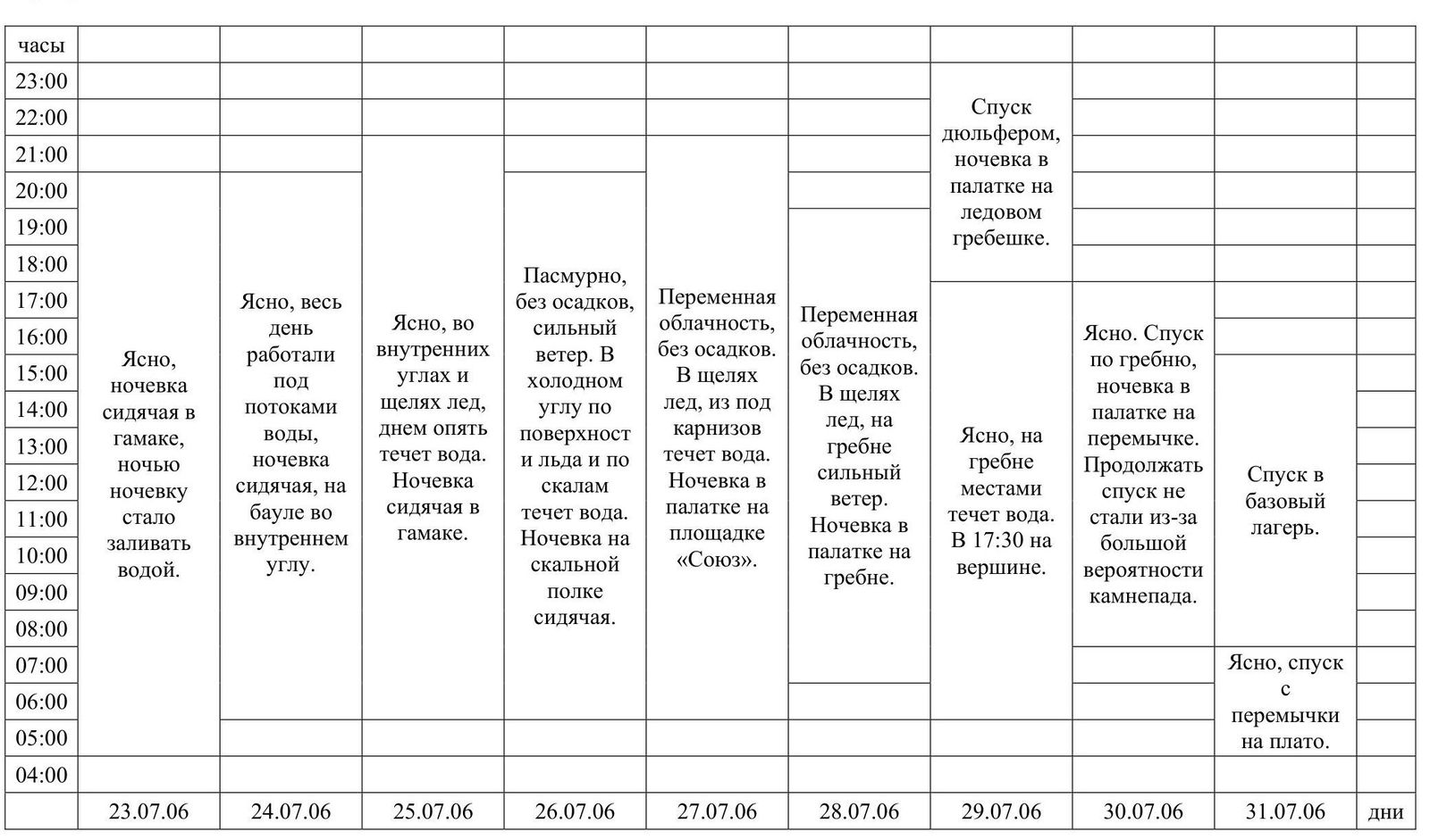
| Hours | 23.07.2006 | 24.07.2006 | 25.07.2006 | 26.07.2006 | 27.07.2006 | 28.07.2006 | 29.07.2006 | 30.07.2006 | 31.07.2006 | Days |
|---|---|---|---|---|---|---|---|---|---|---|
| 23:00 | Descent via rappel, overnight in a tent on an icy ridge. | |||||||||
| 22:00 | ||||||||||
| 21:00 | ||||||||||
| 20:00 | ||||||||||
| 19:00 | ||||||||||
| 18:00 | ||||||||||
| 17:00 | Clear, worked under water flows all day, overnight sitting on a sack in an inner corner. | Clear, ice in inner corners and crevices, water flows again during the day. Overnight sitting in a hammock. | Cloudy, no precipitation, strong wind. Water flows on the surface of ice and rocks in the "cold corner." Overnight on a rock ledge, sitting. | Variable cloudiness, no precipitation. Ice in creans, water flows from under carports. Overnight in a tent on the "Soyuz" ledge. | Variable cloudiness, no precipitation. Ice in crevices, strong wind on the ridge. Overnight in a tent on the ridge. | Clear, water flows on the ridge at times. Reached the summit at 17:30. | Clear. Descended along the ridge, overnight in a tent on a saddle. Did not continue descent due to high probability of rockfall. | Descent to the base camp. | ||
| 16:00 | Clear, overnight in a hammock, overnight stop began to be flooded with water. | |||||||||
| 15:00 | ||||||||||
| 14:00 | ||||||||||
| 13:00 | ||||||||||
| 12:00 | ||||||||||
| 11:00 | ||||||||||
| 10:00 | ||||||||||
| 09:00 | ||||||||||
| 08:00 | ||||||||||
| 07:00 | Clear, descent from the saddle to the plateau. | |||||||||
| 06:00 | ||||||||||
| 05:00 | ||||||||||
| 04:00 |
List of Equipment Used:
- Ropes – 2 pcs.
- Stopper nuts – 15 pcs.
- Stregor friends – 12 pcs.
- Black Diamond cams – 2 pcs.
- Pitons – 7 pcs.
- Anchor pitons – 4 pcs.
- Black Diamond ice axes – 2 pcs.
- Skyhooks – 2 pcs.
- Removable bolt pitons – 2 pcs.
- Ice screws – 6 pcs.
- Self-drilling ice screw – 1 pc.
- Rock hammer – 1 pc.
- Bolt kit – drill and 5 pitons with ears (for emergency).
- Ice tools – 2 pcs. One of them with a hammerhead and a "vydyrga"*.
- Quickdraws – 15 pcs.
- Screwgate carabiners – 10 pcs.
- Petzl ProTraxion hauler – 1 pc.
- Jumars – 2 pcs.
- Knee pads – 2 sets.
- Hammock – 1 pc.
- 2-person tent – 1 pc.
- Sleeping bag – 1 pc.
- Sleeping mat – 1 pc.
- Kitchen – (stove, gas, cookware)
- Sack – 140 l.
- Backpack – 45 l.
- Radio – 1 pc.1
Description by Sections
R0–R1: Snow-ice slope, then a wet inner corner leading to a ledge. R1–R2: A series of flakes and crevices leading to the base of an inner corner. R2–R3: Inclined inner corner. R3–R4: Slab leading to a ledge. R4–R5: Traverse right into the base of a chimney. R5–R6: Wide chimney with ice accretion, a huge "pancake" carport at the top. Old bolt pitons, loops, and pitons are found. R6–R7: Inclined inner corner, direction to the right. R7–R8: Continuation of the inner corner leads to a ledge on the right. Site of the first overnight stop. R8–R9: Inner corner filled with snow and ice leads to a ledge.
R9–R10: Traverse right along a ledge. R10–R11: First a slab with bolt pitons, then right into an inner corner leading to a ledge, which is the junction of the Pershin, Vedernikov, and Troshchinenko routes.
R11–R12: Up a slab (holes for skyhooks), then a bolt piton and climbing into a depression, from there right-up towards a diagonal crack. At the end of the diagonal crack, on an inclined slab, there is a belay station. The bolt pitons are old; additional pitons were placed.
R12–R13: Up a slab. Bolt pitons, pitons, ice axes. In some places, bolt pitons are missing or have torn ears. Skyhooks work well. Station on a ledge with a large snow patch. The bolt pitons are old; additional pitons were placed.
R13–R14: Along a ledge to the left, then up a couloir-corner to the left. Second overnight stop. R14–R15: Up the corner to the left, then right along a slab, and again left up the corner. R15–R16: Left up along ledges to a large flake. R16–R17: From the flake, left up 5 m into the base of a vertical inner corner with a blind crack. There is a hole for a removable bolt pito. Up the corner to a ledge.
R17–R18: Along the ledge to the right and up onto a belt of destroyed rocks. Along the destroyed rocks, left-up towards the "cold corner." Overnight stop.
R18–R19: Exit into the "cold corner." Ice "rivers" alternate with sections of destroyed rocks.
R19–R20: Exit from destroyed rocks into an icy couloir. R20–R21: Along the icy couloir, following its right edge. Exit onto a small inclined ledge. Overnight stop.
R21–R22: Up an inner corner. Cracks filled with ice. Possibly bypass to the right along a rib. R22–R23: Through wedged, overhanging blocks, exit right onto a ledge on a rib. R23–R24: Along a slab with cracks, then along destroyed rocks onto a ledge on a ridge. R24–R25: Through a narrow crack in a slab, exit onto ledges for the "Soyuz" overnight stop. Overnight stop. R25–R26: Along talus under a gendarme. Right along an inner corner onto a ridge under the gendarme. R26–R27: Bypass the gendarme on the left along a ledge with ice and exit onto an inclined icy ledge after the gendarme. R27–R28: Along large-block rocks, approach under an overhanging inner corner with a wide crack filled with ice. R28–R29: Along the crack and next to it, exit onto a ridge. R29–R30: Up, left of the ridge, along cracks and flakes, exiting onto a ridge. R30–R31: Bypassing the ridge on the right, along ledges, exit to the base of a wide inner corner. R31–R32: Up the corner to a ledge. R32–R33: From the ledge, left-up through a vertical destroyed wall onto a ledge with rock blocks, along the ledge into an inner corner (destroyed rocks), and further up the corner. R33–R34: Up the corner, exit onto a ledge. Overnight stop. R34–R35: Up along a ridge. R35–R36: Right of the ridge, along ledges and a wall, exit onto a large ledge. R36–R37: Bypassing the rise of the ridge on the right along a diagonal crack, exit onto a ledge on the right of the ridge. R37–R38: Right along the ridge under an inner corner and up the inner corner onto a ledge. R38–R39: From the ledge up, then right, bypassing vertical walls of the ridge, exit into a pass. R39–R40: Bypassing the ridge on the left along ice, exit onto a lowering in the ridge. R40–R41: Up destroyed rocks, exit to a rappel loop. R41–R42: Along a simple ridge to the summit.
Hand-drawn profile of the route
- Steepness of the main part — 74°
- Steepness of the route — 60°
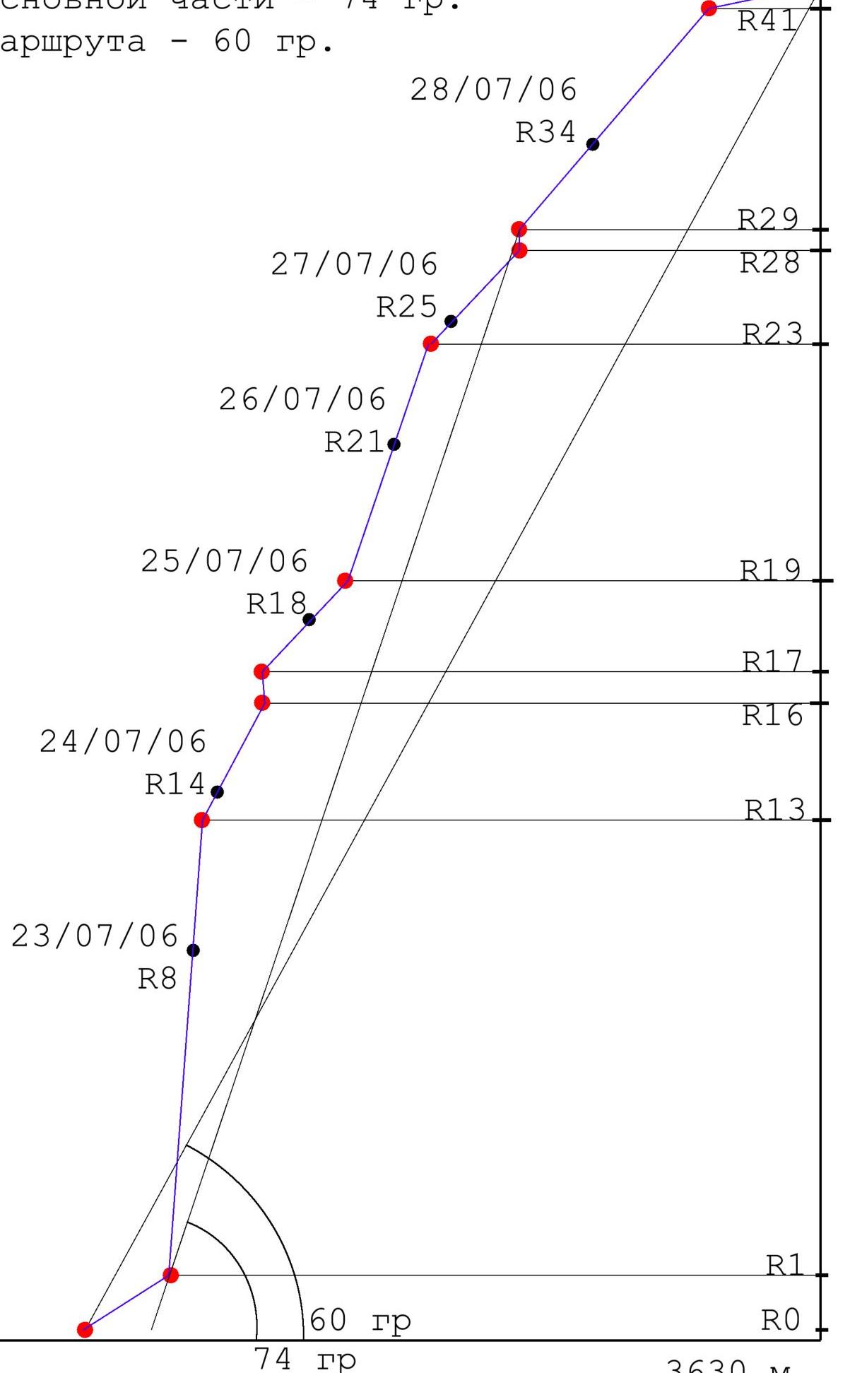 Diagram of the route in UIAA symbols
| Rock | Nuts | Bolt | Ice | Section # | Date | Length (m) | Steepness (°) | UIAA |
|---|---|---|---|---|---|---|---|---|
| R11 | ||||||||
| 5 | 4* | R10 | 40 | 90 | VI A0 | |||
| R9 | 23.07 | 50 | easy | III | ||||
| 5 | R8 | 30 | 80 | V | ||||
| 15 | R7 | 40 | 80 | VI | ||||
| 2 | 8 | R6 | 30 | 70 | V | |||
| 15 | 15 | 2* | R5 | 60 | 100 | VI A2 | ||
| 3 | R4 | 50 | easy | III | ||||
| 3 | R3 | 20 | 70 | IV | ||||
| 10 | R2 | 40 | 70 | V | ||||
| 3 | 10 | R1 | 40 | 90 | V | |||
| 2 | R0 | 200 | 50 | III–IV | ||||
| R19 | ||||||||
| 5 | 8 | R18 | 90 | 60 | V | |||
| 1 | 2 | R17 | 25.07 | 50 | 50 | IV | ||
| 5 | 16 | R16 | 45 | 90 | VI A2 | |||
| 2 | R15 | 50 | 50 | IV | ||||
| 3 | 3 | R14 | 50 | 70 | V | |||
| R13 | 40 | easy | III | |||||
| 4 | 15* | R12 | 45 | 90 | VI A2 | |||
| 3 | 18 | R11 | 45 | 90 | VI A2 | |||
| R29 | ||||||||
| 4 | 12 | 1* | 3 | R29 | 75 | 90 | VI | |
| R28 | ||||||||
| 2 | R27 | 50 | 50 | IV | ||||
| 4 | 2 | 1 | R26 | 50 | 60 | V | ||
| 4 | R25 | 60 | 70 | V | ||||
| 5 | R24 | 27.07 | 50 | 60 | V | |||
| 10 | 15 | R23 | 40 | 60 | V | |||
| 3 | 10 | R22 | 90 | 70 | V | |||
| 3 | R21 | 26.07 | 45 | 70 | VI | |||
| 5 | R20 | 120 | 55 | V | ||||
| R19 | 50 | 70 | V | |||||
| R42 | 29.07 | |||||||
| R41 | 300 | 30 | III–IV | |||||
| 1 | R39 | 50 | 40 | IV | ||||
| 2 | R38 | 50 | 50 | IV | ||||
| 2 | R37 | 50 | 60 | V | ||||
| 2 | 9 | R36 | 40 | 90 | VI A2 | |||
| 1 | R35 | 40 | 50 | IV | ||||
| R34 | 28.07 | 50 | 40 | IV | ||||
| R33 | 30 | 40 | IV | |||||
| 2 | R32 | 50 | 60 | IV | ||||
| 3 | R31 | 45 | 70 | V | ||||
| R30 | 50 | 30 | III | |||||
| 3 | R29 | 50 | 70 | V |
Technical photo of the route
Photos of Sections
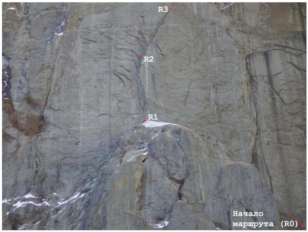
Photo 1. Sections R0–R4 (photo taken from "Korean overnight stops").
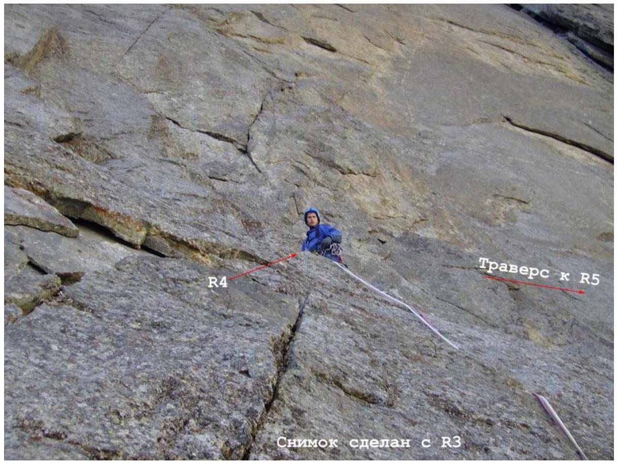
Photo 2. Section R3–R4. July 23, 2006.
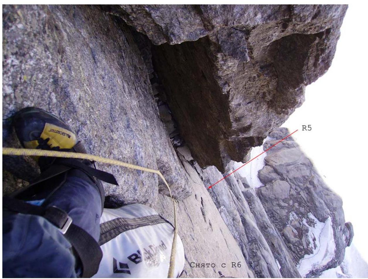
Photo 3. Section R5–R6. July 23, 2006.
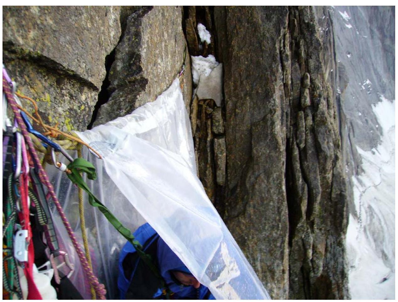
Photo 4. Overnight stop on July 23 (first). End of section R7–R8.
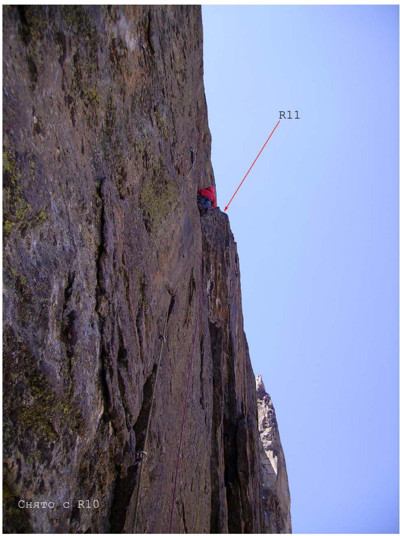
Photo 5. Section R10–R11. July 24, 2006.
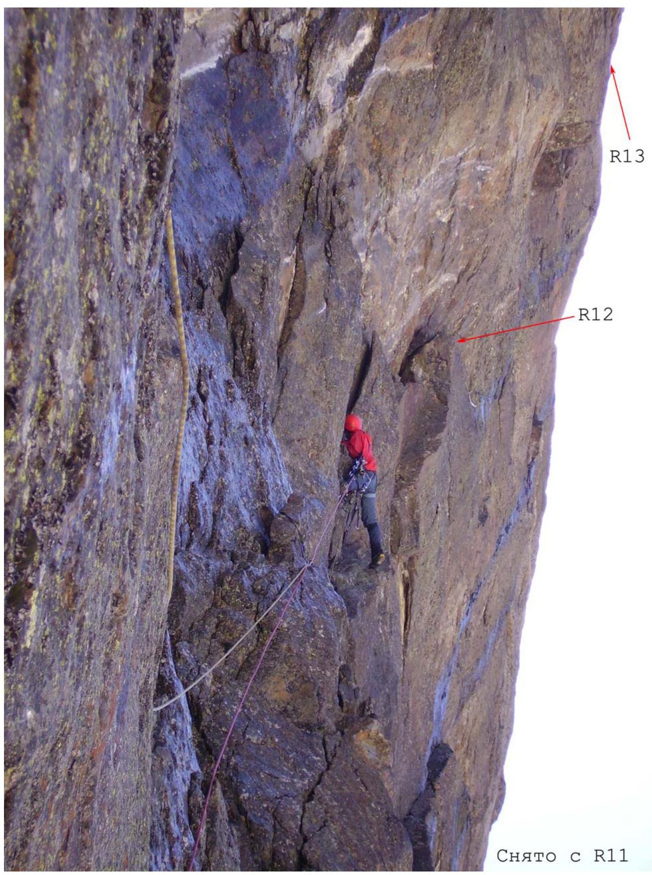
Photo 6. Section R11–R12. July 24, 2006.
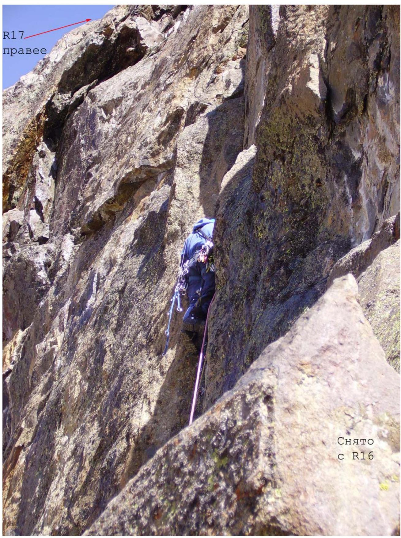
Photo 7. Section R16–R17. July 25, 2006.
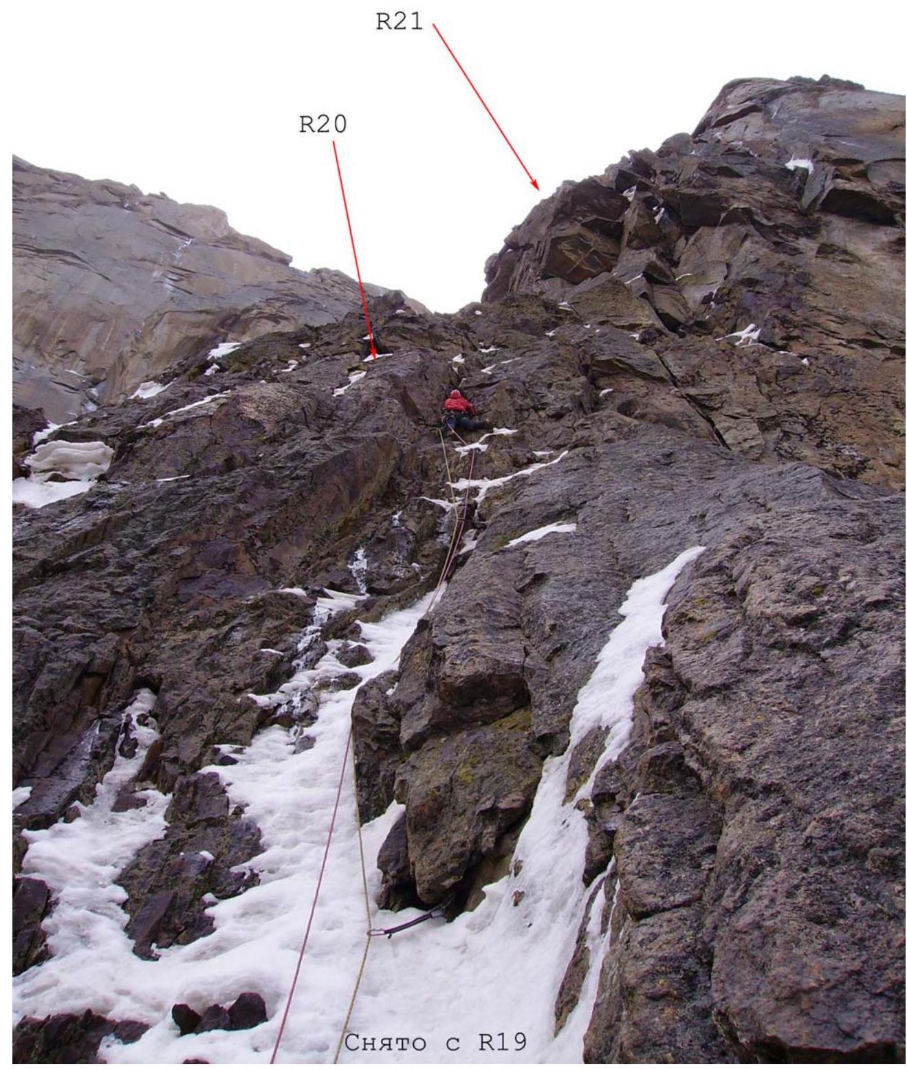
Photo 8. Section R19–R20. July 26, 2006.
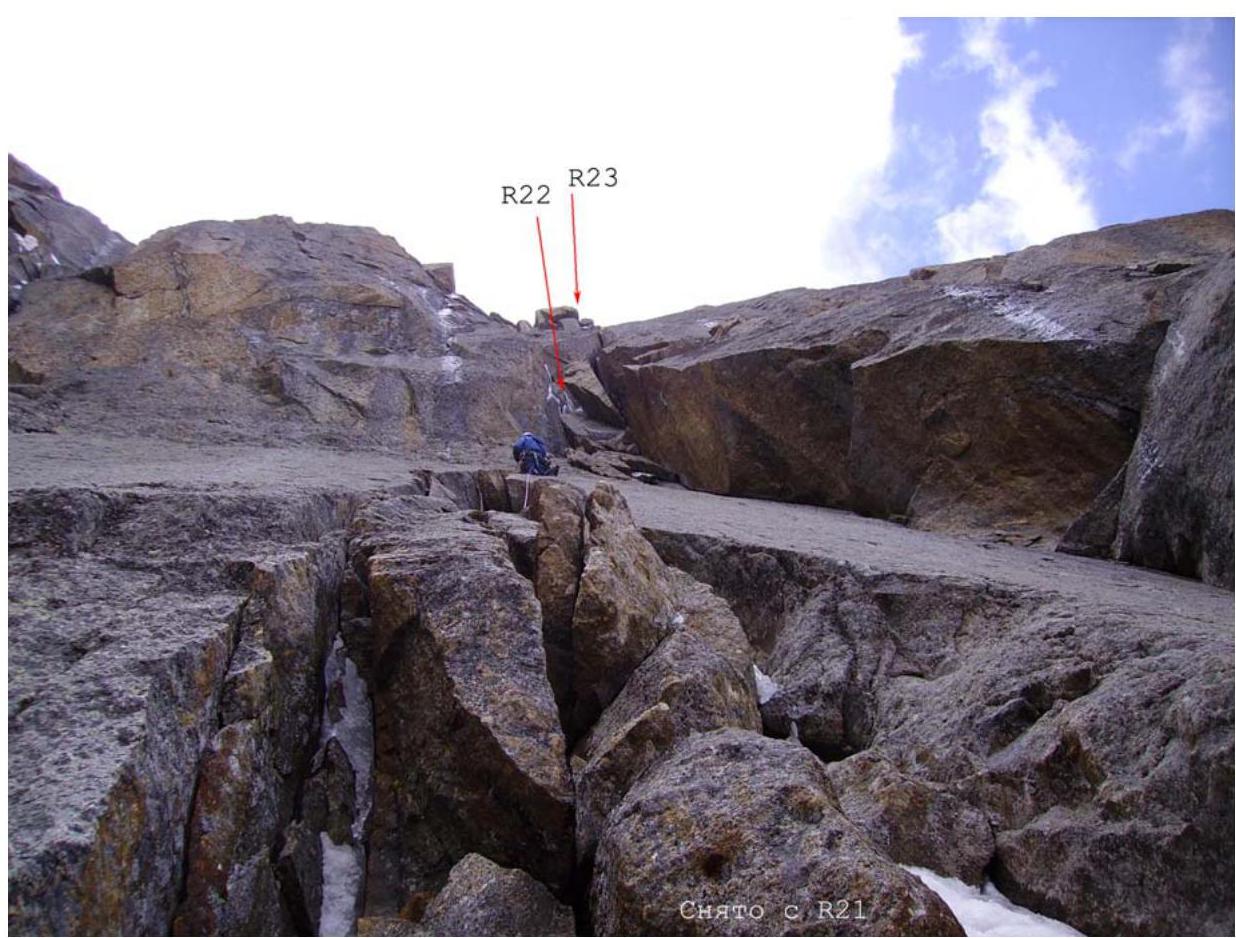
Photo 9. Section R21–R22. July 27, 2006.

Photo 10. Section R28–R29. July 28, 2006.
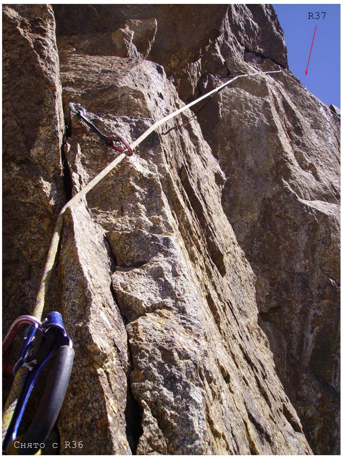
Photo 11. Section R36–R37. July 29, 2006.
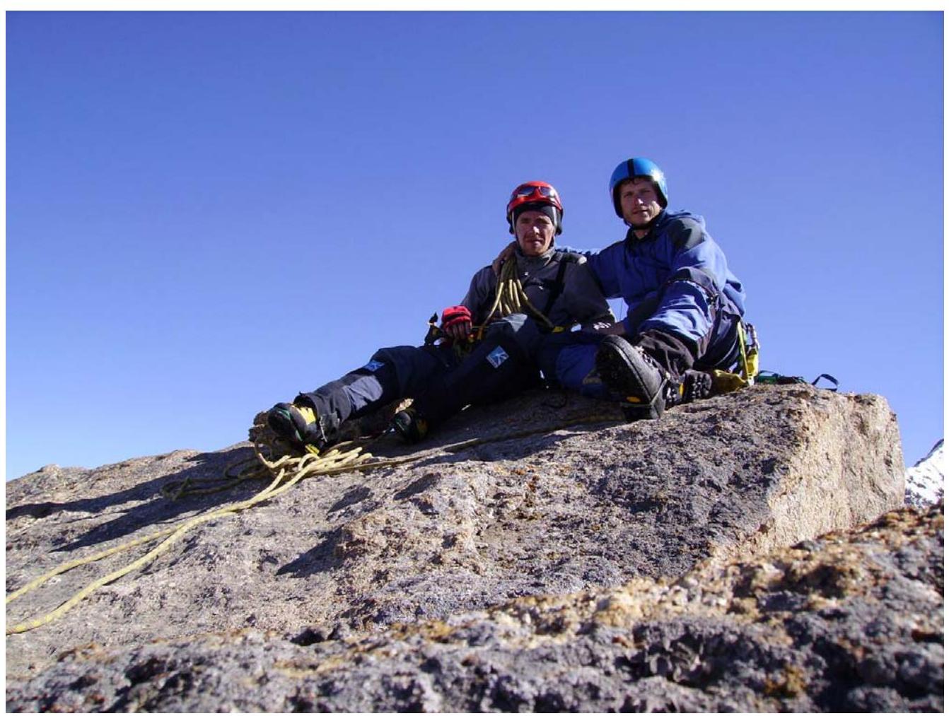
Photo 12. Summit, July 29, 2006, 17:00
Notes
A note from the summit is attached. A control tour on a snow patch on section R13–R14 was found, but there was no note.
Footnotes
-
- VYDYRGA — a steel cable attached to a hammer and used by us for pulling out pitons.