Ascent Passport
- Region of ascent: PAMIR-ALAI, Turkestan Ridge, Laylyak gorge area
- Name of the peak: Aksu North (5217)
- Name of the route: "To the wall" (L. Troshchinenko)
- Category: 6A
- Nature of the route: combined
- Height difference: 1517 m
Route length: 1895 m
Length of sections:
- category V — 810 m
- category VI — 755 m
Average steepness:
- wall section — 79°
- entire route — 67°
-
Equipment used on the route (including for ITD): Pitons: 146 (23); Ice screws: 31; Drill-in pitons: 29 (16) (14 of them are old); закладные элементы: 178 (8); Skyhooks: 4 (4) Total ITD used: 53 points
-
Leader: Nagayev Rustem Raisovich, Candidate Master of Sports Participants:
- Kirichenko Ruslan Sergeyevich, Candidate Master of Sports
- Koltunov Oleg Sergeyevich, 1st sports category
-
Location of Base Camp: Below the route
-
Time spent on the route: 95.5 hours – 9 days (including descent from the summit — 19 hours, 2 days)
-
Time:
- Start of the route: July 20, 2007 at 6:30
- Reach the summit: July 28, 2004 at 13:00
- Return to Base Camp: July 30, 2007 at 14:00
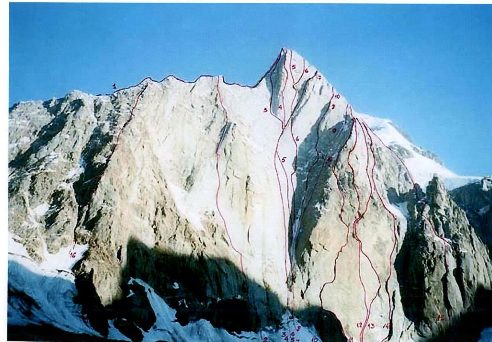
Photo. General photo: 1 — to the ridge (Budyanov) — 5B 2 — left bastion of N wall (Kovunenko) — 6A 3 — center of N wall — 6A 4 — center of N wall through the "nose" (Shabalin) — 6A 5 — N wall (Klenov) — 6A — ? 6 — center of N wall (Ruchkin, Odintsov) — 6A 7 — center of N wall (Chaplynsky) — 6A 8 — center of N wall (Moshnikov) — 6A 9 — "cold angle" of N wall (Antonov) — 6A 10 — N wall (Kostenko) — 6A 11 — N wall (Troshchinenko) — 6A 12 — bastion of N wall (Klenov) — 6A 13 — right part of N wall (Pershin) — 6A 14 — right part of N wall (Vedernikov) — 6A 15 — right bastion of N wall (Vedernikov) — 6A 16 — left couloir flank of N wall (Korshunov) — 6A
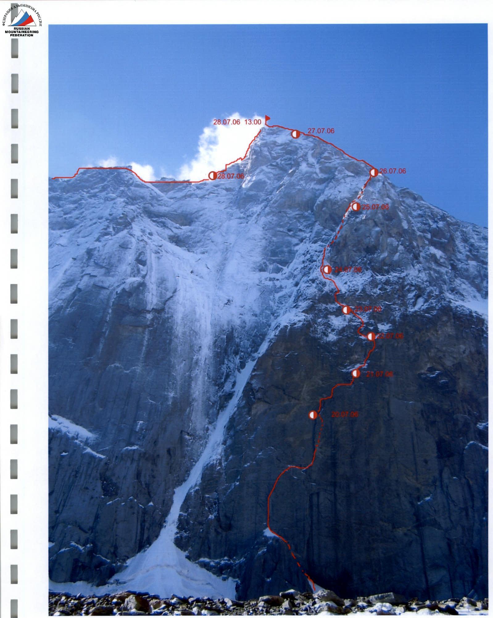
Photo 2. Technical photo
Ascent Graph
(time to reach the designated height is indicated)
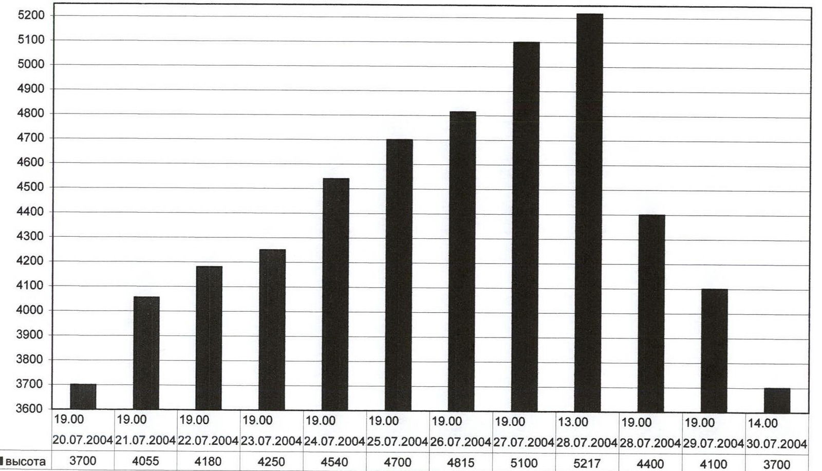
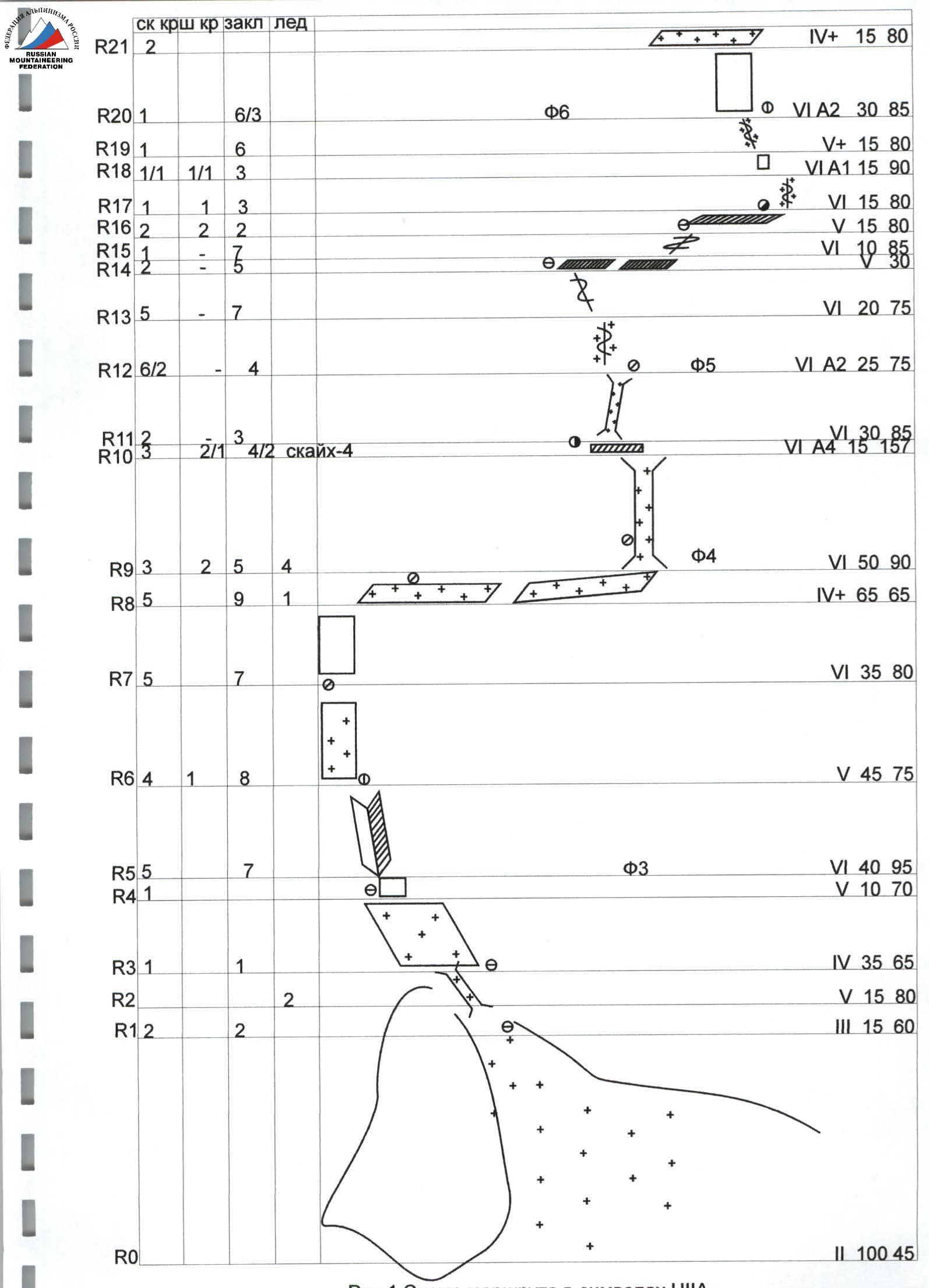
Fig. 1. Route diagram in UIIA symbols
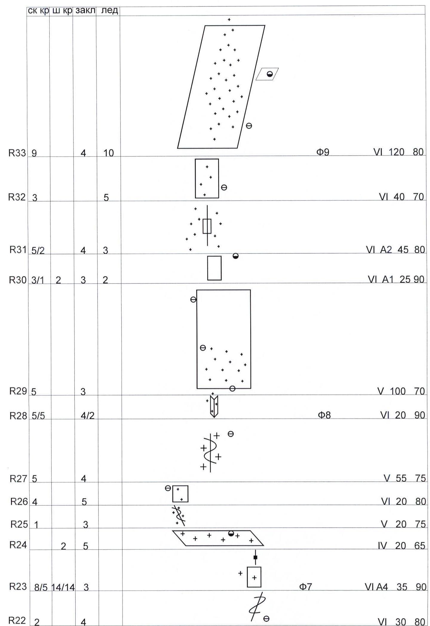
Fig. 2. Route diagram in UIIA symbols M 1:2000
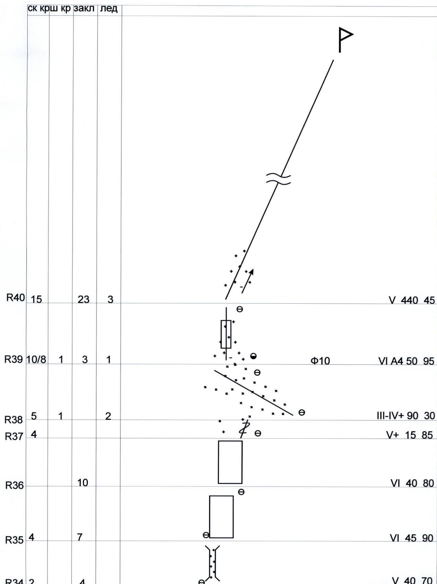
Fig. 3. Route diagram in UIIA symbols M 1:2000
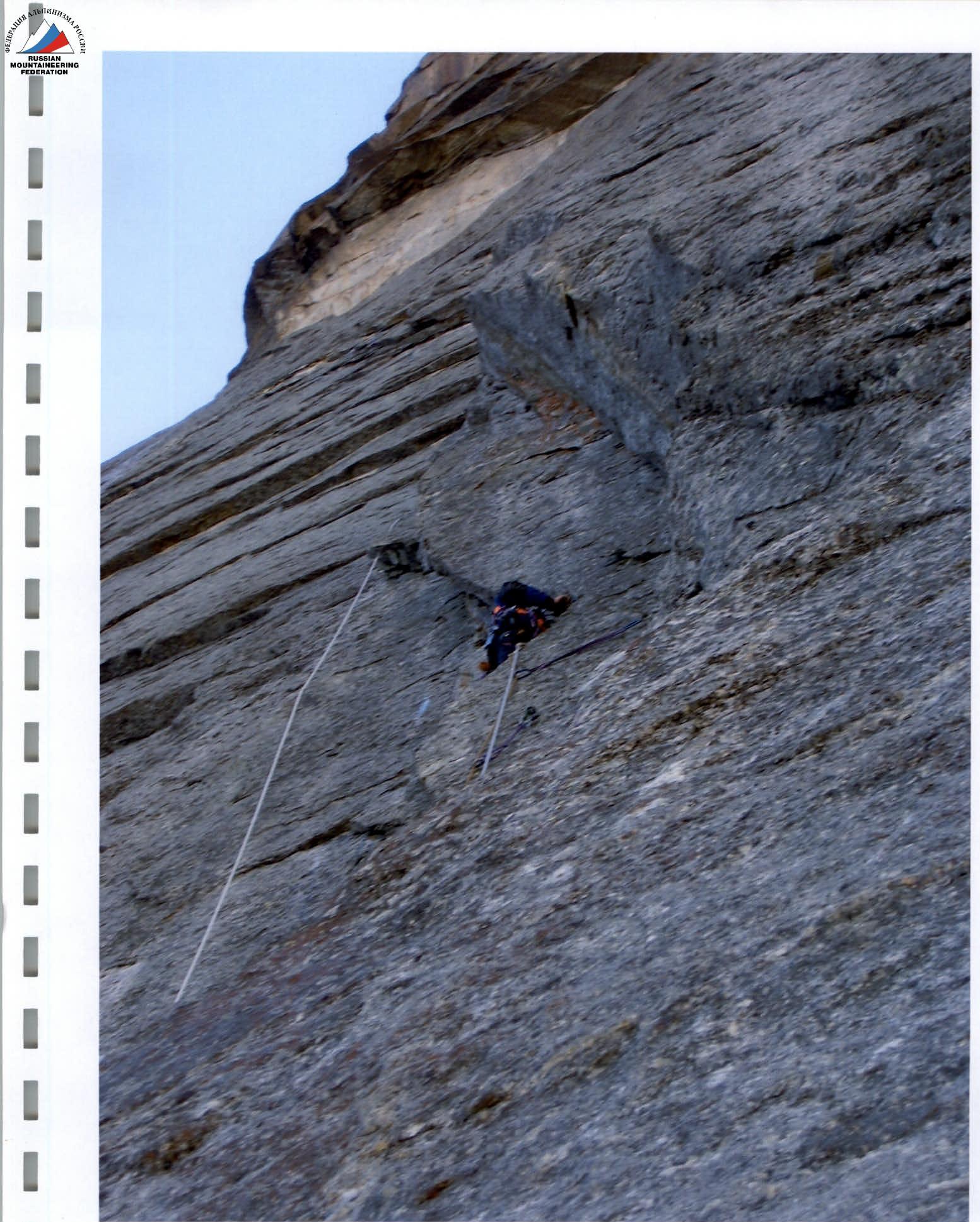
Photo 3. Section R5 — Nagayev is working first
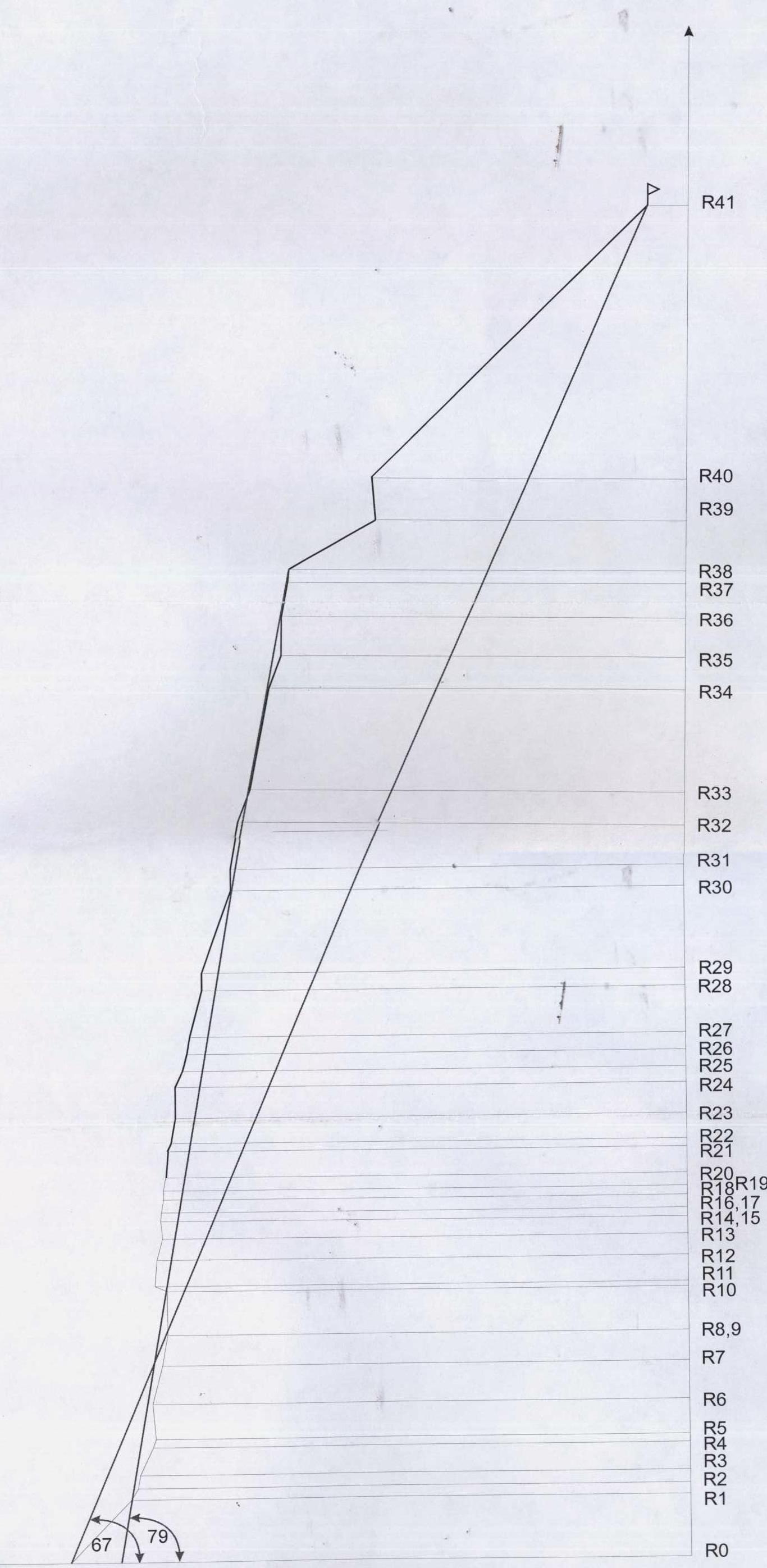
Fig. 4. Route profile M 1:5000
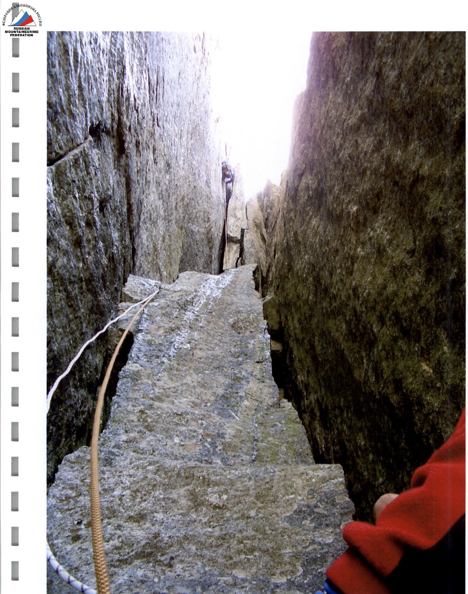
Photo 4. Section R9-R10 — Nagayev is working first
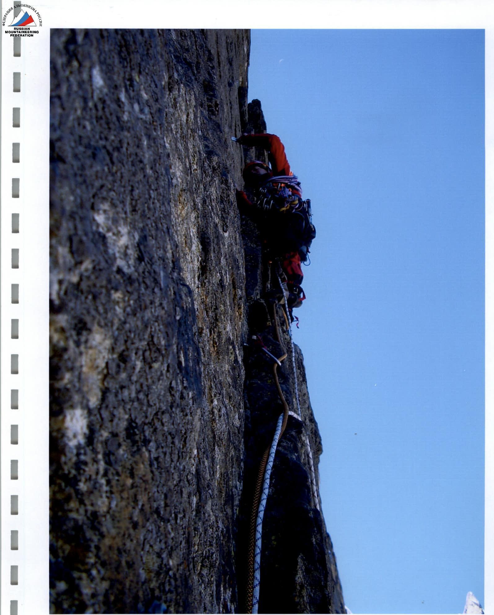
Photo 5. Section R12 — Koltunov is working first
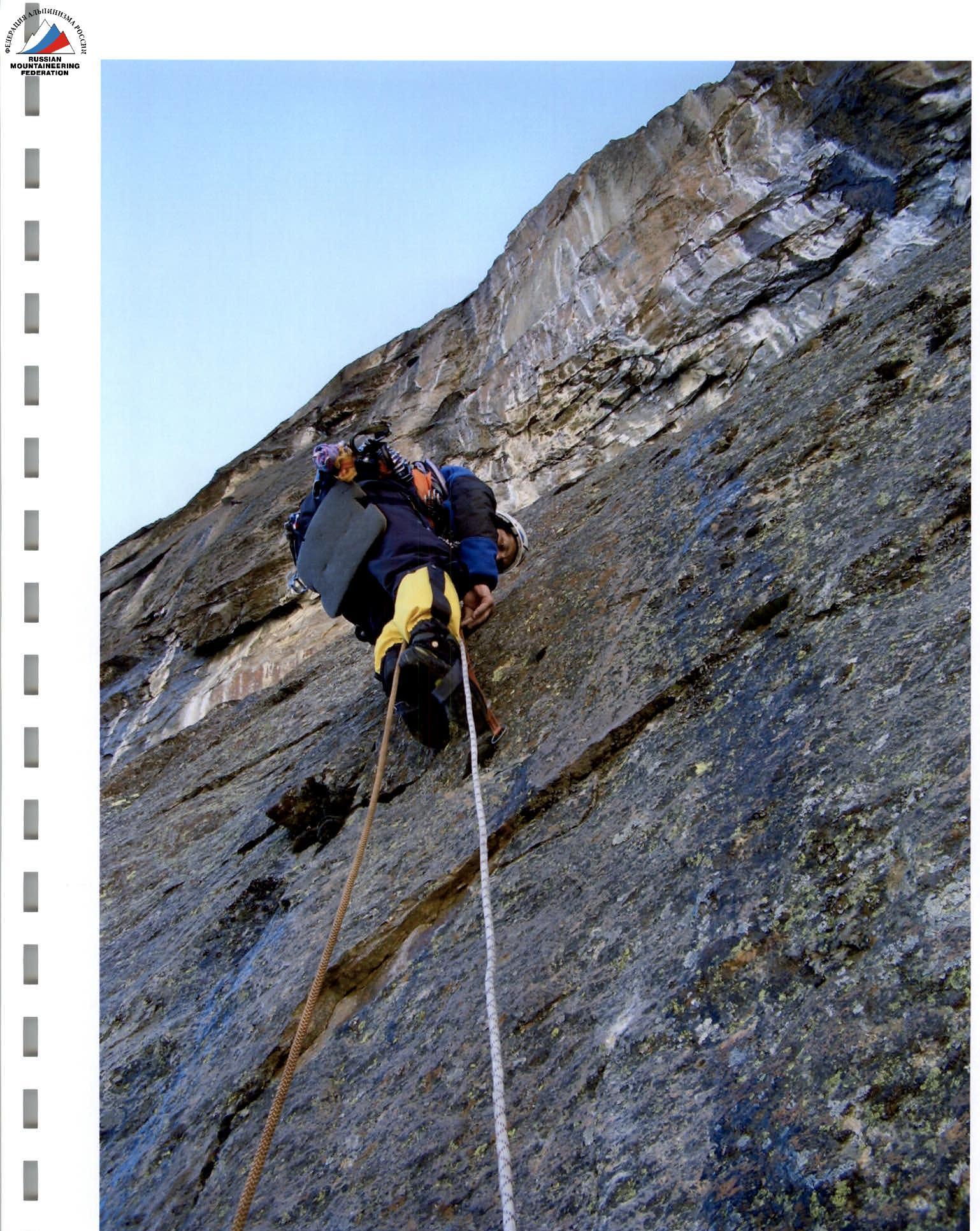
Photo 6. Section R20 — Nagayev is working first
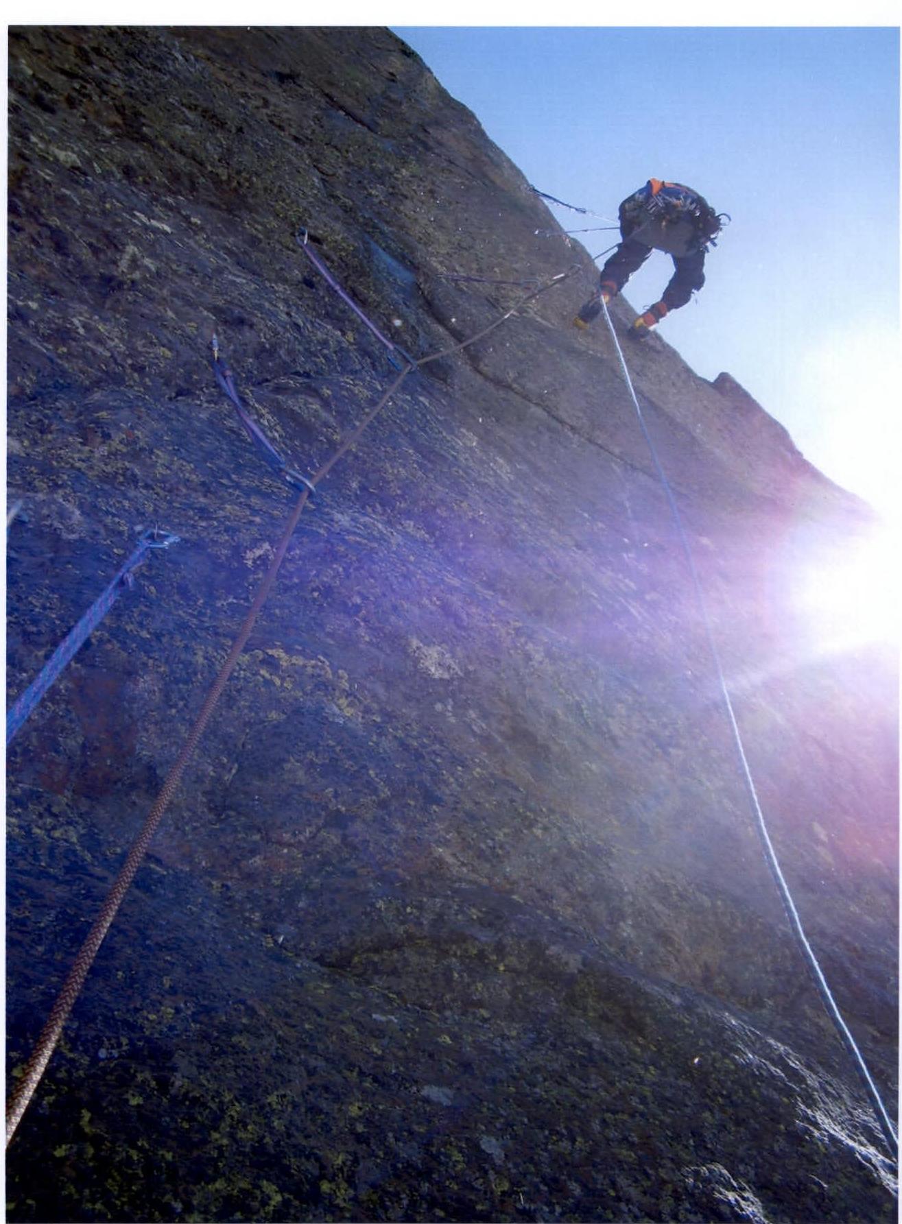
Photo 7. Section R23 — Nagayev is working first
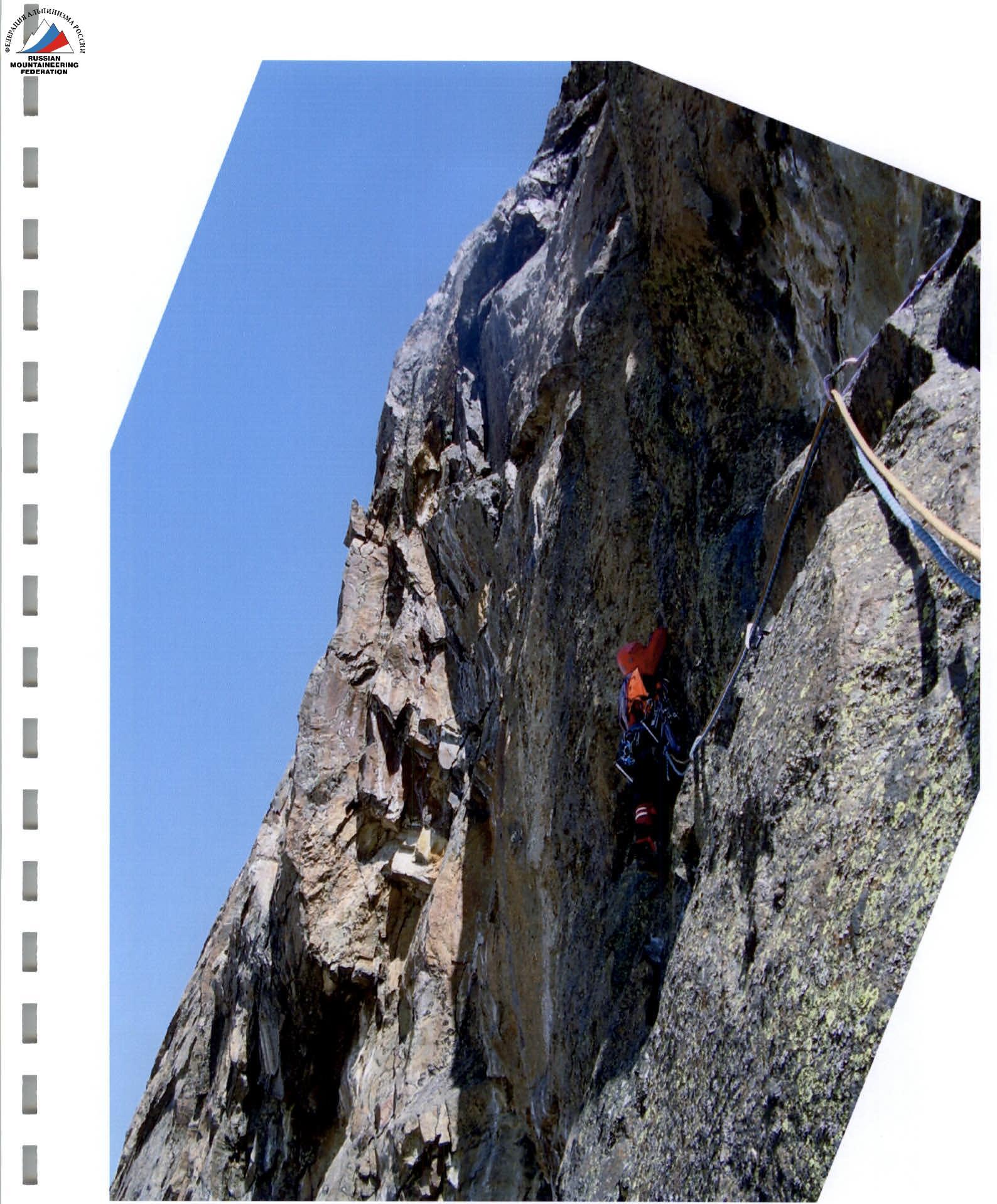
Photo 8. Section R28 — Koltunov is working first
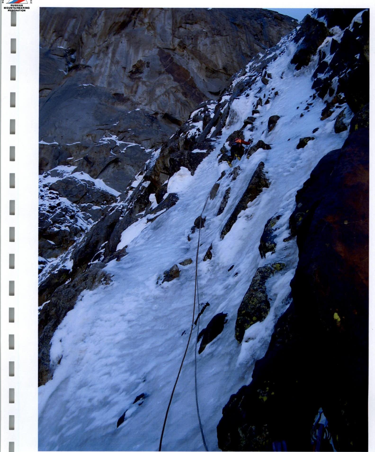
Photo 9. Section R33 — Koltunov is working first
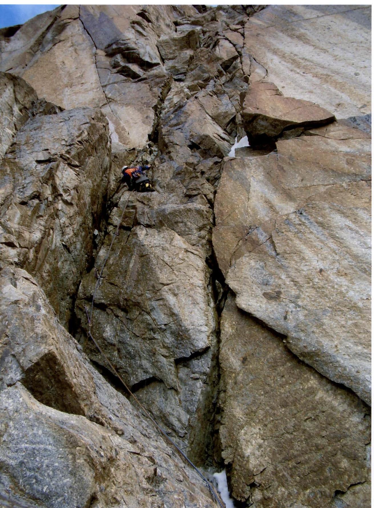
Photo 10. Section R39 — Nagayev is working first

Photo 11. Summit of Aksu North: Nagayev, Koltunov. Kirichenko is taking the photo