Ascent Passport
- Ascent category — technical
- Ascent region — Pamir-Alay, Zeravshan Range
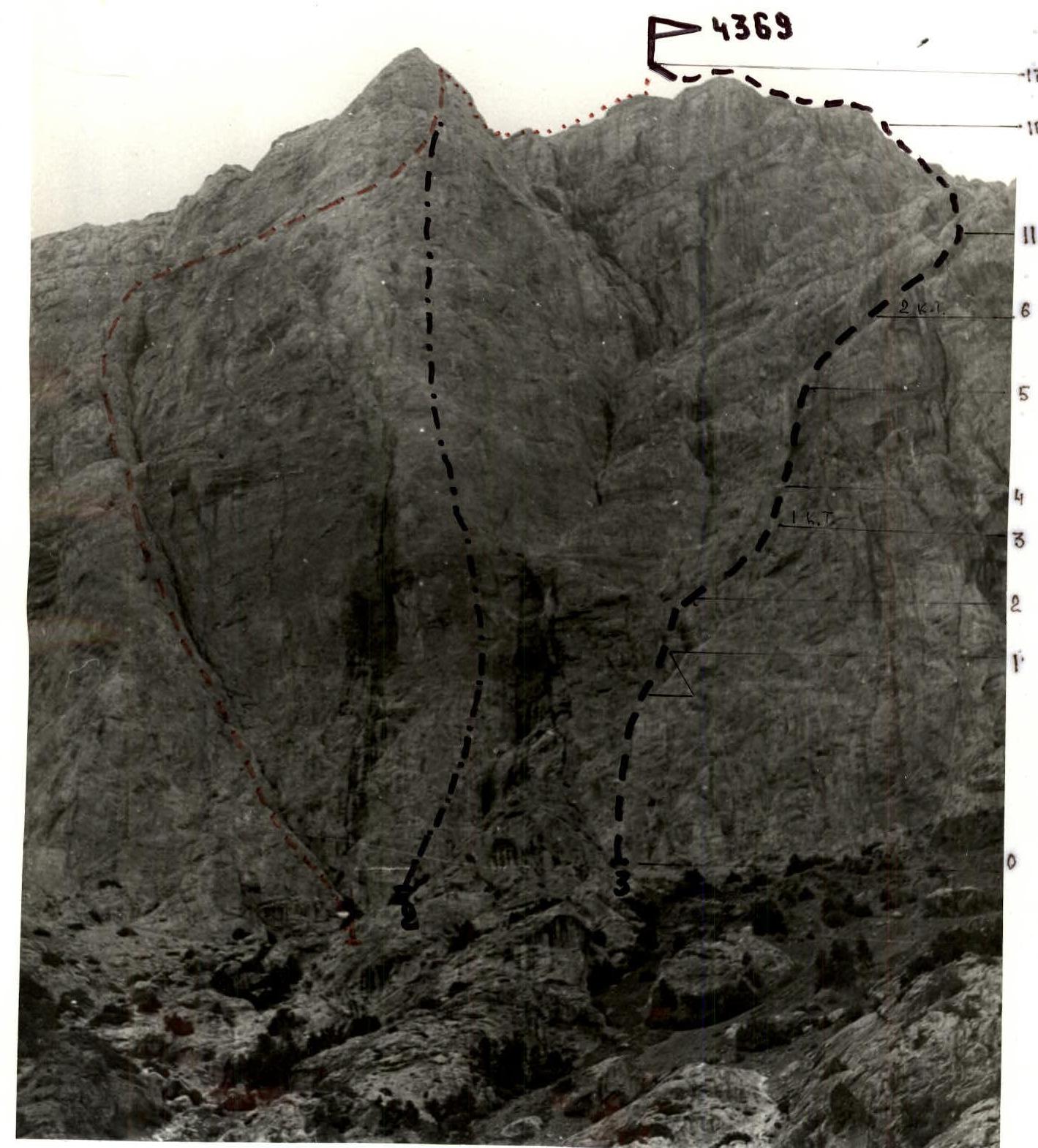
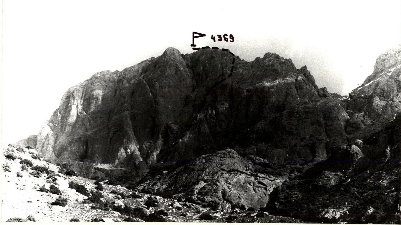
- Peak — 4369 (Peak 40-letiya Pobedy) via the center of the South face
- Proposed — 5A category of difficulty, first ascent
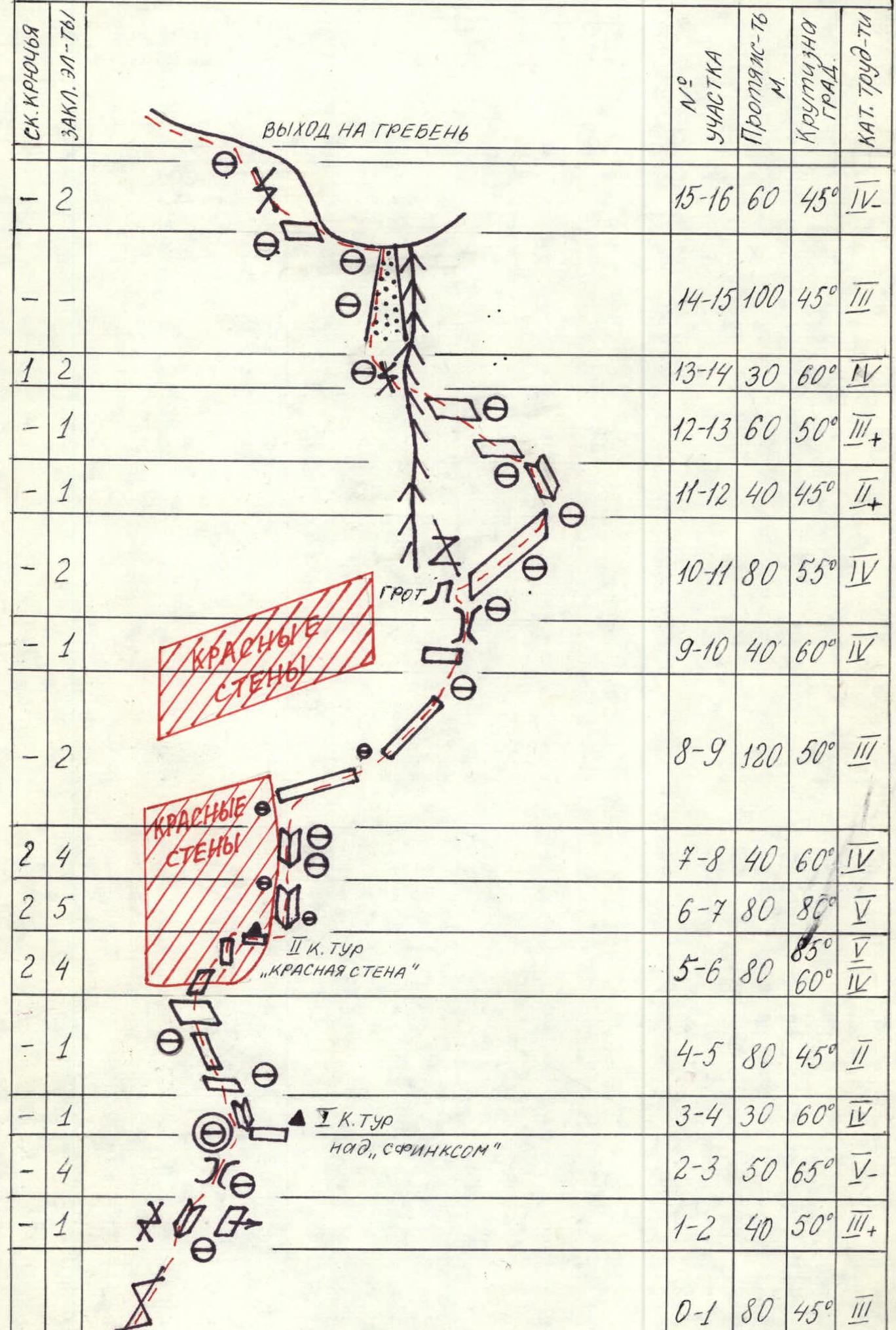
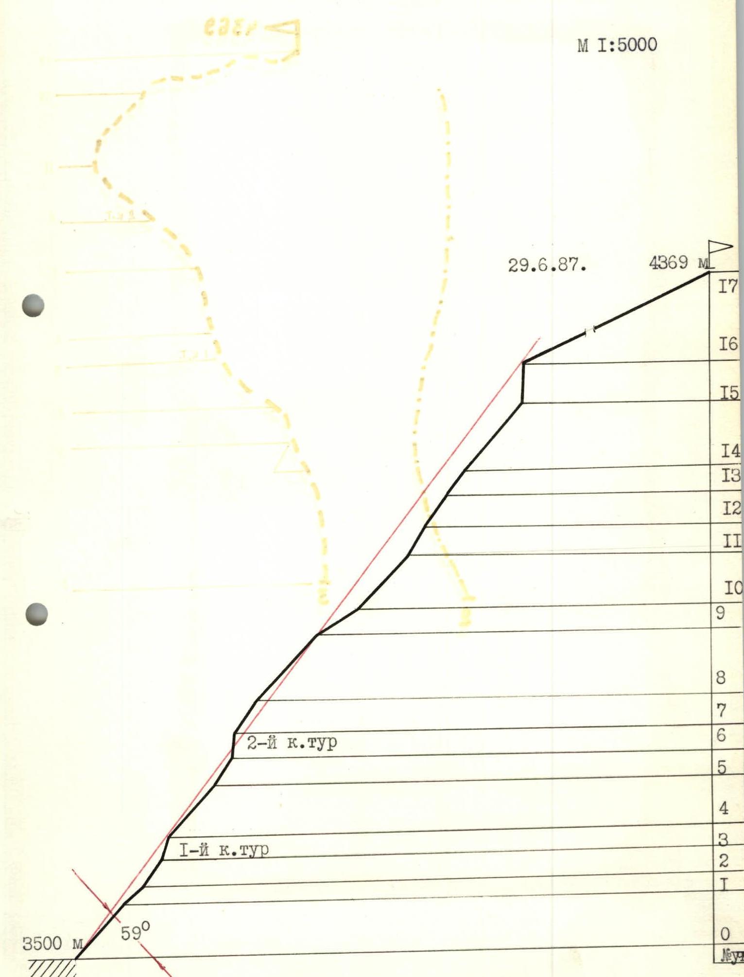
- Height difference — 869 m Length — 1260 m. Length of sections with 5th category of difficulty — 170 m. Average steepness of the wall section — 59°
- Pitons driven: rock — 17 chocks — 31
- Climbing hours — 13 (1 day)
- Leader — Malinovsky Andrey Igorevich — Candidate Master of Sports
Participants:
- Basenko Alexander Ivanovich — Candidate Master of Sports
- Lutsenko Vladimir Anatolyevich — Candidate Master of Sports
- Matveycheva Lyubov Dmitrievna — 1st sports category
- Coach — Master of Sports of the USSR Glushko Vyacheslav Ivanovich
- Group of instructors from the AUSB "Varzob"
- Departure on the route — June 29, 1987 Summit — June 29, 1987 Return — June 29, 1987
"Serp"
- V. Glushko's route via the Central counterfort of the South wall, 5B category of difficulty (1985)
- A. Kotelnikov's route via the Central counterfort of the South wall, 5B category of difficulty (1987)
- A. Malinovsky's route via the center of the South wall, 5A category of difficulty (1987)

Massif of Peak 4369
Route profile to Peak 4369 (40-letiya Pobedy) via the center of the South wall, 5A category of difficulty
Map of the "Arch Plateau" area
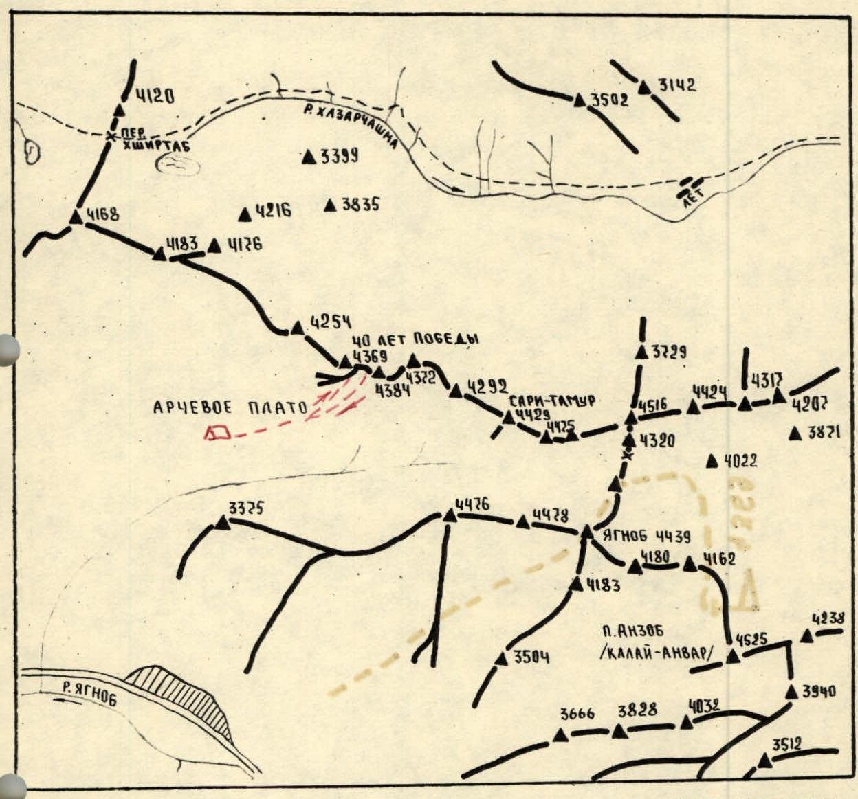
Legend:
- group's path
- location of the assault camp
- CPs and photo points
Note: in 1987, the map was adjusted according to photopanoramic surveys.
Route diagram in UIAA symbols