
I. Rock Class
- Pamir-Alay. Fann Mountains. Imat Valley.
- "Stupenka" Peak.
- Proposed category 2B difficulty level. First ascent.
- Height difference 250 m. Length of sections with category 3 difficulty – 35 m, category 2 difficulty – 250 m.
- 5 pitons hammered, 8 chocks placed.
- Climbing time – 2.5 hours.
- Team members: Baykovsky Yuri Viktorovich MS
- Gupalov Andrey II
- Pilkevich Oleg II
- Pilkevich Andrey II
- Coach: Baykovsky Yu.V. MS 1st category.
- Ascent made on August 31, 1994.
- Organization: State Committee for Sports of the Republic of Tajikistan. Association of Alpinism, Rock Climbing, and Travel of Tajikistan.
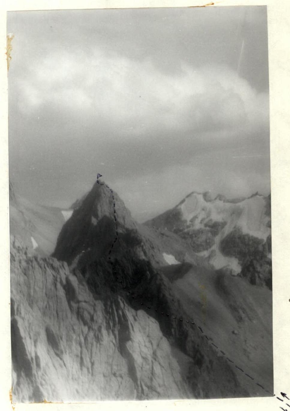
Photo of "Stupenka" Peak 4200 m
Photo taken from Patrush Peak. In the background, on the right, is the ridge of Peak Independence of Tajikistan.
| Section | Steepness | Length | Difficulty |
|---|---|---|---|
| R7–R8 | 50° | 10 m | 3 |
| R6–R7 | 45° | 10 m | 2+ |
| R5–R6 | 50° | 15 m | 3+ |
| R4–R5 | 50° | 10 m | 3 |
| R3–R4 | 20° | 20 m | 2 |
| R2–R3 | 45° | 30 m | 2+ |
| R1–R2 | 40° | 120 m | 2 |
| R0–R1 | 35° | 30 m | 2* |
Route Description by Sections
The approach from the shepherd's summer camps takes 2–2.5 hours. Move up the couloir to the saddle between "Pamyati druzey" Peak and "Stupenka" Peak. Upon reaching the powerful gendarme on the saddle, bypass it on the right. 40 m before the saddle, reach a rocky outcrop. From here, a route is visible upwards and to the right through an internal angle and then along a pronounced counterfort.
The route is rocky, ridge, and logical. Height difference 250 m.
Section R0–R1: From the rocky outcrop, move upwards and to the left along the scree for 30 m to an internal angle.
Section R1–R2: Up the internal angle for 120 m, then exit to the right onto a pronounced counterfort.
Section R2–R3: Up a series of walls and ledges for 30 m to a ledge.
Section R3–R4: Move to the right along the ledge for 20 m. Good places for belays. The ledge leads to monolithic rocks. From the end of the ledge, the summit is visible.
Section R4–R5: Up a complex monolithic wall for 10 m. Steep.
Section R5–R6: Left along the ledge for 5 m and then up the wall for 10 m. Key section of the route. Climbing is complex. Rocks are monolithic. Reach a ledge.
Section R6–R7: Up and to the left along the ledge for 10 m. Reach under a powerful pre-summit wall. At the end of the ledge, a cairn is built. A note is left here as there is no place for a cairn on the summit.
Section R7–R8: From the end of the ledge, move to the left to bypass the summit wall. Reach the ridge. A sharp ridge for 8 m leads to the summit. There is no space for the whole group on the summit, so it's better to gather on the ledge (section R6–R7).
Descent from the summit is via the ascent route. The ascent takes 2 hours 30 minutes.
Comments
Sign in to leave a comment