
Report
The teams of climbers from the Kuibyshev Regional Council of the "Trud" Sports Society on the "Skalnaya стена" peak via the southern wall from the "Khoroshevsky" pass, category 4B-5A (approximately).
July 30 - August 1, 1968, Fann Mountains.
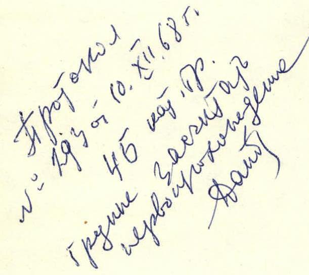
Protocol No. 293 dated 10.XII.68. Category 4B. The group is credited with a first ascent.
Tolyatti
Route map
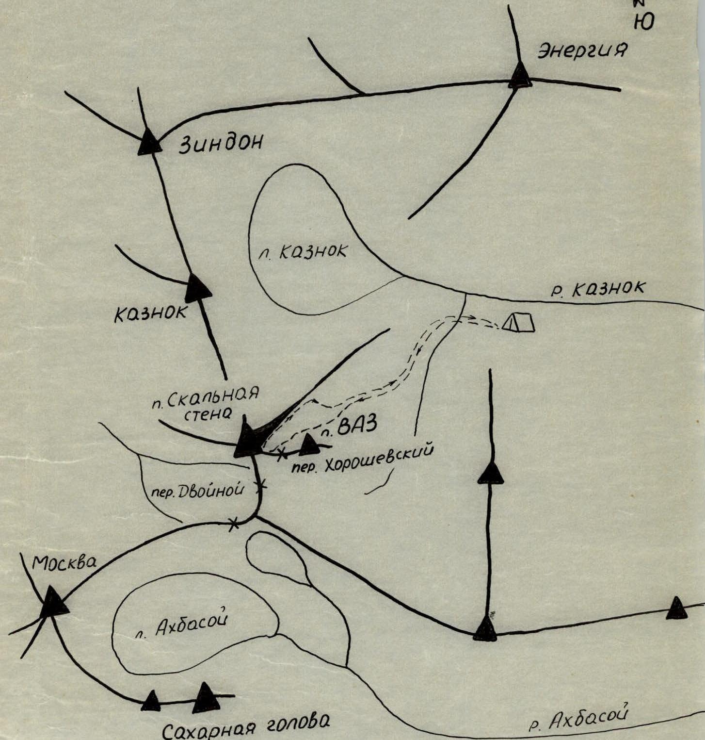
D - assault camp. → - route of the assault group.

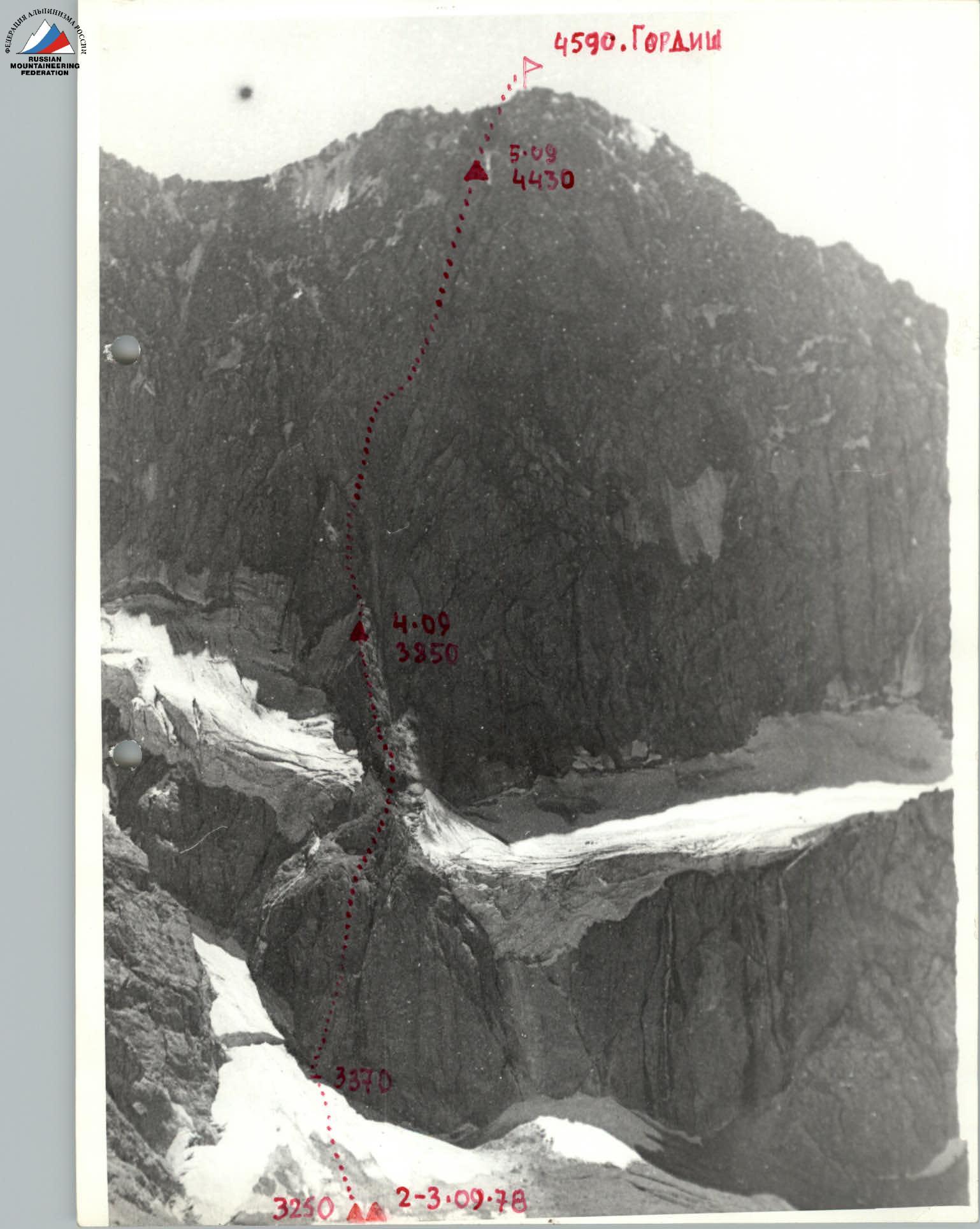
Photo 1. Peak Skalnaya стена (4800 m). View from the south. The route of the first ascent by the Kuibyshev "Trud" team via the southern wall.
I. Characteristics of the area
The "Skalnaya стена" peak is located in the central part of the Fann Mountains, a high-altitude region belonging to the Zeravshan mountain range (Pamir-Alay).
The nearest neighbors of the "Skalnaya стена" peak are the "Energiya" peak (5112 m), "Moscow" peak (5193 m), and "Sakharnaя голова" peak (4987 m).
The Kaznok River originates at the northern foot of the "Skalnaya стена" peak's ridge. The prevailing rock types in this area are marbles and marbleized limestones. All routes are characterized by rockfall hazards. Arbitrary rockfalls are rare, but rockfalls caused by the presence of groups on the route are common. Therefore, helmets are necessary on all routes. Another feature of limestone rocks is their high surface roughness, which greatly increases friction with rubber-soled footwear, and it is recommended to replace crampons with:
- Sneakers;
- Galoshes;
- Boots.
The first ascent to the "Skalnaya стена" peak was made by a team led by Morozov from Chelyabinsk in 1967 via the northern wall from the Zindon gorge, classified as category 5B difficulty by the first ascent team. We unexpectedly found out about this only at the summit, discovering a cairn and a note from Morozov's team.
The southern wall is adjacent to the ridge of an unnamed peak (4400 m) via the Khoroshevsky pass, which was ascended this year via two routes by climbers from the Kuibyshev "Trud" and named peak "VAZ" (Volzhsky Avtozavod). The Kuibyshev climbers have established three routes to the "Skalnaya стена" peak:
- Via the southern wall;
- Via the northern wall from the Kaznok gorge;
- Ascent via the western ridge with a traverse of the entire massif.
As a result of the expedition, the area was enriched with five new routes ranging from category 2B to 5B (according to the climbers' assessments).
II. Preparatory stage
The expedition's base camp was located on the Kaznok River, slightly above the confluence with the Akhbas River under the Arg peak. The expedition arrived at the base camp from Dushanbe via:
- Aizoy pass;
- Lake Iskander-Kul;
- Kon-choy settlement;
- Sarytag;
- and then along the Arg River valley.
The first acquaintance with the "Skalnaya стена" peak occurred on July 27, after the group of climbers approached with the goal of scouting possible ascent options.
The scouting group consisted of ascent leader L. Statsky and participant A. Pshenichnikov.
The ascent route via the southern wall was viewed from the plateau between the "Skalnaya стена" peak and the "VAZ" peak. As a result of the scouting, key sections were identified, a possible path was outlined, and a tactical plan for the ascent was developed and approved by the expedition's coaching council. Given that the lower part of the route consists of rock walls with a steepness of about 80°, stretching about 100 m, and it was unclear whether it was possible to camp before reaching the ridge, it was decided to conduct preliminary processing of the route with a return to the assault camp, to attempt to reach the ridge the next day, complete the main route, and camp on the ridge.
This ascent plan was fully executed.
III. Team composition
The coaching council recommended that a team of four with experience in category 4B-5A ascents in the area be formed for the route.
The team consisted of:
- Leader - Statsky Leonid Nikolaevich - 1st sports category, Tolyatti, Sosnovy pr., 100.
- Persiyantsev Gennadiy Ivanovich - 1st sports category, Kuibyshev.
- Yastrebov Vadim Georgievich - 1st sports category, Kuibyshev, per. Botanichesky sad, 63a.
- Pshenichnikov Arkadiy Anisimforovich - 2nd sports category, Tolyatti, ul. M. Gorkogo, 35-89.
Statsky L. and Pshenichnikov A. had experience in joint ascents this year on peak Arg, category 4B.
Statsky L., Yastrebov V., and Persiyantsev G. had experience in joint ascents on peak Sakharnaя голова via the northern wall of the western ridge, category 5A.
In previous years, these participants also completed joint ascents to peaks of categories 3-5. In addition, all participants:
- Had repeatedly met at rock climbing training sessions;
- Participated in rock climbing competitions on the banks of the Volga River (Verblud mountain).
Throughout the ascent, observation was carried out by participants making the first ascent to peak VAZ, who were in the assault camp, and interaction was maintained with two groups of climbers making first ascents via the northern wall and via the western ridge with a traverse of the entire "Skalnaya стена" peak massif. In addition to visual communication, groups of climbers and observers exchanged signal flares.
IV. Route description and passage
On July 29 at 10:00, participants in the ascents, consisting of four groups and observers, departed from the base camp to the assault camp under the "Skalnaya стена" peak. The path goes up the Kaznok River along a good trail. The assault camp is located on a green meadow at the spurs of the "Skalnaya стена" peak's ridge. The travel time is 2 hours and 30 minutes.
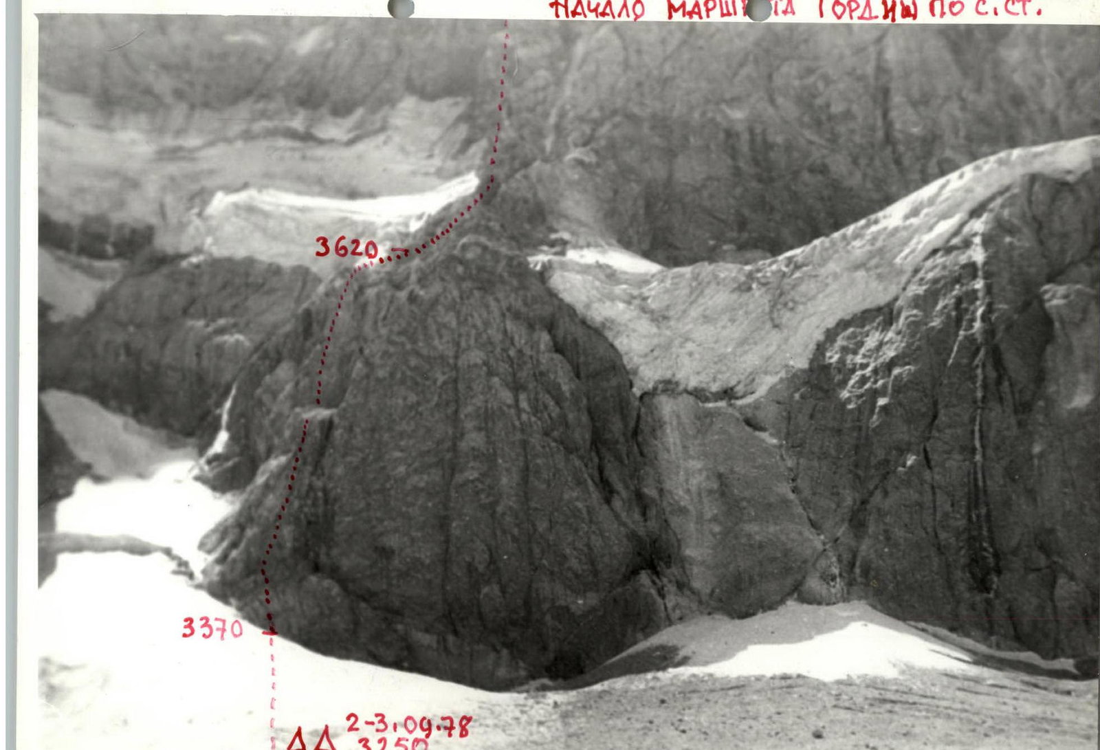
On July 30 at 10:00, the group departed from the assault camp to process the route according to the ascent plan. The path to the start of the route leads to the left of the rock massif along the riverbed and leads to a moraine plateau between the "Skalnaya стена" peak and the "VAZ" peak. Then, along the snow, hugging the walls of "VAZ", we ascend via steep snow with rocks to the Khoroshevsky pass, which is a saddle between the southern side of the "Skalnaya стена" peak and the northwest ridge of the "VAZ" peak.
The travel time from the assault camp to the Khoroshevsky pass is 2 hours and 20 minutes. There is a site for camping, and snow for water. At 13:00, we begin processing the route.
1st section. From the Khoroshevsky pass, via moderately difficult broken rocks, we ascend to a flat area 1.5-2 m wide under overhanging smooth walls. Belaying is done through outcrops, with alternating movement. The length is 40 m, steepness is 50-60°, time is 30 minutes.
2nd section. Directly from the area, a sheer white wall begins, with a visible crack 5 m above, extending vertically upwards. These five meters of very difficult climbing are completed by L. Statsky, who first changes into galoshes, using a three-step ladder, finding a barely noticeable crack for hammering a piton. Then, pitons are hammered upwards along the crack. 40 m, steepness 80-85°, 7 pitons, 1.5 hours.
3rd section. Rocks of moderate difficulty, 40 m long, 45° steep, with many loose rocks, lead to the right under a vertical internal corner, where it is possible to organize a reception for the partner in the rope team and release them upwards along the steep internal corner, 15 m long.
From the corner, leftwards and upwards along inclined slabs, 20 m, 60° steep, under an overhanging wall, 3-4 m long. V. Yastrebov completes this section using a three-step ladder.
80 m have been covered, 6 pitons have been hammered in 1.5 hours. Thus, having processed the lower part of the route, we return down to the Khoroshevsky pass and from there, 40 minutes later, we are back at the assault camp.
On July 31 at 6:00, we depart from the assault camp along the familiar path, traveling lightly to the Khoroshevsky pass, and at 8:00, we begin the ascent via the processed sections.
4th section. An inclined ledge covered with loose rocks, 20 m long. Above it, a rock face overhangs, which we bypass to the left. Rockfall hazard! We reach the base of a steep (70°) couloir, 20 m long, with rimed ice, and establish the first control cairn. The couloir with rimed ice is traversed using free climbing with piton belaying, leading to an inclined ledge with scree. 3 pitons have been hammered, 1 hour.
5th section. Before us lies a rock massif with a reddish hue, to the right - a steep, narrow chimney leading under overhanging rocks, to the left - a red crack, about 20 m long. We ascend via the left crack, which leads to a narrow, expanding inclined area.
40 m, 2 pitons, 1 hour.
6th section. From the area, leftwards and upwards along a white internal corner, 50 m long, extending vertically, the first rope team ascends with careful belaying. The walls of the corner are covered with easily removable rocks that fall when touched by hand, foot, or rope. High rockfall hazard! Difficult climbing, few places for piton placement. The internal corner ends with a small ridge where one can stand, and a wide wall that has an exit to the right through an overhanging depression, 5 m long.
G. Persiyantsev, using a three-step ladder, traverses this wall with an overhang of broken rocks and exits to the right onto an inclined area where the entire team can gather.
100 m, 8 pitons, 2 hours.
7th section. Having traversed the inclined area, we approach a white wall, 75° steep, 50 m long, with a narrow chimney. Above the wall, overhanging cornices loom. A. Pshenichnikov ascends via the chimney under the overhang and organizes a reception for the second rope team to his right. 90 m, 4 pitons, 40 minutes.
8th section. Via difficult rocks, bypassing the overhanging rocks to the right - upwards, we exit onto smooth, polished slabs, 40 m long, 60-70° steep, which lead under an overhanging rock face. Below, a narrow inclined ledge is present, where we establish the 2nd control cairn. The rock face is bypassed to the left - upwards, from where a steep rock couloir and the western edge of the ridge are visible. We traverse the wall to the left, about 60 m, and exit onto a small area where water is available. Here, we take a break for lunch.
110 m, 5 pitons, 2 hours.
9th section. From the area, leftwards - upwards, via difficult rocks, we exit into a couloir, 60-70° steep, partially filled with snow and ice. The couloir, about 100 m long, leads to the summit ridge. To the right, on a large rock outcrop, we unexpectedly discover a control cairn of the first ascent team led by Morozov from Chelyabinsk.
120 m, 5 pitons, 1.5 hours.
10th section. From the control cairn on the summit, the path proceeds along the eastern ridge. 150 m along the snowy ridge with cornices. Movement is partly simultaneous, partly with alternating belaying via ice axe. Having traversed the first tower, we find a convenient area for camping below the ridge.
On August 1 at 9:00, we continue moving along the ridge. Belaying is done via pitons and outcrops. The second tower is bypassed to the right via red, broken rocks with careful belaying, and we approach a widening couloir, partially filled with snow. The entire 10th section, 400 m long, is traversed in 3 hours, with 5 rock pitons hammered.
Descent via the couloir is done using a rope fixed on a piton via a loop (80 m) to a long but not very wide ledge, from where we organize a descent to the moraine. This section from the ledge to the moraine (240 m) consists of monolithic, rough rocks with a steepness of 40-45°, featuring many ledges.
From the descent point on the moraine, we reach the assault camp on the green meadow within an hour. The ascent is complete.
Table of route section characteristics on the "Skalnaya стена" peak via the Southern wall
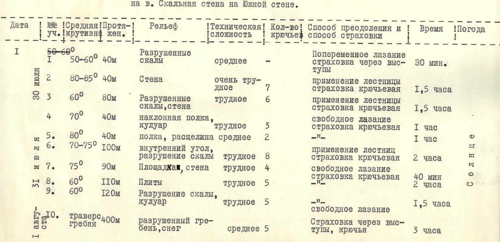
| Date | Section No. | Average steepness | Length | Relief | Technical difficulty | Number of pitons | Method of traversal and belaying | Time | Weather |
|---|---|---|---|---|---|---|---|---|---|
| I | 50–60° | Broken rocks | medium | Alternating climbing, belaying via outcrops | |||||
| July 30 | I | 50–60° | 40 m | Broken rocks | medium | Alternating climbing, belaying via outcrops | 30 min | ||
| 2 | 80–85° | 40 m | Wall | very difficult | 7 | Use of ladder, piton belaying | 1.5 hours | ||
| 3 | 60° | 80 m | Broken rocks, wall | difficult | 6 | Use of ladder, piton belaying | 1.5 hours | ||
| 4 | 70° | 40 m | Inclined ledge, couloir | difficult | 3 | Free climbing, piton belaying | 1 hour | ||
| 5 | 80° | 40 m | Ledge, crack | medium | 2 | - | 1 hour! | ||
| July 31 | 6 | 70–75° | 100 m | Internal corner, broken rocks | difficult | 8 | Use of ladders, piton belaying | 2 hours | |
| 7 | 75° | 90 m | Area, wall | difficult | 4 | Free climbing, piton belaying | 40 min | Sun | |
| 8 | 60° | 110 m | Slabs | difficult | 5 | - | 2 hours | ||
| 9 | 60° | 120 m | Broken rocks, couloir | difficult | 5 | Free climbing | 1.5 hours | ||
| August 1 | 10 | 400 m | Broken ridge, snow | medium | 5 | Belaying via outcrops, pitons | 3 hours |
www.alpfederation.ru ↗
 www.alpfederation.ru ↗
 www.alpfederation.ru ↗

Comments
Sign in to leave a comment