61
DESCRIPTION
Ascent to the peak Selegrad, cat. III first ascent via the South-West ridge
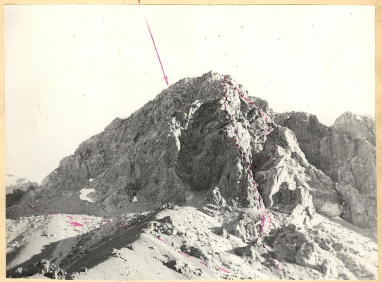
Peak Selegrad. Start of the ascent to the South-West ridge. --- previously traversed route, cat. III (non-classified route)
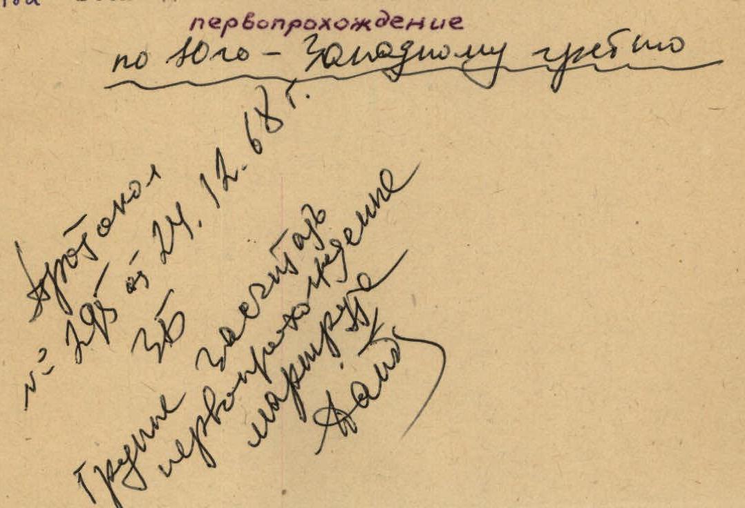
Protocol № 295, dated December 24, 1968 The group is credited with the first ascent of the route cat. III rock climbers
Description of the Climbing Area
In the western part of the Zeravshan Range, between the Fan-Darya and Ktut-Darya river basins, a relatively isolated massif rises - the Fann Mountains.
The peaks of this mountain node reach an altitude of 5500 m (Chimtarga 5487 m, Big Ganza 5415 m, Dukdon 5208 m, Energia 5105 m, and others - a total of up to 10 peaks exceeding 5000 meters). The Fann Mountains occupy the space between the Zeravshan and Risar Ranges.
Significant glaciation in this area is predominantly found not on the northern slopes. To the south of the Big Ganza peak, in the upper reaches of the Iskander-Darya River, at an altitude of 2238 m lies the large and very beautiful Lake Iskanderkul, a dammed lake. The area is still insufficiently explored, with peaks waiting for their first ascents.
The massif of the Selegard peak is located at the end of a ridge, which is a spur of the main ridge, where peaks like Krasnaya Moskva, Energia, Ganza, and others are located. The southern spurs of the Selegard peak descend to the Akhbasoy River, on the right bank of which the Arg peak rises. The height of the Selegard peak is 3883 m.
Description of the Ascent
From the base camp, located on the left bank of the Kaznok River, we head towards the bridge over the Kaznok River, which is situated near the confluence of the Kaznok and Akhbasoy rivers, where we cross to the right bank. After crossing the river, we reach the grassy slopes of the southern ridge of the counterfort of the peak. We ascend the slope, heading towards a prominent square white rock clearly visible in the lower part of the rocky counterfort of the peak.
R1. The route begins in a couloir located to the left of the square white rock. The couloir starts with a small snowpatch, which ends before the first overhanging plug. The width of the couloir is 3-4 meters. The plug is bypassed on the left via a wall with an angle of 80-90°. The climbing is moderate for one rope (pitons!). Then, we traverse along the vertical wall to the right and re-enter the couloir.
Under the second plug, we ascend via scree for one rope. The exit to the second plug is made from under the plug, leading to the left rocks of the couloir, which are climbed with moderate difficulty. The rocks are like "ram's foreheads," requiring careful belaying.
These rocks allow us to bypass the third plug. Then, we traverse to the right (1 rope) into the couloir, which ends with an overhanging wall. By traversing to the right for one rope, we reach a platform below a gendarme, which is 18-20 meters high and has an angle of 85-90°.
R2. In the middle of the gendarme, there is a crack that allows ascent. The crack is narrow and smooth - difficult climbing (pitons!). The first climber should wear rubber boots or climbing shoes.
After the gendarme, we exit to a severely shattered wall (80-85°) with an overhanging rock at the top.
R3. The wall is bounded on the left by red, sheer walls and on the right by rocks with a negative angle. The wall is climbed via a ledge upwards to the left, then upwards to the right, and under the overhanging rock, vertically upwards (pitons! rockfall hazard!). By bypassing the rock on the right via the couloir, we reach the ridge of the counterfort. Control cairn.
R4. Along the ridge (50-60°), we ascend for three ropes and reach a protruding wall (pitons!).
R5. We climb to the right along an inclined (50°) slab, in which there is a crack with a width of 1.5-5 cm. The crack ends with a one-meter step. Very difficult climbing (pitons!). Further, the ridge of the counterfort is traversed on the left, and then we exit onto the ridge, which is climbed simultaneously.
R6. After joining the counterfort with the main ridge, we continue along the ridge simultaneously. The time taken to traverse the ridge is 15-20 minutes. The summit.
Descent from the summit is via a cat. III route.
Conclusions
- Due to rockfall hazard, the group should consist of no more than 4 participants.
- The ascent should begin no later than 8:00.
- The first climber should wear rubber shoes.
- For a group of 4 participants, the following equipment is required: 2 x 40-meter ropes, 10 rock pitons.
- The time taken to complete the route is 10-13 hours.
Leader: Tutushkin Participants: Vinokurov, Merlis, Arakcheev.
