- Technical category
- Pamir-Alay. Fann Mountains (northern part). Imat Valley.
- Eastern peak of "Paltsy" via the North-West ridge.
- Proposed 2A category of complexity. First ascent.
- Height difference 300 m. Length 500 m.
- Length of sections — 1 category. 210 m.
Pitons driven:
- rock — 2
- chockstones — 3
- ice screws — 1.
- Climbing hours — 6.
- Leader: Yuri Baykovsky Team members: Rustam Turaev CMS, Andrey Nilkevich II (MS in mountain tourism)
- Coach: Yuri Baykovsky. MS 1st rank
- Ascent made on September 1, 1995.
- Organization: State Committee of the Republic of Tajikistan for Physical Culture and Sports
Overview of the ascent area
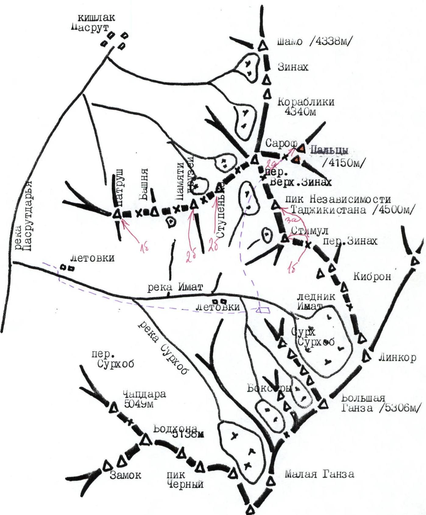
The "Paltsy" peak is located in the same ridge as the Sarof peak. It is a spur in the Big Ganza ridge, Peak of Independence of Tajikistan, Sarof, and Korabliki.
The first ascent to the peak was made by a group of badge holders in 1963. However, there is no description of the ascent to the peak and data in the Classification table of routes to mountain peaks. The route passed by the group was evaluated as 2B category of complexity.
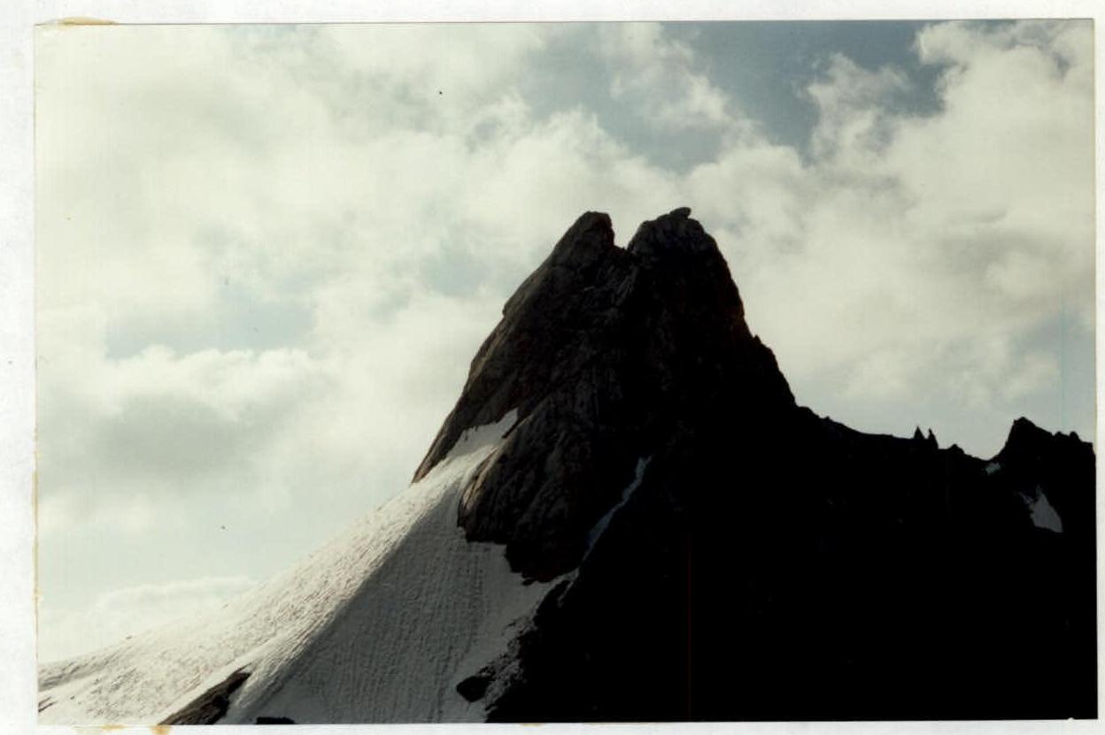
The peak is composed of marbleized limestone. The rock is destroyed. A significant part of the route is covered with ice and firn. "Paltsy" represents two peaks: Western and Eastern.
From the Verkhny Zinak pass, the Western peak is clearly visible (in the photo), and the Eastern peak is covered by it. There is no convenient point for photographing the Eastern peak with the adjacent Sarof pass, as the Sarof peak is in close proximity to the Paltsy peak.
Western peak:
- Lower than the Eastern peak
- Represents a steep, but relatively short massif
- Located fairly independently
- Has logical route options for ascents
Route: from Dushanbe through the Anzob pass to the city of Zeravshan. Then turn left into the Pasrud-dara valley. Drive to the kishlok Pasrud (6 km) and to the upper kishlok Marguzor (through the pass). From this kishlok to the bridge and the confluence of the Imat River. The fork has a local name Sang-Safed due to the bizarre jumble of stones on the slopes. From the fork, 1 km to the left along the road to the summer pastures. Then walk along the trail on the right side of the river for 2–2.5 hours to the summer pastures. From the summer pastures, 30 minutes along the river to the juniper grove. There are convenient places for helicopter landing.
In the Imat River valley, a base camp can be organized. From the valley, go along the north-west slope along the trail to the Sarof cirque — 2 hours. Pass through the forest zone and reach the flat fields at the foot of the Peak of Independence of Tajikistan.
Convenient places for overnight stays. There is ice, and water can be collected during the day.
A bivouac can be organized higher, within an hour's walk — BN, on the Sarof glacier moraine. There is a stream.
The approach from the bivouac to the start of the route takes 2.5 hours. Pass through the Verkhny Zinak pass and descend to the Paltsy peaks. Go towards the saddle between:
- Western
- Eastern peaks.
The area is promising in terms of sports.
General view of the peak (from the Verkhny Zinak pass)
UIAA SYMBOL ROUTE SCHEME
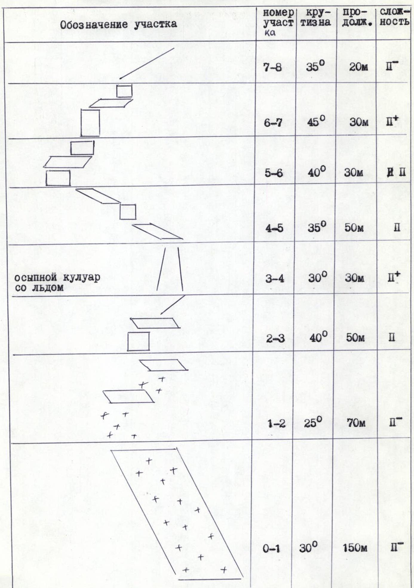
Photo of the peak (pre-summit bastion)
Description of the route by sections
Total route length 450 m. Ice-snow 200 m.
Section R0–R1. Descend from the Verkhny Zinak pass towards the peak 150 m. Traverse along the glacier to reach a rocky outcrop. Climb up towards the saddle between the Western and Eastern peaks 150 m along the ice-firn slope with a slope of 30–40°.
Section R1–R2. Traverse, without reaching the rocks, go 70 m along the firn and rocky outcrops. Not difficult. Reach the rocky bastion.
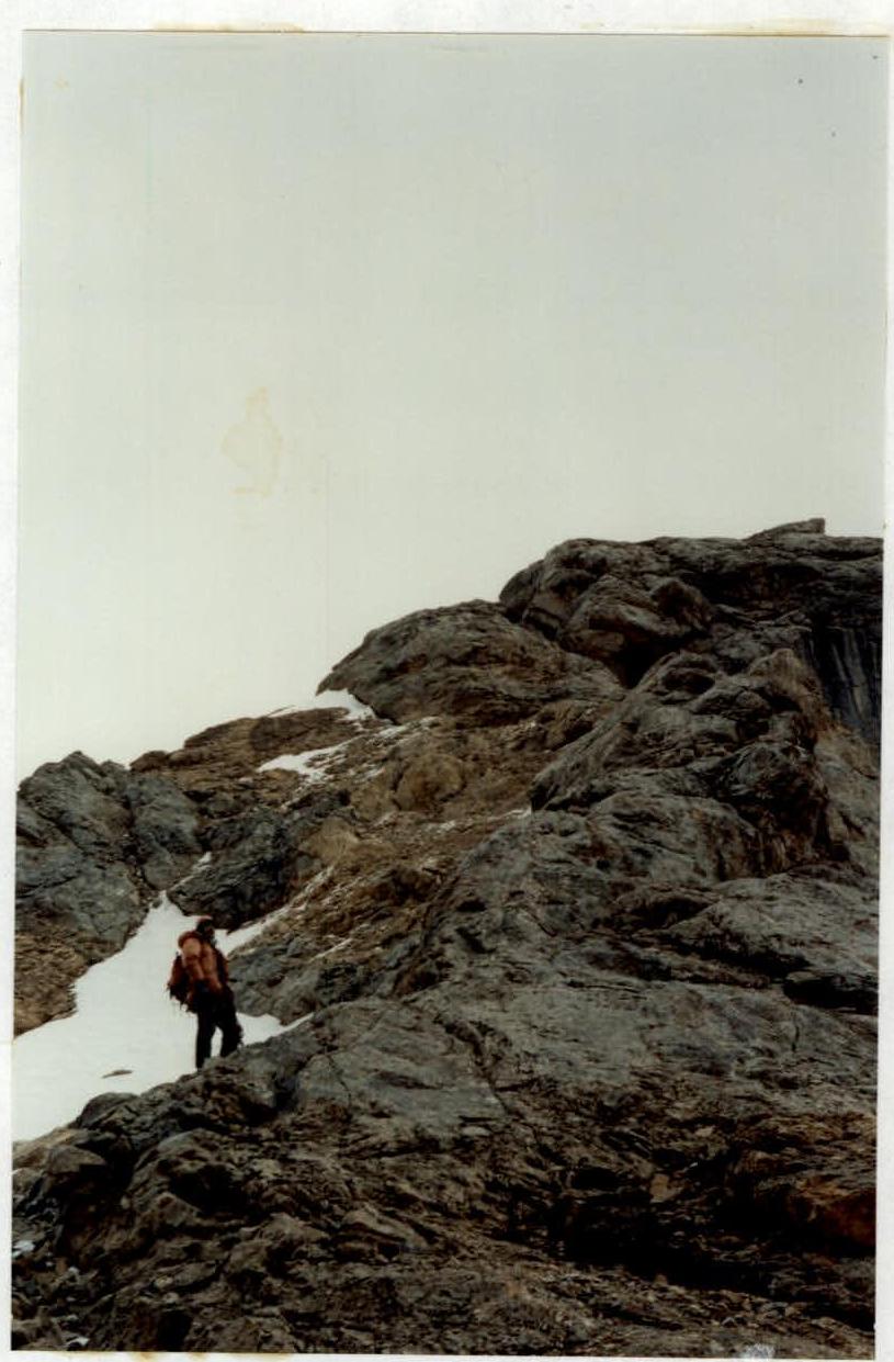
Section R2–R3. Exit from the firn to the rocks is difficult. 10 m up. Then along the rocks (crampons not needed further), reach the ridge. Along the ridge 40 m up. The ridge then becomes steeper. To the left — destroyed rocks and a couloir.
Section R3–R4. Cross the couloir. Caution: loose rocks, ice. Reach the counterfort.
Section R4–R5. Up the counterfort 20 m and then to the left along the rocky ledges, bypassing the ridge 40 m.
Section R5–R6. Along the ledges and steep walls up-left 30 m.
Section R6–R7. "Crux". 30 m straight up the steep rocks. Piton protection. Reach convenient ledges.
Section R7–R8. Along the ledges and the ridge reach the summit.
Descent via the ascent route.
Ascent from the bivouac takes 6 hours.