
Ascent Log
- Technical category
- Pamir-Alai, Fann Mountains, Imat valley
- Peak 4520 m (Peak of Independence of Tajikistan). Western wall.
- Proposed 6A category. First ascent.
- Height difference 860 m, length 1020 m.
- Length of sections with V–VI category — 880 m, of which VI category — 590 m.
- Average steepness — 74.6° Average steepness of the wall section of the route — 77.5°
- Pitons driven: rock pitons bolt pitons ice screws 186/54 18/10 141/47
- Team's climbing hours — 33 h, days — 3, descent on the 4th day — 4 h.
- Overnights: 3 (2 of them bivouacs on the route, 1 — on the summit).
- Team leader: Pilkevich A.V. — Master of Sports Participants: Pilkevich O.V. — International Master of Sports, Gupalov A.V. — 1st class
- Coaches: Gurevich Ya.B. — Candidate Master of Sports Pilkevich O.V. — International Master of Sports
- Approach to the route — September 8, 1998 Summit — September 10, 1998 Return — September 11, 1998
- Organization: Mountain Rescue Service of the Republic of Tajikistan
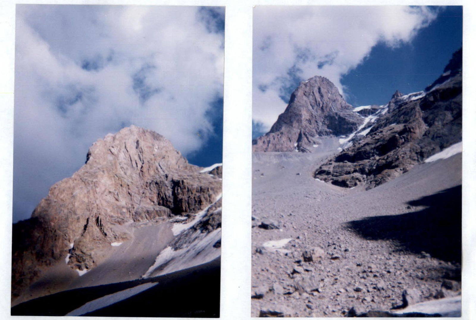
General photo of the route
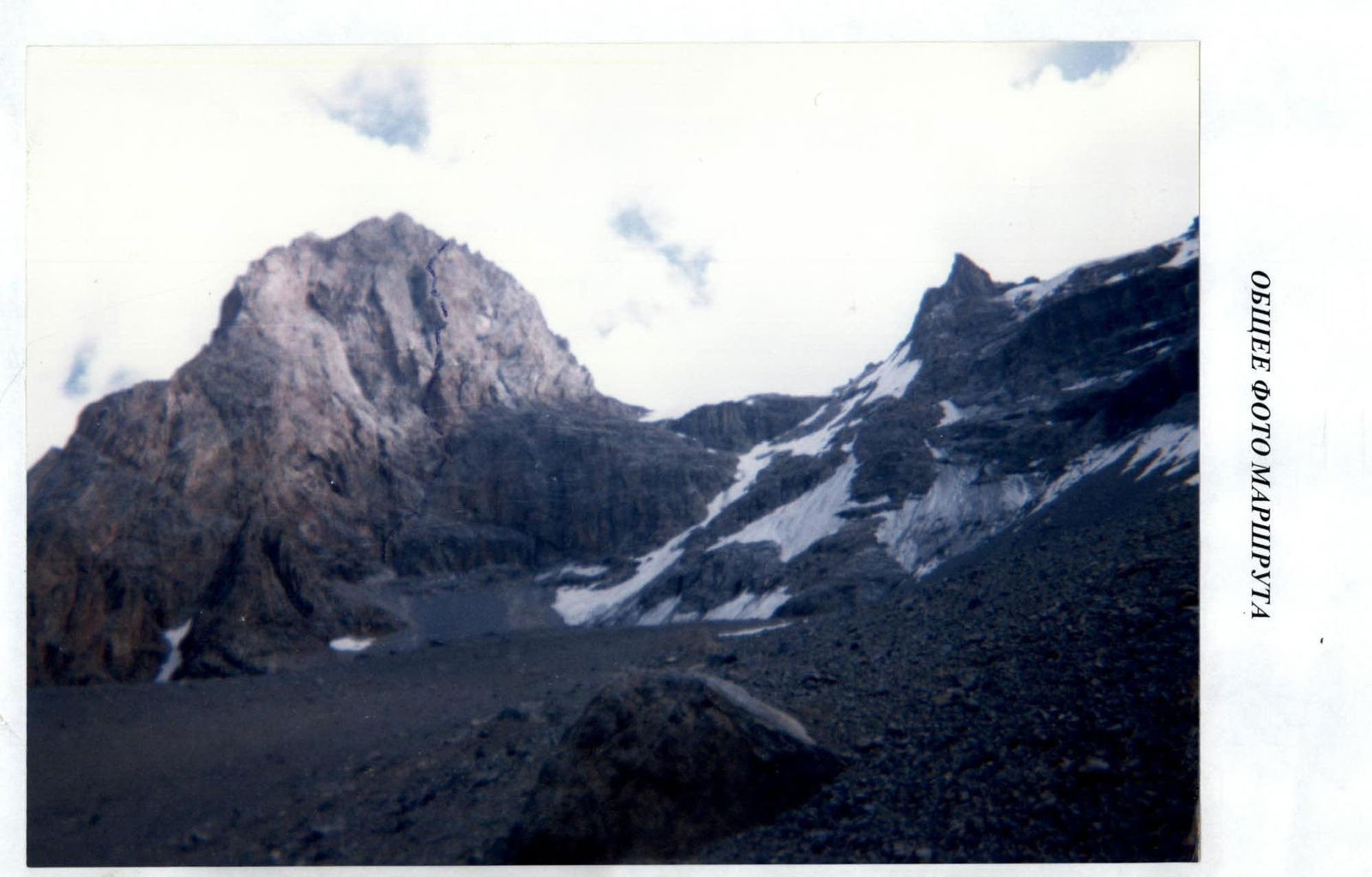
General photo of the route
Route description
The approach to the foot of the summit from the Imat-Pasrud fork takes 4.5 h. Overnight stay under the route to the left of the base of the North-West ridge.
The team started the route at 8:00. The route was visually determined by the central part of the wall. The beginning of the route is clearly marked by an overhanging internal corner (110°).
The first rope is climbed on the right side of the corner, with a steepness of up to 75°. Rock pitons and protection gear are used.
After reaching a ledge, leaving the overhang on the left, move right-up:
- Two ropes along a crack, rock steepness 65–70°.
- Fourth rope — very difficult climbing, along a clearly defined gap, leaving the wall on the left.
- The next rope is climbed on the wall to the left of the counterfort — climbing is difficult, average rock steepness 80°.
This section is rockfall-prone.
The seventh rope is climbed to the left of the edge with entry onto the left plane of the edge. Climbing is difficult. Directly in the direction of movement — an overhang.
The eighth rope is climbed under the overhang, right-up.
There is a small ledge under the overhang for setting up a bivouac. Comfortable overnight stay.
The ninth and tenth ropes are the most difficult. The team took over 3 h to process this section. The overhang is bypassed on the right along an internal corner, more protected from rockfall. Drill holes are used when passing through the internal corner.
The eleventh rope — internal corner, rocks are destroyed. Corner steepness up to 80°. From here, the most difficult section begins, with overhangs on the right and left. The direction of movement is determined by the wall section. Drill holes are used. Climbing is done using artificial climbing holds (ACH).
Twelfth rope:
- Is climbed along an inclined ledge right-up, steepness up to 70°.
- Move along the edge — the key section of the route.
Thirteenth and fourteenth ropes — very difficult climbing using bolt pitons.
On the 15th rope, there is a ledge with an overhang on the left, protected from rocks. A bivouac is set up.
Section:
- Very destroyed
- Rockfall-prone
The bivouac is set up under an overhanging wall, shielding from rockfall.
The sixteenth rope leads under an overhang.
The next two ropes (17–18) pass under the overhang right-up along destroyed rocks and in the upper part — along a monolithic slab.
Two ropes pass along a cleft, average steepness — 70°.
The twenty-first rope leads to the ridge.
Ahead are four gendarmes.
To the left of the gendarmes in a north-easterly direction, after five ropes along destroyed rocks with an average steepness of 60°, we reach the summit. Overnight stay on the summit.
The team descended along the South-West ridge (category 3A). It is also possible to descend along the North-East ridge (category 2B), but it is longer.