Passport
- Technical category
- Pamir-Alay. Fann Mountains (northern part). Imat Valley.
- Peak "Nezavisimosti Tadzhikistana" via the Southwest ridge
- Proposed 3A category, first ascent.
- Height difference 600 m, length 750 m.
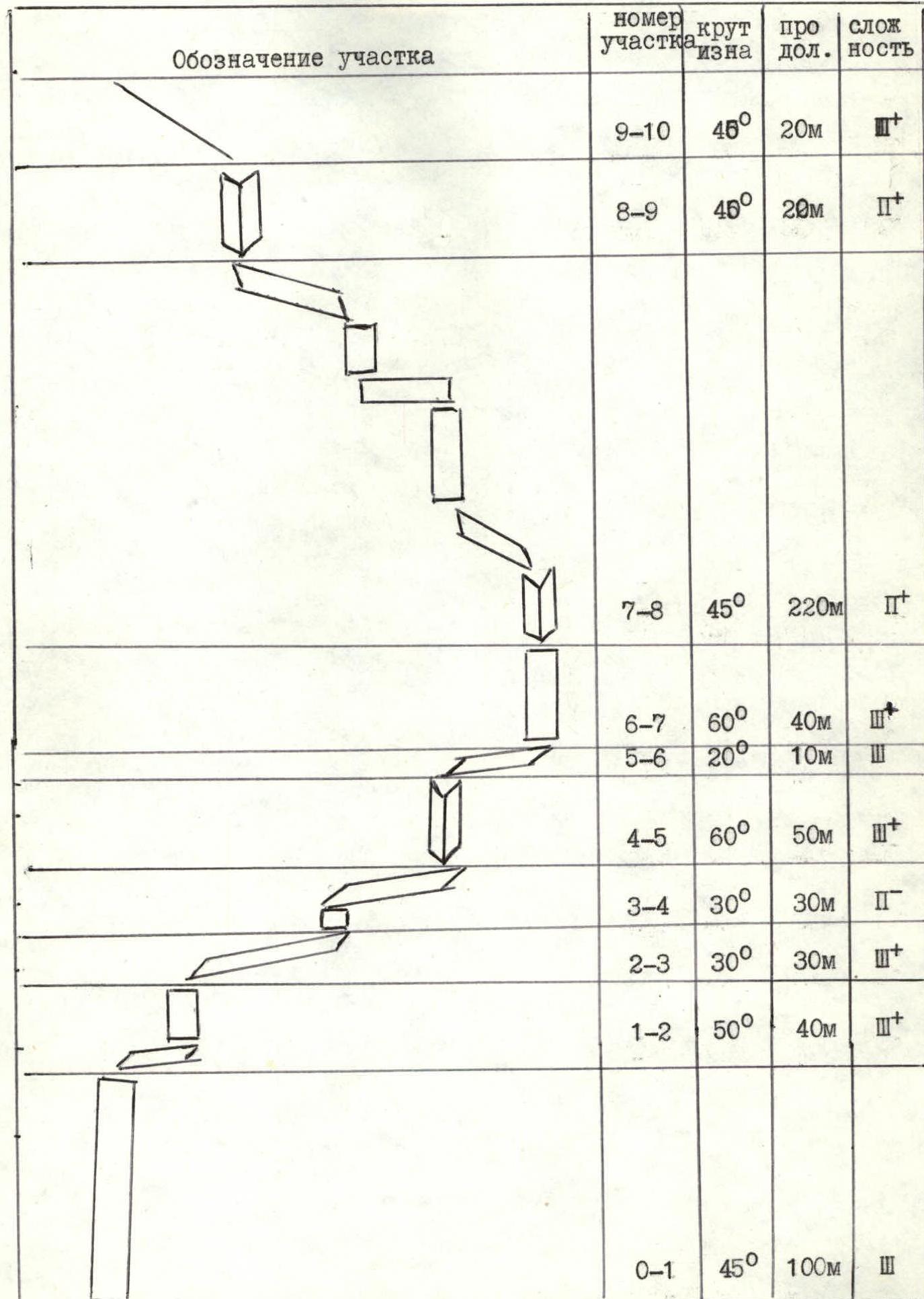
Length of sections:
- Category III — 270 m
- Category II — 290 m
-
Pitons driven: rock pitons 20, chockstones — 35
-
Travel time — 9 hours
-
Leader: Baykovsky Yuri Viktorovich MS
Participants:
- Moskovkin Andrey P
- Pilkevich Andrey
- Gupalov Andrey P
- Coach: Baykovsky Yu.V. MS 1st sports category
- Ascent completed on August 31, 1993
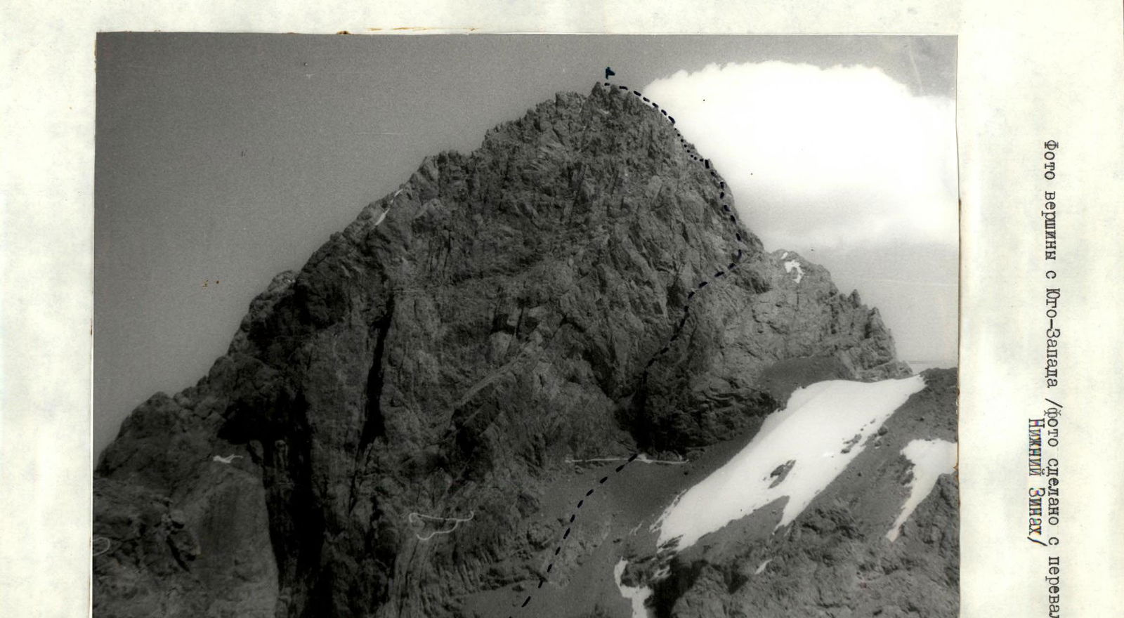
- Organization: State Committee of the Republic of Tajikistan for Physical Culture and Sports. Photo of the summit from the Southwest (photo taken from Nizhny Zinak pass).
 The length of the wall section of the route is 560 m, the total length of the route is 900 m.
Route description by sections
Section R0–R1. Move 100 m up to the right towards a clearly defined saddle along monolithic "ram's foreheads" with a steepness of 40–60°. There are loose rocks on the ledges. Climbing is of medium difficulty. Few cracks for belay organization. Use chockstones.
Section R1–R2. There's a good ledge for a comfortable belay station. One rope length up along the monolithic wall and ledges to a wide scree ledge. There's a difficult section. The length of the section is 40 m, steepness 50–60°.
Section R2–R4. From the ledge, 3 m up a complex inner corner, then along the ledges to the right. A series of walls, inner corners, and comfortable ledges. The length of the section is 60 m. Reach a wide scree saddle. Comfortable place for a belay station.
Section R4–R5. Along the ledge and a series of walls up and to the right for 20 m. Then:
- 10 m up a complex inner corner — there's some flowstone ice.
- 15 m up a grey marble wall to a comfortable ledge. Good cracks for a belay station.
Section 5–7. 10 m to the right along the ledge. 20 m up a vertical wall, difficult. Key section of the route. Use stemming. Exit onto ledges, up and to the right to a wide scree ledge. Comfortable place for a belay station.
Section 7–8. 220 m up and to the left. Alternating:
- short, complex walls
- simple scree ledges Belay via rock bulges. Move in the direction of the summit.
Section 8–9. 20 m inner corner. Climbing is not difficult. Exit onto the ridge.
Section 9–10. 20 m along the ridge to the left to the summit. Descent from the summit via the ascent route.
UIAA route diagram