PASSPORT
-
Technical category
-
Pamir-Alay. Fann Mountains (northern part). Imat valley.
-
Peak "Nezavisimosti Tadzhikistana" via the north-eastern ridge.
-
Proposed as 2B category of complexity, first ascent.
-
Height difference 700 m, length 1100 m.
Length of sections with category III complexity — 100 m, category II — 600 m.
-
Pitons hammered in:
rock pitons — 15, protection gear — 18, ice screws — 8.
-
Travel time — 10 hours.
-
Leader: Baykovsky Yury Viktorovich, Master of Sports
Participants: Turaev Rustam Khodzhaevich, Candidate Master of Sports Pilkevich Andrey, 2nd category
-
Coach: Baykovsky Yu. V., Master of Sports, 1st class
-
Ascent made on September 2, 1955.
-
Organization: State Committee for Physical Education and Sports of the Republic of Tajikistan. General view of the summit from the west (taken on the approach from the base camp).
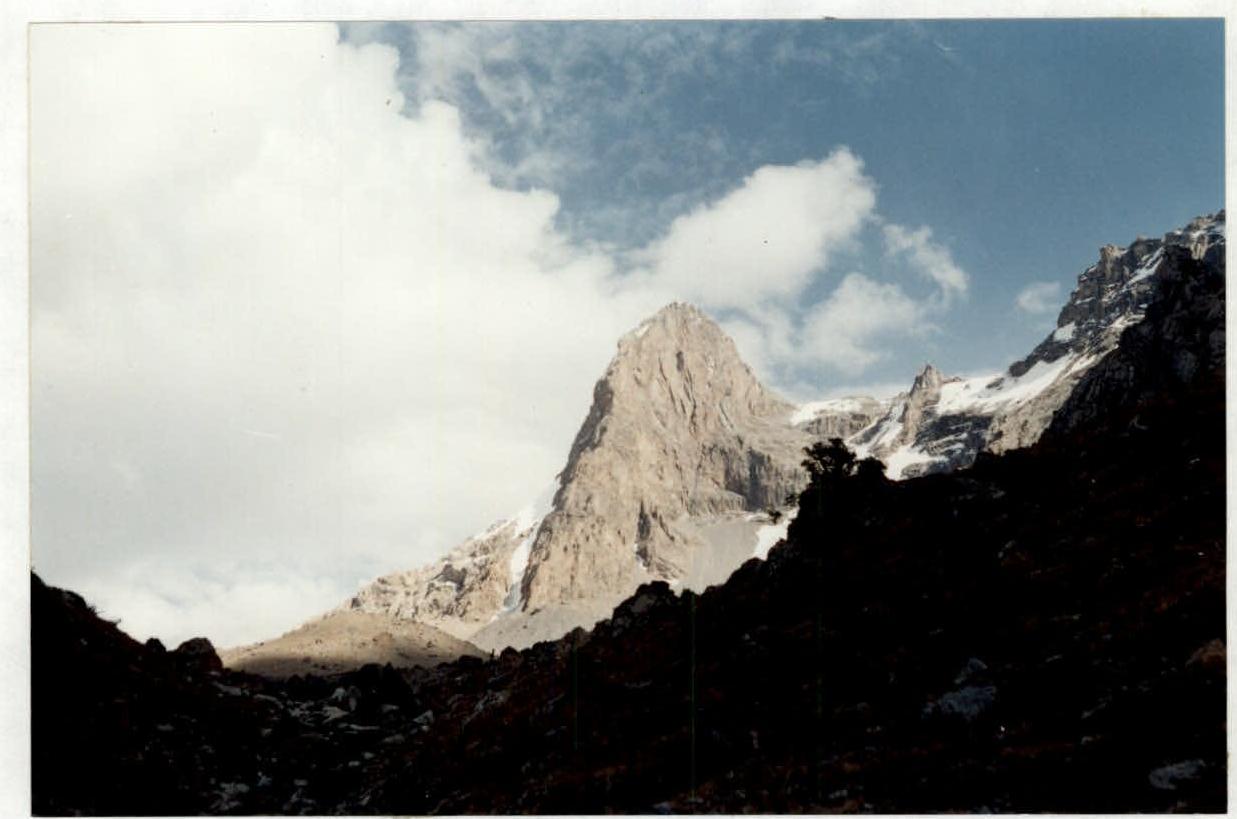
Peak "Nezavisimosti Tadzhikistana"
General view of the summit from v. Patrush (from the North-West). v. Sarof ↓ Peak "Nezavisimosti Tadzhikistana" ↓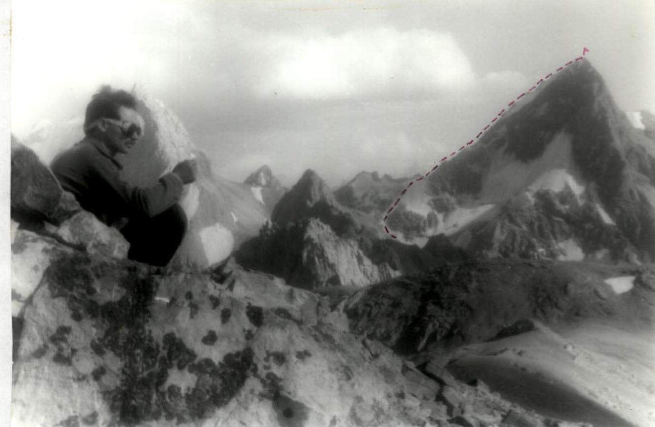 ROUTE SCHEME IN UIAA SYMBOLS


Peak "Nezavisimosti Tadzhikistana". Technical photo from Turz-Ul pass.
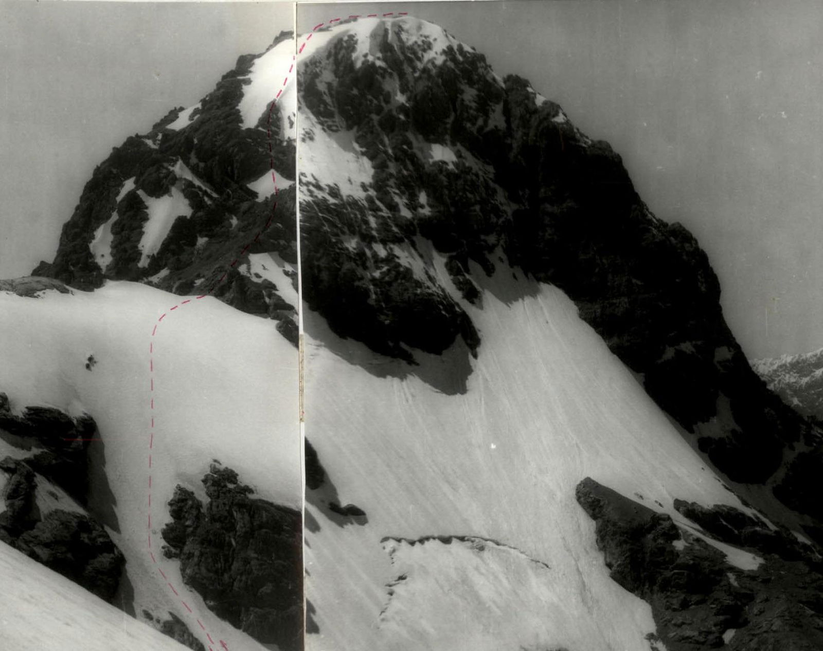 Photo of the summit (from the east, taken from the summit "Paltsy").
The total length of the route is 1100 m. Ice section — 400 m.
Section R0–R1. Move up and to the right along a slope (scree, ice) with a steepness of 30° to a steep ice slope.
Photo of the summit (from the east, taken from the summit "Paltsy").
The total length of the route is 1100 m. Ice section — 400 m.
Section R0–R1. Move up and to the right along a slope (scree, ice) with a steepness of 30° to a steep ice slope.
Section R1–R2. Move up and to the right along an ice slope with a steepness of 35° in the direction of the saddle between two powerful gendarmes on the ridge. There are rock outcrops. Be cautious while traversing these sections.
Section R2–R3. Move along the ridge, on ice and rocks, bypassing a powerful gendarme on the ridge to the right along the ice (or to the left, losing significant height, via scree). Reach the saddle on the ridge.
Section R3–R4. Difficult rock section. 70 m of category 4 complexity in the direction of the summit. Piton belay.
Section R4–R5. The ridge becomes less steep. Belay using rock features and pitons. Ridge steepness is 40°, length is 200 m.
Section R5–R6. The most challenging ice section. Steepness reaches 45–50°. Belay using ice screws. Move in crampons using ice axes. Reach the pre-summit ridge.
Section R6–R7. 150 m along the pre-summit ridge. Belay using rock features. Reach the summit.
Descent is via the ascent route. The ascent takes 10 hours.


