Ascents
- Climbing category: Rock climbing.
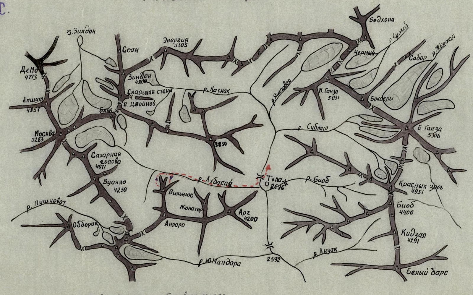
- Climbing area: Zeravshan Range.
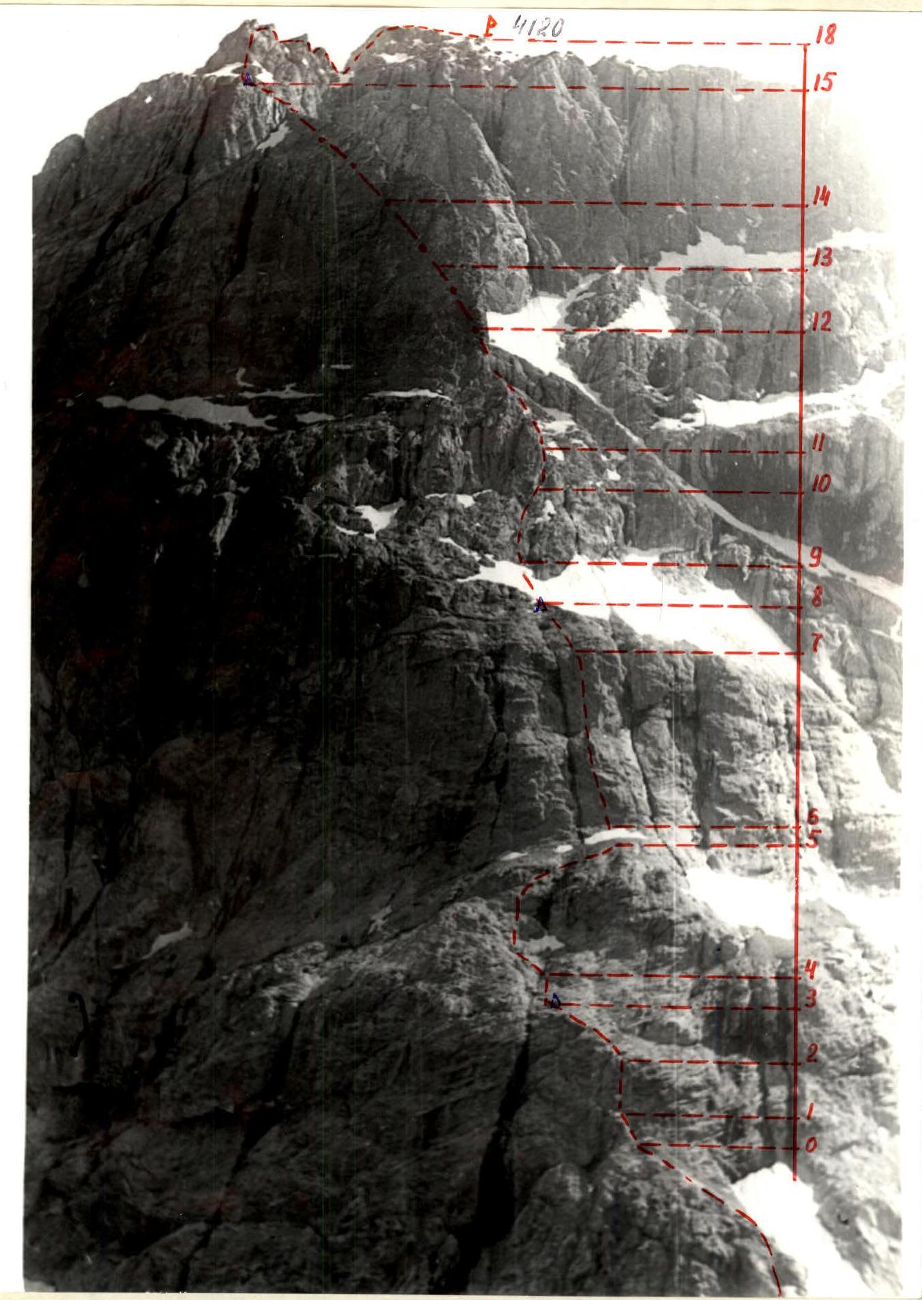
- Peak, its height, and ascent route: Vilnius, 4120 m, first ascent via the northeast wall.
- Estimated difficulty category: 4A.
- Route characteristics:
- Height difference: 820 m
- Average steepness: 53°
- Length of sections: R1–R100 m, R2–R160 m, R3–R530 m, R4–R200 m, R5–R200 m.
- Pitons driven:
- Rock: 60.
- Ice (wedges): 10.
- Number of climbing hours: 13.
- Number of overnight stays: Overnight stay under the wall on a clearing.
- Surname, first name, patronymic of the leader and participants, their sports qualification:
- Leader — Filimonov V., 1st sports category in alpinism.
- Participant — Timofeev V., 1st sports category in alpinism, Candidate for Master of Sports in rock climbing.
- Participant — Khitrikov V., 1st sports category in alpinism, Candidate for Master of Sports in rock climbing.
- Participant — Dashko O., 1st sports category in alpinism.
- Team coach: Instructor, Candidate for Master of Sports Petrichenko N.N.
- Date of departure and return: 31.07.1979, 6:00, departure from overnight stays under the wall. 20:00, return to overnight stays.
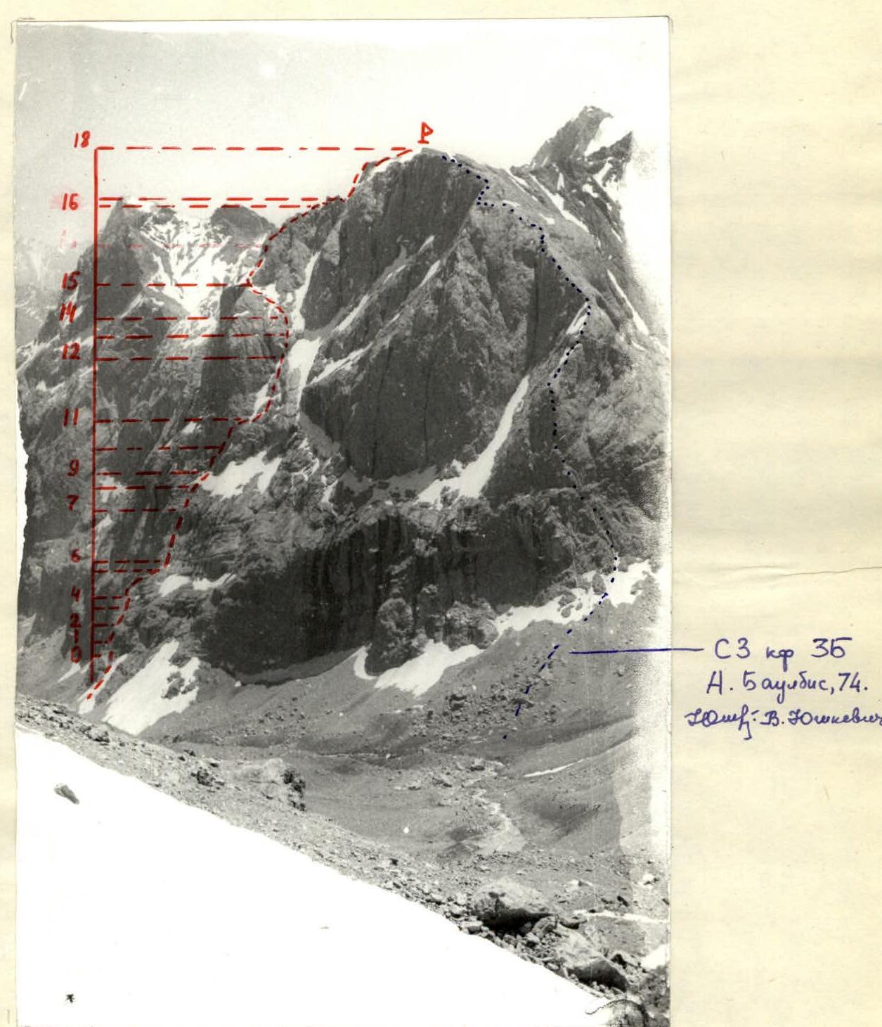
In 1973, with Yurgenenis.
Fann Mountains
| Date | Designation | Average steepness in degrees | Length | Terrain characteristics | Difficulty | Condition | Weather conditions | Rock | Ice (wedges) | Bolts |
|---|---|---|---|---|---|---|---|---|---|---|
| I | 2 | 3 | 4 | 5 | 6 | 7 | 8 | 9 | 10 | 11 |
| 31.07. | R0–R1 | 50 | 20 | Chimney | 3 | Monolithic | Good | 1 | – | – |
| R1–R2 | 70 | 40 | Wall | 5 | Monolithic | 6 | – | – | ||
| R2–R3 | 40 | 40 | Slabs | 3 | Monolithic | 2 | – | – | ||
| R3–R4 | 45 | 20 | Slabs | 3 | Monolithic | 1 | – | – | ||
| R4–R5 | 50 | 40 | Walls, shelves | 3 | Monolithic | 2 | – | – | ||
| R5–R6 | 30 | 20 | Snow | 3 | Dense | Belay | via ice axe | |||
| R6–R7 | 80 | 100 | Wall | 5 | Monolithic | 14 | 1 | – | ||
| R7–R8 | 45 | 80 | Slabs | 3 | Monolithic, damaged | 3 | 2 | – | ||
| R8–R9 | 35 | 40 | Snow | 3 | Dense | Belay | via ice axe | |||
| R9–R10 | 60 | 40 | Wall | 4 | Monolithic, wet | 4 | 1 | – | ||
| R10–R11 | 75 | 40 | Wall | 5 | Monolithic | 5 | – | – | ||
| R11–R12 | 40 | 150 | Ramps | 3 | Monolithic | 6 | 1 | – | ||
| R12–R13 | 65 | 40 | Wall | 4 | Monolithic | 5 | – | – | ||
| R13–R14 | 40 | 40 | Snow | 3 | Dense | Belay | via ice axe | |||
| R14–R15 | 40 | 80 | Snow, rocks | 3 | Dense, damaged | – | 2 | – | ||
| I | 2 | 3 | 4 | 5 | 6 | 7 | 8 | 9 | 10 | 11 |
| 31.07. | R15–R16 | 60 | 40 | Wall | 4 | Monolithic | Good | 2 | 1 | – |
| R16–R17 | 90 | 20 | Wall | 5 | Monolithic | 4, 1 | – | – | ||
| R17–R18 | 60 | 80 | Wall | 4 | Damaged | 4 | 2 | – | ||
| Climbing hours | – 13 hours, departure at 6:00, return to overnight stay at 20:00, descent – 1.5 hours. |
From the base camp at TEP, ascent along the left bank of the Ak-Basay River under the northeast wall of Vilnius Peak (2 hours). Overnight stay on a green clearing. Cross to the right bank of the Ak-Basay River via rocks. In the left part of the wall, ascend via a snow cone with a steepness of 30°, emerging from under a large black streak on the wall. Along a green ledge, move left and upwards to a standalone "finger", approximately 60 m.
Section R0–R1. Ascend via a steep couloir to the "finger" 20 m.
Section R1–R2. From the "finger", climb straight up the wall 40 m. Rocks are monolithic, with few crack for pitons. Movement in crampons is difficult.
Section R2–R3. Then, ascend via slabs to the left and upwards 40 m to a black streak with water. First control point.
Section R3–R4. Climb up the right side of the stream 20 m.
Section R4–R5. From under the wall, where the black streak begins, move left and upwards via ledges 40 m. Alternate belay. Along the green ledge, move right and upwards with simultaneous belay to a black mass protruding from the wall.
Section R5–R6. Climb straight up via not very steep snow 20 m to the black mass.
Section R6–R7. Along it, climb straight up 100 m. Climbing is very difficult via monolithic rocks. In the upper part, a cornice is bypassed on the left. Difficult climbing with alternate belay. Mainly using combined pitons and wedges. The section is climbed on a double rope.
Section R7–R8. Climb straight up via slabs with small ledges 80 m. Second control point — on a large, visible ledge. Overnight stay is possible.
Section R8–R9. Further, move upwards via snow; in the upper part, there is a steep ascent under the wall.
Section R9–R10. Along the wall, climb right and upwards 40 m via slippery rocks with few cracks. Then, via small ledges, 20 m approach under a wall with an opening in the upper part.
Section R10–R11. Climb via the wall with an opening 40 m upwards. Climbing is difficult via monolithic rocks with small holds. Few places for pitons.
Section R11–R12. Move via ramps with variable and simultaneous belay 150 m left and upwards to a separate wall.
Section R12–R13. Climb via the wall 40 m. Climbing is difficult in crampons to steep snow.
Section R13–R14. Move via snow 40 m. In the upper part, in three pitches.
Section R14–R15. Left and upwards towards the ridge 80 m via alternating rocks and snow. On the ridge, the 3rd control point.
Section R15–R16. Climb via the wall in its central part 40 m. Difficult climbing. Then, 80 m along the ridge with simultaneous and alternate belay, using protrusions to a vertical wall.
Section R16–R17. Climb via the vertical wall 20 m. Very difficult climbing in crampons. Pitons are combined. Then, 40 m simultaneous movement along the ridge to an opening. Rappel 15 m and further with alternate belay 40 m to the pre-summit wall.
Section R17–R18. Climb via the wall 80 m upwards; in the upper part, with a slight traverse left onto ledges. Few places for pitons. Then, simultaneous movement to the summit.
Descent to the southwest to a saddle and via a snowy couloir towards Sugar Head Peak. Ascent via the route takes 13 hours, descent from the summit to the bivouac 1.5 hours. The route is approximately 4A category of difficulty.
Route profile 4A. Northeast wall of G. Filimonov, 1979.