Report
on the ascent of team No. 1 of the Magnitogorsk Alpine Club to the summit of Chapdara (5049 m) via the North Ridge
Magnitogorsk 2010
Captain: Shadrina Tatyana Valeryevna, Nizhnyaya Salda, 1 Microdistrict, bld. 1, apt. 26
Coaches:
- Soldatov Sergey Yuryevich, 455017 Magnitogorsk, Izmailovsky Lane, bld. 5, tel.: (3519) 22-40-97
- Igolkin Viktor Ivanovich, 455000 Magnitogorsk, Lenin Ave., 37, apt. 23, tel.: (3519) 20-82-17, e-mail: iavare.ivi@gmail.com
Ascent Passport
- Competition class: EASC Championship, technical class.
- Region: Pamir-Alay, Zeravshan Range, Fann Mountains.
- Summit: Chapdara 5049 m.
- Ascent route: via the northern ridge.
- Category of difficulty: 5A.
- Route characteristics: — combined. Height difference — 799 m; route length — 1200 m; including sections of 5th category of difficulty — 380 m; average steepness — 50°.
- Pitons used: rock — 40; ice — 17; chocks — 69.
- Climbing hours — 18.0 hours. Climbing days — 1.5 days.
- Departure to the route: August 14, 06:00. Summit ascent: August 15, 12:00. Return to base camp: August 15, 18:00.
- Team: team No. 1 of the Magnitogorsk Alpine Club.
Leader: Shadrina Tatyana Valeryevna, 1st sports category, Nizhnyaya Salda;
Participants:
- Soldatov Sergey Yuryevich, Master of Sports, Magnitogorsk;
- Akhunov Ruslan Yasavievich, 2nd sports category, Yekaterinburg;
- Bogolyubsky Konstantin Alekseyevich, 2nd sports category, Chelyabinsk;
- Ilyinykh Kirill Igorevich, 2nd sports category, Zlatoust;
- Team coach: Soldatov Sergey Yuryevich, Master of Sports, Magnitogorsk.
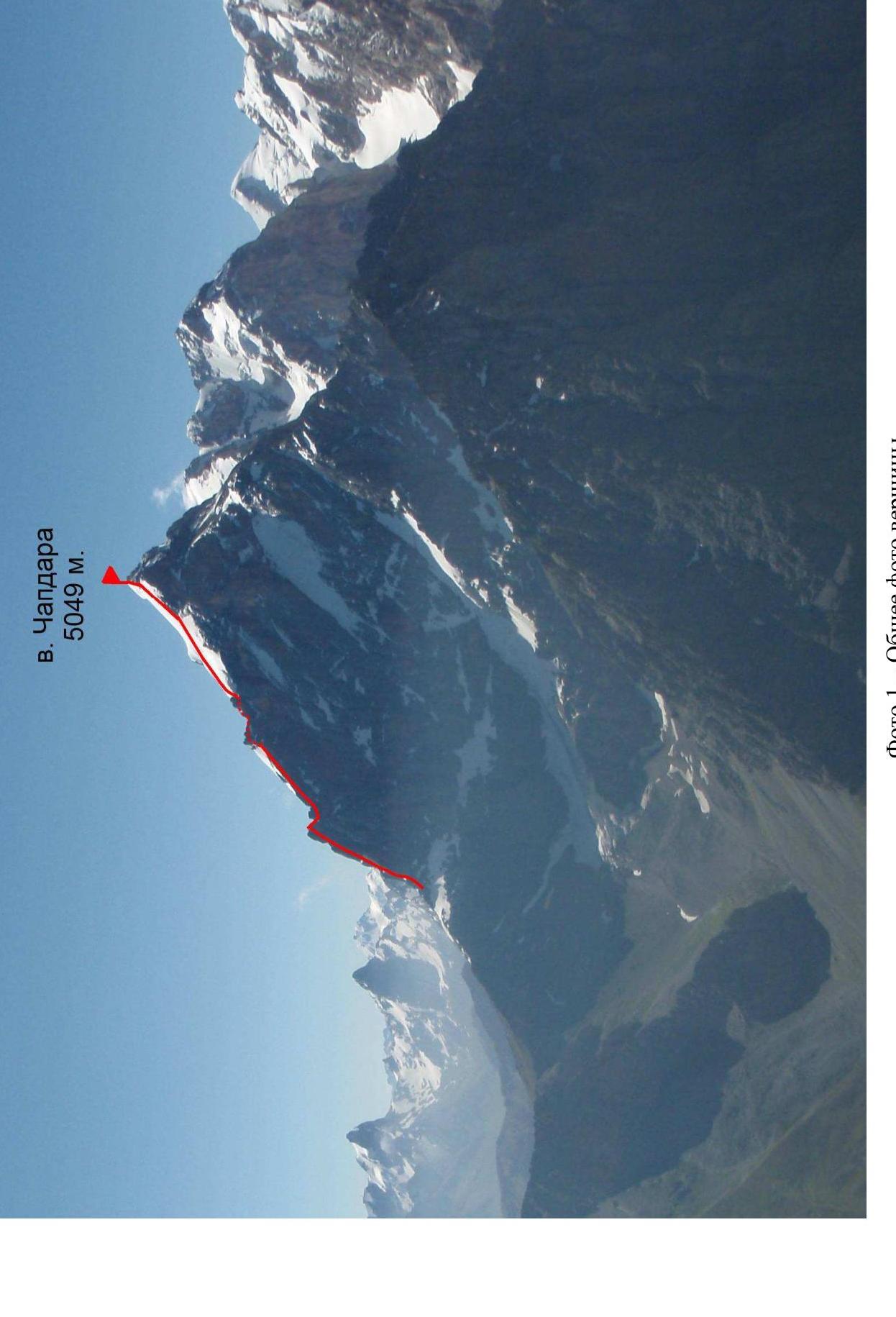
Photo 1 — General photo of the summit
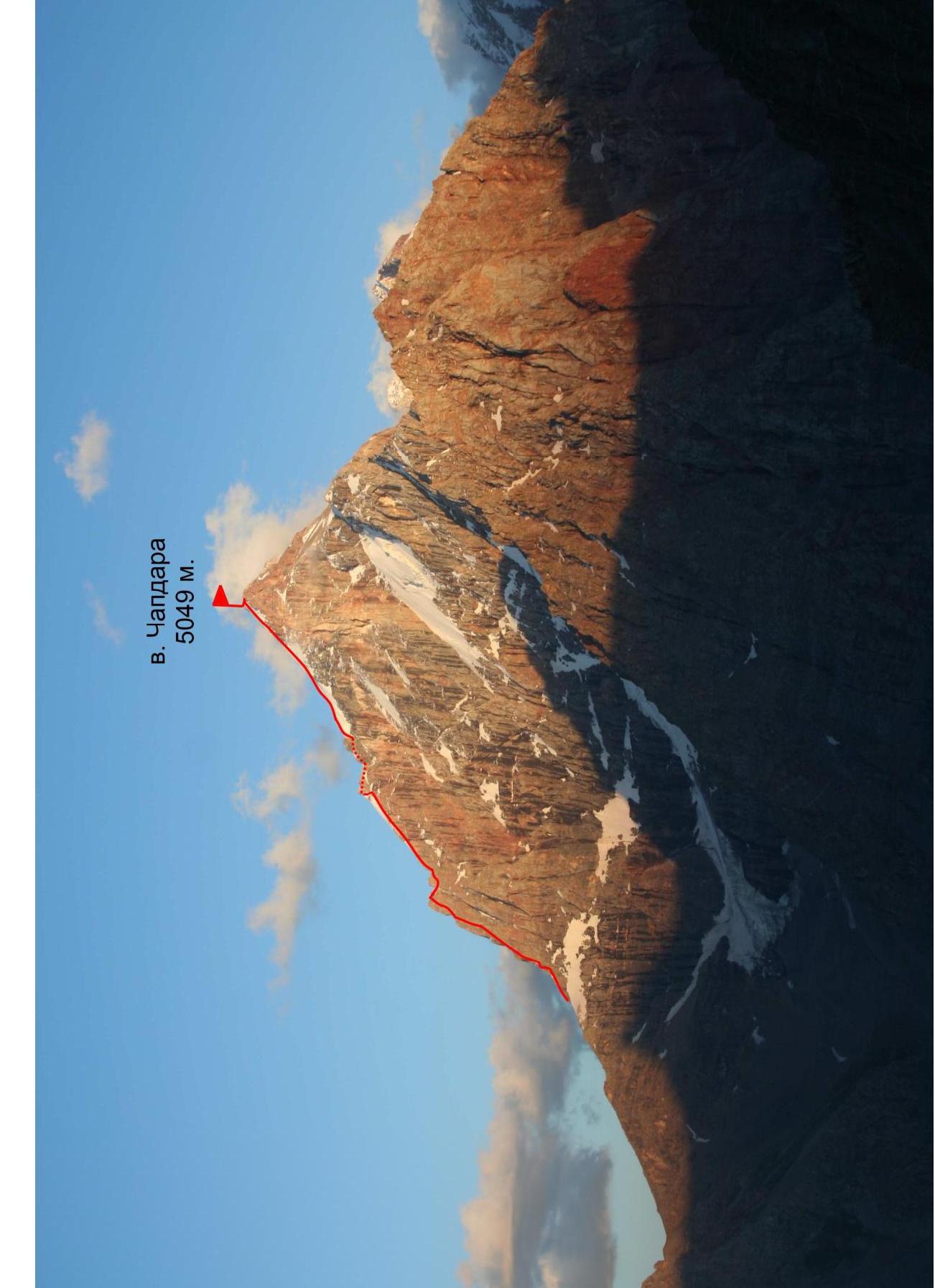
Photo 2 — Left profile
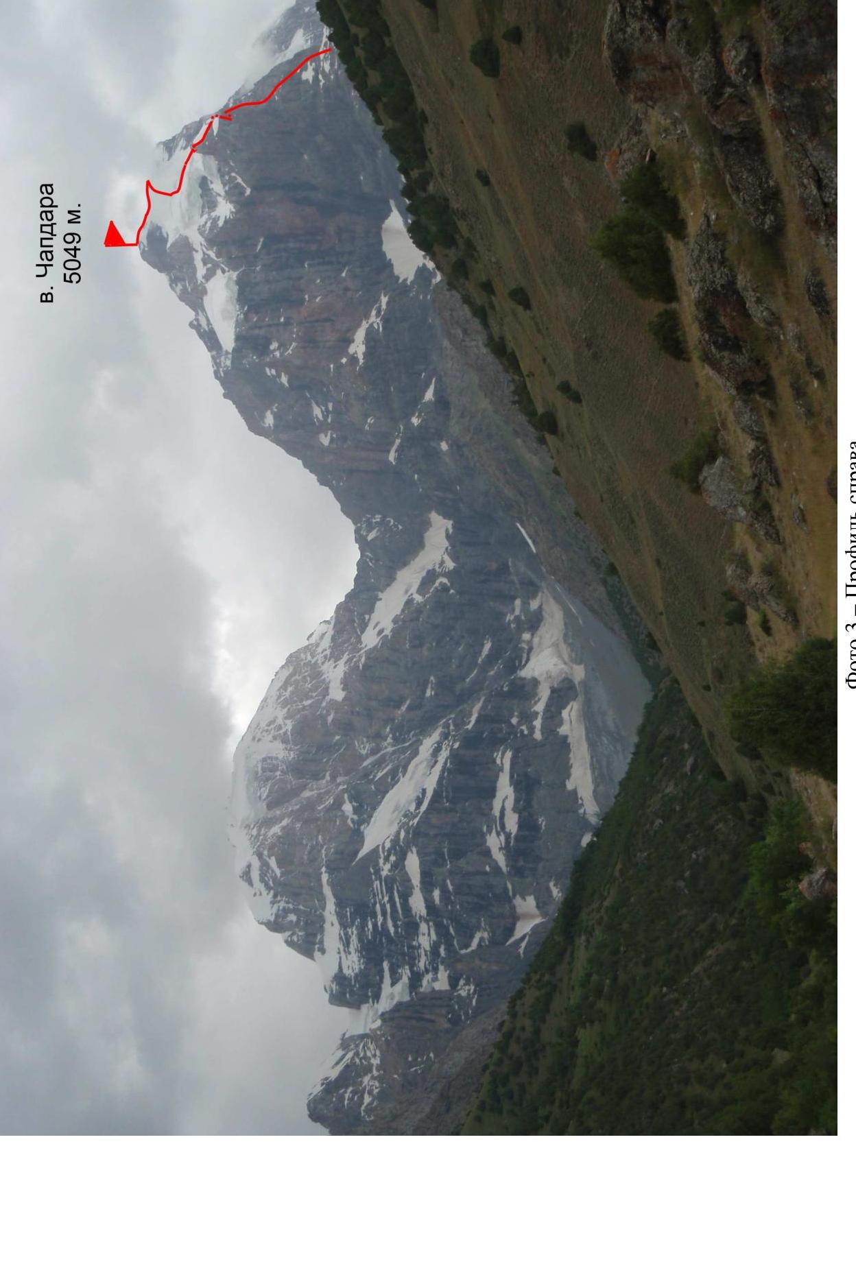
Photo 3 — Right profile
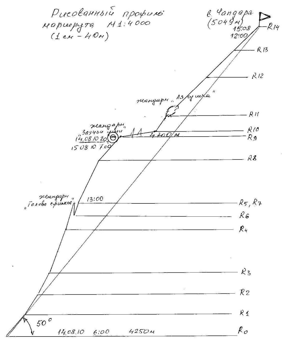
Hand-drawn route profile M1:4000 (1 cm–40 m)
Map of the area
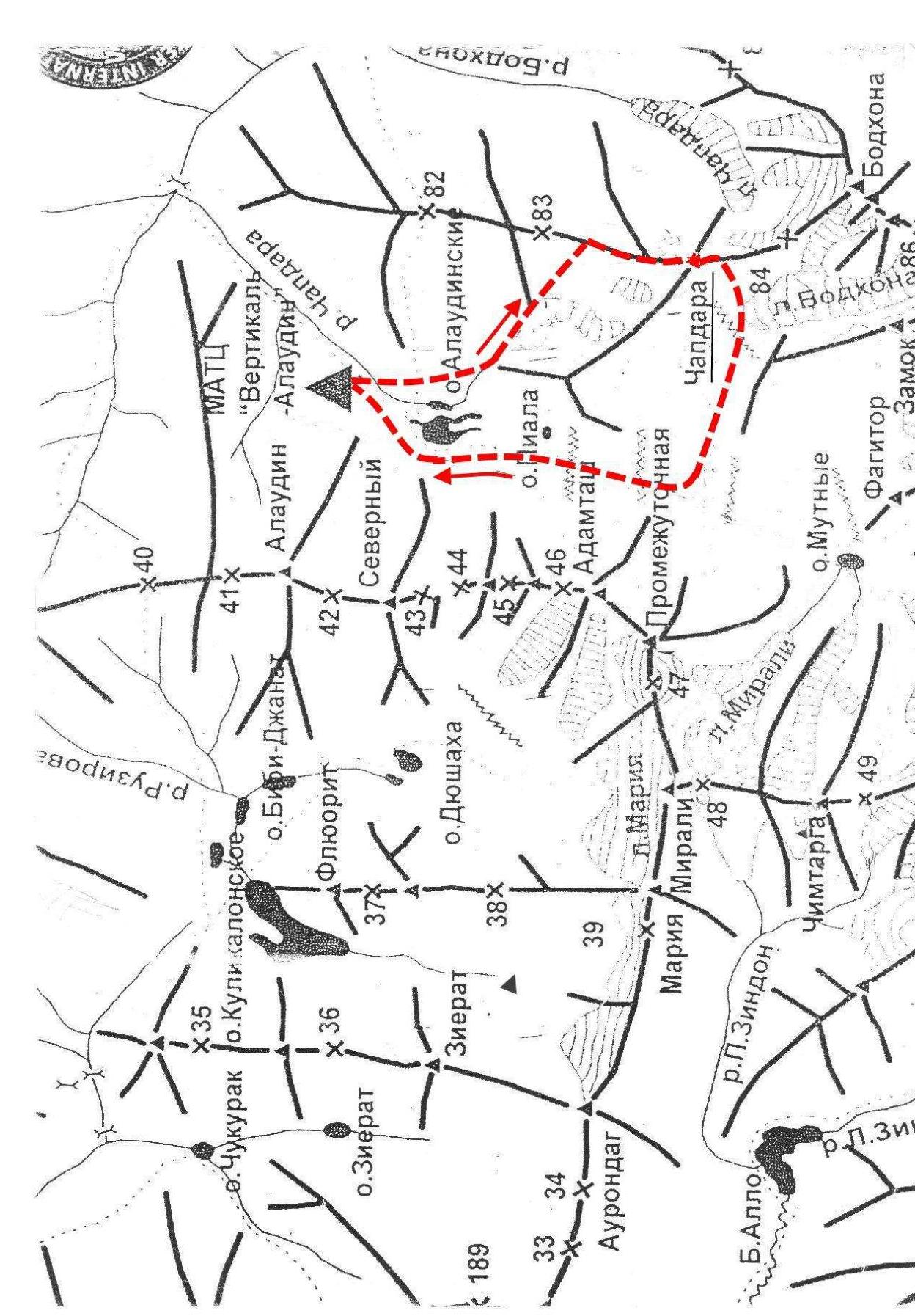
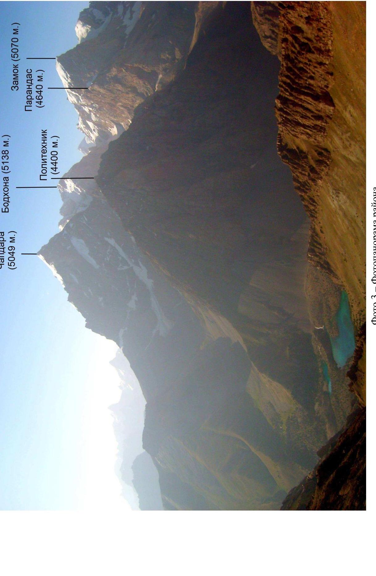
Photo 3 — Panoramic photo of the area
Brief description of the ascent area
The summit of Chapdara is one of the most challenging five-thousanders in the western part of the Pamir-Alay mountain system. Located in the center of the Fann Mountains, between the Gissar and Zeravshan ranges, it is a typical representative of this mountain system. Characterized by steep slopes, dropping off to the east, south, and west, with powerful glaciation on the northern ridge and northwestern ridge with icefalls to the north. The summit is virtually surrounded by five-thousanders Bodkhona and Zamok. Here, the height differences reach 1–1.5 thousand meters. To the south, it is connected by a steep ridge to the summit of Bodkhona (5138 m), and by a western ridge to Polytechnik (4400 m). At the same time, the ridges have an elevation of over 4300 m. The glacier line on the northern slopes is at an altitude of 3200–3300 m, and the snow line is above 4000 m.
Routes to the summit have been laid from all sides. The most challenging ones are on the sheer northern wall with a height difference of over 1000 m. Approaches to the northern wall and ridge from the Alaudin lakes are covered, with a large height difference, and take no more than 4 hours. The starting point of the routes along the northern ridge is from an elevation of over 4000 m. This determines the almost constant negative temperatures on the wall in the shade and freezing of water in the absence of sunlight. Administratively, the summit is located in the Ayniy district of the Sogdian region of Tajikistan. An international alpine tourist center "Vertikal" operates in the Alaudin valley, through which it is easiest to enter this region. Routes of the highest category of difficulty have been laid to the five-thousanders Chimtarga, Chapdara, Bodkhona, Zamok, Mirali, Adamtash, and Zindon.
Preparation for the ascent
The team members had experience of joint ascents within the framework of alpine events of the Alpine Club in the Pamir-Alay mountains. In the summer season, they made joint ascents on routes of 4A and 4B categories of difficulty in the Fann Mountains. Therefore, the tactics and techniques for passing such routes were worked out. Everyone successfully participated in regional rock climbing competitions. The materials of the reports on the passage of the route were carefully studied.
Tactical actions of the team
The style chosen was sports-oriented, i.e., the ridge was climbed without processing, using free climbing. All team members were proficient in rock climbing techniques. Therefore, each worked as the first climber. The entire route lay above 4300 m; on sections not exposed to sunlight, the temperature was always negative, and there was ice in the crevices and couloirs. Here, anchor pitons and ice screws were effective. The main emphasis in the ascent was on free climbing with protection using ice screws.
Movement schedule

| Rock pitons | Ice pitons | Chocks | Route scheme in UIAA symbols (M 1:2000) | Section | Length | Steepness | Category of difficulty | Date, time | Note |
|---|---|---|---|---|---|---|---|---|---|
| — | — | 2 |  | R14 | 100 | 45 | 3Б | August 15, 12:00 | Chapdara summit 5049 m |
| — | — | 3 |  | R13 | 410 | 45 | 3Б | ||
| — | — | 3 | R12 | 150 | 45 | 3Б | |||
| 3 | 2 | 3 | R11 | 50 | 60 | 4А | |||
| 2 | 8 | — | R10 | 100 | 20 | 4А | August 15, 07:00 | "Rabbit ears" pinnacle — overnight | |
| 2 | 1 | 5 | R9 | 90 | 60 | 4А | August 14, 20:00 | ||
| 10 | 17 | — | R8 | 130 | 70 | 5А | |||
| 3 | 3 | — | R7 | 20 | 70 | 5А | |||
| — | — | — | descent | R6 | –20 | 70 | 5А | ||
| 1 | — | 1 | R5 | 80 | 75 | 5А | August 14, 13:00 | "Sphinx Head" | |
| 19 | 18 | — | R4 | 130 | 70 | 5А | |||
| 4 | 10 | — | R3 | 70 | 65 | 4Б | |||
| 3 | 8 | — | R2 | 70 | 60 | 4А | |||
| 3 | 5 | — | R0–R1 | 80 | 50 | 3Б | August 14, 06:00 | 4250 m |

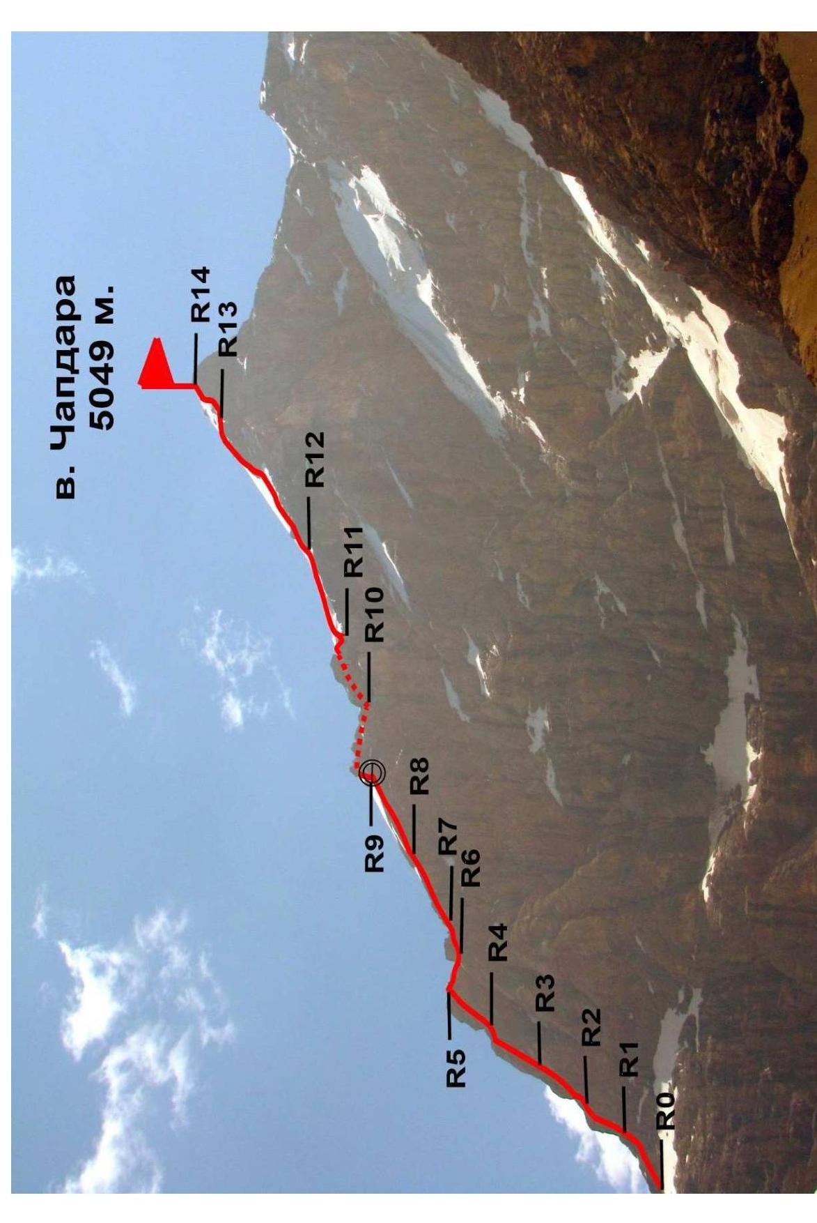
Photo 4 — Technical photo
Photo illustrations for the report
on the ascent of team No. 1 of the Magnitogorsk Alpine Club to the summit of Chapdara (5049 m) via the North Ridge
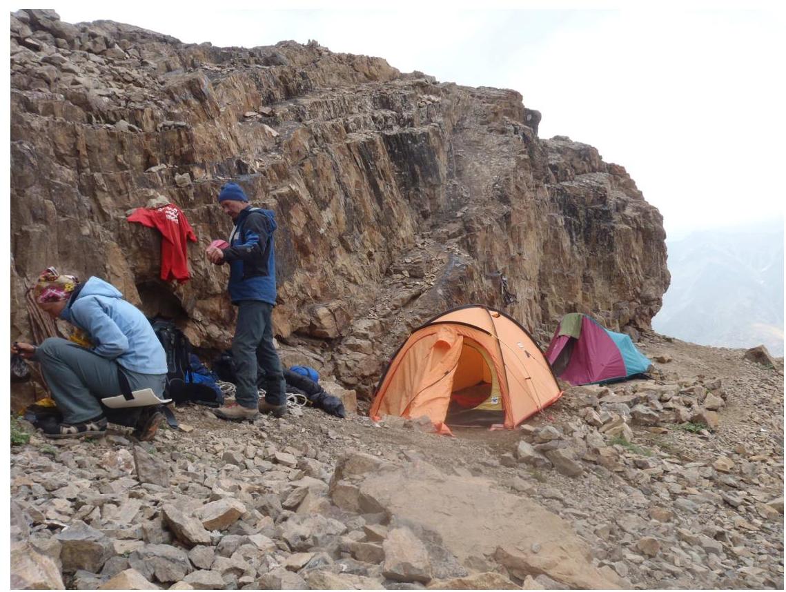
Photo 6 — Assault camp
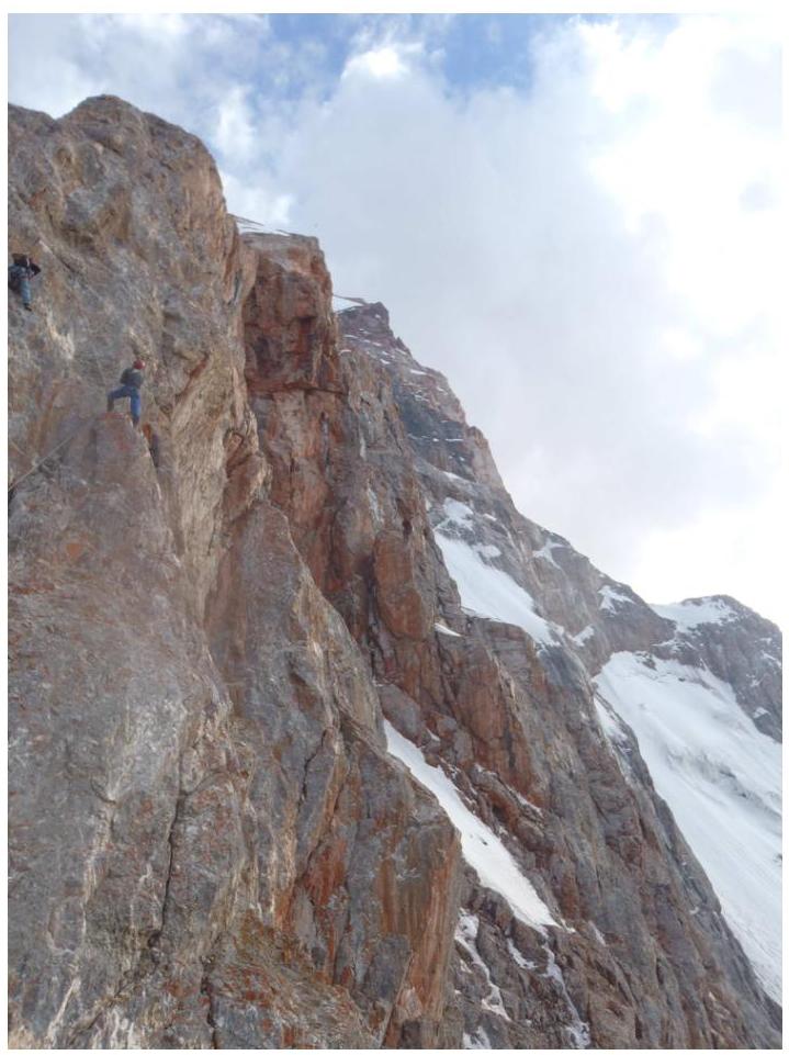
Photo 7 — Section R7–R8
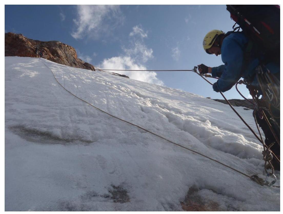
Photo 8 — Section R8–R9
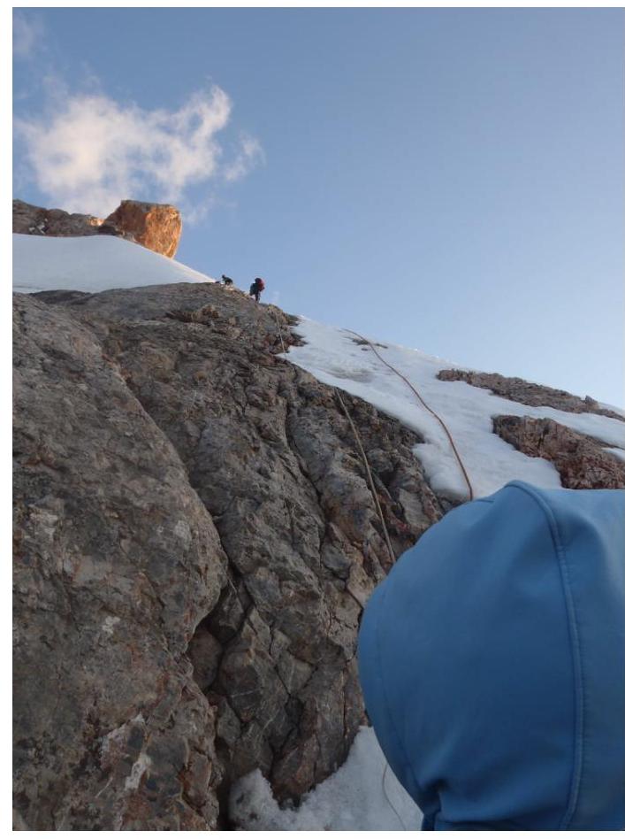
Photo 9 — Upper part of section R8–R9