Ascent to Chapdara Peak, 5049 m via the North Ridge, cat. 5A (through the "Sphinx")
Climbing Passport
- Class: technical
- Fann Mountains, Zeravshan Range.
- Chapdara, 5049 m, via the North Ridge (through the "Sphinx").
- Difficulty category: 5A
- Elevation gain: 1100 m (wall section – 580 m)
Length – 1800 m. Length of sections with 5th category difficulty – 580 m. Average steepness of the wall section – 55°.
- Pitons driven:
rock ice 4*+4 26 7
* – reusing previously driven pitons
- Team's travel time: 20 hours and days: 3
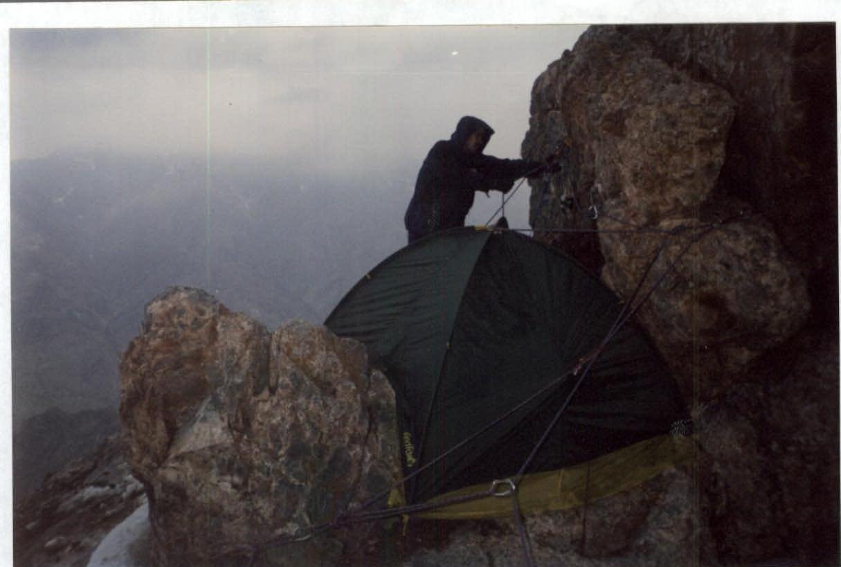
- Overnight stays: 1st (lying) — platform on the ridge below the route 2nd (lying) — platform on the head of the "Sphinx"; 3rd (lying) — in a hollow on the pre-summit ridge
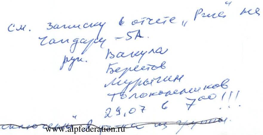
- Team leader: Berezov P. V. — Candidate Master of Sports Participants: Tolokonnikov V. A. — 1st sports category
- Coach: Vakula I. V.
- Route reconnaissance: July 25, 2000
Departure to the route: July 26; Summit: July 28; Descent to Bodhona Glacier: July 28
- MEPhI Alpine Club
Ascent Schedule
July 25 — approach under the North Ridge via Talbas Pass, afternoon — reconnaissance of the lower key;
July 26 — ascent to the head of the "Sphinx";
July 27 — passage of the combined ridge, exit under the summit;
July 28 — ascent to the summit, descent to Bodhona Glacier;
| Section # | Brief Characteristics |
|---|---|
| R0 | Approach under the wall via easy rocks and snowy slope |
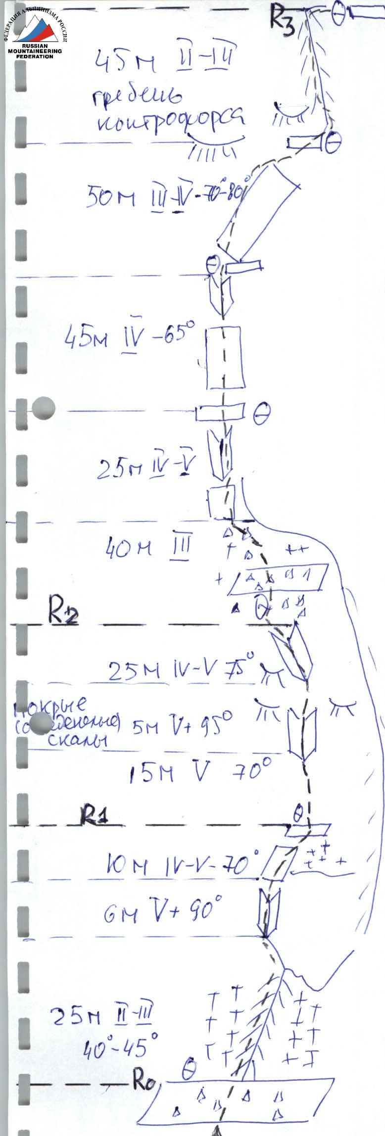
| R1 | Easy rocks right-up to a talus shelf, then 15 m at 30–70° to an internal corner, internal corner, wall with steepness up to 90°, with an overhanging section, 50 m to a shelf under steep rock slabs |
| R2 | Rock slabs at 45–50°, 140 m, then ridge of a counterfort at 55–60°, 50 m to the wall |
| R3 | Along the wall right-up under the head of the "Sphinx" and then along the head to a large internal corner, exit to the head of the "Sphinx" via its right face. At the top, 10 m of icy rocks with steepness up to 80° |
| R4 | Combined ridge. Most difficult sections — two icy gendarmes after the head of the "Sphinx", 20–30 m, up to 90°. Total 480 m, average 20°. Above the "Frog" gendarme — a convenient bivouac site |
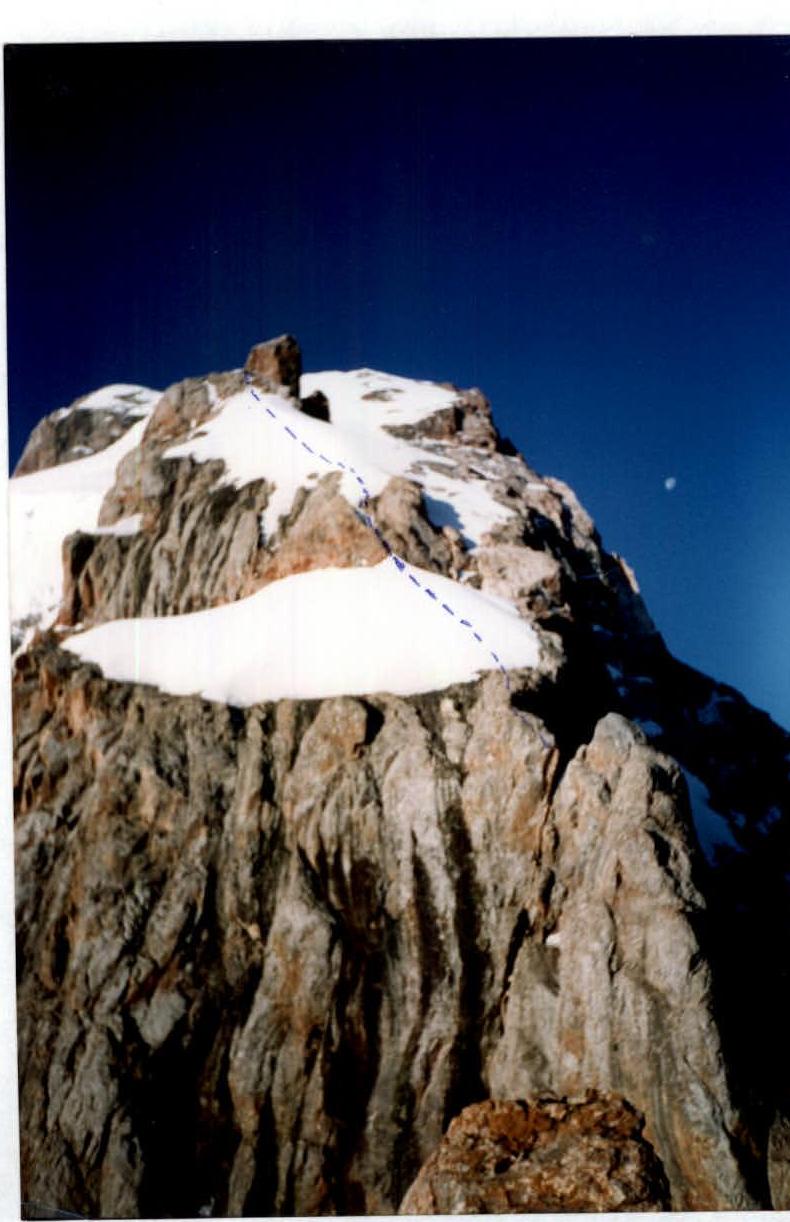
| R5 | Wide snow-ice slope with steepness up to 40°, 500 m ascent to the pre-summit ridge |
| R6 | Easy ridge with snow and rock outcrops, ascent to Chapdara summit |
Route description by sections. Day 0, July 25. We depart from the "Vertical" base along a trail to the right bank of the river and then under Talbas Pass. 2 hours 30 minutes. Pass ascent — easy snow slope with steepness up to 35°, 800 m. Then along an easy rocky-talus ridge under the wall. 50 minutes. Here is a platform for overnight stay. We set up camp at 14:00 and process the first three rope lengths of the route.
Day 1, July 26. Departure at 7:15 am.
Section R0
- Approach under the wall via easy rocks and talus-snow slope on the left side of the ridge.
Section R1
- Along the boundary between rocks and snow, left-up under an internal corner.
- On the right side of the corner, difficult climbing to a large inclined shelf, upper part covered with an ice patch.
- Up the ice patch, 15 m along the wall to a small shelf under the internal corner, covered with a local overhang (everything wet in the evening).
- Along the internal corner, 30 m of difficult climbing on icy rocks right-up, then left-up to inclined rock slabs with loose rocks and snow.
- From there, 50 m left-up with easy climbing under steep slabs to a shelf.
Section R2
From the shelf, straight up along steep slabs, 140 m with gradually easier climbing to the ridge of a counterfort. Along the ridge up, 50 m under the wall — climbing of medium difficulty.
Section R3
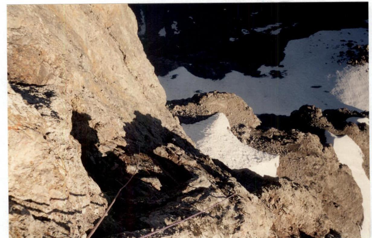
Along the wall — difficult climbing right-up (difficult traverse) under the head of the "Sphinx" and then along the head to a large internal corner, exit to the head of the "Sphinx" via its right face. Total 70 m of difficult climbing (at the top, 10 m on icy rocks), belays on small ledges.
Reach the head of the "Sphinx" at 16:30. Thunderstorm at the summit, but here everything is calm, except for a slight tingling sensation in the limbs.
Day 2, July 27. Departure at 7:45 am.
Section R4
Passage of the combined ridge. From the overnight stay, 20 m to a loop, from where a 20 m rappel to a snowy saddle under the first gendarme, then bypassing right, 10 m easy on a rising ledge of medium difficulty — approach under the second gendarme. Here:
- 30 m of medium climbing,
- 30 m of difficult climbing (small holds) on icy rocks.
Then along an easy ridge — exit to its snowy-icy part. Along a wide snowy-icy ridge with a rocky outcrop — ascent under the "Hares" gendarme. The gendarme is bypassed on the left along rocks of medium difficulty and then along the ridge to the "Frog" gendarme. Before the gendarme — a 7 m descent to a small saddle. The "Frog" gendarme is bypassed on the left along a snowy slope, 70 m, above the gendarme — a wide hollow under a bergschrund, possible bivouac.
Section R5
Along a wide snowy-icy slope with steepness up to 40°, in its left part, 500 m ascent to the pre-summit ridge at 17:00. A lot of snow, reminiscent of winter Caucasus, no belays required. Bivouac in a hollow.
Day 3, July 28.
Section R6
Along an easy ridge with snow and rock outcrops, ascent to Chapdara summit at 8:15. To and from the summit with filming — 35–40 minutes. Start of descent at 8:30. Descent to Bodhona Glacier: talus slopes, rocky couloirs, movement along the ridge of Polytechnik Peak, to the talus — 9 rappels of 25–45 m, 5 hours 30 minutes.
Tactical Actions of the Team
The team had at its disposal a description of the ascent led by Julio in 2000. Weather during the ascent was favorable. On difficult sections, backpacks were pulled up using an auxiliary rope. There were 2 such sections. On the descent, however, there was continuous fog, thunderstorm, and snow with rain, which complicated orientation. General recommendation: after descending from the summit by about 150 m vertically, traverse the slope towards Polytechnik Peak and after a significant talus field turning into a system of couloirs — look for a descent down.
YUAA Scheme
Rock Bastion
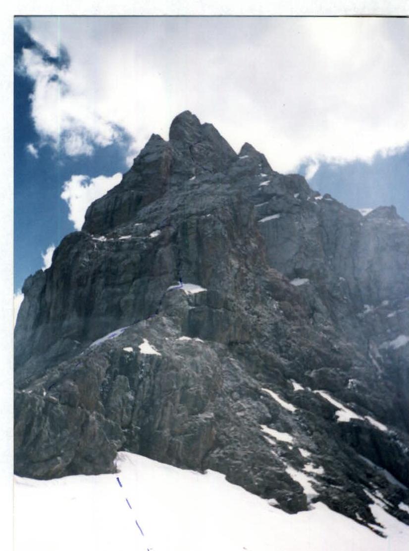
"Sphinx" Bastion: view from the ridge
Section R1
On the "Sphinx"
To the ridge: view from the head of the "Sphinx"