Ascent Passport
- Pamiro-Alai, Zeravshan ridge, Fann Mountains. 5.3.1
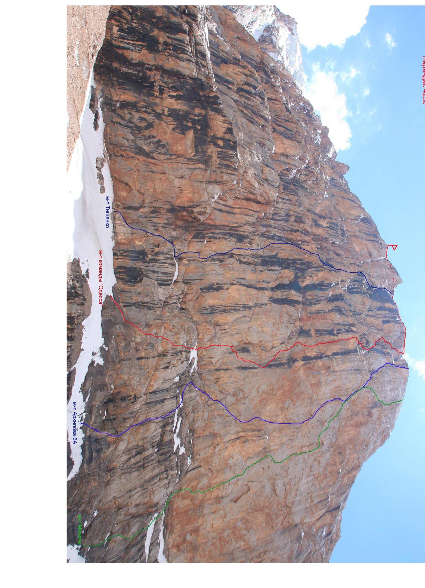
- v. Parandas 4250 m via the center of the North face
- First ascent, proposed 6A category of complexity
- Route character — rocky.
- Route height difference: 850 m, wall part 780 m.
- Route length 1280 m, main part 890 m. Sections of 6th category 470 m. Sections of 5th category 180 m. Average steepness of the wall part 80°.
- Pitons left on the route: total 21, including 20 bolts. "Pitons" used on the route (in the denominator for ITO): Rock protection elements bolted skyhooks ice 120/72 100/60 20/4 12 4
- Travel hours 55 days 6.5
- Team leader Tsushko Taras Viktorovich MS Participants: Lavrinenko Alexander Vadimovich MS Polyakov Maxim Vladimirovich 1st sports category Khomenko Alexander Alexandrovich CMS
- Team coach: Gorbenko Mstislav Mstislavovich HMS, Honored Coach
- Approach to the route July 12, 2010. Summit July 18, 2010. Return July 19, 2010.
- Organization a/c "Odessa"
Parandas 4250 m


Dado the two hinges latrines
| Used on the route | UIAA route scheme | |||||||||
|---|---|---|---|---|---|---|---|---|---|---|
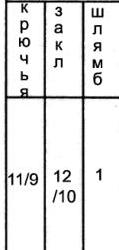 |  |  |  |  |  |  | 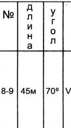 |  |  | |
| 11/9 | 12/7 | 1/1 | 8–9 | 45 m | 70° | 5 | ||||
| 9/5 | 10/9 | 2/1 | 11 | 7–8 | 35 m | 80° | 6 | |||
| 10/8 | 8/8 | 1/1 | 4 | 6–7 | 30 m | 75° | 6 | |||
| 2/2 | 7/3 | 1/1 | 5–6 | 20 m | 65° | 3 | ||||
| 10 m | 80° | 5 | ||||||||
| 4/4 | 6/1 | 4–5 | 45 m | 80° | 5 | |||||
| 4/2 | 8/3 | 3–4 | 30 m | 65° | 3 | |||||
| 20 m | 80° | 5 | ||||||||
| 5/5 | 1/1 | 2–3 | 30 m | 75° | 5 | |||||
| 3/3 | 1–2 | 30 m | 65° | 3 | ||||||
| 2/1 | 0–1 | 50 m | 45° | 2 |
UIAA Scheme sheet 2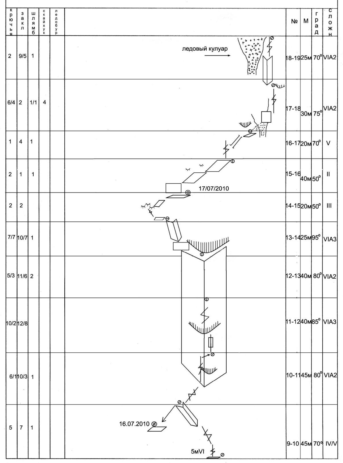

UIAA Scheme sheet 3
| № | M | deg | Difficulty |
|---|---|---|---|
| 24–28 | 400 m | 45° | 2 |
| 23–24 | 20 m | 60° | 3 |
| 22–23 | 50 m | 70° | 5 |
| 21–22 | 50 m | 70° | 4 |
| 20–21 | 50 m | 70° | 4 |
| 19–20 | 45 m | 70° | 5 |
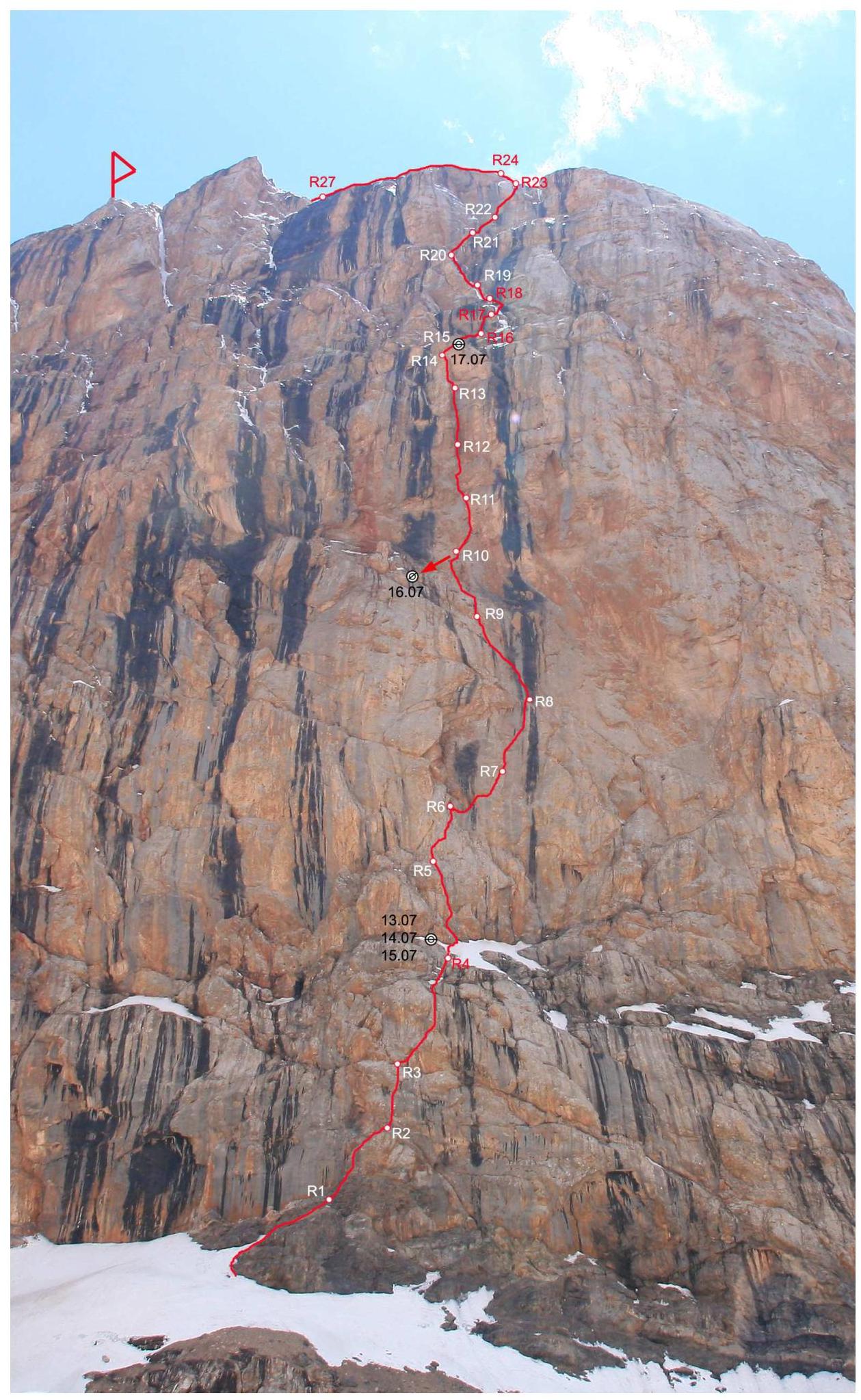
Route description by sections
R0–R1 Ascend a snowy slope, then simple rocks "ram's foreheads" to approach the base of the inner corner. 50 m 45° 2 R1–R2 Ascend the right side of the corner, then right up through broken rocks to a ledge. 30 m 65° 3 R2–R3 Ascend through a smooth steep wall, a bolt is placed, further complex climbing up, exit to a small ledge. 30 m 75° 5 R3–R4 To the right of the station is a chimney, ascend it to the top of the break. Further through a crack, partly on ITO, to a shallow ice-filled inner corner. Station at the end of the corner. 20 m 80° 5, 30 m 65° 3 R4–R5 Ascend an inclined snow ledge (25–30°), approach the wall. Start up an inclined inner corner to the left, then up to the right, into a vertical inner corner, ascend it to a more gentle slope. Station on a small ledge. 45 m 80° 5 R5–R6 Ascend right up a crack 10 m 5, then move right, into an inner corner, up the corner 20 m 65° 3, to a wedged block, station on it. R6–R7 From the station descend 3 m right down, traverse right 5 m, then right up on ITO to a bolt. From it traverse right, under the overhang to a crack. Ascend the crack, on ITO, after 10 m move right up, climbing, to another crack. Station in front of the inner corner. 30 m 75° 6 R7–R8 Ascend the corner, then through a small overhang. Above the overhang right up, through deaf cracks, partly on a slab on skyhooks, exit to a small ledge, at the base of an oblique crack. 35 m 80° 6 R8–R9 Ascend an oblique crack, left up, ITO + climbing. Station on a small ledge. 45 m 70° 5 R9–R10 Ascend through a ruined overhang 5 m 5, then up a crack, climbing becomes easier (3–4), left up, in the direction of a huge inner corner. Station on a small ledge. Below the station at 10 m — a ledge, bivouac site (sitting). 45 m 70° R10–R11 From the station right up, enter the base of the inner corner, further up the corner, the overhang is passed in the left part. Further up the corner. Station to the right under an overhang. 45 m 80° 5 R11–R12 Ascend the corner, surmount an overhang consisting of "rumbling" blocks, further again up the corner, the corner narrows inward, with ice inside. 40 m 85° 6 R12–R13 Ascend the corner. From above the corner is blocked by a large overhang. Under it is a station. 40 m 80° 5 R13–R14 Under the overhang left, exit from the corner. Then through an overhanging wall, up. Station on a ledge. 25 m 95° 6 R14–R15 Ascend to gentle "ram's foreheads", along them right, to a good ledge. Here is a station and bivouac site. 20 m 2 R15–R16 From the station up through a wall, then right up through simple rocks, station at the base of a crack. 40 m 1 R16–R17 Ascend a crack, then a chimney to exit to a "balcony". 20 m 70° 4 R17–R18 Ascend right, intersect an ice-filled corner — a couloir. Surmount a wall right up and ascend a crack to exit to a small ledge, protected by an overhang. In the 2nd half of the day — rockfall hazard. 30 m 75° 5 R18–R19 Ascend left up, into an inner corner, up the corner, move right of an ice streak. 25 m 70° 5 R19–R20 Ascend a crack 10 m up, then left, exit to ice, further up, exit through overhanging ice-covered rocks to a small ledge. 45 m 70° 5 (ascend early in the morning, after 12:00 water flows, ice and stones fall) R20–R21 Ascend left up, into an inner corner. Up the corner is not difficult climbing to a ledge. 50 m 70° 4 R21–R22 Along the ledge right, to a crack. Up a wet, ruined crack, to a small ledge, then right, and up a corner to a ledge. 50 m 70° 4 R22–R23 Up a cleft right up. Wet, partly icy. 50 m 70° 5 R23–R24 Up simple, but icy rocks to exit to the ridge. 20 m 60° 3
Tactical actions of the team
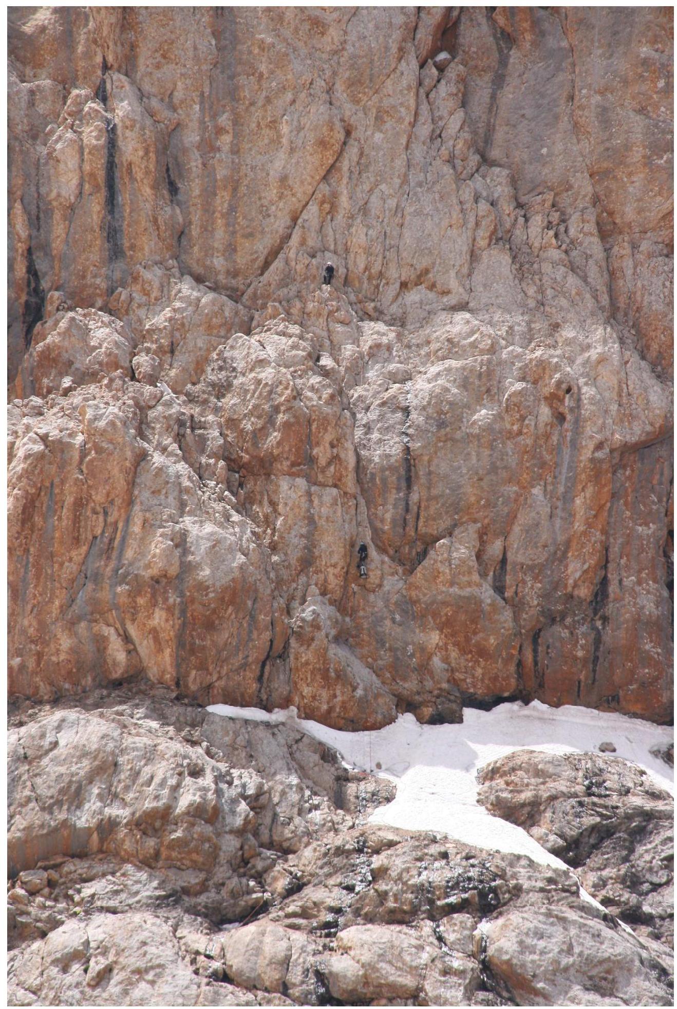
The route was ascended in accordance with the tactical plan. After studying a photograph of the wall and the intended route on site, it was decided to ascend the route without using a platform, moving from ledge to ledge. July 12, 2010. The Lavrinenko — Tsushko rope team placed 5 ropes. The next day it was decided to break away from the ground. July 13 from the morning — bad weather, snow. The team moved the camp to a snowy ledge above R4 (in the left edge of the ledge — a control point), started processing the next sections. Due to bad weather it was possible to ascend only 1.5–2 ropes. July 14–15 — processing from the same bivouac, the Polyakov — Lavrinenko rope team reached R11. Below was found a ledge, where it was possible to bivouac sitting. July 16 — camp relocation, the Tsushko — Khomenko rope team ascended a hanging corner — one of the key sections and reached a more gentle slope. July 17 — camp moved to R15 (control point on a bolt) and processing to R19. July 18 — early morning exit, to "catch" rockfall-prone sections R17–R19 before the sun hits. At 12:20 the team reached the ridge, and by 15:00 was on the summit of Parandas. A note from the Vladivostok FandS team from 2007 was retrieved. The route is clearly more difficult than the neighboring routes of Tischenko and Arkhipov. Also more difficult and logical than the route of Mogila, in which Tsushko and Lavrinenko participated. 20 bolts were left on the route, 5 for passage, 15 for stations. The route is objectively safe, except for the approach and section R17–R19 (rock and ice fall from the ridge). All bivouac sites and most stations are under overhangs, in safe places.
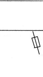
Section 4–5 photographed from the camp under the wall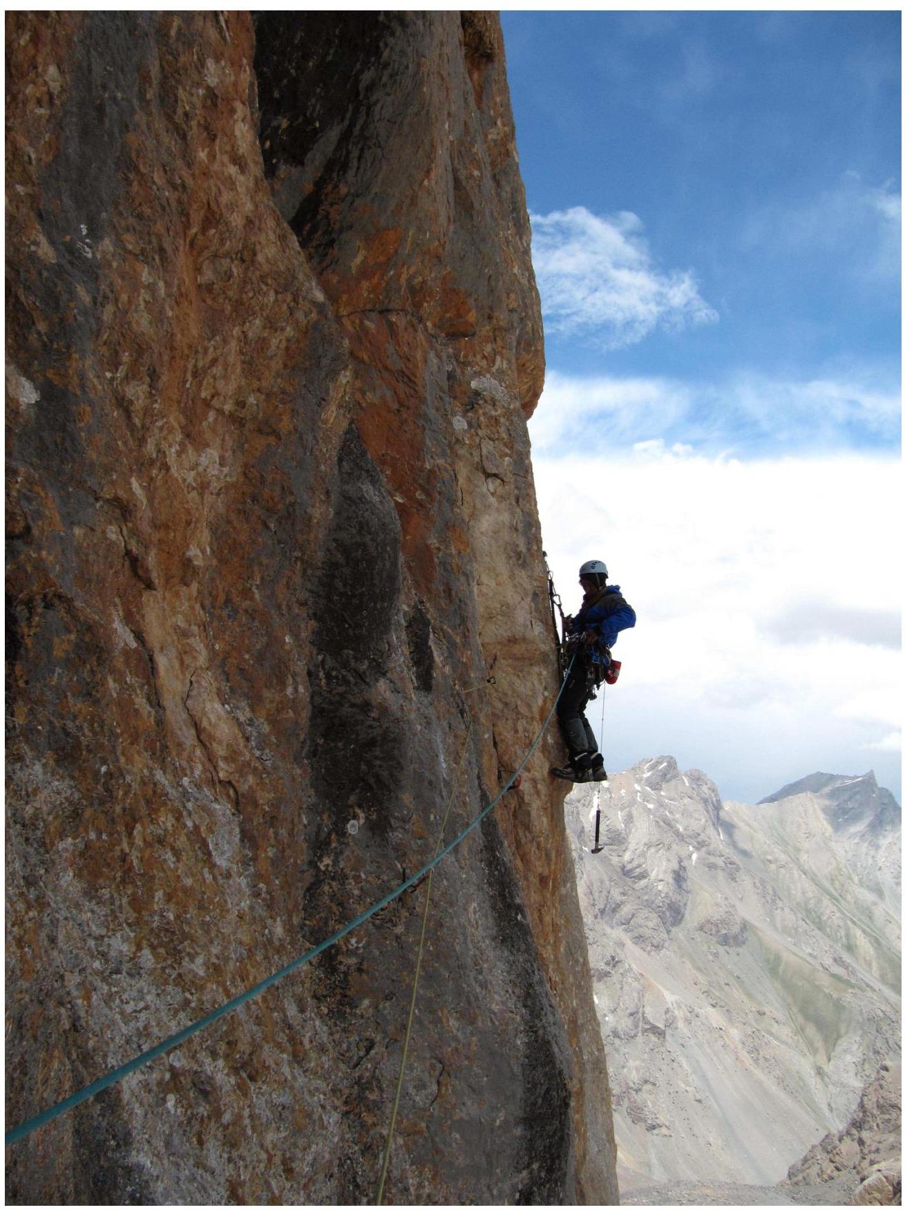
Section 6–7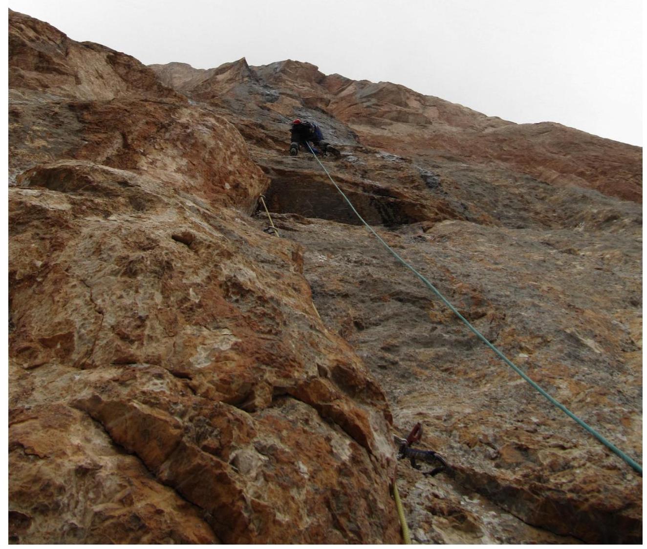
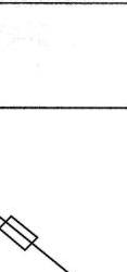
Section 7–8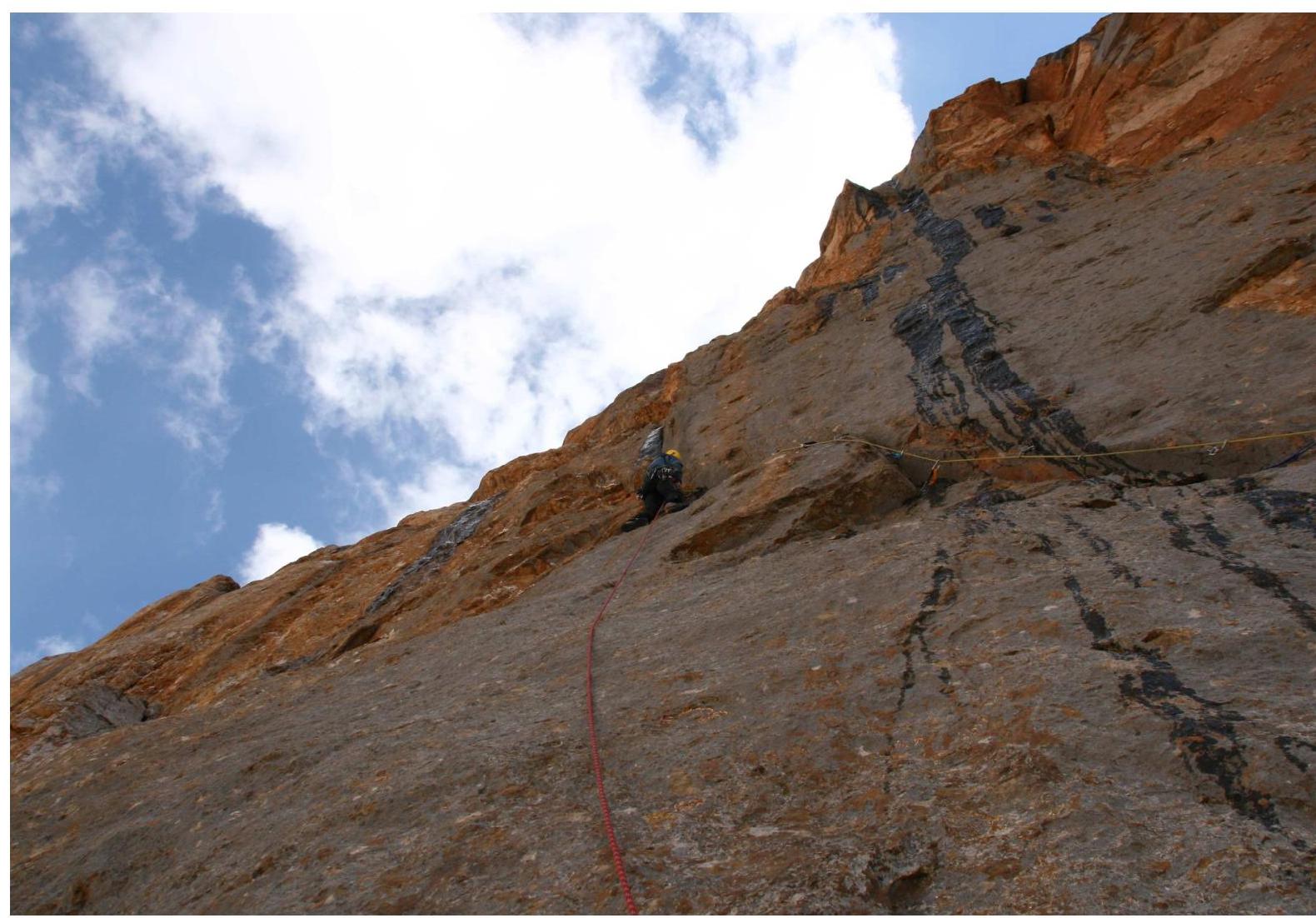
Section 8–9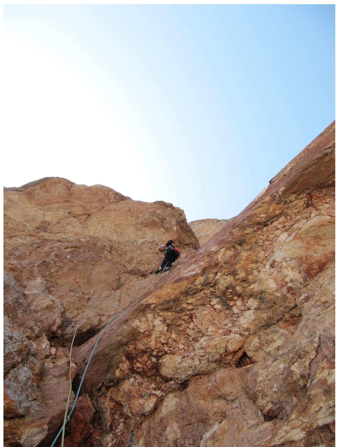
Section R11–R12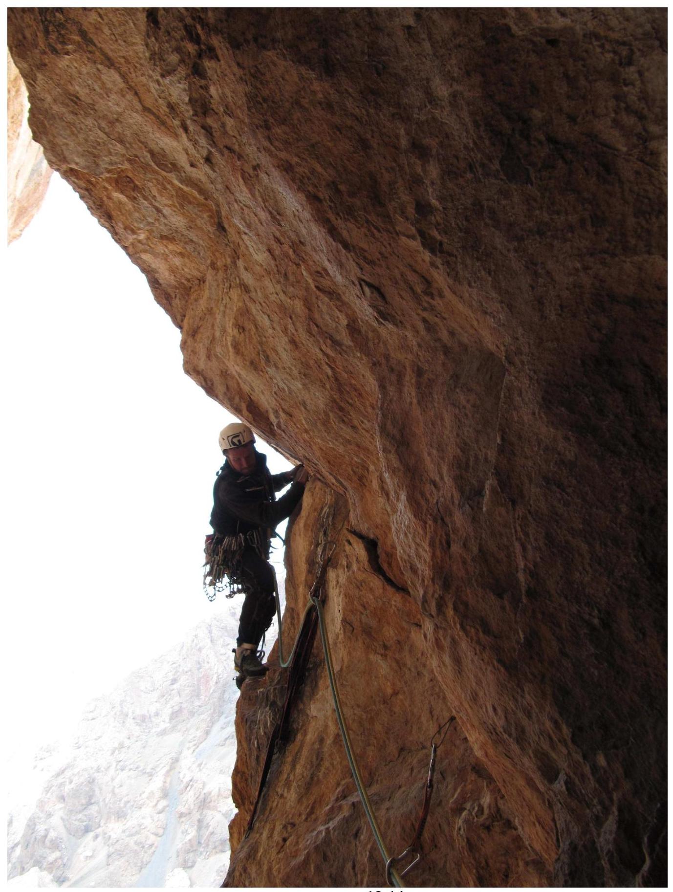
Start of section R13–R14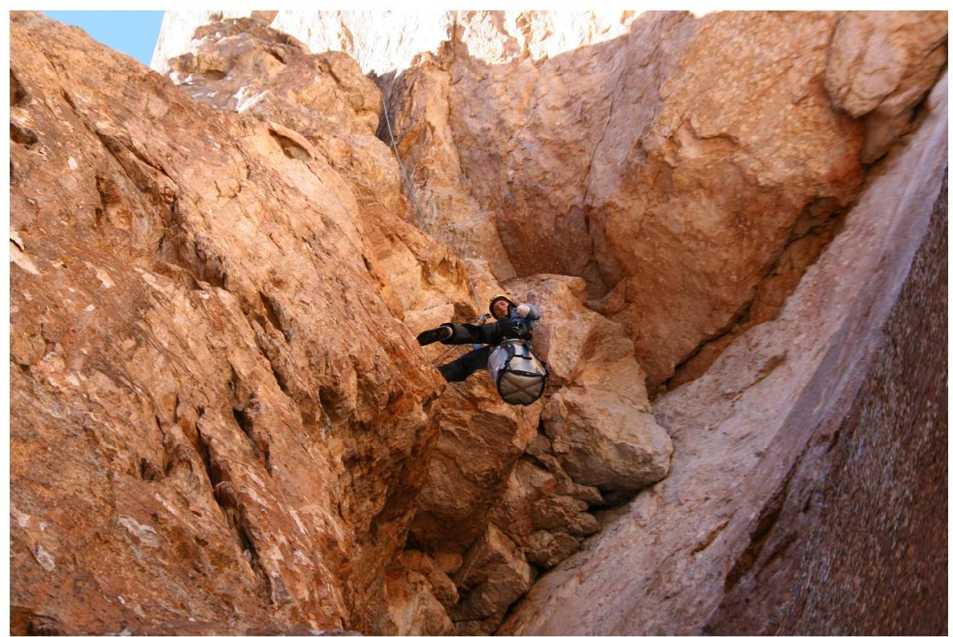
Railing on R13–R14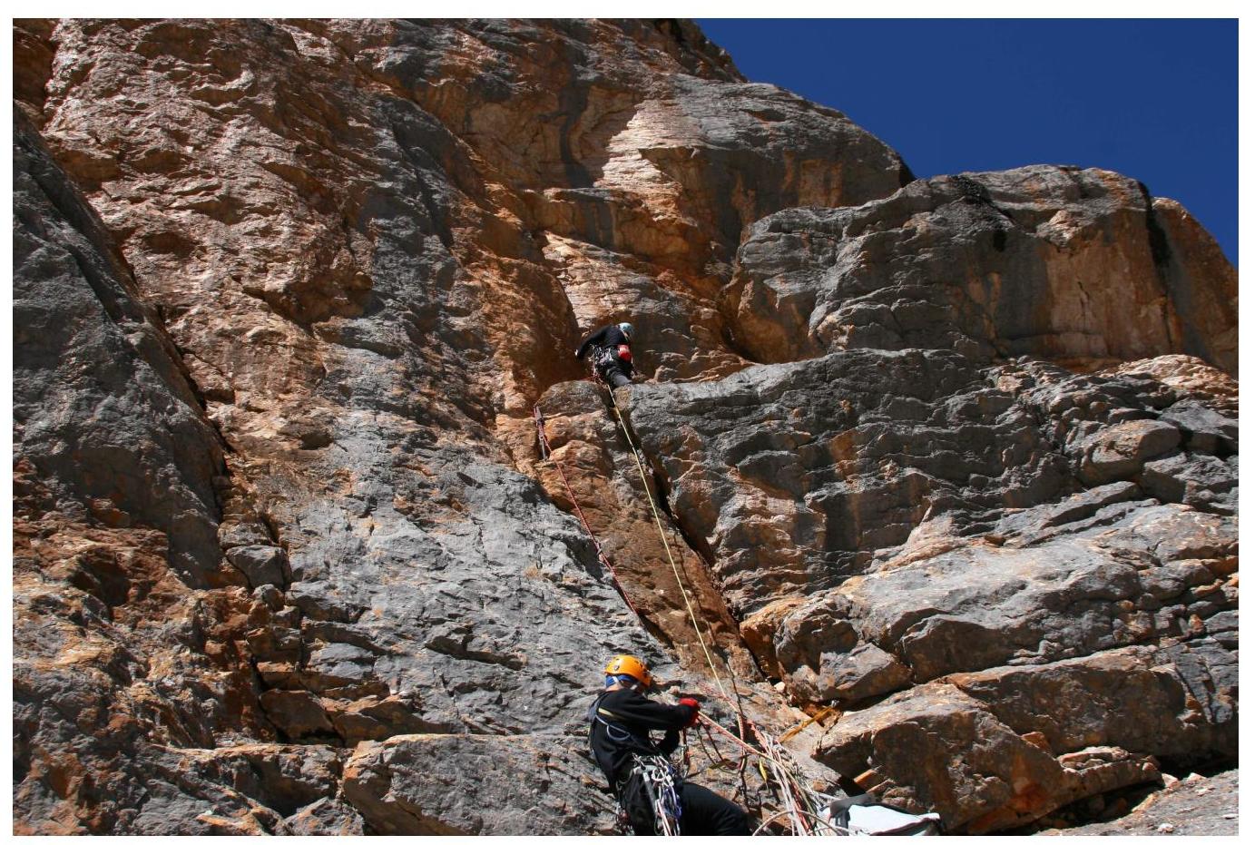
Section R16–R17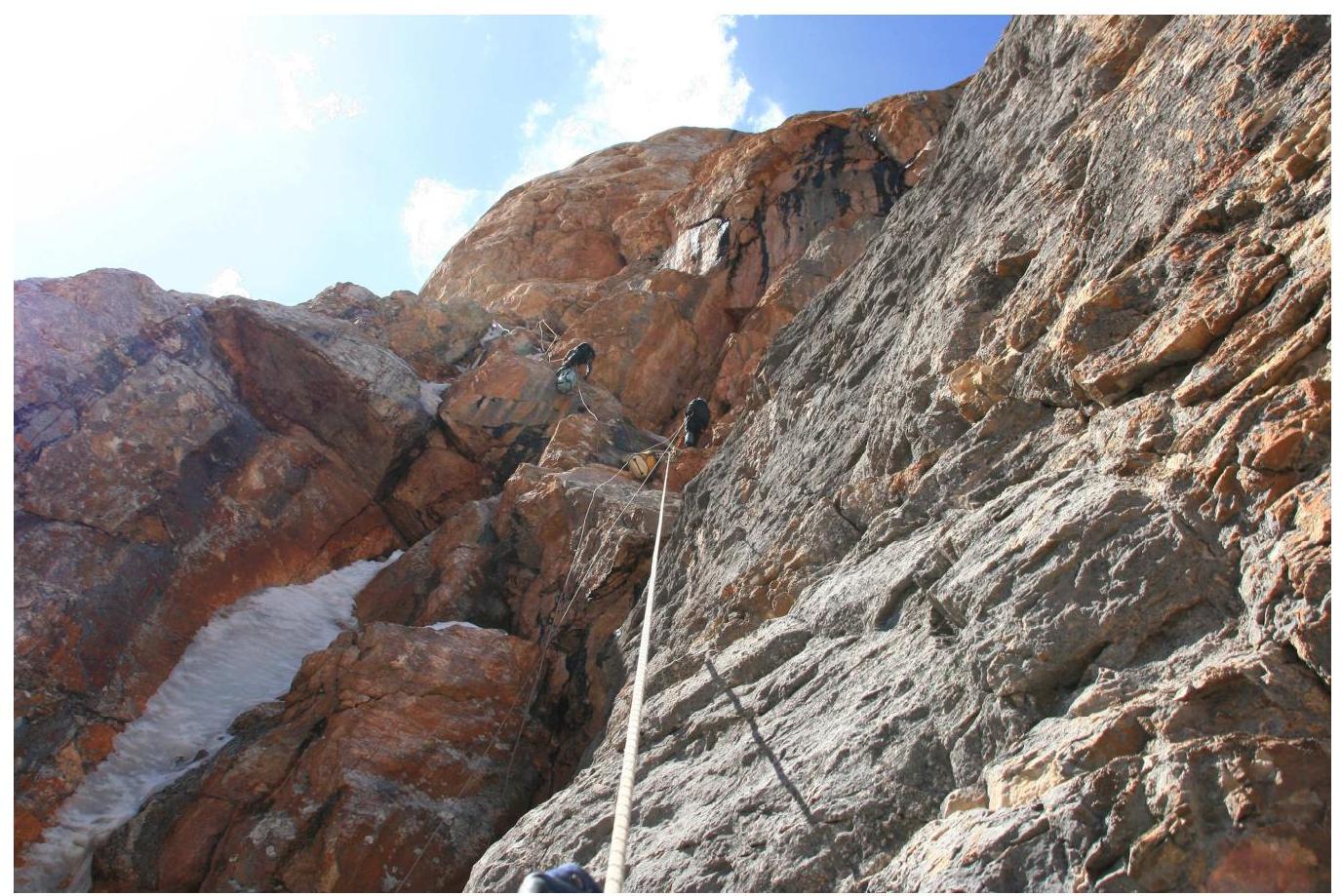
Section R19–R20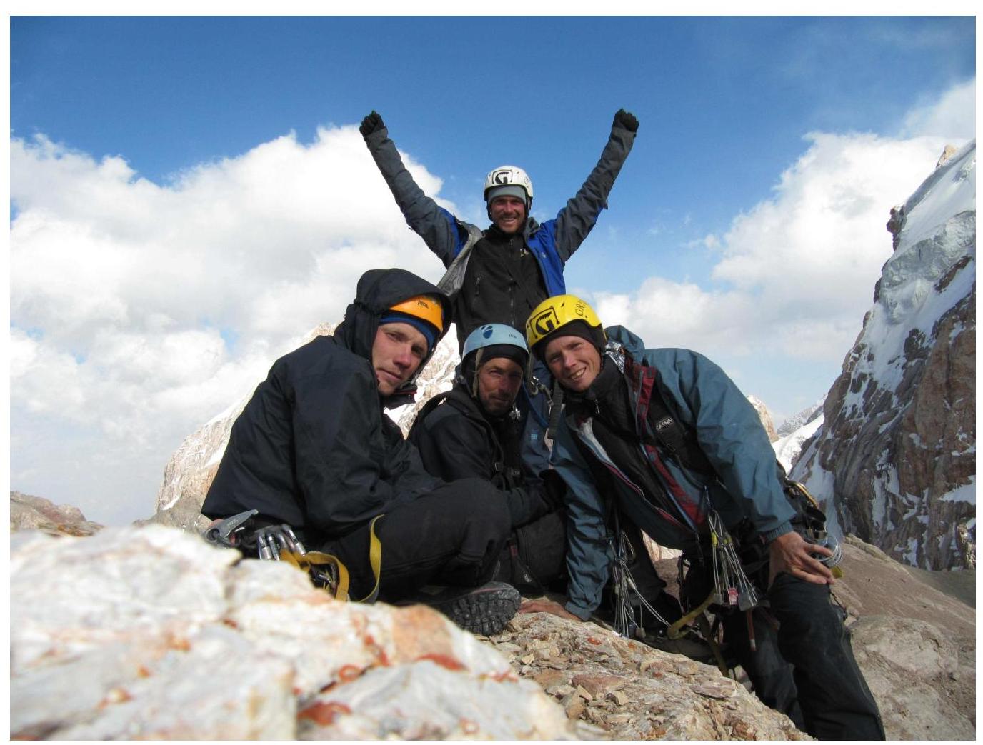
Summit of Parandas mountain