Ascent Log
- Ascent type: rock climbing
- Ascent area: Fann Mountains — northern part
- Peak: Zamok (via Arandas), V. Arkhipov's route
- Climbing category: 6A
- Elevation gain: 600 m, including 600 m of wall climbing
Total route length: 850 m, including:
- category 5 difficulty — 375 m
- category 6 difficulty — 250 m Average route steepness — 75°
- Pitons placed on the route (for ITO) Rock pitons – 40/10, chocks – 80/60, bolted pitons – 2 (removable 3)
- Total climbing hours/days: 32/4
- Overnight bivouacs: 1 semi-sitting, 1 lying down.
- Team leader: Zvyagintsev M.V. CMS (team leader)
Participants:
- Zenovich E.V. CMS
- Kirikov A.V. CMS
- Proskurin A.V. CMS
- Coach: Baykovskiy Yu.V.
- Ascent dates: Route reconnaissance – August 1, 2002 Departure on the route August 2, 2002 Summit: August 4, 2002 Return: August 5, 2002
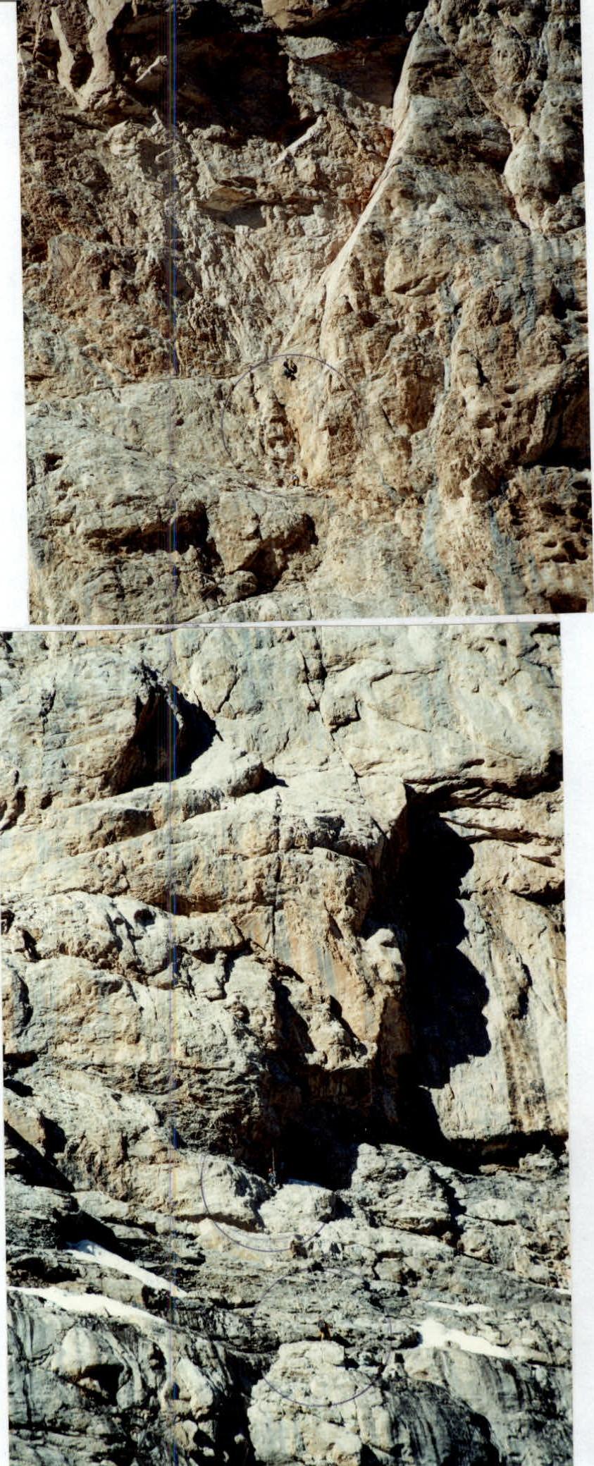
Team on the route (Photo taken from 500 m distance)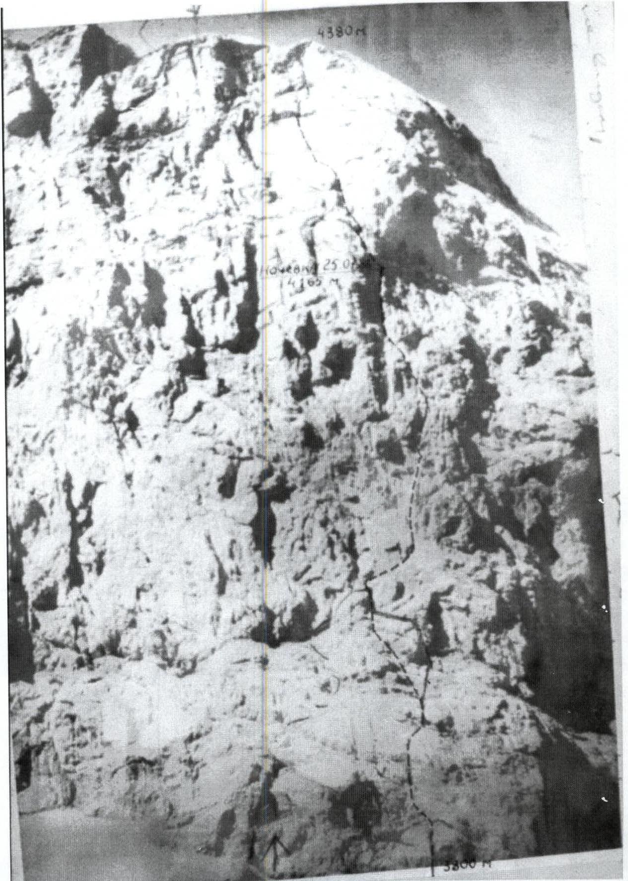
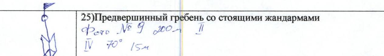
R12. 15 m, 90, 6. Overnight bivouac, 4 people on a sloping ledge, feet on hanging backpacks, snow available for food preparation. Control turn, no note found. A friend left on the ledge in a niche. R11. 40 m, 80, 6. R10. 30 m, 80, 6. Hanging belay station. R9. 10 m, 95, 6. The cornice has a split, climbed directly, 2 m overhang — friends, pitons on the slab. R8. 35 m, 80, 5. R7. 40 m, 85, 6. Small cornice (1 m) to the right, reliable crack. R6. 65 m, 85–90, 6. First crux of the route, internal corner, ITO, etriers, pitons, friends. R5. 45 m, 75, 4. Series of rollers with good holds, place of processing. R4. 50 m, 75, 4. Cornice bypassed via internal corner, then good crack. R3. 40 m, 85, 5. Cornice bypassed to the right on slabs, piton protection, approach to a large cornice. R2. 40 m, 60, 4. Rollers broken by small ledges. R1. 50 m, 70, 5. Series of internal corners climbed with free climbing, protection on friends and eccentric placements. R0. 40 m, 60, 4. Start of the route — chimney, hidden by a slab, so it's not visible, and we started on heavily destroyed vertically standing slabs, slightly to the right of the first ascenders. Heavily destroyed vertical live slabs. 3800 m. R25. Pre-summit ridge with standing gendarmes. Photo #9 200 m Ⅱ, 4, 70°, 15 m.
R24. 1, 25°, 200 m. Photo # 8.
R23. 50 m, 80, 5. Quite steep chimney ending with a comfortable ledge, 1.5×1.5 m.
R22. 40 m, 70, 5. Exit to a grotto via inclined ledges, site of 2nd overnight bivouac. Photo # 7.
R21. 18 m, 70, 5. Second control turn is on a slab before exiting to a ledge, quite uncomfortable, no note found. Bolt to the right on the ledge.
R20. 25 m, 95, 6.
R19. 40 m, 75, 5.
R18. 30 m, 70, 5.
R17. 15 m, 95, 6. Heavily destroyed internal corner ending with a cornice. At the bottom, a bolt was placed to reinforce the belay station, protection is unreliable. Photo # 5a.
R16. 30 m, 70, 5.
R15. 15 m, 60, 6.
R14. 6 m, 120, 6. From the crack to the right, a slab filled with ice, above it a cornice.
R13. 40 m, 75, 5. Processed on the second day of work.
Photo #1a. Section R7
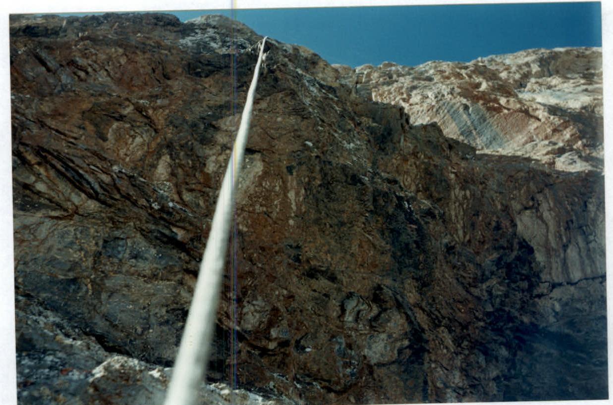
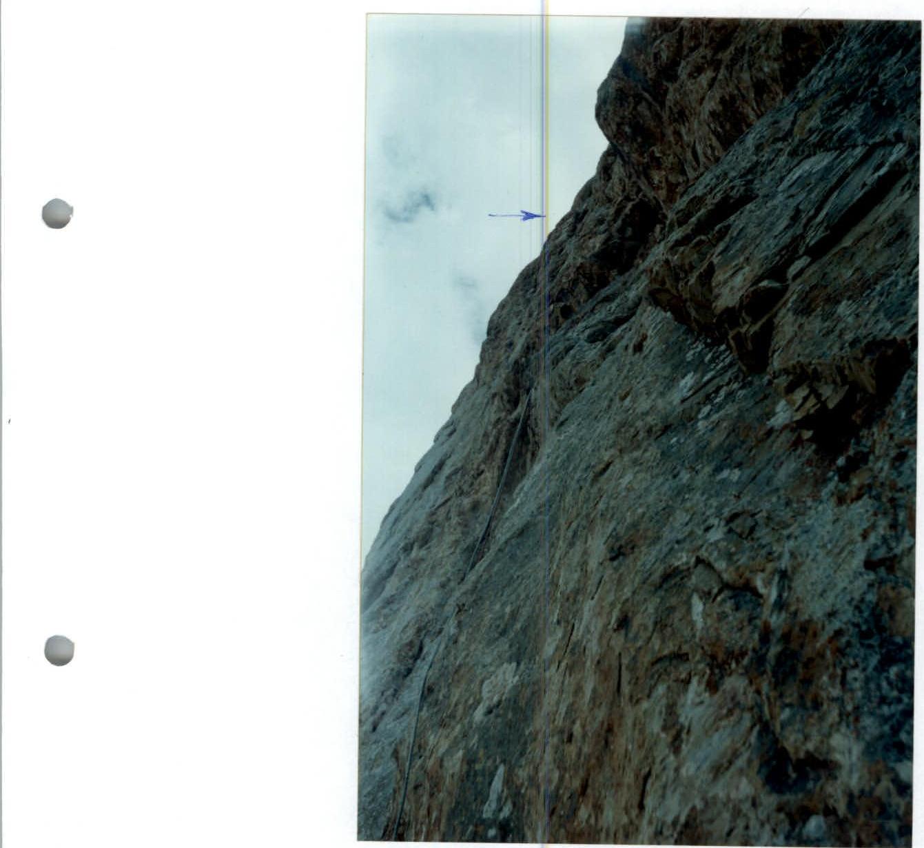 Photo #2. Section R9
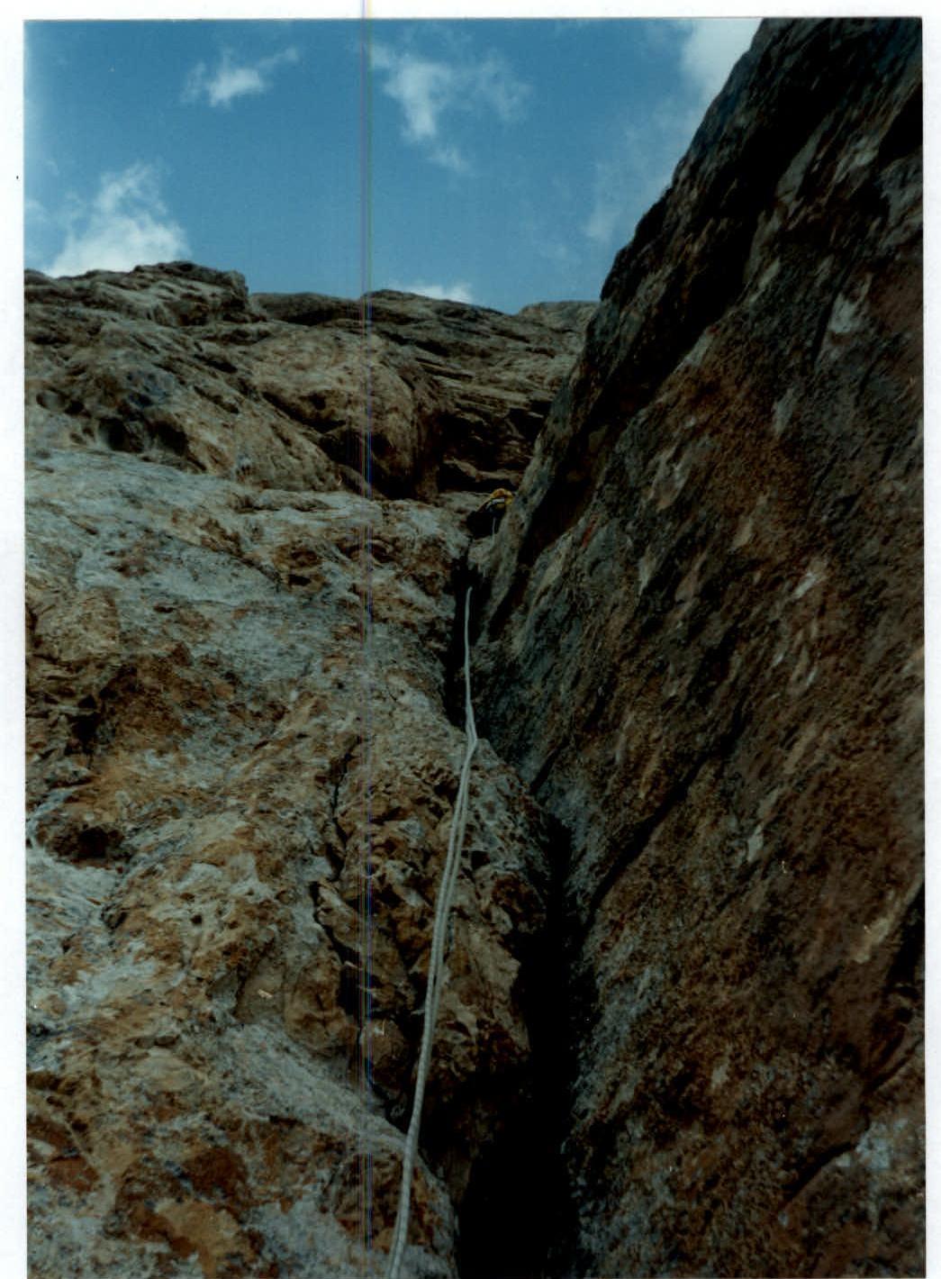 Photo #3. Section R11