Ascent Log
-
Climbing category: rock climbing
-
Climbing area, ridge: Fann Mountains. Zeravshan Range.
-
Peak, its height, ascent route: Zierat, 3800 m, via the northeast edge
-
Route characteristics:
height difference — 600 m length of sections with fifth category difficulty — none average steepness — 60°
-
Pitons used for protection:
rock — 32 ice — none bolted — none
-
Number of climbing hours: five–six
-
Number of bivouacs and their characteristics — none
-
Full name of the leader, participants, and their qualification:
Vorotilin V.N. — 1st sports category, leader Danshin B.I. — 1st sports category, participant Pronin A.V. — 1st sports category, participant Soldatkin V.Z. — 1st sports category, participant
-
Team coach: Arefieva R.G.
-
Date of departure and return: August 22, 1978
| Date | Designations | Average steepness on the section in degrees | Length | Terrain characteristics | Difficulty | Condition | Weather conditions | Rock | Ice | Bolted | Notes |
|---|---|---|---|---|---|---|---|---|---|---|---|
| 22.08.1978 | R0–R1 | 60° | 40 m | inner corner, wall | 3 | monolithic | excellent | 3 and ledges | - | - | Departed at 9:00 |
| -" - | R1–R2 | 30° | 80–90 m | inclined ledge, wall | 2–3 | monolithic | -" - | 8 | - | - | Began the route at 10:00 |
| -" - | R2–R3 | 85° | 20 m | wall | 4 | monolithic | -" - | 6 | - | - | Reached the summit at 16:00 |
| -" - | R3–R4 | 65° | 40 m | couloir | 3 | monolithic, rockfall hazard | -" - | 6 and ledges | - | - | 5 climbing hours, ascent |
| -" - | R4–R5 | 20° | 20 m | scree couloir | 1 | broken | -" - | ledges | - | - | Descended to bivouac at 17:30 |
| -" - | R5–R6 | 70° | 80 m | wall | 3 | broken, rockfall hazard | -" - | 7 and ledges | - | - | |
| -" - | R6–R7 | 30° | 120 m | scree couloir | 1 | broken | -" - | simultaneously | - | - | 1.5 climbing hours on descent |
| -" - | R7–R8 | 60° | 20–30 m | wall | 3 | broken | -" - | ledges | - | - | |
| -" - | R8–R9 | 40° | 700 m | ridge | 3 | broken | -" - | simultaneously | - | - | |
| -" - | R9–R10 | 20° | 100 m | scree couloir | 1 | broken | -" - | simultaneously | - | - | |
| -" - | R10–R11 | 60° | 60 m | wall | 2 | broken | -" - | simultaneously | - | - | |
| 22.08.1978 | R11–R12 | 50° | 100 m | ridge | 1 | monolithic | excellent | simultaneously | - | - | |
| -" - | R12–R13 | 60° | 15 m | inner corner | 3 | monolithic | -" - | 2 and ledges | - | - |
Brief Explanation of the Table
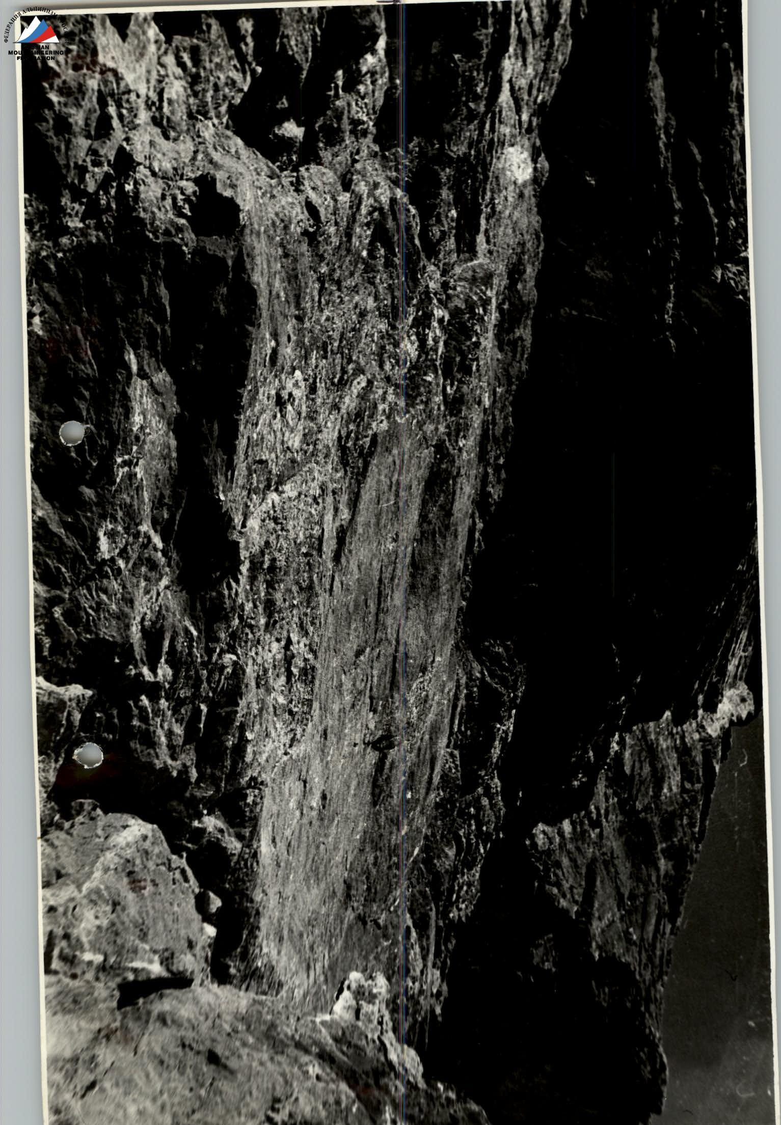
From the scree area at the start of the route, move up to the right to the point between two rusty overhanging walls. First, follow the inner corner and the right side of the scree couloir, then climb the wall to reach an inclined ledge. Climbing is of moderate difficulty (section R0–R1).
Then, move right and up under the cornice along the inclined ledge. The ledge has three tiers. Climb from the first to the second tier via an inner corner (5 m), and from the second to the third tier via a wall with a cleft (10 m). Climbing starts easy but gradually becomes more difficult. Protection is via pitons and ledges. After 60–70 meters, the ledge disappears. Traverse the wall to the right for 10 m to reach a scree area. Climbing is of moderate and above-moderate difficulty (section R1–R2).
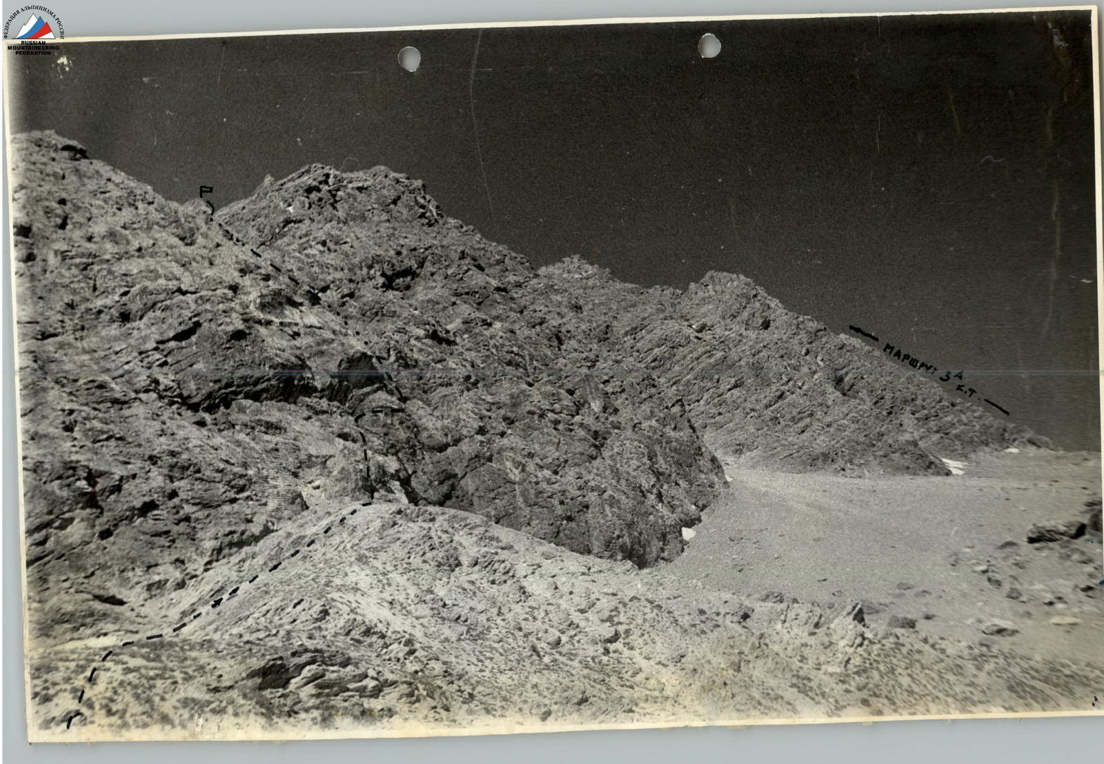
From the area, climb 20 m up (slightly left) to the right of the overhanging wall via a wall with a horizontal quartz vein. This is a key location. Climbing is above moderate difficulty and harder. Protection is via pitons (section R2–R3). At the top of the wall, there is a small ledge. From it, move up via a poorly defined rock section and then along the right side of the scree couloir (piton protection) to areas located on the right side (along the route) of the couloir (section R3–R4). Here is the control cairn.
A distinctive landmark is a long scree ledge above the overhanging rocks, located below and to the left of the cairn.
The group should gather at the cairn area because rocks fall when crossing the couloir.
Then, cross the wide scree couloir (section R4–R5) and climb the wall to the left of a narrow, winding couloir with a stream. The first 20 m are climbed directly up the couloir, then 30 m along a poorly defined ridge to a wide area. Climbing is of moderate difficulty. The rocks are initially broken, then monolithic. Protection is via pitons and ledges (section R5–R6).
On the area, the rope can be shortened. Move along the scree couloir, which widens upwards. After 100–150 m, the couloir turns right (section R6–R7). Cross the couloir and, continuing in the same direction, climb simple, broken rocks to reach the Northeast ridge (section R7–R8).
From the start of the route to the ridge, it takes 3–4 hours. After reaching the ridge, climb along it. The ridge is wide and rocky-scree. Movement is simultaneous on a shortened rope. Small gendarmes are bypassed on the left. It takes 1 hour to reach the first Big Gendarme (with a red wall) (section R8–R9).
Bypass the gendarme on the left along the scree slope, cross the scree couloir (section R9–R10), and climb the pre-summit rise — the second big gendarme — via simple broken rocks (section R10–R11).
Then, move along the North ridge to the summit tower — 100 m (section R11–R12).
Climb to the summit via the inner corner on the left. Climbing is of moderate difficulty. 15 m. Protection is via pitons (section R12–R13).
Descent is via the route of 2A category difficulty. Follow the scree gullies and ledges to the saddle between Zierat and Aurondag. Then, descend along the fine scree to the glacier. The ice fall is bypassed on the left via "sheep's foreheads," where a 20 m sports descent is organized.