PASSPORT
I. Technical Class
2. Pamir-Alay, Zeravshan ridge
3. Pik Adamtash, 4700 m, via N. slope of E. ridge
4. Category 5B, third ascent
5. Route characteristics:
elevation gain 630 m
length 980 m
length of sections with category 5-6 difficulty 380 m
average steepness of the main part of the route 75 °
6. Pitons used:
rock: 10/3
bolts: 3/2
chocks: 130/9
7. Time taken: 17 hours, 2 days
8. Overnight stay, lying down, in bivouac bags
9. Participants: Kuznetsov Alexander Vladimirovich CMS
Pavelyev Anatoly Nikolaevich CMS
10. Coach: Zakharov Nikolai Nikolaevich
II. Departure to the route: August 1, 1986
summit: August 2, 1986
return: August 2, 1986
12. Sports club "Yenisey"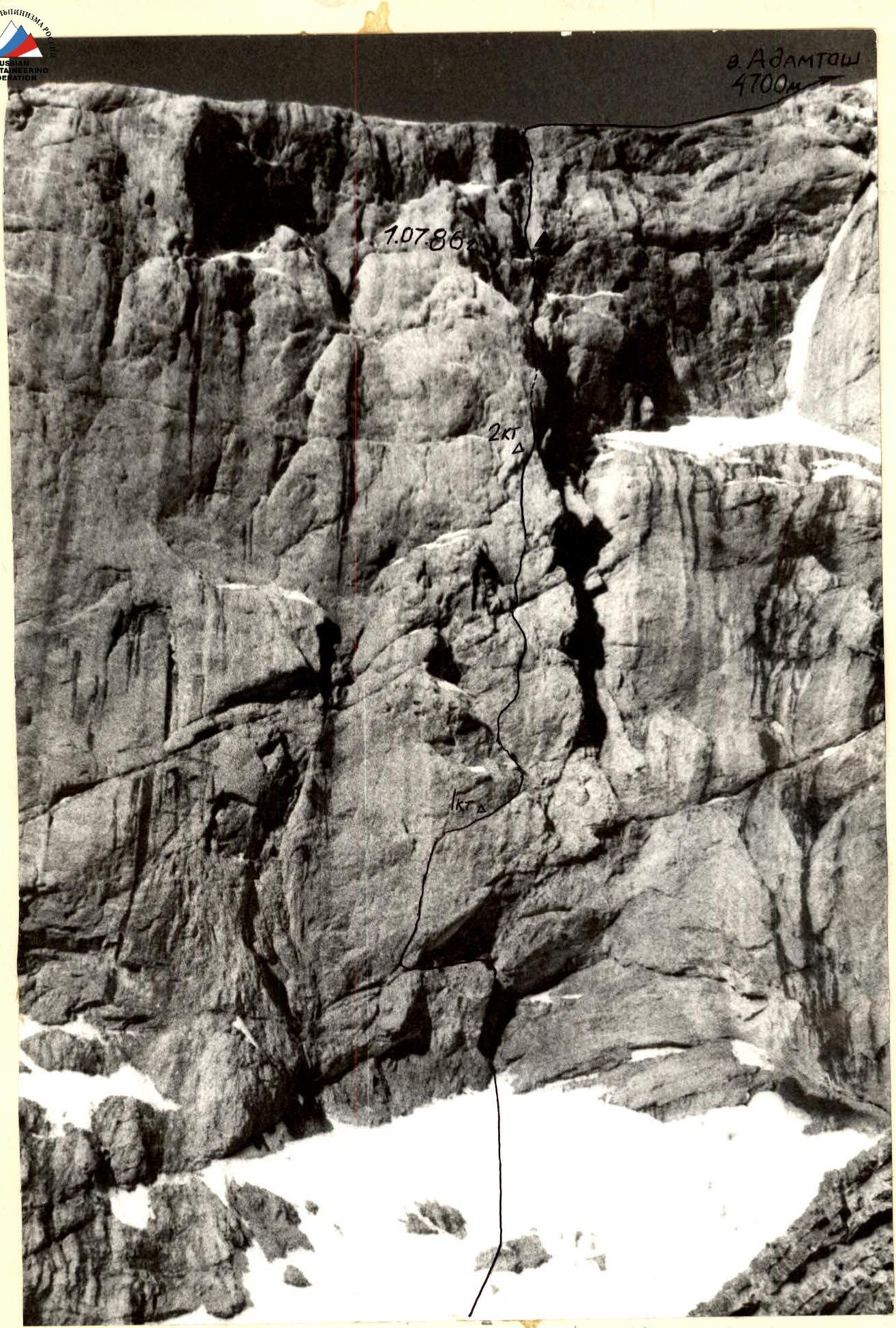
General photo of the summit. Taken on June 30, 1986 at 17:00. "Industar" lens, F = 50 mm. Distance 600 m.
Brief description of the route by sections
R0–R1. Internal corner, heavily broken. R1–R2. Traverse up to the left on a vertical wall, approach to the cleft through an overhang. R2–R3. Cleft in a vertical wall, monolith. "Friends" and large chocks are used. R3–R4. Traverse to the right on an inclined shelf. R4–R5. Wall, left edge of a buttress. R5–R6. Ridge, left edge, monolith. R6–R7. Transition to an internal corner, then along the corner, rocks are broken, icy, exit to a snow shelf under overhanging rocks. R7–R8. Vertical wall with an overhang, monolith. R8–R9. Wall, moving up to the left towards a large internal corner. Snow, ice. R9–R10. Wall, ends in an internal corner, then a chimney. Ice, snow. Exit to scree fields. Further along route 4-A.
